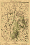
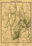
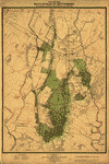
This CD contains 61 rare historic maps and descriptive pages representing fascinating details about Pennsylvania and its vicinity during the Civil War.
This CD contains 61 rare historic maps and descriptive pages representing fascinating details about Pennsylvania and its vicinity during the Civil War in MrSid format. This format allows you to see the entire map on your computer screen or drill down to see the smallest details. The original maps are often quite large, as much as 36" long or larger and quite detailed. With the MrSID software, you can manipulate the map to print the entire map in great detail or zoom into a portion of the map in full detail for viewing or printing. You could even bring the images to a local print shop to have the maps reprinted in their full size. (MrSID software is included on the CD.)
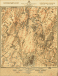
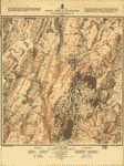
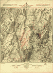
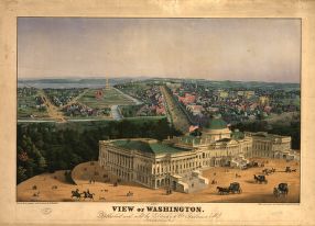
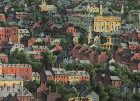
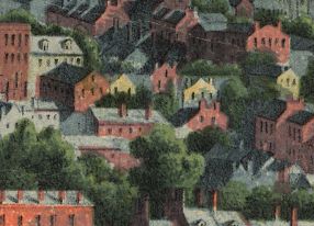
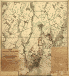
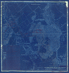
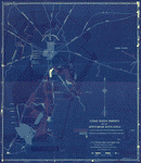
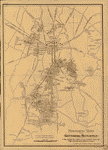
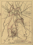
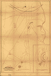
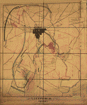
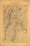
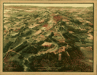
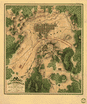
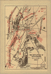
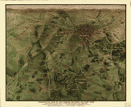
To give you a sample of the detail you can expect in these maps, here is an example based on a panoramic map of Washington, DC.
 |
 |
 |
 |
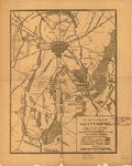
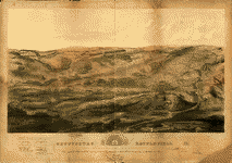
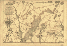
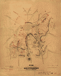
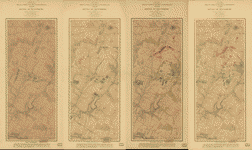
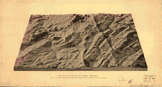
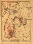
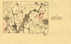
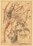
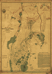
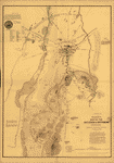
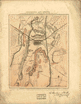
The table below shows the description and a small image of each map on this fascinating civil war history CD.
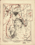
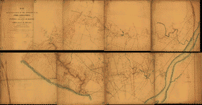
 Map of reconnaissance of the valley of Brandywine Creek : including the section from Smiths Bridge to the State Road / made under the direction of A.D. Bache, eng'r in charge of the defenses of Philadelphia, Dec. 1863 ; by Henry L. Whiting, asst. U.S. Coast Survey. Whiting, Henry L. CREATED/PUBLISHED 1863. NOTES Topographic map showing roads, railroad, bridges, fortifications, batteries, and various Revolutionary War sites along Brandywine Creek, Chester County, Pennsylvania. Relief shown by contours, hachures, and spot heights. Map of reconnaissance of the valley of Brandywine Creek : including the section from Smiths Bridge to the State Road / made under the direction of A.D. Bache, eng'r in charge of the defenses of Philadelphia, Dec. 1863 ; by Henry L. Whiting, asst. U.S. Coast Survey. Whiting, Henry L. CREATED/PUBLISHED 1863. NOTES Topographic map showing roads, railroad, bridges, fortifications, batteries, and various Revolutionary War sites along Brandywine Creek, Chester County, Pennsylvania. Relief shown by contours, hachures, and spot heights. |
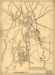
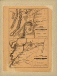
 Gettysburg / National Park Service, U.S. Department of the Interior. United States. National Park Service. CREATED/PUBLISHED [Washington] : The Service, [1978] NOTES Scale ca. 1:27,500. Gettysburg / National Park Service, U.S. Department of the Interior. United States. National Park Service. CREATED/PUBLISHED [Washington] : The Service, [1978] NOTES Scale ca. 1:27,500. |
 Map of the battlefield of Gettysburg Prepared under the direction of the Gettysburg National Park Commission, Colonel John P. Nicholson, Chairman, Major Wm. M. Robbins, Major C. A. Richardson, L't. Col. E. B. Cope, Engineer [and] S. A. Hammond, Ass't Engineer. February 1st., 1898. Gettysburg National Military Park Commission. CREATED/PUBLISHED [S.l., 1898] NOTES Scale ca. 1:12,000. "No. 1" is in the upper margin. Title and "Explanatory notes" are attached to the map in the lower left corner and a list of "Work on the field accomplished by this Commission to date" is attached to the map in the lower right corner. Map of the battlefield, with manuscript annotations and hand coloring, showing lands belonging to the United States tinted yellow, additional land "needed for the work in hand" tinted green, completed telford roads in red, roads in "need of piking" in black and "public roads ceded to the United States" in blue. Map of the battlefield of Gettysburg Prepared under the direction of the Gettysburg National Park Commission, Colonel John P. Nicholson, Chairman, Major Wm. M. Robbins, Major C. A. Richardson, L't. Col. E. B. Cope, Engineer [and] S. A. Hammond, Ass't Engineer. February 1st., 1898. Gettysburg National Military Park Commission. CREATED/PUBLISHED [S.l., 1898] NOTES Scale ca. 1:12,000. "No. 1" is in the upper margin. Title and "Explanatory notes" are attached to the map in the lower left corner and a list of "Work on the field accomplished by this Commission to date" is attached to the map in the lower right corner. Map of the battlefield, with manuscript annotations and hand coloring, showing lands belonging to the United States tinted yellow, additional land "needed for the work in hand" tinted green, completed telford roads in red, roads in "need of piking" in black and "public roads ceded to the United States" in blue. |
 Map of one square mile or 1/25 of the battlefield of Gettysburg Surveyed and drawn under the direction of Gettysburg National Military Park Commission, Col. John P. Nicholson, Ch'm., Maj. W. M. Robbins, Maj. C. A. Richardson, Lt. Col. E. B. Cope, Engineer, [and] S. A. Hammond, Ass't Engineer. Feb. 1st 1898. Gettysburg National Military Park Commission. CREATED/PUBLISHED [S.l., 1898] NOTES Scale ca. 1:2400. At top of map: No. 3; Culp's Hill. Map title, legend, and a brief account of the "Work completed on United States property on this square by the Gettysburg National Park Commission," signed by E. B. Cope, Engineer, is attached to the map in the lower left corner. Detailed map of Culp's Hill, with manuscript annotations and hand coloring, showing the extent of U.S. property, telford roads, stone walls, rebuilt stone walls, mounted guns, monuments and markers, lines of earth works, and lunettes for artillery. Map of one square mile or 1/25 of the battlefield of Gettysburg Surveyed and drawn under the direction of Gettysburg National Military Park Commission, Col. John P. Nicholson, Ch'm., Maj. W. M. Robbins, Maj. C. A. Richardson, Lt. Col. E. B. Cope, Engineer, [and] S. A. Hammond, Ass't Engineer. Feb. 1st 1898. Gettysburg National Military Park Commission. CREATED/PUBLISHED [S.l., 1898] NOTES Scale ca. 1:2400. At top of map: No. 3; Culp's Hill. Map title, legend, and a brief account of the "Work completed on United States property on this square by the Gettysburg National Park Commission," signed by E. B. Cope, Engineer, is attached to the map in the lower left corner. Detailed map of Culp's Hill, with manuscript annotations and hand coloring, showing the extent of U.S. property, telford roads, stone walls, rebuilt stone walls, mounted guns, monuments and markers, lines of earth works, and lunettes for artillery. |
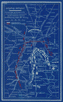
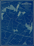
 United States property on the Gettysburg battlefield Gettysburg National Park Commission, Col. John P. Nicholson, Chairman, Major W. M. Robbins, Major C. A. Richardson, [and] Col. E. B. Cope, C.E. [Drawn by] H. W. Mattern, Ass't. Feb. 1st, 1898. Gettysburg National Military Park Commission. CREATED/PUBLISHED [S.l., 1898] NOTES Scale 1:12,000. "Number 256" is in the upper left corner. Hand-colored and annotated blueprint showing lands "Conveyed by the Gettysburg Battlefield Memorial Association," lands "purchased by the U.S.G.B. Commission and the G.N.P. Commission," and the land devoted to the National Cemetery. United States property on the Gettysburg battlefield Gettysburg National Park Commission, Col. John P. Nicholson, Chairman, Major W. M. Robbins, Major C. A. Richardson, [and] Col. E. B. Cope, C.E. [Drawn by] H. W. Mattern, Ass't. Feb. 1st, 1898. Gettysburg National Military Park Commission. CREATED/PUBLISHED [S.l., 1898] NOTES Scale 1:12,000. "Number 256" is in the upper left corner. Hand-colored and annotated blueprint showing lands "Conveyed by the Gettysburg Battlefield Memorial Association," lands "purchased by the U.S.G.B. Commission and the G.N.P. Commission," and the land devoted to the National Cemetery. |
 Monumental guide to the Gettysburg battlefield. A map showing the location of every monument, marker and tablet with approaching roads and avenues Copyright 1899 by Schuyler A. Hammond & Edgar M. Hewitt. Hammond, Schuyler A. CREATED/PUBLISHED [S.l.], c1899. NOTES Scale ca. 1:12,800. Monumental guide to the Gettysburg battlefield. A map showing the location of every monument, marker and tablet with approaching roads and avenues Copyright 1899 by Schuyler A. Hammond & Edgar M. Hewitt. Hammond, Schuyler A. CREATED/PUBLISHED [S.l.], c1899. NOTES Scale ca. 1:12,800. |
 Map of the battlefield of Gettysburg from original surveys by the engineers of the Commission By authority of the Secretary of War under the direction of the Gettysburg national Park Commission, Lt. Col. John P. Nicholson, Chairman, Major General L. L. Lomax, Major Charles A. Richardson, Lt. Col. E. B. Cope, Engineer, S. A. Hammond and H. W. Mattern, Asst. Engineers. Drawn by S. A. Hammond, 1903. Gettysburg National Military Park Commission. CREATED/PUBLISHED Washington, Norris Peters Co., [1903] NOTES Scale ca. 1:8350. Detailed map of the battlefield indicating monuments and markers, roads, railroads, stone walls, four types of fences, woodland, and relief by contour lines at intervals of 12 feet. "Property owners name 1903 italics" and "Property owners name 1863 Gothic." Lands owned by the United States are tinted green. Map of the battlefield of Gettysburg from original surveys by the engineers of the Commission By authority of the Secretary of War under the direction of the Gettysburg national Park Commission, Lt. Col. John P. Nicholson, Chairman, Major General L. L. Lomax, Major Charles A. Richardson, Lt. Col. E. B. Cope, Engineer, S. A. Hammond and H. W. Mattern, Asst. Engineers. Drawn by S. A. Hammond, 1903. Gettysburg National Military Park Commission. CREATED/PUBLISHED Washington, Norris Peters Co., [1903] NOTES Scale ca. 1:8350. Detailed map of the battlefield indicating monuments and markers, roads, railroads, stone walls, four types of fences, woodland, and relief by contour lines at intervals of 12 feet. "Property owners name 1903 italics" and "Property owners name 1863 Gothic." Lands owned by the United States are tinted green. |
 Map of Gettysburg battlefield showing routes that must be taken by all wheeled conveyances during the anniversary celebration, from June 28 to June 30, July 1 to 5, 1913 Prepared by direction of the Gettysburg National Park Commission, Col. John P. Nicholson, Chairman, Lt. Col. E. B. Cope, Engineer. Gettysburg National Military Park Commission. CREATED/PUBLISHED [S.l., 1913] NOTES Scale 1:21,250. Routes to be followed are shown by red dashed lines. Map of Gettysburg battlefield showing routes that must be taken by all wheeled conveyances during the anniversary celebration, from June 28 to June 30, July 1 to 5, 1913 Prepared by direction of the Gettysburg National Park Commission, Col. John P. Nicholson, Chairman, Lt. Col. E. B. Cope, Engineer. Gettysburg National Military Park Commission. CREATED/PUBLISHED [S.l., 1913] NOTES Scale 1:21,250. Routes to be followed are shown by red dashed lines. |
 Map of the battlefield of Gettysburg from original surveys by the engineers of the Commission. Under the direction of the Gettysburg National Park Commission. Drawn by S. A. Hammond. Gettysburg National Military Park Commission. CREATED/PUBLISHED [n.p.] 1914. NOTES Scale ca. 1:8,350. Relief shown by contours and spot heights. Shows 1863 and 1903 landowners and troop positions. Map of the battlefield of Gettysburg from original surveys by the engineers of the Commission. Under the direction of the Gettysburg National Park Commission. Drawn by S. A. Hammond. Gettysburg National Military Park Commission. CREATED/PUBLISHED [n.p.] 1914. NOTES Scale ca. 1:8,350. Relief shown by contours and spot heights. Shows 1863 and 1903 landowners and troop positions. |
 Map of the battlefield of Gettysburg from original surveys by the engineers of the Commission By authority of the Hon. Newton D. Baker, Secretary of War, July 1st, 1916, under the direction of the Gettysburg National Park Commission, Lt. Col. John P. Nicholson, Chairman, Major Charles A. Richardson, Lt. Col. E. B. Cope, Engineer. Drawn by S. A. Hammond, Asst. Engineer, 1916. Gettysburg National Military Park Commission. CREATED/PUBLISHED Philadelphia, John T. Palmer Co., [1916] NOTES Scale ca. 1:8450. Another edition. The map was redrawn for this edition. Map of the battlefield of Gettysburg from original surveys by the engineers of the Commission By authority of the Hon. Newton D. Baker, Secretary of War, July 1st, 1916, under the direction of the Gettysburg National Park Commission, Lt. Col. John P. Nicholson, Chairman, Major Charles A. Richardson, Lt. Col. E. B. Cope, Engineer. Drawn by S. A. Hammond, Asst. Engineer, 1916. Gettysburg National Military Park Commission. CREATED/PUBLISHED Philadelphia, John T. Palmer Co., [1916] NOTES Scale ca. 1:8450. Another edition. The map was redrawn for this edition. |
 Map of the Gettysburg battlefield Prepared by direction of the Gettysburg National Park Commission, Col. John P. Nicholson, Chairman, Col. E. B. Cope, Engineer. May, 1921. Gettysburg National Military Park Commission. CREATED/PUBLISHED [S.l., 1921] NOTES Scale ca. 1:21,250. Map indicates roads, park towers, and the location of the cyclorama. Troop positions are not indicated. Map of the Gettysburg battlefield Prepared by direction of the Gettysburg National Park Commission, Col. John P. Nicholson, Chairman, Col. E. B. Cope, Engineer. May, 1921. Gettysburg National Military Park Commission. CREATED/PUBLISHED [S.l., 1921] NOTES Scale ca. 1:21,250. Map indicates roads, park towers, and the location of the cyclorama. Troop positions are not indicated. |
 The battle of Gettysburg. February 1948, revised 1951. United States. National Park Service. CREATED/PUBLISHED [Washington, Government Printing Office, 1957] NOTES Scale ca. 1:60,000. In its Gettysburg National Military Park, Pennsylvania. [Washington, Government Printing Office, 1957] Insert: Cavalry battlefield, Scale ca. 1:60,000. 4 x 3 cm. Indicates troop positions and movements, roads, railroad, drainage, relief by hachures, principal points of interest, and a suggested tour route. The battle of Gettysburg. February 1948, revised 1951. United States. National Park Service. CREATED/PUBLISHED [Washington, Government Printing Office, 1957] NOTES Scale ca. 1:60,000. In its Gettysburg National Military Park, Pennsylvania. [Washington, Government Printing Office, 1957] Insert: Cavalry battlefield, Scale ca. 1:60,000. 4 x 3 cm. Indicates troop positions and movements, roads, railroad, drainage, relief by hachures, principal points of interest, and a suggested tour route. |
 Gettysburg National Military Park, Pennsylvania. United States. National Park Service. CREATED/PUBLISHED Washington, U.S. Govt. Print. Off. [1973] NOTES Scale ca. 1:28,000. Gettysburg National Military Park, Pennsylvania. United States. National Park Service. CREATED/PUBLISHED Washington, U.S. Govt. Print. Off. [1973] NOTES Scale ca. 1:28,000. |
 Gettysburg National Military Park, Pennsylvania / National Park Service, U.S. Department of the Interior. United States. National Park Service. CREATED/PUBLISHED [Washington] : The Service, [1982] NOTES Relief shown by shading. Gettysburg National Military Park, Pennsylvania / National Park Service, U.S. Department of the Interior. United States. National Park Service. CREATED/PUBLISHED [Washington] : The Service, [1982] NOTES Relief shown by shading. |
 Plan of Gettysburg with the battlefield of July 2nd & 3rd, 1863 and the National Cemetery. Meisel, Augustus. CREATED/PUBLISHED [S.l.], A. Meisel, lith., [18--?] NOTES Scale 1:7920. Inset: [Plan of the] National Cemetery. Uncolored. 26 x 16 cm. Shows troop positions, roads, railroads, streams, and a few houses. Plan of Gettysburg with the battlefield of July 2nd & 3rd, 1863 and the National Cemetery. Meisel, Augustus. CREATED/PUBLISHED [S.l.], A. Meisel, lith., [18--?] NOTES Scale 1:7920. Inset: [Plan of the] National Cemetery. Uncolored. 26 x 16 cm. Shows troop positions, roads, railroads, streams, and a few houses. |
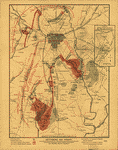
 Map of Gettysburg and vicinity / drawn by Gaylord Weeks, Denison, Iowa. Weeks, Gaylord. CREATED/PUBLISHED [1863] NOTES Shows Civil-War battle positions in rural districts surrounding Gettysburg (Pa.). Union lines are shown by blue dashes and Confederate lines by red ones. Also shows locations of artillery, significant features of the battlefield, some dwellings with names of residents, vegetation, drainage, roads, and railways. Map of Gettysburg and vicinity / drawn by Gaylord Weeks, Denison, Iowa. Weeks, Gaylord. CREATED/PUBLISHED [1863] NOTES Shows Civil-War battle positions in rural districts surrounding Gettysburg (Pa.). Union lines are shown by blue dashes and Confederate lines by red ones. Also shows locations of artillery, significant features of the battlefield, some dwellings with names of residents, vegetation, drainage, roads, and railways. |
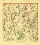
 The battlefield of Gettysburg, July 1st, 2d, 3d, 1863, showing the movements of the 12th Army Corps. Goodhue, W. F. CREATED/PUBLISHED [S.l., 1863] NOTES Scale ca. 1:21,250. Shows drainage, vegetation, roads, railroads, houses and names of inhabitants, and points of interest on the battlefield. In addition to the movements of the 12th Army Corps, the Union and Confederate positions are shown, with names of the commanding officers of some units. The battlefield of Gettysburg, July 1st, 2d, 3d, 1863, showing the movements of the 12th Army Corps. Goodhue, W. F. CREATED/PUBLISHED [S.l., 1863] NOTES Scale ca. 1:21,250. Shows drainage, vegetation, roads, railroads, houses and names of inhabitants, and points of interest on the battlefield. In addition to the movements of the 12th Army Corps, the Union and Confederate positions are shown, with names of the commanding officers of some units. |
 Gettysburg battle-field. Battle fought at Gettysburg, Pa., July 1st, 2d & 3d, 1863 by the Federal and Confederate armies, commanded respectively by Genl. G. G. Meade and Genl. Robert E. Lee Jno. B. Bachelder, del. Endicott & Co., lith, N.Y. Bachelder, John B. (John Badger), 1825-1894. CREATED/PUBLISHED Boston and New York, Jno. B. Bachelder, c1863. NOTES Scale not given. Inset: Plan of the Soldiers National Cemetery. Uncolored. 6 x 13 cm. Bears a "Proof" mark in the lower left corner. Endorsed (facsim.): I am perfectly satisfied with the accuracy with which the topography is delineated and the position of the troops laid down. [Signed] Geo. G. Meade, Maj. Gen. of Vols. comd. A. P. The reproduced signatures of A. Doubleday, John Newton, Winf. St. Hancock, D.B. Birney, Geo. Sykes, John Sedgwick, O. O. Howard, A. S. Williams, and H. W. Slocum appear below the following statement: The positions of the troops of our respective commands represented upon this picture have been arranged under our immediate direction and may be relied upon as substantially corrct. Colored bird's-eye view showing the topography of the battlefield by the perspective of the drawing, shading and coloring. Drainage, vegetation, roads and strets, railroads, bridges, houses and names of residents, fences, points of interest on the battlefield, including designations of places where officers were killed or wounded, are indicated. The locations of the corps, divisions, brigades, etc. of both armies, with the names of commanding officers, are given in detail. Badge symbols are used to identify the Federal corps. Gettysburg battle-field. Battle fought at Gettysburg, Pa., July 1st, 2d & 3d, 1863 by the Federal and Confederate armies, commanded respectively by Genl. G. G. Meade and Genl. Robert E. Lee Jno. B. Bachelder, del. Endicott & Co., lith, N.Y. Bachelder, John B. (John Badger), 1825-1894. CREATED/PUBLISHED Boston and New York, Jno. B. Bachelder, c1863. NOTES Scale not given. Inset: Plan of the Soldiers National Cemetery. Uncolored. 6 x 13 cm. Bears a "Proof" mark in the lower left corner. Endorsed (facsim.): I am perfectly satisfied with the accuracy with which the topography is delineated and the position of the troops laid down. [Signed] Geo. G. Meade, Maj. Gen. of Vols. comd. A. P. The reproduced signatures of A. Doubleday, John Newton, Winf. St. Hancock, D.B. Birney, Geo. Sykes, John Sedgwick, O. O. Howard, A. S. Williams, and H. W. Slocum appear below the following statement: The positions of the troops of our respective commands represented upon this picture have been arranged under our immediate direction and may be relied upon as substantially corrct. Colored bird's-eye view showing the topography of the battlefield by the perspective of the drawing, shading and coloring. Drainage, vegetation, roads and strets, railroads, bridges, houses and names of residents, fences, points of interest on the battlefield, including designations of places where officers were killed or wounded, are indicated. The locations of the corps, divisions, brigades, etc. of both armies, with the names of commanding officers, are given in detail. Badge symbols are used to identify the Federal corps. |
 Map showing the positions occupied by the Tenth New York Cavalry in the cavalry engagements on the right flank at Gettysburg, Penn. : on July 2 & 3, 1863, between the Union cavalry under Gen. D. McM. Gregg and the Confederate cavalry under Gen. J.E.B. Stuart. Presto, Noble D. CREATED/PUBLISHED [1891?] NOTES Finished ms. version of later printed map showing Federal cavalry positions and movements, camp and barracks of the 10th N.Y. Cavalry in 1861-62, drainage, vegetation, roads, streets, railroad, houses, and names of occupants. Covers troop positions in rural areas east of Gettysburg. Relief of hills shown by form lines. Map showing the positions occupied by the Tenth New York Cavalry in the cavalry engagements on the right flank at Gettysburg, Penn. : on July 2 & 3, 1863, between the Union cavalry under Gen. D. McM. Gregg and the Confederate cavalry under Gen. J.E.B. Stuart. Presto, Noble D. CREATED/PUBLISHED [1891?] NOTES Finished ms. version of later printed map showing Federal cavalry positions and movements, camp and barracks of the 10th N.Y. Cavalry in 1861-62, drainage, vegetation, roads, streets, railroad, houses, and names of occupants. Covers troop positions in rural areas east of Gettysburg. Relief of hills shown by form lines. |
 Map of the battle field of Gettysburg. [July 1st, 2nd, and 3rd 1863] T. Sinclair's lith. Entered according to an Act of Congress in the year 1863 by J. B. Lippincott & Co. . . J.B. Lippincott Company. CREATED/PUBLISHED [Philadelphia, J. B. Lippincott, 1864] NOTES Scale 1:15,840. Indicates Union positions in red and Confederate positions in blue, Union artillery positions, roads, railroads, houses and names of residents, drainage, and vegetation. Map of the battle field of Gettysburg. [July 1st, 2nd, and 3rd 1863] T. Sinclair's lith. Entered according to an Act of Congress in the year 1863 by J. B. Lippincott & Co. . . J.B. Lippincott Company. CREATED/PUBLISHED [Philadelphia, J. B. Lippincott, 1864] NOTES Scale 1:15,840. Indicates Union positions in red and Confederate positions in blue, Union artillery positions, roads, railroads, houses and names of residents, drainage, and vegetation. |
 Plan of the Gettysburg battle ground. Reed, Charles Wellington, 1841-1926. CREATED/PUBLISHED [S.l.], Chas. W. Reed, 9th Mass. Battery, c1864. NOTES Scale ca. 1:36,500. Map gives Union positions in black and Confederate positions in red, batteries and lines of fire, roads and streets, vegetation, drainage, and relief by hachures. Plan of the Gettysburg battle ground. Reed, Charles Wellington, 1841-1926. CREATED/PUBLISHED [S.l.], Chas. W. Reed, 9th Mass. Battery, c1864. NOTES Scale ca. 1:36,500. Map gives Union positions in black and Confederate positions in red, batteries and lines of fire, roads and streets, vegetation, drainage, and relief by hachures. |
|
Map of the battle field of Gettysburg. July 1st, 2nd, 3rd, 1863 Published by authority of the Hon. the Secretary of War, office of the Chief of Engineers, U.S. Army, 1876. Positions of troops compiled and added for the Government by John B. Bachelder. Bachelder, John B. (John Badger), 1825-1894. CREATED/PUBLISHED Boston, John B. Bachelder, 1876. NOTES Scale 1:12,000. "Topography engraved by Julia Bien . . . N.Y. Positions & lettering by Louis E. Neuman . . . N.Y." "Printed by Endicott & Co. . . . N.Y." The maps are entitled: First day's battle. Second day's battle. Third day's battle. "The map is reduced from one on a scale of 200 feet to the inch, deposited in the Archives of the office of the Chief of Engineers. The survey was ordered by Brevet Major General A. A. Humphreys, Chief of Engineers, and conducted under Brevet Major General G. K. Warren, Major of Engineers." An extremely detailed topographic map with spot elevations and contours "given for every change of 4 feet in elevation." Drainage, vegetation, roads, railroads, fences, houses with names of residents, and a detailed plan of the town of Gettysburg are shown. "Every object is represented here as near as possible as it was at the time of the battle." A very minute analysis of the deployment of the various units of both armies, with the names of commanding officers, period of time spent in a particular position, and other pertinent information is given. Dotted lines and arrows indicate the movements of the troops, and the positions at various times of the day are shown by symbols explained in the legend. |
 Map of the field of operations of Gregg's (Union) & Stuart's (Confederate) cavalry at the battle of Gettysburg, July 3, 1863 Surveyed by Frank O. Maxson, C.E. under the direction of John B. Bachelder, authorized by Act of Congress, approved June 9th, 1880. Bachelder, John B. (John Badger), 1825-1894. CREATED/PUBLISHED [S.l., Julius Bien & Co. lith., 1880] NOTES Scale 1:12,000. The maps are entitled "No. 4a. 6-8 P.M., July 2," "No. 10. 4-11 A.M., July 3," "No. 11. 11 A.M.-2 P.M., July 3" and "No. 12. 2-5 P.M., July 3." Detailed topographic map with spot elevations and contours "given for every change of four feet in elevation . . . Every object is represented, as nearly as possible, as it was at the time of the battle." Shows drainage, vegetation, roads, railroads, fences, and houses with names of residents. Minute analysis of the movements of the cavalry units of both armies, with names of commanding officers and the period of time spent in a particular position. Dotted lines and arrows indicate the movements of the troops. Map of the field of operations of Gregg's (Union) & Stuart's (Confederate) cavalry at the battle of Gettysburg, July 3, 1863 Surveyed by Frank O. Maxson, C.E. under the direction of John B. Bachelder, authorized by Act of Congress, approved June 9th, 1880. Bachelder, John B. (John Badger), 1825-1894. CREATED/PUBLISHED [S.l., Julius Bien & Co. lith., 1880] NOTES Scale 1:12,000. The maps are entitled "No. 4a. 6-8 P.M., July 2," "No. 10. 4-11 A.M., July 3," "No. 11. 11 A.M.-2 P.M., July 3" and "No. 12. 2-5 P.M., July 3." Detailed topographic map with spot elevations and contours "given for every change of four feet in elevation . . . Every object is represented, as nearly as possible, as it was at the time of the battle." Shows drainage, vegetation, roads, railroads, fences, and houses with names of residents. Minute analysis of the movements of the cavalry units of both armies, with names of commanding officers and the period of time spent in a particular position. Dotted lines and arrows indicate the movements of the troops. |
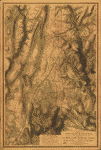
 Relief map of the battle field of Gettysburg. Looking south. Showing the town, fields, farm buildings, forests, streams, roads and lanes as they were at the time of the battle. Lehman, Ambrose E. CREATED/PUBLISHED [S.l., c1886] NOTES Scale ca. 1:27,000. Relief map of the battle field of Gettysburg. Looking south. Showing the town, fields, farm buildings, forests, streams, roads and lanes as they were at the time of the battle. Lehman, Ambrose E. CREATED/PUBLISHED [S.l., c1886] NOTES Scale ca. 1:27,000. |
| Map of the battle field of Gettysburg. [July 1st, 2nd, and 3rd 1863]. J.B. Lippincott Company. CREATED/PUBLISHED [Philadelphia, 1888?] NOTES [Scale 1:15,840]. |
 tysburg and vicinity, showing the lines of battle, July, 1863, and the land purchased and dedicated to the public by General S. Wylie Crawford and the Gettysburg Battlefield Memorial Association Eng'd. by American Bank Note Co., New York. Long, James T. (James Thomas), b. 1843. CREATED/PUBLISHED [S.l., c1891] NOTES Scale 1:15,840. From his Gettysburg: How the battle was fought. c1891. Inset: Site of Gen. Gregg's calvary [sic] operations. Three miles east of Gettysburg. Uncolored. Scale 1:63,360. 13 x 7 cm. Shows Union positions in blue and Confederate positions in red, roads, houses and names of residents, fences, railroad, vegetation, and drainage. tysburg and vicinity, showing the lines of battle, July, 1863, and the land purchased and dedicated to the public by General S. Wylie Crawford and the Gettysburg Battlefield Memorial Association Eng'd. by American Bank Note Co., New York. Long, James T. (James Thomas), b. 1843. CREATED/PUBLISHED [S.l., c1891] NOTES Scale 1:15,840. From his Gettysburg: How the battle was fought. c1891. Inset: Site of Gen. Gregg's calvary [sic] operations. Three miles east of Gettysburg. Uncolored. Scale 1:63,360. 13 x 7 cm. Shows Union positions in blue and Confederate positions in red, roads, houses and names of residents, fences, railroad, vegetation, and drainage. |
 Map showing the positions occupied by the Third Pennsylvania Cavalry in the engagements on the right flank at Gettysburg, Pa., between the Union cavalry under Gen. D. McM. Gregg and the "Stonewall" Brigade of Confederate infantry on July 2d, 1863, and the Confederate cavalry under Gen. J. E. B. Stuart on July 3d, 1863. United States. Army. Pennsylvania Cavalry Regiment, 3rd (1861-1865). CREATED/PUBLISHED [Philadelphia, Franklin Printing Company, 1905] NOTES Scale ca. 1:24,200. From History of the Third Pennsylvania Cavalry . . . Philadelphia, Franklin Printing Company, 1905. opp. p. 261. Indicates troop, cavalry, and artillery positions, roads and streets, railroad, houses and names of residents, vegetation, and drainage. Base map was drawn by Noble D. Preston. Map showing the positions occupied by the Third Pennsylvania Cavalry in the engagements on the right flank at Gettysburg, Pa., between the Union cavalry under Gen. D. McM. Gregg and the "Stonewall" Brigade of Confederate infantry on July 2d, 1863, and the Confederate cavalry under Gen. J. E. B. Stuart on July 3d, 1863. United States. Army. Pennsylvania Cavalry Regiment, 3rd (1861-1865). CREATED/PUBLISHED [Philadelphia, Franklin Printing Company, 1905] NOTES Scale ca. 1:24,200. From History of the Third Pennsylvania Cavalry . . . Philadelphia, Franklin Printing Company, 1905. opp. p. 261. Indicates troop, cavalry, and artillery positions, roads and streets, railroad, houses and names of residents, vegetation, and drainage. Base map was drawn by Noble D. Preston. |
 e battlefield of Gettysburg, July 1st, 2nd and 3rd, 1863 Gatchel & Manning. Phila. Minnigh, Luther W. (Luther William). CREATED/PUBLISHED Gettysburg, L. W. Minnigh, 1905. NOTES Scale 1:15,840. Shows Union positions in black and Confederate positions in red, names of field commanders, relief by hachures, drainage, vegetation, roads, railroad, and a few houses and names of residents. e battlefield of Gettysburg, July 1st, 2nd and 3rd, 1863 Gatchel & Manning. Phila. Minnigh, Luther W. (Luther William). CREATED/PUBLISHED Gettysburg, L. W. Minnigh, 1905. NOTES Scale 1:15,840. Shows Union positions in black and Confederate positions in red, names of field commanders, relief by hachures, drainage, vegetation, roads, railroad, and a few houses and names of residents. |
 Gettysburg battlefield today. Pennsylvania Railroad. Pennsylvania Railroad. CREATED/PUBLISHED [S.l., c1913] NOTES Scale not given. Panoramic map of the Gettysburg battlefield. Round Top is in the foreground. Gettysburg battlefield today. Pennsylvania Railroad. Pennsylvania Railroad. CREATED/PUBLISHED [S.l., c1913] NOTES Scale not given. Panoramic map of the Gettysburg battlefield. Round Top is in the foreground. |
 Gettysburg and vicinity, showing the lines of battle, July, 1863 Copyrighted April 1922, by Prof. J. Warren Gilbert. Gilbert, J. Warren. CREATED/PUBLISHED [S.l.], c1922. NOTES Scale ca. 1:22,500 (not "4 inches = 1 mile"). Inset: Site of Gen. Greggs cavalry operations. Three miles east of Gettysburg. July 3rd 1863. Colored. Scale not given. 10 x 5 cm. Shows Union positions in black and Confederate positions in red, roads, railroad, houses and names of residents, fences, vegetation, and drainage. Gettysburg and vicinity, showing the lines of battle, July, 1863 Copyrighted April 1922, by Prof. J. Warren Gilbert. Gilbert, J. Warren. CREATED/PUBLISHED [S.l.], c1922. NOTES Scale ca. 1:22,500 (not "4 inches = 1 mile"). Inset: Site of Gen. Greggs cavalry operations. Three miles east of Gettysburg. July 3rd 1863. Colored. Scale not given. 10 x 5 cm. Shows Union positions in black and Confederate positions in red, roads, railroad, houses and names of residents, fences, vegetation, and drainage. |
 Gettysburg and vicinity, showing the lines of battle, July, 1863. Burk & McFetridge. CREATED/PUBLISHED Phila., Burk & McFetridge Co., lith., [18--?] NOTES Scale 1:15,840. Inset: Site of Gen. Gregg's cavalry operations. Three miles east of Gettysburg. Uncolored. Scale. 1:63,360. 13 x 7 cm. Lower right corner: Compliments of Holtzworth Bros., propr's of the Ziegler and Holtzworth Livery, in rear of Eagle Hotel, Gettysburg, Pa. Shows drainage, vegetation, roads, railroads, fences, dwellings with names of inhabitants, and land owned by the United States. Union and Confederate positions are shown, with names of corps and divisions, sometimes including names of commanding officers, and location of artillery. Gettysburg and vicinity, showing the lines of battle, July, 1863. Burk & McFetridge. CREATED/PUBLISHED Phila., Burk & McFetridge Co., lith., [18--?] NOTES Scale 1:15,840. Inset: Site of Gen. Gregg's cavalry operations. Three miles east of Gettysburg. Uncolored. Scale. 1:63,360. 13 x 7 cm. Lower right corner: Compliments of Holtzworth Bros., propr's of the Ziegler and Holtzworth Livery, in rear of Eagle Hotel, Gettysburg, Pa. Shows drainage, vegetation, roads, railroads, fences, dwellings with names of inhabitants, and land owned by the United States. Union and Confederate positions are shown, with names of corps and divisions, sometimes including names of commanding officers, and location of artillery. |
 Gettysburg battlefield Surveyed 1863 by E. B. Cope, U.S.T.E. Drawn under direction U.S. Commission, Col. John P. Nicholson, Chairman, by E. B. Cope, Eng. [and] E. M. Hewitt, Asst. Eng. Cope, Emmor B. CREATED/PUBLISHED [S.l., 1863] NOTES Scale ca. 1:26,000. Upper right corner: No. 825. Shows troops and artillery points, drainage, roads, railroads, dwellings with names of occupants, several points of interest on the battlefield, and a few of the highest points by hachures. Gettysburg battlefield Surveyed 1863 by E. B. Cope, U.S.T.E. Drawn under direction U.S. Commission, Col. John P. Nicholson, Chairman, by E. B. Cope, Eng. [and] E. M. Hewitt, Asst. Eng. Cope, Emmor B. CREATED/PUBLISHED [S.l., 1863] NOTES Scale ca. 1:26,000. Upper right corner: No. 825. Shows troops and artillery points, drainage, roads, railroads, dwellings with names of occupants, several points of interest on the battlefield, and a few of the highest points by hachures. |
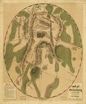 Field of Gettysburg, July 1st, 2nd & 3rd, 1863 Prepared by T. Ditterline. Ditterline, T. (Theodore). CREATED/PUBLISHED [Philada. P. S. Duval & Son lith. 1863] NOTES Scale ca. 1:25,500,. Oval-shaped map depicting troop and artillery positions, relief by hachures, drainage, roads, railroads, and houses with names of residents. Field of Gettysburg, July 1st, 2nd & 3rd, 1863 Prepared by T. Ditterline. Ditterline, T. (Theodore). CREATED/PUBLISHED [Philada. P. S. Duval & Son lith. 1863] NOTES Scale ca. 1:25,500,. Oval-shaped map depicting troop and artillery positions, relief by hachures, drainage, roads, railroads, and houses with names of residents. |
 Map of the battle of Gettysburg, Pa., July 1st, 2nd & 3rd, 1863, showing line of battle on P.M. of 2nd Prepared by Wm. H. Willcox, Captn. & A.D.C. on Maj. Genl. Reynold's staff. 3d ed. Lith of P. S. Duval & Son, Philada. J. G. Shoemaker, engr. Willcox, William H. CREATED/PUBLISHED [S.l., 1863] NOTES Scale ca. 1:13,100. Shows topography by hachures, vegetation, drainage, roads, railroads, houses, stonewalls, cultivated areas, churches, and cemeteries. Union and Confederate positions are shown, including the location of the artillery. Confederate corps are named; Union forces are given in more detail, including names of some division commanders. Shows the Union breast works and cavalry positions. Map of the battle of Gettysburg, Pa., July 1st, 2nd & 3rd, 1863, showing line of battle on P.M. of 2nd Prepared by Wm. H. Willcox, Captn. & A.D.C. on Maj. Genl. Reynold's staff. 3d ed. Lith of P. S. Duval & Son, Philada. J. G. Shoemaker, engr. Willcox, William H. CREATED/PUBLISHED [S.l., 1863] NOTES Scale ca. 1:13,100. Shows topography by hachures, vegetation, drainage, roads, railroads, houses, stonewalls, cultivated areas, churches, and cemeteries. Union and Confederate positions are shown, including the location of the artillery. Confederate corps are named; Union forces are given in more detail, including names of some division commanders. Shows the Union breast works and cavalry positions. |
 Map of the battlefield of Gettysburg Made from an accurate survey of the ground by transit and chain by S. G. Elliott, C.E. Elliott, S. G. CREATED/PUBLISHED New York H. H. Lloyd & Co. 1864. NOTES Scale 1:9051. Inset: Plan of the National Cemetery. Lower right corner: Sketch of the battle of Gettysburg. [Text] Map of the battlefield of Gettysburg Made from an accurate survey of the ground by transit and chain by S. G. Elliott, C.E. Elliott, S. G. CREATED/PUBLISHED New York H. H. Lloyd & Co. 1864. NOTES Scale 1:9051. Inset: Plan of the National Cemetery. Lower right corner: Sketch of the battle of Gettysburg. [Text] |
 Elliott's map of the battlefield of Gettysburg, Pennsylvania Made from an accurate survey of the ground by transit and chain. F. Bourquin & Co., liths., Philada. S. G. Elliott & Co. CREATED/PUBLISHED [Philadelphia], S. G. Elliott & Co., c1864. NOTES Scale 1:9051. Shows breastworks and rifle pits, graves of Union and Confederate soldiers, "dead horses" reads and streets, relief by hachures, vegetation, drainage, houses and names of residents. Elliott's map of the battlefield of Gettysburg, Pennsylvania Made from an accurate survey of the ground by transit and chain. F. Bourquin & Co., liths., Philada. S. G. Elliott & Co. CREATED/PUBLISHED [Philadelphia], S. G. Elliott & Co., c1864. NOTES Scale 1:9051. Shows breastworks and rifle pits, graves of Union and Confederate soldiers, "dead horses" reads and streets, relief by hachures, vegetation, drainage, houses and names of residents. |
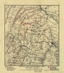
 Gettysburg and vicinity. Constructed and engraved to illustrate "The war with the South" A topographical map of the battles of Gettysburg, July 1st, 2nd & 3rd, 1863, from an actual survey by an engineer officer on General Doubleday's staff. Entered according to Act of Congress A.D. 1864 by Virtue & Yorston . . . Sholl, Charles. CREATED/PUBLISHED [S.l., 1867] NOTES Scale ca. 1:53,000. Indicates Union positions in red, Confederate positions in blue, artillery positions, roads, railroad, vegetation, and streams. Gettysburg and vicinity. Constructed and engraved to illustrate "The war with the South" A topographical map of the battles of Gettysburg, July 1st, 2nd & 3rd, 1863, from an actual survey by an engineer officer on General Doubleday's staff. Entered according to Act of Congress A.D. 1864 by Virtue & Yorston . . . Sholl, Charles. CREATED/PUBLISHED [S.l., 1867] NOTES Scale ca. 1:53,000. Indicates Union positions in red, Confederate positions in blue, artillery positions, roads, railroad, vegetation, and streams. |
 Plan der Schlacht von Gettysburg am 1, 2 & 3 Juli, 1863.-Plan zur Erlauterung von Gen. Grant's Vicksburg Campagne Mai-Juli, 1863 Gez v. E. R. Schmidt. Th. Leonhardt, lith., Philada. Schmidt, Ernst Reinhold. CREATED/PUBLISHED [Philadelphia, 1869] NOTES Scales vary. Gettysburg map shows the location of Union and Confederate corps. The Vicksburg campaign map indicates the route followed by General Grant. Plan der Schlacht von Gettysburg am 1, 2 & 3 Juli, 1863.-Plan zur Erlauterung von Gen. Grant's Vicksburg Campagne Mai-Juli, 1863 Gez v. E. R. Schmidt. Th. Leonhardt, lith., Philada. Schmidt, Ernst Reinhold. CREATED/PUBLISHED [Philadelphia, 1869] NOTES Scales vary. Gettysburg map shows the location of Union and Confederate corps. The Vicksburg campaign map indicates the route followed by General Grant. |
 Battle field of Gettysburg. Warren, Gouverneur Kemble, 1830-1882. CREATED/PUBLISHED [Washington, U.S. Army, Office of the Chief of Engineers 187-?] NOTES Scale 1:12,000 (1 inch equals 1000 feet). Detailed topographic map subsequently used as the base for John B. Bachelder's "Map of the Battle Field of Gettysburg" Battle field of Gettysburg. Warren, Gouverneur Kemble, 1830-1882. CREATED/PUBLISHED [Washington, U.S. Army, Office of the Chief of Engineers 187-?] NOTES Scale 1:12,000 (1 inch equals 1000 feet). Detailed topographic map subsequently used as the base for John B. Bachelder's "Map of the Battle Field of Gettysburg" |
 Gettysburg and vicinity, showing the position of the troops July 3, 1863 (third day's fight), and the land purchased and dedicated to the public by General S. Wylie Crawford and the Gettysburg Battlefield Memorial Association Thos. Hunter, lith., Phila. Gettysburg Battlefield Memorial Association. CREATED/PUBLISHED [S.l.], Gettysburg Battlefield Memorial Association, 1883. NOTES Scale ca. 1:15,840. "Land of battlefield Memorial Association tinted pink" and "land of General Crawford tinted blue." Indicates troop positions and movements, roads, "Gettysburg and Hanover Railroad," houses, names of residents, fences, and drainage. Gettysburg and vicinity, showing the position of the troops July 3, 1863 (third day's fight), and the land purchased and dedicated to the public by General S. Wylie Crawford and the Gettysburg Battlefield Memorial Association Thos. Hunter, lith., Phila. Gettysburg Battlefield Memorial Association. CREATED/PUBLISHED [S.l.], Gettysburg Battlefield Memorial Association, 1883. NOTES Scale ca. 1:15,840. "Land of battlefield Memorial Association tinted pink" and "land of General Crawford tinted blue." Indicates troop positions and movements, roads, "Gettysburg and Hanover Railroad," houses, names of residents, fences, and drainage. |
 Gettysburg and vicinity, showing the position of the troops July 1st and 3rd, 1863, and the land purchased and dedicated to the public by General S. Wylie Crawford and the Gettysburg Battlefield Memorial Association. Gettysburg Battlefield Memorial Association. CREATED/PUBLISHED [S.l.], Gettysburg Battlefield Memorial Association, 1885. NOTES Scale ca. 1:15,840. Indicates Union troop positions and movements, points of interest on the battlefield, dwellings with names of inhabitants, drainage, fences, roads, and railroads. Gettysburg and vicinity, showing the position of the troops July 1st and 3rd, 1863, and the land purchased and dedicated to the public by General S. Wylie Crawford and the Gettysburg Battlefield Memorial Association. Gettysburg Battlefield Memorial Association. CREATED/PUBLISHED [S.l.], Gettysburg Battlefield Memorial Association, 1885. NOTES Scale ca. 1:15,840. Indicates Union troop positions and movements, points of interest on the battlefield, dwellings with names of inhabitants, drainage, fences, roads, and railroads. |
 Extract from the original (large scale) map of Gettysburg battle field in 4 sheets, being portions of sheets 2 and 3 lying S. & S.W. of the town of Gettysburg. United States. Army. Corps of Engineers. CREATED/PUBLISHED Washington Office of the Chief of Engineers, U.S.A. 1886. NOTES Scale 1:2400 ("1" = 200 feet"). Manuscript map drawn on tracing linen of the intersection of the Emmitsburg and Taneytown roads. Depicted are roads, buildings, names of residents, fence lines, vegetation, and fortifications, and relief by contour lines at intervals of 4 feet. Extract from the original (large scale) map of Gettysburg battle field in 4 sheets, being portions of sheets 2 and 3 lying S. & S.W. of the town of Gettysburg. United States. Army. Corps of Engineers. CREATED/PUBLISHED Washington Office of the Chief of Engineers, U.S.A. 1886. NOTES Scale 1:2400 ("1" = 200 feet"). Manuscript map drawn on tracing linen of the intersection of the Emmitsburg and Taneytown roads. Depicted are roads, buildings, names of residents, fence lines, vegetation, and fortifications, and relief by contour lines at intervals of 4 feet. |
 Gettysburg and vicinity, showing the lines of battle July, 1863, and the land purchased and dedicated to the public by General S. Wylie Crawford and the Gettysburg Battlefield Memorial Association Burk & McFetridge lith., Phila. Gettysburg Battlefield Memorial Association. CREATED/PUBLISHED [S.l.], Gettysburg Battlefield Memorial Association, 1886. NOTES Scale 1:15,840. Inset: Site of General Gregg's operations. Three miles east of Gettysburg. Uncolored. Scale 1:63,360. 13 x 7 cm. Shows drainage, vegetation, roads, railroads, property lines, fences, dwellings with names of inhabitants, points of interest on the battlefield, and in addition to the land owned by the association, that which is proposed to be purchased. Union and Confederate positions are shown, with names of corps and divisions, sometimes including the name of the commanding officer, and the location of artillery. Gettysburg and vicinity, showing the lines of battle July, 1863, and the land purchased and dedicated to the public by General S. Wylie Crawford and the Gettysburg Battlefield Memorial Association Burk & McFetridge lith., Phila. Gettysburg Battlefield Memorial Association. CREATED/PUBLISHED [S.l.], Gettysburg Battlefield Memorial Association, 1886. NOTES Scale 1:15,840. Inset: Site of General Gregg's operations. Three miles east of Gettysburg. Uncolored. Scale 1:63,360. 13 x 7 cm. Shows drainage, vegetation, roads, railroads, property lines, fences, dwellings with names of inhabitants, points of interest on the battlefield, and in addition to the land owned by the association, that which is proposed to be purchased. Union and Confederate positions are shown, with names of corps and divisions, sometimes including the name of the commanding officer, and the location of artillery. |
 Map of the battlefield of Gettysburg Office of the New York Board of Gettysburg Monuments Commissioners, A. J. Zabriskie, Engineer. Gettysburg Monuments Commissioners. New York Board. CREATED/PUBLISHED [S.l., 1894] NOTES Scale ca. 1:12,000. Map indicates lands owned by the Gettysburg Battlefield Memorial Association and the U.S. government and the "proposed purchases of lands." Map of the battlefield of Gettysburg Office of the New York Board of Gettysburg Monuments Commissioners, A. J. Zabriskie, Engineer. Gettysburg Monuments Commissioners. New York Board. CREATED/PUBLISHED [S.l., 1894] NOTES Scale ca. 1:12,000. Map indicates lands owned by the Gettysburg Battlefield Memorial Association and the U.S. government and the "proposed purchases of lands." |
 Battle of Gettysburg, July 1, 1863. First day. General position of troops, 2 to 3.30 p.m. CREATED/PUBLISHED [S.l., n.p., 19--?] NOTES Scale 1:23,400 (1950 feet to the inch). Map of the environs of Gettysburg showing troop and artillery positions, roads, houses and names of residents, relief by contour lines at intervals of 20 feet and spot heights, woodland, the Gettysburg & Hanover R.R., and drainage. Battle of Gettysburg, July 1, 1863. First day. General position of troops, 2 to 3.30 p.m. CREATED/PUBLISHED [S.l., n.p., 19--?] NOTES Scale 1:23,400 (1950 feet to the inch). Map of the environs of Gettysburg showing troop and artillery positions, roads, houses and names of residents, relief by contour lines at intervals of 20 feet and spot heights, woodland, the Gettysburg & Hanover R.R., and drainage. |
 Position of Union and Confederate armies on the morning of July 1, 1863. CREATED/PUBLISHED [S.l.], n.p., [19-?] NOTES Scale 1:633,600 (10 miles to 1 inch). Map of northeastern Virginia, Maryland, and southern Pennsylvania showing roads, railroads, cities and towns, drainage, relief by hachures, and troop positions at the beginning of the Battle of Gettysburg. Position of Union and Confederate armies on the morning of July 1, 1863. CREATED/PUBLISHED [S.l.], n.p., [19-?] NOTES Scale 1:633,600 (10 miles to 1 inch). Map of northeastern Virginia, Maryland, and southern Pennsylvania showing roads, railroads, cities and towns, drainage, relief by hachures, and troop positions at the beginning of the Battle of Gettysburg. |
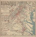 Map of the main battlefields, routes, camps and head qrs., in the Gettysburg, Wilderness and Appomattox campaigns of the Civil War in U.S. Compiled and published by Joshua Smith, 1st Lieut., Co. K, 20th Pa.' Cav., 2nd Brig., 1st Div., Sheridan's command. Chicago, c1899. Smith, Joshua, 1841- CREATED/PUBLISHED Chicago, 1900. NOTES Scale 1:506,880. Shows "places and dates of battles," "blue lines-Union routes," "red lines-Confederate routes," railroads, canals, towns, rivers, and relief by hachures. "Losses in some of the battles," "Union Army campaign organizations," "Confed.' Army campaign organizations," and a number of engagements in the states of Pennsylvania, Maryland, Washington, D.C., West Virginia, and Virginia are indicated beneath the map title. List of the "authorities used" is in the lower left corner. Map of the main battlefields, routes, camps and head qrs., in the Gettysburg, Wilderness and Appomattox campaigns of the Civil War in U.S. Compiled and published by Joshua Smith, 1st Lieut., Co. K, 20th Pa.' Cav., 2nd Brig., 1st Div., Sheridan's command. Chicago, c1899. Smith, Joshua, 1841- CREATED/PUBLISHED Chicago, 1900. NOTES Scale 1:506,880. Shows "places and dates of battles," "blue lines-Union routes," "red lines-Confederate routes," railroads, canals, towns, rivers, and relief by hachures. "Losses in some of the battles," "Union Army campaign organizations," "Confed.' Army campaign organizations," and a number of engagements in the states of Pennsylvania, Maryland, Washington, D.C., West Virginia, and Virginia are indicated beneath the map title. List of the "authorities used" is in the lower left corner. |
 Map of the Gettysburg Battlefield prepared by authority of the Hon. Daniel S. Lamont, Russell A. Alger, Elihu Root, Secretaries of War, under the direction of the Gettysburg National Military Park Commission, Lt. Col. John P. Nicholson Chairman, John B. Bachelder, Esq., Major William M. Robbins, Brig. General William H. Forney, Major Charles A. Richardson. Original survey by Lt. Col. E. B. Cope, Engineer, S. A. Hammond and H.W. Mattern Ass't Engineers, reduced from the original by H. W. Mattern. Gettysburg National Military Park Commission. CREATED/PUBLISHED [S.l., 1900?] NOTES Scale ca. 1:7000. ote: "Property owners name 1863 small italics," and "property owners name 1900 large italics." Map of the Gettysburg Battlefield prepared by authority of the Hon. Daniel S. Lamont, Russell A. Alger, Elihu Root, Secretaries of War, under the direction of the Gettysburg National Military Park Commission, Lt. Col. John P. Nicholson Chairman, John B. Bachelder, Esq., Major William M. Robbins, Brig. General William H. Forney, Major Charles A. Richardson. Original survey by Lt. Col. E. B. Cope, Engineer, S. A. Hammond and H.W. Mattern Ass't Engineers, reduced from the original by H. W. Mattern. Gettysburg National Military Park Commission. CREATED/PUBLISHED [S.l., 1900?] NOTES Scale ca. 1:7000. ote: "Property owners name 1863 small italics," and "property owners name 1900 large italics." |
 Gettysburg. Army War College (U.S.) CREATED/PUBLISHED [Washington, 1906?] NOTES Various scales. The three preliminary leaves give a chronological summary of the battle. Maps are numbered 9 to 18. They show the troop positions in color from June 29th through July 3rd. Corps and divisions are identified, sometimes with numbers, more frequently by names of commanding officers. Cavalry and artillery are located by symbol, and arrows show movements of battle. The large scale maps give topography by hachures, drainage, vegetation, roads, railroads, and a few place names. Gettysburg. Army War College (U.S.) CREATED/PUBLISHED [Washington, 1906?] NOTES Various scales. The three preliminary leaves give a chronological summary of the battle. Maps are numbered 9 to 18. They show the troop positions in color from June 29th through July 3rd. Corps and divisions are identified, sometimes with numbers, more frequently by names of commanding officers. Cavalry and artillery are located by symbol, and arrows show movements of battle. The large scale maps give topography by hachures, drainage, vegetation, roads, railroads, and a few place names. |
 Map of a part of the east cavalry field showing positions of division and brigade markers and batteries Prepared under the direction of the Gettysburg National Park Commission, Col. John P. Nicholson, Chairman, Maj. C. A. Richardson, Commissioner, Maj. Gen. L. L. Lomax, Commissioner [and] E. B. Cope, Engineer. August 12th, 1910. Gettysburg National Military Park Commission. CREATED/PUBLISHED [S.l., 1910] NOTES Scale 1:7200. Map of the area between York Pike and Hanover Road showing battlefield markers, fence lines, roads, woodland, and contour lines at intervals of 12 feet. "Residents 1863 in Egyptian letters" and "Residents 1906 in italics." Map of a part of the east cavalry field showing positions of division and brigade markers and batteries Prepared under the direction of the Gettysburg National Park Commission, Col. John P. Nicholson, Chairman, Maj. C. A. Richardson, Commissioner, Maj. Gen. L. L. Lomax, Commissioner [and] E. B. Cope, Engineer. August 12th, 1910. Gettysburg National Military Park Commission. CREATED/PUBLISHED [S.l., 1910] NOTES Scale 1:7200. Map of the area between York Pike and Hanover Road showing battlefield markers, fence lines, roads, woodland, and contour lines at intervals of 12 feet. "Residents 1863 in Egyptian letters" and "Residents 1906 in italics." |
 The battlefield of Gettysburg, July 1st, 2nd and 3rd 1863 Gatchel & Manning, Phila. Tipton and Blocher. CREATED/PUBLISHED Gettysburg, Tipton & Blocher, c1912. NOTES Scale 1:15,840. The battlefield of Gettysburg, July 1st, 2nd and 3rd 1863 Gatchel & Manning, Phila. Tipton and Blocher. CREATED/PUBLISHED Gettysburg, Tipton & Blocher, c1912. NOTES Scale 1:15,840. |
 Perspective view of Gettysburg National Military Park Drawn under the direction of the Gettysburg National Park Commission, Colonel John P. Nicholson, Chairman, Major Charles A. Richardson, Commissioner. Drawing made February, 1916, by Lieut.-Colonel E. B. Cope, Engineer. Cope, Emmor B. CREATED/PUBLISHED [S.l., 1916] NOTES Scale not given. Panoramic map, with Round Top in the foreground, showing roads, railroads, field patterns, woodland, observation towers, monuments, and houses. Perspective view of Gettysburg National Military Park Drawn under the direction of the Gettysburg National Park Commission, Colonel John P. Nicholson, Chairman, Major Charles A. Richardson, Commissioner. Drawing made February, 1916, by Lieut.-Colonel E. B. Cope, Engineer. Cope, Emmor B. CREATED/PUBLISHED [S.l., 1916] NOTES Scale not given. Panoramic map, with Round Top in the foreground, showing roads, railroads, field patterns, woodland, observation towers, monuments, and houses. |
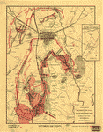
 Map of a reconnaissance of the approaches to Philadelphia showing the positions and lines of defence on the north front of the city / made under the direction of A.D. Bache, Supt. U.S. Coast Survey, Engineer in Charge of the Defences ; general field reconnaissance by George Davidson, Assistant U.S. Coast Survey ; details by George Davidson ... [et al.] ; map plotted and drawn by George Davidson, assisted by A.R. FauntLeRoy and W.E. Weber ; tracing by A.R. FauntLeRoy and W.E. Weber. United States Coast Survey. CREATED/PUBLISHED 1863. NOTES Topographic map of northern Philadelphia and small adjacent part of Montgomery County showing Civil War earthworks and batteries. Relief shown by contours and hachures. Map of a reconnaissance of the approaches to Philadelphia showing the positions and lines of defence on the north front of the city / made under the direction of A.D. Bache, Supt. U.S. Coast Survey, Engineer in Charge of the Defences ; general field reconnaissance by George Davidson, Assistant U.S. Coast Survey ; details by George Davidson ... [et al.] ; map plotted and drawn by George Davidson, assisted by A.R. FauntLeRoy and W.E. Weber ; tracing by A.R. FauntLeRoy and W.E. Weber. United States Coast Survey. CREATED/PUBLISHED 1863. NOTES Topographic map of northern Philadelphia and small adjacent part of Montgomery County showing Civil War earthworks and batteries. Relief shown by contours and hachures. |
 Map of supplementary reconnaissance of the approaches to Philadelphia by the West-Chester Road : including the section from Newtown Square to the east branch of the Brandywine Creek / made under the direction of A.D. Bache, Eng'r in Charge of the Defenses of Philadelphia ; by Henry L. Whiting, Asst. U.S. Coast Survey. Whiting, Henry L. CREATED/PUBLISHED [1863] NOTES Topographic map showing Civil War earthworks and batteries. Relief shown by contours and spot heights. Map of supplementary reconnaissance of the approaches to Philadelphia by the West-Chester Road : including the section from Newtown Square to the east branch of the Brandywine Creek / made under the direction of A.D. Bache, Eng'r in Charge of the Defenses of Philadelphia ; by Henry L. Whiting, Asst. U.S. Coast Survey. Whiting, Henry L. CREATED/PUBLISHED [1863] NOTES Topographic map showing Civil War earthworks and batteries. Relief shown by contours and spot heights. |
 Map of a reconnoissance [sic] of the approaches to Philadelphia showing the positions and lines of defence on the west front of the city / made under the direction of A.D. Bache, Sup't U.S. Coast Survey, Engineer in charge of Defences ; general field reconnoissance [sic] by H.L. Whiting, Assis't U.S. Coast Survey ; detailed portions by R.M. Bache ... [et al.] ; outlines from local published maps enlarged & drawn by W.B. McMurtrie. United States Coast Survey. CREATED/PUBLISHED 1863. NOTES Topographic map of western Philadelphia and small adjacent parts of Montgomery and Delaware counties showing 1st- and 2nd-order Civil War earthworks and batteries. Relief shown by contours, hachures, and spot heights. Map of a reconnoissance [sic] of the approaches to Philadelphia showing the positions and lines of defence on the west front of the city / made under the direction of A.D. Bache, Sup't U.S. Coast Survey, Engineer in charge of Defences ; general field reconnoissance [sic] by H.L. Whiting, Assis't U.S. Coast Survey ; detailed portions by R.M. Bache ... [et al.] ; outlines from local published maps enlarged & drawn by W.B. McMurtrie. United States Coast Survey. CREATED/PUBLISHED 1863. NOTES Topographic map of western Philadelphia and small adjacent parts of Montgomery and Delaware counties showing 1st- and 2nd-order Civil War earthworks and batteries. Relief shown by contours, hachures, and spot heights. |
 Map of a reconnaissance of the approaches to Philadelphia showing the positions and lines of defence on the north front of the city / Made under the direction of A.D. Bache, Supt. U.S. Coast Survey, Engineer in Charge of the Defences ; general field reconnaissance by George Davidson, Assistant U.S. Coast Survey ; details by George Davidson ; assisted by C.M. Bache ... [et al.] ; map plotted and drawn by George Davidson ; assisted by A.R. FauntLeRoy and W.E. Weber. United States Coast Survey. CREATED/PUBLISHED 1863. NOTES Topographic map of the northern part of Philadelphia County and small adjacent part of Montgomery County showing proposed 1st-, 2nd-, and 3rd-order Civil War batteries. Map of a reconnaissance of the approaches to Philadelphia showing the positions and lines of defence on the north front of the city / Made under the direction of A.D. Bache, Supt. U.S. Coast Survey, Engineer in Charge of the Defences ; general field reconnaissance by George Davidson, Assistant U.S. Coast Survey ; details by George Davidson ; assisted by C.M. Bache ... [et al.] ; map plotted and drawn by George Davidson ; assisted by A.R. FauntLeRoy and W.E. Weber. United States Coast Survey. CREATED/PUBLISHED 1863. NOTES Topographic map of the northern part of Philadelphia County and small adjacent part of Montgomery County showing proposed 1st-, 2nd-, and 3rd-order Civil War batteries. |
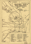 Military map of Philadelphia 1861-1865 Drawn by Frank H. Taylor. Taylor, Frank H., d. 1918. CREATED/PUBLISHED [S.l., 1914?] NOTES Scale not given. Important buildings and sites are keyed by number to the map. Hospitals are identified by letters. Military map of Philadelphia 1861-1865 Drawn by Frank H. Taylor. Taylor, Frank H., d. 1918. CREATED/PUBLISHED [S.l., 1914?] NOTES Scale not given. Important buildings and sites are keyed by number to the map. Hospitals are identified by letters. |
 Route of the Tenth New York Cavalry from Culpeper to Gettysburg and return. Summer and fall campaigns of 1863. Preston, Noble D. CREATED/PUBLISHED [S.l.] 1863. NOTES Scale ca. 1:440,000. Finished pen and ink manuscript map of parts of Virginia, Maryland, and Pennsylvania, showing location and date of encampments and battles, route of the Tenth New York Cavalry, route of Capt. Pratt, roads, railroads, towns, drainage, and relief by hachures. Route of the Tenth New York Cavalry from Culpeper to Gettysburg and return. Summer and fall campaigns of 1863. Preston, Noble D. CREATED/PUBLISHED [S.l.] 1863. NOTES Scale ca. 1:440,000. Finished pen and ink manuscript map of parts of Virginia, Maryland, and Pennsylvania, showing location and date of encampments and battles, route of the Tenth New York Cavalry, route of Capt. Pratt, roads, railroads, towns, drainage, and relief by hachures. |
 Battle-field map showing field of operations of the Armies of the Potomac and James Compiled from latest government surveys and published by J. C. & C. G. Van Hook. A. B. Graham, photo-lith., Washington, D. C. Van Hook, J. C. CREATED/PUBLISHED Washington, 1892 NOTES Scale ca. 1:508,500. Map of Virginia and Maryland showing engagements, railroads, rivers and streams, place names, and relief by hachures. "Dates and locations of principal engagements as shown on this map" are listed in the lower left corner. Battle-field map showing field of operations of the Armies of the Potomac and James Compiled from latest government surveys and published by J. C. & C. G. Van Hook. A. B. Graham, photo-lith., Washington, D. C. Van Hook, J. C. CREATED/PUBLISHED Washington, 1892 NOTES Scale ca. 1:508,500. Map of Virginia and Maryland showing engagements, railroads, rivers and streams, place names, and relief by hachures. "Dates and locations of principal engagements as shown on this map" are listed in the lower left corner. |
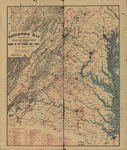
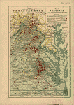 Map of Virginia and neighboring states showing the location of battles in the Civil War 1861-1865. Northrup, William P. CREATED/PUBLISHED Buffalo, N.Y., The Matthews-Northrup Works, c1912. NOTES Scale ca. 1:366,000. Map of eastern Virginia and parts of North Carolina, Maryland, West Virginia, and Pennsylvania, showing "battles in which New York regiments were engaged," "railroads at time of war," and "turnpikes and plank roads." Union states are colored yellow, and Confederate states are green. Map of Virginia and neighboring states showing the location of battles in the Civil War 1861-1865. Northrup, William P. CREATED/PUBLISHED Buffalo, N.Y., The Matthews-Northrup Works, c1912. NOTES Scale ca. 1:366,000. Map of eastern Virginia and parts of North Carolina, Maryland, West Virginia, and Pennsylvania, showing "battles in which New York regiments were engaged," "railroads at time of war," and "turnpikes and plank roads." Union states are colored yellow, and Confederate states are green. |
This is a must have collection for any civil war history buff!
To use this software, you must install the free ExpressView MrSid software which is included on the CD. This is a 30 second process and will allow you to view and manipulate/print all the maps in this CD collection in full detail. There is a version for Windows platforms and full installation instructions are included on the CD.