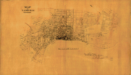
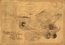
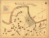
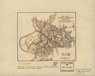
This CD contains 77 rare historic maps and descriptive pages representing fascinating details about Tennessee and its vicinity during the Civil War.
This CD contains 77 rare historic maps and descriptive pages representing fascinating details about Tennessee and its vicinity during the Civil War in MrSid format. This format allows you to see the entire map on your computer screen or drill down to see the smallest details. The original maps are often quite large, as much as 36" long or larger and quite detailed. With the MrSID software, you can manipulate the map to print the entire map in great detail or zoom into a portion of the map in full detail for viewing or printing. You could even bring the images to a local print shop to have the maps reprinted in their full size. (MrSID software is included on the CD.)
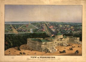
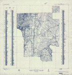
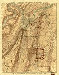
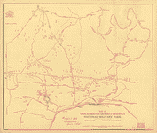
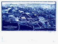
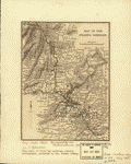
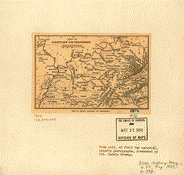
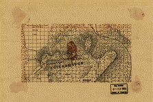
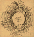
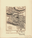
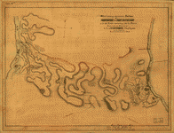
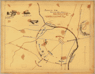
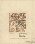
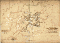
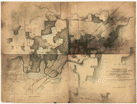
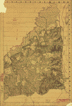
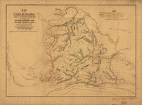
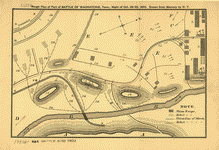
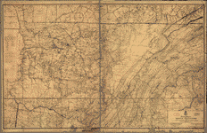
To give you a sample of the detail you can expect in these maps, here is an example based on a panoramic map of Washington, DC.
 |
 |
 |
 |
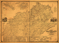
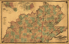
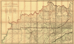
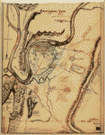
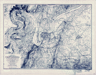
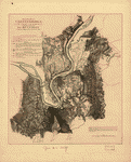
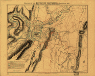
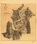
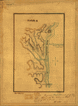
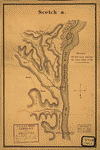
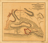
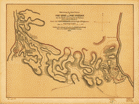
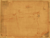
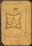
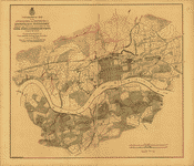
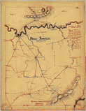
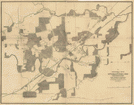
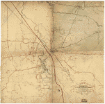
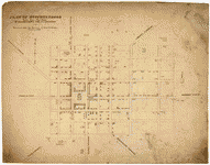
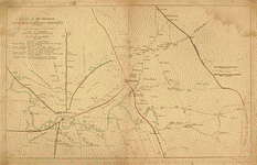
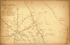
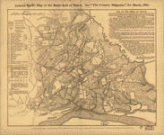
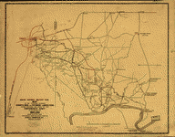
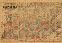
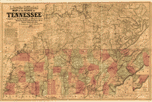
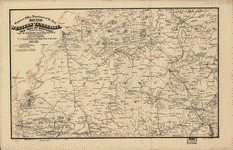
The table below shows the description and a small image of each map on this fascinating civil war history CD.
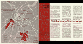
 Chickamauga and Chattanooga National Military Park, Ga. (Chickamauga Battlefield). Geological Survey (U.S.) CREATED/PUBLISHED [Washington, 1934] NOTES Scale 1:9600. "Advance sheet. Subject to correction." Title at top of sheet: Georgia. Chickamauga and Chattanooga National Military Park (Chickamauga Battlefield). Detailed topographic map indicating monuments and markers. 290 sites are listed and keyed by number to the map. Countour interval is 5 feet. Chickamauga and Chattanooga National Military Park, Ga. (Chickamauga Battlefield). Geological Survey (U.S.) CREATED/PUBLISHED [Washington, 1934] NOTES Scale 1:9600. "Advance sheet. Subject to correction." Title at top of sheet: Georgia. Chickamauga and Chattanooga National Military Park (Chickamauga Battlefield). Detailed topographic map indicating monuments and markers. 290 sites are listed and keyed by number to the map. Countour interval is 5 feet. |
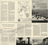 Chickamauga and Chattanooga National Military Park, Georgia and Tennessee : principal roads and streets between Chattanooga and park areas. United States. National Park Service. OTHER TITLES Point Park Lookout Mountain and Chattanooga battlefields CREATED/PUBLISHED [Washington], Government Printing Office, 1957 NOTES Scale ca. 1:64,000. Chickamauga and Chattanooga National Military Park, Georgia and Tennessee : principal roads and streets between Chattanooga and park areas. United States. National Park Service. OTHER TITLES Point Park Lookout Mountain and Chattanooga battlefields CREATED/PUBLISHED [Washington], Government Printing Office, 1957 NOTES Scale ca. 1:64,000. |
 Chickamauga and Chattanooga National Military Park. United States. National Park Service. CREATED/PUBLISHED [Washington, U.S. Govt. Print. Off.] 1968. NOTES Scale ca. 1:95,000. Chickamauga and Chattanooga National Military Park. United States. National Park Service. CREATED/PUBLISHED [Washington, U.S. Govt. Print. Off.] 1968. NOTES Scale ca. 1:95,000. |
 Georgia, Chickamauga and Chattanooga National Military Park (Chickamauga Battlefield) / Department of the Interior, U.S. Geological Survey ; topography by Frank Larner and R. E. Amidon. Geological Survey (U.S.) CREATED/PUBLISHED [Knoxville : Tennessee Valley Authority, 1975?] NOTES Scale 1:9,600 or 1 in. = 800 ft. Includes compilation diagr. and index of battle monuments and sites. Georgia, Chickamauga and Chattanooga National Military Park (Chickamauga Battlefield) / Department of the Interior, U.S. Geological Survey ; topography by Frank Larner and R. E. Amidon. Geological Survey (U.S.) CREATED/PUBLISHED [Knoxville : Tennessee Valley Authority, 1975?] NOTES Scale 1:9,600 or 1 in. = 800 ft. Includes compilation diagr. and index of battle monuments and sites. |
 Map of Chickamauga & Chattanooga National Park The Matthews-Northrup Co., Buffalo, N.Y. Nashville, Chattanooga, and St. Louis Railway. OTHER TITLES War route to Chickamauga. Dedication Chickamauga and Chattanooga National Park, September 18, 19, and 20, 1895. CREATED/PUBLISHED [Nashville, Nashville, Chattanooga & St. Louis Ry., 1895] NOTES Scale ca. 1:57,000. Map shows roads, railroads, state boundaries, place names, and boundary of national park. "Red lines indicate government roads." Map of Chickamauga & Chattanooga National Park The Matthews-Northrup Co., Buffalo, N.Y. Nashville, Chattanooga, and St. Louis Railway. OTHER TITLES War route to Chickamauga. Dedication Chickamauga and Chattanooga National Park, September 18, 19, and 20, 1895. CREATED/PUBLISHED [Nashville, Nashville, Chattanooga & St. Louis Ry., 1895] NOTES Scale ca. 1:57,000. Map shows roads, railroads, state boundaries, place names, and boundary of national park. "Red lines indicate government roads." |
 Map of Chickamauga and Chattanooga National Military Park Drawn by B. B. Ramey. Copyrighted 1895, by W. E. Birchmore. Engraved by Buff[alo] Elec. & Eng. Co. Ramey, B. B. CREATED/PUBLISHED [S.l.], c1895. NOTES Scale 1:12,000. Map indicates roads, drainage, houses, and names of residents. "Key to monuments, locations, and markers" depicted on map Map of Chickamauga and Chattanooga National Military Park Drawn by B. B. Ramey. Copyrighted 1895, by W. E. Birchmore. Engraved by Buff[alo] Elec. & Eng. Co. Ramey, B. B. CREATED/PUBLISHED [S.l.], c1895. NOTES Scale 1:12,000. Map indicates roads, drainage, houses, and names of residents. "Key to monuments, locations, and markers" depicted on map |
 Aero view of Chickamauga and Chattanooga National Military Park (looking east). Painted by Rudolph J. Shutting. Shutting, Rudolph J. CREATED/PUBLISHED Chattanooga, 1913. [Knoxville, Tenn., Tennessee Valley Authority, 1974?] NOTES Perspective map not drawn to scale. Bird's-eye-view. Indexed for points of interest. Aero view of Chickamauga and Chattanooga National Military Park (looking east). Painted by Rudolph J. Shutting. Shutting, Rudolph J. CREATED/PUBLISHED Chattanooga, 1913. [Knoxville, Tenn., Tennessee Valley Authority, 1974?] NOTES Perspective map not drawn to scale. Bird's-eye-view. Indexed for points of interest. |
 Map of the Atlanta campaign. [May-Sept. 1864]. Western and Atlantic Railroad Company. CREATED/PUBLISHED [S.l., 1887] NOTES Scale ca. 1:830,000. From Century illustrated monthly magazine, v. 34, July 1887. P. 446. Map of the northwest Georgia showing location and date of engagements, railroads, towns, rivers, relief by hachures, and county names and boundaries. Map of the Atlanta campaign. [May-Sept. 1864]. Western and Atlantic Railroad Company. CREATED/PUBLISHED [S.l., 1887] NOTES Scale ca. 1:830,000. From Century illustrated monthly magazine, v. 34, July 1887. P. 446. Map of the northwest Georgia showing location and date of engagements, railroads, towns, rivers, relief by hachures, and county names and boundaries. |
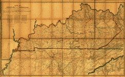
 New map of Kentucky and Tennessee from authentic reports of county surveyors throughout the states of Kentucky and Tennessee with a new key for measuring distances and specifying localities (which key is secured by copyright.). Campbell and Barlow. CREATED/PUBLISHED Louisville, Ky., Campbell & Barlow, c1861. NOTES Scale ca. 1:600,000. Index to cities counties is printed below the map. General map indicating roads and railroads, county names and boundaries, cities and towns, rivers, and relief by hachures. Some roads and railroads in Kentucky have been colored red and black respectively. A nearly illegible pencil note in the lower right corner states that this map was "Turned into Bureau of Tpl. Eng. by Lieut. O. M. Poe, Top. Engr., August 1861, referred [to] in his letter of Aug. 17, 1861." Insets: The city of Memphis, Tennessee. 20 x 29 cm.-The city of Louisville, Kentucky. 19 x 32 cm. New map of Kentucky and Tennessee from authentic reports of county surveyors throughout the states of Kentucky and Tennessee with a new key for measuring distances and specifying localities (which key is secured by copyright.). Campbell and Barlow. CREATED/PUBLISHED Louisville, Ky., Campbell & Barlow, c1861. NOTES Scale ca. 1:600,000. Index to cities counties is printed below the map. General map indicating roads and railroads, county names and boundaries, cities and towns, rivers, and relief by hachures. Some roads and railroads in Kentucky have been colored red and black respectively. A nearly illegible pencil note in the lower right corner states that this map was "Turned into Bureau of Tpl. Eng. by Lieut. O. M. Poe, Top. Engr., August 1861, referred [to] in his letter of Aug. 17, 1861." Insets: The city of Memphis, Tennessee. 20 x 29 cm.-The city of Louisville, Kentucky. 19 x 32 cm. |
 New map of Kentucky and Tennessee from authentic reports of county surveyors throughout the states of Kentucky and Tennessee with a new key for measuring distances and specifying localities (which key is secured by copyright.). Campbell and Barlow. CREATED/PUBLISHED Cincinnati, Middleton Strobridge & Co., c1861. NOTES Scale ca. 1:690,000. Map is annotated in blue to show the "Great national military rail road" and in red to show the "Great national military road." New map of Kentucky and Tennessee from authentic reports of county surveyors throughout the states of Kentucky and Tennessee with a new key for measuring distances and specifying localities (which key is secured by copyright.). Campbell and Barlow. CREATED/PUBLISHED Cincinnati, Middleton Strobridge & Co., c1861. NOTES Scale ca. 1:690,000. Map is annotated in blue to show the "Great national military rail road" and in red to show the "Great national military road." |
 Military map of the States of Kentucky and Tennessee, within eleven miles of the 35th parallel of latitude or southern boundary of Tennessee; compiled from the best authentic original maps, various documents, and miscellaneous latest sources of information; commenced under the authority of Major General Don Carlos Buell, commanding the Department of the Ohio, by Capt. N. Michler, Corps Topogl. Engrs. U.S.A., continued under Major General H. G. Wright by Maj. L. Sitgreaves Corps Topogl. Engrs. U.S.A., and completed under Major General Ambrose E. Burnside, commanding the Department, by Lieut. Col. J. H. Simpson, Corps Engrs. U.S.A., Chief Engr. in the Department. Drawn by Charles E. Swann, Ass't. Engr. Swann, Charles E., Assistant Engineer. CREATED/PUBLISHED Cincinnati, O., Ehrgott, Forbriger & Co., Lithographers, Engravers & Printers, 1863. NOTES Scale 1:350,000. In this issue Camp Burnside on the Cumberland River is named, the lithographer's name has been revised, and a dotted line representing the "out line of coal field" has been added in the southeastern quadrant. Military map of the States of Kentucky and Tennessee, within eleven miles of the 35th parallel of latitude or southern boundary of Tennessee; compiled from the best authentic original maps, various documents, and miscellaneous latest sources of information; commenced under the authority of Major General Don Carlos Buell, commanding the Department of the Ohio, by Capt. N. Michler, Corps Topogl. Engrs. U.S.A., continued under Major General H. G. Wright by Maj. L. Sitgreaves Corps Topogl. Engrs. U.S.A., and completed under Major General Ambrose E. Burnside, commanding the Department, by Lieut. Col. J. H. Simpson, Corps Engrs. U.S.A., Chief Engr. in the Department. Drawn by Charles E. Swann, Ass't. Engr. Swann, Charles E., Assistant Engineer. CREATED/PUBLISHED Cincinnati, O., Ehrgott, Forbriger & Co., Lithographers, Engravers & Printers, 1863. NOTES Scale 1:350,000. In this issue Camp Burnside on the Cumberland River is named, the lithographer's name has been revised, and a dotted line representing the "out line of coal field" has been added in the southeastern quadrant. |
 Military map of the States of Kentucky and Tennessee, within eleven miles of the 35th parallel of latitude or southern boundary of Tennessee; compiled from the best authentic original maps, various documents, and miscellaneous latest sources of information; commenced under the authority of Major General Don Carlos Buell, commanding the Department of the Ohio, by Capt. N. Michler, Corps Topogl. Engrs. U.S.A., continued under Major General H. G. Wright by Maj. L. Sitgreaves Corps Topogl. Engrs. U.S.A., and completed under Major General Ambrose E. Burnside, commanding the Department, by Lieut. Col. J. H. Simpson, Corps Engrs. U.S.A., Chief Engr. in the Department. Drawn by Charles E. Swann, Ass't. Engr. Ehrgott, Forbriger & Co., Lithographers, Engraphers [sic] and Printers, Cincinnati, O. Swann, Charles E. CREATED/PUBLISHED Cincinnati, Ohio, Office of Chief Engineer, Dept. of the Ohio, 1863. NOTES Scale 1:350,000 (5.524 miles to one inch). Detailed map of Kentucky and most of Tennessee showing towns and villages, county seats, iron works and forges, salt works, mills, post offices, existing and proposed railroads, roads, rivers, and limits of coal fields. Map has been annotated in red ink to show the location of "Camp Burnside" on the Cumberland River south of Somerset, Kentucky. Military map of the States of Kentucky and Tennessee, within eleven miles of the 35th parallel of latitude or southern boundary of Tennessee; compiled from the best authentic original maps, various documents, and miscellaneous latest sources of information; commenced under the authority of Major General Don Carlos Buell, commanding the Department of the Ohio, by Capt. N. Michler, Corps Topogl. Engrs. U.S.A., continued under Major General H. G. Wright by Maj. L. Sitgreaves Corps Topogl. Engrs. U.S.A., and completed under Major General Ambrose E. Burnside, commanding the Department, by Lieut. Col. J. H. Simpson, Corps Engrs. U.S.A., Chief Engr. in the Department. Drawn by Charles E. Swann, Ass't. Engr. Ehrgott, Forbriger & Co., Lithographers, Engraphers [sic] and Printers, Cincinnati, O. Swann, Charles E. CREATED/PUBLISHED Cincinnati, Ohio, Office of Chief Engineer, Dept. of the Ohio, 1863. NOTES Scale 1:350,000 (5.524 miles to one inch). Detailed map of Kentucky and most of Tennessee showing towns and villages, county seats, iron works and forges, salt works, mills, post offices, existing and proposed railroads, roads, rivers, and limits of coal fields. Map has been annotated in red ink to show the location of "Camp Burnside" on the Cumberland River south of Somerset, Kentucky. |
 Map of Kentucky and Tennessee. CREATED/PUBLISHED [S.l., 1864] NOTES Scale ca. 1:6,200,000. From Century illustrated monthly magazine, v. 34, Aug. 1887. p. 596. Title in the lower margin: Map of Hood's invasion of Tennessee. Map of Kentucky and Tennessee. CREATED/PUBLISHED [S.l., 1864] NOTES Scale ca. 1:6,200,000. From Century illustrated monthly magazine, v. 34, Aug. 1887. p. 596. Title in the lower margin: Map of Hood's invasion of Tennessee. |
  Grierson's route from La Grange to Baton Rouge. [April 17-May 2, 1863]. CREATED/PUBLISHED [S.l., 1863] NOTES Scale ca. 1:3,625,000. Grierson's route from La Grange to Baton Rouge. [April 17-May 2, 1863]. CREATED/PUBLISHED [S.l., 1863] NOTES Scale ca. 1:3,625,000. |
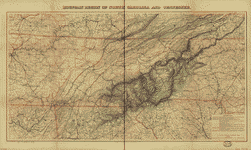 Mountain region of North Carolina and Tennessee / compiled by W. L. Nicholson & A. Lindenkohl, 1863 ; drawn by A. Lindenkohl ; H. Lindenkohl & Chas. G. Krebs, lith. Nicholson, W. L. CREATED/PUBLISHED [Washington] : U.S. Coast Survey, [1863] NOTES Scale 1:633,600; 1 in. = 10 miles. Relief shown by hachures. Mountain region of North Carolina and Tennessee / compiled by W. L. Nicholson & A. Lindenkohl, 1863 ; drawn by A. Lindenkohl ; H. Lindenkohl & Chas. G. Krebs, lith. Nicholson, W. L. CREATED/PUBLISHED [Washington] : U.S. Coast Survey, [1863] NOTES Scale 1:633,600; 1 in. = 10 miles. Relief shown by hachures. |
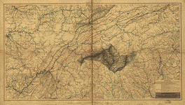 Mountain region of North Carolina and Tennessee Compiled by W. L. Nicholson, 1863. Drawn by A. Lindenkohl. H. Lindenkohl & Chas. G. Krebs, lith. Nicholson, W. L. CREATED/PUBLISHED [Washington D. C.], U.S. Coast Survey, A. D. Bache Supt., 1863. NOTES Scale 1:633,600. In top margin: Unfinished proof. Map title printed in the lower right corner. Mountain region of North Carolina and Tennessee Compiled by W. L. Nicholson, 1863. Drawn by A. Lindenkohl. H. Lindenkohl & Chas. G. Krebs, lith. Nicholson, W. L. CREATED/PUBLISHED [Washington D. C.], U.S. Coast Survey, A. D. Bache Supt., 1863. NOTES Scale 1:633,600. In top margin: Unfinished proof. Map title printed in the lower right corner. |
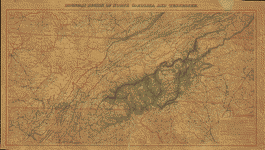 Mountain region of North Carolina and Tennessee. Compiled by W. L. Nicholson & A. Lindenkohl, 1863.-With corrections to May, 1864. Drawn by A. Lindenkohl. H. Lindenkohl & Chas. G. Krebs, lith. Nicholson, W. L. CREATED/PUBLISHED [S.l.], U.S. Coast Survey, A.D. Bache, Supt., [1864] NOTES Scale 1:633,600. Map of parts of the states of Kentucky, Tennessee, Virginia, North and South Carolina, Georgia, and Alabama, showing relief by hachures, drainage, names and boundaries of states, roads, and railroads. Part of the route of the "proposed military railroad from Nicholasville & Lebanon" is indicated. Mountain region of North Carolina and Tennessee. Compiled by W. L. Nicholson & A. Lindenkohl, 1863.-With corrections to May, 1864. Drawn by A. Lindenkohl. H. Lindenkohl & Chas. G. Krebs, lith. Nicholson, W. L. CREATED/PUBLISHED [S.l.], U.S. Coast Survey, A.D. Bache, Supt., [1864] NOTES Scale 1:633,600. Map of parts of the states of Kentucky, Tennessee, Virginia, North and South Carolina, Georgia, and Alabama, showing relief by hachures, drainage, names and boundaries of states, roads, and railroads. Part of the route of the "proposed military railroad from Nicholasville & Lebanon" is indicated. |
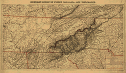 Mountain region of North Carolina and Tennessee, compiled by W. L. Nicholson & A. Lindenkohl, with corrections to January 1865. Drawn by A. Lindenkohl. H. Lindenkohl & Chas. G. Krebs, lith. Nicholson, W. L. CREATED/PUBLISHED [S.l.], U.S. Coast Survey, A. D. Bache, Supt., [1865] NOTES Scale 1:633,600. Map title printed in the top margin. Map covers parts of the states of Kentucky, Tennessee, Virginia, North and South Carolina, Georgia, and Alabama and shows relief by hachures, drainage, names and boundaries of states, roads, and railroads. This edition has been significantly revised in the vicinity of Chattanooga, Tennessee, and Northern Georgia. Mountain region of North Carolina and Tennessee, compiled by W. L. Nicholson & A. Lindenkohl, with corrections to January 1865. Drawn by A. Lindenkohl. H. Lindenkohl & Chas. G. Krebs, lith. Nicholson, W. L. CREATED/PUBLISHED [S.l.], U.S. Coast Survey, A. D. Bache, Supt., [1865] NOTES Scale 1:633,600. Map title printed in the top margin. Map covers parts of the states of Kentucky, Tennessee, Virginia, North and South Carolina, Georgia, and Alabama and shows relief by hachures, drainage, names and boundaries of states, roads, and railroads. This edition has been significantly revised in the vicinity of Chattanooga, Tennessee, and Northern Georgia. |
  Chattanooga Tenn. 1863 / G.H. Blakeslee, U.S. Top. Eng. Blakeslee, G. H. CREATED/PUBLISHED 1863. NOTES Sketch map showing fortifications, Union/Confederate picket lines, rifle pits, "Rebel camp[s]", roads, railroads, and streams. Relief shown by hachures and spot heights. Chattanooga Tenn. 1863 / G.H. Blakeslee, U.S. Top. Eng. Blakeslee, G. H. CREATED/PUBLISHED 1863. NOTES Sketch map showing fortifications, Union/Confederate picket lines, rifle pits, "Rebel camp[s]", roads, railroads, and streams. Relief shown by hachures and spot heights. |
 Map of Chattanooga and vicinity. [1863-1864] Prepared for and presented with compliments of Western and Atlantic R.R. Co. Western and Atlantic Railroad Company. CREATED/PUBLISHED Buffalo, N.Y., Matthews, Northrup & Co., Art-Printing Works, [1864] NOTES Scale ca. 1:310,000. Indicates the battles of Missionary Ridge, Chickamauga Station, Graysville, Chickamauga, Ringgold, and the "battle among the Clouds," roads, railroads, towns, drainage, and relief by hachures. Map of Chattanooga and vicinity. [1863-1864] Prepared for and presented with compliments of Western and Atlantic R.R. Co. Western and Atlantic Railroad Company. CREATED/PUBLISHED Buffalo, N.Y., Matthews, Northrup & Co., Art-Printing Works, [1864] NOTES Scale ca. 1:310,000. Indicates the battles of Missionary Ridge, Chickamauga Station, Graysville, Chickamauga, Ringgold, and the "battle among the Clouds," roads, railroads, towns, drainage, and relief by hachures. |
 Map of the battlefields of Chattanooga, movement against Orchard Knob. Prepared ... by the Chickamauga and Chattanooga National Park Commission. Compiled and drawn by Edward E. Betts. United States. Chickamauga and Chattanooga National Park Commission. CREATED/PUBLISHED [Washington?] 1901. [Knoxville, Tenn., Tennessee Valley Authority, 1974?] NOTES Scale ca. 1:48,000. Relief shown by contours and spot heights. Covers Chattanooga region. Map of the battlefields of Chattanooga, movement against Orchard Knob. Prepared ... by the Chickamauga and Chattanooga National Park Commission. Compiled and drawn by Edward E. Betts. United States. Chickamauga and Chattanooga National Park Commission. CREATED/PUBLISHED [Washington?] 1901. [Knoxville, Tenn., Tennessee Valley Authority, 1974?] NOTES Scale ca. 1:48,000. Relief shown by contours and spot heights. Covers Chattanooga region. |
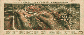 attanooga and surrounding battlefields [By Reginald] Purse. Purse, Reginald. CREATED/PUBLISHED Chattanooga, [Purse Printing Co.], c1913. NOTES Scale not given. y-three points of interest are listed in the lower margin and keyed by number to the panoramic map. attanooga and surrounding battlefields [By Reginald] Purse. Purse, Reginald. CREATED/PUBLISHED Chattanooga, [Purse Printing Co.], c1913. NOTES Scale not given. y-three points of interest are listed in the lower margin and keyed by number to the panoramic map. |
  Battle map of Chickamauga, Georgia. Saturday 19 [and] Sunday, 20 September 1863. Map of the Chattanooga battle-fields, November, 1863. Orchard Knob, 23d, Lookout Mountain, 24th, Missionary Ridge, 25th. Norwood, Charles W. CREATED/PUBLISHED Chattanooga, c1898. NOTES Scale ca. 1:32,600. -- Scale ca. 1:63,360. The Chickamauga map is divided "into quarter-mile sections, numbered 1 to 20 on the west and east margins, and lettered A to O on the north and sourth." Map indicates approximate troop positions, movements, commanding officers, a few houses and names of residents, roads, "Chatta., Rome & Southern R.R.," and drainage. The Chattanooga map is divided "into half-mile sections, numbered 1 to 19 on the west and east sides, and lettered A to L on the north and south." The map includes positions of "troops only in their critical situations," relief by hachures, drainage, railroads, and the outline of the streets of Chattanooga. Battle map of Chickamauga, Georgia. Saturday 19 [and] Sunday, 20 September 1863. Map of the Chattanooga battle-fields, November, 1863. Orchard Knob, 23d, Lookout Mountain, 24th, Missionary Ridge, 25th. Norwood, Charles W. CREATED/PUBLISHED Chattanooga, c1898. NOTES Scale ca. 1:32,600. -- Scale ca. 1:63,360. The Chickamauga map is divided "into quarter-mile sections, numbered 1 to 20 on the west and east margins, and lettered A to O on the north and sourth." Map indicates approximate troop positions, movements, commanding officers, a few houses and names of residents, roads, "Chatta., Rome & Southern R.R.," and drainage. The Chattanooga map is divided "into half-mile sections, numbered 1 to 19 on the west and east sides, and lettered A to L on the north and south." The map includes positions of "troops only in their critical situations," relief by hachures, drainage, railroads, and the outline of the streets of Chattanooga. |
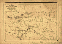 Map of a portion of Missionary Ridge, illustrating the positions of Baird's & Wood's div's., Nov. 23, 24 and 25, 1863. Julius Bien & Co. CREATED/PUBLISHED [S.l.], Julius Bien & Co., photo. lith., [18-?] NOTES Scale ca. 1:11,800. Shows topography by contours, drainage, roads, railroads, and dwellings with names of inhabitants. Names of corps and commanding officers are given. Arrows indicate battle movements. Map of a portion of Missionary Ridge, illustrating the positions of Baird's & Wood's div's., Nov. 23, 24 and 25, 1863. Julius Bien & Co. CREATED/PUBLISHED [S.l.], Julius Bien & Co., photo. lith., [18-?] NOTES Scale ca. 1:11,800. Shows topography by contours, drainage, roads, railroads, and dwellings with names of inhabitants. Names of corps and commanding officers are given. Arrows indicate battle movements. |
 Fisheye view of Chattanooga and vicinity showing troop positions in 1863]. CREATED/PUBLISHED [S.l., 1863] NOTES Not drawn to scale. Fisheye view of Chattanooga and vicinity showing troop positions in 1863]. CREATED/PUBLISHED [S.l., 1863] NOTES Not drawn to scale. |
 Battlefield of Chattanooga with the operations of the national forces under the command of Maj. Gen. U.S. Grant during the battles of Nov. 23, 24, & 25, 1863 Published at the U.S. Coast Survey Office, from surveys made under the direction of Br. Genl. W. F. Smith, Chief Engr., Mil. Div. Miss. . . . Chas. G. Krebs, lith. Smith, William F. CREATED/PUBLISHED [S.l.], U.S. Coast Survey Office, [1863] NOTES Scale ca. 1:42,500. Indicates troop positions, Union and Confederate headquarters, roads, railroads, drainage, vegetation, relief by shading, and the names of a few residents in the outlying areas. Battlefield of Chattanooga with the operations of the national forces under the command of Maj. Gen. U.S. Grant during the battles of Nov. 23, 24, & 25, 1863 Published at the U.S. Coast Survey Office, from surveys made under the direction of Br. Genl. W. F. Smith, Chief Engr., Mil. Div. Miss. . . . Chas. G. Krebs, lith. Smith, William F. CREATED/PUBLISHED [S.l.], U.S. Coast Survey Office, [1863] NOTES Scale ca. 1:42,500. Indicates troop positions, Union and Confederate headquarters, roads, railroads, drainage, vegetation, relief by shading, and the names of a few residents in the outlying areas. |
 Sketch of the battles of Chattanooga, Nov. 23-26, 1863 U.S. Coast Survey Office, A. D. Bache Supdt. From a sketch by Capt. Preston C. F. West, U.S. Coast Survey. Drawn by H. Lindenkohl. Lindenkohl, H. (Henry) CREATED/PUBLISHED [S.l., H. Lindenkohl & Chas. G Krebs, Lith., 1863] NOTES Scale 1:63,360. Map of the environs of Chattanooga showing troop positions and movements, roads, railroads, towns, drainage, and relief by shading. Sketch of the battles of Chattanooga, Nov. 23-26, 1863 U.S. Coast Survey Office, A. D. Bache Supdt. From a sketch by Capt. Preston C. F. West, U.S. Coast Survey. Drawn by H. Lindenkohl. Lindenkohl, H. (Henry) CREATED/PUBLISHED [S.l., H. Lindenkohl & Chas. G Krebs, Lith., 1863] NOTES Scale 1:63,360. Map of the environs of Chattanooga showing troop positions and movements, roads, railroads, towns, drainage, and relief by shading. |
 Map of the battlefield of Chattanooga Prepared to accompany report of Maj. Genl. U.S. Grant. By direction of Brigd. Genl. W. F. Smith, Chief Engr., Milty. Div. Miss. 1864. Published by authority of the Secretary of War in the office of the Chief of Engrs., U.S.A. 1875. Smith, William F. CREATED/PUBLISHED [N.Y., Julius Bien & Co., photo lith., 1875] NOTES Scale ca. 1:26,600 (not "1:20,000"). Gives troop positions, "route of Hooker's command, Nov. 20th," "route of pontoons," "line of retreat of enemy," relief by hachures, vegetation, drainage, roads, railroads, houses, and the names of a few residents. Map of the battlefield of Chattanooga Prepared to accompany report of Maj. Genl. U.S. Grant. By direction of Brigd. Genl. W. F. Smith, Chief Engr., Milty. Div. Miss. 1864. Published by authority of the Secretary of War in the office of the Chief of Engrs., U.S.A. 1875. Smith, William F. CREATED/PUBLISHED [N.Y., Julius Bien & Co., photo lith., 1875] NOTES Scale ca. 1:26,600 (not "1:20,000"). Gives troop positions, "route of Hooker's command, Nov. 20th," "route of pontoons," "line of retreat of enemy," relief by hachures, vegetation, drainage, roads, railroads, houses, and the names of a few residents. |
 Battle of Chattanooga, Nov. 23, 24, 25, 1863. Badeau, Adam. CREATED/PUBLISHED [S.l., 1885] NOTES Scale ca. 1:108,000. From Century illustrated monthly magazine, v. 31, Nov. 1885. p. 132. Shows troop positions, "National works," "Confederate works," roads, rivers, railroads, houses, and relief by hachures. Battle of Chattanooga, Nov. 23, 24, 25, 1863. Badeau, Adam. CREATED/PUBLISHED [S.l., 1885] NOTES Scale ca. 1:108,000. From Century illustrated monthly magazine, v. 31, Nov. 1885. p. 132. Shows troop positions, "National works," "Confederate works," roads, rivers, railroads, houses, and relief by hachures. |
 Battlefield of Chatanooga. [October-November 1863]. United States. Army. Illinois Infantry Regiment, 13th (1861-1864) CREATED/PUBLISHED [Chicago, Woman's Temperance Publishing Association, 1892] NOTES Scale ca 1:73,000. From its Military history and reminiscences of the Thirteenth regiment of Illinois volunteer infantry in the Civil War in the United States, 1861-65. Prepared by a committee of the regiment, 1891. Chicago, Woman's Temperance Publishing Association, 1892. Facing p. 366. Map indicates troop positions "when Gen. Grant took command, Oct. 23, 1863," and on November 23, 24, and 25. Battlefield of Chatanooga. [October-November 1863]. United States. Army. Illinois Infantry Regiment, 13th (1861-1864) CREATED/PUBLISHED [Chicago, Woman's Temperance Publishing Association, 1892] NOTES Scale ca 1:73,000. From its Military history and reminiscences of the Thirteenth regiment of Illinois volunteer infantry in the Civil War in the United States, 1861-65. Prepared by a committee of the regiment, 1891. Chicago, Woman's Temperance Publishing Association, 1892. Facing p. 366. Map indicates troop positions "when Gen. Grant took command, Oct. 23, 1863," and on November 23, 24, and 25. |
 Map of Chattanooga and environs. Copyright 1895 by W. E. Birchmore. Engraved by Buff[alo] Elec. & Eng. Co. Lynde, Francis, 1856-1930. CREATED/PUBLISHED [Chattanooga, W. E. Birchmore, c1895] NOTES Scale 1:30,000. Map indicates the location of monuments and tablets. Map of Chattanooga and environs. Copyright 1895 by W. E. Birchmore. Engraved by Buff[alo] Elec. & Eng. Co. Lynde, Francis, 1856-1930. CREATED/PUBLISHED [Chattanooga, W. E. Birchmore, c1895] NOTES Scale 1:30,000. Map indicates the location of monuments and tablets. |
 Map illustrating the operations of the Seventh Division under Brig. General G. W. Morgan at Cumberland Gap, Tennessee, during a portion of the year 1862 Compiled by Edward Ruger at Headqr's., Dept. of the Cumberland. Published by authority of the Hon. the Secretary of War in the office of the Chief of Engineers, U.S. Army, 1877. Ruger, Edward. CREATED/PUBLISHED [S.l., 1877] NOTES Scale 1:253,440. Shows troop movements and fortifications, roads, towns, drainage, and hachures. Map illustrating the operations of the Seventh Division under Brig. General G. W. Morgan at Cumberland Gap, Tennessee, during a portion of the year 1862 Compiled by Edward Ruger at Headqr's., Dept. of the Cumberland. Published by authority of the Hon. the Secretary of War in the office of the Chief of Engineers, U.S. Army, 1877. Ruger, Edward. CREATED/PUBLISHED [S.l., 1877] NOTES Scale 1:253,440. Shows troop movements and fortifications, roads, towns, drainage, and hachures. |
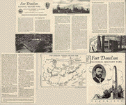 Fort Donelson National Military Park, Tennessee Drawn by R. M. Montesano, January 1947. United States. National Park Service. CREATED/PUBLISHED [Washington], Government Printing Office, reprint 1959. NOTES Scale ca. 1:22,500. Illustrates the descriptive leaflet. The map indicates the park boundary, earthworks, roads, and "tactical disposition of troops on the night of Feb. 15, 1862." Fort Donelson National Military Park, Tennessee Drawn by R. M. Montesano, January 1947. United States. National Park Service. CREATED/PUBLISHED [Washington], Government Printing Office, reprint 1959. NOTES Scale ca. 1:22,500. Illustrates the descriptive leaflet. The map indicates the park boundary, earthworks, roads, and "tactical disposition of troops on the night of Feb. 15, 1862." |
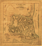 Plan of Fort Donelson and outworks : [Tennessee] / surveyed by Lieut's Janney and Kossak ; under the direction of Lieut. Col. J.B. McPherson, Chief Eng'r ; drawn by Otto H. Matz, Ass't Top'l Eng'r. Matz, Otto H., 1830-1919. CREATED/PUBLISHED [1862] NOTES Shows the fort, town of Dover, fortifications, "Enemies' tents", "Enemies' log huts", woods, and areas of fallen timber. Relief shown by hachures and form lines. Plan of Fort Donelson and outworks : [Tennessee] / surveyed by Lieut's Janney and Kossak ; under the direction of Lieut. Col. J.B. McPherson, Chief Eng'r ; drawn by Otto H. Matz, Ass't Top'l Eng'r. Matz, Otto H., 1830-1919. CREATED/PUBLISHED [1862] NOTES Shows the fort, town of Dover, fortifications, "Enemies' tents", "Enemies' log huts", woods, and areas of fallen timber. Relief shown by hachures and form lines. |
 Map of the environs of Fort Donelson, Tennessee, Feb. 1862]. CREATED/PUBLISHED [1862?] NOTES Shows Fort Donelson, town of Dover, "Reported battery on Jackson's Hill", obstructions on the Cumberland River, and mortar boats below the obstructions. Relief shown by form lines. Map of the environs of Fort Donelson, Tennessee, Feb. 1862]. CREATED/PUBLISHED [1862?] NOTES Shows Fort Donelson, town of Dover, "Reported battery on Jackson's Hill", obstructions on the Cumberland River, and mortar boats below the obstructions. Relief shown by form lines. |
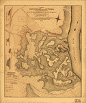 Plan of Fort Donelson and its outworks. [Feb. 1862] Surveyed under the direction of Lieut. Col. J. B. McPherson, A.D.C. & Capt. of Engineers, by Lieuts. Janney and Kossak. Published by authority of the Hon. the Secretary of War, office of the Chief of Engineers, U.S. Army, 1875. McPherson, James Birdseye, 1828-1864. CREATED/PUBLISHED St. Louis, Lith. by T. Schrader, [1875] NOTES Scale 1:7200. Shows topography by hachures, drainage, vegetation, roads, houses, fences, a plan of Dover, fallen timber, "enemy's" tents and log huts, water batteries, entrenchments, Grant's headquarters, and the location of the divisions of General Smith, General Wallace, and General McClernand. A profile of the fort, another profile of the rifle pits, and one of the water battery appear on the left side of the map. Plan of Fort Donelson and its outworks. [Feb. 1862] Surveyed under the direction of Lieut. Col. J. B. McPherson, A.D.C. & Capt. of Engineers, by Lieuts. Janney and Kossak. Published by authority of the Hon. the Secretary of War, office of the Chief of Engineers, U.S. Army, 1875. McPherson, James Birdseye, 1828-1864. CREATED/PUBLISHED St. Louis, Lith. by T. Schrader, [1875] NOTES Scale 1:7200. Shows topography by hachures, drainage, vegetation, roads, houses, fences, a plan of Dover, fallen timber, "enemy's" tents and log huts, water batteries, entrenchments, Grant's headquarters, and the location of the divisions of General Smith, General Wallace, and General McClernand. A profile of the fort, another profile of the rifle pits, and one of the water battery appear on the left side of the map. |
 Map of Fort Henry, Tennessee, and environs] / J. Pitzman. Pitzman, Julius, b. 1837. CREATED/PUBLISHED [1862] NOTES Scale ca. 1:42,000. Map of Fort Henry, Tennessee, and environs] / J. Pitzman. Pitzman, Julius, b. 1837. CREATED/PUBLISHED [1862] NOTES Scale ca. 1:42,000. |
 Map of Fort Henry, Tennessee, and environs]. Pitzman, Julius, b. 1837. CREATED/PUBLISHED St. Louis, Lith. by T. Schrader, [1863?] NOTES No scale given. Relief shown by hachures. Oriented with north to the bottom. Map of Fort Henry, Tennessee, and environs]. Pitzman, Julius, b. 1837. CREATED/PUBLISHED St. Louis, Lith. by T. Schrader, [1863?] NOTES No scale given. Relief shown by hachures. Oriented with north to the bottom. |
 Plan of Fort Henry and its outworks. [Feb. 1862] Drawn under the direction of Lieut. Col. J. B. McPherson, A.D.C. and Capt. of Engineers. Published by authority of the Hon. the Secretary of War, office of the Chief of Engineers, U.S. Army, 1875. McPherson, James Birdseye, 1828-1864. CREATED/PUBLISHED [S.l., 1875] NOTES Scale ca. 1:6488. Shows topography by hachures, drainage, vegetation, roads, fallen timber, and a plan of the fort, with guns and quarters lettered and explained by a key. A profile of the fort and one of the rifle pits appears at the right. Plan of Fort Henry and its outworks. [Feb. 1862] Drawn under the direction of Lieut. Col. J. B. McPherson, A.D.C. and Capt. of Engineers. Published by authority of the Hon. the Secretary of War, office of the Chief of Engineers, U.S. Army, 1875. McPherson, James Birdseye, 1828-1864. CREATED/PUBLISHED [S.l., 1875] NOTES Scale ca. 1:6488. Shows topography by hachures, drainage, vegetation, roads, fallen timber, and a plan of the fort, with guns and quarters lettered and explained by a key. A profile of the fort and one of the rifle pits appears at the right. |
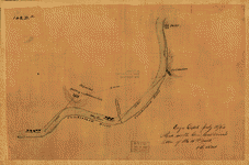
 Sketch showing the relative positions of Fort Henry and Fort Donelson, also the roads connecting the two positions / drawn under the direction of Lieut. Col. J. B. McPherson, A.D.C. & Capt. of Engineers. McPherson, James Birdseye, 1828-1864. CREATED/PUBLISHED [Washington] : Office of the Chief of Engineers, U.S. Army, 1875. NOTES Scale 1:95,040; 1 1/2 miles to an in. Sketch showing the relative positions of Fort Henry and Fort Donelson, also the roads connecting the two positions / drawn under the direction of Lieut. Col. J. B. McPherson, A.D.C. & Capt. of Engineers. McPherson, James Birdseye, 1828-1864. CREATED/PUBLISHED [Washington] : Office of the Chief of Engineers, U.S. Army, 1875. NOTES Scale 1:95,040; 1 1/2 miles to an in. |
 Sketch showing the relative positions of Fort Henry and Fort Donelson : with the roads connecting the two places / drawn under the direction of Lt. Col. J.B. McPherson, Chief Engineer, by Chas. Lambecker. Lambecker, Chas. CREATED/PUBLISHED [1862] NOTES Shows the forts, roads, outwork fortifications in the vicinity of the forts, fortifications in the vicinity of the town of Dover, outlying buildings, and streams. Relief shown by hachures. Sketch showing the relative positions of Fort Henry and Fort Donelson : with the roads connecting the two places / drawn under the direction of Lt. Col. J.B. McPherson, Chief Engineer, by Chas. Lambecker. Lambecker, Chas. CREATED/PUBLISHED [1862] NOTES Shows the forts, roads, outwork fortifications in the vicinity of the forts, fortifications in the vicinity of the town of Dover, outlying buildings, and streams. Relief shown by hachures. |
 Original maps of Forts Henry & Donelson and vicinity. CREATED/PUBLISHED [1862] NOTES Not drawn to scale. Title from verso. Manuscript; pen-and-ink. Relief shown by hachures. Oriented with north to the bottom. Original maps of Forts Henry & Donelson and vicinity. CREATED/PUBLISHED [1862] NOTES Not drawn to scale. Title from verso. Manuscript; pen-and-ink. Relief shown by hachures. Oriented with north to the bottom. |
  Map of Fort Sanders, Knoxville, Tennessee, showing the Confederate assault of Nov. 29, 1863]. Orth, John G. CREATED/PUBLISHED [1863] NOTES Detailed city map showing streets, railroads, all buildings (major ones identified), larger land tracts with owners' names, and streams. Ink handwritten index to points of interest and misc. lead-pencil notes on verso. Map of Fort Sanders, Knoxville, Tennessee, showing the Confederate assault of Nov. 29, 1863]. Orth, John G. CREATED/PUBLISHED [1863] NOTES Detailed city map showing streets, railroads, all buildings (major ones identified), larger land tracts with owners' names, and streams. Ink handwritten index to points of interest and misc. lead-pencil notes on verso. |
 Franklin--Tenn. profield [sic] June 1863 / by G.H. Blakeslee. Blakeslee, G. H. OTHER TITLES Franklin--Tenn. profiled June 1863 CREATED/PUBLISHED 1863. NOTES Sketch map showing troop positions, roads, railroads, streams, and location of the "Cherry tree where was [sic] hung the rebel spies Col. Williams and Lieut. W.G. Peter--June 10, 1863". Franklin--Tenn. profield [sic] June 1863 / by G.H. Blakeslee. Blakeslee, G. H. OTHER TITLES Franklin--Tenn. profiled June 1863 CREATED/PUBLISHED 1863. NOTES Sketch map showing troop positions, roads, railroads, streams, and location of the "Cherry tree where was [sic] hung the rebel spies Col. Williams and Lieut. W.G. Peter--June 10, 1863". |
 Field works at Franklin, Tenn., occupied by the 23d and 4th corps during engagement of Nov. 30th 1864, Maj. Gen. J. M. Schofield, comdg. CREATED/PUBLISHED [S.l., 1864] NOTES Scale ca. 1:28,000. Indicates troop positions and names of commanders, roads, "Nashville and Decatur R.R.," drainage, relief by hachures, and a few houses and names of occupants. The scale of the map is cited as "275 feet = 1 inch." This does not agree with the bar scale. Field works at Franklin, Tenn., occupied by the 23d and 4th corps during engagement of Nov. 30th 1864, Maj. Gen. J. M. Schofield, comdg. CREATED/PUBLISHED [S.l., 1864] NOTES Scale ca. 1:28,000. Indicates troop positions and names of commanders, roads, "Nashville and Decatur R.R.," drainage, relief by hachures, and a few houses and names of occupants. The scale of the map is cited as "275 feet = 1 inch." This does not agree with the bar scale. |
 Battlefield in front of Franklin, Tenn., November 30th, 1864]. Merrill, W. E. (William Emery), 1837-1891. CREATED/PUBLISHED [1874?] NOTES Unfinished topographic map showing troop positions, roads, railroads, buildings, rural householders' names, fences, streams, vegetation, and streets of town of Franklin. Relief shown by hachures and form lines. Battlefield in front of Franklin, Tenn., November 30th, 1864]. Merrill, W. E. (William Emery), 1837-1891. CREATED/PUBLISHED [1874?] NOTES Unfinished topographic map showing troop positions, roads, railroads, buildings, rural householders' names, fences, streams, vegetation, and streets of town of Franklin. Relief shown by hachures and form lines. |
 Battlefield in front of Franklin, Tenn. where the United States forces, consisting of the 4th & 23rd Corps and the Cavalry Corps M.D.M., all under the command of Maj. Gen'l. J. M. Schofield, severely repulsed the Confederate army, commanded by Lt. Gen'l Hood, November 30th 1864 Published by authority of the Hon. Secretary of War in the office of the Chief of Engineers, U.S. Army, 1874. Merrill, W. E. (William Emery), 1837-1891. CREATED/PUBLISHED [S.l.], 1874. NOTES Scale ca. 1:10,650. ndicates troop positions, roads, railroad, houses, names of residents, fences, drainage, vegetation, and relief by hachures. Battlefield in front of Franklin, Tenn. where the United States forces, consisting of the 4th & 23rd Corps and the Cavalry Corps M.D.M., all under the command of Maj. Gen'l. J. M. Schofield, severely repulsed the Confederate army, commanded by Lt. Gen'l Hood, November 30th 1864 Published by authority of the Hon. Secretary of War in the office of the Chief of Engineers, U.S. Army, 1874. Merrill, W. E. (William Emery), 1837-1891. CREATED/PUBLISHED [S.l.], 1874. NOTES Scale ca. 1:10,650. ndicates troop positions, roads, railroad, houses, names of residents, fences, drainage, vegetation, and relief by hachures. |
 Battlefield of Franklin, Tenn. Nov. 3rd 1864 Compiled from the official map. Cowen, James. CREATED/PUBLISHED [S.l., 1887] NOTES Scale ca. 1:50,000. From Century illustrated monthly magazine, v. 34, Aug. 1887. p. 602. Indicates troop and cavalry positions, the street pattern of Franklin, rivers, relief by hachures, houses, names of occupants, fences, and vegetation. Battlefield of Franklin, Tenn. Nov. 3rd 1864 Compiled from the official map. Cowen, James. CREATED/PUBLISHED [S.l., 1887] NOTES Scale ca. 1:50,000. From Century illustrated monthly magazine, v. 34, Aug. 1887. p. 602. Indicates troop and cavalry positions, the street pattern of Franklin, rivers, relief by hachures, houses, names of occupants, fences, and vegetation. |
 pographical map of the approaches and defences of Knoxville, E. Tennessee, shewing the positions occupied by the United States & Confederate forces during the siege Surveyed by direction of Capt. O. M. Poe, Chf. Engr., Dept. of the Ohio, during Dec., Jan. and Feb. 1863-4. Published by authority of the Hon. Secretary of War in the office of the Chief of Engineers, U.S. Army. Rockwell, Cleveland. CREATED/PUBLISHED [N.Y., The Graphic Co., photolith., 1864] NOTES Scale ca. 1:9,900. Union and confederate positions shown by the colors blue and red respectively. Indicates roads, railroads, contour lines, spot elevations, vegetation, drainage, and houses. pographical map of the approaches and defences of Knoxville, E. Tennessee, shewing the positions occupied by the United States & Confederate forces during the siege Surveyed by direction of Capt. O. M. Poe, Chf. Engr., Dept. of the Ohio, during Dec., Jan. and Feb. 1863-4. Published by authority of the Hon. Secretary of War in the office of the Chief of Engineers, U.S. Army. Rockwell, Cleveland. CREATED/PUBLISHED [N.Y., The Graphic Co., photolith., 1864] NOTES Scale ca. 1:9,900. Union and confederate positions shown by the colors blue and red respectively. Indicates roads, railroads, contour lines, spot elevations, vegetation, drainage, and houses. |
 Middle Tennessee / G.H. Blakeslee--1863. Blakeslee, G. H. OTHER TITLES Alternate title at bottom: Fourteen trips across Tennessee 1862-1864 CREATED/PUBLISHED 1863. NOTES Sketch map showing federal troop movement routes, engagements, settlements, and streams. Relief shown by hachures. Also covers Nashville city region. Middle Tennessee / G.H. Blakeslee--1863. Blakeslee, G. H. OTHER TITLES Alternate title at bottom: Fourteen trips across Tennessee 1862-1864 CREATED/PUBLISHED 1863. NOTES Sketch map showing federal troop movement routes, engagements, settlements, and streams. Relief shown by hachures. Also covers Nashville city region. |
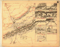
 Topographical sketch of the battlefield of Stone's River near Murfreesboro, Tennessee, December 31st, 1862 to Jan. 3d, 1863 : Major General W.S. Rosecrans, Commanding of the Forces of the United States : General Braxton Bragg, Commanding the enemy's forces. CREATED/PUBLISHED N.Y. : Lith. of J. Bien, [1863] NOTES Shows troop positions, names of commanders, Confederate works, roads, "Nashville and Chattanooga R.R.," vegetation, houses, fences, names of residents, and rivers. Topographical sketch of the battlefield of Stone's River near Murfreesboro, Tennessee, December 31st, 1862 to Jan. 3d, 1863 : Major General W.S. Rosecrans, Commanding of the Forces of the United States : General Braxton Bragg, Commanding the enemy's forces. CREATED/PUBLISHED N.Y. : Lith. of J. Bien, [1863] NOTES Shows troop positions, names of commanders, Confederate works, roads, "Nashville and Chattanooga R.R.," vegetation, houses, fences, names of residents, and rivers. |
 Topographical sketch of the battle field of Stone River near Murfreesboro, Tennessee, December 30th 1862 to January 3d 1863 . . . Position of the U.S. troops on the 2d of Jan. 1863. Surveyed under the direction of Capt. N. Michler, Corps of Topogl. Engrs., U.S.A., by Major J.E. Weyss, assisted by Captains W. Starling, D.P. Thruston, J.W. Stinchcomb, and Lieut. M. Allen, U.S. Vols. Weyss, John E. CREATED/PUBLISHED [S.l., 1863] NOTES Scale [ca. 1:23,000] Gives positions of the U.S. 14th Army Corps, "line of works of the enemy," roads, "Nashville and Chattanooga R.R.," houses, names of residents, drainage, and vegetation. Topographical sketch of the battle field of Stone River near Murfreesboro, Tennessee, December 30th 1862 to January 3d 1863 . . . Position of the U.S. troops on the 2d of Jan. 1863. Surveyed under the direction of Capt. N. Michler, Corps of Topogl. Engrs., U.S.A., by Major J.E. Weyss, assisted by Captains W. Starling, D.P. Thruston, J.W. Stinchcomb, and Lieut. M. Allen, U.S. Vols. Weyss, John E. CREATED/PUBLISHED [S.l., 1863] NOTES Scale [ca. 1:23,000] Gives positions of the U.S. 14th Army Corps, "line of works of the enemy," roads, "Nashville and Chattanooga R.R.," houses, names of residents, drainage, and vegetation. |
 Topographical sketch of the environs of Murfreesboro, Tennessee. Surveyed Jan. 1863 under the direction of Capt. N. Michler, U.S.A., Chief Topl. Engr., Army of the Cumberland, by Maj. John E. Weyss, assisted by Captains: W. Starling, D. Thruston, J.W. Stinchcomb, R. Rose and Lts. M. Allen and H. Greenwood, U.S. Volunteers. Weyness, John E. CREATED/PUBLISHED [S.l., 1863] NOTES Scale [ca. 1:43,000] Shows "line of battle of the United States forces," "line of battle of the Confederate forces," roads, distances, houses, names of residents, fields, and vegetation. Drainage is colored in blue and the "Nashville and Chattanooga R.R." is colored in red. Topographical sketch of the environs of Murfreesboro, Tennessee. Surveyed Jan. 1863 under the direction of Capt. N. Michler, U.S.A., Chief Topl. Engr., Army of the Cumberland, by Maj. John E. Weyss, assisted by Captains: W. Starling, D. Thruston, J.W. Stinchcomb, R. Rose and Lts. M. Allen and H. Greenwood, U.S. Volunteers. Weyness, John E. CREATED/PUBLISHED [S.l., 1863] NOTES Scale [ca. 1:43,000] Shows "line of battle of the United States forces," "line of battle of the Confederate forces," roads, distances, houses, names of residents, fields, and vegetation. Drainage is colored in blue and the "Nashville and Chattanooga R.R." is colored in red. |
 Topographical sketch of the battle field of Stone River near Murfreesboro, Tennessee, December 30th 1862 to January 3d 1863 . . . Position of the U.S. troops on the 31st of December, 1862. Surveyed under the direction of Capt. N. Michler, Corps of Topogl. Engrs., U.S.A., by Major J.E. Weyss, assisted by Captains W. Starling, D.P. Thruston, J.W. Stinchcomb, and Lieut. M. Allen, U.S. Vols. Weyss, John E. CREATED/PUBLISHED [S.l., 1863] NOTES Scale [ca. 1:15,840] Indicates "line of works of the enemy," roads, "Nashville and Chattanooga R.R.," houses, names of residents, drainage, and vegetation. Topographical sketch of the battle field of Stone River near Murfreesboro, Tennessee, December 30th 1862 to January 3d 1863 . . . Position of the U.S. troops on the 31st of December, 1862. Surveyed under the direction of Capt. N. Michler, Corps of Topogl. Engrs., U.S.A., by Major J.E. Weyss, assisted by Captains W. Starling, D.P. Thruston, J.W. Stinchcomb, and Lieut. M. Allen, U.S. Vols. Weyss, John E. CREATED/PUBLISHED [S.l., 1863] NOTES Scale [ca. 1:15,840] Indicates "line of works of the enemy," roads, "Nashville and Chattanooga R.R.," houses, names of residents, drainage, and vegetation. |
 at of Murfreesboro. Taken from a top'l. sketch of Murfreesboro and its environs. Surveyed under the direction of Capt. N. Michler, Top'l. Engs., U.S.A. Michler, N. (Nathaniel), 1827-1881. CREATED/PUBLISHED [S.l., 1863?] NOTES Scale not given. Map indicates streets and buildings. Sites occupied by the 14th and 21st Corps of the Army of the Cumberland, Department Headquarters, and the Quarter Master are identified. Bar scale appears in the lower right corner, but units of measure are not given. at of Murfreesboro. Taken from a top'l. sketch of Murfreesboro and its environs. Surveyed under the direction of Capt. N. Michler, Top'l. Engs., U.S.A. Michler, N. (Nathaniel), 1827-1881. CREATED/PUBLISHED [S.l., 1863?] NOTES Scale not given. Map indicates streets and buildings. Sites occupied by the 14th and 21st Corps of the Army of the Cumberland, Department Headquarters, and the Quarter Master are identified. Bar scale appears in the lower right corner, but units of measure are not given. |
 Map of Nashville, Tennessee. United States. Army. Military Division of the Mississippi. Chief Engrs. Office. CREATED/PUBLISHED [186-] NOTES Detailed city map showing streets, railroads, all buildings (major ones identified), larger land tracts with owners' names, and streams. Relief shown by fold lines. Map of Nashville, Tennessee. United States. Army. Military Division of the Mississippi. Chief Engrs. Office. CREATED/PUBLISHED [186-] NOTES Detailed city map showing streets, railroads, all buildings (major ones identified), larger land tracts with owners' names, and streams. Relief shown by fold lines. |
 Topographical map of Nashville, Tenn. / from a survey made by Lieut. Jas. R. Willett, 38th Ill. Vol. Infantry. Willett, James R. (James Rowland), 1831-1907. CREATED/PUBLISHED Nashville : Commd'g Eng. Dept., [186-] NOTES Shows physicasl relief, street rights-of-way, railroads, and outstanding buildings. Does not show vernacular buildings or other cultural features. Relief shown by gradated hachures. Topographical map of Nashville, Tenn. / from a survey made by Lieut. Jas. R. Willett, 38th Ill. Vol. Infantry. Willett, James R. (James Rowland), 1831-1907. CREATED/PUBLISHED Nashville : Commd'g Eng. Dept., [186-] NOTES Shows physicasl relief, street rights-of-way, railroads, and outstanding buildings. Does not show vernacular buildings or other cultural features. Relief shown by gradated hachures. |
 Nashville--Tenn. and vicinity 1863 / G.H. Blakeslee, Topo. Eng. Blakeslee, G. H. CREATED/PUBLISHED 1863. NOTES Sketch map showing fortifications, picket lines, camps of the 105th and 129th Ill. regiments, roads, city streets, railroads, and streams. Relief shown by hachures. Nashville--Tenn. and vicinity 1863 / G.H. Blakeslee, Topo. Eng. Blakeslee, G. H. CREATED/PUBLISHED 1863. NOTES Sketch map showing fortifications, picket lines, camps of the 105th and 129th Ill. regiments, roads, city streets, railroads, and streams. Relief shown by hachures. |
 Map of the battle of Nashville, dec. 15th & 16th 1864 Based on the government surveyed and drawn under the direction of Gen. Tower by M. Peseux. Cowen, James. CREATED/PUBLISHED [S.l., 1887] NOTES Scale ca. 1:110,000. From Century illustrated monthly magazine, v. 34, Aug. 1887. p. 611. Indicates troop and cavalry positions, roads, railroads, drainage, vegetation, and relief by hachures. Map of the battle of Nashville, dec. 15th & 16th 1864 Based on the government surveyed and drawn under the direction of Gen. Tower by M. Peseux. Cowen, James. CREATED/PUBLISHED [S.l., 1887] NOTES Scale ca. 1:110,000. From Century illustrated monthly magazine, v. 34, Aug. 1887. p. 611. Indicates troop and cavalry positions, roads, railroads, drainage, vegetation, and relief by hachures. |
 Sketch of the environs of Shelbyville, Wartrace & Normandy, Tennessee Compiled from the best information under the direction of Capt. N. Michler, Corps of Topographical Engrs. U.S.A., by John E. Weyss, Maj. Ky. Vols., Chief Asst. Drawn by C. S. Mergell. Photographed by M. Carpenter.]. Weyss, J. E. CREATED/PUBLISHED [S.l., 1863] NOTES Scale ca. 1:150,000. Hand-colored photocopy showing roads, railroads, houses and names of residents, towns, rivers, and mills. Descriptions of six "Crossings (i.e., fords) of Duck River" appear below the map title. Sketch of the environs of Shelbyville, Wartrace & Normandy, Tennessee Compiled from the best information under the direction of Capt. N. Michler, Corps of Topographical Engrs. U.S.A., by John E. Weyss, Maj. Ky. Vols., Chief Asst. Drawn by C. S. Mergell. Photographed by M. Carpenter.]. Weyss, J. E. CREATED/PUBLISHED [S.l., 1863] NOTES Scale ca. 1:150,000. Hand-colored photocopy showing roads, railroads, houses and names of residents, towns, rivers, and mills. Descriptions of six "Crossings (i.e., fords) of Duck River" appear below the map title. |
 Sketch of the environs of Shelbyville, Wartrace & Normandy, Tennessee Compiled from the best information under the direction of Capt. N. Michler, Corps of Topographical Engrs. U.S.A., by John E. Weyss, Maj. Ky. Vols., Chief Asst. Drawn by C. S. Mergell. Photographed by M. Carpenter.]. Weyss, J. E. CREATED/PUBLISHED [S.l., 1863] NOTES Scale ca. 1:150,000. Sketch of the environs of Shelbyville, Wartrace & Normandy, Tennessee Compiled from the best information under the direction of Capt. N. Michler, Corps of Topographical Engrs. U.S.A., by John E. Weyss, Maj. Ky. Vols., Chief Asst. Drawn by C. S. Mergell. Photographed by M. Carpenter.]. Weyss, J. E. CREATED/PUBLISHED [S.l., 1863] NOTES Scale ca. 1:150,000. |
 General Buell's map of the battle-field of Shiloh. [April 6-7, 1862] Copyright, 1886, by the Century Co. Buell, Don Carlos, 1818-1898. CREATED/PUBLISHED [S.l., 1886] NOTES Scale ca. 1:14,500. Detailed map showing the positions of the armies of the Ohio and Tennessee, Confederate lines, headquarters, "regimental camps at the date of the battle," roads, houses, drainage, vegetation, fields, and relief by hachures. The letters A-W identify Union divisions and batteries. "Numbers indicate hours of the day, or periods of the battles . . . " General Buell's map of the battle-field of Shiloh. [April 6-7, 1862] Copyright, 1886, by the Century Co. Buell, Don Carlos, 1818-1898. CREATED/PUBLISHED [S.l., 1886] NOTES Scale ca. 1:14,500. Detailed map showing the positions of the armies of the Ohio and Tennessee, Confederate lines, headquarters, "regimental camps at the date of the battle," roads, houses, drainage, vegetation, fields, and relief by hachures. The letters A-W identify Union divisions and batteries. "Numbers indicate hours of the day, or periods of the battles . . . " |
 Map of the territory between Corinth, Miss. and Pittsburgh Landing, Tenn. showing positions and route of the Confederate army in its advance to Shiloh, April 3, 4, 5 & 6, 1862 From official maps and actual surveys. Atwell Thompson, B.E., engineer in charge. June 27, 1901. Thompson, Atwell. CREATED/PUBLISHED [S.l., 1901] NOTES Scale ca. 1:82,000. At head of title: Shiloh National Military Park. Includes fortifications, roads, railroads, rivers, towns, and the names of few residents. Some roads have been hand-colored. Map of the territory between Corinth, Miss. and Pittsburgh Landing, Tenn. showing positions and route of the Confederate army in its advance to Shiloh, April 3, 4, 5 & 6, 1862 From official maps and actual surveys. Atwell Thompson, B.E., engineer in charge. June 27, 1901. Thompson, Atwell. CREATED/PUBLISHED [S.l., 1901] NOTES Scale ca. 1:82,000. At head of title: Shiloh National Military Park. Includes fortifications, roads, railroads, rivers, towns, and the names of few residents. Some roads have been hand-colored. |
 Map of the battlefield of Shiloh. CREATED/PUBLISHED [S.l., 1920?] NOTES Scale 1:10,560. Stamped in red below title: Reproduced in Photographic Section, Military Information Division, General Staff. Anonymous map indicating roads, drainage, fields, woodland, contour lines, and the "boundary line of park." Troop positions and fortifications are not delineated. Map of the battlefield of Shiloh. CREATED/PUBLISHED [S.l., 1920?] NOTES Scale 1:10,560. Stamped in red below title: Reproduced in Photographic Section, Military Information Division, General Staff. Anonymous map indicating roads, drainage, fields, woodland, contour lines, and the "boundary line of park." Troop positions and fortifications are not delineated. |
 Shiloh National Military Park, Tenn. Albert Pike, Division Engineer. Topography by J. K. Bailey and F. H. Sargent. Control by U.S. Geological Survey. Surveyed in 1934. Geological Survey (U.S.) CREATED/PUBLISHED [Washington, 1934] NOTES Scale 1:9600. Detailed topographical map indicating monuments, plaques, markers, and burial grounds. One hundred forty-five monuments are listed and keyed by numbers to the map. The contour interval is 5 feet. Shiloh National Military Park, Tenn. Albert Pike, Division Engineer. Topography by J. K. Bailey and F. H. Sargent. Control by U.S. Geological Survey. Surveyed in 1934. Geological Survey (U.S.) CREATED/PUBLISHED [Washington, 1934] NOTES Scale 1:9600. Detailed topographical map indicating monuments, plaques, markers, and burial grounds. One hundred forty-five monuments are listed and keyed by numbers to the map. The contour interval is 5 feet. |
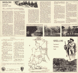 Shiloh National Military Park. United States. National Park Service CREATED/PUBLISHED [Washington], U.S. Government Printing Office, reprint 1957. NOTES Scale ca. 1:40,500. Illustrates a descriptive leaflet entitled "Shiloh National Military Park, Tennessee." Map indicates the park boundary, tour route, and points of interest. Shiloh National Military Park. United States. National Park Service CREATED/PUBLISHED [Washington], U.S. Government Printing Office, reprint 1957. NOTES Scale ca. 1:40,500. Illustrates a descriptive leaflet entitled "Shiloh National Military Park, Tennessee." Map indicates the park boundary, tour route, and points of interest. |
 Map of the battle field of Shiloh, April 6 & 7, 1862 / L?on J. Fr?maux, Capt. of Engrs. P.A.C.S. Fr?maux, L?on Joseph, 1821-1898. NOTES Relief shown by hachures. Map of the battle field of Shiloh, April 6 & 7, 1862 / L?on J. Fr?maux, Capt. of Engrs. P.A.C.S. Fr?maux, L?on Joseph, 1821-1898. NOTES Relief shown by hachures. |
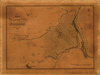
 Map of the field of Shiloh, near Pittsburgh Landing, Tenn., shewing the positions of the U.S. forces under the command of Maj. Genl. U. S. Grant, U.S. Vol. and Maj. Genl. D. C. Buell, U.S. Vol. on the 6th and 7th of April 1862 Surveyed under the direction of Col. Geo. Thom, Chief of Topl. Engrs. Drawn by Otto H. Matz, Asst. Topl. Engr. Lith. by Chas. Robyn & Co., St. Louis, Mo. Matz, Otto H. CREATED/PUBLISHED [S.l.], 1862 NOTES Scale 1:14,400. hows relief by hachures, vegetation, drainage, houses, fields, fences, mills, and roads. Map of the field of Shiloh, near Pittsburgh Landing, Tenn., shewing the positions of the U.S. forces under the command of Maj. Genl. U. S. Grant, U.S. Vol. and Maj. Genl. D. C. Buell, U.S. Vol. on the 6th and 7th of April 1862 Surveyed under the direction of Col. Geo. Thom, Chief of Topl. Engrs. Drawn by Otto H. Matz, Asst. Topl. Engr. Lith. by Chas. Robyn & Co., St. Louis, Mo. Matz, Otto H. CREATED/PUBLISHED [S.l.], 1862 NOTES Scale 1:14,400. hows relief by hachures, vegetation, drainage, houses, fields, fences, mills, and roads. |
 Battle of Pittsburgh Landing [i.e., Shiloh] Engraved for "Grant and his campaigns." [April 6-7, 1862]. Coppee, Henry. CREATED/PUBLISHED [Cincinnati, C. F. Vent & Co., 1866] NOTES Scale not given. From his Grant and his campaigns: a military biography. New York, C. B. Richardson; Cincinnati, C. F. Vent & Co., 1866. facing p. 85. Map indicates morning and evening positions of Union forces on April 6 and 7, 1862. Legend notes that "The positions of Rebels forces were generally parallel to those thereon indicated." Battle of Pittsburgh Landing [i.e., Shiloh] Engraved for "Grant and his campaigns." [April 6-7, 1862]. Coppee, Henry. CREATED/PUBLISHED [Cincinnati, C. F. Vent & Co., 1866] NOTES Scale not given. From his Grant and his campaigns: a military biography. New York, C. B. Richardson; Cincinnati, C. F. Vent & Co., 1866. facing p. 85. Map indicates morning and evening positions of Union forces on April 6 and 7, 1862. Legend notes that "The positions of Rebels forces were generally parallel to those thereon indicated." |
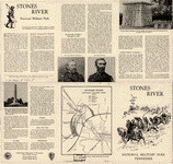 Stones River National Military Park, Tennessee. United States. National Park Service. CREATED/PUBLISHED [Washington], Government Printing Office, reprint 1957. NOTES Scale ca. 1:58,000. Illustrates a descriptive leaflet. The map indicates Union and Confederate lines, the direction of the Confederate attack, roads and streets, and the park boundary. Stones River National Military Park, Tennessee. United States. National Park Service. CREATED/PUBLISHED [Washington], Government Printing Office, reprint 1957. NOTES Scale ca. 1:58,000. Illustrates a descriptive leaflet. The map indicates Union and Confederate lines, the direction of the Confederate attack, roads and streets, and the park boundary. |
 From Mitchelsville [sic] to Gallatin--Sumner Co., Tenn., 1862 / G.H.B. Blakeslee, G. H. CREATED/PUBLISHED 1862. NOTES Sketch map showing military engagements, fortifications, roads, railroads, settlements, farms, and streams. Relief shown by hachures. From Mitchelsville [sic] to Gallatin--Sumner Co., Tenn., 1862 / G.H.B. Blakeslee, G. H. CREATED/PUBLISHED 1862. NOTES Sketch map showing military engagements, fortifications, roads, railroads, settlements, farms, and streams. Relief shown by hachures. |
 Rough plan of part of battle of Wauhatchie, Tenn., night of Oct. 28-29, 1863 Drawn from memory by H. T. [i.e., Hector Tyndale. 188-]. Tyndale, Hector, 1821-1880. CREATED/PUBLISHED [Philadelphia, Collings, printer, 1882] NOTES Scale not given. Map indicates troop positions and lines of march. Rough plan of part of battle of Wauhatchie, Tenn., night of Oct. 28-29, 1863 Drawn from memory by H. T. [i.e., Hector Tyndale. 188-]. Tyndale, Hector, 1821-1880. CREATED/PUBLISHED [Philadelphia, Collings, printer, 1882] NOTES Scale not given. Map indicates troop positions and lines of march. |
 Lloyd's official map of the State of Tennessee Drawn & engraved from actual surveys and used by our commanders. Lloyd, James T. CREATED/PUBLISHED New York, J. T. Lloyd, 1862. NOTES Scale ca 1:506,880. Map indicates county names and boundaries, cities and towns, roads and railroads, rivers, and fortifications. Battle sites are underlined in red. Lloyd's official map of the State of Tennessee Drawn & engraved from actual surveys and used by our commanders. Lloyd, James T. CREATED/PUBLISHED New York, J. T. Lloyd, 1862. NOTES Scale ca 1:506,880. Map indicates county names and boundaries, cities and towns, roads and railroads, rivers, and fortifications. Battle sites are underlined in red. |
 Lloyd's official map of the State of Tennessee Compiled from actual surveys and official documents, showing every rail road & rail road station with the distances between each station. Also the counties and county seats, cities, towns, villages, post offices, wagon roads, canals, forts, fortifications, &c. Lloyd, James T. CREATED/PUBLISHED New York, J. T. Lloyd, 1863. NOTES Scale ca. 1:506,880. Battle sites are not underlined in this edition. Lloyd's official map of the State of Tennessee Compiled from actual surveys and official documents, showing every rail road & rail road station with the distances between each station. Also the counties and county seats, cities, towns, villages, post offices, wagon roads, canals, forts, fortifications, &c. Lloyd, James T. CREATED/PUBLISHED New York, J. T. Lloyd, 1863. NOTES Scale ca. 1:506,880. Battle sites are not underlined in this edition. |
 Western Tennessee, and part of Kentucky Prepared by order of Capt. McAlester, Chief Engr. M.D.W.M. under direction of Capt. P. C. Hains, U.S. Engr. & Actg. Chief Engr. Dept. of the Gulf. Compiled & drawn for stone by B. von Reizenstein, & F. D'Avignon. Printed by E. Boehler. Feb. 1865. Von Reizenstein, B. CREATED/PUBLISHED [S.l., 1865] NOTES Scale 1:633,600. Indicates cities and towns, forts, roads, railroads, rivers, and some relief by hachures. Western Tennessee, and part of Kentucky Prepared by order of Capt. McAlester, Chief Engr. M.D.W.M. under direction of Capt. P. C. Hains, U.S. Engr. & Actg. Chief Engr. Dept. of the Gulf. Compiled & drawn for stone by B. von Reizenstein, & F. D'Avignon. Printed by E. Boehler. Feb. 1865. Von Reizenstein, B. CREATED/PUBLISHED [S.l., 1865] NOTES Scale 1:633,600. Indicates cities and towns, forts, roads, railroads, rivers, and some relief by hachures. |
 Military map of middle Tennessee and parts of East Tennessee and the adjoining states, being part of the Department of the Cumberland, commanded by Maj. Gen. Geo. H. Thomas, U.S.A. Compiled and drawn under the direction of Col. Wm. E. Merrill, 1st U.S.V.V. Eng'rs, Capt. Corps of Eng's, & Chief Engr. Dept of the Cumberland, with the assistance of Prof. J. M. Safford, late State Geologist of Tennessee, by C. S. Mergell, Asst. Engr., 1865. Published by authority of the Hon. Secretary of War, and the office of the Chief of Engineers, U.S. Army, 1874. Mergell, C. S. CREATED/PUBLISHED N.Y., Am. Photo-Litographic Co., (Osborne's process), [1874] NOTES Scale ca. 1:350,000. Shows topography by hachures, drainage, roads, railroads, dwellings with names of inhabitants, and battlefields, giving dates of engagements and names of oppossing commanding officers. The authorities from which the map is compiled are listed in detail, followed by a key to the topographical signs. Military map of middle Tennessee and parts of East Tennessee and the adjoining states, being part of the Department of the Cumberland, commanded by Maj. Gen. Geo. H. Thomas, U.S.A. Compiled and drawn under the direction of Col. Wm. E. Merrill, 1st U.S.V.V. Eng'rs, Capt. Corps of Eng's, & Chief Engr. Dept of the Cumberland, with the assistance of Prof. J. M. Safford, late State Geologist of Tennessee, by C. S. Mergell, Asst. Engr., 1865. Published by authority of the Hon. Secretary of War, and the office of the Chief of Engineers, U.S. Army, 1874. Mergell, C. S. CREATED/PUBLISHED N.Y., Am. Photo-Litographic Co., (Osborne's process), [1874] NOTES Scale ca. 1:350,000. Shows topography by hachures, drainage, roads, railroads, dwellings with names of inhabitants, and battlefields, giving dates of engagements and names of oppossing commanding officers. The authorities from which the map is compiled are listed in detail, followed by a key to the topographical signs. |
 The approaches from Washington, to Richmond From surveys supplied by officers of the army. Entered according to Act of Congress in the year 1862 by D. A. Heald. Heald, D. A. (Daniel Addison), 1818-1900. CREATED/PUBLISHED [New York, 1864] NOTES Scale ca. 1:445,000. "Presented by the Home Insurance Compy. of New York." Map of eastern Virginia showing roads, railroads, towns, drainage, and some relief by hachures. Battlefields are identified by crossed swords. Inset: The strategic points of east Tennessee, northern Alabama, and Georgia, from the U.S. official military map, 1864. Entered according to Act of Congress in the year 1864, by D. A. Heald . . . Scale ca. 1:1,300,000. 23 x 31 cm. The approaches from Washington, to Richmond From surveys supplied by officers of the army. Entered according to Act of Congress in the year 1862 by D. A. Heald. Heald, D. A. (Daniel Addison), 1818-1900. CREATED/PUBLISHED [New York, 1864] NOTES Scale ca. 1:445,000. "Presented by the Home Insurance Compy. of New York." Map of eastern Virginia showing roads, railroads, towns, drainage, and some relief by hachures. Battlefields are identified by crossed swords. Inset: The strategic points of east Tennessee, northern Alabama, and Georgia, from the U.S. official military map, 1864. Entered according to Act of Congress in the year 1864, by D. A. Heald . . . Scale ca. 1:1,300,000. 23 x 31 cm. |
This is a must have collection for any civil war history buff!
To use this software, you must install the free ExpressView MrSid software which is included on the CD. This is a 30 second process and will allow you to view and manipulate/print all the maps in this CD collection in full detail. There is a version for Windows platforms and full installation instructions are included on the CD.