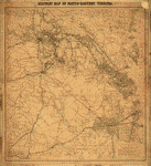
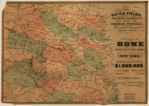
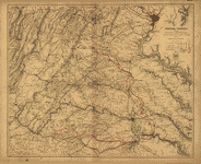
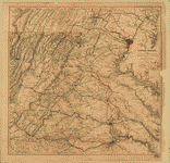
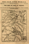
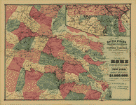
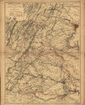
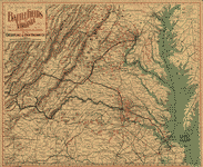
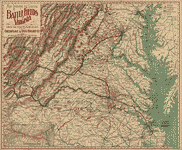
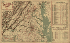
This CD contains 83 rare historic maps and descriptive pages representing fascinating details about Virginia and its vicinity during the Civil War.
This CD contains 83 rare historic maps and descriptive pages representing fascinating details about Virginia and its vicinity during the Civil War in MrSid format. This format allows you to see the entire map on your computer screen or drill down to see the smallest details. The original maps are often quite large, as much as 36" long or larger and quite detailed. With the MrSID software, you can manipulate the map to print the entire map in great detail or zoom into a portion of the map in full detail for viewing or printing. You could even bring the images to a local print shop to have the maps reprinted in their full size. (MrSID software is included on the CD.)
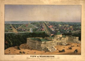
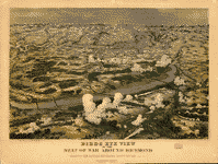
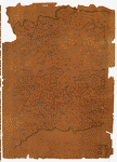
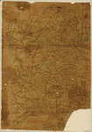
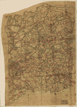
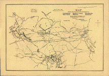
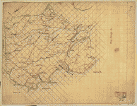
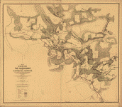
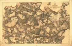
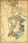
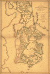
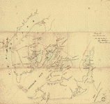
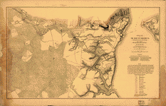
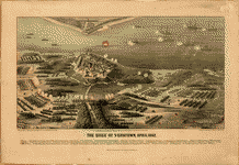
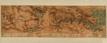
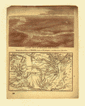
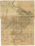
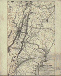
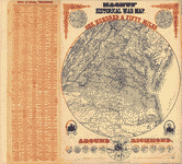
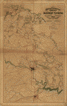
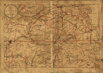
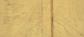
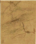
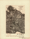
To give you a sample of the detail you can expect in these maps, here is an example based on a panoramic map of Washington, DC.
 |
 |
 |
 |
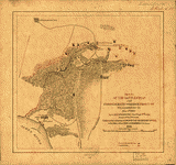
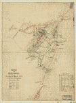
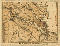
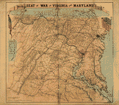
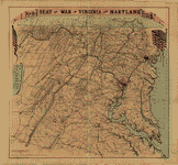
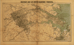
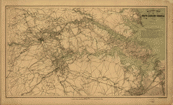
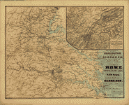
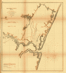
The table below shows the description and a small image of each map on this fascinating civil war history CD.
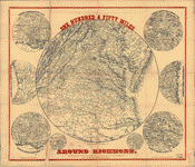
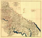
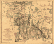
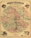 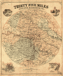 Thirty five miles around Richmond, Va. Compiled by Jed. Hotchkiss. CREATED/PUBLISHED Washington, Richmond, Va., C. Bohn, 1867. NOTES Scale ca. 1:200,000. Shows fortifications, towns, county names and boundaries, roads, railroads, and drainage. Insets: Map of the city of Richmond, Va., from the U.S. Coast Survey map of 1860, with additions by Jed. Hotchkiss. . . . 1866. Scale ca. 1:52,000. 12 x 14 cm.-Map of the city of Petersburg, Va., from Lynch's map with the Confederate & Federal lines on the east from C.S. Engr. maps by Jed. Hotchkiss. Scale ca. 1:52,000. 10 x 13 cm.-[View of] the capitol of the C.S., Richmond. 9 x 10 cm.-[View of] Washington Monument, Richmond. 10 x 10 cm. Thirty five miles around Richmond, Va. Compiled by Jed. Hotchkiss. CREATED/PUBLISHED Washington, Richmond, Va., C. Bohn, 1867. NOTES Scale ca. 1:200,000. Shows fortifications, towns, county names and boundaries, roads, railroads, and drainage. Insets: Map of the city of Richmond, Va., from the U.S. Coast Survey map of 1860, with additions by Jed. Hotchkiss. . . . 1866. Scale ca. 1:52,000. 12 x 14 cm.-Map of the city of Petersburg, Va., from Lynch's map with the Confederate & Federal lines on the east from C.S. Engr. maps by Jed. Hotchkiss. Scale ca. 1:52,000. 10 x 13 cm.-[View of] the capitol of the C.S., Richmond. 9 x 10 cm.-[View of] Washington Monument, Richmond. 10 x 10 cm. |
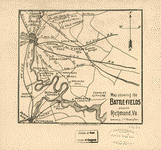 Map showing the battle-fields around Richmond, Va. Compiled by J. T. Redd & Son. Copyrighted, 1896, by J. L. Hill Printing Co., Richmond, Va. J. T. Redd & Son. CREATED/PUBLISHED [S.l.], c1896. NOTES Scale not given. Battlefields are located by small flags. Map showing the battle-fields around Richmond, Va. Compiled by J. T. Redd & Son. Copyrighted, 1896, by J. L. Hill Printing Co., Richmond, Va. J. T. Redd & Son. CREATED/PUBLISHED [S.l.], c1896. NOTES Scale not given. Battlefields are located by small flags. |
  One hundred & fifty miles around Richmond. 10th ed. Magnus, Charles. CREATED/PUBLISHED [New York, Washington, Charles Magnus, 186-] NOTES [Scale ca. 1:880,000]. For the Army of the Potomac. Containing a new military map: 150 miles around Richmond and 1200 miles of southern territory in smaller circles, acknowledged for the best published, and the glorious Union packet inside . . . New York and Washington, Charles Magnus. "Dedicated to the gallant soldiers, fighting to suppress the rebellion." One hundred & fifty miles around Richmond. 10th ed. Magnus, Charles. CREATED/PUBLISHED [New York, Washington, Charles Magnus, 186-] NOTES [Scale ca. 1:880,000]. For the Army of the Potomac. Containing a new military map: 150 miles around Richmond and 1200 miles of southern territory in smaller circles, acknowledged for the best published, and the glorious Union packet inside . . . New York and Washington, Charles Magnus. "Dedicated to the gallant soldiers, fighting to suppress the rebellion." |
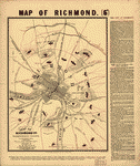 Map of Richmond, Va., shewing fortifications surrounding the Confederate capital. From the latest government surveys. Bailey, A. M. CREATED/PUBLISHED London, C. J. Culliford, lith., [186-?] NOTES Scale ca. 1:57,000. At top of map: Map of Richmond. (6D) A description of "The city of Richmond" and the "Forts around Richmond, with their armament" appears to the right of the map. Important buildings are identified and the positions are located on the map by letters and numbers. Gives the street pattern of Richmond and Manchester, forts, roads, railroads, drainage, and relief by hachures. Map of Richmond, Va., shewing fortifications surrounding the Confederate capital. From the latest government surveys. Bailey, A. M. CREATED/PUBLISHED London, C. J. Culliford, lith., [186-?] NOTES Scale ca. 1:57,000. At top of map: Map of Richmond. (6D) A description of "The city of Richmond" and the "Forts around Richmond, with their armament" appears to the right of the map. Important buildings are identified and the positions are located on the map by letters and numbers. Gives the street pattern of Richmond and Manchester, forts, roads, railroads, drainage, and relief by hachures. |
 Map exhibiting the approaches to the city of Richmond prepared for Maj. Gen. Geo. B. McClellan, U.S.A. CREATED/PUBLISHED [S.l., 1862] NOTES [Scale ca. 1:76,000]. Map exhibiting the approaches to the city of Richmond prepared for Maj. Gen. Geo. B. McClellan, U.S.A. CREATED/PUBLISHED [S.l., 1862] NOTES [Scale ca. 1:76,000]. |
 Map of the battle ground near Richmond, showing plainly, every point of interest of the late & present position of the Union army. L. Prang & Co. CREATED/PUBLISHED Boston, L. Prang & Co., [1862] NOTES Scale ca. 1:250,000. Indicates location and dates of battles, "McClellan's present defensive line" at Harrison's Landing, principal roads, railroads, towns, and drainage. Map of the battle ground near Richmond, showing plainly, every point of interest of the late & present position of the Union army. L. Prang & Co. CREATED/PUBLISHED Boston, L. Prang & Co., [1862] NOTES Scale ca. 1:250,000. Indicates location and dates of battles, "McClellan's present defensive line" at Harrison's Landing, principal roads, railroads, towns, and drainage. |
 Birds eye view of the seat of war around Richmond showing the battle of Chickahominy River, 29 June 1862 Drawn from nature and lith. by John Bachmann. Bachmann, John. CREATED/PUBLISHED New York, c1862. NOTES Scale not given. Perspective drawing. Birds eye view of the seat of war around Richmond showing the battle of Chickahominy River, 29 June 1862 Drawn from nature and lith. by John Bachmann. Bachmann, John. CREATED/PUBLISHED New York, c1862. NOTES Scale not given. Perspective drawing. |
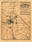 A complete map of Richmond and its fortifications within a circle of 12 miles showing the numerous forts, batteries and the range of their fire, and the various obstacles that impede the approach of the Federal army, also, the principal towns & plantations, in the immediate vicinity of Richmond, together with several of the battle fields of 1862. CREATED/PUBLISHED Boston, W. H. Forbes & Co., [1863] NOTES Scale ca. 1:54,000. "As a guide to note the approach of the Federal army, this map is invaluable, as the plan of its fortifications is taken from a correct drawing of a Southern engineer, who recently escaped to Europe." A complete map of Richmond and its fortifications within a circle of 12 miles showing the numerous forts, batteries and the range of their fire, and the various obstacles that impede the approach of the Federal army, also, the principal towns & plantations, in the immediate vicinity of Richmond, together with several of the battle fields of 1862. CREATED/PUBLISHED Boston, W. H. Forbes & Co., [1863] NOTES Scale ca. 1:54,000. "As a guide to note the approach of the Federal army, this map is invaluable, as the plan of its fortifications is taken from a correct drawing of a Southern engineer, who recently escaped to Europe." |
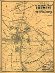 Forbes' new and complete map of Richmond and its fortifications Entered according to Act of Congress in the year 1864 by Forbes & Russell. Forbes, W. H. and Benjamin B. Russell. CREATED/PUBLISHED [S.l.] W. H. Forbes & B. B. Russell [1864] NOTES Scale ca. 1:48,000. Printed in blue ink. Shows forts, street pattern of Richmond, towns, roads, railroads, drainage, and relief by hachures. Forbes' new and complete map of Richmond and its fortifications Entered according to Act of Congress in the year 1864 by Forbes & Russell. Forbes, W. H. and Benjamin B. Russell. CREATED/PUBLISHED [S.l.] W. H. Forbes & B. B. Russell [1864] NOTES Scale ca. 1:48,000. Printed in blue ink. Shows forts, street pattern of Richmond, towns, roads, railroads, drainage, and relief by hachures. |
 Richmond [1862-1865] From surveys under the direction of Bvt. Brig. Gen. N., Michler. CREATED/PUBLISHED [S.l.], 1867. NOTES Scale 1:42,240. In this issue, the map is printed on a yellow background with the James River colored blue. Detailed topographic map of the environs of Richmond showing Confederate fortifications in red, Union fortifications in blue, roads, street pattern of Richmond and Manchester, railroads, towns, vegetation, drainage, hachures, houses, and names of residents. Richmond [1862-1865] From surveys under the direction of Bvt. Brig. Gen. N., Michler. CREATED/PUBLISHED [S.l.], 1867. NOTES Scale 1:42,240. In this issue, the map is printed on a yellow background with the James River colored blue. Detailed topographic map of the environs of Richmond showing Confederate fortifications in red, Union fortifications in blue, roads, street pattern of Richmond and Manchester, railroads, towns, vegetation, drainage, hachures, houses, and names of residents. |
 Map of the vicinity of Richmond and part of the Peninsula From surveys made under the direction of A. H. Campbell. CREATED/PUBLISHED Pikesville, Baltimore Co., Maryland, T. Sewall Ball, [1891] NOTES Scale 1:92,000 (not "1:80,000"). Cover title: Fac-simile reproduction of the Confederate war map of the "Vicinity of Richmond and part of the Peninsula" which was issued to Gen'l. Robert E. Lee and his corps commanders in 1864. Map of the vicinity of Richmond and part of the Peninsula From surveys made under the direction of A. H. Campbell. CREATED/PUBLISHED Pikesville, Baltimore Co., Maryland, T. Sewall Ball, [1891] NOTES Scale 1:92,000 (not "1:80,000"). Cover title: Fac-simile reproduction of the Confederate war map of the "Vicinity of Richmond and part of the Peninsula" which was issued to Gen'l. Robert E. Lee and his corps commanders in 1864. |
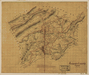 Roanoke County, Virginia. CREATED/PUBLISHED [1865?] NOTES Relief shown by hachures. Shows the names of some residents. Roanoke County, Virginia. CREATED/PUBLISHED [1865?] NOTES Relief shown by hachures. Shows the names of some residents. |
 Rockbridge Co., Va. OTHER TITLES Rockbridge County, Virginia CREATED/PUBLISHED [186-] NOTES Relief shown by hachures. Shows the names of some residents. Rockbridge Co., Va. OTHER TITLES Rockbridge County, Virginia CREATED/PUBLISHED [186-] NOTES Relief shown by hachures. Shows the names of some residents. |
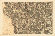
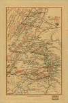
 Map of the Shenandoah Valley]. Hotchkiss, Jedediah, 1828-1899. CREATED/PUBLISHED [1862] NOTES Relief shown by form lines and hachures. Shows the Shenandoah Valley from Winchester to Staunton, and from the Blue Ridge to the Alleghany mountains, and includes the names of many residents. Drawn on a 3/4 in. grid. Map of the Shenandoah Valley]. Hotchkiss, Jedediah, 1828-1899. CREATED/PUBLISHED [1862] NOTES Relief shown by form lines and hachures. Shows the Shenandoah Valley from Winchester to Staunton, and from the Blue Ridge to the Alleghany mountains, and includes the names of many residents. Drawn on a 3/4 in. grid. |
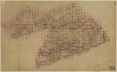
 Map of Spotsylvania County / surveyed by and under the direction of Captain John Grant P.A.C.S. ; S.T. Pendleton, Principal Asst. Engr. Grant, John, Captain. CREATED/PUBLISHED 1862. NOTES Relief shown by hachures. Shows the names of some residents. Ink with pencil annotations on a 1 1/2-inch pencil grid, on irregularly shaped tracing linen pasted together from 4 sheets, sectioned an mounted on cloth. Several dark blotches down the center of the map, water staining overall, and large rectangular discoloration in upper left. Map of Spotsylvania County / surveyed by and under the direction of Captain John Grant P.A.C.S. ; S.T. Pendleton, Principal Asst. Engr. Grant, John, Captain. CREATED/PUBLISHED 1862. NOTES Relief shown by hachures. Shows the names of some residents. Ink with pencil annotations on a 1 1/2-inch pencil grid, on irregularly shaped tracing linen pasted together from 4 sheets, sectioned an mounted on cloth. Several dark blotches down the center of the map, water staining overall, and large rectangular discoloration in upper left. |
 Map of Spotsylvania and Caroline Counties, Virginia]. CREATED/PUBLISHED [186-] NOTES Relief shown by hachures. Includes the names of residents. Map of Spotsylvania and Caroline Counties, Virginia]. CREATED/PUBLISHED [186-] NOTES Relief shown by hachures. Includes the names of residents. |
 Map of Spotsylvania County, Virginia]. CREATED/PUBLISHED [186-] NOTES Relief shown by hachures. Shows fortifications in the Chancellorsville area and the names of some residents. Map of Spotsylvania County, Virginia]. CREATED/PUBLISHED [186-] NOTES Relief shown by hachures. Shows fortifications in the Chancellorsville area and the names of some residents. |
 Map of Spotsylvania County, Va.]. CREATED/PUBLISHED [186-] NOTES Relief shown by hachures. Shows fortifications in the Chancellorsville area, and includes the names of residents. Map of Spotsylvania County, Va.]. CREATED/PUBLISHED [186-] NOTES Relief shown by hachures. Shows fortifications in the Chancellorsville area, and includes the names of residents. |
 Map of Spotsylvania County, Virginia]. CREATED/PUBLISHED [186-] NOTES Relief shown by hachures. Shows fortifications in the Chancellorsville area, and includes the names of residents. Map of Spotsylvania County, Virginia]. CREATED/PUBLISHED [186-] NOTES Relief shown by hachures. Shows fortifications in the Chancellorsville area, and includes the names of residents. |
 Map showing the locations of the battlefields of Fredericksburg, Hamilton's Crossing, Chancellorsville, Salem Church, Wilderness, [and] Spotsylvania, and also showing the boundaries of the battlefield park surveys of 6556 acres. Kishpaugh, Robert A. CREATED/PUBLISHED Fredericksburg, 1906. NOTES Scale ca. 1:90,000. Accompanied by a pamphlet entitled Map of the Six Battlefields: Fredericksburg, Hamilton's Crossing, Chancellorsville, Salem Church, Spotsylvania, Wilderness, and illustrated sketch of Fredericksburg (Fredericksburg, Virginia, R.A. Kishpaugh, 1906). Map indicates Union and Confederate works, roads, railroads, towns, and drainage. Map showing the locations of the battlefields of Fredericksburg, Hamilton's Crossing, Chancellorsville, Salem Church, Wilderness, [and] Spotsylvania, and also showing the boundaries of the battlefield park surveys of 6556 acres. Kishpaugh, Robert A. CREATED/PUBLISHED Fredericksburg, 1906. NOTES Scale ca. 1:90,000. Accompanied by a pamphlet entitled Map of the Six Battlefields: Fredericksburg, Hamilton's Crossing, Chancellorsville, Salem Church, Spotsylvania, Wilderness, and illustrated sketch of Fredericksburg (Fredericksburg, Virginia, R.A. Kishpaugh, 1906). Map indicates Union and Confederate works, roads, railroads, towns, and drainage. |
 Map of Stafford County, Va.]. CREATED/PUBLISHED [186-] NOTES Includes the names of some residents. Map of Stafford County, Va.]. CREATED/PUBLISHED [186-] NOTES Includes the names of some residents. |
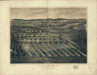 Camp of the 196th Regt. O.V.I. Col. R. P. Kennedy comdg. Stevensons Station near Winchester, Va. Drawn by A. Ruger, Co. E., 196th Reg. O.V.I. Ruger, A. CREATED/PUBLISHED Baltimore, Md., Schmidt & Trowe; for sale by S. ... lleck & Co., Columbus, O. [186-?] NOTES Perspective map not drawn to scale. Bird's-eye view. Camp of the 196th Regt. O.V.I. Col. R. P. Kennedy comdg. Stevensons Station near Winchester, Va. Drawn by A. Ruger, Co. E., 196th Reg. O.V.I. Ruger, A. CREATED/PUBLISHED Baltimore, Md., Schmidt & Trowe; for sale by S. ... lleck & Co., Columbus, O. [186-?] NOTES Perspective map not drawn to scale. Bird's-eye view. |
 Military map of Suffolk & vicinity for Majr. Genl. J. A. Dix / surveyed and drawn by Oscar Soederquist, Lieut, 99th N.Y. Vol. Soederquist, Oscar. OTHER TITLES Military map of Suffolk and vicinity for Majr. Genl. J. A. Dix CREATED/PUBLISHED [1863?] NOTES Shows fortifications, houses, names of residents, roads, railroads, and drainage. Relief shown by hachures. Military map of Suffolk & vicinity for Majr. Genl. J. A. Dix / surveyed and drawn by Oscar Soederquist, Lieut, 99th N.Y. Vol. Soederquist, Oscar. OTHER TITLES Military map of Suffolk and vicinity for Majr. Genl. J. A. Dix CREATED/PUBLISHED [1863?] NOTES Shows fortifications, houses, names of residents, roads, railroads, and drainage. Relief shown by hachures. |
 S.E. portion of Virginia and N.E. portion of N'th Carolina / drawn b. Serg't Ch. Worret ; & compiled under the direction of Col. T.J. Cram, Chief Top'l Eng'r Dep't Va. Worret, Ch. CREATED/PUBLISHED [186-] NOTES Covers Tidewater Region (Va.) and Albemarle Sound Region (N.C.). Shows fortifications, settlements, roads, railroads, canals, streams, swamps, and distances. S.E. portion of Virginia and N.E. portion of N'th Carolina / drawn b. Serg't Ch. Worret ; & compiled under the direction of Col. T.J. Cram, Chief Top'l Eng'r Dep't Va. Worret, Ch. CREATED/PUBLISHED [186-] NOTES Covers Tidewater Region (Va.) and Albemarle Sound Region (N.C.). Shows fortifications, settlements, roads, railroads, canals, streams, swamps, and distances. |
 Military map of south-eastern Virginia / compiled at the U.S. Coast Survey Office ; drawn by A. Lindenkohl. United States Coast Survey. CREATED/PUBLISHED [Washington, D.C.?] : U.S. Coast Survey Office, [1865?] (H. Lindenkohl & Chs. G. Krebs, lith.) NOTES Depths shown by contours and soundings. Shows fortifications, settlements, roads, railroads, streams, and vegetation in some areas. Also covers Richmond city region. Military map of south-eastern Virginia / compiled at the U.S. Coast Survey Office ; drawn by A. Lindenkohl. United States Coast Survey. CREATED/PUBLISHED [Washington, D.C.?] : U.S. Coast Survey Office, [1865?] (H. Lindenkohl & Chs. G. Krebs, lith.) NOTES Depths shown by contours and soundings. Shows fortifications, settlements, roads, railroads, streams, and vegetation in some areas. Also covers Richmond city region. |
 Map of the battle fields of the Tolopotomoy, and Bethesda Church : showing the field of operations of the Army of the Potomac commanded by Maj. Gen. George G. Meade U.S.A., from May 28th to June 2nd, 1864 / surveyed under the orders of Bvt. J.C. Duane, Major of Engineers, Chief Engineer, Army of the Potomac, by Bvt. Maj. C.W. Howell, 1st Lieut. of Engineers ; assisted by Messrs. L.C. Oswell, L. Bell, and R.B. Talfor, topographical engineers ; J. Bien, lith., N.Y. Howell, C. W. CREATED/PUBLISHED [Washington, D.C.? : s.n., 1865?] NOTES Relief shown by hachures. Map of the battle fields of the Tolopotomoy, and Bethesda Church : showing the field of operations of the Army of the Potomac commanded by Maj. Gen. George G. Meade U.S.A., from May 28th to June 2nd, 1864 / surveyed under the orders of Bvt. J.C. Duane, Major of Engineers, Chief Engineer, Army of the Potomac, by Bvt. Maj. C.W. Howell, 1st Lieut. of Engineers ; assisted by Messrs. L.C. Oswell, L. Bell, and R.B. Talfor, topographical engineers ; J. Bien, lith., N.Y. Howell, C. W. CREATED/PUBLISHED [Washington, D.C.? : s.n., 1865?] NOTES Relief shown by hachures. |
 Totopotomoy [1864] From surveys under the direction of Bvt. Brig. Gen. N. Michler, Maj. of Engineers, by command of Bvt. Maj. Genl. A. A. Humphreys, Brig. Genl. & Chief of Engineers. Surveyed & drawn by Maj: J. E. Weyss, assisted by F. Theilkuhl, J. Strasser & G. Thompson. Photolith. by the N.Y. Lithographing, Engraving & Printing Co., Julius Bien, Supt. 1867. Michler, N. (Nathaniel), 1827-1881. CREATED/PUBLISHED [S.l., 1867] NOTES Scale 1:21,120. In this issue, the map is printed on a yellow background with the Pamunkey River colored green. Detailed map giving Union works in blue and Confederate works in red, roads, "Virginia Central R.R.," houses, names of residents, vegetation, drainage, and relief by hachures. Totopotomoy [1864] From surveys under the direction of Bvt. Brig. Gen. N. Michler, Maj. of Engineers, by command of Bvt. Maj. Genl. A. A. Humphreys, Brig. Genl. & Chief of Engineers. Surveyed & drawn by Maj: J. E. Weyss, assisted by F. Theilkuhl, J. Strasser & G. Thompson. Photolith. by the N.Y. Lithographing, Engraving & Printing Co., Julius Bien, Supt. 1867. Michler, N. (Nathaniel), 1827-1881. CREATED/PUBLISHED [S.l., 1867] NOTES Scale 1:21,120. In this issue, the map is printed on a yellow background with the Pamunkey River colored green. Detailed map giving Union works in blue and Confederate works in red, roads, "Virginia Central R.R.," houses, names of residents, vegetation, drainage, and relief by hachures. |
 Map of the part of Virginia lying between the York and James rivers : showing battles and routes of Union forces 1861-62]. CREATED/PUBLISHED [1862?] NOTES Covers the Virginia Peninsula inland to Richmond and Hanover. Shows settlements, battle sites, troop movements, roads, railroads, county names, and county boundaries. Map of the part of Virginia lying between the York and James rivers : showing battles and routes of Union forces 1861-62]. CREATED/PUBLISHED [1862?] NOTES Covers the Virginia Peninsula inland to Richmond and Hanover. Shows settlements, battle sites, troop movements, roads, railroads, county names, and county boundaries. |
 The battle fields and military positions in the Virginian Peninsula, from surveys supplied by officers of the army Entered according to Act of Congress in the year 1862 by D. A. Heald . . . Heald, D. A. (Daniel Addison), 1818-1900. CREATED/PUBLISHED [S.l., 1862] NOTES Scale ca. 1:375,000. A few battle sites are marked by crossed swords. Shows roads, railroads, towns, county names and boundaries, and drainage. The battle fields and military positions in the Virginian Peninsula, from surveys supplied by officers of the army Entered according to Act of Congress in the year 1862 by D. A. Heald . . . Heald, D. A. (Daniel Addison), 1818-1900. CREATED/PUBLISHED [S.l., 1862] NOTES Scale ca. 1:375,000. A few battle sites are marked by crossed swords. Shows roads, railroads, towns, county names and boundaries, and drainage. |
 Map of the battle of Frayser's Farm (Charles City cross roads or Glendale), June 30, 1862, showing approximate positions of Union and Confederate troops. Also disposition of troops during the military engagement at White Oak Bridge. Wells, Jacob. CREATED/PUBLISHED [S.l., 1885] NOTES Scale ca. 1:73,000. From Century illustrated monthly magazine, v. 30, July 1885. p. 470. Brigades and batteries are identified and keyed by numbers and letters to the map. Gives roads, streams, fords, "White Oak Swamp," and relief by hachures. Map of the battle of Frayser's Farm (Charles City cross roads or Glendale), June 30, 1862, showing approximate positions of Union and Confederate troops. Also disposition of troops during the military engagement at White Oak Bridge. Wells, Jacob. CREATED/PUBLISHED [S.l., 1885] NOTES Scale ca. 1:73,000. From Century illustrated monthly magazine, v. 30, July 1885. p. 470. Brigades and batteries are identified and keyed by numbers and letters to the map. Gives roads, streams, fords, "White Oak Swamp," and relief by hachures. |
 Sketch of the battlefield and Confederate works in front of Williamsburg, Va., May 5th 1862 by Lt. M. D. McAlester, Chief Engr., 3rd Corps, Army of the Potomac. Publishsed [sic] by authority of the Hon. the Secretary of War, in the office of the Chief of Engineers, U.S. Army. 1876. McAlester, Miles D. CREATED/PUBLISHED [S.l., office of the Chief of Engineers, U.S. Army, 1876] NOTES Scale 1:7200. Indicates "United States forces" in blue and "Confederate forces" in red, names of Union field commanders, hospitals, roads, houses, names of residents, drainage, vegetation, and relief by hachures. Sketch of the battlefield and Confederate works in front of Williamsburg, Va., May 5th 1862 by Lt. M. D. McAlester, Chief Engr., 3rd Corps, Army of the Potomac. Publishsed [sic] by authority of the Hon. the Secretary of War, in the office of the Chief of Engineers, U.S. Army. 1876. McAlester, Miles D. CREATED/PUBLISHED [S.l., office of the Chief of Engineers, U.S. Army, 1876] NOTES Scale 1:7200. Indicates "United States forces" in blue and "Confederate forces" in red, names of Union field commanders, hospitals, roads, houses, names of residents, drainage, vegetation, and relief by hachures. |
 Battle of Kernstown, Sunday, 23 March, 1862 / Jed. Hotchkiss, Top. Eng. Valley D. Hotchkiss, Jedediah, 1828-1899. NOTES Relief shown by hachures. Includes an index to the locations of regiments and brigades in the Valley Division and a pencil annotation at the lower edge which reads, "Hd. Qrs. of Maj. Gen. Jackson in a fence corner, Sunday night." Battle of Kernstown, Sunday, 23 March, 1862 / Jed. Hotchkiss, Top. Eng. Valley D. Hotchkiss, Jedediah, 1828-1899. NOTES Relief shown by hachures. Includes an index to the locations of regiments and brigades in the Valley Division and a pencil annotation at the lower edge which reads, "Hd. Qrs. of Maj. Gen. Jackson in a fence corner, Sunday night." |
 Battle field of Winchester, Va. (Opequon) [September 19, 1864] Prepared by Bvt. Lt. Col. G. L. Gillespie, Major of Engineers, U.S.A., from surveys under his directions, by order of Lt. Gen. P. H. Sheridan, and under the authority of the Hon. Secretary of War, and, of the Chief of Engineers, U.S.A. George B. Strauch and E. Siegesmund, Assistants. 1873. Gillespie, G. L. CREATED/PUBLISHED [S.l.], 1873. NOTES Scale ca. 1:9600. Detailed map of Winchester and vicinity showing Union positions in blue and Confederate positions in red, troop movements, names of commanders, roads, railroads, street plan of Winchester, drainage, vegetation, houses, fences, names of residents, and relief by hachures and contour lines. Battle field of Winchester, Va. (Opequon) [September 19, 1864] Prepared by Bvt. Lt. Col. G. L. Gillespie, Major of Engineers, U.S.A., from surveys under his directions, by order of Lt. Gen. P. H. Sheridan, and under the authority of the Hon. Secretary of War, and, of the Chief of Engineers, U.S.A. George B. Strauch and E. Siegesmund, Assistants. 1873. Gillespie, G. L. CREATED/PUBLISHED [S.l.], 1873. NOTES Scale ca. 1:9600. Detailed map of Winchester and vicinity showing Union positions in blue and Confederate positions in red, troop movements, names of commanders, roads, railroads, street plan of Winchester, drainage, vegetation, houses, fences, names of residents, and relief by hachures and contour lines. |
 Field map of the north part of Wythe County / surveys by Mayhew's party under command of 1st Lieut. Walter Izard. Izard, Walter. CREATED/PUBLISHED [186-] NOTES Relief shown by hachures. Includes the names of some residents. Field map of the north part of Wythe County / surveys by Mayhew's party under command of 1st Lieut. Walter Izard. Izard, Walter. CREATED/PUBLISHED [186-] NOTES Relief shown by hachures. Includes the names of some residents. |
 Map of part of Wythe County, Va.]. CREATED/PUBLISHED [186-] NOTES Relief shown by form lines. Includes the names of some residents. Map of part of Wythe County, Va.]. CREATED/PUBLISHED [186-] NOTES Relief shown by form lines. Includes the names of some residents. |
 Yorktown to Williamsburg] This map compiled by Capt. H. L. Abbot, Top. Eng'rs., September 1862. Photographic reduction by L. E. Walker, Treasury Department. Abbot, Henry L. CREATED/PUBLISHED [S.l., 1862] NOTES Scale ca. 1:95,000. Yorktown to Williamsburg] This map compiled by Capt. H. L. Abbot, Top. Eng'rs., September 1862. Photographic reduction by L. E. Walker, Treasury Department. Abbot, Henry L. CREATED/PUBLISHED [S.l., 1862] NOTES Scale ca. 1:95,000. |
 Yorktown to Williamsburg Prepared by command of Maj. Gen. George B. McClellan, U.S.A., commanding Army of the Potomac. Compilation under the direction of Brig. Gen. A. A. Humphreys, by Capt. H. L. Abbot, Top. Eng'rs. Engraved by W. H. Dougal. Abbot, Henry L. CREATED/PUBLISHED [S.l., 1862] NOTES Scale ca. 1:63,360. At head of title: Campaign maps, Army of the Potomac, map no. 1. Shows fortifications, towns, roads, houses, names of residents, vegetation, drainage, and relief by hachures. Yorktown to Williamsburg Prepared by command of Maj. Gen. George B. McClellan, U.S.A., commanding Army of the Potomac. Compilation under the direction of Brig. Gen. A. A. Humphreys, by Capt. H. L. Abbot, Top. Eng'rs. Engraved by W. H. Dougal. Abbot, Henry L. CREATED/PUBLISHED [S.l., 1862] NOTES Scale ca. 1:63,360. At head of title: Campaign maps, Army of the Potomac, map no. 1. Shows fortifications, towns, roads, houses, names of residents, vegetation, drainage, and relief by hachures. |
 York River and Mobajack [sic] Bay, Va. / tracing for Maj. Genl. Franklin from Maj. Humphrey's [sic] Comg. Topl. Engrs., Army of Potomac. Humphreys, A. A. (Andrew Atkinson), 1810-1883. OTHER TITLES York River and Mobjack Bay, Va. CREATED/PUBLISHED [1862?] NOTES Depths shown by soundings. Shows roads, settlements, farmsteads with residents' names, battery on North River tributary, and low-water line. York River and Mobajack [sic] Bay, Va. / tracing for Maj. Genl. Franklin from Maj. Humphrey's [sic] Comg. Topl. Engrs., Army of Potomac. Humphreys, A. A. (Andrew Atkinson), 1810-1883. OTHER TITLES York River and Mobjack Bay, Va. CREATED/PUBLISHED [1862?] NOTES Depths shown by soundings. Shows roads, settlements, farmsteads with residents' names, battery on North River tributary, and low-water line. |
 Official plan of the siege of Yorktown, Va., conducted by the Army of the Potomac under command of Maj. Gen. George B. McClellan. CREATED/PUBLISHED [S.l., 1862] NOTES Scale ca. 1:13,500. "This plan shows about half the line, including the point of attack. The Rebel works are laid down from reconnoissances [sic] made immediately after the evacuation, and are correctly, but very incompletely represented, owing to want of time for sketching minor details.-Our works of siege, including the approaches in the ravines of Wormley Creek, are accurately shown. Redoubts being denoted by letters, and batteries by numbers." Contains a list of the "proposed armament of batteries." Indicates headquarters of Generals McClellan, Porter, Woodbury, and Heintzelman, houses, names of residents, roads, drainage, vegetation, and relief by hachures and spot heights. Official plan of the siege of Yorktown, Va., conducted by the Army of the Potomac under command of Maj. Gen. George B. McClellan. CREATED/PUBLISHED [S.l., 1862] NOTES Scale ca. 1:13,500. "This plan shows about half the line, including the point of attack. The Rebel works are laid down from reconnoissances [sic] made immediately after the evacuation, and are correctly, but very incompletely represented, owing to want of time for sketching minor details.-Our works of siege, including the approaches in the ravines of Wormley Creek, are accurately shown. Redoubts being denoted by letters, and batteries by numbers." Contains a list of the "proposed armament of batteries." Indicates headquarters of Generals McClellan, Porter, Woodbury, and Heintzelman, houses, names of residents, roads, drainage, vegetation, and relief by hachures and spot heights. |
 The siege of Yorktown, April 1862 Drawn on the spot by C. Worret 20. N.Y.R. Lith. by E. Sachse & Co., Baltimore. Worret, Ch. CREATED/PUBLISHED Washington, D.C. and Old Point Comfort, Va., C. Bohn, c1862. NOTES Scale not given. "Entered accord. to Act of Congress A.D. 1862 by C. Bohn in the Clerks Office of the District of Columbia." Bird's-eye view of the Union siege of Yorktown, with 23 places, batteries, ship positions, troop positions, and field headquarters keyed by number to list in lower margin. The siege of Yorktown, April 1862 Drawn on the spot by C. Worret 20. N.Y.R. Lith. by E. Sachse & Co., Baltimore. Worret, Ch. CREATED/PUBLISHED Washington, D.C. and Old Point Comfort, Va., C. Bohn, c1862. NOTES Scale not given. "Entered accord. to Act of Congress A.D. 1862 by C. Bohn in the Clerks Office of the District of Columbia." Bird's-eye view of the Union siege of Yorktown, with 23 places, batteries, ship positions, troop positions, and field headquarters keyed by number to list in lower margin. |
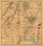
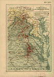
 Central Virginia showing Lieut. Gen'l. U.S. Grant's Campaign and marches of the armies under his command. CREATED/PUBLISHED [S.l., 186-] NOTES Scale 1:350,000. Map extends from Dinwiddie C. H. to about four miles north of the District of Columbia and from Lexington east to Heathsville. The routes of the II, V, VI, IX, X, XVIII, XIX, XXIV, and XXV corps, the regular cavalry, and Sheridan's cavalry are identified by colored lines. The badges of the corps are given in the legend. Fortifications and battlefields are marked in blue. The map also indicates roads, railroads, towns, drainage, and relief by hachures. Central Virginia showing Lieut. Gen'l. U.S. Grant's Campaign and marches of the armies under his command. CREATED/PUBLISHED [S.l., 186-] NOTES Scale 1:350,000. Map extends from Dinwiddie C. H. to about four miles north of the District of Columbia and from Lexington east to Heathsville. The routes of the II, V, VI, IX, X, XVIII, XIX, XXIV, and XXV corps, the regular cavalry, and Sheridan's cavalry are identified by colored lines. The badges of the corps are given in the legend. Fortifications and battlefields are marked in blue. The map also indicates roads, railroads, towns, drainage, and relief by hachures. |
 Central Virginia showing Lieut. Gen'l. U.S. Grant's Campaign and marches of the armies under his command in 1864-65 Engineer Bureau, War Dept. Prepared by order of the Secretary of War for the officers of the U.S. Army under the command of Lieut. Gen. U.S. Grant.]. United States. Army. Corps of Engineers. CREATED/PUBLISHED [S.l., 186-] NOTES [Scale 1:350,000]. Another issue. Same as the preceding issue but with the cavalry badge (crossed swords in an oval) added to the legend. Central Virginia showing Lieut. Gen'l. U.S. Grant's Campaign and marches of the armies under his command in 1864-65 Engineer Bureau, War Dept. Prepared by order of the Secretary of War for the officers of the U.S. Army under the command of Lieut. Gen. U.S. Grant.]. United States. Army. Corps of Engineers. CREATED/PUBLISHED [S.l., 186-] NOTES [Scale 1:350,000]. Another issue. Same as the preceding issue but with the cavalry badge (crossed swords in an oval) added to the legend. |
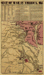
 Map of the seat of war, positions of the rebel forces, batteries, entrenchments, and encampments in Virginia-the fortifications for the protection of Richmond Waters & son, engravers, N.Y. CREATED/PUBLISHED [London, The London American, 1861] NOTES Scale ca. 1:800,000. Includes a mileage table. Reference is made in the lower margin to the "battle of Bull's [sic] Run, fought on Sunday, the 21st July [1861], about 22,000 unionists and about 60,000 rebels were in the engagement." Map of the seat of war, positions of the rebel forces, batteries, entrenchments, and encampments in Virginia-the fortifications for the protection of Richmond Waters & son, engravers, N.Y. CREATED/PUBLISHED [London, The London American, 1861] NOTES Scale ca. 1:800,000. Includes a mileage table. Reference is made in the lower margin to the "battle of Bull's [sic] Run, fought on Sunday, the 21st July [1861], about 22,000 unionists and about 60,000 rebels were in the engagement." |
 Country between Washington & Manassas Junction [and] Topographical map of the country between Fortress Monroe & Richmond. Lang & Laing Lith. CREATED/PUBLISHED New York, Lang & Laing, [1861-1865?] NOTES Scales ca. 1:200,000 and 1:400,000. General maps showing roads, railroads, rivers, and place names. Country between Washington & Manassas Junction [and] Topographical map of the country between Fortress Monroe & Richmond. Lang & Laing Lith. CREATED/PUBLISHED New York, Lang & Laing, [1861-1865?] NOTES Scales ca. 1:200,000 and 1:400,000. General maps showing roads, railroads, rivers, and place names. |
 The seat of war in Virginia. Positions of the rebel forces, batteries, intrenchments and encampments in Virginia-the fortifications for the protection of Richmond Waters & So, engravers, N.Y. CREATED/PUBLISHED [New York], 1861. NOTES Scale ca. 1:800,000. From the New York Herald, morning edition, June 17, 1861. p. 1. The seat of war in Virginia. Positions of the rebel forces, batteries, intrenchments and encampments in Virginia-the fortifications for the protection of Richmond Waters & So, engravers, N.Y. CREATED/PUBLISHED [New York], 1861. NOTES Scale ca. 1:800,000. From the New York Herald, morning edition, June 17, 1861. p. 1. |
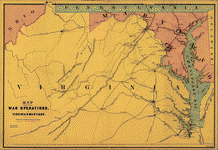 Map showing the war operations, in Virginia & Maryland. Bufford, John Henry, 1810-1870. CREATED/PUBLISHED Boston, J. H. Bufford, c1861. NOTES Scale not given. Indicates railroads, principal towns, and a few batteries. Map showing the war operations, in Virginia & Maryland. Bufford, John Henry, 1810-1870. CREATED/PUBLISHED Boston, J. H. Bufford, c1861. NOTES Scale not given. Indicates railroads, principal towns, and a few batteries. |
 Army map of the seat of war in Virginia, showing the battle fields, fortification, etc. on & near the Potomac River Drawn by J. G. Bruff. Lith. of P. S. Duval & Son, Philada. Bruff, Joseph Goldsborough, 1804-1889. CREATED/PUBLISHED New York and Washn., D.C., J. Disturnell and Hudson Taylor, c1861. NOTES Scale ca. 1:183,000. Map of the Potomac River and vicinity from Harpers Ferry to Swan Point showing towns, roads, railroads, names and boundaries of counties, drainage, and relief by hachures. Principal Union and Confederate positions are marked by small flags or underlined in blue and red respectively. List of 33 forts defending Washington is in the right corner. Army map of the seat of war in Virginia, showing the battle fields, fortification, etc. on & near the Potomac River Drawn by J. G. Bruff. Lith. of P. S. Duval & Son, Philada. Bruff, Joseph Goldsborough, 1804-1889. CREATED/PUBLISHED New York and Washn., D.C., J. Disturnell and Hudson Taylor, c1861. NOTES Scale ca. 1:183,000. Map of the Potomac River and vicinity from Harpers Ferry to Swan Point showing towns, roads, railroads, names and boundaries of counties, drainage, and relief by hachures. Principal Union and Confederate positions are marked by small flags or underlined in blue and red respectively. List of 33 forts defending Washington is in the right corner. |
 Topographical map of Virginia between Washington and Manassas Junction. Magnus, Charles. CREATED/PUBLISHED New York, Chs. Magnus, [1861?] NOTES Scale ca. 1:270,000. Indicates Union and Confederate positions at "battle of Bull Run, July 21st 1861," Union encampments, towns, roads, the street pattern of Washington, railroads, rivers, and relief by hachures. Inset: Leesburg to Harpers Ferry. 4 x 5 cm. "Panoramic view of the fortifications around Washington" (12 x 20 cm.) appears above the map. Topographical map of Virginia between Washington and Manassas Junction. Magnus, Charles. CREATED/PUBLISHED New York, Chs. Magnus, [1861?] NOTES Scale ca. 1:270,000. Indicates Union and Confederate positions at "battle of Bull Run, July 21st 1861," Union encampments, towns, roads, the street pattern of Washington, railroads, rivers, and relief by hachures. Inset: Leesburg to Harpers Ferry. 4 x 5 cm. "Panoramic view of the fortifications around Washington" (12 x 20 cm.) appears above the map. |
 Map of the seat of war in Virginia, Dec. 1, 1862. Duncan, B. CREATED/PUBLISHED Columbia, S.C. : B. Duncan, [1862] (Columbia : B. Duncan Litho.) NOTES Relief shown by hachures. Map of the seat of war in Virginia, Dec. 1, 1862. Duncan, B. CREATED/PUBLISHED Columbia, S.C. : B. Duncan, [1862] (Columbia : B. Duncan Litho.) NOTES Relief shown by hachures. |
 Map of n. eastern Virginia and vicinity of Washington. CREATED/PUBLISHED [Washington, D.C.? : s.n., 1862] NOTES Shows forts and batteries in the District of Columbia and immediate vicinity. Relief shown by hachures. Depths shown by soundings. At head of title: Surveys for military defences. "Additions & corrections for Rappahannock and Rapid Ann Rivers and their vicinity ..." added to data used in compilation. Map of n. eastern Virginia and vicinity of Washington. CREATED/PUBLISHED [Washington, D.C.? : s.n., 1862] NOTES Shows forts and batteries in the District of Columbia and immediate vicinity. Relief shown by hachures. Depths shown by soundings. At head of title: Surveys for military defences. "Additions & corrections for Rappahannock and Rapid Ann Rivers and their vicinity ..." added to data used in compilation. |
 Map of route and positions, First Corps, Army of Va., Maj. Gen. Sigel comg., from July 7th to Septr. 10th 1862 Compiled from maps, and actual surveys. Spetr. 1862. Franz Kappner, Maj. and Chef [sic] Engr. Kappner, Franz. CREATED/PUBLISHED [S.l., 1862] NOTES Scale not given. In upper right corner: Ho. Reps. Ex. Doc. no. 81-37th Cong. 3rd Sess. The route of the First Corps is shown from Middletown, Virginia, to the defenses of Washington. Roads, towns, vegetation, drainage, houses, and names of residents are indicated along the line of march. Map of route and positions, First Corps, Army of Va., Maj. Gen. Sigel comg., from July 7th to Septr. 10th 1862 Compiled from maps, and actual surveys. Spetr. 1862. Franz Kappner, Maj. and Chef [sic] Engr. Kappner, Franz. CREATED/PUBLISHED [S.l., 1862] NOTES Scale not given. In upper right corner: Ho. Reps. Ex. Doc. no. 81-37th Cong. 3rd Sess. The route of the First Corps is shown from Middletown, Virginia, to the defenses of Washington. Roads, towns, vegetation, drainage, houses, and names of residents are indicated along the line of march. |
 Map of the seat of war in Virginia Lith. by E. Sachse & Co., Baltimore. Bohn, Casimir. CREATED/PUBLISHED Washington, D.C. & Old Point Comfort, Va., C. Bohn, c1862. NOTES Scale ca. 1:440,000. Map of southeast Virginia showing fortifications and camps underlined in brown, roads, railroads, towns, and drainage. "Table of distances from Norfolk" is in the lower left corner. Map of the seat of war in Virginia Lith. by E. Sachse & Co., Baltimore. Bohn, Casimir. CREATED/PUBLISHED Washington, D.C. & Old Point Comfort, Va., C. Bohn, c1862. NOTES Scale ca. 1:440,000. Map of southeast Virginia showing fortifications and camps underlined in brown, roads, railroads, towns, and drainage. "Table of distances from Norfolk" is in the lower left corner. |
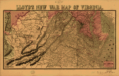 Lloyd's new war map of Virginia. Lloyd H. Hall Co. CREATED/PUBLISHED New York, c1862. NOTES Scale ca. 1:980,000. Shows battlefields underlined in red, towns, roads, railroads, drainage, and relief by hachures. Lloyd's new war map of Virginia. Lloyd H. Hall Co. CREATED/PUBLISHED New York, c1862. NOTES Scale ca. 1:980,000. Shows battlefields underlined in red, towns, roads, railroads, drainage, and relief by hachures. |
 Seat of war in America, 6d. Waters & son, engravers, N.Y. Bacon & Co. CREATED/PUBLISHED London, 1862. NOTES Scale ca. 1:820,000. Map of eastern Virginia and part of Maryland showing batteries, towns, roads, railroads, and rivers. McClellan's position on the Peninsula is shaded red. Names of Union and Confederate generals, "Exports in 1860," and "Colton's seetl [i.e., steel]-plate maps of the United States of America" are listed at the top of the map. Seat of war in America, 6d. Waters & son, engravers, N.Y. Bacon & Co. CREATED/PUBLISHED London, 1862. NOTES Scale ca. 1:820,000. Map of eastern Virginia and part of Maryland showing batteries, towns, roads, railroads, and rivers. McClellan's position on the Peninsula is shaded red. Names of Union and Confederate generals, "Exports in 1860," and "Colton's seetl [i.e., steel]-plate maps of the United States of America" are listed at the top of the map. |
 Army map of the seat of war in Virginia, showing the battle fields, fortifications, etc. on & near the Potomac River. CREATED/PUBLISHED New-York and Washn., D.C., J. Disturnell and Hudson Taylor, 1862. NOTES Scale ca. 1:183,000. Map of the Potomac River and vicinity from Harpers Ferry to Swan Point showing towns, roads, railroads, names and boundaries of counties, drainage, and relief by hachures. Principal Union and Confederate positions are marked by small flags or underlined in blue and red respectively. List of 34 forts defending Washington is in the lower right corner. Army map of the seat of war in Virginia, showing the battle fields, fortifications, etc. on & near the Potomac River. CREATED/PUBLISHED New-York and Washn., D.C., J. Disturnell and Hudson Taylor, 1862. NOTES Scale ca. 1:183,000. Map of the Potomac River and vicinity from Harpers Ferry to Swan Point showing towns, roads, railroads, names and boundaries of counties, drainage, and relief by hachures. Principal Union and Confederate positions are marked by small flags or underlined in blue and red respectively. List of 34 forts defending Washington is in the lower right corner. |
 Bacon's new army map of the seat of war in Virginia, showing the battle fields, fortifications, etc., on & near the Potomac River Compiled from the army map of the Federal Government, and other authentic sources Bacon & Co. CREATED/PUBLISHED London, 1862. NOTES Scale ca. 1:180,000. Map of northeast Virginia, Washington, D.C., and part of Maryland showing the location and date of engagements, battles in which cannons were used, country names and boundaries, roads, railroads, towns, drainage, hachures, and a few soundings in the Potomac River. Positions held by Union and Confederate forces are marked by flags. Bacon's new army map of the seat of war in Virginia, showing the battle fields, fortifications, etc., on & near the Potomac River Compiled from the army map of the Federal Government, and other authentic sources Bacon & Co. CREATED/PUBLISHED London, 1862. NOTES Scale ca. 1:180,000. Map of northeast Virginia, Washington, D.C., and part of Maryland showing the location and date of engagements, battles in which cannons were used, country names and boundaries, roads, railroads, towns, drainage, hachures, and a few soundings in the Potomac River. Positions held by Union and Confederate forces are marked by flags. |
 Geological map of the state of Virginia] / made under the direction of Maj. A.A. Humphreys ; by Tho. S. Ridgeway, geologist &c., formerly of the Geological Survey of Va., March 1862. Ridgeway, Thomas S. CREATED/PUBLISHED 1862. NOTES Ms. geological features shown on photocopy base map. Military information not shown. Relief shown by hachures on base map. Geological map of the state of Virginia] / made under the direction of Maj. A.A. Humphreys ; by Tho. S. Ridgeway, geologist &c., formerly of the Geological Survey of Va., March 1862. Ridgeway, Thomas S. CREATED/PUBLISHED 1862. NOTES Ms. geological features shown on photocopy base map. Military information not shown. Relief shown by hachures on base map. |
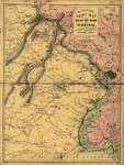
 The battle fields and military positions in eastern Virginia, from surveys supplied by officers of the army CREATED/PUBLISHED [New York, 1863] NOTES Scale ca. 1:450,000. "Presented by the Home Insurance Compy of New York." Inset: [Map of northern Virginia, Maryland, Delaware, and southern Pennsylvania] 16 x 32 cm. Gives names and boundaries of Virginia counties, roads, railroads, towns, and drainage. Battles are indicated by crossed swords. The battle fields and military positions in eastern Virginia, from surveys supplied by officers of the army CREATED/PUBLISHED [New York, 1863] NOTES Scale ca. 1:450,000. "Presented by the Home Insurance Compy of New York." Inset: [Map of northern Virginia, Maryland, Delaware, and southern Pennsylvania] 16 x 32 cm. Gives names and boundaries of Virginia counties, roads, railroads, towns, and drainage. Battles are indicated by crossed swords. |
 Route of the Tenth New York Cavalry from Culpeper to Gettysburg and return. Summer and fall campaigns of 1863. Preston, Noble D. CREATED/PUBLISHED [S.l.] 1863. NOTES Scale ca. 1:440,000. Finished pen and ink manuscript map of parts of Virginia, Maryland, and Pennsylvania, showing location and date of encampments and battles, route of the Tenth New York Cavalry, route of Capt. Pratt, roads, railroads, towns, drainage, and relief by hachures. Route of the Tenth New York Cavalry from Culpeper to Gettysburg and return. Summer and fall campaigns of 1863. Preston, Noble D. CREATED/PUBLISHED [S.l.] 1863. NOTES Scale ca. 1:440,000. Finished pen and ink manuscript map of parts of Virginia, Maryland, and Pennsylvania, showing location and date of encampments and battles, route of the Tenth New York Cavalry, route of Capt. Pratt, roads, railroads, towns, drainage, and relief by hachures. |
 New map of the seat of war in Virginia and Maryland Drawn by J. G. Bruff. Lith of Lang & Cooper, New York. Bruff, Joseph G. CREATED/PUBLISHED New York and Washington, D.C., J. Disturnell and W. H. and O. H. Morrison, 1863. NOTES Scale ca. 1:360,000. Map of eastern Virginia and Maryland showing the location and date of battles, forts, roads, railroads, towns, drainage, and relief by hachures. New map of the seat of war in Virginia and Maryland Drawn by J. G. Bruff. Lith of Lang & Cooper, New York. Bruff, Joseph G. CREATED/PUBLISHED New York and Washington, D.C., J. Disturnell and W. H. and O. H. Morrison, 1863. NOTES Scale ca. 1:360,000. Map of eastern Virginia and Maryland showing the location and date of battles, forts, roads, railroads, towns, drainage, and relief by hachures. |
 New map of the seat of war in Virginia and Maryland Drawn by J. G. Bruff. Lith of Lang & Cooper, New York. Bruff, Joseph G. CREATED/PUBLISHED New York and Washington, D.C., J. Disturnell and W. H. and O. H. Morrison, 1863. NOTES [Scale ca. 1:360,000]. Another issue. This issue contains the following additions: a) Washington is described as being "Surrounded by forts, batteries, and redoubts." b) Fredericksburg is labeled "H. 2 Rebel forces, Dec. 1862." c) "Explanation" contains the statement that "Washington City is the centre of the circles of measurement, 10 miles apart" d) Town and country names have been added. New map of the seat of war in Virginia and Maryland Drawn by J. G. Bruff. Lith of Lang & Cooper, New York. Bruff, Joseph G. CREATED/PUBLISHED New York and Washington, D.C., J. Disturnell and W. H. and O. H. Morrison, 1863. NOTES [Scale ca. 1:360,000]. Another issue. This issue contains the following additions: a) Washington is described as being "Surrounded by forts, batteries, and redoubts." b) Fredericksburg is labeled "H. 2 Rebel forces, Dec. 1862." c) "Explanation" contains the statement that "Washington City is the centre of the circles of measurement, 10 miles apart" d) Town and country names have been added. |
 Sheridan's last raid. The line of Sheridan's march, from Newcastle, on the Pamunkey, to Gordonsville. [June 7-June 11, 1864]. CREATED/PUBLISHED N.Y., W. Waters [&] Son sc., [1864] NOTES Scale ca. 1:385,000. Anonymous, undated newspaper map showing the location and dates of encampments and the "route of rebels, June 11th" at Trevilian Station. Sheridan's last raid. The line of Sheridan's march, from Newcastle, on the Pamunkey, to Gordonsville. [June 7-June 11, 1864]. CREATED/PUBLISHED N.Y., W. Waters [&] Son sc., [1864] NOTES Scale ca. 1:385,000. Anonymous, undated newspaper map showing the location and dates of encampments and the "route of rebels, June 11th" at Trevilian Station. |
 Military map of south-eastern Virginia A. Lindenkohl, del. Lindenkohl, A. CREATED/PUBLISHED [S.l.], H. Lindenkohl & Chas. G. Krebs, lith., [1864] NOTES [Scale 1:200,000]. Another issue. [Indicates 5-mile concentric circles centered on Richmond, roads, bridges, railroads, towns, houses, drainage, vegetation, and some fortifications in the Richmond-Petersburg area] Map title on this and the following two issues appears outside of the top border. Fortifications and vegetation in the Richmond-Petersburg area are more extensive here than on the preceding issue. Military map of south-eastern Virginia A. Lindenkohl, del. Lindenkohl, A. CREATED/PUBLISHED [S.l.], H. Lindenkohl & Chas. G. Krebs, lith., [1864] NOTES [Scale 1:200,000]. Another issue. [Indicates 5-mile concentric circles centered on Richmond, roads, bridges, railroads, towns, houses, drainage, vegetation, and some fortifications in the Richmond-Petersburg area] Map title on this and the following two issues appears outside of the top border. Fortifications and vegetation in the Richmond-Petersburg area are more extensive here than on the preceding issue. |
 Military map of south-eastern Virginia Drawn by A. Lindenkohl. Lindenkohl, A. CREATED/PUBLISHED [S.l.], H. Lindenkohl & Chs. G. Krebs, lith., [1864] NOTES Scale 1:200,000. Map title appears inside the border in the upper right corner. Indicates 5-mile concentric circles centered on Richmond, roads, bridges, railroads, towns, houses, drainage, vegetation, and some fortifications in the Richmond-Petersburg area. Military map of south-eastern Virginia Drawn by A. Lindenkohl. Lindenkohl, A. CREATED/PUBLISHED [S.l.], H. Lindenkohl & Chs. G. Krebs, lith., [1864] NOTES Scale 1:200,000. Map title appears inside the border in the upper right corner. Indicates 5-mile concentric circles centered on Richmond, roads, bridges, railroads, towns, houses, drainage, vegetation, and some fortifications in the Richmond-Petersburg area. |
 The approaches from Washington, to Richmond From surveys supplied by officers of the army. CREATED/PUBLISHED [New York, 1864] NOTES Scale ca. 1:445,000. "Presented by the Home Insurance Compy. of New York." Map of eastern Virginia showing roads, railroads, towns, drainage, and some relief by hachures. Battlefields are identified by crossed swords. Inset: The strategic points of east Tennessee, northern Alabama, and Georgia, from the U.S. official military map, 1864. Entered according to Act of Congress in the year 1864, by D. A. Heald . . . Scale ca. 1:1,300,000. 23 x 31 cm. The approaches from Washington, to Richmond From surveys supplied by officers of the army. CREATED/PUBLISHED [New York, 1864] NOTES Scale ca. 1:445,000. "Presented by the Home Insurance Compy. of New York." Map of eastern Virginia showing roads, railroads, towns, drainage, and some relief by hachures. Battlefields are identified by crossed swords. Inset: The strategic points of east Tennessee, northern Alabama, and Georgia, from the U.S. official military map, 1864. Entered according to Act of Congress in the year 1864, by D. A. Heald . . . Scale ca. 1:1,300,000. 23 x 31 cm. |
 Metomkin Inlet, Virginia. From a trigonometrical survey under the direction of A. D. Bache, Superintendent of the survey of the coast of the United States. Triangulation by John Farley, Assist. Topography by Geo. D. Wise and A. M. Harrison, Assists. Hydrography by the party under the direction of A. M. Harrison, Assist. Engd. by W. A. Thompson & J. G. Thompson. [Washington, U.S. Coast Survey] 1862. United States Coast Survey. CREATED/PUBLISHED [Washington, Government Printing Office, 1864] NOTES Scale 1:20,000. Metomkin Inlet, Virginia. From a trigonometrical survey under the direction of A. D. Bache, Superintendent of the survey of the coast of the United States. Triangulation by John Farley, Assist. Topography by Geo. D. Wise and A. M. Harrison, Assists. Hydrography by the party under the direction of A. M. Harrison, Assist. Engd. by W. A. Thompson & J. G. Thompson. [Washington, U.S. Coast Survey] 1862. United States Coast Survey. CREATED/PUBLISHED [Washington, Government Printing Office, 1864] NOTES Scale 1:20,000. |
 Magnus' historical war map. One hundred & fifty miles around Richmond. Magnus, Charles. CREATED/PUBLISHED New York, Washington, Charles Magnus, [1864] NOTES Scale ca. 1:920,000. General map centered on Richmond, Virginia. "Mirror of events [i.e., list of battles] 1861-62-63-64" has been attached to the left of the map. Insets: Maj. Gen. Canby' base of operations [Mississippi and Red River area] 9 x 8 cm.-Maj. Gen. W. T. Sherman's base of operations [northern Georgia] 9 x 8 cm.-Fortifications around Richmond, Va. 12 x 11 cm.-Prominent battle grounds [Bethel, Bull Run, Winchester, Fair Oaks, Seven days' battles, Malvern Hill, Antietam, Chancellorsville, Mt. Crawford, and Monocacy, 1861-64] 10 maps, each 4 x 4 cm. Includes portraits of Generals Grant and Lee. Magnus' historical war map. One hundred & fifty miles around Richmond. Magnus, Charles. CREATED/PUBLISHED New York, Washington, Charles Magnus, [1864] NOTES Scale ca. 1:920,000. General map centered on Richmond, Virginia. "Mirror of events [i.e., list of battles] 1861-62-63-64" has been attached to the left of the map. Insets: Maj. Gen. Canby' base of operations [Mississippi and Red River area] 9 x 8 cm.-Maj. Gen. W. T. Sherman's base of operations [northern Georgia] 9 x 8 cm.-Fortifications around Richmond, Va. 12 x 11 cm.-Prominent battle grounds [Bethel, Bull Run, Winchester, Fair Oaks, Seven days' battles, Malvern Hill, Antietam, Chancellorsville, Mt. Crawford, and Monocacy, 1861-64] 10 maps, each 4 x 4 cm. Includes portraits of Generals Grant and Lee. |
 Military topographical map of eastern Virginia showing the routes taken by the several army corps & the battles fought in the present campaign of 1864 under Lt. Gen. U. S. Grant Compiled and drawn by Charles Sholl, Civil & Topographical Engineer. Entered according to Act of Congress A.D. 1864 by R. Chauncy . . . J. Bien, Lith, N.Y. Sholl, Charles. CREATED/PUBLISHED N. York, Published by Capt. R. Chauncy, H.M.B.N.I., [1864] NOTES Scale ca. 1:135,000. Includes fortifications surrounding Richmond and Petersburg, roads, railroads, drainage, vegetation, towns, and houses. Military topographical map of eastern Virginia showing the routes taken by the several army corps & the battles fought in the present campaign of 1864 under Lt. Gen. U. S. Grant Compiled and drawn by Charles Sholl, Civil & Topographical Engineer. Entered according to Act of Congress A.D. 1864 by R. Chauncy . . . J. Bien, Lith, N.Y. Sholl, Charles. CREATED/PUBLISHED N. York, Published by Capt. R. Chauncy, H.M.B.N.I., [1864] NOTES Scale ca. 1:135,000. Includes fortifications surrounding Richmond and Petersburg, roads, railroads, drainage, vegetation, towns, and houses. |
 Schonberg's Virginia campaign map, 1864. Sch?nberg & Co. CREATED/PUBLISHED New York, 1864 NOTES Scale ca. 1:425,000. Map extends from Ashby's Gap south to Winfield and Charlottesville east to Tappahannock and shows the location and date of engagements, towns, roads, railroads, county names and boundaries, drainage, and some relief by hachures. A few place names are underlined in red. Schonberg's Virginia campaign map, 1864. Sch?nberg & Co. CREATED/PUBLISHED New York, 1864 NOTES Scale ca. 1:425,000. Map extends from Ashby's Gap south to Winfield and Charlottesville east to Tappahannock and shows the location and date of engagements, towns, roads, railroads, county names and boundaries, drainage, and some relief by hachures. A few place names are underlined in red. |
 Map of the seat of war in Virginia. CREATED/PUBLISHED 1865. NOTES Covers southern Virginia and northern North Carolina extending from Richmond, Va. south to Raleigh, N.C. Shows the "Line of march" from Richmond and Petersburg to Appomattox Court House along with the locations of the first, second, third, and fourth fights and the surrender. Map of the seat of war in Virginia. CREATED/PUBLISHED 1865. NOTES Covers southern Virginia and northern North Carolina extending from Richmond, Va. south to Raleigh, N.C. Shows the "Line of march" from Richmond and Petersburg to Appomattox Court House along with the locations of the first, second, third, and fourth fights and the surrender. |
 Central Virginia showing Lieut. Gen'l. U.S. Grant's Campaign and marches of the armies under his command. CREATED/PUBLISHED [S.l., 1866] NOTES Scale 1:350,000. Map extends from Martinsburg south to Dinwiddie C. H. and from Staunton east to Port Tobacco. In this edition, the map title and legend have been moved from the right hand side of the sheet to the upper left corner. Central Virginia showing Lieut. Gen'l. U.S. Grant's Campaign and marches of the armies under his command. CREATED/PUBLISHED [S.l., 1866] NOTES Scale 1:350,000. Map extends from Martinsburg south to Dinwiddie C. H. and from Staunton east to Port Tobacco. In this edition, the map title and legend have been moved from the right hand side of the sheet to the upper left corner. |
 The Wilderness [1864] CREATED/PUBLISHED [S.l.], 1867. NOTES Scale 1:21,120. In this issue, the map is printed on a yellow background with the Rapidan River colored green. Detailed map giving Union works in blue and Confederate works in red, roads, railroads, houses, fences, names of residents, vegetation, drainage, and relief by hachures. The Wilderness [1864] CREATED/PUBLISHED [S.l.], 1867. NOTES Scale 1:21,120. In this issue, the map is printed on a yellow background with the Rapidan River colored green. Detailed map giving Union works in blue and Confederate works in red, roads, railroads, houses, fences, names of residents, vegetation, drainage, and relief by hachures. |
 Map of Royal Land Company's Railroad (narrow gauge) from their anthracite coal fields to deep water; Carter M. Braxton, C.E., [187-]. Hotchkiss, Jedediah, 1828-1899. CREATED/PUBLISHED [187-] NOTES Scale 1:316,800. Map of Royal Land Company's Railroad (narrow gauge) from their anthracite coal fields to deep water; Carter M. Braxton, C.E., [187-]. Hotchkiss, Jedediah, 1828-1899. CREATED/PUBLISHED [187-] NOTES Scale 1:316,800. |
 Route of the New River R.R., 188-. Hotchkiss, Jedediah, 1828-1899. CREATED/PUBLISHED [188-] NOTES Scale ca. 1:180,700. Description derived from published bibliography. Sketch map of part of West Virginia. Dashed red line across the map indicates the "Proposed New River R.R." Shows counties and names the line of railroads. Route of the New River R.R., 188-. Hotchkiss, Jedediah, 1828-1899. CREATED/PUBLISHED [188-] NOTES Scale ca. 1:180,700. Description derived from published bibliography. Sketch map of part of West Virginia. Dashed red line across the map indicates the "Proposed New River R.R." Shows counties and names the line of railroads. |
 The Wilderness. [May 5-7, 1864] CREATED/PUBLISHED [S.l., 1887] NOTES Scale ca. 1:69,000. From Century illustrated monthly magazine, v. 34, June 1887. p.279. "Union works are marked U" and "Confederate works are marked C." Shows roads, houses, names of residents, drainage, vegetation, and relief by hachures. The Wilderness. [May 5-7, 1864] CREATED/PUBLISHED [S.l., 1887] NOTES Scale ca. 1:69,000. From Century illustrated monthly magazine, v. 34, June 1887. p.279. "Union works are marked U" and "Confederate works are marked C." Shows roads, houses, names of residents, drainage, vegetation, and relief by hachures. |
 Map showing the location of battle fields of Virginia Compiled from official war records and maps for the Chesapeake & Ohio Railway Co., 1891. Chesapeake and Ohio Railway Company. CREATED/PUBLISHED Chicago, Poole Bros., Engr's., c1892. NOTES Scale ca. 1:680,000. Map includes "Chesapeake & Ohio R.R. after the war," "other railroads after the war," "railroads during the war," "plank roads and turnpikes," "other roads," rivers, towns, and relief by hachures. Map showing the location of battle fields of Virginia Compiled from official war records and maps for the Chesapeake & Ohio Railway Co., 1891. Chesapeake and Ohio Railway Company. CREATED/PUBLISHED Chicago, Poole Bros., Engr's., c1892. NOTES Scale ca. 1:680,000. Map includes "Chesapeake & Ohio R.R. after the war," "other railroads after the war," "railroads during the war," "plank roads and turnpikes," "other roads," rivers, towns, and relief by hachures. |
 Battle-field map showing field of operations of the Armies of the Potomac and James CREATED/PUBLISHED Washington, 1892 NOTES Scale ca. 1:508,500. Map of Virginia and Maryland showing engagements, railroads, rivers and streams, place names, and relief by hachures. "Dates and locations of principal engagements as shown on this map" are listed in the lower left corner. Battle-field map showing field of operations of the Armies of the Potomac and James CREATED/PUBLISHED Washington, 1892 NOTES Scale ca. 1:508,500. Map of Virginia and Maryland showing engagements, railroads, rivers and streams, place names, and relief by hachures. "Dates and locations of principal engagements as shown on this map" are listed in the lower left corner. |
 Map showing the location of battle fields of Virginia Compiled from official war records and maps for the Chesapeake & Ohio Railway Co., 1891. Chesapeake and Ohio Railway Company. CREATED/PUBLISHED [Chicago, Poole Bros., Engr's., 1895] NOTES [Scale ca. 1:680,000]. Map showing the location of battle fields of Virginia Compiled from official war records and maps for the Chesapeake & Ohio Railway Co., 1891. Chesapeake and Ohio Railway Company. CREATED/PUBLISHED [Chicago, Poole Bros., Engr's., 1895] NOTES [Scale ca. 1:680,000]. |
 Map showing the location of battle fields of Virginia Compiled from official war records and maps for the Chesapeake & Ohio Railway Co., 1891. c1892. Chesapeake and Ohio Railway Company. CREATED/PUBLISHED Chicago, Poole Bros., Engr's., c1898. NOTES [Scale ca. 1:680,000]. Title when folded: 32nd annual encampment, G.A.R. Sept 5th 1898. Cincinnati, Ohio, via Chesapeake & Ohio Ry. Poole Bros., Chicago. To right of map: Principal battles and engagements occurring within the limits of the accompanying map, and the losses sustained by the opposing forces- Comparative statement of the number of men furnished and of the deaths in the Army during the war. Map showing the location of battle fields of Virginia Compiled from official war records and maps for the Chesapeake & Ohio Railway Co., 1891. c1892. Chesapeake and Ohio Railway Company. CREATED/PUBLISHED Chicago, Poole Bros., Engr's., c1898. NOTES [Scale ca. 1:680,000]. Title when folded: 32nd annual encampment, G.A.R. Sept 5th 1898. Cincinnati, Ohio, via Chesapeake & Ohio Ry. Poole Bros., Chicago. To right of map: Principal battles and engagements occurring within the limits of the accompanying map, and the losses sustained by the opposing forces- Comparative statement of the number of men furnished and of the deaths in the Army during the war. |
 Map of Virginia and neighboring states showing the location of battles in the Civil War 1861-1865. Northrup, William P. CREATED/PUBLISHED Buffalo, N.Y., The Matthews-Northrup Works, c1912. NOTES Scale ca. 1:366,000. Map of eastern Virginia and parts of North Carolina, Maryland, West Virginia, and Pennsylvania, showing "battles in which New York regiments were engaged," "railroads at time of war," and "turnpikes and plank roads." Map of Virginia and neighboring states showing the location of battles in the Civil War 1861-1865. Northrup, William P. CREATED/PUBLISHED Buffalo, N.Y., The Matthews-Northrup Works, c1912. NOTES Scale ca. 1:366,000. Map of eastern Virginia and parts of North Carolina, Maryland, West Virginia, and Pennsylvania, showing "battles in which New York regiments were engaged," "railroads at time of war," and "turnpikes and plank roads." |
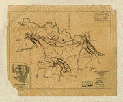
 Grant's and Sheridan's campaigns, 1864 [and 1865]. Rhodes, James Ford, 1848-1927. CREATED/PUBLISHED New York, The Macmillan Co., 1917. NOTES Scale ca. 1:880,000. Map of central Virginia and the Shenandoah Valley indicating the operations of Union forces in blue and "Gen. Lee's line of retreat" in red. Grant's and Sheridan's campaigns, 1864 [and 1865]. Rhodes, James Ford, 1848-1927. CREATED/PUBLISHED New York, The Macmillan Co., 1917. NOTES Scale ca. 1:880,000. Map of central Virginia and the Shenandoah Valley indicating the operations of Union forces in blue and "Gen. Lee's line of retreat" in red. |
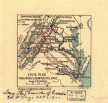 Civil War Virginia campaigns, 1862 Prepared for the Chronicles of America under the direction of W. L. G. Joerg, American Geographical Society. Julius Bien lith., N.Y. Joerg, W. L. G. (Wolfgang Louis Gottfried), b. 1885. CREATED/PUBLISHED [New Haven, Yale University Press, 1921] NOTES Scale 1:3,750,000. Black lines indicate the routes of McClellan and Burnside, and red lines the routes of Lee and Jackson. Civil War Virginia campaigns, 1862 Prepared for the Chronicles of America under the direction of W. L. G. Joerg, American Geographical Society. Julius Bien lith., N.Y. Joerg, W. L. G. (Wolfgang Louis Gottfried), b. 1885. CREATED/PUBLISHED [New Haven, Yale University Press, 1921] NOTES Scale 1:3,750,000. Black lines indicate the routes of McClellan and Burnside, and red lines the routes of Lee and Jackson. |
 Index sheet of battlefield maps for Fredericksburg, Spottsylvania C. H., Wilderness, Chancellorsville, Virginia. [1862-64] To accompany report of the Battlefield Commission created by Act of Congress public no. 261, 68th Congress dated 1925. 26 x 34 cm. CREATED/PUBLISHED [S.l., 1925] NOTES Scale ca. 1:135,000. Map indicates troop positions, trenches, public roads, "roads, special, to be built," "property to be acquired," and "some of the important points to be marked." Index sheet of battlefield maps for Fredericksburg, Spottsylvania C. H., Wilderness, Chancellorsville, Virginia. [1862-64] To accompany report of the Battlefield Commission created by Act of Congress public no. 261, 68th Congress dated 1925. 26 x 34 cm. CREATED/PUBLISHED [S.l., 1925] NOTES Scale ca. 1:135,000. Map indicates troop positions, trenches, public roads, "roads, special, to be built," "property to be acquired," and "some of the important points to be marked." |
This is a must have collection for any civil war history buff!
To use this software, you must install the free ExpressView MrSid software which is included on the CD. This is a 30 second process and will allow you to view and manipulate/print all the maps in this CD collection in full detail. There is a version for Windows platforms and full installation instructions are included on the CD.