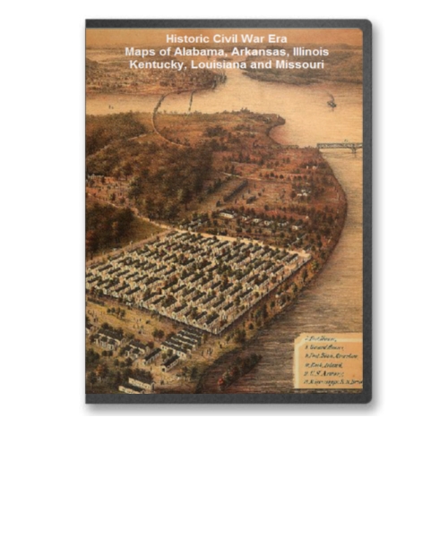
This CD contains 57 rare historic maps and descriptive pages representing fascinating details about Alabama, Arkansas, Illinois, Kentucky, Louisiana and Missouri and its vicinity during the Civil War.
This CD contains 57 rare historic maps and descriptive pages representing fascinating details about Alabama, Arkansas, Illinois, Kentucky, Louisiana and Missouri and its vicinity during the Civil War in MrSid format. This format allows you to see the entire map on your computer screen or drill down to see the smallest details. The original maps are often quite large, as much as 36" long or larger and quite detailed. With the MrSID software, you can manipulate the map to print the entire map in great detail or zoom into a portion of the map in full detail for viewing or printing. You could even bring the images to a local print shop to have the maps reprinted in their full size. (MrSID software is included on the CD.)
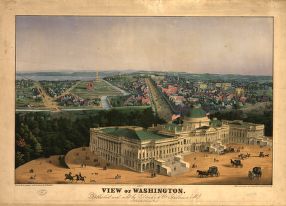
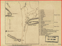
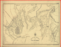
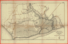
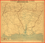
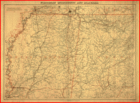
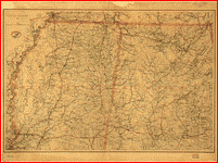
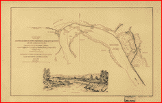
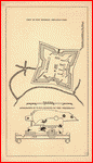
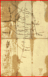
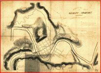
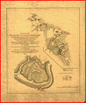
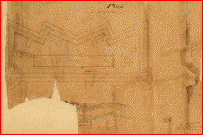
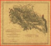
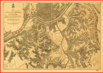
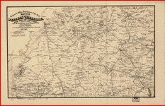
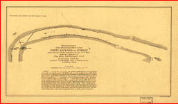
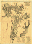
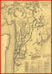
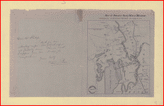
To give you a sample of the detail you can expect in these maps, here is an example based on a panoramic map of Washington, DC.
 |
 |
 |
 |
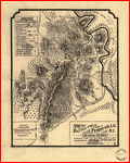
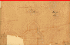
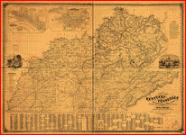
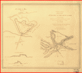
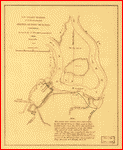
The table below shows the description and a small image of each map on this fascinating civil war history CD.
Alabama
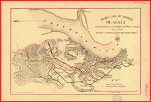 Rebel line of works at Blakely captured by the Army of West Miss., April 9, 1865 Position & approaches by the Union forces. . United States. Army. Corps of Engineers. CREATED/PUBLISHED [S.l.], Engraved in the Engineer Dept., [1865] NOTES Scale 1:14,400. Union positions are colored blue, and Confederate works are red. Includes roads, vegetation, drainage, and relief by hachures. Rebel line of works at Blakely captured by the Army of West Miss., April 9, 1865 Position & approaches by the Union forces. . United States. Army. Corps of Engineers. CREATED/PUBLISHED [S.l.], Engraved in the Engineer Dept., [1865] NOTES Scale 1:14,400. Union positions are colored blue, and Confederate works are red. Includes roads, vegetation, drainage, and relief by hachures. |
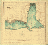 Approaches to Mobile, Ala. 1864. . United States Coast Survey. CREATED/PUBLISHED [S.l., 1864] NOTES Scale ca. 1:205,000. Map of Mobile Bay showing forts, towns, soundings, and a few roads. Description derived from published bibliography. Approaches to Mobile, Ala. 1864. . United States Coast Survey. CREATED/PUBLISHED [S.l., 1864] NOTES Scale ca. 1:205,000. Map of Mobile Bay showing forts, towns, soundings, and a few roads. Description derived from published bibliography. |
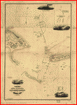 Chart showing the entrance of Rear Admiral Farragut into Mobile Bay. 5th of August 1864 Drawn & compiled by Robt. Weir, for Rear Admiral D. G. Farragut, Novr. 1st 1864. . Weir, Robert, 1836-1905. CREATED/PUBLISHED N.Y. Lith. by Hatch & Co. 1864 NOTES Scale ca. 1:22,500. Detailed map showing five positions and the tracks of the vessels during the sea battle, obstructions, channels, banks, and shoals. Includes small views of the "Iron-clad Tennessee," Federal ship colliding with the Ram Tennessee, a vessel sailing past what appears to be Mobile Point, and a general view of the battle. Inset: [Diagram] showing points of collision of different vessels upon the Ram [Tennessee]. 19 x 15 cm. Chart showing the entrance of Rear Admiral Farragut into Mobile Bay. 5th of August 1864 Drawn & compiled by Robt. Weir, for Rear Admiral D. G. Farragut, Novr. 1st 1864. . Weir, Robert, 1836-1905. CREATED/PUBLISHED N.Y. Lith. by Hatch & Co. 1864 NOTES Scale ca. 1:22,500. Detailed map showing five positions and the tracks of the vessels during the sea battle, obstructions, channels, banks, and shoals. Includes small views of the "Iron-clad Tennessee," Federal ship colliding with the Ram Tennessee, a vessel sailing past what appears to be Mobile Point, and a general view of the battle. Inset: [Diagram] showing points of collision of different vessels upon the Ram [Tennessee]. 19 x 15 cm. |
 Plan of the battle of August 5, 1864. [Mobile Bay] . CREATED/PUBLISHED [S.l., 1864] NOTES Scale not given. From Harper's weekly, v. 8, Sept. 24, 1864. p. 613. Names of ships are keyed by number and letter to the left of the map. Plan of the battle of August 5, 1864. [Mobile Bay] . CREATED/PUBLISHED [S.l., 1864] NOTES Scale not given. From Harper's weekly, v. 8, Sept. 24, 1864. p. 613. Names of ships are keyed by number and letter to the left of the map. |
 Map of the defences of the city of Mobile. [1862-64] Engraved in the Engineer Bureau, War Dept. . United States. Army. Corps of Engineers. CREATED/PUBLISHED Philada., Bowen & Co. lith., [1866] NOTES Scale not given. From 39th Cong., 1st Sess. [1866]-Report of the Chief Engineer, U.S.A. No. 10. Map of Mobile and environs, showing roads, "Mobile and Ohio Rail-Road," drainage, vegetation, hachures, and fortifications at Blakely and Spanish Fort and those built in 1862, 1863, and 1864 at Mobile. Map of the defences of the city of Mobile. [1862-64] Engraved in the Engineer Bureau, War Dept. . United States. Army. Corps of Engineers. CREATED/PUBLISHED Philada., Bowen & Co. lith., [1866] NOTES Scale not given. From 39th Cong., 1st Sess. [1866]-Report of the Chief Engineer, U.S.A. No. 10. Map of Mobile and environs, showing roads, "Mobile and Ohio Rail-Road," drainage, vegetation, hachures, and fortifications at Blakely and Spanish Fort and those built in 1862, 1863, and 1864 at Mobile. |
 Rebel defences, Mobile, Alabama, occupied by Union forces under Maj. Gen. E.R.S. Canby comdg. Engraved in the Engineer Department. S. Geismar, lith. . United States. Army. Corps of Engineers. CREATED/PUBLISHED Philada., Bowen & Co. lith., [1866] NOTES Scale ca. 1:18,200. From 39th Cong., 1st Sess. [1866]-Report of the Chief Engineer, U.S.A. No. 9. Map shows the three lines of fortifications constructed in 1862, 1863, and 1864, streets, "Mobile and Ohio Rail Road," vegetation, drainage, and relief by hachures. Most of the streets are not named. Rebel defences, Mobile, Alabama, occupied by Union forces under Maj. Gen. E.R.S. Canby comdg. Engraved in the Engineer Department. S. Geismar, lith. . United States. Army. Corps of Engineers. CREATED/PUBLISHED Philada., Bowen & Co. lith., [1866] NOTES Scale ca. 1:18,200. From 39th Cong., 1st Sess. [1866]-Report of the Chief Engineer, U.S.A. No. 9. Map shows the three lines of fortifications constructed in 1862, 1863, and 1864, streets, "Mobile and Ohio Rail Road," vegetation, drainage, and relief by hachures. Most of the streets are not named. |
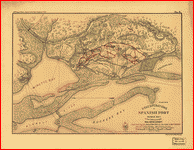 Siege operations at Spanish Fort, Mobile Bay, by the U.S. forces under Maj. Gen. Canby. Captured by the Army of West Miss. on the night of April 8 & 9, 1865. Major M. D. McAlester, Senior Engr., Major J. C. Palfrey, Asst. Engr., Capt. C. J. Allen, Asst. Engr., Capt. Patten, Inspector Genl's. Dept., Vol. Asst. Engr. Engraved in the Engineer Department. . McAlester, Miles D. CREATED/PUBLISHED Philada., Bowen & Co. lith., [1866] NOTES Scale ca. 1:16,600. From 39th Cong., 1st Sess. [1866]-Report of the Chief Engineer, U.S.A. No. 8. At head of title: Plan no. 8. Detailed map showing entrenchments, number, type, and position of Federal guns, vegetation, drainage, roads, and relief by hachures. Siege operations at Spanish Fort, Mobile Bay, by the U.S. forces under Maj. Gen. Canby. Captured by the Army of West Miss. on the night of April 8 & 9, 1865. Major M. D. McAlester, Senior Engr., Major J. C. Palfrey, Asst. Engr., Capt. C. J. Allen, Asst. Engr., Capt. Patten, Inspector Genl's. Dept., Vol. Asst. Engr. Engraved in the Engineer Department. . McAlester, Miles D. CREATED/PUBLISHED Philada., Bowen & Co. lith., [1866] NOTES Scale ca. 1:16,600. From 39th Cong., 1st Sess. [1866]-Report of the Chief Engineer, U.S.A. No. 8. At head of title: Plan no. 8. Detailed map showing entrenchments, number, type, and position of Federal guns, vegetation, drainage, roads, and relief by hachures. |
 Military map no. 54, prepared as basis for additional surveys prepared under direction of Capt. P. C. Hains, U.S.A., Act. Chief, Engineer Dept. of the Gulf. Drawn for stone by Helmuth Holtz. . Hains, Peter C. (Peter Conover), 1840-1921. CREATED/PUBLISHED [S.l.], Printed by W. Pro[bert, 1864?] NOTES Scale 1:380,160. General map of southern Alabama and West Florida showing roads, railroads, towns, drainage, and a few names of residents along the Tensaw River. Description derived from published bibliography. Map is incomplete; the bottom border is missing. DLC Military map no. 54, prepared as basis for additional surveys prepared under direction of Capt. P. C. Hains, U.S.A., Act. Chief, Engineer Dept. of the Gulf. Drawn for stone by Helmuth Holtz. . Hains, Peter C. (Peter Conover), 1840-1921. CREATED/PUBLISHED [S.l.], Printed by W. Pro[bert, 1864?] NOTES Scale 1:380,160. General map of southern Alabama and West Florida showing roads, railroads, towns, drainage, and a few names of residents along the Tensaw River. Description derived from published bibliography. Map is incomplete; the bottom border is missing. DLC |
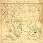
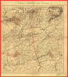 Northern Alabama and Georgia Compiled and engraved at the U.S. Coast Survey Office, from state maps, postoffice maps, local surveys, military reconnoissance and information furnished by the U.S. Engineers attached to the Military Division of the Miss. Drawn by A. Lindenkohl. . CREATED/PUBLISHED [S.l.], H. Lindenkohl & Chas. G. Krebs, lith., [1864?] NOTES Scale 1:633,600. Signed in ink in upper margin: Llewellyn F. Haskell, Lt. Col., 7 U.S.C.I. July 15, 1864. DLC General map of northeastern Alabama and northwestern Georgia indicating cities and towns, roads and railroads, rivers, and some relief by hachures. Map overprinted in red to highlight state boundaries and railroads. Northern Alabama and Georgia Compiled and engraved at the U.S. Coast Survey Office, from state maps, postoffice maps, local surveys, military reconnoissance and information furnished by the U.S. Engineers attached to the Military Division of the Miss. Drawn by A. Lindenkohl. . CREATED/PUBLISHED [S.l.], H. Lindenkohl & Chas. G. Krebs, lith., [1864?] NOTES Scale 1:633,600. Signed in ink in upper margin: Llewellyn F. Haskell, Lt. Col., 7 U.S.C.I. July 15, 1864. DLC General map of northeastern Alabama and northwestern Georgia indicating cities and towns, roads and railroads, rivers, and some relief by hachures. Map overprinted in red to highlight state boundaries and railroads. |
 Part of northern Georgia : no. 2 / compiled under the direction of Capt. Wm. E. Merrill, chief, Top'l Eng'r, D.C. . Merrill, W. E. (William Emery), 1837-1891. CREATED/PUBLISHED [Washington, D.C.? : s.n., 1864] NOTES Covers a portion of northwestern Georgia and adjacent Alabama to the west of Atlanta. Annotated in blue pencil in upper margin: Specimen of field maps used in Sherman's campaigns, 1864. DLC Relief shown by hachures. Part of northern Georgia : no. 2 / compiled under the direction of Capt. Wm. E. Merrill, chief, Top'l Eng'r, D.C. . Merrill, W. E. (William Emery), 1837-1891. CREATED/PUBLISHED [Washington, D.C.? : s.n., 1864] NOTES Covers a portion of northwestern Georgia and adjacent Alabama to the west of Atlanta. Annotated in blue pencil in upper margin: Specimen of field maps used in Sherman's campaigns, 1864. DLC Relief shown by hachures. |
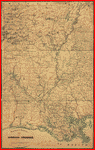
 Southern Mississippi and Alabama : showing the approaches to Mobile / Coast Survey Office, A.D. Bache, supt. . United States Coast Survey. CREATED/PUBLISHED [Washington, D.C.] : The Office, 1863. NOTES Covers the area west to east, from Jackson, Miss. to Montgomery, Ala. and north to south, from Philadelphia, Miss./Centreville, Ala. to Gulf of Mexico. Southern Mississippi and Alabama : showing the approaches to Mobile / Coast Survey Office, A.D. Bache, supt. . United States Coast Survey. CREATED/PUBLISHED [Washington, D.C.] : The Office, 1863. NOTES Covers the area west to east, from Jackson, Miss. to Montgomery, Ala. and north to south, from Philadelphia, Miss./Centreville, Ala. to Gulf of Mexico. |
 Northern Mississippi and Alabama Compiled and engraved at the U.S. Coast Survey Office, from state maps, post office maps, local surveys, etc., with additions from campaign maps and information furnished by Capt. O. M. Poe, Chief Engineer, Military Division of the Mississippi and by Capt. W. E. Merrill, Chief Engineer, Department of the Cumberland. Drawn by A. Lindenkohl. . CREATED/PUBLISHED [S.l., H. Lindenkohl & Chas. G. Krebs, lith.], 1864. NOTES Scale 1:633,600. General map indicating cities and towns, roads and railroads, rivers, and some relief by hachures. The map is overprinted in red to show state names and highlight state boundaries and railroads. Northern Mississippi and Alabama Compiled and engraved at the U.S. Coast Survey Office, from state maps, post office maps, local surveys, etc., with additions from campaign maps and information furnished by Capt. O. M. Poe, Chief Engineer, Military Division of the Mississippi and by Capt. W. E. Merrill, Chief Engineer, Department of the Cumberland. Drawn by A. Lindenkohl. . CREATED/PUBLISHED [S.l., H. Lindenkohl & Chas. G. Krebs, lith.], 1864. NOTES Scale 1:633,600. General map indicating cities and towns, roads and railroads, rivers, and some relief by hachures. The map is overprinted in red to show state names and highlight state boundaries and railroads. |
 Northern Mississippi and Alabama Drawn by A. Lindenkohl. H. Lindenkohl & Chas. G. Krebs, lith. . CREATED/PUBLISHED [S.l.], U.S. Coast Survey, A. D. Bache, Supdt., 1865. NOTES Scale 1:633,600. General map, without title. State names, boundaries, and railroads are colored red. Northern Mississippi and Alabama Drawn by A. Lindenkohl. H. Lindenkohl & Chas. G. Krebs, lith. . CREATED/PUBLISHED [S.l.], U.S. Coast Survey, A. D. Bache, Supdt., 1865. NOTES Scale 1:633,600. General map, without title. State names, boundaries, and railroads are colored red. |
Arkansas
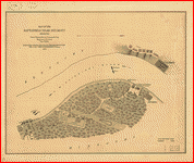
 Approaches to Fort Hindman, Arkansas Post, on the Arkansas River : captured by the U.S. Mississippi Squadron, under command of Act'g. Rear Admiral David D. Porter, U.S.N., January 11th, 1863 / surveyed by C. Fendall, sub. assistant, U.S. Coast Survey, acting under orders of Rear Admiral D.D. Porter ; U.S. Coast Survey, A.D. Bache, supdt.; autographic transfer, J.W. Maedel. . Fendall, C. CREATED/PUBLISHED [Washington, D.C.] : The Survey, 1863. NOTES Annotated in pencil on verso: Approaches to Fort Hindman, Arkansas River, January 11, 1863. DLC Shows Fort Hindman and adjacent areas of the Arkansas River. Approaches to Fort Hindman, Arkansas Post, on the Arkansas River : captured by the U.S. Mississippi Squadron, under command of Act'g. Rear Admiral David D. Porter, U.S.N., January 11th, 1863 / surveyed by C. Fendall, sub. assistant, U.S. Coast Survey, acting under orders of Rear Admiral D.D. Porter ; U.S. Coast Survey, A.D. Bache, supdt.; autographic transfer, J.W. Maedel. . Fendall, C. CREATED/PUBLISHED [Washington, D.C.] : The Survey, 1863. NOTES Annotated in pencil on verso: Approaches to Fort Hindman, Arkansas River, January 11, 1863. DLC Shows Fort Hindman and adjacent areas of the Arkansas River. |
 View of Fort Hindman, Arkansas Post. [January 11, 1863] . United States. Navy. CREATED/PUBLISHED [S.l.], 1863 NOTES Scale ca. 1:2,450. From Report of the Secretary of the Navy, with an appendix, containing reports from officers. December, 1863 (Washington, Government Printing Office, 1863). fol. p. 414. Inset: Appearance of IX-gun silenced by the "Cincinnati." View of Fort Hindman, Arkansas Post. [January 11, 1863] . United States. Navy. CREATED/PUBLISHED [S.l.], 1863 NOTES Scale ca. 1:2,450. From Report of the Secretary of the Navy, with an appendix, containing reports from officers. December, 1863 (Washington, Government Printing Office, 1863). fol. p. 414. Inset: Appearance of IX-gun silenced by the "Cincinnati." |
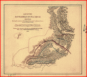 Map of the battlefield of Pea Ridge, Arkansas, showing the positions of the United States and Confederate forces on the 8th of March 1862 From a map forwarded to the Engineer Department Sept. 11th 1865 by Brevet Brig. Gen. C. B. Comstock A.D.C. . United States. Army. Corps of Engineers. CREATED/PUBLISHED [Washington], 1876. NOTES Scale not given. Shows relief by hachures, drainage, vegetation, and houses. Map of the battlefield of Pea Ridge, Arkansas, showing the positions of the United States and Confederate forces on the 8th of March 1862 From a map forwarded to the Engineer Department Sept. 11th 1865 by Brevet Brig. Gen. C. B. Comstock A.D.C. . United States. Army. Corps of Engineers. CREATED/PUBLISHED [Washington], 1876. NOTES Scale not given. Shows relief by hachures, drainage, vegetation, and houses. |
 Map of Louisiana & Arkansas. Prepared under direction of 1st Lieut. Wm. Hoelcke, 39 U.S. Infty, acting Chief Engineer at hd. qts. Dept. of La., by Helmuth Holtz. . CREATED/PUBLISHED [S.l., 1864?] NOTES Scale ca. 1:650,000. At head of title: Department of Louisiana. General map showing roads, railroads, drainage, names and boundaries of counties, towns, forts, "military road to Memphis," and camp sites in St. Francis County, Ark. On August 2, 3, and 6, 1864. Map of Louisiana & Arkansas. Prepared under direction of 1st Lieut. Wm. Hoelcke, 39 U.S. Infty, acting Chief Engineer at hd. qts. Dept. of La., by Helmuth Holtz. . CREATED/PUBLISHED [S.l., 1864?] NOTES Scale ca. 1:650,000. At head of title: Department of Louisiana. General map showing roads, railroads, drainage, names and boundaries of counties, towns, forts, "military road to Memphis," and camp sites in St. Francis County, Ark. On August 2, 3, and 6, 1864. |
Illinois
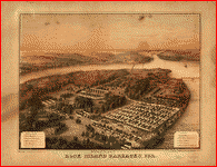 Rock Island Barracks, Ill. Lith. C. Vogt. H. Lambach sct., Davenport Io. . Speidel, C. CREATED/PUBLISHED Rock Island, Ill., C. Speidel, 1864. NOTES Scale not given. "Print, by J. McKittrick & Co., St. Louis Mo." Perspective drawing of the prison for Confederate soldiers at Rock Island. Principal buildings and features are listed and keyed by number to the appropriate position in the view. Rock Island Barracks, Ill. Lith. C. Vogt. H. Lambach sct., Davenport Io. . Speidel, C. CREATED/PUBLISHED Rock Island, Ill., C. Speidel, 1864. NOTES Scale not given. "Print, by J. McKittrick & Co., St. Louis Mo." Perspective drawing of the prison for Confederate soldiers at Rock Island. Principal buildings and features are listed and keyed by number to the appropriate position in the view. |
 Plan of a fort opposite Paducah, Ky. . CREATED/PUBLISHED [1864] NOTES Shows the environs of the proposed fort in Massac County, Illinois. In the lower right corner: Engr. Dept., July 18/64. recd. with Gen. Cullum's letter of the 16th inst. (C. 5621). Pen-and-ink, pencil, and watercolor. Includes a map of Paducah, Ky. Copy imperfect: Part of map in lower left missing Plan of a fort opposite Paducah, Ky. . CREATED/PUBLISHED [1864] NOTES Shows the environs of the proposed fort in Massac County, Illinois. In the lower right corner: Engr. Dept., July 18/64. recd. with Gen. Cullum's letter of the 16th inst. (C. 5621). Pen-and-ink, pencil, and watercolor. Includes a map of Paducah, Ky. Copy imperfect: Part of map in lower left missing |
 Sketch and plan for a fortification opposite Paducah, Ky. . CREATED/PUBLISHED [1864] NOTES Shows sketch of the environs of the proposed fort in Massac County, Illinois. Relief shown by hachures. In the lower right corner: Engr. Dept., July 18/64. Recd. with Gen. Cullum's letter of the 16th inst. (C5621). Pen-and-ink and pencil. Includes plan and profile of the proposed fort. Copy imperfect: Part of profile in lower left missing Sketch and plan for a fortification opposite Paducah, Ky. . CREATED/PUBLISHED [1864] NOTES Shows sketch of the environs of the proposed fort in Massac County, Illinois. Relief shown by hachures. In the lower right corner: Engr. Dept., July 18/64. Recd. with Gen. Cullum's letter of the 16th inst. (C5621). Pen-and-ink and pencil. Includes plan and profile of the proposed fort. Copy imperfect: Part of profile in lower left missing |
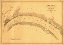 Ohio River between Mound City and Cairo. Surveyed by the party of F. H. Gerdes, Asst., assigned by A. D. Bache, Supdt., U.S. Coast Survey, to act . Gerdes, F. H. CREATED/PUBLISHED [S.l., 1864] NOTES Scale ca. 1:23,500. Indicates Fort Cairo, naval depot, and "harbor for powder barges" at Mound City, soundings in feet, roads and streets, and vegetation. Ohio River between Mound City and Cairo. Surveyed by the party of F. H. Gerdes, Asst., assigned by A. D. Bache, Supdt., U.S. Coast Survey, to act . Gerdes, F. H. CREATED/PUBLISHED [S.l., 1864] NOTES Scale ca. 1:23,500. Indicates Fort Cairo, naval depot, and "harbor for powder barges" at Mound City, soundings in feet, roads and streets, and vegetation. |
Kentucky
 Sketch of vicinity of head qtrs. U.S. forces, Snows Pond, Kentuckey [sic]. . CREATED/PUBLISHED [1862] NOTES Covers Florence area, west to Independence and east to Union, in central Boone County, Kentucky. Snows Pond not shown. Shows street names, houses, and names of residents. Sketch of vicinity of head qtrs. U.S. forces, Snows Pond, Kentuckey [sic]. . CREATED/PUBLISHED [1862] NOTES Covers Florence area, west to Independence and east to Union, in central Boone County, Kentucky. Snows Pond not shown. Shows street names, houses, and names of residents. |
 Military map of the vicinity of Frankfort, Kentucky / made by order of Brig. Gen. Q.A. Gillmore, Comd'g District of Central Kentucky, under direction of T.B. Brooks, Capt. Vol. Engr's. A.D.C., by J.H. Brooks, civil assistant to U.S. Topog. Engr's., February 1863. . Brooks, J. H. CREATED/PUBLISHED [1863] NOTES Shows streets, rivers and creeks, locations of the arsenal and "U.S. Hd. Qrs.," and recommended defensive positions. Annotated in blue pencil : Positions for defensive works proferred [sic] by Col. Gilbert with force and armament marked blue. Relief shown by hachures and spot heights. Military map of the vicinity of Frankfort, Kentucky / made by order of Brig. Gen. Q.A. Gillmore, Comd'g District of Central Kentucky, under direction of T.B. Brooks, Capt. Vol. Engr's. A.D.C., by J.H. Brooks, civil assistant to U.S. Topog. Engr's., February 1863. . Brooks, J. H. CREATED/PUBLISHED [1863] NOTES Shows streets, rivers and creeks, locations of the arsenal and "U.S. Hd. Qrs.," and recommended defensive positions. Annotated in blue pencil : Positions for defensive works proferred [sic] by Col. Gilbert with force and armament marked blue. Relief shown by hachures and spot heights. |
 Sketch of the battlefield of Logan's Cross Roads and of the enemys fortified position at and opposite Mill Spring, Ky. to which he retreated after his defeat, Major General George H. Thomas comdg. the U.S. forces, General G. B. Crittenden comdg. the Confed. Forces, Jan. 19th 1862. Drawn under the direction of Capt. N. Michler, Topl. Engrs, U.S.A. and Edward Ruger. From a survey by Lt. Col. Hunten 1st Mich. Engrs. . Sketch of the battlefield of Logan's Cross Roads and of the enemys fortified position at and opposite Mill Spring, Ky. to which he retreated after his defeat, Major General George H. Thomas comdg. the U.S. forces, General G. B. Crittenden comdg. the Confed. Forces, Jan. 19th 1862. Drawn under the direction of Capt. N. Michler, Topl. Engrs, U.S.A. and Edward Ruger. From a survey by Lt. Col. Hunten 1st Mich. Engrs. Michler, N. (Nathaniel), 1827-1881. CREATED/PUBLISHED [S.l.], Published by authority of the Hon. the Secretary of War in the office of the Chief of Engineers, U.S.A., [1877] NOTES Scale 1:15,840. Map of Logan's Cross Roads indicates four positions of Union and Confederate soldiers, troop camps, location of graves, roads, drainage, vegetation, houses, fences, and a few hachures. Map of Mill Spring shows Confederate entrenchments, roads, drainage, vegetation, hachures, houses and the names of residents. Eight-mile stretch of road between Longan's Cross Roads and Mill Spring is not shown. Sketch of the battlefield of Logan's Cross Roads and of the enemys fortified position at and opposite Mill Spring, Ky. to which he retreated after his defeat, Major General George H. Thomas comdg. the U.S. forces, General G. B. Crittenden comdg. the Confed. Forces, Jan. 19th 1862. Drawn under the direction of Capt. N. Michler, Topl. Engrs, U.S.A. and Edward Ruger. From a survey by Lt. Col. Hunten 1st Mich. Engrs. . Sketch of the battlefield of Logan's Cross Roads and of the enemys fortified position at and opposite Mill Spring, Ky. to which he retreated after his defeat, Major General George H. Thomas comdg. the U.S. forces, General G. B. Crittenden comdg. the Confed. Forces, Jan. 19th 1862. Drawn under the direction of Capt. N. Michler, Topl. Engrs, U.S.A. and Edward Ruger. From a survey by Lt. Col. Hunten 1st Mich. Engrs. Michler, N. (Nathaniel), 1827-1881. CREATED/PUBLISHED [S.l.], Published by authority of the Hon. the Secretary of War in the office of the Chief of Engineers, U.S.A., [1877] NOTES Scale 1:15,840. Map of Logan's Cross Roads indicates four positions of Union and Confederate soldiers, troop camps, location of graves, roads, drainage, vegetation, houses, fences, and a few hachures. Map of Mill Spring shows Confederate entrenchments, roads, drainage, vegetation, hachures, houses and the names of residents. Eight-mile stretch of road between Longan's Cross Roads and Mill Spring is not shown. |
 Plan of a fort opposite Paducah, Ky. . CREATED/PUBLISHED [1864] NOTES Shows the environs of the proposed fort in Massac County, Illinois. In the lower right corner: Engr. Dept., July 18/64. recd. with Gen. Cullum's letter of the 16th inst. (C. 5621). Pen-and-ink, pencil, and watercolor. Includes a map of Paducah, Ky. Copy imperfect: Part of map in lower left missing Plan of a fort opposite Paducah, Ky. . CREATED/PUBLISHED [1864] NOTES Shows the environs of the proposed fort in Massac County, Illinois. In the lower right corner: Engr. Dept., July 18/64. recd. with Gen. Cullum's letter of the 16th inst. (C. 5621). Pen-and-ink, pencil, and watercolor. Includes a map of Paducah, Ky. Copy imperfect: Part of map in lower left missing |
 Map of the battlefield of Perryville, Ky. Major General Don Carlos Buell commanding the U.S. forces, General Braxton Bragg commanding the Confederate forces. October 8th 1862. Surveyed and compiled by order of Major General George H. Thomas U.S.A., by Edward Ruger and Anton Kilp. . Ruger, Edward. CREATED/PUBLISHED [S.l.] Published by authority of the Hon. the Secretary of War in the office of the Chief of Engineers, U.S. Army. 1877. NOTES Scale ca. 1:48,000. "Authorities: surveys by Edward Ruger and Anton Kilp [and] official reports of officers of both armies." Map gives "position of General Gilbert's corps on the evening of October 7th" and the positions of both the Union and Confederate troops "on the 8th before being brought into action," "while engaged," and "after dark on the evening of the 8th." Roads, the railroad from Lebanon to Stanford, drainage, vegetation, relief by hachures, houses, and the names of residents are also represented. Map of the battlefield of Perryville, Ky. Major General Don Carlos Buell commanding the U.S. forces, General Braxton Bragg commanding the Confederate forces. October 8th 1862. Surveyed and compiled by order of Major General George H. Thomas U.S.A., by Edward Ruger and Anton Kilp. . Ruger, Edward. CREATED/PUBLISHED [S.l.] Published by authority of the Hon. the Secretary of War in the office of the Chief of Engineers, U.S. Army. 1877. NOTES Scale ca. 1:48,000. "Authorities: surveys by Edward Ruger and Anton Kilp [and] official reports of officers of both armies." Map gives "position of General Gilbert's corps on the evening of October 7th" and the positions of both the Union and Confederate troops "on the 8th before being brought into action," "while engaged," and "after dark on the evening of the 8th." Roads, the railroad from Lebanon to Stanford, drainage, vegetation, relief by hachures, houses, and the names of residents are also represented. |
 Map of the battle-field of Perryville, Ky., October 8th 1862. Compiled from the records and other sources by J. B. Work, 52d Ohio Vol. Inf. . Work, J. B. CREATED/PUBLISHED Chicago, Ill. [1900] NOTES Scale ca. 1:38,000. Indicates roads, drainage, vegetation, houses, names of residents, relief by hachures, names of commanders; and by symbols, the positions of the Union and Confederate troops on the "evening Oct. 7th," "Oct. 8th before being brought into action," "Oct. 8th while engaged," "Oct. 8th after dark," "in reserve during the battle," and "batteries while engaged." Map of the battle-field of Perryville, Ky., October 8th 1862. Compiled from the records and other sources by J. B. Work, 52d Ohio Vol. Inf. . Work, J. B. CREATED/PUBLISHED Chicago, Ill. [1900] NOTES Scale ca. 1:38,000. Indicates roads, drainage, vegetation, houses, names of residents, relief by hachures, names of commanders; and by symbols, the positions of the Union and Confederate troops on the "evening Oct. 7th," "Oct. 8th before being brought into action," "Oct. 8th while engaged," "Oct. 8th after dark," "in reserve during the battle," and "batteries while engaged." |
 Sketch and plan for a fortification opposite Paducah, Ky. . CREATED/PUBLISHED [1864] NOTES Shows sketch of the environs of the proposed fort in Massac County, Illinois. Relief shown by hachures. In the lower right corner: Engr. Dept., July 18/64. Recd. with Gen. Cullum's letter of the 16th inst. (C5621). Pen-and-ink and pencil. Includes plan and profile of the proposed fort. Copy imperfect: Part of profile in lower left missing Sketch and plan for a fortification opposite Paducah, Ky. . CREATED/PUBLISHED [1864] NOTES Shows sketch of the environs of the proposed fort in Massac County, Illinois. Relief shown by hachures. In the lower right corner: Engr. Dept., July 18/64. Recd. with Gen. Cullum's letter of the 16th inst. (C5621). Pen-and-ink and pencil. Includes plan and profile of the proposed fort. Copy imperfect: Part of profile in lower left missing |
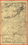
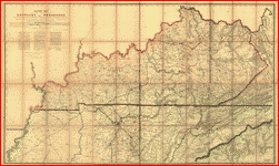
 New map of Kentucky and Tennessee from authentic reports of county surveyors throughout the states of Kentucky and Tennessee with a new key for measuring distances and specifying localities. Campbell and Barlow. CREATED/PUBLISHED Louisville, Ky., Campbell & Barlow, c1861. NOTES Scale ca. 1:600,000. "Entered accoring to Act of Congress in the year 1861 by Campbell & Barlow." Index to cities counties is printed below the map. General map indicating roads and railroads, county names and boundaries, cities and towns, rivers, and relief by hachures. Some roads and railroads in Kentucky have been colored red and black respectively. A nearly illegible pencil note in the lower right corner states that this map was "Turned into Bureau of Tpl. Eng. by Lieut. O. M. Poe, Top. Engr., August 1861, referred [to] in his letter of Aug. 17, 1861." Insets: The city of Memphis, Tennessee. 20 x 29 cm.-The city of Louisville, Kentucky. 19 x 32 cm. New map of Kentucky and Tennessee from authentic reports of county surveyors throughout the states of Kentucky and Tennessee with a new key for measuring distances and specifying localities. Campbell and Barlow. CREATED/PUBLISHED Louisville, Ky., Campbell & Barlow, c1861. NOTES Scale ca. 1:600,000. "Entered accoring to Act of Congress in the year 1861 by Campbell & Barlow." Index to cities counties is printed below the map. General map indicating roads and railroads, county names and boundaries, cities and towns, rivers, and relief by hachures. Some roads and railroads in Kentucky have been colored red and black respectively. A nearly illegible pencil note in the lower right corner states that this map was "Turned into Bureau of Tpl. Eng. by Lieut. O. M. Poe, Top. Engr., August 1861, referred [to] in his letter of Aug. 17, 1861." Insets: The city of Memphis, Tennessee. 20 x 29 cm.-The city of Louisville, Kentucky. 19 x 32 cm. |
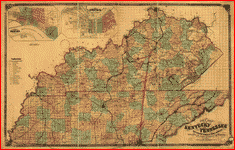 New map of Kentucky and Tennessee from authentic reports of county surveyors throughout the states of Kentucky and Tennessee with a new key for measuring distances and specifying localities . Campbell and Barlow. CREATED/PUBLISHED Cincinnati, Middleton Strobridge & Co., c1861. NOTES Scale ca. 1:690,000. Another edition. "Entered according to Act of Congress in the year 1861 by Campbell & Barlow." In this edition, the index to place names has been dropped. Map is annotated in blue to show the "Great national military rail road" and in red to show the "Great national military road." New map of Kentucky and Tennessee from authentic reports of county surveyors throughout the states of Kentucky and Tennessee with a new key for measuring distances and specifying localities . Campbell and Barlow. CREATED/PUBLISHED Cincinnati, Middleton Strobridge & Co., c1861. NOTES Scale ca. 1:690,000. Another edition. "Entered according to Act of Congress in the year 1861 by Campbell & Barlow." In this edition, the index to place names has been dropped. Map is annotated in blue to show the "Great national military rail road" and in red to show the "Great national military road." |
 Across Kentucky Drawn by G.H.B. [i.e., G.H. Blakeslee]. . Blakeslee, G. H. CREATED/PUBLISHED [1862] NOTES Scale ca. 1:1,020,000. Pen and ink sketch map showing "route of regiment" of the "38th Brigade, Gilbert's Division, of Buel's [sic] Army" from Louisville to "Mitchelsville" (i.e., Mitchellville), Tennessee. Across Kentucky Drawn by G.H.B. [i.e., G.H. Blakeslee]. . Blakeslee, G. H. CREATED/PUBLISHED [1862] NOTES Scale ca. 1:1,020,000. Pen and ink sketch map showing "route of regiment" of the "38th Brigade, Gilbert's Division, of Buel's [sic] Army" from Louisville to "Mitchelsville" (i.e., Mitchellville), Tennessee. |
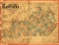 Lloyd's official map of the State of Kentucky Compiled from actual surveys and official documents, showing every rail road & rail road station with the distances between each station. Also the counties and county seats, cities, towns, villages, post offices, wagon roads, canals, forts, fortifications, &c. . Lloyd, James T. CREATED/PUBLISHED New York and Cincinnati, J. T. Lloyd, 1862. NOTES Scale ca. 1:506,880. "Entered according to Act of Congress in the year 1862, by J. T. Lloyd." Stamped in the upper left corner: Copyright Library, Nov. 19, 1862. General map showing forts and fortifications and the "military rail road propos[ed] by the President in his last message to connect Danville, Ky. with Knoxsville, Ten[n]." Lloyd's official map of the State of Kentucky Compiled from actual surveys and official documents, showing every rail road & rail road station with the distances between each station. Also the counties and county seats, cities, towns, villages, post offices, wagon roads, canals, forts, fortifications, &c. . Lloyd, James T. CREATED/PUBLISHED New York and Cincinnati, J. T. Lloyd, 1862. NOTES Scale ca. 1:506,880. "Entered according to Act of Congress in the year 1862, by J. T. Lloyd." Stamped in the upper left corner: Copyright Library, Nov. 19, 1862. General map showing forts and fortifications and the "military rail road propos[ed] by the President in his last message to connect Danville, Ky. with Knoxsville, Ten[n]." |
 Lloyd's official map of the state of Kentucky compiled from actual surveys and official documents, showing every rail road & rail road station with the distances between each station. Also the counties and county seats, cities, towns, villages, post offices, wagon roads, canals, forts fortifications &c. . Lloyd, James T. CREATED/PUBLISHED New York, 1863, c1862. NOTES Scale 1:512,500. Detailed township and county map showing relief by hachures, drainage, coal and iron mines, salt works, canals, roads, and the railroad network. Lloyd's official map of the state of Kentucky compiled from actual surveys and official documents, showing every rail road & rail road station with the distances between each station. Also the counties and county seats, cities, towns, villages, post offices, wagon roads, canals, forts fortifications &c. . Lloyd, James T. CREATED/PUBLISHED New York, 1863, c1862. NOTES Scale 1:512,500. Detailed township and county map showing relief by hachures, drainage, coal and iron mines, salt works, canals, roads, and the railroad network. |
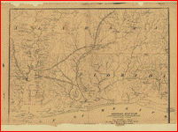
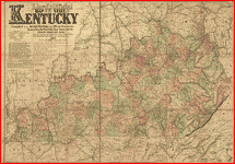
 Military map of the States of Kentucky and Tennessee, within eleven miles of the 35th parallel of latitude or southern boundary of Tennessee; compiled from the best authentic original maps, various documents, and miscellaneous latest sources of information; commenced under the authority of Major General Don Carlos Buell, commanding the Department of the Ohio, by Capt. N. Michler, Corps Topogl. Engrs. U.S.A., continued under Major General H. G. Wright by Maj. L. Sitgreaves Corps Topogl. Engrs. U.S.A., and completed under Major General Ambrose E. Burnside, commanding the Department, by Lieut. Col. J. H. Simpson, Corps Engrs. U.S.A., Chief Engr. in the Department. Drawn by Charles E. Swann, Ass't. Engr. . Swann, Charles E., Assistant Engineer. CREATED/PUBLISHED Cincinnati, O., Ehrgott, Forbriger & Co., Lithographers, Engravers & Printers, 1863. NOTES Scale 1:350,000. Another issue. In this issue Camp Burnside on the Cumberland River is named, the lithographer's name has been revised, and a dotted line representing the "out line of coal field" has been added in the southeastern quadrant. Military map of the States of Kentucky and Tennessee, within eleven miles of the 35th parallel of latitude or southern boundary of Tennessee; compiled from the best authentic original maps, various documents, and miscellaneous latest sources of information; commenced under the authority of Major General Don Carlos Buell, commanding the Department of the Ohio, by Capt. N. Michler, Corps Topogl. Engrs. U.S.A., continued under Major General H. G. Wright by Maj. L. Sitgreaves Corps Topogl. Engrs. U.S.A., and completed under Major General Ambrose E. Burnside, commanding the Department, by Lieut. Col. J. H. Simpson, Corps Engrs. U.S.A., Chief Engr. in the Department. Drawn by Charles E. Swann, Ass't. Engr. . Swann, Charles E., Assistant Engineer. CREATED/PUBLISHED Cincinnati, O., Ehrgott, Forbriger & Co., Lithographers, Engravers & Printers, 1863. NOTES Scale 1:350,000. Another issue. In this issue Camp Burnside on the Cumberland River is named, the lithographer's name has been revised, and a dotted line representing the "out line of coal field" has been added in the southeastern quadrant. |
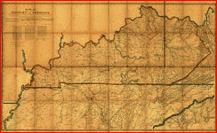 Military map of the States of Kentucky and Tennessee, within eleven miles of the 35th parallel of latitude or southern boundary of Tennessee; compiled from the best authentic original maps, various documents, and miscellaneous latest sources of information; commenced under the authority of Major General Don Carlos Buell, commanding the Department of the Ohio, by Capt. N. Michler, Corps Topogl. Engrs. U.S.A., continued under Major General H. G. Wright by Maj. L. Sitgreaves Corps Topogl. Engrs. U.S.A., and completed under Major General Ambrose E. Burnside, commanding the Department, by Lieut. Col. J. H. Simpson, Corps Engrs. U.S.A., Chief Engr. in the Department. Drawn by Charles E. Swann, Ass't. Engr. Ehrgott, Forbriger & Co., Lithographers, Engraphers [sic] and Printers, Cincinnati, O. . Swann, Charles E. CREATED/PUBLISHED Cincinnati, Ohio, Office of Chief Engineer, Dept. of the Ohio, 1863. NOTES Scale 1:350,000 (5.524 miles to one inch). Detailed map of Kentucky and most of Tennessee showing towns and villages, county seats, iron works and forges, salt works, mills, post offices, existing and proposed railroads, roads, rivers, and limits of coal fields. Map has been annotated in red ink to show the location of "Camp Burnside" on the Cumberland River south of Somerset, Kentucky. Military map of the States of Kentucky and Tennessee, within eleven miles of the 35th parallel of latitude or southern boundary of Tennessee; compiled from the best authentic original maps, various documents, and miscellaneous latest sources of information; commenced under the authority of Major General Don Carlos Buell, commanding the Department of the Ohio, by Capt. N. Michler, Corps Topogl. Engrs. U.S.A., continued under Major General H. G. Wright by Maj. L. Sitgreaves Corps Topogl. Engrs. U.S.A., and completed under Major General Ambrose E. Burnside, commanding the Department, by Lieut. Col. J. H. Simpson, Corps Engrs. U.S.A., Chief Engr. in the Department. Drawn by Charles E. Swann, Ass't. Engr. Ehrgott, Forbriger & Co., Lithographers, Engraphers [sic] and Printers, Cincinnati, O. . Swann, Charles E. CREATED/PUBLISHED Cincinnati, Ohio, Office of Chief Engineer, Dept. of the Ohio, 1863. NOTES Scale 1:350,000 (5.524 miles to one inch). Detailed map of Kentucky and most of Tennessee showing towns and villages, county seats, iron works and forges, salt works, mills, post offices, existing and proposed railroads, roads, rivers, and limits of coal fields. Map has been annotated in red ink to show the location of "Camp Burnside" on the Cumberland River south of Somerset, Kentucky. |
 Map of Kentucky and Tennessee. . CREATED/PUBLISHED [S.l., 1864] NOTES Scale ca. 1:6,200,000. From Century illustrated monthly magazine, v. 34, Aug. 1887. p. 596. Title in the lower margin: Map of Hood's invasion of Tennessee. Map of Kentucky and Tennessee. . CREATED/PUBLISHED [S.l., 1864] NOTES Scale ca. 1:6,200,000. From Century illustrated monthly magazine, v. 34, Aug. 1887. p. 596. Title in the lower margin: Map of Hood's invasion of Tennessee. |
 Map showing the military defences of Cincinnati, Covington and Newport Constructed under the direction of Brig. O. M. Mitchell, by Col. Charles Whittlesey in 1861: repaired and extended under the direction of Major Genl. H. G. Wright commanding Department of the Ohio, by Maj. J. H. Simpson, Chief Topogl. Engr. of the Dept. Bvt. Capt. W. E. Merrill, & Lieut. J. A. Tardy, Corps of Engs., and Col. Chas. Whittlesey, in 1862. Complied by order of Maj. Genl. H. G. Wright commanding Department of the Ohio, chiefly from surveys made under the direction of Maj. J. H. Simpson by W. H. Searles, G. A. Aschbach, O. P. Ransom, and J. R. Gillis, in Septr. & Octr. 1862. Published by authority of the Hon. the Sec. of War, in the office of the Chief of Engineers, U.S. Army. . United States. Army. Corps of Engineers. CREATED/PUBLISHED [S.l.], office of the Chief of Engineers, U.S. Army, 1877. NOTES Scale ca. 1:16,000. Detailed map showing batteries and rifle pits, common and military roads, turnpikes, city streets and names, bridges, ferries, rural houses and names of some residents, drainage, vegetation, towns, and relief by hachures. Map showing the military defences of Cincinnati, Covington and Newport Constructed under the direction of Brig. O. M. Mitchell, by Col. Charles Whittlesey in 1861: repaired and extended under the direction of Major Genl. H. G. Wright commanding Department of the Ohio, by Maj. J. H. Simpson, Chief Topogl. Engr. of the Dept. Bvt. Capt. W. E. Merrill, & Lieut. J. A. Tardy, Corps of Engs., and Col. Chas. Whittlesey, in 1862. Complied by order of Maj. Genl. H. G. Wright commanding Department of the Ohio, chiefly from surveys made under the direction of Maj. J. H. Simpson by W. H. Searles, G. A. Aschbach, O. P. Ransom, and J. R. Gillis, in Septr. & Octr. 1862. Published by authority of the Hon. the Sec. of War, in the office of the Chief of Engineers, U.S. Army. . United States. Army. Corps of Engineers. CREATED/PUBLISHED [S.l.], office of the Chief of Engineers, U.S. Army, 1877. NOTES Scale ca. 1:16,000. Detailed map showing batteries and rifle pits, common and military roads, turnpikes, city streets and names, bridges, ferries, rural houses and names of some residents, drainage, vegetation, towns, and relief by hachures. |
 Western Tennessee, and part of Kentucky Prepared by order of Capt. McAlester, Chief Engr. M.D.W.M. under direction of Capt. P. C. Hains, U.S. Engr. & Actg. Chief Engr. Dept. of the Gulf. Compiled & drawn for stone by B. von Reizenstein, & F. D'Avignon. Printed by E. Boehler. Feb. 1865. . Von Reizenstein, B. CREATED/PUBLISHED [S.l., 1865] NOTES Scale 1:633,600. At head of title: Engineer's Office, Department of the Gulf. Map no. 55. "Authorities: U. S. Coast Surveys, & Lloyd's military map." Indicates cities and towns, forts, roads, railroads, rivers, and some relief by hachures. Western Tennessee, and part of Kentucky Prepared by order of Capt. McAlester, Chief Engr. M.D.W.M. under direction of Capt. P. C. Hains, U.S. Engr. & Actg. Chief Engr. Dept. of the Gulf. Compiled & drawn for stone by B. von Reizenstein, & F. D'Avignon. Printed by E. Boehler. Feb. 1865. . Von Reizenstein, B. CREATED/PUBLISHED [S.l., 1865] NOTES Scale 1:633,600. At head of title: Engineer's Office, Department of the Gulf. Map no. 55. "Authorities: U. S. Coast Surveys, & Lloyd's military map." Indicates cities and towns, forts, roads, railroads, rivers, and some relief by hachures. |
Louisiana
 Approaches to Fort Butte La Rose, Louisiana, captured by the U.S. fleet, co-operating with the forces under the command of Major Gen. N. P. Banks. April 20th 1863. Surveyed by J. G. Oltmanns, Sub-asst., U.S. Coast Survey, acting under orders of Major Gen. N. P. Banks. J. W. Maedel. . United States Coast Survey. CREATED/PUBLISHED [S.l., 1863] NOTES Scale 1:31,680. Gives vegetation, drainage, houses, fences, road leading from fort, and the position of the U.S. steamers Clifton, Arizona, Calhoun and Estrella, and the Confederate transport Anna and gunboat Marytie. Insets: [Plan of] Fort Butte La Rose. 1:600. 22 x 20 cm.-[Two] cross sections. 1:300. 7 x 15 cm. Approaches to Fort Butte La Rose, Louisiana, captured by the U.S. fleet, co-operating with the forces under the command of Major Gen. N. P. Banks. April 20th 1863. Surveyed by J. G. Oltmanns, Sub-asst., U.S. Coast Survey, acting under orders of Major Gen. N. P. Banks. J. W. Maedel. . United States Coast Survey. CREATED/PUBLISHED [S.l., 1863] NOTES Scale 1:31,680. Gives vegetation, drainage, houses, fences, road leading from fort, and the position of the U.S. steamers Clifton, Arizona, Calhoun and Estrella, and the Confederate transport Anna and gunboat Marytie. Insets: [Plan of] Fort Butte La Rose. 1:600. 22 x 20 cm.-[Two] cross sections. 1:300. 7 x 15 cm. |
 Sketch of Fort De Russy, Louisiana Surveyed by C. Fendall, Sub Assist. . United States Coast Survey. CREATED/PUBLISHED [S.l.], 1864. NOTES Scale 1:10,000. Shows rifle pits, breastworks, location and number of guns, roads, houses, fences, woods, and drainage. Sketch of Fort De Russy, Louisiana Surveyed by C. Fendall, Sub Assist. . United States Coast Survey. CREATED/PUBLISHED [S.l.], 1864. NOTES Scale 1:10,000. Shows rifle pits, breastworks, location and number of guns, roads, houses, fences, woods, and drainage. |
 Plan showing the defences of the fort on Red River, built by Gen. De Russey [sic], rebel army, destroyed May 9, 1863, by the flagship Benton. . United States. Navy. CREATED/PUBLISHED [S.l., 1863] NOTES Scale ca. 1:9,600. From Report of the Secretary of the Navy, with an appendix, containing reports from officers. December, 1863 (Washington, Government Printing Office, 1863). opp. p. 482. Map of Confederate Fort De Russy, Louisiana, and vicinity. Original sketch from which this was reproduced was sent to the Secretary of the Navy by Acting Rear Adm. David D. Porter on May 16, 1863. Plan showing the defences of the fort on Red River, built by Gen. De Russey [sic], rebel army, destroyed May 9, 1863, by the flagship Benton. . United States. Navy. CREATED/PUBLISHED [S.l., 1863] NOTES Scale ca. 1:9,600. From Report of the Secretary of the Navy, with an appendix, containing reports from officers. December, 1863 (Washington, Government Printing Office, 1863). opp. p. 482. Map of Confederate Fort De Russy, Louisiana, and vicinity. Original sketch from which this was reproduced was sent to the Secretary of the Navy by Acting Rear Adm. David D. Porter on May 16, 1863. |
 Reconnoissance of the Mississippi River below Forts Jackson and St. Philip : made previous to the reduction by the U.S. Fleet, under the command of flag officer D.G. Farragut, U.S.N. / by the party under the direction of F.H. Gerdes, Asst., U.S. Coast Survey, A.D. Bache, supdt. . United States Coast Survey. CREATED/PUBLISHED [1862?] NOTES At head of title: U.S. Coast Survey. Prof. A. D. Bache, Supt. Stamped in lower right corner: From collection of David Dixon Porter. Pen and ink manuscript drawn on tracing cloth, covering the environs of forts St. Philip and Jackson, Louisiana. "Note: The forts and their immediate vicinity were taken from data furnished by Major Barnard, U.S.E., excepting the trigonometrical determinations of the forts and the hulks. This chart to be returned to Capt. D. D. Porter, U.S.N., after its use in the river ceases." Reconnoissance of the Mississippi River below Forts Jackson and St. Philip : made previous to the reduction by the U.S. Fleet, under the command of flag officer D.G. Farragut, U.S.N. / by the party under the direction of F.H. Gerdes, Asst., U.S. Coast Survey, A.D. Bache, supdt. . United States Coast Survey. CREATED/PUBLISHED [1862?] NOTES At head of title: U.S. Coast Survey. Prof. A. D. Bache, Supt. Stamped in lower right corner: From collection of David Dixon Porter. Pen and ink manuscript drawn on tracing cloth, covering the environs of forts St. Philip and Jackson, Louisiana. "Note: The forts and their immediate vicinity were taken from data furnished by Major Barnard, U.S.E., excepting the trigonometrical determinations of the forts and the hulks. This chart to be returned to Capt. D. D. Porter, U.S.N., after its use in the river ceases." |
 Reconnoissance of the Mississippi River below Forts Jackson and St. Philip : made previous to the reduction by the U.S. Fleet, under the command of flag officer D.G. Farragut, U.S.N. / by the party under the direction of F.H. Gerdes, Asst., U.S. Coast Survey, A.D. Bache, supdt. . United States Coast Survey. CREATED/PUBLISHED [Washington, D.C.] : The Survey, [1863?] (Philad[elphi]a : Bowen & Co., Lith.) NOTES Includes note describing positions of Union "mortar flotilla" on April 18-21, 1862. Annotated in pencil on verso: Forts of Jackson/St. Philip, [1863?]. DLC "The Forts from data furnished by the Chief Engineer, U.S. Army." Reconnoissance of the Mississippi River below Forts Jackson and St. Philip : made previous to the reduction by the U.S. Fleet, under the command of flag officer D.G. Farragut, U.S.N. / by the party under the direction of F.H. Gerdes, Asst., U.S. Coast Survey, A.D. Bache, supdt. . United States Coast Survey. CREATED/PUBLISHED [Washington, D.C.] : The Survey, [1863?] (Philad[elphi]a : Bowen & Co., Lith.) NOTES Includes note describing positions of Union "mortar flotilla" on April 18-21, 1862. Annotated in pencil on verso: Forts of Jackson/St. Philip, [1863?]. DLC "The Forts from data furnished by the Chief Engineer, U.S. Army." |
 Plan of Fort Jackson, showing the effect of the bombardment by the U.S. mortar flotilla and gunboats, April 18th to 24th 1862 : flag officer D.G. Farragut commanding fleet, Com. D.D. Porter commanding flotilla / surveyed by J.S. Harris under the direction of F.H. Gerdes, asst., U.S. Coast Survey, A.D. Bache, supdt. ; drawn by E. Hergesheimer. . Hergesheimer, E. (Edwin) CREATED/PUBLISHED [Washington, D.C.] : U.S. Coast Survey, [1862?] (Philad[elphi]a : Bowen & Co., Lith.) NOTES Annotated in pencil on verso: Plan of Fort Jackson. [1862?]. Plan of Fort Jackson, showing the effect of the bombardment by the U.S. mortar flotilla and gunboats, April 18th to 24th 1862 : flag officer D.G. Farragut commanding fleet, Com. D.D. Porter commanding flotilla / surveyed by J.S. Harris under the direction of F.H. Gerdes, asst., U.S. Coast Survey, A.D. Bache, supdt. ; drawn by E. Hergesheimer. . Hergesheimer, E. (Edwin) CREATED/PUBLISHED [Washington, D.C.] : U.S. Coast Survey, [1862?] (Philad[elphi]a : Bowen & Co., Lith.) NOTES Annotated in pencil on verso: Plan of Fort Jackson. [1862?]. |
 Port Hudson and its defences Constructed and engraved to illustrate "The war with the South." [Compiled by Charles Sholl] Engd. by W. Kemble. . Sholl, Charles. CREATED/PUBLISHED [S.l., c1863] NOTES Scale ca. 1:72,500. From Tomes, Robert. The war with the South, New York, Virtue & Yorston, 1862-1867. v. 3, between p. 16 and 17. Caption in lower margin: A topographical map of Port Hudson and its vicinity, shewing earthworks, &c. that were in existence at the time of its fall. Port Hudson and its defences Constructed and engraved to illustrate "The war with the South." [Compiled by Charles Sholl] Engd. by W. Kemble. . Sholl, Charles. CREATED/PUBLISHED [S.l., c1863] NOTES Scale ca. 1:72,500. From Tomes, Robert. The war with the South, New York, Virtue & Yorston, 1862-1867. v. 3, between p. 16 and 17. Caption in lower margin: A topographical map of Port Hudson and its vicinity, shewing earthworks, &c. that were in existence at the time of its fall. |
 Port Hudson and its defences Constructed and engraved to illustrate "The war with the South." [Compiled by Charles Sholl] Engd. by W. Kemble. . Sholl, Charles. CREATED/PUBLISHED [S.l., c1863] NOTES Scale ca. 1:72,500. From Tomes, Robert. The war with the South, New York, Virtue & Yorston, 1862-1867. v. 3, between p. 16 and 17. Signed (facism): Charles: Sholl, Topl. Engineer. "Entered according to act of Congress AD. 1863 by Virtue, Yorston & Co." Caption in lower margin: A topographical map of Port Hudson and its vicinity, shewing earthworks, &c. that were in existence at the time of its fall. Port Hudson and its defences Constructed and engraved to illustrate "The war with the South." [Compiled by Charles Sholl] Engd. by W. Kemble. . Sholl, Charles. CREATED/PUBLISHED [S.l., c1863] NOTES Scale ca. 1:72,500. From Tomes, Robert. The war with the South, New York, Virtue & Yorston, 1862-1867. v. 3, between p. 16 and 17. Signed (facism): Charles: Sholl, Topl. Engineer. "Entered according to act of Congress AD. 1863 by Virtue, Yorston & Co." Caption in lower margin: A topographical map of Port Hudson and its vicinity, shewing earthworks, &c. that were in existence at the time of its fall. |
 Map of Port Hudson and vicinity Prepared by order of Major General N. P. Banks under the direction of Major D. C. Houston, Chief Engineer, Department of the Gulf and Captain Peter C. Hains, Corps of Engr's. 1864. . Houston, D. C. (David Crawford), 1835-1893. CREATED/PUBLISHED [S.l.] Published by authority of the Hon. the Secretary of War., office of the Chief of Engineers, U.S. Army 1875. NOTES Scale ca. 1:,950. Map indicates fortifications, drainage, hachures, vegetation, roads, and houses. Positions of Confederate batteries are shown with the number of guns in each. Inset contains a keyed list of the Union batteries giving the number and type of guns in each position, and the names of the battery commanders. Map of Port Hudson and vicinity Prepared by order of Major General N. P. Banks under the direction of Major D. C. Houston, Chief Engineer, Department of the Gulf and Captain Peter C. Hains, Corps of Engr's. 1864. . Houston, D. C. (David Crawford), 1835-1893. CREATED/PUBLISHED [S.l.] Published by authority of the Hon. the Secretary of War., office of the Chief of Engineers, U.S. Army 1875. NOTES Scale ca. 1:,950. Map indicates fortifications, drainage, hachures, vegetation, roads, and houses. Positions of Confederate batteries are shown with the number of guns in each. Inset contains a keyed list of the Union batteries giving the number and type of guns in each position, and the names of the battery commanders. |
 Port Hudson Compiled from government surveys and other sources and drawn by Charles McGregor, Historian of the 15th N.H. Volunterrs. [Lith. by] Geo. H. Walker & Co., Boston. . McGregor, Charles. CREATED/PUBLISHED Nashua, N. H., c1900. NOTES Scale ca. 1:8250. Shows fortifications, relief by hachures, vegetation, drainage, roads, railroad, houses, and contains an index to artillery batteries and principal points of action. The index includes the number and type of Confederate and Union guns, and the names of the Union battery commanders Port Hudson Compiled from government surveys and other sources and drawn by Charles McGregor, Historian of the 15th N.H. Volunterrs. [Lith. by] Geo. H. Walker & Co., Boston. . McGregor, Charles. CREATED/PUBLISHED Nashua, N. H., c1900. NOTES Scale ca. 1:8250. Shows fortifications, relief by hachures, vegetation, drainage, roads, railroad, houses, and contains an index to artillery batteries and principal points of action. The index includes the number and type of Confederate and Union guns, and the names of the Union battery commanders |
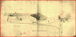 Sketch of the two breakwaters above Alexandria in the Red River, constructed by Lieut. Col. Bailey, U.S.A., to extricate the heavy ironclads and transports of the Mississippi Squadron, under command of Rear Admiral D. D. Porter. Drawn from Col. De Russy's map and from information received from the Admiral, by F. H. Gerdes, Asst., U.S. Coast Survey. . Gerdes, F. H. CREATED/PUBLISHED [1864] NOTES Scale ca. 1:2000. "M. Section VIII.66." Detailed map showing upper and lower dams, falls, "Tennyson's channel," "De Russy's Channel," and some relief by hachures. Sketch of the two breakwaters above Alexandria in the Red River, constructed by Lieut. Col. Bailey, U.S.A., to extricate the heavy ironclads and transports of the Mississippi Squadron, under command of Rear Admiral D. D. Porter. Drawn from Col. De Russy's map and from information received from the Admiral, by F. H. Gerdes, Asst., U.S. Coast Survey. . Gerdes, F. H. CREATED/PUBLISHED [1864] NOTES Scale ca. 1:2000. "M. Section VIII.66." Detailed map showing upper and lower dams, falls, "Tennyson's channel," "De Russy's Channel," and some relief by hachures. |
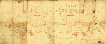 Falls in Red River, surveyed by L. G. De Russy. . De Russy, Lewis G. CREATED/PUBLISHED [S.l. 1864?] NOTES Scale ca. 1:2,200. Pen and ink manuscript map drawn on tracing linen showing soundings and obstructions in Red River. A red line delineates the river channel. Stamped at bottom: From collection of David Dixon Porter. Falls in Red River, surveyed by L. G. De Russy. . De Russy, Lewis G. CREATED/PUBLISHED [S.l. 1864?] NOTES Scale ca. 1:2,200. Pen and ink manuscript map drawn on tracing linen showing soundings and obstructions in Red River. A red line delineates the river channel. Stamped at bottom: From collection of David Dixon Porter. |
 Map of a part of Louisiana and Mississippi, illustrating the operations of the U.S. forces, in the Department of the Gulf Drawn by H. Lindenkohl. E. Moliter lith. . United States Coast Survey. CREATED/PUBLISHED [S.l.], 1863. NOTES Scale ca. 1:380,160. In margin at bottom: Line of marsh [sic] of Gen. Banks corps d'armee April & Mai 1863. Map extends from Natchez, Mississippi, in the north to Marsh Island, Louisiana, in the south, and Columbia, Mississippi, in the east to Alexandria, Louisiana, in the west. Roads, railroads, drainage, and towns are shown. Map of a part of Louisiana and Mississippi, illustrating the operations of the U.S. forces, in the Department of the Gulf Drawn by H. Lindenkohl. E. Moliter lith. . United States Coast Survey. CREATED/PUBLISHED [S.l.], 1863. NOTES Scale ca. 1:380,160. In margin at bottom: Line of marsh [sic] of Gen. Banks corps d'armee April & Mai 1863. Map extends from Natchez, Mississippi, in the north to Marsh Island, Louisiana, in the south, and Columbia, Mississippi, in the east to Alexandria, Louisiana, in the west. Roads, railroads, drainage, and towns are shown. |
 Map of Louisiana & Arkansas. Prepared under direction of 1st Lieut. Wm. Hoelcke, 39 U.S. Infty, acting Chief Engineer at hd. qts. Dept. of La., by Helmuth Holtz. . Holtz, Helmuth. CREATED/PUBLISHED [S.l., 1864?] NOTES Scale ca. 1:650,000. At head of title: Department of Louisiana. General map showing roads, railroads, drainage, names and boundaries of counties, towns, forts, "military road to Memphis," and camp sites in St. Francis County, Ark. On August 2, 3, and 6, 1864. Map of Louisiana & Arkansas. Prepared under direction of 1st Lieut. Wm. Hoelcke, 39 U.S. Infty, acting Chief Engineer at hd. qts. Dept. of La., by Helmuth Holtz. . Holtz, Helmuth. CREATED/PUBLISHED [S.l., 1864?] NOTES Scale ca. 1:650,000. At head of title: Department of Louisiana. General map showing roads, railroads, drainage, names and boundaries of counties, towns, forts, "military road to Memphis," and camp sites in St. Francis County, Ark. On August 2, 3, and 6, 1864. |
Missouri
 Map of the battlefield near Belmont, Missouri United States forces commanded by Brig. Gen. U.S. Grant. Nov. 7th 1861. Published by authority of the Hon. the Secretary of War. Office of the Chief of Engineers, U.S Army. . United States. Army. Corps of Engineers. CREATED/PUBLISHED [S.l.], 1876. NOTES Scale not given. Detailed map showing Confederate camp and batteries near Columbus, Kentucky, "Camp and battery of secessionists" near Belmont, Missouri, Union troop positions and movements during battle, location and names of Union gunboats, roads, vegetation, fences,and relief by hachures. Map of the battlefield near Belmont, Missouri United States forces commanded by Brig. Gen. U.S. Grant. Nov. 7th 1861. Published by authority of the Hon. the Secretary of War. Office of the Chief of Engineers, U.S Army. . United States. Army. Corps of Engineers. CREATED/PUBLISHED [S.l.], 1876. NOTES Scale not given. Detailed map showing Confederate camp and batteries near Columbus, Kentucky, "Camp and battery of secessionists" near Belmont, Missouri, Union troop positions and movements during battle, location and names of Union gunboats, roads, vegetation, fences,and relief by hachures. |
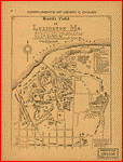 Battle field of Lexington, Mo., showing plan of earthwork defended by Federal and State troops under command of Col. James A. Mulligan, U.S.A. during the 18th, 19th and 20th Sept. 1861. Surrendered to Genl. Sterling Price, C.S.A., Sept. 20th 1861 Drawn by Capt. J. A. Wilson for the Court of Inquiry, held by Gen. McNulta in 187-. Copied by Cadet J. B. Raymond, W.M.A. for the Lexington Historical Society. . Wilson, J. A., Capt. CREATED/PUBLISHED [S.l., 187-] NOTES Scale 1:2400. "Compliments of Henry C. Chiles." Shows fortifications, troop positions, vegetation, drainage, streets, and relief by hachures and spot heights. Important sites are listed in the legend and keyed to the map by letters. Battle field of Lexington, Mo., showing plan of earthwork defended by Federal and State troops under command of Col. James A. Mulligan, U.S.A. during the 18th, 19th and 20th Sept. 1861. Surrendered to Genl. Sterling Price, C.S.A., Sept. 20th 1861 Drawn by Capt. J. A. Wilson for the Court of Inquiry, held by Gen. McNulta in 187-. Copied by Cadet J. B. Raymond, W.M.A. for the Lexington Historical Society. . Wilson, J. A., Capt. CREATED/PUBLISHED [S.l., 187-] NOTES Scale 1:2400. "Compliments of Henry C. Chiles." Shows fortifications, troop positions, vegetation, drainage, streets, and relief by hachures and spot heights. Important sites are listed in the legend and keyed to the map by letters. |
 Map of the present seat of war in Missouri. . Manouvrier, J. CREATED/PUBLISHED 30, Camp St. N.O., J. Manouvrier, [1862] NOTES Scale 1:316,800. Confederate imprint. Map of parts of Illinois, Missouri, and Kentucky in the environs of Cairo and New Madrid, showing roads, railroads, towns, troop positions at New Madrid, drainage, and fortifications at Cairo, Illinois, and Birds Point, Missouri. The following handwritten note appears to the left of the map: Dear Mr. Phillips: I send you some interesting maps. Two of local origins and scarce. This one must I suppose have been intended for correspondence. Yours truly William Beer. Map of the present seat of war in Missouri. . Manouvrier, J. CREATED/PUBLISHED 30, Camp St. N.O., J. Manouvrier, [1862] NOTES Scale 1:316,800. Confederate imprint. Map of parts of Illinois, Missouri, and Kentucky in the environs of Cairo and New Madrid, showing roads, railroads, towns, troop positions at New Madrid, drainage, and fortifications at Cairo, Illinois, and Birds Point, Missouri. The following handwritten note appears to the left of the map: Dear Mr. Phillips: I send you some interesting maps. Two of local origins and scarce. This one must I suppose have been intended for correspondence. Yours truly William Beer. |
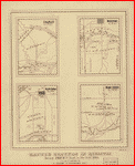 Battle grounds in Missouri during Price's raid in the fall 1864 Surveyed & published by A. Konig, 2d Colorado Cavy. J. C. Wood, St. Louis. Entered according to Act of Congress in the year 1865 by A. Konig. . Konig, A. CREATED/PUBLISHED [S.l., 1865] NOTES Scale not given. Maps of the battlefields at "Mine Creek, Oct. 22d 64," "Westport, Oct. 23d 64" "Charlot, Oct. 25th 64," and "Newtonia, Nov. 4th 64," showing the positions of troops, roads, drainage, a few houses, and relief by hachures. Battle grounds in Missouri during Price's raid in the fall 1864 Surveyed & published by A. Konig, 2d Colorado Cavy. J. C. Wood, St. Louis. Entered according to Act of Congress in the year 1865 by A. Konig. . Konig, A. CREATED/PUBLISHED [S.l., 1865] NOTES Scale not given. Maps of the battlefields at "Mine Creek, Oct. 22d 64," "Westport, Oct. 23d 64" "Charlot, Oct. 25th 64," and "Newtonia, Nov. 4th 64," showing the positions of troops, roads, drainage, a few houses, and relief by hachures. |
This is a must have collection for any civil war history buff!
To use this software, you must install the free ExpressView MrSid software which is included on the CD. This is a 30 second process and will allow you to view and manipulate/print all the maps in this CD collection in full detail. There is a version for Windows platforms and full installation instructions are included on the CD.