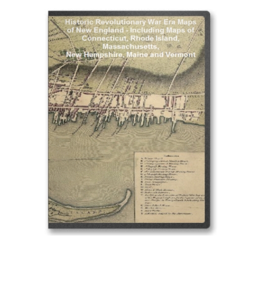
This CD contains 70 rare antique maps and descriptive pages representing fascinating details about New England - Including Maps of Connecticut, Rhode Island, Massachusetts, New Hampshire, Maine and Vermont - and its vicinity during the Revolutionary War.
This CD contains 70 rare antique maps and descriptive pages representing fascinating details about New England and its vicinity during the Revolutionary War in MrSid format. This format allows you to see the entire map on your computer screen or drill down to see the smallest details. The original maps are often quite large, as much as 36" long or larger and quite detailed. With the MrSID software, you can manipulate the map to print the entire map in great detail or zoom into a portion of the map in full detail for viewing or printing. You could even bring the images to a local print shop to have the maps reprinted in their full size. (MrSID software is included on the CD.)
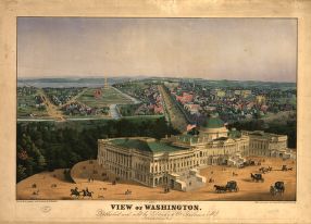
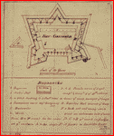
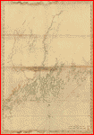
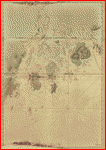
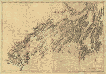
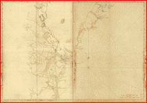
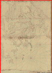
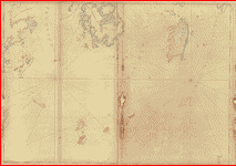
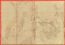
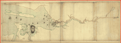
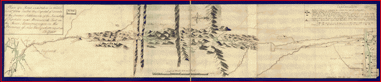
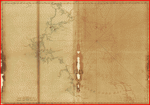
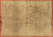
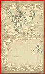
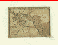
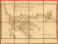
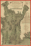
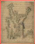
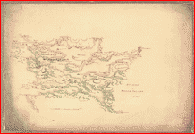
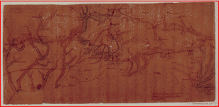
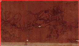
To give you a sample of the detail you can expect in these maps, here is an example based on a panoramic map of Washington, DC.
 |
 |
 |
 |
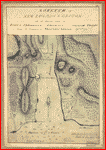
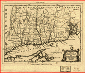
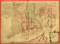
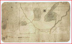
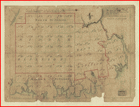
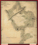
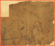
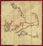
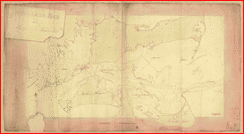
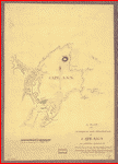
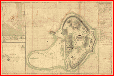
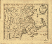
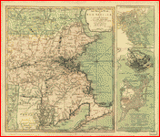
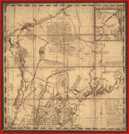
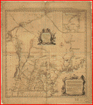
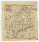
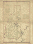
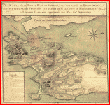
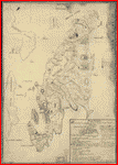
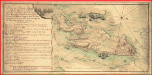
The table below shows the description and a small image of each map on this incredible history CD.
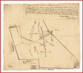 Colchester, May the: 6:th: Day: A.D.: 1765. . Foot, Israel. CREATED/PUBLISHED [1765] Colchester, May the: 6:th: Day: A.D.: 1765. . Foot, Israel. CREATED/PUBLISHED [1765] |
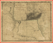
 Gov. Tryon's expedition to Danbury, 1777. . CREATED/PUBLISHED [1777?] NOTES Scale ca. 1:80,000. Relief shown by hachures. Gov. Tryon's expedition to Danbury, 1777. . CREATED/PUBLISHED [1777?] NOTES Scale ca. 1:80,000. Relief shown by hachures. |
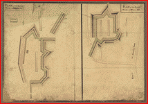
 Fort-Griswold. . CREATED/PUBLISHED [1781?] NOTES Scale ca. 1:720. Fort-Griswold. . CREATED/PUBLISHED [1781?] NOTES Scale ca. 1:720. |
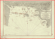
 A sketch of New London & Groton with the attacks made on Forts Trumbull & Griswold by the British troops under the command of Brigr. Genl. Arnold, Sept. 6th. 1781. . Lyman, Daniel. CREATED/PUBLISHED [1781] NOTES Scale ca. 1:21,000. Relief shown by shading and land form drawings. A sketch of New London & Groton with the attacks made on Forts Trumbull & Griswold by the British troops under the command of Brigr. Genl. Arnold, Sept. 6th. 1781. . Lyman, Daniel. CREATED/PUBLISHED [1781] NOTES Scale ca. 1:21,000. Relief shown by shading and land form drawings. |
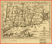
 A map of the colonies in Connecticut and Rhode Island, divided by counties & townships, from best authorities. . Kitchin, Thomas, d. 1784. CREATED/PUBLISHED [London], 1758. A map of the colonies in Connecticut and Rhode Island, divided by counties & townships, from best authorities. . Kitchin, Thomas, d. 1784. CREATED/PUBLISHED [London], 1758. |
 To the right honourable, the Earl of Shelbourne, His Majesty's principal Secretary of State for the Southern Department. This plan of the colony of Connecticut in North-America. Is humbly dedicated by his lordships most obedient humble servt. Moses Park. Novr. 24, 1766. . Park, Moses. CREATED/PUBLISHED [n.p., 1766] NOTES Scale ca. 1:275,000. Relief shown pictorially. Shows counties, towns, rivers, and post roads. To the right honourable, the Earl of Shelbourne, His Majesty's principal Secretary of State for the Southern Department. This plan of the colony of Connecticut in North-America. Is humbly dedicated by his lordships most obedient humble servt. Moses Park. Novr. 24, 1766. . Park, Moses. CREATED/PUBLISHED [n.p., 1766] NOTES Scale ca. 1:275,000. Relief shown pictorially. Shows counties, towns, rivers, and post roads. |
 A map of Connecticut and Rhode Island with Long Island Sound, &c. . CREATED/PUBLISHED [London, 1776] NOTES Shows Fairfield, New Haven, and New London counties in Connecticut, towns, roads, rivers, and place names in Connecticut, Rhode Island and part of Long Island. Includes copper mine near Simsbury, Conn. Also shows relief. A map of Connecticut and Rhode Island with Long Island Sound, &c. . CREATED/PUBLISHED [London, 1776] NOTES Shows Fairfield, New Haven, and New London counties in Connecticut, towns, roads, rivers, and place names in Connecticut, Rhode Island and part of Long Island. Includes copper mine near Simsbury, Conn. Also shows relief. |
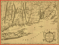 A new and accurate map of Connecticut and Rhode Island, from best authorities. . CREATED/PUBLISHED [London, 1780] NOTES Includes western Long Island and southeast Massachusetts. Shows towns, roads, rivers, some navigational hazards along the coast, "Lands Granted to New York by Connecticut", and relief. A new and accurate map of Connecticut and Rhode Island, from best authorities. . CREATED/PUBLISHED [London, 1780] NOTES Includes western Long Island and southeast Massachusetts. Shows towns, roads, rivers, some navigational hazards along the coast, "Lands Granted to New York by Connecticut", and relief. |
 Connecticut and parts adjacent. At Amsterdam by C�vens and Mortier and C�vens Junior. H. Klockhoff, sculp. . Covens et Mortier et Covens, junior. CREATED/PUBLISHED [Amsterdam] 1780. NOTES Scale ca. 1:375,000. Relief shown pictorially. Shows counties, towns, rivers, and post roads. Connecticut and parts adjacent. At Amsterdam by C�vens and Mortier and C�vens Junior. H. Klockhoff, sculp. . Covens et Mortier et Covens, junior. CREATED/PUBLISHED [Amsterdam] 1780. NOTES Scale ca. 1:375,000. Relief shown pictorially. Shows counties, towns, rivers, and post roads. |
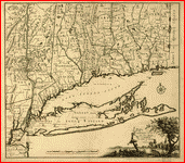
 A new and accurate map of the colony of Massachusets [i.e. Massachusetts] Bay, in North America, from a late survey. . CREATED/PUBLISHED [London : J. Hinton, 1780] NOTES Covers eastern Massachusetts, Rhode Island, eastern Connecticut, and small portions of New Hampshire and Vermont. Relief shown pictorially. A new and accurate map of the colony of Massachusets [i.e. Massachusetts] Bay, in North America, from a late survey. . CREATED/PUBLISHED [London : J. Hinton, 1780] NOTES Covers eastern Massachusetts, Rhode Island, eastern Connecticut, and small portions of New Hampshire and Vermont. Relief shown pictorially. |
 Coast of Maine from Rockland Harbor to Pemaquid Point. . [Des Barres, Joseph F. W. (Joseph Frederick Wallet)] 1722-1824. CREATED/PUBLISHED London, 1776] NOTES Scale ca. 1:49,000. Relief shown by hachures. Depths shown by soundings. Coast of Maine from Rockland Harbor to Pemaquid Point. . [Des Barres, Joseph F. W. (Joseph Frederick Wallet)] 1722-1824. CREATED/PUBLISHED London, 1776] NOTES Scale ca. 1:49,000. Relief shown by hachures. Depths shown by soundings. |
 Coast of Maine from Mosquito Head to Spurwink River. . Des Barres, Joseph F. W. (Joseph Frederick Wallet), 1722-1824. CREATED/PUBLISHED London] I. F. W. Des Barres, 1776. NOTES Scale ca. 1:125,000. Coast of Maine from Mosquito Head to Spurwink River. . Des Barres, Joseph F. W. (Joseph Frederick Wallet), 1722-1824. CREATED/PUBLISHED London] I. F. W. Des Barres, 1776. NOTES Scale ca. 1:125,000. |
 Coast of Maine from Frenchman Bay to Mosquito Harbor. . Des Barres, Joseph F. W. (Joseph Frederick Wallet), 1722-1824. CREATED/PUBLISHED London] 1776. NOTES Scale ca. 1:130,000. Relief shown by hachures. Coast of Maine from Frenchman Bay to Mosquito Harbor. . Des Barres, Joseph F. W. (Joseph Frederick Wallet), 1722-1824. CREATED/PUBLISHED London] 1776. NOTES Scale ca. 1:130,000. Relief shown by hachures. |
 Coast of Maine from Salter Island to Portland Head. . Des Barres, Joseph F. W. (Joseph Frederick Wallet), 1722-1824. CREATED/PUBLISHED London] I. F. W. Des Barres, 1776. NOTES Scale ca. 1:48,000. Relief shown by hachures and shading. Soundings shown in feet. Coast of Maine from Salter Island to Portland Head. . Des Barres, Joseph F. W. (Joseph Frederick Wallet), 1722-1824. CREATED/PUBLISHED London] I. F. W. Des Barres, 1776. NOTES Scale ca. 1:48,000. Relief shown by hachures and shading. Soundings shown in feet. |
 Coast of New England from Cape Elizabeth, Me. to Newburyport, Mass. . Des Barres, Joseph F. W. (Joseph Frederick Wallet), 1722-1824. CREATED/PUBLISHED London] 1776. NOTES Scale ca. 1:130,000. Relief shown by hachures. Coast of New England from Cape Elizabeth, Me. to Newburyport, Mass. . Des Barres, Joseph F. W. (Joseph Frederick Wallet), 1722-1824. CREATED/PUBLISHED London] 1776. NOTES Scale ca. 1:130,000. Relief shown by hachures. |
 Mount Desert Island and neighboring coast of Maine. . [Des Barres, Joseph F. W. (Joseph Frederick Wallet)] 1722-1824. CREATED/PUBLISHED London, 1776?] NOTES Scale ca. 1:49,000. Relief shown by hachures. Depths shown by soundings. Shows coast of Hancock County, Maine. Mount Desert Island and neighboring coast of Maine. . [Des Barres, Joseph F. W. (Joseph Frederick Wallet)] 1722-1824. CREATED/PUBLISHED London, 1776?] NOTES Scale ca. 1:49,000. Relief shown by hachures. Depths shown by soundings. Shows coast of Hancock County, Maine. |
 Coast of Maine showing entrances of Blue Hill Bay, Isle of Haut Bay, and Penobscot Bay, with Owls Head, Vinalhaven Island, Isle au Haut, and other islands. . [Des Barres, Joseph F. W. (Joseph Frederick Wallet)] 1722-1824. CREATED/PUBLISHED London, 1776?] NOTES Scale ca. 1:48,500. Relief shown by hachures. Depths shown by soundings. Coast of Maine showing entrances of Blue Hill Bay, Isle of Haut Bay, and Penobscot Bay, with Owls Head, Vinalhaven Island, Isle au Haut, and other islands. . [Des Barres, Joseph F. W. (Joseph Frederick Wallet)] 1722-1824. CREATED/PUBLISHED London, 1776?] NOTES Scale ca. 1:48,500. Relief shown by hachures. Depths shown by soundings. |
 Coast of Maine showing Blue Hill Bay, Penobscot Bay, Belfast Bay, Islesboro Island, Deer Island, and other islands. . [Des Barres, Joseph F. W. (Joseph Frederick Wallet)] 1722-1824. CREATED/PUBLISHED London, 1776?] NOTES Scale ca. 1:48,500. Relief shown by hachures. Depths shown by soundings. Coast of Maine showing Blue Hill Bay, Penobscot Bay, Belfast Bay, Islesboro Island, Deer Island, and other islands. . [Des Barres, Joseph F. W. (Joseph Frederick Wallet)] 1722-1824. CREATED/PUBLISHED London, 1776?] NOTES Scale ca. 1:48,500. Relief shown by hachures. Depths shown by soundings. |
 The above plan is a discription of a new township containing the quantity of seven and a half mile of land & water, granted by the General Court to the proprietors of Bakerstown so call'd, lying & being in the county of Cumberland ... Deld. at Falmouth, 4th September 1765. Attest. Joseph Noyes, surveyr. . Noyes, Joseph, 1740-1795. CREATED/PUBLISHED [1765] NOTES Scale ca. 1:43,000. Oriented with north toward the upper right. The above plan is a discription of a new township containing the quantity of seven and a half mile of land & water, granted by the General Court to the proprietors of Bakerstown so call'd, lying & being in the county of Cumberland ... Deld. at Falmouth, 4th September 1765. Attest. Joseph Noyes, surveyr. . Noyes, Joseph, 1740-1795. CREATED/PUBLISHED [1765] NOTES Scale ca. 1:43,000. Oriented with north toward the upper right. |
 Plan de la baie et du havre de Casco et des �les adjacentes, par Cyprian Southack. R�dig�, d'apr�s un plan anglois, au D�p�t g�n�ral des cartes, plans et journaux de la marine. Par ordre de M. de Sartine, conseiller d'Etat, ministre et secretaire d'Etat au D�partement de la marine. . Southack, Cyprian, 1662-1745. CREATED/PUBLISHED [Paris] 1779. NOTES Scale ca. 1:85,000. Depths shown by soundings. Plan de la baie et du havre de Casco et des �les adjacentes, par Cyprian Southack. R�dig�, d'apr�s un plan anglois, au D�p�t g�n�ral des cartes, plans et journaux de la marine. Par ordre de M. de Sartine, conseiller d'Etat, ministre et secretaire d'Etat au D�partement de la marine. . Southack, Cyprian, 1662-1745. CREATED/PUBLISHED [Paris] 1779. NOTES Scale ca. 1:85,000. Depths shown by soundings. |
 Part of Oxford and Cumberland counties, Me. Drawn by S. Greenleaf. . Greenleaf, S., Captain. CREATED/PUBLISHED [1771?] NOTES Scale ca. 1:220,000. Title from verso. Land grants and No. 4 township dated 1771. Shows townships, land grants, and landownership of Cumberland County and parts of Oxford, York, and Androscoggin counties. Part of Oxford and Cumberland counties, Me. Drawn by S. Greenleaf. . Greenleaf, S., Captain. CREATED/PUBLISHED [1771?] NOTES Scale ca. 1:220,000. Title from verso. Land grants and No. 4 township dated 1771. Shows townships, land grants, and landownership of Cumberland County and parts of Oxford, York, and Androscoggin counties. |
 The above plan is a discription of a new township called Royalsborough in the county of Cumberland, bounded southeasterly on the headline of Brunswick, southwesterly on Northyarmouth, northwesterly on proprietors land, northeasterly on Androscoggin River ... attest. Joseph Noyes, survayor. Deld. Falmouth, May 22nd, 1766. . Noyes, Joseph, 1740-1795. CREATED/PUBLISHED [1766] NOTES Scale ca. 1:30,000. Oriented with north toward the upper right. Shows township lots and owners. The above plan is a discription of a new township called Royalsborough in the county of Cumberland, bounded southeasterly on the headline of Brunswick, southwesterly on Northyarmouth, northwesterly on proprietors land, northeasterly on Androscoggin River ... attest. Joseph Noyes, survayor. Deld. Falmouth, May 22nd, 1766. . Noyes, Joseph, 1740-1795. CREATED/PUBLISHED [1766] NOTES Scale ca. 1:30,000. Oriented with north toward the upper right. Shows township lots and owners. |
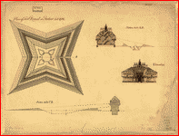 Plan of Fort Pownal at Penobscot built 1759. . CREATED/PUBLISHED [1759?] NOTES Scale not given. Includes 3 profile views. Plan of Fort Pownal at Penobscot built 1759. . CREATED/PUBLISHED [1759?] NOTES Scale not given. Includes 3 profile views. |
 Penobscot River and Bay, with the operations of the English fleet, under Sir George Collyer, against the division of Massachusetts troops acting against Fort Castine, August 1779; with full soundings up to the present site of Bangor. . CREATED/PUBLISHED 1779?] NOTES Scale ca. 1:46,000. Oriented with north to the right. Relief shown by shading. Depths shown by soundings. Penobscot River and Bay, with the operations of the English fleet, under Sir George Collyer, against the division of Massachusetts troops acting against Fort Castine, August 1779; with full soundings up to the present site of Bangor. . CREATED/PUBLISHED 1779?] NOTES Scale ca. 1:46,000. Oriented with north to the right. Relief shown by shading. Depths shown by soundings. |
 Plan of a rout undertaken in winter, Jany. 26th, from Quebec, the capital of Canada, to the frontier settlements of the Township of Topsham near Brunswick Fort on the River Ammerascaegun in the Province of New Hampshire, Feby. 20th 1760 / John Montresor, sub. engr. & lieut. . Montr�sor, John, 1736-1799. CREATED/PUBLISHED [1760?] NOTES Scale 1:506,880; miles 8 to an in. Oriented with north to the right. Relief shown pictorially. Plan of a rout undertaken in winter, Jany. 26th, from Quebec, the capital of Canada, to the frontier settlements of the Township of Topsham near Brunswick Fort on the River Ammerascaegun in the Province of New Hampshire, Feby. 20th 1760 / John Montresor, sub. engr. & lieut. . Montr�sor, John, 1736-1799. CREATED/PUBLISHED [1760?] NOTES Scale 1:506,880; miles 8 to an in. Oriented with north to the right. Relief shown pictorially. |
 Plan of 50 townships to be sold by lottery lying between the rivers Penobscot & Schoodic. . CREATED/PUBLISHED [n.p.] Published by order of the Committe[e, 17--?] NOTES Scale 1:253,440; 4 miles to 1 in. "NB. All the townships within the red line are ordered for sale by lottery." Plan of 50 townships to be sold by lottery lying between the rivers Penobscot & Schoodic. . CREATED/PUBLISHED [n.p.] Published by order of the Committe[e, 17--?] NOTES Scale 1:253,440; 4 miles to 1 in. "NB. All the townships within the red line are ordered for sale by lottery." |
 A map of the sources of the Chaudi�re, Penobscot, and Kennebec rivers, by Montresore. . Montr�sor, John, 1736-1799. CREATED/PUBLISHED [1761?] NOTES Scale ca. 1:390,000. Relief shown pictorially. Shows campsite locations for the author's expedition from Quebec into Maine. A map of the sources of the Chaudi�re, Penobscot, and Kennebec rivers, by Montresore. . Montr�sor, John, 1736-1799. CREATED/PUBLISHED [1761?] NOTES Scale ca. 1:390,000. Relief shown pictorially. Shows campsite locations for the author's expedition from Quebec into Maine. |
 A Plan of the late Province of Main as far as Kennebeck River. . CREATED/PUBLISHED [1778?] NOTES Scale ca. 1:200,000. Oriented with north toward the upper right. Shows internal boundaries. A Plan of the late Province of Main as far as Kennebeck River. . CREATED/PUBLISHED [1778?] NOTES Scale ca. 1:200,000. Oriented with north toward the upper right. Shows internal boundaries. |
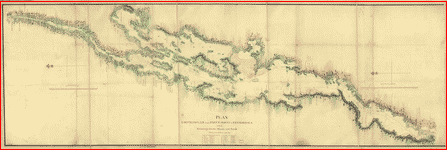
 A plan of the sea coast from Boston Bay to the light house near Rhode Island, reduced from the large survey. . Blaskowitz, Charles. CREATED/PUBLISHED [1775?] NOTES Scale 1:253,440; 4 statute miles to 1 in. Relief shown by shading. A plan of the sea coast from Boston Bay to the light house near Rhode Island, reduced from the large survey. . Blaskowitz, Charles. CREATED/PUBLISHED [1775?] NOTES Scale 1:253,440; 4 statute miles to 1 in. Relief shown by shading. |
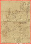 Chart of Buzzards Bay and Vineyard Sound. . Des Barres, Joseph F. W. (Joseph Frederick Wallet), 1722-1824. CREATED/PUBLISHED London] 1776. NOTES Scale ca. 1:51,000. Depths shown by soundings. "Note. The soundings and nautical remarks in this chart are laid down from observations &c. of Lieutenant Knight of the Navy." Chart of Buzzards Bay and Vineyard Sound. . Des Barres, Joseph F. W. (Joseph Frederick Wallet), 1722-1824. CREATED/PUBLISHED London] 1776. NOTES Scale ca. 1:51,000. Depths shown by soundings. "Note. The soundings and nautical remarks in this chart are laid down from observations &c. of Lieutenant Knight of the Navy." |
 Buzzards Bay and shoals of Nantucket. . Knight, John. CREATED/PUBLISHED [1778] NOTES Scale ca. 1:100,000. Soundings shown in fathoms. Buzzards Bay and shoals of Nantucket. . Knight, John. CREATED/PUBLISHED [1778] NOTES Scale ca. 1:100,000. Soundings shown in fathoms. |
 A plan of the harbour and peninsula of Cape Ann in North America, drawn from a survey: the soundings & naval observations by Lieut: Henry Mowat, commander of His. Majys: armed ship Canceaux P: D'Auvergne, fecit, 1776. N.B. this is surveyed by Samuel Holland, Esqr. . Holland, Samuel, 1728-1801. CREATED/PUBLISHED [1776] NOTES Scale ca. 1:53,000. Relief shown by hachures. Depths shown by soundings. A plan of the harbour and peninsula of Cape Ann in North America, drawn from a survey: the soundings & naval observations by Lieut: Henry Mowat, commander of His. Majys: armed ship Canceaux P: D'Auvergne, fecit, 1776. N.B. this is surveyed by Samuel Holland, Esqr. . Holland, Samuel, 1728-1801. CREATED/PUBLISHED [1776] NOTES Scale ca. 1:53,000. Relief shown by hachures. Depths shown by soundings. |
 A general & particular plan of the island of Castle William near Boston, shewing the works in their original & present state, together with sections thro' the same. Carried on and survey'd under the direction of and by John Montr�sor, Esqr., engineer extraordinary & Capt. Lieut. by order of the Honble: Thomas Gage, Esqr., Lieutenant General and Commander in Chief of His Majesty's forces in North America. . Montr�sor, John, 1736-1799. CREATED/PUBLISHED [1771?] NOTES Scale 1:600; 50 ft. to an in. Relief shown by shading. Oriented with north toward the upper right. Includes index to points of interest, inset of "A general plan of the island of Castle William shewing its situation with respect to the adjacent islands," 1:6,000, and two cross section views. A general & particular plan of the island of Castle William near Boston, shewing the works in their original & present state, together with sections thro' the same. Carried on and survey'd under the direction of and by John Montr�sor, Esqr., engineer extraordinary & Capt. Lieut. by order of the Honble: Thomas Gage, Esqr., Lieutenant General and Commander in Chief of His Majesty's forces in North America. . Montr�sor, John, 1736-1799. CREATED/PUBLISHED [1771?] NOTES Scale 1:600; 50 ft. to an in. Relief shown by shading. Oriented with north toward the upper right. Includes index to points of interest, inset of "A general plan of the island of Castle William shewing its situation with respect to the adjacent islands," 1:6,000, and two cross section views. |
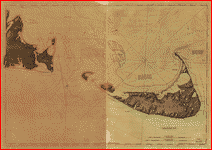 Chart of Nantucket Island and the eastern half of Martha's Vineyard. . Des Barres, Joseph F. W. (Joseph Frederick Wallet), 1722-1824. CREATED/PUBLISHED London] 1776. NOTES Scale ca. 1:51,000. Relief shown by hachures. Depths shown by soundings. Includes navigational notes. Chart of Nantucket Island and the eastern half of Martha's Vineyard. . Des Barres, Joseph F. W. (Joseph Frederick Wallet), 1722-1824. CREATED/PUBLISHED London] 1776. NOTES Scale ca. 1:51,000. Relief shown by hachures. Depths shown by soundings. Includes navigational notes. |
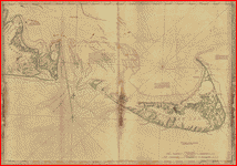 Chart of Nantucket Island and the eastern half of Martha's Vineyard. . Des Barres, Joseph F. W. (Joseph Frederick Wallet), 1722-1824. CREATED/PUBLISHED London] 1776. NOTES Scale ca. 1:51,000. Relief shown by hachures. Depths shown by soundings. Includes navigational notes. Chart of Nantucket Island and the eastern half of Martha's Vineyard. . Des Barres, Joseph F. W. (Joseph Frederick Wallet), 1722-1824. CREATED/PUBLISHED London] 1776. NOTES Scale ca. 1:51,000. Relief shown by hachures. Depths shown by soundings. Includes navigational notes. |
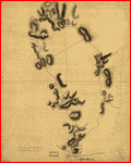
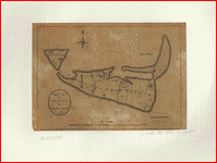 Map of the island of Nantucket. . St. John de Cr�vecoeur, J. Hector, 1735-1813. CREATED/PUBLISHED [London, 1782] NOTES Scale ca. 1:110,000. Relief shown by hachures. Map of the island of Nantucket. . St. John de Cr�vecoeur, J. Hector, 1735-1813. CREATED/PUBLISHED [London, 1782] NOTES Scale ca. 1:110,000. Relief shown by hachures. |
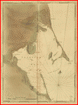 Chart of Plymouth Bay. . Des Barres, Joseph F. W. (Joseph Frederick Wallet), 1722-1824. CREATED/PUBLISHED London, 177-] NOTES Scale ca. 1:24,000. Relief shown by hachures. Depths shown by soundings. Chart of Plymouth Bay. . Des Barres, Joseph F. W. (Joseph Frederick Wallet), 1722-1824. CREATED/PUBLISHED London, 177-] NOTES Scale ca. 1:24,000. Relief shown by hachures. Depths shown by soundings. |
 Plan of the rebels works on Prospect-Hill. Plan of the rebels works on Winter-Hill. . CREATED/PUBLISHED [1775?] Plan of the rebels works on Prospect-Hill. Plan of the rebels works on Winter-Hill. . CREATED/PUBLISHED [1775?] |
 To the Hone. Jno. Hancock, Esqre. president of ye Continental Congress, this map of the seat of civil war in America, is respectfully inscribed by his most obedient humble servant, B. Romans. . Romans, Bernard, ca. 1720-ca. 1784. CREATED/PUBLISHED [n.p., 1775] NOTES Scale ca. 1:320,000. Relief shown pictorially. Indexed for points of interest. Insets with indexes: Plan of Boston and its environs, 1775.--A view of the lines thrown up on Boston Neck; by the ministerial army. To the Hone. Jno. Hancock, Esqre. president of ye Continental Congress, this map of the seat of civil war in America, is respectfully inscribed by his most obedient humble servant, B. Romans. . Romans, Bernard, ca. 1720-ca. 1784. CREATED/PUBLISHED [n.p., 1775] NOTES Scale ca. 1:320,000. Relief shown pictorially. Indexed for points of interest. Insets with indexes: Plan of Boston and its environs, 1775.--A view of the lines thrown up on Boston Neck; by the ministerial army. |
 Coast of Massachusetts from Cape Ann to Manomet Point, including northern tip of Cape Cod. . Des Barres, Joseph F. W. (Joseph Frederick Wallet), 1722-1824. CREATED/PUBLISHED London, 1776] NOTES Scale ca. 1:135,000. Depths shown by soundings. Coast of Massachusetts from Cape Ann to Manomet Point, including northern tip of Cape Cod. . Des Barres, Joseph F. W. (Joseph Frederick Wallet), 1722-1824. CREATED/PUBLISHED London, 1776] NOTES Scale ca. 1:135,000. Depths shown by soundings. |
 Coast of New England from Chatham Harbor to Narragansett Bay. . Des Barres, Joseph F. W. (Joseph Frederick Wallet), 1722-1824. CREATED/PUBLISHED London] 1779. NOTES Scale ca. 1:130,000. Depths shown by soundings. Coast of New England from Chatham Harbor to Narragansett Bay. . Des Barres, Joseph F. W. (Joseph Frederick Wallet), 1722-1824. CREATED/PUBLISHED London] 1779. NOTES Scale ca. 1:130,000. Depths shown by soundings. |
 A new and accurate map of the colony of Massachusets [i.e. Massachusetts] Bay, in North America, from a late survey. . CREATED/PUBLISHED [London : J. Hinton, 1780] NOTES Covers eastern Massachusetts, Rhode Island, eastern Connecticut, and small portions of New Hampshire and Vermont. Relief shown pictorially. A new and accurate map of the colony of Massachusets [i.e. Massachusetts] Bay, in North America, from a late survey. . CREATED/PUBLISHED [London : J. Hinton, 1780] NOTES Covers eastern Massachusetts, Rhode Island, eastern Connecticut, and small portions of New Hampshire and Vermont. Relief shown pictorially. |
 The Seat of war in New England, by an American volunteer, with the marches of the several corps sent by the Colonies towards Boston, with the attack on Bunkers-Hill. . CREATED/PUBLISHED London, Printed for R. Sayer & J. Bennett, 1775. NOTES Scale ca. 1:450,000. Prime meridian: Boston. Relief shown by hachures. Includes "Plan of Boston Harbour, from an actual survey" and "Plan of the town of Boston with the attack on Bunkers-Hill in the peninsula of Charlestown, the 17th of June, 1775." The Seat of war in New England, by an American volunteer, with the marches of the several corps sent by the Colonies towards Boston, with the attack on Bunkers-Hill. . CREATED/PUBLISHED London, Printed for R. Sayer & J. Bennett, 1775. NOTES Scale ca. 1:450,000. Prime meridian: Boston. Relief shown by hachures. Includes "Plan of Boston Harbour, from an actual survey" and "Plan of the town of Boston with the attack on Bunkers-Hill in the peninsula of Charlestown, the 17th of June, 1775." |
 New Hampshire. . CREATED/PUBLISHED [177-?] NOTES Scale ca. 1:24,000. Relief shown by hachures. Depths shown by soundings. New Hampshire. . CREATED/PUBLISHED [177-?] NOTES Scale ca. 1:24,000. Relief shown by hachures. Depths shown by soundings. |
 Plan du port de Portsmouth lev� � vue. . CREATED/PUBLISHED [1782?] NOTES Scale ca. 1:38,000. Relief shown by hachures. Shows fortifications and premier anchorage areas for ships. Indexed for points of interest. Plan du port de Portsmouth lev� � vue. . CREATED/PUBLISHED [1782?] NOTES Scale ca. 1:38,000. Relief shown by hachures. Shows fortifications and premier anchorage areas for ships. Indexed for points of interest. |
 Portsmouth, New Hampshire. . CREATED/PUBLISHED [1782?] NOTES Scale ca. 1:61,000. Oriented with north to the right. Shows Portsmouth harbor, including fortifications on shore and position of the French ships "Pluton," "Auguste," and "Bourgogne." Portsmouth, New Hampshire. . CREATED/PUBLISHED [1782?] NOTES Scale ca. 1:61,000. Oriented with north to the right. Shows Portsmouth harbor, including fortifications on shore and position of the French ships "Pluton," "Auguste," and "Bourgogne." |
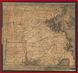
 An accurate map of His Majesty's Province of New-Hampshire in New England & all the adjacent country northward to the River St. Lawrence, & eastward to Penobscot Bay, containing the principal places which relate to the present war on the continent of North America. By Saml. Langdon. . Langdon, Samuel, 1723-1797. CREATED/PUBLISHED 1756 [i.e. 1757] NOTES Scale 1:633,600; 10 miles to an in. Prime meridian: London. Relief shown pictorially. Shows "Fort William Henry taken & demolished by the French A:D: 1757." Includes inscription to "His Excellency Benning Wentworth, Eqr., His Majesty's Governor," numerous historical and descriptive notes and inset "A general map of the River St. Lawrence above Montreal, to Lake Ontario, & the country westward from lake Champlain to the late English fort at Oswege," ca. 1:2,500,000. An accurate map of His Majesty's Province of New-Hampshire in New England & all the adjacent country northward to the River St. Lawrence, & eastward to Penobscot Bay, containing the principal places which relate to the present war on the continent of North America. By Saml. Langdon. . Langdon, Samuel, 1723-1797. CREATED/PUBLISHED 1756 [i.e. 1757] NOTES Scale 1:633,600; 10 miles to an in. Prime meridian: London. Relief shown pictorially. Shows "Fort William Henry taken & demolished by the French A:D: 1757." Includes inscription to "His Excellency Benning Wentworth, Eqr., His Majesty's Governor," numerous historical and descriptive notes and inset "A general map of the River St. Lawrence above Montreal, to Lake Ontario, & the country westward from lake Champlain to the late English fort at Oswege," ca. 1:2,500,000. |
 An accurate map of His Majesty's Province of New-Hampshire in New England, taken from actual surveys of all the inhabited part, and from the best information of what is uninhabited, together with the adjacent countries, which exhibits the theatre of this war in that part of the world, by Col. Blanchard and the Revd. Mr. Langdon. Engraved by Thomas Jefferys. . Blanchard, Joseph, d. 1758. CREATED/PUBLISHED Portsmouth, N.H., 1761. NOTES Scale ca. 1:633,600. Prime meridian: London. Relief shown pictorially. Shows area from Hudson River-Lake Champlain to Penobscot Bay. Includes inscription to "Charles Townshend, His Majesty's Secretary at War," text, and inset "A general plan of the River St. Lawrence above Montreal to Lake Ontario, with the adjacent country on the west from Albany & Lake Champlain," ca. 1:2,340,000. An accurate map of His Majesty's Province of New-Hampshire in New England, taken from actual surveys of all the inhabited part, and from the best information of what is uninhabited, together with the adjacent countries, which exhibits the theatre of this war in that part of the world, by Col. Blanchard and the Revd. Mr. Langdon. Engraved by Thomas Jefferys. . Blanchard, Joseph, d. 1758. CREATED/PUBLISHED Portsmouth, N.H., 1761. NOTES Scale ca. 1:633,600. Prime meridian: London. Relief shown pictorially. Shows area from Hudson River-Lake Champlain to Penobscot Bay. Includes inscription to "Charles Townshend, His Majesty's Secretary at War," text, and inset "A general plan of the River St. Lawrence above Montreal to Lake Ontario, with the adjacent country on the west from Albany & Lake Champlain," ca. 1:2,340,000. |
 An Accurate map of New Hampshire in New England, from a late survey. . CREATED/PUBLISHED [London, 1781] NOTES Scale ca. 1:2,000,000. Relief shown pictorially. An Accurate map of New Hampshire in New England, from a late survey. . CREATED/PUBLISHED [London, 1781] NOTES Scale ca. 1:2,000,000. Relief shown pictorially. |
 A topographical map of the Province of New Hampshire, surveyed agreeably to the orders and instructions of the Right Honourable the Lords Commissioners for Trade and Plantations; unto Samuel Holland, Esqr., His Majesty's Surveyor General of Lands for the Northern District of North America; by the following gentlemen his deputies: Thomas Wright [and others] . Holland, Samuel, 1728-1801. CREATED/PUBLISHED London; Printed for William Faden, 1784. NOTES Scale ca. 1:260,000. Relief shown by hachures. Shows township and patent boundaries. "The respective parts of this plan were survey'd by the several gentlemen concerned with all possible accuracy, and afterwards rectified by Samuel Holland ... " A topographical map of the Province of New Hampshire, surveyed agreeably to the orders and instructions of the Right Honourable the Lords Commissioners for Trade and Plantations; unto Samuel Holland, Esqr., His Majesty's Surveyor General of Lands for the Northern District of North America; by the following gentlemen his deputies: Thomas Wright [and others] . Holland, Samuel, 1728-1801. CREATED/PUBLISHED London; Printed for William Faden, 1784. NOTES Scale ca. 1:260,000. Relief shown by hachures. Shows township and patent boundaries. "The respective parts of this plan were survey'd by the several gentlemen concerned with all possible accuracy, and afterwards rectified by Samuel Holland ... " |
 Carte des positions occupe�s par les trouppes Am�ricaines apres leur retraite de Rhode Island le 30 Aout 1778 / par Mr. Capitaine, a. d. C. du G�n�ral la Fayette. . Capitaine du Chesnoy, Michel, 1746-1804. CREATED/PUBLISHED [1778] NOTES Relief shown by hachures. Some place names in English. Oriented with north toward the lower right. Includes descriptive index to defenses. Carte des positions occupe�s par les trouppes Am�ricaines apres leur retraite de Rhode Island le 30 Aout 1778 / par Mr. Capitaine, a. d. C. du G�n�ral la Fayette. . Capitaine du Chesnoy, Michel, 1746-1804. CREATED/PUBLISHED [1778] NOTES Relief shown by hachures. Some place names in English. Oriented with north toward the lower right. Includes descriptive index to defenses. |
 A topographical chart of the bay of Narraganset in the province of New England, with all the isles contained therein, among which Rhode Island and Connonicut have been particularly surveyed, shewing the true position & bearings of the banks, shoals, rocks &c. as likewise the soundings; To which have been added the several works & batteries raised by the Americans. Taken by order of the principal farmers on Rhode Island. . Blaskowitz, Charles. CREATED/PUBLISHED [London] Engraved & printed for Wm. Faden, 1777. NOTES Scale ca. 1:50,000. Relief shown by hachures. Depths shown by soundings. Inscribed "To the Right Honourable Hugh Earl Percy ... with His Lordship's permission ... by ... Wm. Faden." Includes text, "References to the batteries," and "A list of the principal farms in Rhode Island." A topographical chart of the bay of Narraganset in the province of New England, with all the isles contained therein, among which Rhode Island and Connonicut have been particularly surveyed, shewing the true position & bearings of the banks, shoals, rocks &c. as likewise the soundings; To which have been added the several works & batteries raised by the Americans. Taken by order of the principal farmers on Rhode Island. . Blaskowitz, Charles. CREATED/PUBLISHED [London] Engraved & printed for Wm. Faden, 1777. NOTES Scale ca. 1:50,000. Relief shown by hachures. Depths shown by soundings. Inscribed "To the Right Honourable Hugh Earl Percy ... with His Lordship's permission ... by ... Wm. Faden." Includes text, "References to the batteries," and "A list of the principal farms in Rhode Island." |
 A map of the bay of Narraganset with the islands therein and part of the country adjacent. . Blaskowitz, Charles. CREATED/PUBLISHED [1777?] NOTES Scale ca. 1:63,360. Relief shown by shading. Depths shown by soundings. Includes "References" to the fortifications and defenses of the region. A map of the bay of Narraganset with the islands therein and part of the country adjacent. . Blaskowitz, Charles. CREATED/PUBLISHED [1777?] NOTES Scale ca. 1:63,360. Relief shown by shading. Depths shown by soundings. Includes "References" to the fortifications and defenses of the region. |
 Attacks upon Rhode Island, Augt. 1778. . CREATED/PUBLISHED [1778] NOTES Scale ca. 1:120,000. Shows all of Narragansett Bay. Relief shown by shading. Oriented with north to the right. Attacks upon Rhode Island, Augt. 1778. . CREATED/PUBLISHED [1778] NOTES Scale ca. 1:120,000. Shows all of Narragansett Bay. Relief shown by shading. Oriented with north to the right. |
 A plan of the town of Newport in Rhode Island. Surveyed by Charles Blaskowitz, engraved and publish'd by Willm. Faden. . Blaskowitz, Charles. CREATED/PUBLISHED [London] 1777. NOTES Scale ca. 1:6,000. Relief shown by hachures. Oriented with north to the left. Indexed for points of interest. A plan of the town of Newport in Rhode Island. Surveyed by Charles Blaskowitz, engraved and publish'd by Willm. Faden. . Blaskowitz, Charles. CREATED/PUBLISHED [London] 1777. NOTES Scale ca. 1:6,000. Relief shown by hachures. Oriented with north to the left. Indexed for points of interest. |
 Plan de la ville, du port, et de la rade de New-port et Rhode Island. Debarquement en 1780. . CREATED/PUBLISHED 1780] NOTES Scale ca. 1:26,000. Relief shown by hachures. Shows fortifications, fields of fire, and position of French naval vessels. Oriented with north to the right. Plan de la ville, du port, et de la rade de New-port et Rhode Island. Debarquement en 1780. . CREATED/PUBLISHED 1780] NOTES Scale ca. 1:26,000. Relief shown by hachures. Shows fortifications, fields of fire, and position of French naval vessels. Oriented with north to the right. |
 Plan de la ville, port, et rade de Newport, avec une partie de Rhode-Island occup�e par l'arm�e fran�aise aux ordres de Mr. Le comte de Rochambeau, et de l'escadre fran�aise command�e. par Mr. le Chr. Destouches. . CREATED/PUBLISHED [1780?] NOTES Scale ca. 1:26,200. Relief shown by form lines and shading. Shows fortifications, fields of fire, and positions of French naval vessels. Oriented with north toward the upper right. Includes index to defenses. Plan de la ville, port, et rade de Newport, avec une partie de Rhode-Island occup�e par l'arm�e fran�aise aux ordres de Mr. Le comte de Rochambeau, et de l'escadre fran�aise command�e. par Mr. le Chr. Destouches. . CREATED/PUBLISHED [1780?] NOTES Scale ca. 1:26,200. Relief shown by form lines and shading. Shows fortifications, fields of fire, and positions of French naval vessels. Oriented with north toward the upper right. Includes index to defenses. |
 Plan von Rhode Island, und deren dem comando des Herrn General Majors Presgott inf dies-malig befundlichen campements. Aufgenommen und gezeichnet den 8ten July 1777, von J. C. Schiffer, Artiy. Lieut. . Schiffer, J. C. CREATED/PUBLISHED [1777] NOTES Scale ca. 1:50,000. Relief shown by hachures. Includes index to encampments, fortifications, and naval positions. Plan von Rhode Island, und deren dem comando des Herrn General Majors Presgott inf dies-malig befundlichen campements. Aufgenommen und gezeichnet den 8ten July 1777, von J. C. Schiffer, Artiy. Lieut. . Schiffer, J. C. CREATED/PUBLISHED [1777] NOTES Scale ca. 1:50,000. Relief shown by hachures. Includes index to encampments, fortifications, and naval positions. |
 Plan de Rhode Island et les differentes operations de la flotte-fran�oises et des troupes americaines command�es par le Major General Sullivan contre les for�es de terre et de mer des Anglois depuis le 9 aoust jusqu'� la nuit du 30 au 31 du meme mois 1778 que les Americains ont fait leur retraites. . CREATED/PUBLISHED [1778] NOTES Scale ca. 1:51,000. Relief shown by shading. Depths shown by soundings. Oriented with north toward the lower right. Includes descriptive index to defenses. Plan de Rhode Island et les differentes operations de la flotte-fran�oises et des troupes americaines command�es par le Major General Sullivan contre les for�es de terre et de mer des Anglois depuis le 9 aoust jusqu'� la nuit du 30 au 31 du meme mois 1778 que les Americains ont fait leur retraites. . CREATED/PUBLISHED [1778] NOTES Scale ca. 1:51,000. Relief shown by shading. Depths shown by soundings. Oriented with north toward the lower right. Includes descriptive index to defenses. |
 Marche de l'arm�e fran�aise de Providence � la Rivi�re du Nord. . CREATED/PUBLISHED [1781] NOTES Scale ca. 1:200,000. Relief shown by hachures. Marche de l'arm�e fran�aise de Providence � la Rivi�re du Nord. . CREATED/PUBLISHED [1781] NOTES Scale ca. 1:200,000. Relief shown by hachures. |
 Marche de l'arm�e fran�aise de Providence � la Rivi�re du Nord. . CREATED/PUBLISHED [1781] NOTES Scale ca. 1:200,000. Relief shown by hachures. Marche de l'arm�e fran�aise de Providence � la Rivi�re du Nord. . CREATED/PUBLISHED [1781] NOTES Scale ca. 1:200,000. Relief shown by hachures. |
 Marche de l'arm�e fran�aise de Providence � la Rivi�re du Nord. . CREATED/PUBLISHED [1781] NOTES Scale ca. 1:200,000. Relief shown by hachures. Marche de l'arm�e fran�aise de Providence � la Rivi�re du Nord. . CREATED/PUBLISHED [1781] NOTES Scale ca. 1:200,000. Relief shown by hachures. |
 A survey of Lake Champlain including Crown Point and St. Iohn's on which is fixed the line of forty five degrees north lattit. terminating the boundarys betwe[e]n the provinces of Quebec and New York agre[e]able to his Majesty's proclamation done by order and instruction of the Honourable James Murray, esqr., Governor of the Province of Quebec and the Honourable His Majestys Council by Iohn Collins, depy. surv. genl., May 21th 1765. Charles Blaskowitz, draughtsman. . Collins, John, d. 1795. CREATED/PUBLISHED [1765] NOTES Scale ca. 1:127,000. Relief shown pictorially and by shading. Includes descriptive notes and "References to Crown Point." A survey of Lake Champlain including Crown Point and St. Iohn's on which is fixed the line of forty five degrees north lattit. terminating the boundarys betwe[e]n the provinces of Quebec and New York agre[e]able to his Majesty's proclamation done by order and instruction of the Honourable James Murray, esqr., Governor of the Province of Quebec and the Honourable His Majestys Council by Iohn Collins, depy. surv. genl., May 21th 1765. Charles Blaskowitz, draughtsman. . Collins, John, d. 1795. CREATED/PUBLISHED [1765] NOTES Scale ca. 1:127,000. Relief shown pictorially and by shading. Includes descriptive notes and "References to Crown Point." |
 A map of the country in which the army under Lt. General Burgoyne acted in the campaign of 1777, shewing the marches of the army & the places of the principal actions. Drawn by Mr. Medcalfe & engraved by Wm. Faden. . Medcalfe, Mr. CREATED/PUBLISHED London, W. Faden, 1780. NOTES Scale ca. 1:640,000. Relief shown by hachures. A map of the country in which the army under Lt. General Burgoyne acted in the campaign of 1777, shewing the marches of the army & the places of the principal actions. Drawn by Mr. Medcalfe & engraved by Wm. Faden. . Medcalfe, Mr. CREATED/PUBLISHED London, W. Faden, 1780. NOTES Scale ca. 1:640,000. Relief shown by hachures. |
 Position of the detachment under Lieut't Col. Baum & attacks of the enemy on the 16th August at Walmscock near Benington, 1777. Lieut't Durnford, engineer. . Durnford, Desmaretz, d. 1782. CREATED/PUBLISHED [1777] NOTES Scale ca. 1:6,000; 200 paces to an in. Oriented with north to the right. Relief shown by hachures. Shows troop positions of battle fought in the town of Hoosick, N.Y. in defense of Bennington, Vt. Includes "References." Position of the detachment under Lieut't Col. Baum & attacks of the enemy on the 16th August at Walmscock near Benington, 1777. Lieut't Durnford, engineer. . Durnford, Desmaretz, d. 1782. CREATED/PUBLISHED [1777] NOTES Scale ca. 1:6,000; 200 paces to an in. Oriented with north to the right. Relief shown by hachures. Shows troop positions of battle fought in the town of Hoosick, N.Y. in defense of Bennington, Vt. Includes "References." |
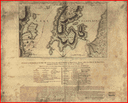
 Plan, Lake Champlain from Fort St. John's to Ticonderoga, with the soundings, rocks, shoals, and sands, surveyed in the years 1778, 1779. . CREATED/PUBLISHED [1779] NOTES Scale 1:63,360; 1 mile to 1 in. Oriented with north to the left. Shows ships present at the Battle of Valcour Island, Oct. 11, 1776 and a running fight at Buttonmold Bay, Oct., 13, 1776. Plan, Lake Champlain from Fort St. John's to Ticonderoga, with the soundings, rocks, shoals, and sands, surveyed in the years 1778, 1779. . CREATED/PUBLISHED [1779] NOTES Scale 1:63,360; 1 mile to 1 in. Oriented with north to the left. Shows ships present at the Battle of Valcour Island, Oct. 11, 1776 and a running fight at Buttonmold Bay, Oct., 13, 1776. |
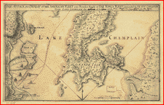 The Attack and defeat of the American fleet under Benedict Arnold by the King's fleet commanded by Sir Guy Carleton upon Lake Champlain in "11th" of "Octr." 1776. . CREATED/PUBLISHED [1776] NOTES Scale ca. 1:70,000. Relief shown by hachures. Date in title changed to "11th" of "Octr." Annotation added to title: From a sketch taken by an officer on the spot. Engraved by Wm. Faden, Charing Cross. The Attack and defeat of the American fleet under Benedict Arnold by the King's fleet commanded by Sir Guy Carleton upon Lake Champlain in "11th" of "Octr." 1776. . CREATED/PUBLISHED [1776] NOTES Scale ca. 1:70,000. Relief shown by hachures. Date in title changed to "11th" of "Octr." Annotation added to title: From a sketch taken by an officer on the spot. Engraved by Wm. Faden, Charing Cross. |
 The attack and defeat of the American fleet under Benedict Arnold, by the Kings fleet commanded by Captn. Thos. Pringle, upon Lake Champlain, the 11th of October, 1776. Engraved by Wm. Faden. From a sketch taken by an officer on the spot. . Faden, William, 1750?-1836. CREATED/PUBLISHED London, 1776. NOTES Scale ca. 1:70,000. Relief shown by hachures. Includes "An account of the expedition of the British fleet on Lake Champlain, under the command of Captain Thomas Pringle, and of the defeat of the rebel fleet, commanded by Benedict Anrold [sic] on the 11th and 13th of October, 1776. Taken from the letters of Sir Guy Carleton, Captains Douglass and Pringle, dated off Crown Point, 15th October, 1776." The attack and defeat of the American fleet under Benedict Arnold, by the Kings fleet commanded by Captn. Thos. Pringle, upon Lake Champlain, the 11th of October, 1776. Engraved by Wm. Faden. From a sketch taken by an officer on the spot. . Faden, William, 1750?-1836. CREATED/PUBLISHED London, 1776. NOTES Scale ca. 1:70,000. Relief shown by hachures. Includes "An account of the expedition of the British fleet on Lake Champlain, under the command of Captain Thomas Pringle, and of the defeat of the rebel fleet, commanded by Benedict Anrold [sic] on the 11th and 13th of October, 1776. Taken from the letters of Sir Guy Carleton, Captains Douglass and Pringle, dated off Crown Point, 15th October, 1776." |
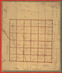 The Above is a plan of the town of Cabot, State of Vermont. . CREATED/PUBLISHED [178-?] NOTES Scale ca. 1:60,000. Cadastral map. The Above is a plan of the town of Cabot, State of Vermont. . CREATED/PUBLISHED [178-?] NOTES Scale ca. 1:60,000. Cadastral map. |
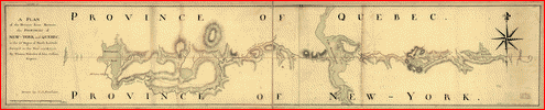 A plan of the division line between the provinces of New-York and Quebec. In the 45th degree of north latitude. Survey'd in the year 1771 & 1772. By Thomas Valentine & John Collins, esquirs. Drawn by C. J. Sauthier. . Valentine, Thomas. CREATED/PUBLISHED [1772] NOTES Scale ca. 1:125,000. Relief shown by hachures. Map shows primarily Vermont with Qu�bec (Province) and New York (State) A plan of the division line between the provinces of New-York and Quebec. In the 45th degree of north latitude. Survey'd in the year 1771 & 1772. By Thomas Valentine & John Collins, esquirs. Drawn by C. J. Sauthier. . Valentine, Thomas. CREATED/PUBLISHED [1772] NOTES Scale ca. 1:125,000. Relief shown by hachures. Map shows primarily Vermont with Qu�bec (Province) and New York (State) |
This is a must have collection for any map history buff!
To use this software, you must install the free ExpressView MrSid software which is included on the CD. This is a 30 second process and will allow you to view and manipulate/print all the maps in this CD collection in full detail. There is viewing software on the disk. It only runs on Windows platforms and full installation instructions are included on the CD.