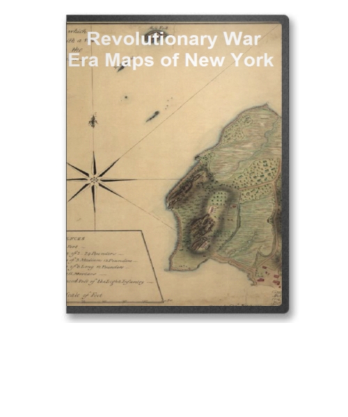
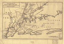
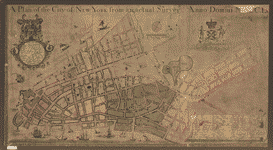
This CD contains 84 rare antique maps and descriptive pages representing fascinating details about New York and its vicinity during the Revolutionary War.
This CD contains 84 rare antique maps and descriptive pages representing fascinating details about New York and its vicinity during the Revolutionary War in MrSid format. T his format allows you to see the entire map on your computer screen or drill down to see the smallest details. The original maps are often quite large, as much as 36" long or larger and quite detailed. With the MrSID software, you can manipulate the map to print the entire map in great detail or zoom into a portion of the map in full detail for viewing or printing. You could even bring the images to a local print shop to have the maps reprinted in their full size. (MrSID software is included on the CD.)
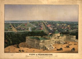
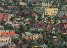
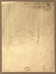
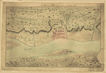
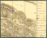
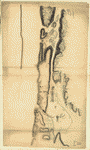
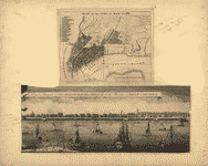
To give you a sample of the detail you can expect in these maps, here is an example based on a panoramic map of Washington, DC.
 |
 |
 |
 |
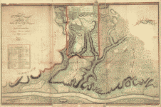
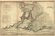
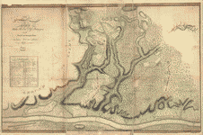
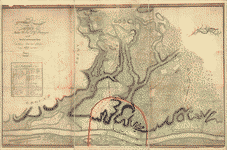
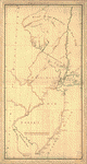
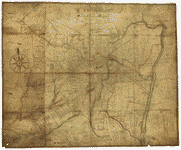
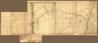
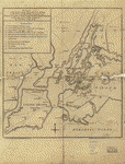
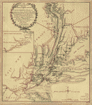
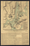
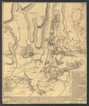
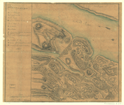
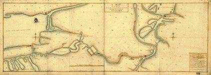
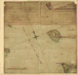
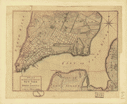
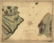
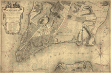
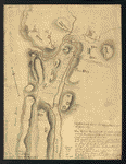
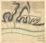
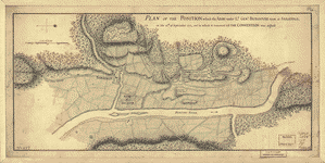
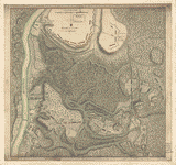
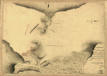
The table below shows the description and a small image of each map on this incredible history CD.
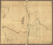
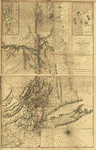
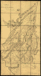
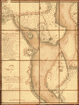
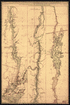
 A survey of Lake Champlain including Crown Point and St. Iohn's on which is fixed the line of forty five degrees north lattit. terminating the boundarys betwe[e]n the provinces of Quebec and New York agre[e]able to his Majesty's proclamation done by order and instruction of the Honourable James Murray, esqr., Governor of the Province of Quebec and the Honourable His Majestys Council by Iohn Collins, depy. surv. genl., May 21th 1765. Charles Blaskowitz, draughtsman. Collins, John, d. 1795. CREATED/PUBLISHED [1765] NOTES Scale ca. 1:127,000. Manuscript, pen-and-ink and watercolor. Relief shown pictorially and by shading. Sectioned and mounted on cloth backing. A survey of Lake Champlain including Crown Point and St. Iohn's on which is fixed the line of forty five degrees north lattit. terminating the boundarys betwe[e]n the provinces of Quebec and New York agre[e]able to his Majesty's proclamation done by order and instruction of the Honourable James Murray, esqr., Governor of the Province of Quebec and the Honourable His Majestys Council by Iohn Collins, depy. surv. genl., May 21th 1765. Charles Blaskowitz, draughtsman. Collins, John, d. 1795. CREATED/PUBLISHED [1765] NOTES Scale ca. 1:127,000. Manuscript, pen-and-ink and watercolor. Relief shown pictorially and by shading. Sectioned and mounted on cloth backing. |
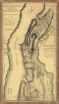
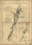 A survey of Lake Champlain, including Lake George, Crown Point, and St. John. Surveyed by order of His Excellency Major-General Sr. Jeffery Amherst, ... Commander in Chief of His Majesty's forces in North America, (now Lord Amherst) by William Brassier, draughtsman. 1762. Brasier, William. CREATED/PUBLISHED London, Printed for Robt. Sayer & Jno. Bennett, 1776. NOTES Scale ca. 1:400,000. Hand colored. Relief shown by hachures. Shows naval actions at Valcour Island and Buttonmold Bay in Oct. 1776. From the publishers' The American military pocket atlas. [1776] Includes indexes to points of interest and descriptive text. Includes text, "Explanation of the engagement, between Valcour Island, and the Western Shore, October the 11th. 1776," and inset "A particular plan of Lake George surveyed in 1756, by Capt. Jackson." A survey of Lake Champlain, including Lake George, Crown Point, and St. John. Surveyed by order of His Excellency Major-General Sr. Jeffery Amherst, ... Commander in Chief of His Majesty's forces in North America, (now Lord Amherst) by William Brassier, draughtsman. 1762. Brasier, William. CREATED/PUBLISHED London, Printed for Robt. Sayer & Jno. Bennett, 1776. NOTES Scale ca. 1:400,000. Hand colored. Relief shown by hachures. Shows naval actions at Valcour Island and Buttonmold Bay in Oct. 1776. From the publishers' The American military pocket atlas. [1776] Includes indexes to points of interest and descriptive text. Includes text, "Explanation of the engagement, between Valcour Island, and the Western Shore, October the 11th. 1776," and inset "A particular plan of Lake George surveyed in 1756, by Capt. Jackson." |
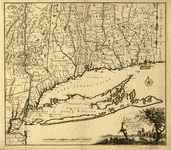 Connecticut and parts adjacent. At Amsterdam by C�vens and Mortier and C�vens Junior. H. Klockhoff, sculp. Covens et Mortier et Covens, junior. CREATED/PUBLISHED [Amsterdam] 1780. NOTES Scale ca. 1:375,000. Relief shown pictorially. Shows counties, towns, rivers, and post roads. Connecticut and parts adjacent. At Amsterdam by C�vens and Mortier and C�vens Junior. H. Klockhoff, sculp. Covens et Mortier et Covens, junior. CREATED/PUBLISHED [Amsterdam] 1780. NOTES Scale ca. 1:375,000. Relief shown pictorially. Shows counties, towns, rivers, and post roads. |
 A chorographical map of the Northern Department of North-America, drawn from the latest and most accurate observations, at Amsterdam by C�vens and Mortier and C�vens, junior. H. Klockhoff, sculp. C�vens et Mortier. CREATED/PUBLISHED [Amsterdam] 1780. NOTES Scale ca. 1:768,000. Hand colored. Relief shown pictorially. Oriented with north toward the lower left. Shows land grants and purchases in northeastern New York State and granted townships in Vermont and parts of New Hampshire, and Massachusetts. A chorographical map of the Northern Department of North-America, drawn from the latest and most accurate observations, at Amsterdam by C�vens and Mortier and C�vens, junior. H. Klockhoff, sculp. C�vens et Mortier. CREATED/PUBLISHED [Amsterdam] 1780. NOTES Scale ca. 1:768,000. Hand colored. Relief shown pictorially. Oriented with north toward the lower left. Shows land grants and purchases in northeastern New York State and granted townships in Vermont and parts of New Hampshire, and Massachusetts. |
 Three maps [i.e. map on 3 sheets] of northern New Jersey, with reference to the boundary between New York and New Jersey. OTHER TITLES Three maps of northern New Jersey, with reference to the boundary between New York and New Jersey CREATED/PUBLISHED [1769?] NOTES Scale ca. 1:180,000. Title from William Faden's Catalogue of a curious and valuable collection of original maps and plans. Boston, 1862. Manuscript, pen-and-ink and watercolor. Relief shown by hachures and shading. Imperfect: Edges torn. Shows roads, county and township boundaries, land grants, the division line between East and West Jersey, 5 different proposed division lines between New Jersey and New York by separate claims and surveys, and part of long island. Three maps [i.e. map on 3 sheets] of northern New Jersey, with reference to the boundary between New York and New Jersey. OTHER TITLES Three maps of northern New Jersey, with reference to the boundary between New York and New Jersey CREATED/PUBLISHED [1769?] NOTES Scale ca. 1:180,000. Title from William Faden's Catalogue of a curious and valuable collection of original maps and plans. Boston, 1862. Manuscript, pen-and-ink and watercolor. Relief shown by hachures and shading. Imperfect: Edges torn. Shows roads, county and township boundaries, land grants, the division line between East and West Jersey, 5 different proposed division lines between New Jersey and New York by separate claims and surveys, and part of long island. |
 Lines run in the Jersies for determining boundaries between that Province & New York. CREATED/PUBLISHED [1769?] NOTES Scale ca. 1:740,000. Lines run in the Jersies for determining boundaries between that Province & New York. CREATED/PUBLISHED [1769?] NOTES Scale ca. 1:740,000. |
 New York & New Jersey commissioners line from 410 on Hudson's River taken in 1769. CREATED/PUBLISHED [1769?] NOTES Scale ca. 1:600,000. Title from verso. At head of title, in a different hand: New York & New Jersey. Manuscript, pen-and-ink and watercolor. Shows "Province of New Jersey," "Part of the province of New York," part of the "Province of Pensylvania," and the "Partition line ordered by the commissioners in 1769." New York & New Jersey commissioners line from 410 on Hudson's River taken in 1769. CREATED/PUBLISHED [1769?] NOTES Scale ca. 1:600,000. Title from verso. At head of title, in a different hand: New York & New Jersey. Manuscript, pen-and-ink and watercolor. Shows "Province of New Jersey," "Part of the province of New York," part of the "Province of Pensylvania," and the "Partition line ordered by the commissioners in 1769." |
 The State of New Jersey. CREATED/PUBLISHED [n.p., 178-?] NOTES Scale ca. 1:650,000. Shows boundaries between East and West Jersey, 1676-1775, and between New Jersey and New York. The State of New Jersey. CREATED/PUBLISHED [n.p., 178-?] NOTES Scale ca. 1:650,000. Shows boundaries between East and West Jersey, 1676-1775, and between New Jersey and New York. |
 A Portion of New York from the Hudson River west to the Unadilla Branch of the Susquehanna River; from the Delaware River north to Fort Stanwix. Drawn for William Harper. CREATED/PUBLISHED [17--] NOTES Scale ca. 1:65,000. Manuscript, pen-and-ink and watercolor on parchment. Area is divided into the various tracts of land with the owners identified. A Portion of New York from the Hudson River west to the Unadilla Branch of the Susquehanna River; from the Delaware River north to Fort Stanwix. Drawn for William Harper. CREATED/PUBLISHED [17--] NOTES Scale ca. 1:65,000. Manuscript, pen-and-ink and watercolor on parchment. Area is divided into the various tracts of land with the owners identified. |
 N.W. parts of New York, no. 156. CREATED/PUBLISHED [between 1750 and 1768] N.W. parts of New York, no. 156. CREATED/PUBLISHED [between 1750 and 1768] |
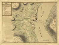
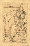
 Map of the northern parts of New York. CREATED/PUBLISHED [1758?] NOTES Scale 1:126,720; 2 miles to an in. Title from verso. Manuscript, pen-and-ink and watercolor. Shows the Hudson River from Albany to Fort Edward, the Mohawk and Hoosic rivers, Schoharie Creek, roads and villages adjacent, and some landowners. Includes descriptive notes, some indicate number of families in each village. Map of the northern parts of New York. CREATED/PUBLISHED [1758?] NOTES Scale 1:126,720; 2 miles to an in. Title from verso. Manuscript, pen-and-ink and watercolor. Shows the Hudson River from Albany to Fort Edward, the Mohawk and Hoosic rivers, Schoharie Creek, roads and villages adjacent, and some landowners. Includes descriptive notes, some indicate number of families in each village. |
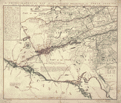
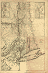
 The provinces of New York, and New Jersey; with part of Pensilvania, and the governments of Trois Rivi�res, and Montreal: Drawn by Capt. Holland. Engraved by Thomas Jefferys, geographer to His Majesty. Holland, Samuel, 1728-1801. CREATED/PUBLISHED [London] Printed for Robt. Sayer ... and T. Jefferys [1768?] NOTES Scale ca. 1:650,000. Title in upper margin: A chorographical map of the country between Albany, Oswego, Fort Frontenac, and les Trois Rivi�res ... Drawn from authentic surveys by Thomas Jefferys, geographer to His Majesty. Hand colored. Prime meridian: London. Relief shown pictorially. The provinces of New York, and New Jersey; with part of Pensilvania, and the governments of Trois Rivi�res, and Montreal: Drawn by Capt. Holland. Engraved by Thomas Jefferys, geographer to His Majesty. Holland, Samuel, 1728-1801. CREATED/PUBLISHED [London] Printed for Robt. Sayer ... and T. Jefferys [1768?] NOTES Scale ca. 1:650,000. Title in upper margin: A chorographical map of the country between Albany, Oswego, Fort Frontenac, and les Trois Rivi�res ... Drawn from authentic surveys by Thomas Jefferys, geographer to His Majesty. Hand colored. Prime meridian: London. Relief shown pictorially. |
 The provinces of New York, and New Jersey; with part of Pensilvania, and the province of Quebec. Drawn by Capt. Holland. Engraved by Thomas Jefferys, geographer to His Majesty. And improved from the modern surveys of those colonies down to the year 1775. Holland, Samuel, 1728-1801. CREATED/PUBLISHED London, Printed for Robt. Sayer & John Bennett, 1775. NOTES Scale ca. 1:650,000. Hand colored. Relief shown pictorially. Shows "Longitude west from London." Shows township and county boundaries. Includes historical notes and insets of "A chart of the mouth of Hudson's River, from Sandy Hook to New York," "A plan of the city of New York," and "Plan of Amboy with its environs." The provinces of New York, and New Jersey; with part of Pensilvania, and the province of Quebec. Drawn by Capt. Holland. Engraved by Thomas Jefferys, geographer to His Majesty. And improved from the modern surveys of those colonies down to the year 1775. Holland, Samuel, 1728-1801. CREATED/PUBLISHED London, Printed for Robt. Sayer & John Bennett, 1775. NOTES Scale ca. 1:650,000. Hand colored. Relief shown pictorially. Shows "Longitude west from London." Shows township and county boundaries. Includes historical notes and insets of "A chart of the mouth of Hudson's River, from Sandy Hook to New York," "A plan of the city of New York," and "Plan of Amboy with its environs." |
  A map of the Province of New-York, reduc'd from the large drawing of that Province, compiled from actual surveys by order of His Excellency William Tryon, Esqr., Captain General & Governor of the same, by Claude Joseph Sauthier; to which is added New-Jersey, from the topographical observations of C. J. Sauthier & B. Ratzer. Engraved by William Faden ... 1776. Sauthier, Claude Joseph. CREATED/PUBLISHED London, Wm. Faden, 1776. NOTES Scale ca. 1:1,050,000. Hand colored. Relief shown by hachures. Shows administrative boundaries in New York and New Jersey. Also shows portions of Pennsylvania and New England. Two copies. Copy 1, on 2 sheets and only boundaries colored. Copy 2, sectioned and mounted on cloth backing and colored in. Both copies show the western boundary of Tryon County and the eastern boundaries of Cumberland and Glocester counties in pink. A map of the Province of New-York, reduc'd from the large drawing of that Province, compiled from actual surveys by order of His Excellency William Tryon, Esqr., Captain General & Governor of the same, by Claude Joseph Sauthier; to which is added New-Jersey, from the topographical observations of C. J. Sauthier & B. Ratzer. Engraved by William Faden ... 1776. Sauthier, Claude Joseph. CREATED/PUBLISHED London, Wm. Faden, 1776. NOTES Scale ca. 1:1,050,000. Hand colored. Relief shown by hachures. Shows administrative boundaries in New York and New Jersey. Also shows portions of Pennsylvania and New England. Two copies. Copy 1, on 2 sheets and only boundaries colored. Copy 2, sectioned and mounted on cloth backing and colored in. Both copies show the western boundary of Tryon County and the eastern boundaries of Cumberland and Glocester counties in pink. |
 A map of the Province of New-York, reduc'd from the large drawing of that Province, compiled from actual surveys by order of His Excellency William Tryon, Esqr. Captain General & Governor of the same, by Claude Joseph Sauthier; to which is added New-Jersey, from the topographical observations of C. J. Sauthier and B. Ratzer. Engraved by William Faden ... 1776. Sauthier, Claude Joseph. CREATED/PUBLISHED London, W. Faden, 1776. NOTES Scale ca. 1:1,000,000. Hand colored. Relief shown by hachures. Prime meridian: New York. Shows administrative boundaries in New York and New Jersey. Also shows portions of Pennsylvania and New England. A map of the Province of New-York, reduc'd from the large drawing of that Province, compiled from actual surveys by order of His Excellency William Tryon, Esqr. Captain General & Governor of the same, by Claude Joseph Sauthier; to which is added New-Jersey, from the topographical observations of C. J. Sauthier and B. Ratzer. Engraved by William Faden ... 1776. Sauthier, Claude Joseph. CREATED/PUBLISHED London, W. Faden, 1776. NOTES Scale ca. 1:1,000,000. Hand colored. Relief shown by hachures. Prime meridian: New York. Shows administrative boundaries in New York and New Jersey. Also shows portions of Pennsylvania and New England. |
 Sketch of the White Plains, by Captain Blaskowitz. Blaskowitz, Charles. CREATED/PUBLISHED [1776?] NOTES Scale 1:6,000; 500 ft. to an in. Manuscript, pen-and-ink and watercolor. Relief shown by hachures and shading. Shows disposition of British, Hessian, and American forces. Sketch of the White Plains, by Captain Blaskowitz. Blaskowitz, Charles. CREATED/PUBLISHED [1776?] NOTES Scale 1:6,000; 500 ft. to an in. Manuscript, pen-and-ink and watercolor. Relief shown by hachures and shading. Shows disposition of British, Hessian, and American forces. |
 A map of the Province of New York, with part of Pensilvania, and New England, from an actual survey by Captain Montr�sor, engineer, 1775. P. Andrews, sculp. Montr�sor, John, 1736-1799. CREATED/PUBLISHED London, A. Dury [1777] NOTES Scale ca. 1:320,000. Relief shown pictorially and by hachures. Shows administrative divisions. A map of the Province of New York, with part of Pensilvania, and New England, from an actual survey by Captain Montr�sor, engineer, 1775. P. Andrews, sculp. Montr�sor, John, 1736-1799. CREATED/PUBLISHED London, A. Dury [1777] NOTES Scale ca. 1:320,000. Relief shown pictorially and by hachures. Shows administrative divisions. |
 A sketch of the operations of His Majesty's fleet and army under the command of Vice Admiral the Rt. Hble. Lord Viscount Howe and Genl. Sr. Wm. Howe, K.B., in 1776. Des Barres, Joseph F. W. (Joseph Frederick Wallet), 1722-1824. CREATED/PUBLISHED [London] J. F. W. D[es Barres, 1777] NOTES Scale ca. 1:130,000. Hand colored. Relief shown by hachures and shading. Depths shown by soundings. Centered on the Hudson River and New York Bay from Sandy Hook to Haverstraw. A sketch of the operations of His Majesty's fleet and army under the command of Vice Admiral the Rt. Hble. Lord Viscount Howe and Genl. Sr. Wm. Howe, K.B., in 1776. Des Barres, Joseph F. W. (Joseph Frederick Wallet), 1722-1824. CREATED/PUBLISHED [London] J. F. W. D[es Barres, 1777] NOTES Scale ca. 1:130,000. Hand colored. Relief shown by hachures and shading. Depths shown by soundings. Centered on the Hudson River and New York Bay from Sandy Hook to Haverstraw. |
 The provinces of New York, and New Jersey; with part of Pensilvania and the province of Quebec. Drawn by Major Holland, Surveyor General of the Northern District in America. Corrected and improved, from the original materials, by Governr. Pownall. Hen. Contger, Sculp. Mog. Pownall, Thomas, 1722-1805. CREATED/PUBLISHED Frankfort upon the Mayn, Harry Lodowick Broenner, 1777. NOTES Scale ca. 1:650,000. Hand colored. Relief shown pictorially. Prime meridian: London. Insets: A chart of the mouth of Hudsons River, from Sandy Hook to New York.--Plan of Amboy with its environs from an actual survey.--A plan of the city of New York. The provinces of New York, and New Jersey; with part of Pensilvania and the province of Quebec. Drawn by Major Holland, Surveyor General of the Northern District in America. Corrected and improved, from the original materials, by Governr. Pownall. Hen. Contger, Sculp. Mog. Pownall, Thomas, 1722-1805. CREATED/PUBLISHED Frankfort upon the Mayn, Harry Lodowick Broenner, 1777. NOTES Scale ca. 1:650,000. Hand colored. Relief shown pictorially. Prime meridian: London. Insets: A chart of the mouth of Hudsons River, from Sandy Hook to New York.--Plan of Amboy with its environs from an actual survey.--A plan of the city of New York. |
 Province de New-York en 4 feuilles, par Montr�sor. Montr�sor, John, 1736-1799. CREATED/PUBLISHED Paris, Chez Le Rouge, 1777. NOTES Scale ca. 1:320,000. Hand colored. LC copy sectioned and mounted on cloth and paper backing. Relief shown pictorially and by hachures. LC copy annotated in black ink: 13. Place names in English. Shows administrative divisions in New York and portions of New Jersey, Pennsylvania, and New England. Based on John Montresor's A map of the Province of New York, with part of Pensilvania. 1775. Province de New-York en 4 feuilles, par Montr�sor. Montr�sor, John, 1736-1799. CREATED/PUBLISHED Paris, Chez Le Rouge, 1777. NOTES Scale ca. 1:320,000. Hand colored. LC copy sectioned and mounted on cloth and paper backing. Relief shown pictorially and by hachures. LC copy annotated in black ink: 13. Place names in English. Shows administrative divisions in New York and portions of New Jersey, Pennsylvania, and New England. Based on John Montresor's A map of the Province of New York, with part of Pensilvania. 1775. |
 A plan of the operations of the King's army under the command of General Sr. William Howe, K.B. in New York and east New Jersey against the American forces commanded by General Washington from the 12th. of October, to the 28th. of November 1776, wherein is particularly distinguished the engagement on the White Plains, the 28th. of October. By Claude Joseph Sauthier; engraved by Wm. Faden, 1777. Sauthier, Claude Joseph. CREATED/PUBLISHED [London] W. Faden, 1777. NOTES Scale ca. 1:84,000. Hand colored. Relief shown by hachures. A plan of the operations of the King's army under the command of General Sr. William Howe, K.B. in New York and east New Jersey against the American forces commanded by General Washington from the 12th. of October, to the 28th. of November 1776, wherein is particularly distinguished the engagement on the White Plains, the 28th. of October. By Claude Joseph Sauthier; engraved by Wm. Faden, 1777. Sauthier, Claude Joseph. CREATED/PUBLISHED [London] W. Faden, 1777. NOTES Scale ca. 1:84,000. Hand colored. Relief shown by hachures. |
 A map containing part of the Provinces of New York and New Jersey, drawn from surveys compiled by Thomas Millidge, major 1st Battalion, New Jersey Volunteers, 1780. This map is drawn for Oliver Delancey, Esquire, adjutant general of N: America & major of the 17th Light Dragoons, by Andrew Skinner, 1781. Skinner, Andrew, geographer. CREATED/PUBLISHED [1781] NOTES Scale ca. 1:126,000. Manuscript, pen-and-ink and watercolor. Relief shown by shading. Shows area between the Hudson and Delaware Rivers, from Kingston, N.Y. to Trenton, including names of some property owners. A map containing part of the Provinces of New York and New Jersey, drawn from surveys compiled by Thomas Millidge, major 1st Battalion, New Jersey Volunteers, 1780. This map is drawn for Oliver Delancey, Esquire, adjutant general of N: America & major of the 17th Light Dragoons, by Andrew Skinner, 1781. Skinner, Andrew, geographer. CREATED/PUBLISHED [1781] NOTES Scale ca. 1:126,000. Manuscript, pen-and-ink and watercolor. Relief shown by shading. Shows area between the Hudson and Delaware Rivers, from Kingston, N.Y. to Trenton, including names of some property owners. |
 A Plan of Albany, as it was in the year 1758. CREATED/PUBLISHED [1759?] NOTES Scale 1:12,000; 1,000 ft. to an in. Manuscript, pen-and-ink and watercolor. Oriented with north to the right. Relief shown by shading. A Plan of Albany, as it was in the year 1758. CREATED/PUBLISHED [1759?] NOTES Scale 1:12,000; 1,000 ft. to an in. Manuscript, pen-and-ink and watercolor. Oriented with north to the right. Relief shown by shading. |
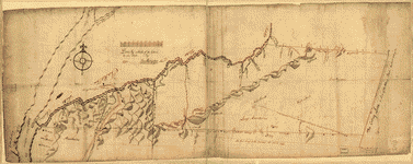
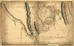
 Position of the detachment under Lieut't Col. Baum & attacks of the enemy on the 16th August at Walmscock near Benington, 1777. Lieut't Durnford, engineer. Durnford, Desmaretz, d. 1782. CREATED/PUBLISHED [1777] NOTES Scale ca. 1:6,000; 200 paces to an in. Manuscript, pen-and-ink and watercolor. Has watermark. Oriented with north to the right. Relief shown by hachures. Shows troop positions of battle fought in the town of Hoosick, N.Y. in defense of Bennington, Vt. Position of the detachment under Lieut't Col. Baum & attacks of the enemy on the 16th August at Walmscock near Benington, 1777. Lieut't Durnford, engineer. Durnford, Desmaretz, d. 1782. CREATED/PUBLISHED [1777] NOTES Scale ca. 1:6,000; 200 paces to an in. Manuscript, pen-and-ink and watercolor. Has watermark. Oriented with north to the right. Relief shown by hachures. Shows troop positions of battle fought in the town of Hoosick, N.Y. in defense of Bennington, Vt. |
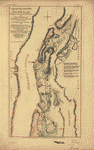
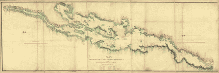 Plan, Lake Champlain from Fort St. John's to Ticonderoga, with the soundings, rocks, shoals, and sands, surveyed in the years 1778, 1779. CREATED/PUBLISHED [1779] NOTES Scale 1:63,360; 1 mile to 1 in. Manuscript, pen-and-ink and watercolor. Oriented with north to the left. Shows ships present at the Battle of Valcour Island, Oct. 11, 1776 and a running fight at Buttonmold Bay, Oct., 13, 1776. Plan, Lake Champlain from Fort St. John's to Ticonderoga, with the soundings, rocks, shoals, and sands, surveyed in the years 1778, 1779. CREATED/PUBLISHED [1779] NOTES Scale 1:63,360; 1 mile to 1 in. Manuscript, pen-and-ink and watercolor. Oriented with north to the left. Shows ships present at the Battle of Valcour Island, Oct. 11, 1776 and a running fight at Buttonmold Bay, Oct., 13, 1776. |
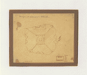
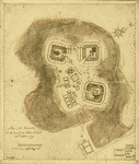
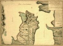 Plan of the fort and fortress at Crown Point with their environs. With the disposition of the English Army under the command of Genl. Amherst encamp'd there 1759. CREATED/PUBLISHED [1759?] NOTES Scale 1:7,200; 200 yards to an in. Manuscript, pen-and-ink and watercolor. Relief shown by shading and hachures. Plan of the fort and fortress at Crown Point with their environs. With the disposition of the English Army under the command of Genl. Amherst encamp'd there 1759. CREATED/PUBLISHED [1759?] NOTES Scale 1:7,200; 200 yards to an in. Manuscript, pen-and-ink and watercolor. Relief shown by shading and hachures. |
 Draft of the lands disputed by Philipse Patent against Beekmans & Rambaults. Hampton, Jona. CREATED/PUBLISHED 1753. NOTES Scale 1:31,680; 40 chains to an in. Title from verso. Alternate title from Philip Lee Phillips' A list of maps of America: [Map of Fishkill and vicinity] Manuscript, pen-and-ink and watercolor. Has watermark. Relief shown pictorially. Shows area in southern Dutchess County between the Hudson River and the Connecticut Colony line and shows designation of Fishkill Town. Draft of the lands disputed by Philipse Patent against Beekmans & Rambaults. Hampton, Jona. CREATED/PUBLISHED 1753. NOTES Scale 1:31,680; 40 chains to an in. Title from verso. Alternate title from Philip Lee Phillips' A list of maps of America: [Map of Fishkill and vicinity] Manuscript, pen-and-ink and watercolor. Has watermark. Relief shown pictorially. Shows area in southern Dutchess County between the Hudson River and the Connecticut Colony line and shows designation of Fishkill Town. |
 Sketch of Forts Clinton & Montgomery, stormed the 6th Octob. 1777 by the troops under the command of Sir Henry Clinton, K.B., Lt. General of H. Maj. forces and commander in chief of New Yorck and its dependencies. CREATED/PUBLISHED [1776] NOTES Scale ca. 1:11,700. Manuscript, pen-and-ink and watercolor. Oriented with north toward the upper right. Relief shown by hachures. Shows routes of troop movements and military units. Sketch of Forts Clinton & Montgomery, stormed the 6th Octob. 1777 by the troops under the command of Sir Henry Clinton, K.B., Lt. General of H. Maj. forces and commander in chief of New Yorck and its dependencies. CREATED/PUBLISHED [1776] NOTES Scale ca. 1:11,700. Manuscript, pen-and-ink and watercolor. Oriented with north toward the upper right. Relief shown by hachures. Shows routes of troop movements and military units. |
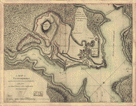
 A plan of the Forts Montgomery & Clinton as taken by His Majesty's forces under the command of Genl. Sr. Henry Clinton the 6th. of Octr. 1777. Survey'd by Major Holland, surr. genl. of the Northern District of North America. Holland, Samuel, 1728-1801. CREATED/PUBLISHED [1777] NOTES Scale ca. 1:18,000 (not ca. 1:6,000 as depicted by bar scale). Has watermarks. Relief shown by hachures. Pictorial map. A plan of the Forts Montgomery & Clinton as taken by His Majesty's forces under the command of Genl. Sr. Henry Clinton the 6th. of Octr. 1777. Survey'd by Major Holland, surr. genl. of the Northern District of North America. Holland, Samuel, 1728-1801. CREATED/PUBLISHED [1777] NOTES Scale ca. 1:18,000 (not ca. 1:6,000 as depicted by bar scale). Has watermarks. Relief shown by hachures. Pictorial map. |
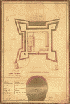 A plan of Fort George at the city of New-York. Survey'd and drawn by C. J. Sauthier. Sauthier, Claude Joseph. CREATED/PUBLISHED [1773?] NOTES Scale ca. 1:330. Manuscript, pen-and-ink and watercolor. Oriented with north to the bottom. Includes index to buildings. A plan of Fort George at the city of New-York. Survey'd and drawn by C. J. Sauthier. Sauthier, Claude Joseph. CREATED/PUBLISHED [1773?] NOTES Scale ca. 1:330. Manuscript, pen-and-ink and watercolor. Oriented with north to the bottom. Includes index to buildings. |
 Plan of Carillon ou [sic] Ticonderoga : which was quitted by the Americaines in the night from the 5th to the 6th of July 1777 / par Mr. Capitaine, A.d.C. du G�n�ral La Fayette. Capitaine du Chesnoy, Michel, 1746-1804. OTHER TITLES Plan of Carillon or Ticonderoga Title on label affixed to cloth backing: Position de l'arm�e ennemie proche le Lac Champlain le 24. 8.[bre?] 1777 CREATED/PUBLISHED [1777] NOTES Shows military installations and British troop positions in the vicinity of Fort Ticonderoga (N.Y.) at the time of the Battle of Saratoga (Oct. 1777). Relief shown by hachures. Parts of index in mixed English and French. Plan of Carillon ou [sic] Ticonderoga : which was quitted by the Americaines in the night from the 5th to the 6th of July 1777 / par Mr. Capitaine, A.d.C. du G�n�ral La Fayette. Capitaine du Chesnoy, Michel, 1746-1804. OTHER TITLES Plan of Carillon or Ticonderoga Title on label affixed to cloth backing: Position de l'arm�e ennemie proche le Lac Champlain le 24. 8.[bre?] 1777 CREATED/PUBLISHED [1777] NOTES Shows military installations and British troop positions in the vicinity of Fort Ticonderoga (N.Y.) at the time of the Battle of Saratoga (Oct. 1777). Relief shown by hachures. Parts of index in mixed English and French. |
 Sketth [sic] of the Hessian attack on Fort Washington under General Knypehausen on the 16th November 1776. CREATED/PUBLISHED [1776] NOTES Scale not given. Manuscript, pen-and-ink (black and red). Relief shown by hachures. Shows route of march from Kingsbridge to the fort. Sketth [sic] of the Hessian attack on Fort Washington under General Knypehausen on the 16th November 1776. CREATED/PUBLISHED [1776] NOTES Scale not given. Manuscript, pen-and-ink (black and red). Relief shown by hachures. Shows route of march from Kingsbridge to the fort. |
 A plan of the attack of Fort Washington, now Fort Knyphausen, and of the American lines on New-York Island by the King's troops, on the 16th of November 1776. Sauthier, Claude Joseph. CREATED/PUBLISHED [1776] NOTES Scale ca. 1:20,000. Manuscript, pen-and-ink and watercolor. Has watermarks. Relief shown by hachures. Includes descriptive index. A plan of the attack of Fort Washington, now Fort Knyphausen, and of the American lines on New-York Island by the King's troops, on the 16th of November 1776. Sauthier, Claude Joseph. CREATED/PUBLISHED [1776] NOTES Scale ca. 1:20,000. Manuscript, pen-and-ink and watercolor. Has watermarks. Relief shown by hachures. Includes descriptive index. |
 A topographical map of the northn. part of New York Island, exhibiting the plan of Fort Washington, now Fort Knyphausen, with the rebels lines to the southward, which were forced by the troops under the command of the Rt. Honble. Earl Percy on the 16th. Novr. 1776, and survey'd immediately after by order of His Lordship, by Claude Joseph Sauthier. To which is added the attack made to the northd. by the Hessians, survey'd by order of Lieutt. Genl. Knyphausen. Published by permission of the Rt. Honble. the Commissioners of Trade & Plantations. Sauthier, Claude Joseph. CREATED/PUBLISHED London, W. Faden, 1777. NOTES Scale ca. 1:20,000. Relief shown by hachures A topographical map of the northn. part of New York Island, exhibiting the plan of Fort Washington, now Fort Knyphausen, with the rebels lines to the southward, which were forced by the troops under the command of the Rt. Honble. Earl Percy on the 16th. Novr. 1776, and survey'd immediately after by order of His Lordship, by Claude Joseph Sauthier. To which is added the attack made to the northd. by the Hessians, survey'd by order of Lieutt. Genl. Knyphausen. Published by permission of the Rt. Honble. the Commissioners of Trade & Plantations. Sauthier, Claude Joseph. CREATED/PUBLISHED London, W. Faden, 1777. NOTES Scale ca. 1:20,000. Relief shown by hachures |
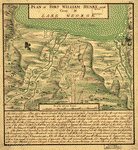 Plan of Fort William Henry and camp at Lake George. W. Eyre, engr. I. Heath dt. Heath, Joseph. CREATED/PUBLISHED [1755?] NOTES Scale ca. 1:4,800. Manuscript, pen-and-ink and watercolor. Relief shown by hachures and shading. Includes descriptive index to military positions. Plan of Fort William Henry and camp at Lake George. W. Eyre, engr. I. Heath dt. Heath, Joseph. CREATED/PUBLISHED [1755?] NOTES Scale ca. 1:4,800. Manuscript, pen-and-ink and watercolor. Relief shown by hachures and shading. Includes descriptive index to military positions. |
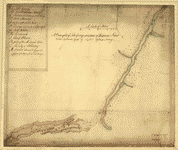 A draught of Lake George, and part of Hudson's River taken September 1756 by Captn. Joshua Loring. Loring, Joshua, 1744-1789. CREATED/PUBLISHED [1756] NOTES Scale ca. 1:253,440. Manuscript, pen-and-ink and watercolor. Oriented with north toward the lower left. Relief shown pictorially. Depths shown by soundings. Indexed for points of interest. A draught of Lake George, and part of Hudson's River taken September 1756 by Captn. Joshua Loring. Loring, Joshua, 1744-1789. CREATED/PUBLISHED [1756] NOTES Scale ca. 1:253,440. Manuscript, pen-and-ink and watercolor. Oriented with north toward the lower left. Relief shown pictorially. Depths shown by soundings. Indexed for points of interest. |
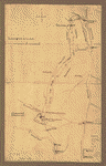 Plan of the attack on Fort William Henry and Ticonderoga; showing the road from Fort Edward, Montcalm's camp and wharf of landing, &c. [Montr�sor, James Gabriel] 1702-1776. CREATED/PUBLISHED [1757?] NOTES Scale 1:253,440; 4 miles to an in. Plan of the attack on Fort William Henry and Ticonderoga; showing the road from Fort Edward, Montcalm's camp and wharf of landing, &c. [Montr�sor, James Gabriel] 1702-1776. CREATED/PUBLISHED [1757?] NOTES Scale 1:253,440; 4 miles to an in. |
 Design for Governor's Island. Montr�sor, John, 1736-1799. CREATED/PUBLISHED [1766?] Design for Governor's Island. Montr�sor, John, 1736-1799. CREATED/PUBLISHED [1766?] |
 Designs for fortifying Governors Island near New York. [By J. M. Montr�sor, John, 1736-1799. CREATED/PUBLISHED 1766?] NOTES Scale 1:144; 12 ft. to an in. Designs for fortifying Governors Island near New York. [By J. M. Montr�sor, John, 1736-1799. CREATED/PUBLISHED 1766?] NOTES Scale 1:144; 12 ft. to an in. |
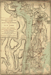
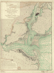
 A topographical map of Hudsons River, with the channels depth of water, rocks, shoals &c. and the country adjacent, from Sandy-Hook, New York and bay to Fort Edward, also the communication with Canada by Lake George and Lake Champlain, as high as Fort Chambly on Sorel River. 1776. Sauthier, Claude Joseph. CREATED/PUBLISHED London, Wm. Faden [1777] NOTES Scale 1:253,440; 4 miles to 1 in. Hand colored. Relief shown by hachures. Depths shown by soundings. A topographical map of Hudsons River, with the channels depth of water, rocks, shoals &c. and the country adjacent, from Sandy-Hook, New York and bay to Fort Edward, also the communication with Canada by Lake George and Lake Champlain, as high as Fort Chambly on Sorel River. 1776. Sauthier, Claude Joseph. CREATED/PUBLISHED London, Wm. Faden [1777] NOTES Scale 1:253,440; 4 miles to 1 in. Hand colored. Relief shown by hachures. Depths shown by soundings. |
 Carte de l'entr�e de la rivi�re d'Hudson, d�puis Sandy-Hook jusques � New-York avec les bancs, sondes, marques de navigation &c. R�dig�e d'apr�s un plan anglois au D�p�t g�n�ral de la marine par ordre de M. de Sartine, conseiller d'Etat, Ministre et Secretaire d'Etat, au D�partement de la marine. France. D�p�t des cartes et plans de la marine. CREATED/PUBLISHED [Paris?] D�p�t de la marine, 1778. NOTES Scale ca. 1:70,000. Hand colored. Depths shown by soundings. Relief shown by land form drawings. Includes "Avertissement." Carte de l'entr�e de la rivi�re d'Hudson, d�puis Sandy-Hook jusques � New-York avec les bancs, sondes, marques de navigation &c. R�dig�e d'apr�s un plan anglois au D�p�t g�n�ral de la marine par ordre de M. de Sartine, conseiller d'Etat, Ministre et Secretaire d'Etat, au D�partement de la marine. France. D�p�t des cartes et plans de la marine. CREATED/PUBLISHED [Paris?] D�p�t de la marine, 1778. NOTES Scale ca. 1:70,000. Hand colored. Depths shown by soundings. Relief shown by land form drawings. Includes "Avertissement." |
 Old map of Brooklyn and greater part of King's County, Long Island. CREATED/PUBLISHED 177-?] NOTES Scale ca. 1:82,000. Title from P. L. Phillips' A list of maps of America, p. 175. Manuscript, pen-and-ink. Oriented with north to the bottom. Relief shown pictorially. Old map of Brooklyn and greater part of King's County, Long Island. CREATED/PUBLISHED 177-?] NOTES Scale ca. 1:82,000. Title from P. L. Phillips' A list of maps of America, p. 175. Manuscript, pen-and-ink. Oriented with north to the bottom. Relief shown pictorially. |
 Sketch of the Heights of Kingsbridge 1777, with the proposed redoubts coloured orange. Old rebel works coloured black. CREATED/PUBLISHED [1777] NOTES Scale ca. 1:7,000. Manuscript, pen-and-ink and watercolor. Has watermarks. Relief shown by hachures and shading. Oriented with north to the left Sketch of the Heights of Kingsbridge 1777, with the proposed redoubts coloured orange. Old rebel works coloured black. CREATED/PUBLISHED [1777] NOTES Scale ca. 1:7,000. Manuscript, pen-and-ink and watercolor. Has watermarks. Relief shown by hachures and shading. Oriented with north to the left |
 Reconnoissance de King's bridge. I. CREATED/PUBLISHED [1781?] NOTES Scale ca. 1:7,900; 600 toises = 97 mm. Title from label on verso. Manuscript, pen-and-ink and watercolor. Has watermarks. Oriented with north to the right. Relief shown by shading. Shows forts and redoubts. Reconnoissance de King's bridge. I. CREATED/PUBLISHED [1781?] NOTES Scale ca. 1:7,900; 600 toises = 97 mm. Title from label on verso. Manuscript, pen-and-ink and watercolor. Has watermarks. Oriented with north to the right. Relief shown by shading. Shows forts and redoubts. |
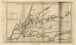 Sketch of the country illustrating the late engagement in Long Island. CREATED/PUBLISHED [London, 1776] NOTES Scale ca. 1:310,000. Depths shown by soundings. Sketch of the country illustrating the late engagement in Long Island. CREATED/PUBLISHED [London, 1776] NOTES Scale ca. 1:310,000. Depths shown by soundings. |
 Attaque de l'arm�e des provinciaux dans Long Island du 27. aoust 1776; dessin de l'isle de New-York et des Etats. Par un officier de l'Arm�e. Par acte du Parlement du 24 8bre. 1776. CREATED/PUBLISHED Paris, Chez Le Rouge [1776] NOTES Scale ca. 1:100,000. Hand colored. Has watermarks. Relief shown by hachures. Attaque de l'arm�e des provinciaux dans Long Island du 27. aoust 1776; dessin de l'isle de New-York et des Etats. Par un officier de l'Arm�e. Par acte du Parlement du 24 8bre. 1776. CREATED/PUBLISHED Paris, Chez Le Rouge [1776] NOTES Scale ca. 1:100,000. Hand colored. Has watermarks. Relief shown by hachures. |
 Plan of the attack the rebels on Long Island, by an officer of the Army. CREATED/PUBLISHED [1776] NOTES Scale ca. 1:125,000. Manuscript, pen-and-ink and watercolor. Has watermark. Annotated showing additional names in a different hand. Plan of the attack the rebels on Long Island, by an officer of the Army. CREATED/PUBLISHED [1776] NOTES Scale ca. 1:125,000. Manuscript, pen-and-ink and watercolor. Has watermark. Annotated showing additional names in a different hand. |
 Plan of the attack on the provincial army on Long Island, August 27th 1776. With the draughts of New York Island, Staten Island, and the adjacent part of the continent. By an officer of the army. CREATED/PUBLISHED [London] Printed for J. Bowles, 1776. NOTES Scale ca. 1:100,000. Manuscript title on verso: Attack Long Island, 1776. Plan of the attack on the provincial army on Long Island, August 27th 1776. With the draughts of New York Island, Staten Island, and the adjacent part of the continent. By an officer of the army. CREATED/PUBLISHED [London] Printed for J. Bowles, 1776. NOTES Scale ca. 1:100,000. Manuscript title on verso: Attack Long Island, 1776. |
 The seat of action, between the British and American forces; or, An authentic plan of the western part of Long Island, with the engagement of the 27th August 1776 between the King's forces and the Americans: containing also Staten Island, and the environs of Amboy and New York, with the course of Hudsons River, from Courtland, the great magazine of the American Army, to Sandy Hook, from the surveys of Major Holland. Holland, Samuel, 1728-1801. CREATED/PUBLISHED London, Printed for Robt. Sayer and Jno. Bennett, 1776. NOTES Scale ca. 1:215,000. Hand colored. Has watermarks. The seat of action, between the British and American forces; or, An authentic plan of the western part of Long Island, with the engagement of the 27th August 1776 between the King's forces and the Americans: containing also Staten Island, and the environs of Amboy and New York, with the course of Hudsons River, from Courtland, the great magazine of the American Army, to Sandy Hook, from the surveys of Major Holland. Holland, Samuel, 1728-1801. CREATED/PUBLISHED London, Printed for Robt. Sayer and Jno. Bennett, 1776. NOTES Scale ca. 1:215,000. Hand colored. Has watermarks. |
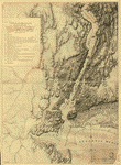
 A plan of New York Island, with part of Long Island, Staten Island & east New Jersey, with a particular description of the engagement on the woody heights of Long Island, between Flatbush and Brooklyn, on the 27th of August 1776 between His Majesty's forces commanded by General Howe and the Americans under Major General Putnam, with the subsequent disposition of both armies. Engraved & publish'd by Wm. Faden. Faden, William, 1750?-1836. CREATED/PUBLISHED London, 1776. NOTES Scale ca. 1:85,000. Hand colored. Has watermarks. Relief shown by hachures. Depths shown by soundings. Pictorial map. Annotated in lower right corner in pencil: 2d impression. In lower margin: An account of the proceedings of His Majesty's forces at the attack of the rebels works on Long Island, on the 27th of August 1776, taken from Gen. Howe's letter to Lord George Germaine ... dated Sep. 3, 1776. A plan of New York Island, with part of Long Island, Staten Island & east New Jersey, with a particular description of the engagement on the woody heights of Long Island, between Flatbush and Brooklyn, on the 27th of August 1776 between His Majesty's forces commanded by General Howe and the Americans under Major General Putnam, with the subsequent disposition of both armies. Engraved & publish'd by Wm. Faden. Faden, William, 1750?-1836. CREATED/PUBLISHED London, 1776. NOTES Scale ca. 1:85,000. Hand colored. Has watermarks. Relief shown by hachures. Depths shown by soundings. Pictorial map. Annotated in lower right corner in pencil: 2d impression. In lower margin: An account of the proceedings of His Majesty's forces at the attack of the rebels works on Long Island, on the 27th of August 1776, taken from Gen. Howe's letter to Lord George Germaine ... dated Sep. 3, 1776. |
 A plan of New York Island, with part of Long Island, Staten Island & east New Jersey, with a particular description of the engagement on the woody heights of Long Island, between Flatbush and Brooklyn, on the 27th of August 1776 between His Majesty's forces commanded by General Howe and the Americans under Major General Putnam, shewing also the landing of the British Army on New-York Island, and the taking of the city of New-York &c. on the 15th of September following, with the subsequent disposition of both the armies. Engraved & publish'd by Wm. Faden. Faden, William, 1750?-1836. CREATED/PUBLISHED London, 1776. NOTES Scale ca. 1:85,000. Hand colored. Relief shown by hachures. Depths shown by soundings. Shows information to Sept. 23, 1776. A plan of New York Island, with part of Long Island, Staten Island & east New Jersey, with a particular description of the engagement on the woody heights of Long Island, between Flatbush and Brooklyn, on the 27th of August 1776 between His Majesty's forces commanded by General Howe and the Americans under Major General Putnam, shewing also the landing of the British Army on New-York Island, and the taking of the city of New-York &c. on the 15th of September following, with the subsequent disposition of both the armies. Engraved & publish'd by Wm. Faden. Faden, William, 1750?-1836. CREATED/PUBLISHED London, 1776. NOTES Scale ca. 1:85,000. Hand colored. Relief shown by hachures. Depths shown by soundings. Shows information to Sept. 23, 1776. |
 New York Island. Military. Unfinished. CREATED/PUBLISHED 1778?] NOTES Scale ca. 1:12,000. Title from manuscript catalog of Peter Force map collection. Title in manuscript on verso "A topographical map of the north part of New York Island." Manuscript, pen-and-ink and watercolor. Has watermarks. Relief shown by shading. Shows fortifications below Fort Washington and redoubts on east side of Harlem River. New York Island. Military. Unfinished. CREATED/PUBLISHED 1778?] NOTES Scale ca. 1:12,000. Title from manuscript catalog of Peter Force map collection. Title in manuscript on verso "A topographical map of the north part of New York Island." Manuscript, pen-and-ink and watercolor. Has watermarks. Relief shown by shading. Shows fortifications below Fort Washington and redoubts on east side of Harlem River. |
 Nord de l'Ile de New-York. CREATED/PUBLISHED [1781?] NOTES Scale ca. 1:19,000; 600 t[oises] = 93 mm. Alternate title: Nord de l'Isle de New-York. Manuscript, pen-and-ink and watercolor. Oriented with north to the right. Relief shown by hachures. Indexed for military points of interest, forts, redoubts, etc. Nord de l'Ile de New-York. CREATED/PUBLISHED [1781?] NOTES Scale ca. 1:19,000; 600 t[oises] = 93 mm. Alternate title: Nord de l'Isle de New-York. Manuscript, pen-and-ink and watercolor. Oriented with north to the right. Relief shown by hachures. Indexed for military points of interest, forts, redoubts, etc. |
 A Map of the route from the city of Albany to the Fort Osswego on the Lake of Cataroque. CREATED/PUBLISHED [175-?] NOTES Scale ca. 1:410,000. Manuscript, pen-and-ink and watercolor. Watermark: I. Villedary. Also shows the route from Albany to "Crown Point, belonging to the French." Includes "An account of miles from the city of Albany to Osswego." A Map of the route from the city of Albany to the Fort Osswego on the Lake of Cataroque. CREATED/PUBLISHED [175-?] NOTES Scale ca. 1:410,000. Manuscript, pen-and-ink and watercolor. Watermark: I. Villedary. Also shows the route from Albany to "Crown Point, belonging to the French." Includes "An account of miles from the city of Albany to Osswego." |
 Plan of Governor's, Kennedy's, and Brown's Islan[ds] and Red Hook together with part of the Bay and soundings, shewing the position they bear to each other and to New York, September 18th. 1766. By order of His Excellency Major General Gage, Commander in Chief of His Majesty's forces in North America. By John Montresor, engineer. Montr�sor, John, 1736-1799. CREATED/PUBLISHED [1766] NOTES Scale 1:4,800; 400 ft. to an in. Manuscript, pen-and-ink and watercolor. Plan of Governor's, Kennedy's, and Brown's Islan[ds] and Red Hook together with part of the Bay and soundings, shewing the position they bear to each other and to New York, September 18th. 1766. By order of His Excellency Major General Gage, Commander in Chief of His Majesty's forces in North America. By John Montresor, engineer. Montr�sor, John, 1736-1799. CREATED/PUBLISHED [1766] NOTES Scale 1:4,800; 400 ft. to an in. Manuscript, pen-and-ink and watercolor. |
 Map of the progress of His Majesty's armies in New York, during the late campaign, illustrating the accounts. CREATED/PUBLISHED [London] Published in the London Gazette [1776] NOTES Scale ca. 1:316,800. Relief shown pictorially. Depths shown by soundings. Map of the progress of His Majesty's armies in New York, during the late campaign, illustrating the accounts. CREATED/PUBLISHED [London] Published in the London Gazette [1776] NOTES Scale ca. 1:316,800. Relief shown pictorially. Depths shown by soundings. |
 The country twenty five miles round New York, drawn by a gentleman from that city. J. Barber, sculp. CREATED/PUBLISHED [London, W. Hawkes, 1776] NOTES Scale ca. 1:220,000. Hand colored. Relief shown pictorially. "Published according to Act of Parliament, 21st November, 1776, by W. Hawkes ... " Shows radial distances. Includes "Chronological table of the most interesting occurrences since the commencement of hostilities in North America." The country twenty five miles round New York, drawn by a gentleman from that city. J. Barber, sculp. CREATED/PUBLISHED [London, W. Hawkes, 1776] NOTES Scale ca. 1:220,000. Hand colored. Relief shown pictorially. "Published according to Act of Parliament, 21st November, 1776, by W. Hawkes ... " Shows radial distances. Includes "Chronological table of the most interesting occurrences since the commencement of hostilities in North America." |
 Plan of New York and Staten Islands with part of Long Island. CREATED/PUBLISHED 178-?] NOTES Scale ca. 1:108,000. Manuscript, pen-and-ink and watercolor. Relief shown by shading. Plan of New York and Staten Islands with part of Long Island. CREATED/PUBLISHED 178-?] NOTES Scale ca. 1:108,000. Manuscript, pen-and-ink and watercolor. Relief shown by shading. |
 Environs de New-York, de Long-Island, etc. CREATED/PUBLISHED [1781] NOTES Scale ca. 1:95,000. Manuscript, pen-and-ink. Oriented with north to the right. Depths shown by soundings. Environs de New-York, de Long-Island, etc. CREATED/PUBLISHED [1781] NOTES Scale ca. 1:95,000. Manuscript, pen-and-ink. Oriented with north to the right. Depths shown by soundings. |
 Plan of New York and Staten Islands with part of Long Island, survey'd in the years 1781, & 82. CREATED/PUBLISHED [1782] NOTES Scale ca. 1:63,360. Manuscript, pen-and-ink and watercolor. Watermark: J. Whatman. Relief shown by shading. Soundings shown in feet. Shows roads and fortifications. Plan of New York and Staten Islands with part of Long Island, survey'd in the years 1781, & 82. CREATED/PUBLISHED [1782] NOTES Scale ca. 1:63,360. Manuscript, pen-and-ink and watercolor. Watermark: J. Whatman. Relief shown by shading. Soundings shown in feet. Shows roads and fortifications. |
 A plan of the city of New York from an actual survey, anno Domini, M[D]CC,LV by F. Maerschalck, city survey[o]r. Maerschalck, Francis W., d. 1776. CREATED/PUBLISHED [New York?] Printed, ingraved for, and sold by G. Duyckinck [1755?] NOTES Scale ca. 1:3,300; foot 660 to one 8 of a mile. "To the Honourable James De Lancey ... this plan of the City of New York is humbly dedict. by your honours most obet. & humble servant G. Duyckinck." Shows ward boundaries. Indexed for points of interest. A plan of the city of New York from an actual survey, anno Domini, M[D]CC,LV by F. Maerschalck, city survey[o]r. Maerschalck, Francis W., d. 1776. CREATED/PUBLISHED [New York?] Printed, ingraved for, and sold by G. Duyckinck [1755?] NOTES Scale ca. 1:3,300; foot 660 to one 8 of a mile. "To the Honourable James De Lancey ... this plan of the City of New York is humbly dedict. by your honours most obet. & humble servant G. Duyckinck." Shows ward boundaries. Indexed for points of interest. |
 Map showing the Bowery Lane area of Manhattan. CREATED/PUBLISHED 176-?] NOTES Scale not given. Manuscript, pen-and-ink and watercolor. Relief shown pictorially. Map showing the Bowery Lane area of Manhattan. CREATED/PUBLISHED 176-?] NOTES Scale not given. Manuscript, pen-and-ink and watercolor. Relief shown pictorially. |
 Plan of the city of New York ; An exact prospect of Charlestown : the metropolis of the province of South Carolina. CREATED/PUBLISHED [London : s.n., 1762-1776] NOTES New York City map shows streets, wharves, ferries, principal buildings, and built-up area. Charleston view is panorama of waterfront and quays with principal buildings lettered for identification (no index present). Relief shown by hachures on New York City map. Plan of the city of New York ; An exact prospect of Charlestown : the metropolis of the province of South Carolina. CREATED/PUBLISHED [London : s.n., 1762-1776] NOTES New York City map shows streets, wharves, ferries, principal buildings, and built-up area. Charleston view is panorama of waterfront and quays with principal buildings lettered for identification (no index present). Relief shown by hachures on New York City map. |
 A plan of the city of New-York & its environs to Greenwich, on the North or Hudsons River, and to Crown Point, on the East or Sound River, shewing the several streets, publick buildings, docks, fort & battery, with the true form & course of the commanding grounds, with and without the town. Survey'd in the winter, 1766. P. Andrews, sculp. Montr�sor, John, 1736-1799. CREATED/PUBLISHED [London, 1766] NOTES Scale ca. 1:6,300. Dedicated "To the Honble. Thos. Gage ... " Relief shown by hachures. Includes text, index to points of interest, and inset "A chart of the entrance to New York from Sandy Hook, shewing the properest channel for sailing, with ye banks and depths of water," ca. 1:128,000. A plan of the city of New-York & its environs to Greenwich, on the North or Hudsons River, and to Crown Point, on the East or Sound River, shewing the several streets, publick buildings, docks, fort & battery, with the true form & course of the commanding grounds, with and without the town. Survey'd in the winter, 1766. P. Andrews, sculp. Montr�sor, John, 1736-1799. CREATED/PUBLISHED [London, 1766] NOTES Scale ca. 1:6,300. Dedicated "To the Honble. Thos. Gage ... " Relief shown by hachures. Includes text, index to points of interest, and inset "A chart of the entrance to New York from Sandy Hook, shewing the properest channel for sailing, with ye banks and depths of water," ca. 1:128,000. |
 A plan of the city and environs of New York in North America. CREATED/PUBLISHED [London : s.n., 1776] NOTES General street map showing selected letter-keyed buildings in built-up area and field lines with generalized land use in rural areas. Relief shown by hachures. Also shows "Road to Kings Bridge where the Rebels mean to make a stand" and "Road to Kepps Bay where the Kings troops landed". Also covers rural part of Manhattan Island up to present-day 14th Street and small parts of Long Island. Removed from: The Universal Magazine of Knowledge and Pleasure, London, Nov. 1776, v. 59. Watermark: Oval cartouche surmounted by crown with capital letter W at right. A plan of the city and environs of New York in North America. CREATED/PUBLISHED [London : s.n., 1776] NOTES General street map showing selected letter-keyed buildings in built-up area and field lines with generalized land use in rural areas. Relief shown by hachures. Also shows "Road to Kings Bridge where the Rebels mean to make a stand" and "Road to Kepps Bay where the Kings troops landed". Also covers rural part of Manhattan Island up to present-day 14th Street and small parts of Long Island. Removed from: The Universal Magazine of Knowledge and Pleasure, London, Nov. 1776, v. 59. Watermark: Oval cartouche surmounted by crown with capital letter W at right. |
 A plan of the Narrows of Hells-gate in the East River, near which batteries of cannon and mortars were erected on Long Island with a view to take off the defences and make breaches in the rebel fort on the opposite shore to facilitate a landing of troops on New York Island. Drawn by Chals. Blaskowitz. Blaskowitz, Charles. CREATED/PUBLISHED [1776] NOTES Scale ca. 1:2,400. Manuscript, pen-and-ink and watercolor. Has watermarks. Relief shown by shading. A plan of the Narrows of Hells-gate in the East River, near which batteries of cannon and mortars were erected on Long Island with a view to take off the defences and make breaches in the rebel fort on the opposite shore to facilitate a landing of troops on New York Island. Drawn by Chals. Blaskowitz. Blaskowitz, Charles. CREATED/PUBLISHED [1776] NOTES Scale ca. 1:2,400. Manuscript, pen-and-ink and watercolor. Has watermarks. Relief shown by shading. |
 To His Excellency Sr. Henry Moore, Bart., captain general and governour in chief, in & over the Province of New York & the territories depending thereon in America, chancellor & vice admiral of the same. This plan of the city of New York, is most humbly inscribed, by ... Bernd. Ratzen. T. Kitchin, sculpt. Ratzer, Bernard. CREATED/PUBLISHED London, Jefferys & Faden, 1776. NOTES Scale ca. 1:5,000. "Survey'd in 1767." Shows ward boundaries. Includes numbered index to buildings. To His Excellency Sr. Henry Moore, Bart., captain general and governour in chief, in & over the Province of New York & the territories depending thereon in America, chancellor & vice admiral of the same. This plan of the city of New York, is most humbly inscribed, by ... Bernd. Ratzen. T. Kitchin, sculpt. Ratzer, Bernard. CREATED/PUBLISHED London, Jefferys & Faden, 1776. NOTES Scale ca. 1:5,000. "Survey'd in 1767." Shows ward boundaries. Includes numbered index to buildings. |
 Disposition of British troops, with fortifications north of Fort Knipehausen, i.e. Fort Washington to Fort Independence. CREATED/PUBLISHED 1778?] NOTES Scale ca. 1:10,600. Manuscript, pen-and-ink and watercolor. Has watermarks. Shows military unit members. "No. 31." Stamped on label on verso: Montresor. Includes table "Cantoonments between Fort Knypehausen and McGowans Pass." Disposition of British troops, with fortifications north of Fort Knipehausen, i.e. Fort Washington to Fort Independence. CREATED/PUBLISHED 1778?] NOTES Scale ca. 1:10,600. Manuscript, pen-and-ink and watercolor. Has watermarks. Shows military unit members. "No. 31." Stamped on label on verso: Montresor. Includes table "Cantoonments between Fort Knypehausen and McGowans Pass." |
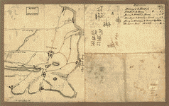
 Map of that part of Orange County lying to the north of the mountains of the highlands shewing that Chester is a much more central & convenient spott to all the country whereon to erect the new court house than that vulgarly known by the name of Goshen Town. CREATED/PUBLISHED [177-?] NOTES Scale 1:79,200; protracted by a scale of 100 chains to an in. Manuscript, pen-and-ink and watercolor. Oriented with north to the bottom. Relief shown by shading. Map of that part of Orange County lying to the north of the mountains of the highlands shewing that Chester is a much more central & convenient spott to all the country whereon to erect the new court house than that vulgarly known by the name of Goshen Town. CREATED/PUBLISHED [177-?] NOTES Scale 1:79,200; protracted by a scale of 100 chains to an in. Manuscript, pen-and-ink and watercolor. Oriented with north to the bottom. Relief shown by shading. |
 [Map of Orange and Rockland counties area of New York] Copied from surveys laid down by R. Erskine, F.R.S. 1778, 1779. Erskine, Robert, 1735-1780. CREATED/PUBLISHED [1779] NOTES Scale ca. 1:126,720. Manuscript, pen-and-ink and pencil. Watermark: J. Whatman. Relief shown by hachures. Shows some landownership. [Map of Orange and Rockland counties area of New York] Copied from surveys laid down by R. Erskine, F.R.S. 1778, 1779. Erskine, Robert, 1735-1780. CREATED/PUBLISHED [1779] NOTES Scale ca. 1:126,720. Manuscript, pen-and-ink and pencil. Watermark: J. Whatman. Relief shown by hachures. Shows some landownership. |
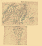
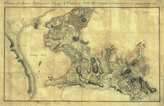
 Oyster Bay and Huntington. Huntington Bay. Des Barres, Joseph F. W. (Joseph Frederick Wallet), 1722-1824. CREATED/PUBLISHED [London, 1778] NOTES Scale ca. 1:25,250. Relief shown by hachures and shading. Depths shown by soundings. Includes text and inset "Hell Gate" ca. 1:25,250. Oyster Bay and Huntington. Huntington Bay. Des Barres, Joseph F. W. (Joseph Frederick Wallet), 1722-1824. CREATED/PUBLISHED [London, 1778] NOTES Scale ca. 1:25,250. Relief shown by hachures and shading. Depths shown by soundings. Includes text and inset "Hell Gate" ca. 1:25,250. |
 Position des Arm�es am�riquaine et fran�oise � Kings-ferry, Peaks-hill, Crompond et Hunts-taverne du 17. septembre au 20 octobre 1782. CREATED/PUBLISHED [1782] NOTES Scale ca. 1:27,000. Manuscript, pen-and-ink and watercolor. Has watermarks. Relief shown by hachures. Kings Ferry operated between Verplank Point and Stony Point. "Peaks-hill" was about 3 miles south of the center of present-day Peekskill. Position des Arm�es am�riquaine et fran�oise � Kings-ferry, Peaks-hill, Crompond et Hunts-taverne du 17. septembre au 20 octobre 1782. CREATED/PUBLISHED [1782] NOTES Scale ca. 1:27,000. Manuscript, pen-and-ink and watercolor. Has watermarks. Relief shown by hachures. Kings Ferry operated between Verplank Point and Stony Point. "Peaks-hill" was about 3 miles south of the center of present-day Peekskill. |
 Position of the army on the 8th Octbr. 1777. CREATED/PUBLISHED [1777] NOTES Scale ca. 1:7,200. Manuscript, pen-and-ink and watercolor. Relief shown by hachures. Shows British and German troop positions. Includes key to the military units. Position of the army on the 8th Octbr. 1777. CREATED/PUBLISHED [1777] NOTES Scale ca. 1:7,200. Manuscript, pen-and-ink and watercolor. Relief shown by hachures. Shows British and German troop positions. Includes key to the military units. |
|
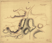
The encampment & position of the army under His Excy. Lt. Gl: Burgoyne at Swords's and Freeman's Farms on Hudsons River near Stillwater, 1777. [Signed:] Wm Cumbd Wilkinson. Wilkinson, William Cumberland. CREATED/PUBLISHED [1777] NOTES Scale 1:7,200; 200 yards to an in. Manuscript, pen-and-ink and watercolor. Has watermarks. Oriented with north to the right. Relief shown by hachures. Four views: View 1. "1st & 2d positions of that Part of the Army Engaged on the 19th of Sept. 1777..." View 2. "3d & 4th Position 19th Sept. 1777." View 3. "Position of the Detatchment &c. &c. in the Action of the 7th of Oct. 1777." View 4. "Position of the Army on the 8th of Oct. 1777." Includes index entitled "Reference" and 3 hinged overlays showing "1st & 2d positions ... on the 19th Septr. 1777," "3d & 4th positions, 19th Septr. 1777," and "Position of the army on the 8th Octr. 1777."
|
 Plan of the position which the army under Lt. Genl. Burgoyne took at Saratoga, on the 10th of September 1777, and in which it remained till the convention was signed. CREATED/PUBLISHED [1777?] NOTES Scale ca. 1:108,000. Manuscript, pen-and-ink. Has watermarks. Oriented with north to the left. Relief shown by hachures. Plan of the position which the army under Lt. Genl. Burgoyne took at Saratoga, on the 10th of September 1777, and in which it remained till the convention was signed. CREATED/PUBLISHED [1777?] NOTES Scale ca. 1:108,000. Manuscript, pen-and-ink. Has watermarks. Oriented with north to the left. Relief shown by hachures. |
 Plan of the encampment and position of the army under His Excelly. Lt. General Burgoyne at Br�mus Heights on Hudson's River near Stillwater on the 20th Septr. with the position of the detachment &c. in the action of the 7th of Octobr. & the position of the army on the 8th Octr. 1777. Drawn by W. C. Wilkinson, Lt. 62 Regt. Asst. Engr. Wilkinson, William Cumberland. CREATED/PUBLISHED 1777?] NOTES Scale ca. 1:14,400. Title from engraved map published by William Faden, 1780. Manuscript, pen-and-ink and watercolor. Oriented with north to the bottom. Relief shown by hachures. Plan of the encampment and position of the army under His Excelly. Lt. General Burgoyne at Br�mus Heights on Hudson's River near Stillwater on the 20th Septr. with the position of the detachment &c. in the action of the 7th of Octobr. & the position of the army on the 8th Octr. 1777. Drawn by W. C. Wilkinson, Lt. 62 Regt. Asst. Engr. Wilkinson, William Cumberland. CREATED/PUBLISHED 1777?] NOTES Scale ca. 1:14,400. Title from engraved map published by William Faden, 1780. Manuscript, pen-and-ink and watercolor. Oriented with north to the bottom. Relief shown by hachures. |
 A Plan of the works on Spikendevil Hill with the ground in front, protracted from a scale of 200 feet to an inch. CREATED/PUBLISHED [1778?] NOTES Scale 1:2,400. Manuscript, pen-and-ink and watercolor. Has watermarks. Oriented with north to the right. Relief shown by shading. A Plan of the works on Spikendevil Hill with the ground in front, protracted from a scale of 200 feet to an inch. CREATED/PUBLISHED [1778?] NOTES Scale 1:2,400. Manuscript, pen-and-ink and watercolor. Has watermarks. Oriented with north to the right. Relief shown by shading. |
 Plan of the redoubts at Richmond on Staten Island, 30th October 1779. CREATED/PUBLISHED [1779] NOTES Scale 1:480; 40 ft. to an in. Manuscript, pen-and-ink and brown wash. Oriented with north toward the upper right. Has watermarks. Relief shown by hachures. Plan of the redoubts at Richmond on Staten Island, 30th October 1779. CREATED/PUBLISHED [1779] NOTES Scale 1:480; 40 ft. to an in. Manuscript, pen-and-ink and brown wash. Oriented with north toward the upper right. Has watermarks. Relief shown by hachures. |
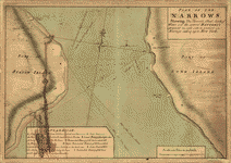 Plan of The Narrows, shewing the channel, shoal, depth of water, and the several battery's proposed on each side to prevent an enemy's sailing up to New York. CREATED/PUBLISHED [1776?] NOTES Scale 1:6,000; 500 ft. to an in. Manuscript, pen-and-ink and watercolor. Has watermarks. Relief shown by shading. Depths shown by soundings. Includes "Explanation." Plan of The Narrows, shewing the channel, shoal, depth of water, and the several battery's proposed on each side to prevent an enemy's sailing up to New York. CREATED/PUBLISHED [1776?] NOTES Scale 1:6,000; 500 ft. to an in. Manuscript, pen-and-ink and watercolor. Has watermarks. Relief shown by shading. Depths shown by soundings. Includes "Explanation." |
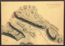
 A Map of Ticonderoga with the old and new lines and batteries, taken from an actual survey & other authentick informations, 1777. CREATED/PUBLISHED [n.p., 1777] NOTES Scale ca. 1:2,300. Hand colored. Relief shown by hachures. Includes notes. A Map of Ticonderoga with the old and new lines and batteries, taken from an actual survey & other authentick informations, 1777. CREATED/PUBLISHED [n.p., 1777] NOTES Scale ca. 1:2,300. Hand colored. Relief shown by hachures. Includes notes. |
This is a must have collection for any map history buff!
To use this software, you must install the free ExpressView MrSid software which is included on the CD. This is a 30 second process and will allow you to view and manipulate/print all the maps in this CD collection in full detail. There is viewing software on the disk. It only runs on Windows platforms and full installation instructions are included on the CD.