The Grand Canyon of the Colorado River in northwestern Arizona is one of the earth's greatest natural wonders. It became a national park in 1919. Theodore Roosevelt created the Grand Canyon Game Preserve by proclamation in 1906 and Grand Canyon National Monument in 1908. Senate bills to establish a national park were introduced and defeated in 1910 and 1911; the Grand Canyon National Park Act was finally signed by President Woodrow Wilson in 1919. The National Park Service, which had been established in 1916, assumed administration of the park.
The Grand Canyon of the Colorado River in northwestern Arizona is one of the earth's greatest natural wonders. It became a national park in 1919. So famous is this landmark to modern Americans that it seems surprising that it took more than thirty years for it to become a national park. President Theodore Roosevelt visited the rim in 1903 and exclaimed:
 "The Grand Canyon fills me with awe. It is beyond comparison--beyond description; absolutely unparalleled throughout the wide world .... Let this great wonder of nature remain as it now is. Do nothing to mar its grandeur, sublimity and loveliness. You cannot improve on it. But what you can do is to keep it for your children, your children's children, and all who come after you, as the one great sight which every American should see."
Despite Roosevelt's enthusiasm and his strong interest in preserving land for public use, the Grand Canyon was not immediately designated as a national park. The first bill to create Grand Canyon National Park had been introduced in 1882 and again in 1883 and 1886 by Senator Benjamin Harrison. As President, Harrison established the Grand Canyon Forest Reserve in 1893. Theodore Roosevelt created the Grand Canyon Game Preserve by proclamation in 1906 and Grand Canyon National Monument in 1908. Senate bills to establish a national park were introduced and defeated in 1910 and 1911; the Grand Canyon National Park Act was finally signed by President Woodrow Wilson in 1919. The National Park Service, which had been established in 1916, assumed administration of the park.
Before the middle of the nineteenth century, very little was known about the geography of the Grand Canyon. Because of its remote location, the area in and around the canyon was not explored or mapped in detail by Europeans, although it was probably visited in 1540 by the Spanish expedition of Garcia Lopez de Cardenas, who searched with Vasques de Coronado for the seven legendary cities of Cibola. In 1776, two Spanish priests, Francisco Dominguez and Silvestre de Escalante, crossed the Colorado River while exploring the area, but little knowledge of the region was passed down in written form to later generations. The primary source of information about the magnificent canyon was an oral tradition sustained by the reports of fur trappers and traders and so-called "mountain men," most of whom were escorted through the rugged terrain by Native American guides.
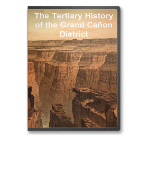
This CD is the Atlas of the Tertiary History of the Grand Canyon District in its entirety in MrSid format. This format allows you to see the entire map on your computer screen or drill down to see the smallest details. The original maps are often quite large, as much as 36" long or larger and quite detailed. With the MrSID software, you can manipulate the map to print the entire map in great detail or zoom into a portion of the map in full detail for viewing or printing. You could even bring the images to a local print shop to have the maps reprinted in their full size. (MrSID software is included on the CD.)
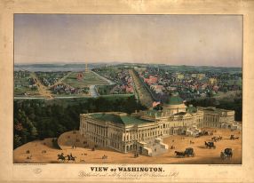
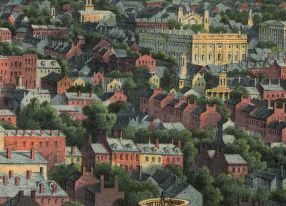
To give you a sample of the detail you can expect in these maps, here is an example based on a panoramic map of Washington, DC.
 |
 |
 |
 |
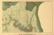
The table below shows the description and a small image of each map on this fascinating Grand Canyon history CD.
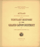 Title page |
 Index |
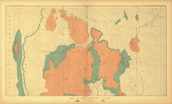
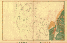
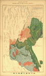 sheet II - Western part of the Plateau Province |
 sheet III - Western part of the Plateau Province |
 sheet IV - The Temples and Towers of the Virgen |
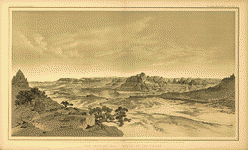
 sheet V - Looking up the Toroweap from Vulcan's Throne |
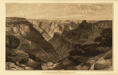
 sheet VI - The Grand Canon at the foot of the Toroweap-Looking East |
 sheet VII - Map of the Uinkaret Plateau |
 sheet VIII - Map of the Uinkaret Plateau |
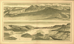
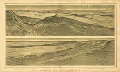
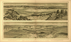 sheet IX - Views looking East and South from Mt. Trumbull |
 sheet X - Views from Mt. Trumbull and Mt. Emma |
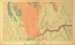
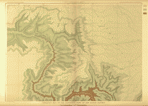 sheet XI - The Southern part of the Kaibab Plateau |
 sheet XII - The Southern part of the Kaibab Plateau |
 sheet XIII - The Grand Canon in the Kaibab Plateau |
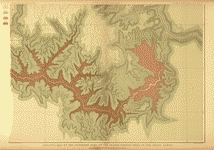 sheet XIV - The Southern part of the Kaibab Plateau-Head of the Grand Canyon (see also ct000216) |
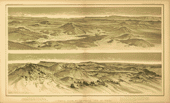
 sheet XV - Panorama from Point Sublime |
 sheet XVI - Panorama from Point Sublime |
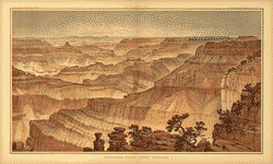 sheet XVII - Panorama from Point Sublime |
 sheet XVIII - The Transept, Kaibab Division, Grand Canyon |
 sheet XIX - Views from the Marble Canon Platform from the Eastern Brink of the Kaibab |
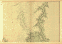
 sheet XX - The South-Western portion of the Mesozoic Terraces |
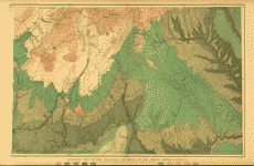 sheet XXI - The Mesozoic Terraces of the Grand Canon District |
 sheet XXII - The Kanab, Kaibab, Paria and Marble Canon Platforms |
 sheet XXIII - The Colorado Plateau and San Francisco Mountains |
This is a must have collection for any map history buff!
To use this software, you must install the free ExpressView MrSid software which is included on the CD. This is a 30 second process and will allow you to view and manipulate/print all the maps in this CD collection in full detail. There is a version for Windows platforms and full installation instructions are included on the CD.