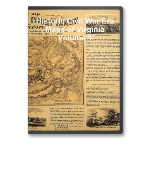
This CD contains 90 rare historic maps and descriptive pages representing fascinating details about Virginia and its vicinity during the Civil War.
This CD contains 90 rare historic maps and descriptive pages representing fascinating details about Virginia and its vicinity during the Civil War in MrSid format. This format allows you to see the entire map on your computer screen or drill down to see the smallest details. The original maps are often quite large, as much as 36" long or larger and quite detailed. With the MrSID software, you can manipulate the map to print the entire map in great detail or zoom into a portion of the map in full detail for viewing or printing. You could even bring the images to a local print shop to have the maps reprinted in their full size. (MrSID software is included on the CD.)
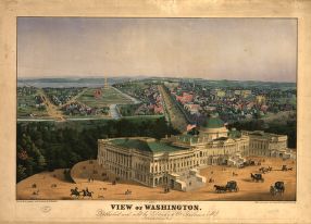
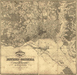
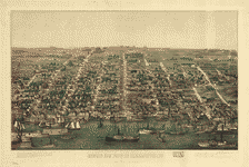
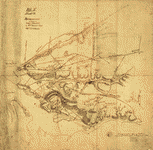
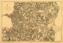
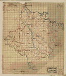
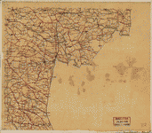
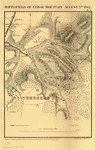
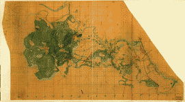
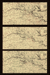
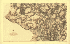
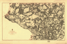
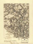
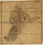
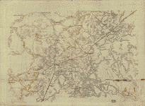
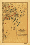
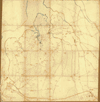
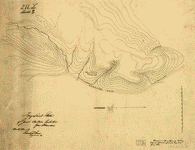
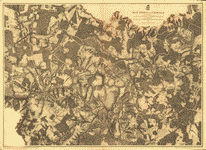
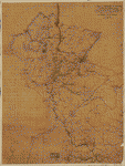
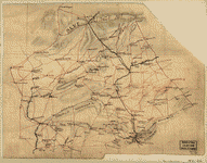
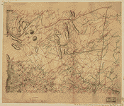
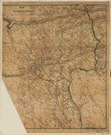
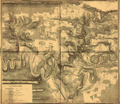
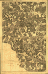
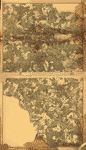
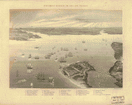
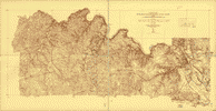
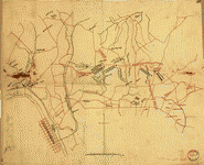
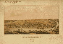
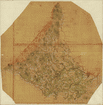
To give you a sample of the detail you can expect in these maps, here is an example based on a panoramic map of Washington, DC.
 |
 |
 |
 |
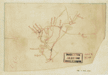
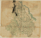
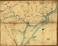
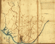
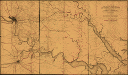
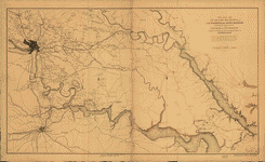
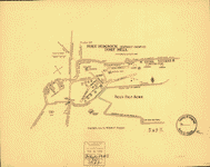
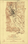
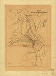
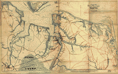
The table below shows the description and a small image of each map on this fascinating civil war history CD.
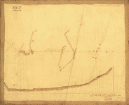
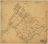
 Sketch no. 4 of roads between H.-Q. 10th Army Corps and Swift Creek on the south : with enemy's 2nd line of intrenchements [sic] around Drury's Bluff on the north / Engineer Office, 10th Army Corps. United States. Army. Corps, 10th. Engineer Office. CREATED/PUBLISHED [186-] NOTES Sketch map of eastern Chesterfield County (Va.) north of Petersburg showing Civil War fortifications, batteries, headquarters, roads, railroads, settlements, farms with occupants' names, vegetation, and streams. Relief shown by hachures. Sketch no. 4 of roads between H.-Q. 10th Army Corps and Swift Creek on the south : with enemy's 2nd line of intrenchements [sic] around Drury's Bluff on the north / Engineer Office, 10th Army Corps. United States. Army. Corps, 10th. Engineer Office. CREATED/PUBLISHED [186-] NOTES Sketch map of eastern Chesterfield County (Va.) north of Petersburg showing Civil War fortifications, batteries, headquarters, roads, railroads, settlements, farms with occupants' names, vegetation, and streams. Relief shown by hachures. |
 A map of Fairfax County, and parts of Loudoun and Prince William Counties, Va., and the District of Columbia] / copied by J. Paul Hoffmann, Top'l. Office, A.N.Va. ; approved S. Howell Brown, 1st Lt. Engs. Troops, in chg. Topl. Dept. A.N.V., March 29th 1864. Hoffmann, J. Paul. NOTES Relief show by hachures. Shows western Washington D.C. region, including fortifications and names of some residents. A map of Fairfax County, and parts of Loudoun and Prince William Counties, Va., and the District of Columbia] / copied by J. Paul Hoffmann, Top'l. Office, A.N.Va. ; approved S. Howell Brown, 1st Lt. Engs. Troops, in chg. Topl. Dept. A.N.V., March 29th 1864. Hoffmann, J. Paul. NOTES Relief show by hachures. Shows western Washington D.C. region, including fortifications and names of some residents. |
 Topographical map of the District of Columbia / surveyed in the years 1856 '57 '58 & '59 by A. Boschke ; engraved by D. McClelland, Washington, D.C. Boschke, A. CREATED/PUBLISHED Washington : D. McClelland, Blanchard & Mohun, 1861. NOTES Partial cadastral map showing some householders' names, individual buildings, and vegetation. Topographical map of the District of Columbia / surveyed in the years 1856 '57 '58 & '59 by A. Boschke ; engraved by D. McClelland, Washington, D.C. Boschke, A. CREATED/PUBLISHED Washington : D. McClelland, Blanchard & Mohun, 1861. NOTES Partial cadastral map showing some householders' names, individual buildings, and vegetation. |
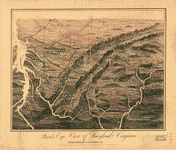 Birds eye view of Maryland and Virginia. S. N. Gaston and Company. CREATED/PUBLISHED [S.l.], S. N. Gaston & Co., c1861. NOTES Not drawn to scale. Panoramic map looking south from southern Pennsylvania showing relief, rivers, place names, and railroads. Birds eye view of Maryland and Virginia. S. N. Gaston and Company. CREATED/PUBLISHED [S.l.], S. N. Gaston & Co., c1861. NOTES Not drawn to scale. Panoramic map looking south from southern Pennsylvania showing relief, rivers, place names, and railroads. |
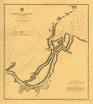 Mouths of Roanoke River, North Carolina Triangulation and topography by R. E. Halter, Sub-Assist. Hydrography by J. S. Bradford, Sub-Assist. acting under orders of Actg. Rear Admiral S. P. Lee, U.S. Navy, Comdg. North Atlantic Blockading Squadron. United States Coast Survey. CREATED/PUBLISHED [Washington, U.S. Coast Survey], 1864. NOTES Scale 1:30,000. Mouths of Roanoke River, North Carolina Triangulation and topography by R. E. Halter, Sub-Assist. Hydrography by J. S. Bradford, Sub-Assist. acting under orders of Actg. Rear Admiral S. P. Lee, U.S. Navy, Comdg. North Atlantic Blockading Squadron. United States Coast Survey. CREATED/PUBLISHED [Washington, U.S. Coast Survey], 1864. NOTES Scale 1:30,000. |
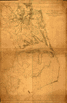 Coast of North Carolina & Virginia compiled at the Coast Survey Office, Febr. 1862. [Drawn by A. Lindenkohl. Lith. by H. Lindenkohl.]. Lindenkohl, A. CREATED/PUBLISHED [Washington, D.C., U.S. Coast Survey, 1862] NOTES Scale 1:200,000. Map is printed in two sheets which have been joined together to form a continuous map. The northern sheet measures 57 x 84 cm., and the southern sheet measures 68 x 84 cm. Map of the coast from Hampton, Virginia, to Old Cedar Inlet, North Carolina, showing roads, railroads, rivers and streams, and place names. Coast of North Carolina & Virginia compiled at the Coast Survey Office, Febr. 1862. [Drawn by A. Lindenkohl. Lith. by H. Lindenkohl.]. Lindenkohl, A. CREATED/PUBLISHED [Washington, D.C., U.S. Coast Survey, 1862] NOTES Scale 1:200,000. Map is printed in two sheets which have been joined together to form a continuous map. The northern sheet measures 57 x 84 cm., and the southern sheet measures 68 x 84 cm. Map of the coast from Hampton, Virginia, to Old Cedar Inlet, North Carolina, showing roads, railroads, rivers and streams, and place names. |
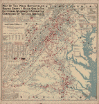 Map of the main battlefields, routes, camps and head qrs., in the Gettysburg, Wilderness and Appomattox campaigns of the Civil War in U.S. Compiled and published by Joshua Smith, 1st Lieut., Co. K, 20th Pa.' Cav., 2nd Brig., 1st Div., Sheridan's command. Chicago, c1899. Smith, Joshua, 1841- CREATED/PUBLISHED Chicago, 1900. NOTES Scale 1:506,880. From his Map and description of the main battlefields, routes, camps and headquarters in the Gettysburg, Wilderness and Appomattox campaigns of the Civil War in the United States. Chicago, 1900. Shows "places and dates of battles," "blue lines-Union routes," "red lines-Confederate routes," railroads, canals, towns, rivers, and relief by hachures. "Losses in some of the battles," "Union Army campaign organizations," "Confed.' Army campaign organizations," and a number of engagements in the states of Pennsylvania, Maryland, Washington, D.C., West Virginia, and Virginia are indicated beneath the map title. Map of the main battlefields, routes, camps and head qrs., in the Gettysburg, Wilderness and Appomattox campaigns of the Civil War in U.S. Compiled and published by Joshua Smith, 1st Lieut., Co. K, 20th Pa.' Cav., 2nd Brig., 1st Div., Sheridan's command. Chicago, c1899. Smith, Joshua, 1841- CREATED/PUBLISHED Chicago, 1900. NOTES Scale 1:506,880. From his Map and description of the main battlefields, routes, camps and headquarters in the Gettysburg, Wilderness and Appomattox campaigns of the Civil War in the United States. Chicago, 1900. Shows "places and dates of battles," "blue lines-Union routes," "red lines-Confederate routes," railroads, canals, towns, rivers, and relief by hachures. "Losses in some of the battles," "Union Army campaign organizations," "Confed.' Army campaign organizations," and a number of engagements in the states of Pennsylvania, Maryland, Washington, D.C., West Virginia, and Virginia are indicated beneath the map title. |
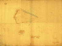
 Sketch of parts of Albemarle and Nelson counties, Virginia, showing road from Charlottesville to Scottsville, Lovingston, Howardsville, Afton, etc.]. Hotchkiss, Jedediah, 1828-1899. CREATED/PUBLISHED [ 186-] NOTES Scale ca. 1:200,000. Pencil sketch giving the names of a number of settlements. Annotation on the reverse, "Foot of Blue Ridge." Sketch of parts of Albemarle and Nelson counties, Virginia, showing road from Charlottesville to Scottsville, Lovingston, Howardsville, Afton, etc.]. Hotchkiss, Jedediah, 1828-1899. CREATED/PUBLISHED [ 186-] NOTES Scale ca. 1:200,000. Pencil sketch giving the names of a number of settlements. Annotation on the reverse, "Foot of Blue Ridge." |
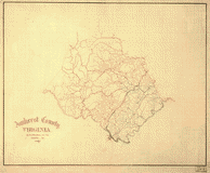
 Map of Albemarle County / from surveys and reconnaissances made under the direction of Albert H. Campbell Capt. P. Eng. & Chief of Topographical Dept. D.N.V. by Lieutt. C.S. Dwight. Dwight, C. S. CREATED/PUBLISHED [1864] NOTES Shows villages, houses, names of residents, roads, and railroads. Relief shown by hachures. Map of Albemarle County / from surveys and reconnaissances made under the direction of Albert H. Campbell Capt. P. Eng. & Chief of Topographical Dept. D.N.V. by Lieutt. C.S. Dwight. Dwight, C. S. CREATED/PUBLISHED [1864] NOTES Shows villages, houses, names of residents, roads, and railroads. Relief shown by hachures. |
 Albemarle County, Virginia by Jed. Hotchkiss, Top. Eng. Hotchkiss, Jedediah, 1828-1899. CREATED/PUBLISHED Staunton, Va. 1867. NOTES Scale 1:126,720. Fine drawing, giving roads in red, drainage in blue, and elevations by hachures. Albemarle County, Virginia by Jed. Hotchkiss, Top. Eng. Hotchkiss, Jedediah, 1828-1899. CREATED/PUBLISHED Staunton, Va. 1867. NOTES Scale 1:126,720. Fine drawing, giving roads in red, drainage in blue, and elevations by hachures. |
 Plan e : [map showing two blockhouses between "Turn Pike Road" and "bridge," Alexandria, Virginia]. United States. Army. Corps of Engineers. CREATED/PUBLISHED [186-] NOTES Shows defenses of Washington situated between Little River Turnpike (Duke Street) and the Telegraph Road bridge crossing Cameron Run. Relief shown by hachures and form lines. Plan e : [map showing two blockhouses between "Turn Pike Road" and "bridge," Alexandria, Virginia]. United States. Army. Corps of Engineers. CREATED/PUBLISHED [186-] NOTES Shows defenses of Washington situated between Little River Turnpike (Duke Street) and the Telegraph Road bridge crossing Cameron Run. Relief shown by hachures and form lines. |
 Birds eye view of Alexandria, Va. Magnus, Charles. CREATED/PUBLISHED New York ; Washington, D.C. : Chas. Magnus, [1863] NOTES "Ent. according to Act of Congress A.D. 1863 by Chas. Magnus in the Clerk's Office of the Southern District of New York." Indexed for points of interest. Birds eye view of Alexandria, Va. Magnus, Charles. CREATED/PUBLISHED New York ; Washington, D.C. : Chas. Magnus, [1863] NOTES "Ent. according to Act of Congress A.D. 1863 by Chas. Magnus in the Clerk's Office of the Southern District of New York." Indexed for points of interest. |
 Topography of the north side of Hunting Creek near Alexandria, Va. / surveyed for the Engineer Dept., May 1863, by C.M. Bache, Sub-Asst. Bache, Chas. M. CREATED/PUBLISHED [1863] NOTES Relief shown by contours and hachures. Topography of the north side of Hunting Creek near Alexandria, Va. / surveyed for the Engineer Dept., May 1863, by C.M. Bache, Sub-Asst. Bache, Chas. M. CREATED/PUBLISHED [1863] NOTES Relief shown by contours and hachures. |
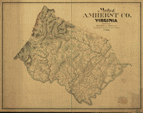 Map of Amherst Co. Virginia prepared by Hotchkiss and Robinson, Topographical Engineers. Hotchkiss, Jedediah, 1828-1899. CREATED/PUBLISHED Staunton, Virginia 1866. NOTES Scale 1:63,360. Finished topographical drawing but lacking all names. Shows roads in red, drainage in blue, and topography by hachures. Map of Amherst Co. Virginia prepared by Hotchkiss and Robinson, Topographical Engineers. Hotchkiss, Jedediah, 1828-1899. CREATED/PUBLISHED Staunton, Virginia 1866. NOTES Scale 1:63,360. Finished topographical drawing but lacking all names. Shows roads in red, drainage in blue, and topography by hachures. |
 Amherst County, Virginia by Jed. Hotchkiss, Top. Eng. Hotchkiss, Jedediah, 1828-1899. CREATED/PUBLISHED Staunton, Va. 1867. NOTES Scale ca. 1:126,720. Unfinished map giving roads in red, drainage in blue, but lacking names. Amherst County, Virginia by Jed. Hotchkiss, Top. Eng. Hotchkiss, Jedediah, 1828-1899. CREATED/PUBLISHED Staunton, Va. 1867. NOTES Scale ca. 1:126,720. Unfinished map giving roads in red, drainage in blue, but lacking names. |
 Memoranda, April 9, 1865, 10 o'clock A.M., Clover Hill (Appomattox Court House) Virginia. CREATED/PUBLISHED [1865] NOTES Shows Appomattox Court House and vicinity at the time of Lee's surrender, including troop positions. Memoranda, April 9, 1865, 10 o'clock A.M., Clover Hill (Appomattox Court House) Virginia. CREATED/PUBLISHED [1865] NOTES Shows Appomattox Court House and vicinity at the time of Lee's surrender, including troop positions. |
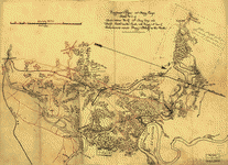
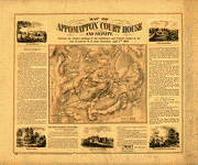 Map of Appomattox Court House and vicinity. Showing the relative positions of the Confederate and Federal Armies at the time of General R. E. Lee's surrender, April 9th 1865. Henderson & Co. CREATED/PUBLISHED Baltimore, Lith. by A. Hoen & Co., c1866. NOTES Scale 1:31,680. Shows positions of Union and Confederate troops by the colors blue and red respectively, houses, names of residents, roads, relief by hachures, drainage, and vegetation. Bordering the map, there are "historical notes" concerning the surrender, "Gen. Lee's farewell to his army," and views of "Lee's Head-Quarters," "McLane's [i.e., McLean's] House," "Appomattox Court House," "place where the arms were stacked," and "Grant's Head-Quarters." Map of Appomattox Court House and vicinity. Showing the relative positions of the Confederate and Federal Armies at the time of General R. E. Lee's surrender, April 9th 1865. Henderson & Co. CREATED/PUBLISHED Baltimore, Lith. by A. Hoen & Co., c1866. NOTES Scale 1:31,680. Shows positions of Union and Confederate troops by the colors blue and red respectively, houses, names of residents, roads, relief by hachures, drainage, and vegetation. Bordering the map, there are "historical notes" concerning the surrender, "Gen. Lee's farewell to his army," and views of "Lee's Head-Quarters," "McLane's [i.e., McLean's] House," "Appomattox Court House," "place where the arms were stacked," and "Grant's Head-Quarters." |
 Appomattox Court House. [1865] From surveys under the direction of Bvt. Brig. Gen. N. Michler, Maj. of Engineers, by command of Bvt. Maj. Genl. A. A. Humphreys, Brig. Genl. & Chief of Engineers. Surveyed & drawn by Maj: J. E. Weyss, assisted by F. Theilkuhl, J. Strasser & G. Thompson. Photolith. by the N. Y. Lithographing, Engraving & Printing Co., Julius Bien, Supt. 1867. Michler, N. (Nathaniel), 1827-1881. CREATED/PUBLISHED [S.l., 1867] Appomattox Court House. [1865] From surveys under the direction of Bvt. Brig. Gen. N. Michler, Maj. of Engineers, by command of Bvt. Maj. Genl. A. A. Humphreys, Brig. Genl. & Chief of Engineers. Surveyed & drawn by Maj: J. E. Weyss, assisted by F. Theilkuhl, J. Strasser & G. Thompson. Photolith. by the N. Y. Lithographing, Engraving & Printing Co., Julius Bien, Supt. 1867. Michler, N. (Nathaniel), 1827-1881. CREATED/PUBLISHED [S.l., 1867] |
 Detailed map of part of Virginia from Alexandria to the Potomac River above Washington, D.C. 186-]. United States. Army. Corps of Engineers. CREATED/PUBLISHED [186-] NOTES Relief shown by form lines. Shows parts of Arlington and Fairfax counties, part of the defenses of Washington, roads, railroads, towns, vegetation, houses, fences, names of residents, and drainage. Detailed map of part of Virginia from Alexandria to the Potomac River above Washington, D.C. 186-]. United States. Army. Corps of Engineers. CREATED/PUBLISHED [186-] NOTES Relief shown by form lines. Shows parts of Arlington and Fairfax counties, part of the defenses of Washington, roads, railroads, towns, vegetation, houses, fences, names of residents, and drainage. |
 Sketch of the seat of war in Alexandria & Fairfax Cos., by V. P. Corbett. Corbett, V. P. CREATED/PUBLISHED Washington City, 1861. NOTES Scale not given. Gives the location and names of Union regiments, entrenchments, houses, names of residents, railroads, roads, and drainage, "Arlington Heights," "Alexandria Heights" and "Shooter's Hill" are indicated by hachures. Sketch of the seat of war in Alexandria & Fairfax Cos., by V. P. Corbett. Corbett, V. P. CREATED/PUBLISHED Washington City, 1861. NOTES Scale not given. Gives the location and names of Union regiments, entrenchments, houses, names of residents, railroads, roads, and drainage, "Arlington Heights," "Alexandria Heights" and "Shooter's Hill" are indicated by hachures. |
 Reconnaissance in advance of Camp Mansfield / by 12th Regiment Engr. Capt. B.S. Church. Church, B. S. CREATED/PUBLISHED [186-] NOTES Shows military camps in Arlington County, Alexandria, and adjoining areas of Fairfax County. Relief shown by hachures. Reconnaissance in advance of Camp Mansfield / by 12th Regiment Engr. Capt. B.S. Church. Church, B. S. CREATED/PUBLISHED [186-] NOTES Shows military camps in Arlington County, Alexandria, and adjoining areas of Fairfax County. Relief shown by hachures. |
  Sketch of the road from Waynesboro toward Staunton, in Augusta County, Virginia.]. Hotchkiss, Jedediah, 1828-1899. CREATED/PUBLISHED [186-] NOTES Scale ca. 1:63,360. Sketch is drawn on both sides of the sheet with colored pencils, showing roads in red and drainage in blue. Sketch of the road from Waynesboro toward Staunton, in Augusta County, Virginia.]. Hotchkiss, Jedediah, 1828-1899. CREATED/PUBLISHED [186-] NOTES Scale ca. 1:63,360. Sketch is drawn on both sides of the sheet with colored pencils, showing roads in red and drainage in blue. |
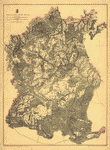
 Augusta County, Virginia, prepared by Jed. Hotchkiss, Top. Engineer. Hotchkiss, Jedediah, 1828-1899. CREATED/PUBLISHED Staunton, Va. 1867. NOTES Scale ca. 1:126,720. Unfinished map, giving roads in red and drainage in blue. Some elevations are shown by hachures, but coverage is incomplete. Augusta County, Virginia, prepared by Jed. Hotchkiss, Top. Engineer. Hotchkiss, Jedediah, 1828-1899. CREATED/PUBLISHED Staunton, Va. 1867. NOTES Scale ca. 1:126,720. Unfinished map, giving roads in red and drainage in blue. Some elevations are shown by hachures, but coverage is incomplete. |
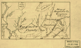 Map of Augusta Co., Virginia, 1738-1770 By Jed. Hotchkiss Hotchkiss, Jedediah, 1828-1899. CREATED/PUBLISHED [1886] NOTES Scale ca. 1:9,000,000. Map of Augusta Co., Virginia, 1738-1770 By Jed. Hotchkiss Hotchkiss, Jedediah, 1828-1899. CREATED/PUBLISHED [1886] NOTES Scale ca. 1:9,000,000. |
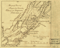 Map of part of Augusta County, Colony of Virginia, 1755-1760 By Jed Hotchkiss, T. E. Hotchkiss, Jedediah, 1828-1899. CREATED/PUBLISHED 1886. NOTES Scale 1:1,450,000. Map of part of Augusta County, Colony of Virginia, 1755-1760 By Jed Hotchkiss, T. E. Hotchkiss, Jedediah, 1828-1899. CREATED/PUBLISHED 1886. NOTES Scale 1:1,450,000. |
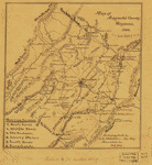 Map of Augusta County, Virginia, 1886 Autographed by Jed. Hotchkiss, Top. Eng. Staunton, Va. Oct. 1886. Hotchkiss, Jedediah, 1828-1899. CREATED/PUBLISHED 1886. NOTES Scale 1:264,000. A list of six magisterial districts in the lower left corner corresponds to numbers on the map. Map of Augusta County, Virginia, 1886 Autographed by Jed. Hotchkiss, Top. Eng. Staunton, Va. Oct. 1886. Hotchkiss, Jedediah, 1828-1899. CREATED/PUBLISHED 1886. NOTES Scale 1:264,000. A list of six magisterial districts in the lower left corner corresponds to numbers on the map. |
 muda Hundred. [1864-1865] From surveys under the direction of Bvt. Brig. Gen. N. Michler, Maj. of Engineers and Bvt. Lieut. Col. P. S. Michie, Capt. of Engineers, by command of Bvt. Maj. Genl. A. A. Humphreys, Brig. Genl. & Chief of Engineers. Surveyed & drawn by Maj: J. E. Weyss, assisted by F. Theilkuhl, J. Strasser & G. Thompson. Photolith. by the N. Y. Lithographing, Engraving & Printing Co., Julius Bien, Supt. 1867. Michler, Nathaniel, and Peter S. Michie. CREATED/PUBLISHED [S.l., 1867] NOTES Scale 1:42,240. In this issue, the map is printed on a yellow background with the James and Appomattox rivers colored blue. Map indicates roads, railroads, towns, drainage, vegetation, relief by hachures, houses, and names of residents. Union and Confederate entrenchments are colored blue and red respectively. muda Hundred. [1864-1865] From surveys under the direction of Bvt. Brig. Gen. N. Michler, Maj. of Engineers and Bvt. Lieut. Col. P. S. Michie, Capt. of Engineers, by command of Bvt. Maj. Genl. A. A. Humphreys, Brig. Genl. & Chief of Engineers. Surveyed & drawn by Maj: J. E. Weyss, assisted by F. Theilkuhl, J. Strasser & G. Thompson. Photolith. by the N. Y. Lithographing, Engraving & Printing Co., Julius Bien, Supt. 1867. Michler, Nathaniel, and Peter S. Michie. CREATED/PUBLISHED [S.l., 1867] NOTES Scale 1:42,240. In this issue, the map is printed on a yellow background with the James and Appomattox rivers colored blue. Map indicates roads, railroads, towns, drainage, vegetation, relief by hachures, houses, and names of residents. Union and Confederate entrenchments are colored blue and red respectively. |
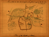 Topographical sketch of the Battle of Bethel, June 10th, 1861. CREATED/PUBLISHED [Virginia? : s.n., 1861?] NOTES Shows Confederate and Union troop positions, entrenchments, and cannon placement. Some topography shown pictorially. Oriented with north to the bottom. Topographical sketch of the Battle of Bethel, June 10th, 1861. CREATED/PUBLISHED [Virginia? : s.n., 1861?] NOTES Shows Confederate and Union troop positions, entrenchments, and cannon placement. Some topography shown pictorially. Oriented with north to the bottom. |
 Map of Buckingham & Appomattox counties / surveyed under direction of A.H. Campbell, Capt. Engrs. & Chief of Topogl. Dept. D.N.V. by Charles E. Cassell, Lieut. Engrs. P.A.C.S. December 25th, 1863. Cassell, Charles E. OTHER TITLES Map of Buckingham and Appomattox counties NOTES Relief shown by hachures. Shows names of some residents. Drawn on a 3/4-in. grid. Oriented with north to the right. Map of Buckingham & Appomattox counties / surveyed under direction of A.H. Campbell, Capt. Engrs. & Chief of Topogl. Dept. D.N.V. by Charles E. Cassell, Lieut. Engrs. P.A.C.S. December 25th, 1863. Cassell, Charles E. OTHER TITLES Map of Buckingham and Appomattox counties NOTES Relief shown by hachures. Shows names of some residents. Drawn on a 3/4-in. grid. Oriented with north to the right. |
 Map of Campbell Co. / made under direction of A.H. Campbell, Maj. Engrs. in chg. Top. Dept. Campbell, Albert H. (Albert Henry), 1826-1899. OTHER TITLES Map of Campbell County CREATED/PUBLISHED [186-] NOTES Relief shown by hachures. Shows names of some residents. Map of Campbell Co. / made under direction of A.H. Campbell, Maj. Engrs. in chg. Top. Dept. Campbell, Albert H. (Albert Henry), 1826-1899. OTHER TITLES Map of Campbell County CREATED/PUBLISHED [186-] NOTES Relief shown by hachures. Shows names of some residents. |
 Map of Caroline County, Va. / from surveys under the direction of Capt. A.H. Campbell, P. Engr's & Chief of Top'l. Department, 1862. Campbell, Albert H. (Albert Henry), 1826-1899. NOTES Shows the names of some residents. Pen on tracing linen sectioned in two and mounted on cloth. Originally folded, with staining and slight losses along fold lines. Map of Caroline County, Va. / from surveys under the direction of Capt. A.H. Campbell, P. Engr's & Chief of Top'l. Department, 1862. Campbell, Albert H. (Albert Henry), 1826-1899. NOTES Shows the names of some residents. Pen on tracing linen sectioned in two and mounted on cloth. Originally folded, with staining and slight losses along fold lines. |
 Caroline County, Virginia / Eng. Office, 2d Corps, A.N.Va. Confederate States of America. Army of Northern Virginia. Corps, 2nd. Engineer Office. CREATED/PUBLISHED [186- ] NOTES Relief shown by hachures. Shows the names of some residents. Caroline County, Virginia / Eng. Office, 2d Corps, A.N.Va. Confederate States of America. Army of Northern Virginia. Corps, 2nd. Engineer Office. CREATED/PUBLISHED [186- ] NOTES Relief shown by hachures. Shows the names of some residents. |
 Caroline Co., Va. CREATED/PUBLISHED [186-] Caroline Co., Va. CREATED/PUBLISHED [186-] |
 Map of parts of Caroline, Hanover, and Henrico counties, Va., west of the Mattaponi River and the Richmond, Fredericksburg, and Potomac Railroad]. CREATED/PUBLISHED [186-] NOTES Shows the names of some residents, some of the outer fortifications of Richmond and those along the railroad north of the South Anna River. Map of parts of Caroline, Hanover, and Henrico counties, Va., west of the Mattaponi River and the Richmond, Fredericksburg, and Potomac Railroad]. CREATED/PUBLISHED [186-] NOTES Shows the names of some residents, some of the outer fortifications of Richmond and those along the railroad north of the South Anna River. |
 Battlefield of Cedar Mountain, August 9th, 1862 Bowen & Co., lith. Pope, John, 1822-1892. CREATED/PUBLISHED Washington, Government Printing Office, 1866. NOTES Scale 1:31,680. Map indicates Union and Confederate positions, roads, houses and names of residents, drainage, railroad, and relief by hachures. Battlefield of Cedar Mountain, August 9th, 1862 Bowen & Co., lith. Pope, John, 1822-1892. CREATED/PUBLISHED Washington, Government Printing Office, 1866. NOTES Scale 1:31,680. Map indicates Union and Confederate positions, roads, houses and names of residents, drainage, railroad, and relief by hachures. |
 Sketch of the battles of Chancellorsville, Salem Church, and Fredericksburg, May 2, 3, and 4, 1863 Prepared by order of General R. E. Lee, by Jed. Hotchkiss, Topogl. Engr. 2d Corps, A.N.V.]. Hotchkiss, Jedediah, 1828-1899. NOTES Scale ca. 1:63,360. Sketch of the battles of Chancellorsville, Salem Church, and Fredericksburg, May 2, 3, and 4, 1863 Prepared by order of General R. E. Lee, by Jed. Hotchkiss, Topogl. Engr. 2d Corps, A.N.V.]. Hotchkiss, Jedediah, 1828-1899. NOTES Scale ca. 1:63,360. |
 Battle of Chancellorsville]. CREATED/PUBLISHED [S.l., 1863] NOTES Scale ca. 1:190,000. Map 1: Dispositions of the Union and Confederate armies prior to the battle of Chancellorsville.-- Map 2: Dispositions of Union and Confederate forces about 11:30 P.M., 30 April, 1863. -- Map 3: Dispositions of Union and Confederate forces at 4:00 P.M., 2nd May, 1863. Each map indicates troop positions, roads, railroads, towns, drainage, fords, and a few houses and names of inhabitants. Battle of Chancellorsville]. CREATED/PUBLISHED [S.l., 1863] NOTES Scale ca. 1:190,000. Map 1: Dispositions of the Union and Confederate armies prior to the battle of Chancellorsville.-- Map 2: Dispositions of Union and Confederate forces about 11:30 P.M., 30 April, 1863. -- Map 3: Dispositions of Union and Confederate forces at 4:00 P.M., 2nd May, 1863. Each map indicates troop positions, roads, railroads, towns, drainage, fords, and a few houses and names of inhabitants. |
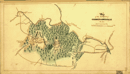 Map of the battlefield of Chancellorsville, Va., 1863. CREATED/PUBLISHED [S.l.], 1863. NOTES Scale 1:63,360. Shows troop positions and movements, roads, railroad, drainage, fords, and vegetation. Map of the battlefield of Chancellorsville, Va., 1863. CREATED/PUBLISHED [S.l.], 1863. NOTES Scale 1:63,360. Shows troop positions and movements, roads, railroad, drainage, fords, and vegetation. |
 Chancellorville [sic] [May 1-3, 1863] Prepared by Bvt. Brig. Genl. N. Michler, Major of Engineers, from surveys under his direction, by order of Brig. Genl. & Bvt. Maj. Genl. A. A. Humphreys, Chief of Engineers, and under the authority of the hon. Secretary of War. Surveyed & drawn by Maj: J. E. Weyss, assisted by F. Theilkuhl, J. Strasser & G. Thompson. Lettering by J. de la Camp. Photolith. by the N. Y. Lithographing, Engraving & Printing Co., Julius Bien, Supt. 1867. Michler, N. (Nathaniel), 1827-1881. CREATED/PUBLISHED [S.l.], 1867. NOTES Scale 1:21,120. In this issue, the map is printed on a yellow background with the Rappahannock and Rapidan rivers colored green. Detailed map showing entrenchments, houses, fences, names of residents, roads, "unfinished railroad," vegetation, drainage, fords, and relief by hachures. Chancellorville [sic] [May 1-3, 1863] Prepared by Bvt. Brig. Genl. N. Michler, Major of Engineers, from surveys under his direction, by order of Brig. Genl. & Bvt. Maj. Genl. A. A. Humphreys, Chief of Engineers, and under the authority of the hon. Secretary of War. Surveyed & drawn by Maj: J. E. Weyss, assisted by F. Theilkuhl, J. Strasser & G. Thompson. Lettering by J. de la Camp. Photolith. by the N. Y. Lithographing, Engraving & Printing Co., Julius Bien, Supt. 1867. Michler, N. (Nathaniel), 1827-1881. CREATED/PUBLISHED [S.l.], 1867. NOTES Scale 1:21,120. In this issue, the map is printed on a yellow background with the Rappahannock and Rapidan rivers colored green. Detailed map showing entrenchments, houses, fences, names of residents, roads, "unfinished railroad," vegetation, drainage, fords, and relief by hachures. |
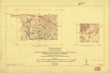 Topographic maps of Chancellorsville and Salem Church battlefields, Spotsylvania County, Virginia Surveyed in cooperation with the Fredericksburg and Spotsylvania County Battlefields Commission. Topography by Shirley Waggener, J. G. Groninger and G. A. Mock. Control by U.S. Geological Survey. Surveyed in 1932. Geological Survey (U.S.) CREATED/PUBLISHED [S.l.], 1932. NOTES Scale 1:24,000. Two maps on one sheet. Map of Chancellorsville measures 21 x 32 cm., and that of Salem Church, 13 x 17 cm. Each indicates "trenches and gun positions," roads, houses, monuments, drainage, and relief by contour lines and spot elevations. "Contour interval 10 feet." Topographic maps of Chancellorsville and Salem Church battlefields, Spotsylvania County, Virginia Surveyed in cooperation with the Fredericksburg and Spotsylvania County Battlefields Commission. Topography by Shirley Waggener, J. G. Groninger and G. A. Mock. Control by U.S. Geological Survey. Surveyed in 1932. Geological Survey (U.S.) CREATED/PUBLISHED [S.l.], 1932. NOTES Scale 1:24,000. Two maps on one sheet. Map of Chancellorsville measures 21 x 32 cm., and that of Salem Church, 13 x 17 cm. Each indicates "trenches and gun positions," roads, houses, monuments, drainage, and relief by contour lines and spot elevations. "Contour interval 10 feet." |
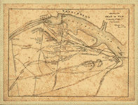
 Cold Harbor. [June 1-3, 1864] From surveys under the direction of Bvt. Brig. Gen. N. Michler, Maj. of Engineers, and Bvt. Lieut. Col. P. S. Michie, Capt. of Engineers, by command of Bvt. Maj. Genl. A. A. Humphreys, Brig. Genl. & Chief of Engineers. Surveyed & drawn by Maj: J. E. Weyss, assisted by F. Theikuhl, J. Strasser & G. Thompson. Photolith. by the N. Y. Lithographing, Engraving & Printing Co., Julius Bien, Supt. 1867. Michler, N. (Nathaniel), 1827-1881. CREATED/PUBLISHED [S.l., 1867] NOTES Scale 1:21,120. In this issue, the map is printed on a yellow background with the Chickahominy River colored green. Shows roads, "Virginia Central R. R.," houses, fences, names of inhabitants, vegetation, drainage, and relief by hachures. Entrenchments are colored red and blue. Cold Harbor. [June 1-3, 1864] From surveys under the direction of Bvt. Brig. Gen. N. Michler, Maj. of Engineers, and Bvt. Lieut. Col. P. S. Michie, Capt. of Engineers, by command of Bvt. Maj. Genl. A. A. Humphreys, Brig. Genl. & Chief of Engineers. Surveyed & drawn by Maj: J. E. Weyss, assisted by F. Theikuhl, J. Strasser & G. Thompson. Photolith. by the N. Y. Lithographing, Engraving & Printing Co., Julius Bien, Supt. 1867. Michler, N. (Nathaniel), 1827-1881. CREATED/PUBLISHED [S.l., 1867] NOTES Scale 1:21,120. In this issue, the map is printed on a yellow background with the Chickahominy River colored green. Shows roads, "Virginia Central R. R.," houses, fences, names of inhabitants, vegetation, drainage, and relief by hachures. Entrenchments are colored red and blue. |
 Cold Harbor. [June 1-3, 1864] From surveys under the direction of Bvt. Brig. Gen. N. Michler, Maj. of Engineers, and Bvt. Lieut. Col. P. S. Michie, Capt. of Engineers, by command of Bvt. Maj. Genl. A. A. Humphreys, Brig. Genl. & Chief of Engineers. Surveyed & drawn by Maj: J. E. Weyss, assisted by F. Theikuhl, J. Strasser & G. Thompson. Photolith. by the N. Y. Lithographing, Engraving & Printing Co., Julius Bien, Supt. 1867. Michler, N. (Nathaniel) 1827-1881. CREATED/PUBLISHED [S.l. 1867] NOTES Scale 1:21,120. In this issue, the map is printed on a yellow background with the Chickahominy River colored green. Shows roads, "Virginia Central R. R.," houses, fences, names of inhabitants, vegetation, drainage, and relief by hachures. Entrenchments are colored red and blue. Cold Harbor. [June 1-3, 1864] From surveys under the direction of Bvt. Brig. Gen. N. Michler, Maj. of Engineers, and Bvt. Lieut. Col. P. S. Michie, Capt. of Engineers, by command of Bvt. Maj. Genl. A. A. Humphreys, Brig. Genl. & Chief of Engineers. Surveyed & drawn by Maj: J. E. Weyss, assisted by F. Theikuhl, J. Strasser & G. Thompson. Photolith. by the N. Y. Lithographing, Engraving & Printing Co., Julius Bien, Supt. 1867. Michler, N. (Nathaniel) 1827-1881. CREATED/PUBLISHED [S.l. 1867] NOTES Scale 1:21,120. In this issue, the map is printed on a yellow background with the Chickahominy River colored green. Shows roads, "Virginia Central R. R.," houses, fences, names of inhabitants, vegetation, drainage, and relief by hachures. Entrenchments are colored red and blue. |
 Cold Harbor. [June 1-3, 1864] From surveys under the direction of B'v't. Brig.-Gen. N. Michler, Maj. of Engineers, and B'v't. Lieut.-Col. P. S. Michie, Capt. of Engineers. 1867. Michler, N. (Nathaniel), 1827-1881. CREATED/PUBLISHED [S.l., 1887] NOTES Scale ca. 1:55,000. From Century illustrated monthly magazine, v. 34, June 1887. p. 296. "Union works are marked . . . U" and "Confederate works are marked . . . C." Shows roads, houses, names of residents, drainage, vegetation, and relief by hachures. Cold Harbor. [June 1-3, 1864] From surveys under the direction of B'v't. Brig.-Gen. N. Michler, Maj. of Engineers, and B'v't. Lieut.-Col. P. S. Michie, Capt. of Engineers. 1867. Michler, N. (Nathaniel), 1827-1881. CREATED/PUBLISHED [S.l., 1887] NOTES Scale ca. 1:55,000. From Century illustrated monthly magazine, v. 34, June 1887. p. 296. "Union works are marked . . . U" and "Confederate works are marked . . . C." Shows roads, houses, names of residents, drainage, vegetation, and relief by hachures. |
 Sketch of the vicinity of Cross Keys, Va.]. CREATED/PUBLISHED [1862] NOTES Shows the names of some residents. Sketch of the vicinity of Cross Keys, Va.]. CREATED/PUBLISHED [1862] NOTES Shows the names of some residents. |
 Survey of Culpeper and a part of Madison counties, Virginia / made under the direction of A.H. Campbell, Capt'n. Provisional Eng'rs. and Chief of Topl. Dept. by Lieut. Dwight, C.S.P.E. ; traced from a map now in progress, April 1863. Dwight, C. S. NOTES Relief shown by hachures. Shows the names of many residents. Survey of Culpeper and a part of Madison counties, Virginia / made under the direction of A.H. Campbell, Capt'n. Provisional Eng'rs. and Chief of Topl. Dept. by Lieut. Dwight, C.S.P.E. ; traced from a map now in progress, April 1863. Dwight, C. S. NOTES Relief shown by hachures. Shows the names of many residents. |
 Map of Culpeper County with parts of Madison, Rappahannock, and Fauquier counties, Virginia] / engr. by J. Schedler ... N. York. United States. Army. Corps of Topographical Engineers. CREATED/PUBLISHED [Washington, D.C.? : U.S. Bureau of Topographical Engineers, 1863?] Map of Culpeper County with parts of Madison, Rappahannock, and Fauquier counties, Virginia] / engr. by J. Schedler ... N. York. United States. Army. Corps of Topographical Engineers. CREATED/PUBLISHED [Washington, D.C.? : U.S. Bureau of Topographical Engineers, 1863?] |
 Map of Culpeper County and parts of the counties of Warren, Rappahannock, Madison, Orange, and Fauquier] Office of Surveys and Maps for the Army of the Potomac. Sept. 21st 1863. United States. Army of the Potomac. CREATED/PUBLISHED [S.l.], 1863. NOTES Scale not given. Reconnaissance map showing villages and towns, houses and names of residents, relief, and woodland principally alongside roads and rail lines. Map of Culpeper County and parts of the counties of Warren, Rappahannock, Madison, Orange, and Fauquier] Office of Surveys and Maps for the Army of the Potomac. Sept. 21st 1863. United States. Army of the Potomac. CREATED/PUBLISHED [S.l.], 1863. NOTES Scale not given. Reconnaissance map showing villages and towns, houses and names of residents, relief, and woodland principally alongside roads and rail lines. |
 Map of Dinwiddie County, Va. / surveyed under the direction of A.H. Campbell, Capt. Eng'rs, P.A.C.S in ch'ge Top'l Dep't. D.N.Va. by S.L. Sommers & H.M. Graves, ass't engr's, 1864. Sommers, S. L. NOTES Relief shown by hachures. Shows names of some residents, and indicates wooded areas. Map of Dinwiddie County, Va. / surveyed under the direction of A.H. Campbell, Capt. Eng'rs, P.A.C.S in ch'ge Top'l Dep't. D.N.Va. by S.L. Sommers & H.M. Graves, ass't engr's, 1864. Sommers, S. L. NOTES Relief shown by hachures. Shows names of some residents, and indicates wooded areas. |
 Map showing portions of the Federal and Confederate forces at the battle of Five Forks, fought April 1, 1865 : it also shows the country over which was fought the Battle of Quaker Road and the Battle of Dinwiddie Court House, fought March 31, 1865 / [drawn by A.S. Perham]. Perham, Aurestus S., b. 1844. CREATED/PUBLISHED [1865?] NOTES Wall map of part of Dinwiddie County (Va.) showing Civil War troop positions, roads, railroad, settlements, buildings, farms with occupants' names, and streams. Does not show troop positions or movements for battles of Quaker Road or Dinwiddie Court House. Map showing portions of the Federal and Confederate forces at the battle of Five Forks, fought April 1, 1865 : it also shows the country over which was fought the Battle of Quaker Road and the Battle of Dinwiddie Court House, fought March 31, 1865 / [drawn by A.S. Perham]. Perham, Aurestus S., b. 1844. CREATED/PUBLISHED [1865?] NOTES Wall map of part of Dinwiddie County (Va.) showing Civil War troop positions, roads, railroad, settlements, buildings, farms with occupants' names, and streams. Does not show troop positions or movements for battles of Quaker Road or Dinwiddie Court House. |
 Map of the action at Drainsville, Va., December 20th 1861. U.S. forces commanded by Brig Gen. E. O. C. Ord. Drawn by H. H. Strickler, Co. A, 9th Pa. Reserve. Published by authority of the Hon. the Secretary of War, office of the Chief of Engineers, U.S. Army, 1875. Strickler, H. H. CREATED/PUBLISHED [S.l.], 1875. NOTES Scale not given. Shows troop positions and unit numbers, houses, roads, vegetation, and drainage. Map of the action at Drainsville, Va., December 20th 1861. U.S. forces commanded by Brig Gen. E. O. C. Ord. Drawn by H. H. Strickler, Co. A, 9th Pa. Reserve. Published by authority of the Hon. the Secretary of War, office of the Chief of Engineers, U.S. Army, 1875. Strickler, H. H. CREATED/PUBLISHED [S.l.], 1875. NOTES Scale not given. Shows troop positions and unit numbers, houses, roads, vegetation, and drainage. |
 Map of part of Essex, King and Queen, and King William Counties / made under the direction of Capt. A.H. Campbell, Chief Topographical Dep't ; traced from a map now in progress ; approved April 21st 1863 by Abert [sic] H. Campbell, Cap. T.Eng. & Chief Top. Dep. D.N.Va. ; copy certified Oct. 22nd 1863 Eng. Office 2nd. Corps, Jed Hotchkiss, Capt. & top. eng. Campbell, Albert H. (Albert Henry), 1826-1899 CREATED/PUBLISHED [1863] NOTES Relief shown by hachures. Shows the names of some residents. Map of part of Essex, King and Queen, and King William Counties / made under the direction of Capt. A.H. Campbell, Chief Topographical Dep't ; traced from a map now in progress ; approved April 21st 1863 by Abert [sic] H. Campbell, Cap. T.Eng. & Chief Top. Dep. D.N.Va. ; copy certified Oct. 22nd 1863 Eng. Office 2nd. Corps, Jed Hotchkiss, Capt. & top. eng. Campbell, Albert H. (Albert Henry), 1826-1899 CREATED/PUBLISHED [1863] NOTES Relief shown by hachures. Shows the names of some residents. |
 Map of part of Fairfax and Prince William Counties, Virginia]. CREATED/PUBLISHED [186-] NOTES Shows roads, railroads, towns, etc. from Fairfax Station to the north to Dumfries on the south and the Potomac River on the east to Manassas Station on the west. Relief shown by hachures. Map of part of Fairfax and Prince William Counties, Virginia]. CREATED/PUBLISHED [186-] NOTES Shows roads, railroads, towns, etc. from Fairfax Station to the north to Dumfries on the south and the Potomac River on the east to Manassas Station on the west. Relief shown by hachures. |
 Sketch of eastern portion of Fairfax County, Va., June 1861. CREATED/PUBLISHED 1861. NOTES Relief shown by hachures. Sketch of eastern portion of Fairfax County, Va., June 1861. CREATED/PUBLISHED 1861. NOTES Relief shown by hachures. |
 Map of part of Fairfax County, Virginia, south of the city of Alexandria and the Orange and Alexandria Railroad] / F. F. Mead, Lt. Co. I, 16th N.Y.V. Del., Aug. 30th 1861. Mead, F. F. CREATED/PUBLISHED 1861. NOTES On tracing cloth, with roads in red, rivers in blue, and railroads, villages, churches, houses, and names of residents in black, and some annotations and emendments in pencil. Map of part of Fairfax County, Virginia, south of the city of Alexandria and the Orange and Alexandria Railroad] / F. F. Mead, Lt. Co. I, 16th N.Y.V. Del., Aug. 30th 1861. Mead, F. F. CREATED/PUBLISHED 1861. NOTES On tracing cloth, with roads in red, rivers in blue, and railroads, villages, churches, houses, and names of residents in black, and some annotations and emendments in pencil. |
 Topographical sketch of ground 1 1/2 miles south west from Alexandria, Nov. 28, 1862 / Edward [Frost?] Engineer. Frost, Edward, engineer. CREATED/PUBLISHED [1862] Topographical sketch of ground 1 1/2 miles south west from Alexandria, Nov. 28, 1862 / Edward [Frost?] Engineer. Frost, Edward, engineer. CREATED/PUBLISHED [1862] |
 High Bridge and Farmville. [1865] From surveys under the direction of Bvt. Brig. Gen. N. Michler, Maj. of Engineers, by command of Bvt. Maj. Genl. A. A. Humphreys, Brig. Genl. & Chief of Engineers. Surveyed & drawn by Maj: J. E. Weyss, assisted by F. Theilkuhl, J. Strasser & G. Thompson. Photolith. by the N.Y. Lithographing, Engraving & Printing Co., Julius Bien, Supt. 1867. Michler, N. (Nathaniel), 1827-1881. CREATED/PUBLISHED [S.l.], 1867. NOTES Scale 1:21,120. Shows entrenchments, roads, "South Side R.R.," street plan of Farmville, houses, fences, names of residents in rural areas, drainage, vegetation, towns, and relief by hachures. Troop positions are not depicted. High Bridge and Farmville. [1865] From surveys under the direction of Bvt. Brig. Gen. N. Michler, Maj. of Engineers, by command of Bvt. Maj. Genl. A. A. Humphreys, Brig. Genl. & Chief of Engineers. Surveyed & drawn by Maj: J. E. Weyss, assisted by F. Theilkuhl, J. Strasser & G. Thompson. Photolith. by the N.Y. Lithographing, Engraving & Printing Co., Julius Bien, Supt. 1867. Michler, N. (Nathaniel), 1827-1881. CREATED/PUBLISHED [S.l.], 1867. NOTES Scale 1:21,120. Shows entrenchments, roads, "South Side R.R.," street plan of Farmville, houses, fences, names of residents in rural areas, drainage, vegetation, towns, and relief by hachures. Troop positions are not depicted. |
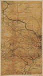
 A map of Fauquier Co. Virginia / compiled from various sources, including a reconnoisance [sic] by Capt. J.K. Boswell, Chf. Eng. 2d C., surveys of the O.& A. and the M.G. railroads, state maps, &c., with personal reconnoisances [sic] ; by Jed. Hotchkiss, Act'g Top, Eng. 2nd Corps A.N.V. March 1863. Hotchkiss, Jedediah, 1828-1899. OTHER TITLES Map of Fauquier County, Virginia NOTES Relief shown by hachures. Shows the names of some residents. A map of Fauquier Co. Virginia / compiled from various sources, including a reconnoisance [sic] by Capt. J.K. Boswell, Chf. Eng. 2d C., surveys of the O.& A. and the M.G. railroads, state maps, &c., with personal reconnoisances [sic] ; by Jed. Hotchkiss, Act'g Top, Eng. 2nd Corps A.N.V. March 1863. Hotchkiss, Jedediah, 1828-1899. OTHER TITLES Map of Fauquier County, Virginia NOTES Relief shown by hachures. Shows the names of some residents. |
 Map of Fauquier County, Va.]. CREATED/PUBLISHED [186-] NOTES Relief shown by hachures. Shows the names of some residents. Map of Fauquier County, Va.]. CREATED/PUBLISHED [186-] NOTES Relief shown by hachures. Shows the names of some residents. |
 Map of parts of Fauquier, Prince William, and Rappahannock counties, Va.]. OTHER TITLES Title from verso: Part of Loudon Co., Va. 1/2-inch scale CREATED/PUBLISHED [186-] NOTES Relief shown by hachures. Shows the names of some residents. Map of parts of Fauquier, Prince William, and Rappahannock counties, Va.]. OTHER TITLES Title from verso: Part of Loudon Co., Va. 1/2-inch scale CREATED/PUBLISHED [186-] NOTES Relief shown by hachures. Shows the names of some residents. |
 Map of Fauquier & Loudon [sic] co's. Va. / by order of Lt. Col. Wm. P. Smith Chf. Eng'r. Topogl. Office A.N.V. ; copied by A. S. Barrows Ass't Eng'r. Barrows, A. S. OTHER TITLES Map of Fauquier and Loudoun counties, Virginia CREATED/PUBLISHED [1863] NOTES Relief shown by hachures. Shows names of residents. Oriented with north to the right. Map of Fauquier & Loudon [sic] co's. Va. / by order of Lt. Col. Wm. P. Smith Chf. Eng'r. Topogl. Office A.N.V. ; copied by A. S. Barrows Ass't Eng'r. Barrows, A. S. OTHER TITLES Map of Fauquier and Loudoun counties, Virginia CREATED/PUBLISHED [1863] NOTES Relief shown by hachures. Shows names of residents. Oriented with north to the right. |
 Battle fields of Fisher's Hill [22 Sept. 1864] and Cedar Creek [19 Oct. 1864], Virginia Prepared by Bvt. Lt. Col. G. L. Gillespie, Major of Engineers, U.S.A. CREATED/PUBLISHED [S.l.], 1873. NOTES Scale 1:12,000. Detailed map indicating earth and wood entrenchments, troop positions and movements, names of commanders and some unit numbers, roads, "Manassas Gap Railroad," houses, names of inhabitants, fences, vegetation, drainage, fords, street pattern of Middletown and Strasburg, and relief by contour lines, hachures, and spot elevations. Union and Confederate troop positions are hand-colored blue and red respectively. Battle fields of Fisher's Hill [22 Sept. 1864] and Cedar Creek [19 Oct. 1864], Virginia Prepared by Bvt. Lt. Col. G. L. Gillespie, Major of Engineers, U.S.A. CREATED/PUBLISHED [S.l.], 1873. NOTES Scale 1:12,000. Detailed map indicating earth and wood entrenchments, troop positions and movements, names of commanders and some unit numbers, roads, "Manassas Gap Railroad," houses, names of inhabitants, fences, vegetation, drainage, fords, street pattern of Middletown and Strasburg, and relief by contour lines, hachures, and spot elevations. Union and Confederate troop positions are hand-colored blue and red respectively. |
 Map of the battlefield of Five-Forks. [March 30-April 1, 1865] Compiled from surveys made under the direction of N. Michler, Major of Engineers, Brv't. Brig. Gen'l U.S.A. Surveyed by Maj. J. E. Weyss, Theilkuhl, Burchard, Schumann, Thompson, Drawn by F. Theilkuhl, Thompson, Schumann. Michler, N. (Nathaniel), 1827-1881. CREATED/PUBLISHED [S.l., 1865?] NOTES Scale 1:15,840. Shows entrenchments, villages, roads, "South Side Rail Road," drainage, vegetation, relief by hachures, houses, and names of residents. Map of the battlefield of Five-Forks. [March 30-April 1, 1865] Compiled from surveys made under the direction of N. Michler, Major of Engineers, Brv't. Brig. Gen'l U.S.A. Surveyed by Maj. J. E. Weyss, Theilkuhl, Burchard, Schumann, Thompson, Drawn by F. Theilkuhl, Thompson, Schumann. Michler, N. (Nathaniel), 1827-1881. CREATED/PUBLISHED [S.l., 1865?] NOTES Scale 1:15,840. Shows entrenchments, villages, roads, "South Side Rail Road," drainage, vegetation, relief by hachures, houses, and names of residents. |
 Map of the battlefield of Five-Forks. [March 30-April 1, 1865] Compiled from surveys made under the direction of N. Michler, Major of Engineers, Brv't. Brig. Gen'l U.S.A. Surveyed by Maj. J. E. Weyss, Theilkuhl, Burchard, Schumann, Thompson, Drawn by F. Theilkuhl, Thompson, Schumann. Michler, N. (Nathaniel), 1827-1881. CREATED/PUBLISHED [S.l., 1865?] NOTES [Scale 1:15,840]. Another issue. Map extends north to the Appomattox River. Shows entrenchments, villages, roads, "South Side Rail Road," drainage, vegetation, relief by hachures, houses, and names of residents. Map of the battlefield of Five-Forks. [March 30-April 1, 1865] Compiled from surveys made under the direction of N. Michler, Major of Engineers, Brv't. Brig. Gen'l U.S.A. Surveyed by Maj. J. E. Weyss, Theilkuhl, Burchard, Schumann, Thompson, Drawn by F. Theilkuhl, Thompson, Schumann. Michler, N. (Nathaniel), 1827-1881. CREATED/PUBLISHED [S.l., 1865?] NOTES [Scale 1:15,840]. Another issue. Map extends north to the Appomattox River. Shows entrenchments, villages, roads, "South Side Rail Road," drainage, vegetation, relief by hachures, houses, and names of residents. |
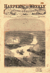 [B]alloon view of the attack on Fort Darling in the James River, by Commander Rogers's [sic] [i.e., Rodger's] gun-boat flotilla, "Galena," "Monitor," etc. [May 16, 1862] CREATED/PUBLISHED [S.l., 1862] NOTES Not drawn to scale. From Harper's weekly, v. 6, May 31, 1862. p. [337] This view was acquired by the Library of Congress in 1948 with the purchase of the papers and maps of Maj. Jedediah Hotchkiss. [B]alloon view of the attack on Fort Darling in the James River, by Commander Rogers's [sic] [i.e., Rodger's] gun-boat flotilla, "Galena," "Monitor," etc. [May 16, 1862] CREATED/PUBLISHED [S.l., 1862] NOTES Not drawn to scale. From Harper's weekly, v. 6, May 31, 1862. p. [337] This view was acquired by the Library of Congress in 1948 with the purchase of the papers and maps of Maj. Jedediah Hotchkiss. |
 Section from Mary Hall to flags-staff Ethan Allen / maping [sic] by B. Dimmick, Private 2nd Art. P.V. Batt. M. 26-4-64 ; [signed] R.A. Chodasiewicz. Dimmick, B. CREATED/PUBLISHED [18]64. NOTES Land-surface elevation profile of a line within Fort Ethan Allen, Alexandria Co. [now Arlington], Va. Section from Mary Hall to flags-staff Ethan Allen / maping [sic] by B. Dimmick, Private 2nd Art. P.V. Batt. M. 26-4-64 ; [signed] R.A. Chodasiewicz. Dimmick, B. CREATED/PUBLISHED [18]64. NOTES Land-surface elevation profile of a line within Fort Ethan Allen, Alexandria Co. [now Arlington], Va. |
 Fort Monroe and vicinity showing entrance to Chesapeake Bay, Norfolk, Portsmouth, Gosport Navy Yard &c. Dutton, E. P. CREATED/PUBLISHED [Boston, 186-] NOTES Scale ca. 1:375,000. Shows forts Monroe, Calhoun, Nelson, and Norfolk, Confederate batteries on Sewell's Point, towns, names of features, drainage, roads, and railroads. "View of Fort Monroe" is in the lower left corner. Fort Monroe and vicinity showing entrance to Chesapeake Bay, Norfolk, Portsmouth, Gosport Navy Yard &c. Dutton, E. P. CREATED/PUBLISHED [Boston, 186-] NOTES Scale ca. 1:375,000. Shows forts Monroe, Calhoun, Nelson, and Norfolk, Confederate batteries on Sewell's Point, towns, names of features, drainage, roads, and railroads. "View of Fort Monroe" is in the lower left corner. |
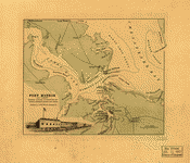
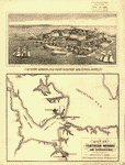 Map of Fortress Monroe and surroundings. Bohn, Casimir. CREATED/PUBLISHED Washington, [1861] NOTES Scale not given. Sketch map showing the location of batteries on the James River and Hampton Roads, and a few place names. Inset: [View of] Fortress Monroe, Old Point Comfort and Hygeia Hotel, Va. Map of Fortress Monroe and surroundings. Bohn, Casimir. CREATED/PUBLISHED Washington, [1861] NOTES Scale not given. Sketch map showing the location of batteries on the James River and Hampton Roads, and a few place names. Inset: [View of] Fortress Monroe, Old Point Comfort and Hygeia Hotel, Va. |
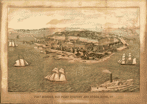 Fort Monroe, Old Point Comfort and Hygeia Hotel, Va. Drawn from nature, lith. & print. by E. Sachse & Co., Balto. Pub. & sold by C. Bohn, Washington, D.C. E. Sachse & Co. CREATED/PUBLISHED [S.l.], c1861. NOTES Scale not given. Bird's-eye view. Fort Monroe, Old Point Comfort and Hygeia Hotel, Va. Drawn from nature, lith. & print. by E. Sachse & Co., Balto. Pub. & sold by C. Bohn, Washington, D.C. E. Sachse & Co. CREATED/PUBLISHED [S.l.], c1861. NOTES Scale not given. Bird's-eye view. |
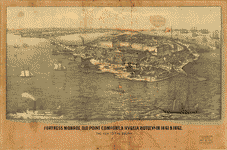 Fortress Monroe, Old Point Comfort, & Hygeia Hotel, Va. in 1861 & 1862. The key to the South Entered according to Act of Congress in the year 1862 by E. Sachse & Co. E. Sachse & Co. CREATED/PUBLISHED Washington, D.C., C. Bohn, [1862] NOTES Scale not given. Bird's-eye view. Fortress Monroe, Old Point Comfort, & Hygeia Hotel, Va. in 1861 & 1862. The key to the South Entered according to Act of Congress in the year 1862 by E. Sachse & Co. E. Sachse & Co. CREATED/PUBLISHED Washington, D.C., C. Bohn, [1862] NOTES Scale not given. Bird's-eye view. |
 Fortress Monroe, Va. and its vicinity J. Wells, del. R. Hinshelwood, sc. Wells, Jacob. CREATED/PUBLISHED [New York], Virtue & Co., c1862. NOTES Scale not given. Perspective drawing with 20 important places keyed by number to a list below the map. Fortress Monroe, Va. and its vicinity J. Wells, del. R. Hinshelwood, sc. Wells, Jacob. CREATED/PUBLISHED [New York], Virtue & Co., c1862. NOTES Scale not given. Perspective drawing with 20 important places keyed by number to a list below the map. |
 Part of the map of the military department of S.E. Virginia and Fort Monroe, showing the approaches to Richmond and Petersburg compiled in the Bureau of Topographical Engineers of the War Department, 1861, with additions and corrections from the map of the siege of Yorktown and the campaign maps of the Army of the Potomac, compiled by Capt. H. L. Abbot, Corps Topogl. Engrs. United States. Army. Corps of Engineers. CREATED/PUBLISHED N.Y. Engraved on stone by J. Schedler 1862. NOTES Scale 1:80,000. Gives fortifications, towns, roads, railroads, houses, names of residents, and drainage. Part of the map of the military department of S.E. Virginia and Fort Monroe, showing the approaches to Richmond and Petersburg compiled in the Bureau of Topographical Engineers of the War Department, 1861, with additions and corrections from the map of the siege of Yorktown and the campaign maps of the Army of the Potomac, compiled by Capt. H. L. Abbot, Corps Topogl. Engrs. United States. Army. Corps of Engineers. CREATED/PUBLISHED N.Y. Engraved on stone by J. Schedler 1862. NOTES Scale 1:80,000. Gives fortifications, towns, roads, railroads, houses, names of residents, and drainage. |
 Part of the map of the military department of S.E. Virginia and Fort Monroe showing the approaches to Richmond and Petersburg compiled in the Bureau of Topographical Engineers of the War Department, with additions and corrections from Gen. Barnard's map of the siege of Yorktown, Gen. Humphrey's campaign maps of the Army of the Potomac, compiled by Capt. H. L. Abbot, Corps Topogl. Engineers, 1862, and Brig. Gen. Weitzel's sketch of the operations against Fort Darling, May, 1864. United States. Army. Corps of Engineers. CREATED/PUBLISHED N.Y., Engraved on stone by J. Schedler, [1864] Part of the map of the military department of S.E. Virginia and Fort Monroe showing the approaches to Richmond and Petersburg compiled in the Bureau of Topographical Engineers of the War Department, with additions and corrections from Gen. Barnard's map of the siege of Yorktown, Gen. Humphrey's campaign maps of the Army of the Potomac, compiled by Capt. H. L. Abbot, Corps Topogl. Engineers, 1862, and Brig. Gen. Weitzel's sketch of the operations against Fort Darling, May, 1864. United States. Army. Corps of Engineers. CREATED/PUBLISHED N.Y., Engraved on stone by J. Schedler, [1864] |
 Plan of Fort Sedgwick generally known as Fort Hell W. P. Hopkins, Oct. 20th 1902. Hopkins, William Palmer, 1845- CREATED/PUBLISHED [S.l.], c1903. NOTES Scale ca. 1:3880. Shows "front [and] rear line of works," artillery positions, magazines, bomb proofs, covered ways, stockade, and sutler's tent. Plan of Fort Sedgwick generally known as Fort Hell W. P. Hopkins, Oct. 20th 1902. Hopkins, William Palmer, 1845- CREATED/PUBLISHED [S.l.], c1903. NOTES Scale ca. 1:3880. Shows "front [and] rear line of works," artillery positions, magazines, bomb proofs, covered ways, stockade, and sutler's tent. |
 derick Co. Va., from Wood's map. OTHER TITLES Frederick County, Virginia, from Wood's map CREATED/PUBLISHED [186-] NOTES Relief shown by hachures. Shows names of some residents. derick Co. Va., from Wood's map. OTHER TITLES Frederick County, Virginia, from Wood's map CREATED/PUBLISHED [186-] NOTES Relief shown by hachures. Shows names of some residents. |
 Fredericksburg-Spotsylvania Battlefield National Monument, Virginia Surveyed in part in cooperation with the War Department and the Fredericksburg and Spotsylvania County Battlefields Memorial Commission. Surveyed in 1931-1934. Topography by H. A. Bean, G. E. Sisson, Paul Blake, Benjamin Munroe, Jr., J. G. Groninger, Shirley Waggener, G. A. Mock, J. H. Lycett, Severin Sabas, F. E. Doane, R. V. Ford, and J. G. Harrison. Control by U.S. Geological Survey. Geological Survey (U.S.) CREATED/PUBLISHED [Washington 1934] NOTES Scale 1:24,000. Fredericksburg-Spotsylvania Battlefield National Monument, Virginia Surveyed in part in cooperation with the War Department and the Fredericksburg and Spotsylvania County Battlefields Memorial Commission. Surveyed in 1931-1934. Topography by H. A. Bean, G. E. Sisson, Paul Blake, Benjamin Munroe, Jr., J. G. Groninger, Shirley Waggener, G. A. Mock, J. H. Lycett, Severin Sabas, F. E. Doane, R. V. Ford, and J. G. Harrison. Control by U.S. Geological Survey. Geological Survey (U.S.) CREATED/PUBLISHED [Washington 1934] NOTES Scale 1:24,000. |
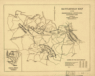 Battlefield map of the Fredericksburg-Spotsylvania Battlefield Park. Kishpaugh, Robert A., 1878- CREATED/PUBLISHED Fredericksburg, [19--?] NOTES Scale not given. Map of the battlefields of the Wilderness, Chancellorsville, Fredericksburg, and Spotsylvania, showing troop positions, names of commanders, roads, railroads, towns, and drainage. "Losses on the battlefields" are given in the lower right corner. Battlefield map of the Fredericksburg-Spotsylvania Battlefield Park. Kishpaugh, Robert A., 1878- CREATED/PUBLISHED Fredericksburg, [19--?] NOTES Scale not given. Map of the battlefields of the Wilderness, Chancellorsville, Fredericksburg, and Spotsylvania, showing troop positions, names of commanders, roads, railroads, towns, and drainage. "Losses on the battlefields" are given in the lower right corner. |
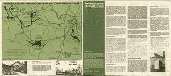 Fredericksburg and Spotsylvania National Military Park. United States. National Park Service. CREATED/PUBLISHED [Washington, U.S. Govt. Print. Off., 1972] NOTES Scale ca. 1:95,000. Fredericksburg and Spotsylvania National Military Park. United States. National Park Service. CREATED/PUBLISHED [Washington, U.S. Govt. Print. Off., 1972] NOTES Scale ca. 1:95,000. |
 Fredericksburg / National Park Service, U.S. Department of the Interior. United States. National Park Service. CREATED/PUBLISHED [Washington] : The Service, [1979] NOTES Scale ca. 1:92,000. Fredericksburg / National Park Service, U.S. Department of the Interior. United States. National Park Service. CREATED/PUBLISHED [Washington] : The Service, [1979] NOTES Scale ca. 1:92,000. |
 Approaches of A. of P. to Fredericksburg. United States. Army of the Potomac. CREATED/PUBLISHED [1862] NOTES Shows "Genl. Hd Qrs.," routes of approach of the 2nd, 3rd, 5th and 6th Corps, roads, railroad, towns, drainage, and houses and names of residents. Relief shown by shading. Approaches of A. of P. to Fredericksburg. United States. Army of the Potomac. CREATED/PUBLISHED [1862] NOTES Shows "Genl. Hd Qrs.," routes of approach of the 2nd, 3rd, 5th and 6th Corps, roads, railroad, towns, drainage, and houses and names of residents. Relief shown by shading. |
 Sketch of the battle field of Fredericksburg / drawn by S. H. Brown, Topl. Engr. P.A.C.S. Decr. 13th 1862. Brown, Samuel Howell. CREATED/PUBLISHED 1862. NOTES Shows infantry and cavalry positions, artillery placement, roads, railroads, houses, and names of corps and field commanders and residents. Relief shown by hachures. Sketch of the battle field of Fredericksburg / drawn by S. H. Brown, Topl. Engr. P.A.C.S. Decr. 13th 1862. Brown, Samuel Howell. CREATED/PUBLISHED 1862. NOTES Shows infantry and cavalry positions, artillery placement, roads, railroads, houses, and names of corps and field commanders and residents. Relief shown by hachures. |
 Map of field of occupation of Army of the Potomac / prepared by order of Gen. Hooker from reconnaisances [sic] made under Capt. R. S. Williamson, Lt. N. Bowen, Gen. D. P. Woodbury, and others. United States. Army. Corps of Topographical Engineers. OTHER TITLES Title on verso: Field of occupation of the Army of the Potomac, March 1863 CREATED/PUBLISHED [1863] NOTES Shows roads, railroads, towns, houses, and names of residents in the Fredericksburg, Virginia region. Does not show troop positions. Map of field of occupation of Army of the Potomac / prepared by order of Gen. Hooker from reconnaisances [sic] made under Capt. R. S. Williamson, Lt. N. Bowen, Gen. D. P. Woodbury, and others. United States. Army. Corps of Topographical Engineers. OTHER TITLES Title on verso: Field of occupation of the Army of the Potomac, March 1863 CREATED/PUBLISHED [1863] NOTES Shows roads, railroads, towns, houses, and names of residents in the Fredericksburg, Virginia region. Does not show troop positions. |
 Topographic map of Fredericksburg and vicinity, Virginia, showing battlefields Surveyed in cooperation with the War Department and the Fredericksburg and Spotsylvania County Battlefields Memorial Commission. Topography by G. E. Sisson, Paul Blake, and Benjamin Munroe. CREATED/PUBLISHED [S.l. 1931] NOTES Scale 1:24,000. "Advanced sheet subject to correction." Detailed topographic map indicating relief by contour lines and spot heights, fortifications, roads and streets, houses, and drainage. Topographic map of Fredericksburg and vicinity, Virginia, showing battlefields Surveyed in cooperation with the War Department and the Fredericksburg and Spotsylvania County Battlefields Memorial Commission. Topography by G. E. Sisson, Paul Blake, and Benjamin Munroe. CREATED/PUBLISHED [S.l. 1931] NOTES Scale 1:24,000. "Advanced sheet subject to correction." Detailed topographic map indicating relief by contour lines and spot heights, fortifications, roads and streets, houses, and drainage. |
 Sketch of the battle of Fredericksburg, Saturday, Dec. 13th 1862, Right Wing, C.S.A., Lt. Gl. Jackson's corps / by Jed. Hotchkiss, T.E., 2nd Corps, A.N. Va. Hotchkiss, Jedediah, 1828-1899. CREATED/PUBLISHED [S.l. : s.n., 1862?] Probably printed by the Union Army since the inscription contains the names of the Union generals Franklin and Butterfield. Shows Union and Confederate positions, names of the field commanders in Jackson's Corps, headquarters of Lee, Jackson, and Longstreet, roads, railroad, drainage, houses, and names of residents. Sketch of the battle of Fredericksburg, Saturday, Dec. 13th 1862, Right Wing, C.S.A., Lt. Gl. Jackson's corps / by Jed. Hotchkiss, T.E., 2nd Corps, A.N. Va. Hotchkiss, Jedediah, 1828-1899. CREATED/PUBLISHED [S.l. : s.n., 1862?] Probably printed by the Union Army since the inscription contains the names of the Union generals Franklin and Butterfield. Shows Union and Confederate positions, names of the field commanders in Jackson's Corps, headquarters of Lee, Jackson, and Longstreet, roads, railroad, drainage, houses, and names of residents. |
 View of Fredericksburg, Va. Nov. 1862. E. Sachse & Co. CREATED/PUBLISHED Balt[im]o[re] 1863. NOTES Perspective map not drawn to scale. Bird's-eye-view. View of Fredericksburg, Va. Nov. 1862. E. Sachse & Co. CREATED/PUBLISHED Balt[im]o[re] 1863. NOTES Perspective map not drawn to scale. Bird's-eye-view. |
 Fredericksburg. [Dec. 1862] Prepared by Bvt. Brig. Genl. N. Michler, Major of Engineers, from surveys under his direction, by order of Brig. Genl. & Bvt. Maj. Genl. A. A. Humphreys, Chief of Engineers, and under the authority of the hon. Secretary of War. Surveyed & drawn by Maj. J. E. Weyss, assisted by F. Theilkuhl, J. Strasser & G. Thompson. Photolith. by the N.Y. Lithographing, Engraving & Printing Co., Julius Bien, Supt. 1867. Michler, N. (Nathaniel), 1827-1881. CREATED/PUBLISHED [S.l.], 1867. NOTES Scale 1:21,120. Detailed map of the environs of Fredericksburg giving Union entrenchments in blue and Confederate entrenchments in red, roads, "Richmond, Fredericksburg and Potomac Rail Road," street plan of Fredericksburg and Falmouth, houses, fences, names of residents in rural areas, vegetation, drainage, and relief by hachures. Fredericksburg. [Dec. 1862] Prepared by Bvt. Brig. Genl. N. Michler, Major of Engineers, from surveys under his direction, by order of Brig. Genl. & Bvt. Maj. Genl. A. A. Humphreys, Chief of Engineers, and under the authority of the hon. Secretary of War. Surveyed & drawn by Maj. J. E. Weyss, assisted by F. Theilkuhl, J. Strasser & G. Thompson. Photolith. by the N.Y. Lithographing, Engraving & Printing Co., Julius Bien, Supt. 1867. Michler, N. (Nathaniel), 1827-1881. CREATED/PUBLISHED [S.l.], 1867. NOTES Scale 1:21,120. Detailed map of the environs of Fredericksburg giving Union entrenchments in blue and Confederate entrenchments in red, roads, "Richmond, Fredericksburg and Potomac Rail Road," street plan of Fredericksburg and Falmouth, houses, fences, names of residents in rural areas, vegetation, drainage, and relief by hachures. |
 Battle of Fredericksburg. Dec. 13, 1862. Wells, Jacob. CREATED/PUBLISHED [S.l., 1886] NOTES Scale ca. 1:50,000. From Century illustrated monthly magazine, v. 32, Aug. 1886. p. 622. "In indicating the Union artillery, we have followed an official map made under the direction of General Henry J. Hunt, chief of artillery." Gives troop positions, batteries, names of commanders, roads, R.F. & P Railroad and the unfinished railroad, houses and names of residents, street pattern of Fredericksburg, drainage, vegetation, and relief by hachures. Battle of Fredericksburg. Dec. 13, 1862. Wells, Jacob. CREATED/PUBLISHED [S.l., 1886] NOTES Scale ca. 1:50,000. From Century illustrated monthly magazine, v. 32, Aug. 1886. p. 622. "In indicating the Union artillery, we have followed an official map made under the direction of General Henry J. Hunt, chief of artillery." Gives troop positions, batteries, names of commanders, roads, R.F. & P Railroad and the unfinished railroad, houses and names of residents, street pattern of Fredericksburg, drainage, vegetation, and relief by hachures. |
 Greene Co., Virginia / Eng'r Office 2nd Corps. Confederate States of America. Army of Northern Virginia. Corps, 2nd. Engineer Office. CREATED/PUBLISHED 1863. NOTES Shows roads, settlements, rural householders' names, and streams. Does not show military features. Relief shown by hachures. Greene Co., Virginia / Eng'r Office 2nd Corps. Confederate States of America. Army of Northern Virginia. Corps, 2nd. Engineer Office. CREATED/PUBLISHED 1863. NOTES Shows roads, settlements, rural householders' names, and streams. Does not show military features. Relief shown by hachures. |
 Map of Greene County, Va.]. CREATED/PUBLISHED [186-] NOTES Relief shown by hachures. Shows names of some residents. Map of Greene County, Va.]. CREATED/PUBLISHED [186-] NOTES Relief shown by hachures. Shows names of some residents. |
 Copy of a map military reconnaissance Dep't Va. : [Hampton Roads and Norfolk regions, Va.] / drawn and compiled under the direction of Col. T.J. Cram, Chief Top'l Enge'r Dep. Va. ; by Sergt. Ch. Worret. Worret, Ch. CREATED/PUBLISHED [1862] NOTES Map of the Hampton Roads vicinity showing Confederate fortifications/camps, settlements, city street patterns, roads, railroads, canals, streams, vegetation, and swamps. "Note--This map shows the positions of the rebel forces and their batteries as they were some six weeks since." Locates the "Minnesota 8 & 9 March 1862 on ground" and the "Monitor & Merrimac engagement on the 9th of March 1862". Copy of a map military reconnaissance Dep't Va. : [Hampton Roads and Norfolk regions, Va.] / drawn and compiled under the direction of Col. T.J. Cram, Chief Top'l Enge'r Dep. Va. ; by Sergt. Ch. Worret. Worret, Ch. CREATED/PUBLISHED [1862] NOTES Map of the Hampton Roads vicinity showing Confederate fortifications/camps, settlements, city street patterns, roads, railroads, canals, streams, vegetation, and swamps. "Note--This map shows the positions of the rebel forces and their batteries as they were some six weeks since." Locates the "Minnesota 8 & 9 March 1862 on ground" and the "Monitor & Merrimac engagement on the 9th of March 1862". |
This is a must have collection for any civil war history buff!
To use this software, you must install the free ExpressView MrSid software which is included on the CD. This is a 30 second process and will allow you to view and manipulate/print all the maps in this CD collection in full detail. There is a version for Windows platforms and full installation instructions are included on the CD.