This
CD contains 39 rare historic maps and descriptive pages representing
fascinating details about Mississippi and its vicinity during
the Civil War in MrSid format.
This
format allows you to see the entire map on your computer screen
or drill down to see the smallest details. The original maps
are often quite large, as much as 36" long or larger
and quite detailed. With the MrSID software, you can manipulate
the map to print the entire map in great detail or zoom into
a portion of the map in full detail for viewing or printing.
You could even bring the images to a local print shop to have
the maps reprinted in their full size. (MrSID software is
included on the CD.)
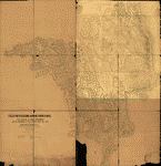
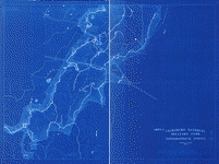
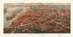
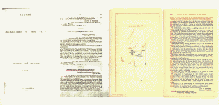
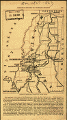
To
give you a sample of the detail you can expect in these maps,
here is an example based on a panoramic map of Washington,
DC.
The
table below shows the description and a small image of each
map on this fascinating civil war history CD.
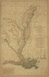
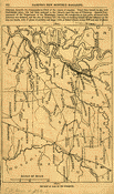
 Map
of a part of Louisiana and Mississippi, illustrating the
operations of the U.S. forces, in the Department of the
Gulf Drawn by H. Lindenkohl. E. Moliter lith. United States
Coast Survey. CREATED/PUBLISHED [S.l.], 1863. NOTES Scale
ca. 1:380,160. In margin at bottom: Line of marsh [sic]
of Gen. Banks corps d'armee April & Mai 1863. Map extends
from Natchez, Mississippi, in the north to Marsh Island,
Louisiana, in the south, and Columbia, Mississippi, in
the east to Alexandria, Louisiana, in the west. Roads,
railroads, drainage, and towns are shown. Map
of a part of Louisiana and Mississippi, illustrating the
operations of the U.S. forces, in the Department of the
Gulf Drawn by H. Lindenkohl. E. Moliter lith. United States
Coast Survey. CREATED/PUBLISHED [S.l.], 1863. NOTES Scale
ca. 1:380,160. In margin at bottom: Line of marsh [sic]
of Gen. Banks corps d'armee April & Mai 1863. Map extends
from Natchez, Mississippi, in the north to Marsh Island,
Louisiana, in the south, and Columbia, Mississippi, in
the east to Alexandria, Louisiana, in the west. Roads,
railroads, drainage, and towns are shown. |
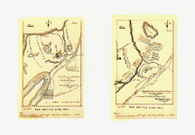
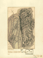
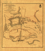 Map
of battlefield of Big Black River Bridge, Mississippi,
showing the positions of the U.S. troops, May 17th 1863
Prepared under the direction of Lieut. P. C. Hains. U.S.
Engrs., by F. Mason, Act. Asst. Engineer. Published by
authority of the Hon. the Secretary of War. Mason, F.
Act. Asst. Engineer. CREATED/PUBLISHED [S.l.], Office
of the Chief of Engineers, U.S. Army, 1876. NOTES Scale
ca. 1:7200. Inset: [Cross] section of parapet A. 6 x 16
cm. Detailed map indicating "confederate works," Union
troop positions and names of commanders, artillery positions,
roads, "Vicksburg and Jackson Rail Road," houses, fences,
vegetation, drainage, and relief by hachures. Map
of battlefield of Big Black River Bridge, Mississippi,
showing the positions of the U.S. troops, May 17th 1863
Prepared under the direction of Lieut. P. C. Hains. U.S.
Engrs., by F. Mason, Act. Asst. Engineer. Published by
authority of the Hon. the Secretary of War. Mason, F.
Act. Asst. Engineer. CREATED/PUBLISHED [S.l.], Office
of the Chief of Engineers, U.S. Army, 1876. NOTES Scale
ca. 1:7200. Inset: [Cross] section of parapet A. 6 x 16
cm. Detailed map indicating "confederate works," Union
troop positions and names of commanders, artillery positions,
roads, "Vicksburg and Jackson Rail Road," houses, fences,
vegetation, drainage, and relief by hachures. |
 No.
1. First Vicksburg campaign or Chicksaw [sic] Bayou. Dec.
27th 1862-Jan. 3rd 1863.-No. 2. Map of battle ground of
Chickasaw Bayou, Dec. 28th and 29th 1862 Enlarged and
drawn by E. A. Munn from Gen. Morgan's map. Munn, Edward
A. CREATED/PUBLISHED [Chicago, Woman's Temperance Publishing
Association, 1892] NOTES Scale of map 1, ca. 1:150,000;
scale of map 2 not given. Maps indicate troop movements
and positions. No.
1. First Vicksburg campaign or Chicksaw [sic] Bayou. Dec.
27th 1862-Jan. 3rd 1863.-No. 2. Map of battle ground of
Chickasaw Bayou, Dec. 28th and 29th 1862 Enlarged and
drawn by E. A. Munn from Gen. Morgan's map. Munn, Edward
A. CREATED/PUBLISHED [Chicago, Woman's Temperance Publishing
Association, 1892] NOTES Scale of map 1, ca. 1:150,000;
scale of map 2 not given. Maps indicate troop movements
and positions. |
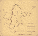
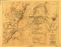
 General
plan of the field-fortifications around Corinth, Miss.
: also exhibiting the rebel entrenchments and the approaches
of the U.S. forces during May 1862 under Major Genl. H.
W. Halleck, U.S.A. / surveyed and drawn under the direction
of Captain Fred. E. Prime, Corps of Engineers, Chief Engineer,
Department of Tennessee ; surveyed and drawn by F. Shraag
and F. Theinert. Shraag, F. CREATED/PUBLISHED [1862] NOTES
Relief shown by hachures and pictorially. Detailed topographic
map showing Union and Confederate fortifications by the
colors blue and red respectively, powder magazines, city
streets and buildings (both unnamed), rural houses and
names of a few residents, fences, roads, railroads, vegetation,
drainage, and artesian wells. General
plan of the field-fortifications around Corinth, Miss.
: also exhibiting the rebel entrenchments and the approaches
of the U.S. forces during May 1862 under Major Genl. H.
W. Halleck, U.S.A. / surveyed and drawn under the direction
of Captain Fred. E. Prime, Corps of Engineers, Chief Engineer,
Department of Tennessee ; surveyed and drawn by F. Shraag
and F. Theinert. Shraag, F. CREATED/PUBLISHED [1862] NOTES
Relief shown by hachures and pictorially. Detailed topographic
map showing Union and Confederate fortifications by the
colors blue and red respectively, powder magazines, city
streets and buildings (both unnamed), rural houses and
names of a few residents, fences, roads, railroads, vegetation,
drainage, and artesian wells. |
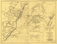
 Map
of the country between Monterey, Tenn: & Corinth, Miss:
showing the lines of entrenchments made & the routes followed
by the U.S. forces under the command of Maj. Genl. Halleck,
U.S. Army, in their advance upon Corinth in May 1862:
Surveyed under the direction of Col. Geo. Thom, A.D.C.
& Chief of Topl. Engrs., Department of the Mississippi,
by Lieuts. Fred. Schraag and C. L. Spangenberg, Asst.
Topl. Engrs. and drawn by Lieut. Otto H. Matz, Asst. Topl.
Engr. Matz, Otto H. CREATED/PUBLISHED N.Y., Lith. of J.
Bien, [1862] NOTES Scale 1:31,680. Includes houses, names
of residents, fences, roads, railroads, vegetation, fields,
drainage, and relief by hachures. Map
of the country between Monterey, Tenn: & Corinth, Miss:
showing the lines of entrenchments made & the routes followed
by the U.S. forces under the command of Maj. Genl. Halleck,
U.S. Army, in their advance upon Corinth in May 1862:
Surveyed under the direction of Col. Geo. Thom, A.D.C.
& Chief of Topl. Engrs., Department of the Mississippi,
by Lieuts. Fred. Schraag and C. L. Spangenberg, Asst.
Topl. Engrs. and drawn by Lieut. Otto H. Matz, Asst. Topl.
Engr. Matz, Otto H. CREATED/PUBLISHED N.Y., Lith. of J.
Bien, [1862] NOTES Scale 1:31,680. Includes houses, names
of residents, fences, roads, railroads, vegetation, fields,
drainage, and relief by hachures. |
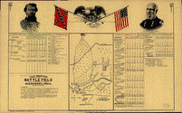 Map
showing the battle field at Harrisburg, Miss. July 13-15,
1864. Allman, Eugene H. CREATED/PUBLISHED Mobile, Alabama,
Aynsley Litho. & Eng. Co. Inc., c1912. NOTES Scale not
given. "Legend: This map shows the position of the Confederate
and the Federal forces during the three days encounter,
showing in detail the position of the several commands.
"The tables show the record of casualties, in offices
[sic] and men, killed, wounded and captured during the
three days, as compiled from the official records of the
Union and Confederate armies, and is authentic. Indicates
entrenchments, batteries, roads, towns, vegetation, drainage,
and some relief by hachures. There are colored portraits
of "Maj. Gen. Nathan B. Forrest, C.S. Army" and "Maj.
Gen. Andrew J. Smith, U.S. Army" in the top margin, as
well as a drawing of an eagle perched on the crossed flags
of the Confederate States and United States with "at peace"
printed below the flags. Map
showing the battle field at Harrisburg, Miss. July 13-15,
1864. Allman, Eugene H. CREATED/PUBLISHED Mobile, Alabama,
Aynsley Litho. & Eng. Co. Inc., c1912. NOTES Scale not
given. "Legend: This map shows the position of the Confederate
and the Federal forces during the three days encounter,
showing in detail the position of the several commands.
"The tables show the record of casualties, in offices
[sic] and men, killed, wounded and captured during the
three days, as compiled from the official records of the
Union and Confederate armies, and is authentic. Indicates
entrenchments, batteries, roads, towns, vegetation, drainage,
and some relief by hachures. There are colored portraits
of "Maj. Gen. Nathan B. Forrest, C.S. Army" and "Maj.
Gen. Andrew J. Smith, U.S. Army" in the top margin, as
well as a drawing of an eagle perched on the crossed flags
of the Confederate States and United States with "at peace"
printed below the flags. |
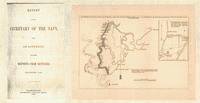
 Sketch
of rebel fortifications at Hayne's Bluff. United States.
Navy. CREATED/PUBLISHED [S.l., 1863] NOTES Scale ca. 1:23,000. Sketch
of rebel fortifications at Hayne's Bluff. United States.
Navy. CREATED/PUBLISHED [S.l., 1863] NOTES Scale ca. 1:23,000.
|
 Map
of the battle of Iuka, Mississippi, showing the positions
of the United States and Confederate troops on the 19th
of September 1862 Accompanying the report of Maj. Gen.
W. S. Rosecrans. Published by authority of the Hon. the
Secretary of War, office of the Chief of Engineers, U.S.
Army. United States. Army. Corps of Engineers. CREATED/PUBLISHED
[S.l.], 1876. NOTES Scale 1:6336. "The United States forces
are shown in blue [and] the Confederate forces are shown
in red." Detailed map indicating roads, the "route to
heights commanding Fulton Road," street pattern and buildings
in Iuka, houses and names of residents in outlying areas,
fences, "Memphis & Charleston R.R.," vegetation, drainage,
and relief by hachures. Map
of the battle of Iuka, Mississippi, showing the positions
of the United States and Confederate troops on the 19th
of September 1862 Accompanying the report of Maj. Gen.
W. S. Rosecrans. Published by authority of the Hon. the
Secretary of War, office of the Chief of Engineers, U.S.
Army. United States. Army. Corps of Engineers. CREATED/PUBLISHED
[S.l.], 1876. NOTES Scale 1:6336. "The United States forces
are shown in blue [and] the Confederate forces are shown
in red." Detailed map indicating roads, the "route to
heights commanding Fulton Road," street pattern and buildings
in Iuka, houses and names of residents in outlying areas,
fences, "Memphis & Charleston R.R.," vegetation, drainage,
and relief by hachures. |
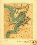
 Map
of Jackson, Miss: and surroundings during the siege July
10th-16th, 1863, and location of the Cooper home whence
a piano was carried by a company of pioneers, commanded
by a Capt: McPheely, to the position of 5th Company, Washington
(Louisiana) Battery, and there remained during the siege,
and played upon while the battle, July 12th, 1863, was
in progress. Duff, William H. CREATED/PUBLISHED [S.l.],
c1908. NOTES Scale not given. Sketch map showing the "Confederate's
line of works," positions of "Slocomb's Louisiana Battery"
and "Cobb's Kentucky Battery," "Federal line," "Mrs. Cooper's
home," railroads, roads, and drainage. Map
of Jackson, Miss: and surroundings during the siege July
10th-16th, 1863, and location of the Cooper home whence
a piano was carried by a company of pioneers, commanded
by a Capt: McPheely, to the position of 5th Company, Washington
(Louisiana) Battery, and there remained during the siege,
and played upon while the battle, July 12th, 1863, was
in progress. Duff, William H. CREATED/PUBLISHED [S.l.],
c1908. NOTES Scale not given. Sketch map showing the "Confederate's
line of works," positions of "Slocomb's Louisiana Battery"
and "Cobb's Kentucky Battery," "Federal line," "Mrs. Cooper's
home," railroads, roads, and drainage. |
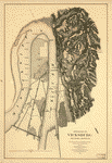
 Vicksburg
National Military Park. Vicksburg National Park Commission.
CREATED/PUBLISHED [S.l.] Topographical survey, 1902. NOTES
Scale 1:2500. Large-scale topographic map showing contour
lines, drainage, and fortifications in the vicinity of
the Alabama and Vicksburg R.R. at Two Mile Bridge. Vicksburg
National Military Park. Vicksburg National Park Commission.
CREATED/PUBLISHED [S.l.] Topographical survey, 1902. NOTES
Scale 1:2500. Large-scale topographic map showing contour
lines, drainage, and fortifications in the vicinity of
the Alabama and Vicksburg R.R. at Two Mile Bridge. |
 The
Vicksburg National Military Park and vicinity showing
lines of siege and defense of the city. National cemetery
in background. Poole Brothers. CREATED/PUBLISHED Chicago,
Poole Bros., c1925. NOTES Scale not given. Panoramic map
in which "black lines indicate the Union trenches," "red
lines indicate the Confederate line of defense," "white
lines show the park roads," and "the stars mark general
headquarters." The
Vicksburg National Military Park and vicinity showing
lines of siege and defense of the city. National cemetery
in background. Poole Brothers. CREATED/PUBLISHED Chicago,
Poole Bros., c1925. NOTES Scale not given. Panoramic map
in which "black lines indicate the Union trenches," "red
lines indicate the Confederate line of defense," "white
lines show the park roads," and "the stars mark general
headquarters." |
 ksburg
National Military Park, Miss. Albert Pike, Division Engineer.
Topography by Frank Larner, H. G. Warner, and J. G. Harrison.
Control by U.S. Geological Survey. Surveyed in 1935. Geological
Survey (U.S.) CREATED/PUBLISHED [Washington, U.S. Geological
Survey, 1935] NOTES Scale 1:9600. Detailed topographic
map. Contour interval 10 feet. Includes a detailed list
of monuments, markers, batteries, and approaches keyed
by number to the map. ksburg
National Military Park, Miss. Albert Pike, Division Engineer.
Topography by Frank Larner, H. G. Warner, and J. G. Harrison.
Control by U.S. Geological Survey. Surveyed in 1935. Geological
Survey (U.S.) CREATED/PUBLISHED [Washington, U.S. Geological
Survey, 1935] NOTES Scale 1:9600. Detailed topographic
map. Contour interval 10 feet. Includes a detailed list
of monuments, markers, batteries, and approaches keyed
by number to the map. |
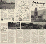
 Vicksburg
National Military Park and Vicksburg National Cemetery.
United States. National Park Service. CREATED/PUBLISHED
[S.l.], reprint 1952. NOTES Scale ca. 1:62,000. Illustrates
a descriptive leaflet by the U.S. National Park Service
entitled "Vicksburg National Military Park, Mississippi."
Map indicates Union and Confederate lines, "significant
structures" in the park, a park tour, roads, and railroads. Vicksburg
National Military Park and Vicksburg National Cemetery.
United States. National Park Service. CREATED/PUBLISHED
[S.l.], reprint 1952. NOTES Scale ca. 1:62,000. Illustrates
a descriptive leaflet by the U.S. National Park Service
entitled "Vicksburg National Military Park, Mississippi."
Map indicates Union and Confederate lines, "significant
structures" in the park, a park tour, roads, and railroads.
|
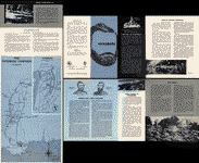
 Vicksburg
National Military Park, Mississippi. United States. National
Park Service. CREATED/PUBLISHED [Washington], Government
Printing Office, 1958. NOTES Scale ca. 1:62,000. Descriptive
leaflet illustrated with the following two maps: [a] Vicksburg
National Military Park, Mississippi. Colored. Scale ca.
1:14,400. 11 x 22 cm. (Shows names of commander roads,
railroad, and tour route.) [b] The Vicksburg campaign.
Aug. 1962. Colored. Scale ca. 1:2,350,000. 40 x 23 cm.
(Map of the Mississippi River from Memphis to the Gulf
of Mexico showing drainage, railroads, and towns.) Vicksburg
National Military Park, Mississippi. United States. National
Park Service. CREATED/PUBLISHED [Washington], Government
Printing Office, 1958. NOTES Scale ca. 1:62,000. Descriptive
leaflet illustrated with the following two maps: [a] Vicksburg
National Military Park, Mississippi. Colored. Scale ca.
1:14,400. 11 x 22 cm. (Shows names of commander roads,
railroad, and tour route.) [b] The Vicksburg campaign.
Aug. 1962. Colored. Scale ca. 1:2,350,000. 40 x 23 cm.
(Map of the Mississippi River from Memphis to the Gulf
of Mexico showing drainage, railroads, and towns.) |
 Vicksburg
National Military Park, Mississippi. United States. National
Park Service. CREATED/PUBLISHED [Washington], Government
Printing Office, 1963. NOTES Various scales. Descriptive
leaflet illustrated with the following two maps: [a] Vicksburg
National Military Park, Mississippi. Colored. Scale ca.
1:14,400. 11 x 22 cm. (Shows names of commander roads,
railroad, and tour route.) [b] The Vicksburg campaign.
Aug. 1962. Colored. Scale ca. 1:2,350,000. 40 x 23 cm.
(Map of the Mississippi River from Memphis to the Gulf
of Mexico showing drainage, railroads, and towns.) Vicksburg
National Military Park, Mississippi. United States. National
Park Service. CREATED/PUBLISHED [Washington], Government
Printing Office, 1963. NOTES Various scales. Descriptive
leaflet illustrated with the following two maps: [a] Vicksburg
National Military Park, Mississippi. Colored. Scale ca.
1:14,400. 11 x 22 cm. (Shows names of commander roads,
railroad, and tour route.) [b] The Vicksburg campaign.
Aug. 1962. Colored. Scale ca. 1:2,350,000. 40 x 23 cm.
(Map of the Mississippi River from Memphis to the Gulf
of Mexico showing drainage, railroads, and towns.) |
 Vicksburg
National Military Park, Mississippi. United States. National
Park Service. CREATED/PUBLISHED [Washington, U.S. Govt.
Print. Off., 1969] NOTES Scale ca. 1:34,000. Includes
descriptive index and illus. Vicksburg
National Military Park, Mississippi. United States. National
Park Service. CREATED/PUBLISHED [Washington, U.S. Govt.
Print. Off., 1969] NOTES Scale ca. 1:34,000. Includes
descriptive index and illus. |
 Vicksburg
National Military Park. United States. National Park Service.
CREATED/PUBLISHED [Washington, U.S. Govt. Print. Off.]
1973. NOTES Scale ca. 1:28,000. Folded title: Vicksburg
National Military Park, Mississippi. Includes descriptive
index, text, and illus. Vicksburg
National Military Park. United States. National Park Service.
CREATED/PUBLISHED [Washington, U.S. Govt. Print. Off.]
1973. NOTES Scale ca. 1:28,000. Folded title: Vicksburg
National Military Park, Mississippi. Includes descriptive
index, text, and illus. |
 Approaches
to Vicksburg and Rebel defences From a reconnaissance
by C. Fendall, Sub. Assist., under the direction of F.
H. Gerdes, Assist., assigned by A. D. Bache, Supdt., U.S.
Coast Survey, to act under orders of Rear Admiral D. D.
Porter, U.S. Navy, commanding Mississippi Squadron. Fendall,
C. CREATED/PUBLISHED [S.l.] 1863. NOTES Scale 1:20,000.
Indicates fortifications, names and positions of boats,
roads, streets, railroads, canal across De Soto Point,
houses, vegetation, drainage, and relief by hachures. Approaches
to Vicksburg and Rebel defences From a reconnaissance
by C. Fendall, Sub. Assist., under the direction of F.
H. Gerdes, Assist., assigned by A. D. Bache, Supdt., U.S.
Coast Survey, to act under orders of Rear Admiral D. D.
Porter, U.S. Navy, commanding Mississippi Squadron. Fendall,
C. CREATED/PUBLISHED [S.l.] 1863. NOTES Scale 1:20,000.
Indicates fortifications, names and positions of boats,
roads, streets, railroads, canal across De Soto Point,
houses, vegetation, drainage, and relief by hachures.
|
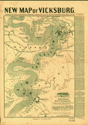
 Map
illustrating the operations of the U.S. forces against
Vicksburg. United States Coast Survey. CREATED/PUBLISHED
[S.l.], J. W. Maedel, [1863] NOTES Scale ca. 1:390,000.
"Indicates "Genl. Grant's track," "Union forces surrounding
Vicksburg," and "track of Genl. Blair." Roads, railroads,
drainage, and towns are shown. "Union victories" are noted
by colored U.S. flags. Map
illustrating the operations of the U.S. forces against
Vicksburg. United States Coast Survey. CREATED/PUBLISHED
[S.l.], J. W. Maedel, [1863] NOTES Scale ca. 1:390,000.
"Indicates "Genl. Grant's track," "Union forces surrounding
Vicksburg," and "track of Genl. Blair." Roads, railroads,
drainage, and towns are shown. "Union victories" are noted
by colored U.S. flags. |
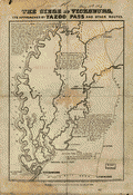 The
siege of Vicksburg, its approaches by Yazoo Pass and other
routes T. S. Hardee, del. W. R. Robertson, Mobile, Ala.,
lith. Mobile, S. H. Goetzel & Co., May 1st, 1863. Hardee,
T. S. CREATED/PUBLISHED [Mobile S. H. Goetzel & Co. 1863]
NOTES Scale not given. Gives towns, Fort Pemberton, railroads,
drainage, and the location of "Gen. Grant's Army 75000"
opposite Vicksburg. Brief notes describe the "land lying
between the Mississippi and Yazoo rivers" and the first
and second "inland expedition[s] of the enemy." The
siege of Vicksburg, its approaches by Yazoo Pass and other
routes T. S. Hardee, del. W. R. Robertson, Mobile, Ala.,
lith. Mobile, S. H. Goetzel & Co., May 1st, 1863. Hardee,
T. S. CREATED/PUBLISHED [Mobile S. H. Goetzel & Co. 1863]
NOTES Scale not given. Gives towns, Fort Pemberton, railroads,
drainage, and the location of "Gen. Grant's Army 75000"
opposite Vicksburg. Brief notes describe the "land lying
between the Mississippi and Yazoo rivers" and the first
and second "inland expedition[s] of the enemy." |
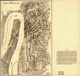
 Map
of the siege of Vicksburg, Miss. by the U.S. forces under
the command of Maj. Genl. U.S. Grant, U.S. Vls. Maj. F.
E. Prime, Chief Engr. Surveyed and constructed under the
direction of Capt. C. B. Comstock, U.S. Engrs. and Lt.
Col. Js. H. Wilson, A. I. Genl., 1st Lt. Engrs., by Major
Otto H. Matz, Ills. Vols., Chs. Spangenberg, Asst. Engr.,
Lts. Patton, Karnasch & Helmle, Mo. Vols., L. Zwanziger,
S. R. Tresilian, B. Barth, S. Hartwell, Asst. Engs. Drawn
by Chs. Spangenberg, Asst. Engr. Engr. on stone by J.
Schedler, N.Y. Vicksburg, Miss., Head Qrs. of the Dept.
of the Tenn., Aug. 20th, 1863. Spangenberg, Charles. CREATED/PUBLISHED
[Vicksburg, Miss., Head Qrs. of the Dept. of the Tenn.,
1863] NOTES Scale ca. 1:17,000 (not "1:15,840"). Detailed
map showing entrenchments, roads, streets, railroads,
hachures, vegetation, houses, and drainage. Contains five
topographic profiles, six cross sections of artillery
batteries, and one cross section of a "rebel rifle pit." Map
of the siege of Vicksburg, Miss. by the U.S. forces under
the command of Maj. Genl. U.S. Grant, U.S. Vls. Maj. F.
E. Prime, Chief Engr. Surveyed and constructed under the
direction of Capt. C. B. Comstock, U.S. Engrs. and Lt.
Col. Js. H. Wilson, A. I. Genl., 1st Lt. Engrs., by Major
Otto H. Matz, Ills. Vols., Chs. Spangenberg, Asst. Engr.,
Lts. Patton, Karnasch & Helmle, Mo. Vols., L. Zwanziger,
S. R. Tresilian, B. Barth, S. Hartwell, Asst. Engs. Drawn
by Chs. Spangenberg, Asst. Engr. Engr. on stone by J.
Schedler, N.Y. Vicksburg, Miss., Head Qrs. of the Dept.
of the Tenn., Aug. 20th, 1863. Spangenberg, Charles. CREATED/PUBLISHED
[Vicksburg, Miss., Head Qrs. of the Dept. of the Tenn.,
1863] NOTES Scale ca. 1:17,000 (not "1:15,840"). Detailed
map showing entrenchments, roads, streets, railroads,
hachures, vegetation, houses, and drainage. Contains five
topographic profiles, six cross sections of artillery
batteries, and one cross section of a "rebel rifle pit."
|
 Vicksburg
and its defences. Constructed and engraved to illustrate
"The war with the South" [Compiled by Charles Sholl] Engd.
by W. Kemble. Sholl, Charles. CREATED/PUBLISHED [S.l.],
c1863. NOTES Scale ca. 1:72,500. Caption in lower margin:
A topographical map of Vicksburg & its vicinity showing
all batteries that were in existence at the time of its
fall, with the names of the owners of plantations, &c. Vicksburg
and its defences. Constructed and engraved to illustrate
"The war with the South" [Compiled by Charles Sholl] Engd.
by W. Kemble. Sholl, Charles. CREATED/PUBLISHED [S.l.],
c1863. NOTES Scale ca. 1:72,500. Caption in lower margin:
A topographical map of Vicksburg & its vicinity showing
all batteries that were in existence at the time of its
fall, with the names of the owners of plantations, &c.
|
 Environs
of Vicksburg, Mississippi, 1863] / U.S. Coast Survey,
A.D. Bache, supdt. United States Coast Survey. CREATED/PUBLISHED
[Washington, D.C.] : The Survey, 1863. NOTES Relief shown
by hachures. Depths shown by form lines. Maps of "Yazoo
River defences at Walnut Hills" and "Haines Bluff" autogr.
by Hausmann. Yazoo River defences at Walnut Hills, near
Vicksburg, Miss. : occupied by the U.S. Naval Forces,
May 20, 1863 / surveyed for Rear Adminral D.D. Porter,
commanding Mississippi flotilla, by sub. asst., C. Fendall
-- Haines Bluff, Miss. : showing the positions of the
attacking gunboats, April 30th, May 1st, 1863 / sketched
by C. Fendall ... under direction of Rear Admiral D.D.
Porter -- Vicksburg and vicinity / surveyed by C. Fendall
& A. Strausz, under the direction of Real Admiral D.C.
Porter -- Survey of a canal connecting Walnut Bayou with
the Mississippi River : dug by the U.S. Forces under Genl.
Grant in April 1863 / surveyed by C. Fendall & A. Strausz. Environs
of Vicksburg, Mississippi, 1863] / U.S. Coast Survey,
A.D. Bache, supdt. United States Coast Survey. CREATED/PUBLISHED
[Washington, D.C.] : The Survey, 1863. NOTES Relief shown
by hachures. Depths shown by form lines. Maps of "Yazoo
River defences at Walnut Hills" and "Haines Bluff" autogr.
by Hausmann. Yazoo River defences at Walnut Hills, near
Vicksburg, Miss. : occupied by the U.S. Naval Forces,
May 20, 1863 / surveyed for Rear Adminral D.D. Porter,
commanding Mississippi flotilla, by sub. asst., C. Fendall
-- Haines Bluff, Miss. : showing the positions of the
attacking gunboats, April 30th, May 1st, 1863 / sketched
by C. Fendall ... under direction of Rear Admiral D.D.
Porter -- Vicksburg and vicinity / surveyed by C. Fendall
& A. Strausz, under the direction of Real Admiral D.C.
Porter -- Survey of a canal connecting Walnut Bayou with
the Mississippi River : dug by the U.S. Forces under Genl.
Grant in April 1863 / surveyed by C. Fendall & A. Strausz.
|
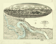 View
of Vicksburg and plan of the canal, fortifications & vicinity
Surveyed by Lieut. L. A. Wrotnowski, Top: Engr. Drawn
& lithogd. by A. F. Wrotnowski C.E. Wrotnowski, L. A.
CREATED/PUBLISHED [S.l.], 1863. NOTES Scale 1:63,360.
Indicates fortifications, location, type and names of
boats, roads, railroads, levees, drainage, vegetation,
and the names of a few residents. Inset: [View of Vicksburg]
17 x 54 cm. View
of Vicksburg and plan of the canal, fortifications & vicinity
Surveyed by Lieut. L. A. Wrotnowski, Top: Engr. Drawn
& lithogd. by A. F. Wrotnowski C.E. Wrotnowski, L. A.
CREATED/PUBLISHED [S.l.], 1863. NOTES Scale 1:63,360.
Indicates fortifications, location, type and names of
boats, roads, railroads, levees, drainage, vegetation,
and the names of a few residents. Inset: [View of Vicksburg]
17 x 54 cm. |
 linson's
map of Vicksburg, showing all the surrounding fortifications,
batteries, principal plantation, &c. Tomlinson, G. W.
(George W.) CREATED/PUBLISHED Boston, J. Mayer & Co.,
lith., c1863. NOTES Scale ca. 1:65,000. At top of map:
New map of Vicksburg, showing the scene of Gen. Grants
operations, together with all of the fortifications, batteries,
rifle pits &c. Text to right of map: Sketch of Vicksburg
and the surrounding batteries. linson's
map of Vicksburg, showing all the surrounding fortifications,
batteries, principal plantation, &c. Tomlinson, G. W.
(George W.) CREATED/PUBLISHED Boston, J. Mayer & Co.,
lith., c1863. NOTES Scale ca. 1:65,000. At top of map:
New map of Vicksburg, showing the scene of Gen. Grants
operations, together with all of the fortifications, batteries,
rifle pits &c. Text to right of map: Sketch of Vicksburg
and the surrounding batteries. |
 Map
of the siege of Vicksburg. [1864]. Badeau, Adam. CREATED/PUBLISHED
[S.l., 1885] NOTES Scale not given. From Century illustrated
monthly magazine, v. 30, Sept. 1885. p. 756. Shows fortifications,
"Maj. Gen. Grant's Hd. Qrs. during the siege," street
pattern of Vicksburg, houses, roads, railroads, drainage,
vegetation, and relief by hachures. Map
of the siege of Vicksburg. [1864]. Badeau, Adam. CREATED/PUBLISHED
[S.l., 1885] NOTES Scale not given. From Century illustrated
monthly magazine, v. 30, Sept. 1885. p. 756. Shows fortifications,
"Maj. Gen. Grant's Hd. Qrs. during the siege," street
pattern of Vicksburg, houses, roads, railroads, drainage,
vegetation, and relief by hachures. |
 Map
of the siege of Vicksburg, Miss. Vicksburg, Miss., Aug.
20th 1863 C. B. Comstock, Capt. of Engrs. Spangenberg,
Charles. CREATED/PUBLISHED [Jackson Mississippi State
Geological Survey 1935] NOTES Scale ca. 1:29,250. Map
of the siege of Vicksburg, Miss. Vicksburg, Miss., Aug.
20th 1863 C. B. Comstock, Capt. of Engrs. Spangenberg,
Charles. CREATED/PUBLISHED [Jackson Mississippi State
Geological Survey 1935] NOTES Scale ca. 1:29,250. |
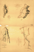
 Map
showing the route of the late expedition, commanded by
Rear Admiral Porter, U.S.N., in attempting to get into
the Yazoo River by the way of Steel's Bluff [i.e., Bayou]
and Deer Creek. United States. Navy. CREATED/PUBLISHED
[S.l., 1863] NOTES Scale ca. 1:500,000. Inset: Plan showing
the place from which Gunboats first commenced to fall
back, to open communications behind them, which had been
obstructed. Scale ca. 1:36,000. 10 x 7 cm. Map
showing the route of the late expedition, commanded by
Rear Admiral Porter, U.S.N., in attempting to get into
the Yazoo River by the way of Steel's Bluff [i.e., Bayou]
and Deer Creek. United States. Navy. CREATED/PUBLISHED
[S.l., 1863] NOTES Scale ca. 1:500,000. Inset: Plan showing
the place from which Gunboats first commenced to fall
back, to open communications behind them, which had been
obstructed. Scale ca. 1:36,000. 10 x 7 cm. |
 Map
of operations of the Yazoo Pass expedition under command
of Lt. Com. Watson Smith, U.S.N., 1863. United States.
Navy. CREATED/PUBLISHED [S.l., 1863] NOTES Scale ca. 1:225,000.
Map of the attack of the Yazoo Pass Expedition on Confederate
Fort Pemberton, near Greenwood, Mississippi, March-April,
1863. Map illustrates "Addition report of Lieutenant Commander
[James P.] Foster" dated April 13, 1863. Map
of operations of the Yazoo Pass expedition under command
of Lt. Com. Watson Smith, U.S.N., 1863. United States.
Navy. CREATED/PUBLISHED [S.l., 1863] NOTES Scale ca. 1:225,000.
Map of the attack of the Yazoo Pass Expedition on Confederate
Fort Pemberton, near Greenwood, Mississippi, March-April,
1863. Map illustrates "Addition report of Lieutenant Commander
[James P.] Foster" dated April 13, 1863. |
 Route
of the late expedtion [sic] commanded by Act'g. Rear Admiral
D. D. Porter U.S.N. attempting to get into the Yazoo River
by the way of Steels Bayou and Deer Creek Compiled & drawn
by A. Strausz, U.S. Coast Survey. Strausz, A. CREATED/PUBLISHED
[Washington], U.S. Coast Survey, 1863. NOTES Scale ca.
1:215,000. "The shaded bayou shows the route actually
travelled by the gun boats. The doted line shows the remaining
proposed route." Indicates the location of bridges, Indian
mounds, and names or residents along Deer Creek. Route
of the late expedtion [sic] commanded by Act'g. Rear Admiral
D. D. Porter U.S.N. attempting to get into the Yazoo River
by the way of Steels Bayou and Deer Creek Compiled & drawn
by A. Strausz, U.S. Coast Survey. Strausz, A. CREATED/PUBLISHED
[Washington], U.S. Coast Survey, 1863. NOTES Scale ca.
1:215,000. "The shaded bayou shows the route actually
travelled by the gun boats. The doted line shows the remaining
proposed route." Indicates the location of bridges, Indian
mounds, and names or residents along Deer Creek. |
 Map
of the alluvial region of the Mississippi Prepared to
accompany the report of Capt. A. A. Humphreys and Lieut
H. L. Abbot, Corps. of Top'l. Engrs., U.S.A. to the Bureau
of Topl. Engrs., War Dept. Drawn by Chs. Mahon. Mahon,
Charles. CREATED/PUBLISHED [S.l., 1861] NOTES Scale 1:1,500,000.Map
of the Mississippi River from Cape Girardeau to the delta
showing the extent of the alluvial region. Map
of the alluvial region of the Mississippi Prepared to
accompany the report of Capt. A. A. Humphreys and Lieut
H. L. Abbot, Corps. of Top'l. Engrs., U.S.A. to the Bureau
of Topl. Engrs., War Dept. Drawn by Chs. Mahon. Mahon,
Charles. CREATED/PUBLISHED [S.l., 1861] NOTES Scale 1:1,500,000.Map
of the Mississippi River from Cape Girardeau to the delta
showing the extent of the alluvial region. |
 Map
of the alluvial region of the Mississippi [Prepared to
accompany the report of Capt. A. A. Humphreys and Lieut
H. L. Abbot, Corps. of Top'l. Engrs., U.S.A. to the Bureau
of Topl. Engrs., War Dept. Drawn by Chs. Mahon] Mahon,
Charles. CREATED/PUBLISHED Phil. Bowen & Co. lith. [1861]
NOTES Scale 1:1,500,000. Map
of the alluvial region of the Mississippi [Prepared to
accompany the report of Capt. A. A. Humphreys and Lieut
H. L. Abbot, Corps. of Top'l. Engrs., U.S.A. to the Bureau
of Topl. Engrs., War Dept. Drawn by Chs. Mahon] Mahon,
Charles. CREATED/PUBLISHED Phil. Bowen & Co. lith. [1861]
NOTES Scale 1:1,500,000. |
  Grierson's
route from La Grange to Baton Rouge. [April 17-May 2,
1863]. CREATED/PUBLISHED [S.l., 1863] NOTES Scale ca.
1:3,625,000. From "Monthly record of current events,"
Harper's new monthly magazine, v. 27, June-Nov., 1863
p. 271. Map of "The seat of war on the Mississippi" is
on the verso. 18 x 13 cm. Grierson's
route from La Grange to Baton Rouge. [April 17-May 2,
1863]. CREATED/PUBLISHED [S.l., 1863] NOTES Scale ca.
1:3,625,000. From "Monthly record of current events,"
Harper's new monthly magazine, v. 27, June-Nov., 1863
p. 271. Map of "The seat of war on the Mississippi" is
on the verso. 18 x 13 cm. |
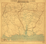 Southern
Mississippi and Alabama : showing the approaches to Mobile
/ Coast Survey Office, A.D. Bache, supt. United States
Coast Survey. CREATED/PUBLISHED [Washington, D.C.] : The
Office, 1863. NOTES Covers the area west to east, from
Jackson, Miss. to Montgomery, Ala. and north to south,
from Philadelphia, Miss./Centreville, Ala. to Gulf of
Mexico. Southern
Mississippi and Alabama : showing the approaches to Mobile
/ Coast Survey Office, A.D. Bache, supt. United States
Coast Survey. CREATED/PUBLISHED [Washington, D.C.] : The
Office, 1863. NOTES Covers the area west to east, from
Jackson, Miss. to Montgomery, Ala. and north to south,
from Philadelphia, Miss./Centreville, Ala. to Gulf of
Mexico. |
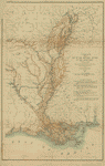
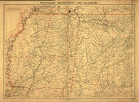 Southern
Mississippi and Alabama Compiled and engraved at the U.S.
Coast Survey Office, from state maps, post office maps,
local surveys, etc., with additions from campaign maps
and information furnished by Capt. O. M. Poe, Chief Engineer,
Military Division of the Mississippi and by Capt. W. E.
Merrill, Chief Engineer, Department of the Cumberland.
Drawn by A. Lindenkohl. Lindenkohl, A. CREATED/PUBLISHED
[S.l., H. Lindenkohl & Chas. G. Krebs, lith.], 1864. NOTES
Scale 1:633,600. General map indicating cities and towns,
roads and railroads, rivers, and some relief by hachures.
The map is overprinted in red to show state names and
highlight state boundaries and railroads. Southern
Mississippi and Alabama Compiled and engraved at the U.S.
Coast Survey Office, from state maps, post office maps,
local surveys, etc., with additions from campaign maps
and information furnished by Capt. O. M. Poe, Chief Engineer,
Military Division of the Mississippi and by Capt. W. E.
Merrill, Chief Engineer, Department of the Cumberland.
Drawn by A. Lindenkohl. Lindenkohl, A. CREATED/PUBLISHED
[S.l., H. Lindenkohl & Chas. G. Krebs, lith.], 1864. NOTES
Scale 1:633,600. General map indicating cities and towns,
roads and railroads, rivers, and some relief by hachures.
The map is overprinted in red to show state names and
highlight state boundaries and railroads. |
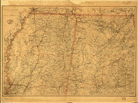 Southern
Mississippi and Alabama] Drawn by A. Lindenkohl. H. Lindenkohl
& Chas. G. Krebs, lith. Lindenkohl, A. CREATED/PUBLISHED
[S.l.], U.S. Coast Survey, A. D. Bache, Supdt., 1865.
NOTES Scale 1:633,600. General map, without title. State
names, boundaries, and railroads are colored red. Southern
Mississippi and Alabama] Drawn by A. Lindenkohl. H. Lindenkohl
& Chas. G. Krebs, lith. Lindenkohl, A. CREATED/PUBLISHED
[S.l.], U.S. Coast Survey, A. D. Bache, Supdt., 1865.
NOTES Scale 1:633,600. General map, without title. State
names, boundaries, and railroads are colored red. |
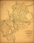
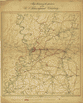
 Map
of the country between Millikens Bend, La. and Jackson,
Miss. shewing the routes followed by the Army of the Tennessee
under the command of Maj. Genl. U.S. Grant, U.S. Vols.
in its march from Millikens Bend to the rear of Vicksburg
in April and May 1863. Wilson, Js. H. CREATED/PUBLISHED
N.Y., Julius Bien & Co., photo lith., 1876. NOTES Scale
1:126,720. Drawn by: Maj. O. H. Matz, Asst. Eng. & 1st
Lt. L. Helmle, 3d Mo. Vols. Inft. Surveys by: 1st Lt.
P. C. Hains, U.S. Eng. & Asst. Engrs. Ulffers, Wrigley,
Tunica, McComas & Mason. Geographl. authorities: La Tourette's
sectl. map, U.S. land surveys, official county and city
maps." Map of Hinds and Warren counties, Mississippi and
parts of Claiborne County, Mississippi, and Madison County,
Louisiana, showing Union positions in blue and Confederate
positions in red, fortifications, "routes followed by
the army of the Tenn.," roads, railroads, drainage, some
vegetation along the Mississippi River, towns, relief
by hachures, and a few houses and names of residents.
Legend contains a brief description of the "face of country,"
"soil," "productions," "roads," "streams," "fords," and
"bayous." Map
of the country between Millikens Bend, La. and Jackson,
Miss. shewing the routes followed by the Army of the Tennessee
under the command of Maj. Genl. U.S. Grant, U.S. Vols.
in its march from Millikens Bend to the rear of Vicksburg
in April and May 1863. Wilson, Js. H. CREATED/PUBLISHED
N.Y., Julius Bien & Co., photo lith., 1876. NOTES Scale
1:126,720. Drawn by: Maj. O. H. Matz, Asst. Eng. & 1st
Lt. L. Helmle, 3d Mo. Vols. Inft. Surveys by: 1st Lt.
P. C. Hains, U.S. Eng. & Asst. Engrs. Ulffers, Wrigley,
Tunica, McComas & Mason. Geographl. authorities: La Tourette's
sectl. map, U.S. land surveys, official county and city
maps." Map of Hinds and Warren counties, Mississippi and
parts of Claiborne County, Mississippi, and Madison County,
Louisiana, showing Union positions in blue and Confederate
positions in red, fortifications, "routes followed by
the army of the Tenn.," roads, railroads, drainage, some
vegetation along the Mississippi River, towns, relief
by hachures, and a few houses and names of residents.
Legend contains a brief description of the "face of country,"
"soil," "productions," "roads," "streams," "fords," and
"bayous." |
 Map
of the country between Millikens Bend, La. and Jackson,
Miss. shewing the routes followed by the Army of the Tennessee
under the command of Maj. Genl. U.S. Grant, U.S. Vols.
in its march from Millikens Bend to the rear of Vicksburg
in April and May 1863; compiled, surveyed and drawn under
the direction of Lt. Col. Js. H. Wilson, A.I. Gnl. & 1st
Lt. Engrs. Published by authority of the Hon. the Secretary
of War. Office of the Chief of Engineers, U.S. Army.]
Drawn on stone by John D. Hoffmann. Wilson, Js. H. CREATED/PUBLISHED
Washington, D.C., Lith. of J. F. Gedney, 1876 NOTES Scale
1:126,720. Another edition. Similar to the preceding map
but drawn on stone by Hoffmann and lithographed by Gedney
instead of Bien. This edition denotes the positions of
the Union and Confederate troops by symbols rather than
by colors, and the legend lacks the statement "Published
by authority of the Hon. the Secretary of War. Office
of the Chief of Engineers, U.S. Army. 1876." Map
of the country between Millikens Bend, La. and Jackson,
Miss. shewing the routes followed by the Army of the Tennessee
under the command of Maj. Genl. U.S. Grant, U.S. Vols.
in its march from Millikens Bend to the rear of Vicksburg
in April and May 1863; compiled, surveyed and drawn under
the direction of Lt. Col. Js. H. Wilson, A.I. Gnl. & 1st
Lt. Engrs. Published by authority of the Hon. the Secretary
of War. Office of the Chief of Engineers, U.S. Army.]
Drawn on stone by John D. Hoffmann. Wilson, Js. H. CREATED/PUBLISHED
Washington, D.C., Lith. of J. F. Gedney, 1876 NOTES Scale
1:126,720. Another edition. Similar to the preceding map
but drawn on stone by Hoffmann and lithographed by Gedney
instead of Bien. This edition denotes the positions of
the Union and Confederate troops by symbols rather than
by colors, and the legend lacks the statement "Published
by authority of the Hon. the Secretary of War. Office
of the Chief of Engineers, U.S. Army. 1876." |
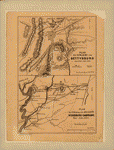 Plan
der Schlacht von Gettysburg am 1, 2 & 3 Juli, 1863.-Plan
zur Erlauterung von Gen. Grant's Vicksburg Campagne Mai-Juli,
1863 Gez v. E. R. Schmidt. Th. Leonhardt, lith., Philada.
Schmidt, Ernst Reinhold. CREATED/PUBLISHED [Philadelphia,
1869] NOTES Scales vary. Gettysburg map shows the location
of Union and Confederate corps. The Vicksburg campaign
map indicates the route followed by General Grant. Plan
der Schlacht von Gettysburg am 1, 2 & 3 Juli, 1863.-Plan
zur Erlauterung von Gen. Grant's Vicksburg Campagne Mai-Juli,
1863 Gez v. E. R. Schmidt. Th. Leonhardt, lith., Philada.
Schmidt, Ernst Reinhold. CREATED/PUBLISHED [Philadelphia,
1869] NOTES Scales vary. Gettysburg map shows the location
of Union and Confederate corps. The Vicksburg campaign
map indicates the route followed by General Grant. |
This
is a must have collection for any civil war history buff!
To use
this software, you must install the free ExpressView MrSid
software which is included on the CD. This is a 30 second
process and will allow you to view and manipulate/print all
the maps in this CD collection in full detail. There is a
version for both Windows platforms and Macintosh platforms
and full installation instructions are included on the CD. |


