This
CD contains 69 rare historic maps and descriptive pages representing
fascinating details about Georgia and its vicinity during
the Civil War in MrSid format.
This
format allows you to see the entire map on your computer screen
or drill down to see the smallest details. The original maps
are often quite large, as much as 36" long or larger
and quite detailed. With the MrSID software, you can manipulate
the map to print the entire map in great detail or zoom into
a portion of the map in full detail for viewing or printing.
You could even bring the images to a local print shop to have
the maps reprinted in their full size. (MrSID software is
included on the CD.)
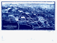
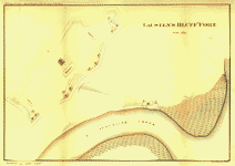
To
give you a sample of the detail you can expect in these maps,
here is an example based on a panoramic map of Washington,
DC.
The
table below shows the description and a small image of each
map on this fascinating civil war history CD.
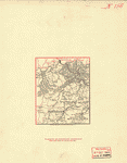
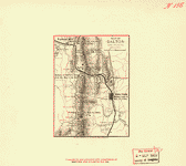
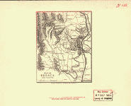
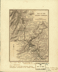
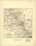
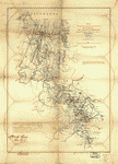
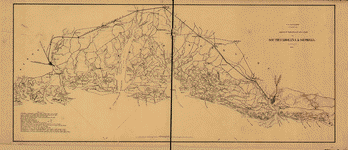
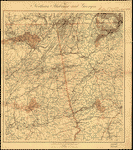 Northern
Alabama and Georgia Compiled and engraved at the U.S.
Coast Survey Office, from state maps, postoffice maps,
local surveys, military reconnoissance and information
furnished by the U.S. Engineers attached to the Military
Division of the Miss. Drawn by A. Lindenkohl. Lindenkohl,
A. CREATED/PUBLISHED [S.l.], H. Lindenkohl & Chas. G.
Krebs, lith., [1864?] NOTES Scale 1:633,600. Signed in
ink in upper margin: Llewellyn F. Haskell, Lt. Col., 7
U.S.C.I. July 15, 1864. DLC General map of northeastern
Alabama and northwestern Georgia indicating cities and
towns, roads and railroads, rivers, and some relief by
hachures. Map overprinted in red to highlight state boundaries
and railroads. Northern
Alabama and Georgia Compiled and engraved at the U.S.
Coast Survey Office, from state maps, postoffice maps,
local surveys, military reconnoissance and information
furnished by the U.S. Engineers attached to the Military
Division of the Miss. Drawn by A. Lindenkohl. Lindenkohl,
A. CREATED/PUBLISHED [S.l.], H. Lindenkohl & Chas. G.
Krebs, lith., [1864?] NOTES Scale 1:633,600. Signed in
ink in upper margin: Llewellyn F. Haskell, Lt. Col., 7
U.S.C.I. July 15, 1864. DLC General map of northeastern
Alabama and northwestern Georgia indicating cities and
towns, roads and railroads, rivers, and some relief by
hachures. Map overprinted in red to highlight state boundaries
and railroads. |
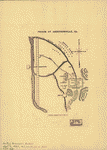 Prison
at Andersonville, Ga. United States Sanitary Commission.
CREATED/PUBLISHED N.Y., Waters & son sc., [1864] NOTES
Scale not given. From Sanitary Commission bulletin, v.
1, no. 21, Sept. 1, 1864. opp. p. 647. Plan of camp showing
the prison, the "dead line," "Rebel camp," batteries,
"Gen. Winder's headquarters," Capt. Wirtz's house, depot,
cook house, dispensary, hospital, road, and drainage. Prison
at Andersonville, Ga. United States Sanitary Commission.
CREATED/PUBLISHED N.Y., Waters & son sc., [1864] NOTES
Scale not given. From Sanitary Commission bulletin, v.
1, no. 21, Sept. 1, 1864. opp. p. 647. Plan of camp showing
the prison, the "dead line," "Rebel camp," batteries,
"Gen. Winder's headquarters," Capt. Wirtz's house, depot,
cook house, dispensary, hospital, road, and drainage.
|
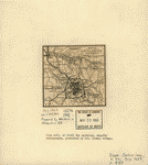 Map
of Atlanta and vicinity. [July 1864]. Western and Atlantic
Railroad Company. CREATED/PUBLISHED [S.l., 1887] NOTES
Scale ca. 1:165,000. From Century illustrated monthly
magazine, v. 34, July 1887. p.457. Shows fortifications,
roads, railroads, rivers, and towns. The battles of peach
Tree Creek (July 20), Atlanta (July 22), and Ezra Church
(July 28) are indicated. Map
of Atlanta and vicinity. [July 1864]. Western and Atlantic
Railroad Company. CREATED/PUBLISHED [S.l., 1887] NOTES
Scale ca. 1:165,000. From Century illustrated monthly
magazine, v. 34, July 1887. p.457. Shows fortifications,
roads, railroads, rivers, and towns. The battles of peach
Tree Creek (July 20), Atlanta (July 22), and Ezra Church
(July 28) are indicated. |
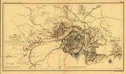
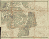
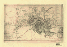 Map
illustrating the siege of Atlanta, Ga., by the U.S. forces
under command of Maj. Gen. W.T. Sherman, from the passage
of Peach Tree Creek, July 19th 1864, to the commencement
of the movement upon the enemy's lines of communication
south of Atlanta, August 26, 1864 / reduced and engraved
in the Engineer Bureau, War Dept., from an original prepared
under the directions of Cap. O.M. Poe, Corps of Eng's
and senr. engr. on Gen'l. Sherman's staff ; Edw. Molitor,
lith. Poe, O. M. (Orlando Metcalfe), 1832-1895. CREATED/PUBLISHED
[Washington, D.C.] : War Dept., [1865?] (Engineer Bureau,
War Dept.) NOTES Partial cadastral map showing selected
buildings and householders' names beyond city limits.
Covers area extending from Mt. Gilead Church in west to
Decatur in east and from Buckhead in north to East Point
in south. Relief shown by hachures and spot heights. Shows
troop positions, Union and Confederate works, roads, railroads,
vegetation, drainage, and names, dates, and sites of battles
connected with Atlanta Campaign. Map
illustrating the siege of Atlanta, Ga., by the U.S. forces
under command of Maj. Gen. W.T. Sherman, from the passage
of Peach Tree Creek, July 19th 1864, to the commencement
of the movement upon the enemy's lines of communication
south of Atlanta, August 26, 1864 / reduced and engraved
in the Engineer Bureau, War Dept., from an original prepared
under the directions of Cap. O.M. Poe, Corps of Eng's
and senr. engr. on Gen'l. Sherman's staff ; Edw. Molitor,
lith. Poe, O. M. (Orlando Metcalfe), 1832-1895. CREATED/PUBLISHED
[Washington, D.C.] : War Dept., [1865?] (Engineer Bureau,
War Dept.) NOTES Partial cadastral map showing selected
buildings and householders' names beyond city limits.
Covers area extending from Mt. Gilead Church in west to
Decatur in east and from Buckhead in north to East Point
in south. Relief shown by hachures and spot heights. Shows
troop positions, Union and Confederate works, roads, railroads,
vegetation, drainage, and names, dates, and sites of battles
connected with Atlanta Campaign. |
 Map
illustrating the siege of Atlanta, Ga. by the U.S. forces
under command of Maj. Gen. W. T. Sherman, from the passage
of Peach Tree Creek, July 19th 1864, to the commencement
of the movement upon the enemy's lines of communication
south of Atlanta, August 26, 1864. Reduced and engraved
in the Engineer Bureau, War Dept., from an original prepared
under the directions of Cap. O. M. Poe, Corps of Eng's.
and senr. engr. on Gen'l. Sherman's staff. Poe, O. M.
(Orlando Metcalfe), 1832-1895. CREATED/PUBLISHED [S.l.,
Edw. Molitor, lith., 1866] NOTES Scale ca. 1:47,520. From
39th Cong., 1st Sess. [1866]-Report of the Chief Engineer
U.S.A. No. 2. In lower right margin: Bowen & Co., lith.,
Philada. Indicates entrenchments, relief by hachures,
vegetation, drainage, roads, railroads, towns, and the
names of a few residents in the environs of Atlanta. Map
illustrating the siege of Atlanta, Ga. by the U.S. forces
under command of Maj. Gen. W. T. Sherman, from the passage
of Peach Tree Creek, July 19th 1864, to the commencement
of the movement upon the enemy's lines of communication
south of Atlanta, August 26, 1864. Reduced and engraved
in the Engineer Bureau, War Dept., from an original prepared
under the directions of Cap. O. M. Poe, Corps of Eng's.
and senr. engr. on Gen'l. Sherman's staff. Poe, O. M.
(Orlando Metcalfe), 1832-1895. CREATED/PUBLISHED [S.l.,
Edw. Molitor, lith., 1866] NOTES Scale ca. 1:47,520. From
39th Cong., 1st Sess. [1866]-Report of the Chief Engineer
U.S.A. No. 2. In lower right margin: Bowen & Co., lith.,
Philada. Indicates entrenchments, relief by hachures,
vegetation, drainage, roads, railroads, towns, and the
names of a few residents in the environs of Atlanta. |
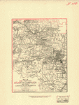
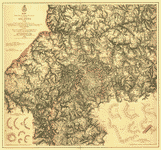 Map
illustrating the military operations in front of Atlanta,
Ga. From the passage of Peach Tree Creek, July 19th 1864,
to the commencement of the movement upon the enemy's lines
of communication, south of Atlanta, August 26th 1864 Compiled
by authority of the Hon. the Secretary of War in the Office
of the Chief of Engineers, U.S.A., 1875. United States.
Army. Corps of Engineers. CREATED/PUBLISHED N.Y., Julius
Bien & Co., photo lith., [1875] NOTES Scale ca. 1:32,000.
Insets: A portion of the Confederate defenses of Atlanta.
Scale ca. 1:1300. 16 x 14 cm. A portion of the U.S. defensive
works erected after the capture of Atlanta. Scale 1:1200.
21 x 25 cm. Confederate and Union defenses shown in the
insets are keyed to the map by the letters A to G and
the numbers 7 to 12 respectively. Detailed map showing
fortifications, headquarters, location and dates of battles,
street outline of Atlanta, roads, railroads, vegetation,
drainage, relief by hachures, towns, mills, churches,
the location of rural houses, and the names of residents. Map
illustrating the military operations in front of Atlanta,
Ga. From the passage of Peach Tree Creek, July 19th 1864,
to the commencement of the movement upon the enemy's lines
of communication, south of Atlanta, August 26th 1864 Compiled
by authority of the Hon. the Secretary of War in the Office
of the Chief of Engineers, U.S.A., 1875. United States.
Army. Corps of Engineers. CREATED/PUBLISHED N.Y., Julius
Bien & Co., photo lith., [1875] NOTES Scale ca. 1:32,000.
Insets: A portion of the Confederate defenses of Atlanta.
Scale ca. 1:1300. 16 x 14 cm. A portion of the U.S. defensive
works erected after the capture of Atlanta. Scale 1:1200.
21 x 25 cm. Confederate and Union defenses shown in the
insets are keyed to the map by the letters A to G and
the numbers 7 to 12 respectively. Detailed map showing
fortifications, headquarters, location and dates of battles,
street outline of Atlanta, roads, railroads, vegetation,
drainage, relief by hachures, towns, mills, churches,
the location of rural houses, and the names of residents.
|
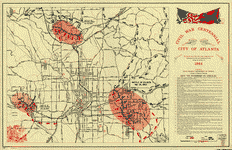 Civil
War Centennial, city of Atlanta : showing the area of
the three major engagements and deployment of Union and
Confederate forces during the summer of 1864 / prepared
by State Highway Department of Georgia, Division of Highway
Planning. Georgia. State Highway Dept. CREATED/PUBLISHED
[Atlanta] : The Dept., [1964?] NOTES Scale ca. 1:24,000.
Includes index to points of interest and ill. (some col.). Civil
War Centennial, city of Atlanta : showing the area of
the three major engagements and deployment of Union and
Confederate forces during the summer of 1864 / prepared
by State Highway Department of Georgia, Division of Highway
Planning. Georgia. State Highway Dept. CREATED/PUBLISHED
[Atlanta] : The Dept., [1964?] NOTES Scale ca. 1:24,000.
Includes index to points of interest and ill. (some col.).
|
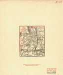 Map
of Rome, Adairsville and vicinity Prepared for a presented
with compliments of Western and Atlantic R. R. Co. Western
and Atlantic Railroad Company CREATED/PUBLISHED Buffalo,
N.Y., Matthews, Northrup & Co., Art-Printing Works, [1864]
NOTES Scale ca. 1:350,000. Shows location of battles of
Lay's or Tanner's Ferry, Adairsville, and Cassville, roads,
railroads, towns, drainage, and relief by hachures. Map
of Rome, Adairsville and vicinity Prepared for a presented
with compliments of Western and Atlantic R. R. Co. Western
and Atlantic Railroad Company CREATED/PUBLISHED Buffalo,
N.Y., Matthews, Northrup & Co., Art-Printing Works, [1864]
NOTES Scale ca. 1:350,000. Shows location of battles of
Lay's or Tanner's Ferry, Adairsville, and Cassville, roads,
railroads, towns, drainage, and relief by hachures. |
 Map
of Allatoona, New Hope Church and vicinity. Prepared for
and presented with compliments of Western and Atlantic
R. R. Co. Western and Atlantic Railroad Company. CREATED/PUBLISHED
Buffalo, N.Y., Mathews, Northrup & Co., Art-Printing Works,
[1864] NOTES Scale ca. 1:280,000. Shows location of battles
of Allatoona, Allatoona Creek, Picketts Mill, and New
Hope Church, roads, railroads, Confederate entrenchments,
towns, drainage, and relief by hachures. Map
of Allatoona, New Hope Church and vicinity. Prepared for
and presented with compliments of Western and Atlantic
R. R. Co. Western and Atlantic Railroad Company. CREATED/PUBLISHED
Buffalo, N.Y., Mathews, Northrup & Co., Art-Printing Works,
[1864] NOTES Scale ca. 1:280,000. Shows location of battles
of Allatoona, Allatoona Creek, Picketts Mill, and New
Hope Church, roads, railroads, Confederate entrenchments,
towns, drainage, and relief by hachures. |
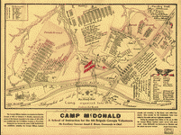 Camp
McDonald; a school of Instruction for the 4th Brigade
Georgia Volunteers His excellency Governor Joseph E. Brown,
Commander in Chief. Souvenir edition, 1917. McClellan,
I. B. CREATED/PUBLISHED Atlanta, c1917. NOTES Scale 1:2400.
Pictorial map showing parade grounds, tents, buildings,
hospitals, streets, relief by hachures, and the names
of principal officers. "The Georgia Military Institute
was organized at Marietta, Georgia, in 1851, by Colonel
A. V. Brumby; chartered at the session of the General
Assembly in the winter of 1851-1852, and modeled after
the U.S. Military Academy at West Point. During the war
between the states Camp McDonald was established, including
the Georgia Military Institute grounds and extending to
Big Shanty (now called Kennsaw). Here recruits for the
Confederate army were drilled by the cadets and new regiments
organized. During the campaign from Dalton to the sea
in 1864 the Georgia Military Institute cadets served with
great credit. Camp McDonald was destroyed by Sherman and
the school was never revived.-Joseph Tyrone Derry." Camp
McDonald; a school of Instruction for the 4th Brigade
Georgia Volunteers His excellency Governor Joseph E. Brown,
Commander in Chief. Souvenir edition, 1917. McClellan,
I. B. CREATED/PUBLISHED Atlanta, c1917. NOTES Scale 1:2400.
Pictorial map showing parade grounds, tents, buildings,
hospitals, streets, relief by hachures, and the names
of principal officers. "The Georgia Military Institute
was organized at Marietta, Georgia, in 1851, by Colonel
A. V. Brumby; chartered at the session of the General
Assembly in the winter of 1851-1852, and modeled after
the U.S. Military Academy at West Point. During the war
between the states Camp McDonald was established, including
the Georgia Military Institute grounds and extending to
Big Shanty (now called Kennsaw). Here recruits for the
Confederate army were drilled by the cadets and new regiments
organized. During the campaign from Dalton to the sea
in 1864 the Georgia Military Institute cadets served with
great credit. Camp McDonald was destroyed by Sherman and
the school was never revived.-Joseph Tyrone Derry." |
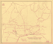
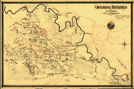
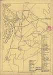 Map
of Chickamauga National Military Park. Ferger, Edward.
CREATED/PUBLISHED [S.l.], c1895. NOTES Scale not given.
98 sites are listed and keyed by number to the map. Map
of Chickamauga National Military Park. Ferger, Edward.
CREATED/PUBLISHED [S.l.], c1895. NOTES Scale not given.
98 sites are listed and keyed by number to the map. |
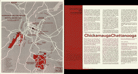
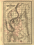
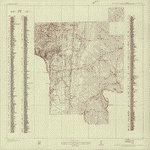 Chickamauga
and Chattanooga National Military Park, Ga. (Chickamauga
Battlefield). Geological Survey (U.S.) CREATED/PUBLISHED
[Washington, 1934] NOTES Scale 1:9600. "Advance sheet.
Subject to correction." Title at top of sheet: Georgia.
Chickamauga and Chattanooga National Military Park (Chickamauga
Battlefield). Detailed topographic map indicating monuments
and markers. 290 sites are listed and keyed by number
to the map. Countour interval is 5 feet. Chickamauga
and Chattanooga National Military Park, Ga. (Chickamauga
Battlefield). Geological Survey (U.S.) CREATED/PUBLISHED
[Washington, 1934] NOTES Scale 1:9600. "Advance sheet.
Subject to correction." Title at top of sheet: Georgia.
Chickamauga and Chattanooga National Military Park (Chickamauga
Battlefield). Detailed topographic map indicating monuments
and markers. 290 sites are listed and keyed by number
to the map. Countour interval is 5 feet. |
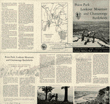 Chickamauga
and Chattanooga National Military Park, Georgia and Tennessee
: principal roads and streets between Chattanooga and
park areas. United States. National Park Service. CREATED/PUBLISHED
[Washington], Government Printing Office, 1957 NOTES Scale
ca. 1:64,000. "NMP-CC-7004." "Reprint 1957." Illustrates
descriptive leaflet by U.S. National Park Service entitled
"Point Park, Lookout Mountain and Chattanooga Battlefields."
Includes text and illustrations. Chickamauga
and Chattanooga National Military Park, Georgia and Tennessee
: principal roads and streets between Chattanooga and
park areas. United States. National Park Service. CREATED/PUBLISHED
[Washington], Government Printing Office, 1957 NOTES Scale
ca. 1:64,000. "NMP-CC-7004." "Reprint 1957." Illustrates
descriptive leaflet by U.S. National Park Service entitled
"Point Park, Lookout Mountain and Chattanooga Battlefields."
Includes text and illustrations. |
 Chickamauga
and Chattanooga National Military Park. United States.
National Park Service. CREATED/PUBLISHED [Washington,
U.S. Govt. Print. Off.] 1968. NOTES Scale ca. 1:95,000.
Folded title: Chickamauga and Chattanooga National Military
Park, Georgia-Tennessee. Chickamauga
and Chattanooga National Military Park. United States.
National Park Service. CREATED/PUBLISHED [Washington,
U.S. Govt. Print. Off.] 1968. NOTES Scale ca. 1:95,000.
Folded title: Chickamauga and Chattanooga National Military
Park, Georgia-Tennessee. |
 Georgia,
Chickamauga and Chattanooga National Military Park (Chickamauga
Battlefield) / Department of the Interior, U.S. Geological
Survey ; topography by Frank Larner and R. E. Amidon.
Geological Survey (U.S.) CREATED/PUBLISHED [Knoxville
: Tennessee Valley Authority, 1975?] NOTES Scale 1:9,600
or 1 in. = 800 ft. Alternate title in lower margin: Chickamauga
and Chattanooga National Military Park, Ga. (Chickamauga
Battlefield). Relief shown by contours and spot heights.
Includes compilation diagr. and index of battle monuments
and sites. Georgia,
Chickamauga and Chattanooga National Military Park (Chickamauga
Battlefield) / Department of the Interior, U.S. Geological
Survey ; topography by Frank Larner and R. E. Amidon.
Geological Survey (U.S.) CREATED/PUBLISHED [Knoxville
: Tennessee Valley Authority, 1975?] NOTES Scale 1:9,600
or 1 in. = 800 ft. Alternate title in lower margin: Chickamauga
and Chattanooga National Military Park, Ga. (Chickamauga
Battlefield). Relief shown by contours and spot heights.
Includes compilation diagr. and index of battle monuments
and sites. |
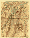
 Battle
of--"Chickamauga"--Sep. 19th & 20th 1863 / under Col.
W.E. Merrill. Merrill, W. E. (William Emery), 1837-1891.
CREATED/PUBLISHED [1864] NOTES Relief shown by contours,
spot heights, and gradient tints. Shows roads, rivers,
and streams. Does not show troop positions. Note at upper
left: Companion sheet to the other map marked No. 61--The
other map represents the positions of the troops at the
battle of Chicamauga [sic], the roads, woods & fields,
but does not represent the irregularities of the surface.
This map represents the roads, rivers, and irregularities
of the surface as developed by contour lines and heavy
tints on the lower portions of the ground, the highest
elevations being untinted. The two maps are from the same
original and agree exactly in the roads and streams. This
map was prepared as a guide to the draughtsman who might
be employed to prepare the complete map of the Battle
of Chicamauga [sic]. By carefully studying the contour
lines and tints on this map an accurate map with hachures
may be made of the ground. If then the locations of the
troops are taken from the other map the battle map will
be complete. W. E. M. [i.e., William E. Merrill]. Battle
of--"Chickamauga"--Sep. 19th & 20th 1863 / under Col.
W.E. Merrill. Merrill, W. E. (William Emery), 1837-1891.
CREATED/PUBLISHED [1864] NOTES Relief shown by contours,
spot heights, and gradient tints. Shows roads, rivers,
and streams. Does not show troop positions. Note at upper
left: Companion sheet to the other map marked No. 61--The
other map represents the positions of the troops at the
battle of Chicamauga [sic], the roads, woods & fields,
but does not represent the irregularities of the surface.
This map represents the roads, rivers, and irregularities
of the surface as developed by contour lines and heavy
tints on the lower portions of the ground, the highest
elevations being untinted. The two maps are from the same
original and agree exactly in the roads and streams. This
map was prepared as a guide to the draughtsman who might
be employed to prepare the complete map of the Battle
of Chicamauga [sic]. By carefully studying the contour
lines and tints on this map an accurate map with hachures
may be made of the ground. If then the locations of the
troops are taken from the other map the battle map will
be complete. W. E. M. [i.e., William E. Merrill]. |
 Tour
route, Chickamauga Battlefield, Chickamauga and Chattanooga
National Military Park, Georgia and Tennessee. United
States. National Park Service. OTHER TITLES Chickamauga
battlefield. CREATED/PUBLISHED [Washington], Government
Printing Office, 1957. NOTES Scale ca. 1:55,000. Illustrates
descriptive brochure entitled "Chickamauga Battlefield,
Chickamauga and Chattanooga National Military Park, Georgia
and Tennessee." Map indicates "Union defense line morning
of Sept. 20." battlefield sites, park boundary, and tour
route. Tour
route, Chickamauga Battlefield, Chickamauga and Chattanooga
National Military Park, Georgia and Tennessee. United
States. National Park Service. OTHER TITLES Chickamauga
battlefield. CREATED/PUBLISHED [Washington], Government
Printing Office, 1957. NOTES Scale ca. 1:55,000. Illustrates
descriptive brochure entitled "Chickamauga Battlefield,
Chickamauga and Chattanooga National Military Park, Georgia
and Tennessee." Map indicates "Union defense line morning
of Sept. 20." battlefield sites, park boundary, and tour
route. |
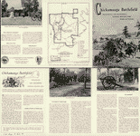
 Chickamauga
Battlefield / National Park Service, U.S. Department of
the Interior. United States. National Park Service. CREATED/PUBLISHED
[Washington] : The Service, [1973] NOTES Scale not given.
Folded title: Chickamauga Battlefield, Chickamauga and
Chattanooga National Military Park, Georgia and Tennessee. Chickamauga
Battlefield / National Park Service, U.S. Department of
the Interior. United States. National Park Service. CREATED/PUBLISHED
[Washington] : The Service, [1973] NOTES Scale not given.
Folded title: Chickamauga Battlefield, Chickamauga and
Chattanooga National Military Park, Georgia and Tennessee.
|
 Map
of Chickamauga & Chattanooga National Park The Matthews-Northrup
Co., Buffalo, N.Y. Nashville, Chattanooga, and St. Louis
Railway. CREATED/PUBLISHED [Nashville, Nashville, Chattanooga
& St. Louis Ry., 1895] NOTES Scale ca. 1:57,000. Copyright,
1895, by Nashville, Chattanooga & St. Louis Ry. Map
of Chickamauga & Chattanooga National Park The Matthews-Northrup
Co., Buffalo, N.Y. Nashville, Chattanooga, and St. Louis
Railway. CREATED/PUBLISHED [Nashville, Nashville, Chattanooga
& St. Louis Ry., 1895] NOTES Scale ca. 1:57,000. Copyright,
1895, by Nashville, Chattanooga & St. Louis Ry. |
 Map
of Chickamauga and Chattanooga National Military Park
Drawn by B. B. Ramey. Copyrighted 1895, by W. E. Birchmore.
Engraved by Buff[alo] Elec. & Eng. Co. Ramey, B. B. CREATED/PUBLISHED
[S.l.], c1895. NOTES Scale 1:12,000. Map indicates roads,
drainage, houses, and names of residents. "Key to monuments,
locations, and markers" depicted on map reproduced on
p. [40] of text. Map
of Chickamauga and Chattanooga National Military Park
Drawn by B. B. Ramey. Copyrighted 1895, by W. E. Birchmore.
Engraved by Buff[alo] Elec. & Eng. Co. Ramey, B. B. CREATED/PUBLISHED
[S.l.], c1895. NOTES Scale 1:12,000. Map indicates roads,
drainage, houses, and names of residents. "Key to monuments,
locations, and markers" depicted on map reproduced on
p. [40] of text. |
 Aero
view of Chickamauga and Chattanooga National Military
Park (looking east). Painted by Rudolph J. Shutting. Shutting,
Rudolph J. CREATED/PUBLISHED Chattanooga, 1913. [Knoxville,
Tenn., Tennessee Valley Authority, 1974?] NOTES Perspective
map not drawn to scale. Photocopy; blue line print. Oriented
with north to the left. Bird's-eye-view. Indexed for points
of interest. Aero
view of Chickamauga and Chattanooga National Military
Park (looking east). Painted by Rudolph J. Shutting. Shutting,
Rudolph J. CREATED/PUBLISHED Chattanooga, 1913. [Knoxville,
Tenn., Tennessee Valley Authority, 1974?] NOTES Perspective
map not drawn to scale. Photocopy; blue line print. Oriented
with north to the left. Bird's-eye-view. Indexed for points
of interest. |
 Battle
field of Chickamauga, Georgia / surveyed by command of
Major Genl. G. H. Thomas, Commanding Department of the
Cumberland, by Capt. C. H. Boyd, Sub-Asst. U.S. Coast
Survey, April and May 1864 ; assisted in levelling by
Lieut. Kuntze & Sergeant Wilson. Boyd, Charles H. CREATED/PUBLISHED
[Knoxville : Tennessee Valley Authority, 1975?] NOTES
Scale ca. 1:31,000 (not "1:20,000"). Battle
field of Chickamauga, Georgia / surveyed by command of
Major Genl. G. H. Thomas, Commanding Department of the
Cumberland, by Capt. C. H. Boyd, Sub-Asst. U.S. Coast
Survey, April and May 1864 ; assisted in levelling by
Lieut. Kuntze & Sergeant Wilson. Boyd, Charles H. CREATED/PUBLISHED
[Knoxville : Tennessee Valley Authority, 1975?] NOTES
Scale ca. 1:31,000 (not "1:20,000"). |
 Battle-field
of Chickamauga, surveyed by command of Maj. Gen. Thomas,
comdg. Dept. of the Cumberland by Capt. C. H. Boyd, U.S.
Coast Survey. April & May 1864. Autogr. & printed under
direction of Col. Wm. E. Merrill, Chief Engr., D.C., Chattanooga,
October, 1864. Boyd, Charles H. CREATED/PUBLISHED [Chattanooga,
1864] NOTES Scale 1:20,000. Shows roads, fords, drainage,
vegetation, houses, names of residents, fences, and relief
by contour lines. Some fortifications are given but troop
positions and movements during the Battle of Chickamauga
are not indicated. Battle-field
of Chickamauga, surveyed by command of Maj. Gen. Thomas,
comdg. Dept. of the Cumberland by Capt. C. H. Boyd, U.S.
Coast Survey. April & May 1864. Autogr. & printed under
direction of Col. Wm. E. Merrill, Chief Engr., D.C., Chattanooga,
October, 1864. Boyd, Charles H. CREATED/PUBLISHED [Chattanooga,
1864] NOTES Scale 1:20,000. Shows roads, fords, drainage,
vegetation, houses, names of residents, fences, and relief
by contour lines. Some fortifications are given but troop
positions and movements during the Battle of Chickamauga
are not indicated. |
 Battle-field
of Chickamauga. [Sept 18-20, 1863]. Wells, Jacob. CREATED/PUBLISHED
[S.l.], 1887. NOTES Scale ca. 1:84,000. From Century illustrated
monthly magazine, v. 33, April 1887. p. 954. Indicates
by symbols the "positions, evening of Sept. 18, 1863,"
"direction of lines of battle, Sept. 19th," "first lines
of battle, Sept. 20th," "last lines of battle, Sept. 20th,"
"positions of Union troops after the battle," and positions
of the cavalry. Map also includes roads, rivers, fords,
bridges, relief by hachures, and houses. Battle-field
of Chickamauga. [Sept 18-20, 1863]. Wells, Jacob. CREATED/PUBLISHED
[S.l.], 1887. NOTES Scale ca. 1:84,000. From Century illustrated
monthly magazine, v. 33, April 1887. p. 954. Indicates
by symbols the "positions, evening of Sept. 18, 1863,"
"direction of lines of battle, Sept. 19th," "first lines
of battle, Sept. 20th," "last lines of battle, Sept. 20th,"
"positions of Union troops after the battle," and positions
of the cavalry. Map also includes roads, rivers, fords,
bridges, relief by hachures, and houses. |
 Chickamauga
battlefield. Accompanies The battle of Chickamauga. Historical
map and guide book. By J. C. McElroy of the Ohio Commission,
late Captain 18th Ohio Infantry. McElroy, Joseph C. CREATED/PUBLISHED
[Cincinnati, The Henderson-Achert-Krebs Lith. Co., c1895]
NOTES Scale not given. The map shows Gen. Robert B. Mitchell's
Union cavalry on Sept. 20th deployed in the north and
south of General Rosecrans's headquarters in the Lee mansion
and Gen. James T. Wheeler's Confederate troops to the
east and south, none of which is included in the preceding
version (Civil War Maps entry no. 155). Chickamauga
battlefield. Accompanies The battle of Chickamauga. Historical
map and guide book. By J. C. McElroy of the Ohio Commission,
late Captain 18th Ohio Infantry. McElroy, Joseph C. CREATED/PUBLISHED
[Cincinnati, The Henderson-Achert-Krebs Lith. Co., c1895]
NOTES Scale not given. The map shows Gen. Robert B. Mitchell's
Union cavalry on Sept. 20th deployed in the north and
south of General Rosecrans's headquarters in the Lee mansion
and Gen. James T. Wheeler's Confederate troops to the
east and south, none of which is included in the preceding
version (Civil War Maps entry no. 155). |
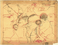
 Chickamauga
battlefield. [Sept 19-20, 1863] Sketched by J. C. McElroy
of the Ohio Commission, late Captain 18th Ohio Infantry.
McElroy, Joseph C. CREATED/PUBLISHED Cincinnati, The Henderson-Achert-Krebs
Lith. Co., c1895. NOTES Scale ca. 1:12,300. Shows troop
positions and movements, names of commanders, location
of battlefield monuments, roads, railroads, fords, bridges,
drainage, vegetation, houses, and names of residents. Chickamauga
battlefield. [Sept 19-20, 1863] Sketched by J. C. McElroy
of the Ohio Commission, late Captain 18th Ohio Infantry.
McElroy, Joseph C. CREATED/PUBLISHED Cincinnati, The Henderson-Achert-Krebs
Lith. Co., c1895. NOTES Scale ca. 1:12,300. Shows troop
positions and movements, names of commanders, location
of battlefield monuments, roads, railroads, fords, bridges,
drainage, vegetation, houses, and names of residents.
|
 Map
of the Chickamauga battle-field, Georgia drawn by W. A.
Wood, expressly for Norwood's Vade-Mecum Guide. Wood,
W. A., cartographer. CREATED/PUBLISHED [S.l.], c1895.
NOTES Scale 1:14,400. In upper margin: The latest and
most accurate. Indicates houses, names of residents, roads,
drainage, Chattanooga, Rome, and Columbus railroad, and
the boundary of the park at the time of dedication in
September 1895. A description of the battle is overprinted
in red and the important points of interest keyed by section,
letter, and number to the map. Map
of the Chickamauga battle-field, Georgia drawn by W. A.
Wood, expressly for Norwood's Vade-Mecum Guide. Wood,
W. A., cartographer. CREATED/PUBLISHED [S.l.], c1895.
NOTES Scale 1:14,400. In upper margin: The latest and
most accurate. Indicates houses, names of residents, roads,
drainage, Chattanooga, Rome, and Columbus railroad, and
the boundary of the park at the time of dedication in
September 1895. A description of the battle is overprinted
in red and the important points of interest keyed by section,
letter, and number to the map. |
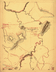
 Map
of the environs of Pine Mountain, Lost Mountain, Kenesaw
Mountain, and Little Kenesaw Mountain] G. H. Blakeslee
T. E. [June 2-22, 1864] Blakeslee, G. H. CREATED/PUBLISHED
[1864] NOTES Scale not given. Pen and ink sketch map of
northwestern Cobb County, Georgia, showing the "route
of Harrison's Brigade," Confederate and Federal works,
battlefields, roads, railroads, churches, drainage, and
relief by hachures. Also depicted are the locations of
the "5th Ind. Bat. [that] kill[ed] Gen. Polk, June 14"
and the "spot where Polk was killed." Map
of the environs of Pine Mountain, Lost Mountain, Kenesaw
Mountain, and Little Kenesaw Mountain] G. H. Blakeslee
T. E. [June 2-22, 1864] Blakeslee, G. H. CREATED/PUBLISHED
[1864] NOTES Scale not given. Pen and ink sketch map of
northwestern Cobb County, Georgia, showing the "route
of Harrison's Brigade," Confederate and Federal works,
battlefields, roads, railroads, churches, drainage, and
relief by hachures. Also depicted are the locations of
the "5th Ind. Bat. [that] kill[ed] Gen. Polk, June 14"
and the "spot where Polk was killed." |
 Map
of Dalton and vicinity. [1864] Prepared for and presented
with compliments of Western and Atlantic R.R. Co. Western
and Atlantic Railroad Company. CREATED/PUBLISHED Buffalo,
N.Y., Matthews, Northrup & Co., Art-Printing Works, [1864]
NOTES Scale ca. 1:130,000. Indicates the location of the
battles of Dalton, Rocky Face, and Mill Creek Gap, roads,
railroads, towns, drainage, and relief by hachures. Map
of Dalton and vicinity. [1864] Prepared for and presented
with compliments of Western and Atlantic R.R. Co. Western
and Atlantic Railroad Company. CREATED/PUBLISHED Buffalo,
N.Y., Matthews, Northrup & Co., Art-Printing Works, [1864]
NOTES Scale ca. 1:130,000. Indicates the location of the
battles of Dalton, Rocky Face, and Mill Creek Gap, roads,
railroads, towns, drainage, and relief by hachures. |
 Ft.
McAllister. Carried by assault on the 13th of Dec. [1864]
by the Second Division, 15th A.C., commanded by Brig.
Gen. W. B. Hazon. CREATED/PUBLISHED [1864] NOTES Scale
not given. Pen and ink manuscript drawn on tracing cloth,
showing fortifications, Union troop positions, road leading
to fort, vegetation, and drainage. Part of the defenses
of Savannah, Georgia. Ft.
McAllister. Carried by assault on the 13th of Dec. [1864]
by the Second Division, 15th A.C., commanded by Brig.
Gen. W. B. Hazon. CREATED/PUBLISHED [1864] NOTES Scale
not given. Pen and ink manuscript drawn on tracing cloth,
showing fortifications, Union troop positions, road leading
to fort, vegetation, and drainage. Part of the defenses
of Savannah, Georgia. |
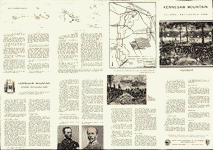 Kennesaw
Mountain National Battlefield Park, Georgia. United States.
National Park Service CREATED/PUBLISHED [Washington],
Government Printing Office, 1959. NOTES Scale ca. 1:50,000.
"August 1959, NBP-KM-7006." Illustrates discriptive leaflet
by U.S. National Park Service entitled "Kennesaw Mountain
National Battlefield Park, Georgia." Insets: Crest of
Kennesaw Mountain. Sept. 1959. NBP-KM-7007.-Cheatham Hill
area. Sept. 1959. NBP-KM-7008. Each 7 x 14 cm. Includes
text and portraits of General William T. Sherman and General
Joseph E. Johnston. Kennesaw
Mountain National Battlefield Park, Georgia. United States.
National Park Service CREATED/PUBLISHED [Washington],
Government Printing Office, 1959. NOTES Scale ca. 1:50,000.
"August 1959, NBP-KM-7006." Illustrates discriptive leaflet
by U.S. National Park Service entitled "Kennesaw Mountain
National Battlefield Park, Georgia." Insets: Crest of
Kennesaw Mountain. Sept. 1959. NBP-KM-7007.-Cheatham Hill
area. Sept. 1959. NBP-KM-7008. Each 7 x 14 cm. Includes
text and portraits of General William T. Sherman and General
Joseph E. Johnston. |
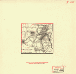 Map
of Marietta and vicinity. [June 1864] Prepared for and
presented with compliments of Western and Atlantic R.R.
Co. Western and Atlantic Railroad Company. CREATED/PUBLISHED
Buffalo, N.Y., Matthews, Northrup & Co., Art-Printing
Works, [1864] NOTES Scale ca. 1:185,000. Indicates location
and date of battles, Confederate entrenchments, roads,
towns, drainage, and relief by hachures. Map
of Marietta and vicinity. [June 1864] Prepared for and
presented with compliments of Western and Atlantic R.R.
Co. Western and Atlantic Railroad Company. CREATED/PUBLISHED
Buffalo, N.Y., Matthews, Northrup & Co., Art-Printing
Works, [1864] NOTES Scale ca. 1:185,000. Indicates location
and date of battles, Confederate entrenchments, roads,
towns, drainage, and relief by hachures. |
 om
the Etowah to Burnt-Hickory, Ga. Blakeslee, G. H. CREATED/PUBLISHED
[S.l.], G. H. B. [i.e., G. H. Blakeslee], 1864] NOTES
Scale ca. 1:27,600. Pen and ink sketch map showing "route
of Harrison's Brigade," engagements, routes of the 20th
and 23rd Army Corps, roads, railroads, drainage, relief
by hachures, woods, and clearings. om
the Etowah to Burnt-Hickory, Ga. Blakeslee, G. H. CREATED/PUBLISHED
[S.l.], G. H. B. [i.e., G. H. Blakeslee], 1864] NOTES
Scale ca. 1:27,600. Pen and ink sketch map showing "route
of Harrison's Brigade," engagements, routes of the 20th
and 23rd Army Corps, roads, railroads, drainage, relief
by hachures, woods, and clearings. |
 Map
of Resaca and vicinity. [1864] Prepared for and presented
with compliments of Western and Atlantic R.R. Co. Western
and Atlantic Railroad Company. CREATED/PUBLISHED Buffalo,
N.Y., Matthews, Northrup & Co., Art-Printing Works, [1864]
NOTES Scale ca. 1:165,000. Map of the environs of Resaca
showing entrenchments, roads, railroads, towns, drainage,
and relief by hachures. Map
of Resaca and vicinity. [1864] Prepared for and presented
with compliments of Western and Atlantic R.R. Co. Western
and Atlantic Railroad Company. CREATED/PUBLISHED Buffalo,
N.Y., Matthews, Northrup & Co., Art-Printing Works, [1864]
NOTES Scale ca. 1:165,000. Map of the environs of Resaca
showing entrenchments, roads, railroads, towns, drainage,
and relief by hachures. |
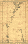
 St.
Mary's River and Fernandina harbor, Florida From a trigonometrical
survey under the direction of A. D. Bache, Superintendent
of the survey of the coast of the United States. Triangulation
by Capt. J. H. Simpson and Lieutenant A. W. Evans, U.S.A.
Assistants. Topography by A. M. Harrison, Assistant. Hydrography
by the party under the command of Lieut. S. D. Trenchard,
U.S.N. Assist. 1857. Resurvey of bar by C. O. Boutelle,
Asst. in 1862. Redd. drng. by P. Witzel. Engd. by A. Maedel
and R. F. Bartle. Bowen & Co. lith., Philada. United States
Coast Survey. CREATED/PUBLISHED [Washington, U.S. Coast
Survey, 1862] NOTES Scale 1:20,000. St.
Mary's River and Fernandina harbor, Florida From a trigonometrical
survey under the direction of A. D. Bache, Superintendent
of the survey of the coast of the United States. Triangulation
by Capt. J. H. Simpson and Lieutenant A. W. Evans, U.S.A.
Assistants. Topography by A. M. Harrison, Assistant. Hydrography
by the party under the command of Lieut. S. D. Trenchard,
U.S.N. Assist. 1857. Resurvey of bar by C. O. Boutelle,
Asst. in 1862. Redd. drng. by P. Witzel. Engd. by A. Maedel
and R. F. Bartle. Bowen & Co. lith., Philada. United States
Coast Survey. CREATED/PUBLISHED [Washington, U.S. Coast
Survey, 1862] NOTES Scale 1:20,000. |
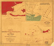 Charts
of Savannah River, Pensacola Bay, and Key West. Showing
the positions of the several fortifications. From the
United States Coast Survey From the United States Coast
Survey. Smith, Jim (Jim C.) CREATED/PUBLISHED New York,
c1861. NOTES Scale not given. [1] Savannah River from
U.S. Coast Survey. Scale ca. 1:63,360. 18 x 26 cm. [2]
[Pensacola Bay] Scale ca. 1:80,000. 18 x 23 cm. [3] Chart
of Key West, Florida. Scale ca. 1:125,000. 22 x 20 cm.
Each chart indicates fortifications, place names, "line
of 18 feet depth of water," and a few soundings. Charts
of Savannah River, Pensacola Bay, and Key West. Showing
the positions of the several fortifications. From the
United States Coast Survey From the United States Coast
Survey. Smith, Jim (Jim C.) CREATED/PUBLISHED New York,
c1861. NOTES Scale not given. [1] Savannah River from
U.S. Coast Survey. Scale ca. 1:63,360. 18 x 26 cm. [2]
[Pensacola Bay] Scale ca. 1:80,000. 18 x 23 cm. [3] Chart
of Key West, Florida. Scale ca. 1:125,000. 22 x 20 cm.
Each chart indicates fortifications, place names, "line
of 18 feet depth of water," and a few soundings. |
 "Causten's
Bluff" fort. [Defenses of Savannah, Georgia. 1865]. United
States. Navy. CREATED/PUBLISHED Philada., W.A.S. Lith.
of Bowen & Co., [1865] NOTES Scale 1:2000. "Causten's
Bluff" fort. [Defenses of Savannah, Georgia. 1865]. United
States. Navy. CREATED/PUBLISHED Philada., W.A.S. Lith.
of Bowen & Co., [1865] NOTES Scale 1:2000. |
 Map
showing the defences of Savannah, on the approaches of
Wilmington and Savannah Rivers, Georgia. Flag St[eame]r
"Harvest Moon" Feb. 8th 1865. United States. Navy. CREATED/PUBLISHED
Philada., W.A.S. Bowen & Co., lith., [1865] NOTES Scale
1:40,000. Insets: Turner's Rocks Battery. Scale 1:2000.
11 x 16 cm.-Ft. Thunderbolt. Scale 1:2000. 6 x 10 cm. Map
showing the defences of Savannah, on the approaches of
Wilmington and Savannah Rivers, Georgia. Flag St[eame]r
"Harvest Moon" Feb. 8th 1865. United States. Navy. CREATED/PUBLISHED
Philada., W.A.S. Bowen & Co., lith., [1865] NOTES Scale
1:40,000. Insets: Turner's Rocks Battery. Scale 1:2000.
11 x 16 cm.-Ft. Thunderbolt. Scale 1:2000. 6 x 10 cm.
|
 Map
illustrating the defence of Savannah, Ga. and the operations
resulting in its capture by the army commanded by Maj.
Genl. W. T. Sherman. Dec. 21st 1864 Compiled 1880-81 under
the direction of Bvt. Brig. Genl. O. M. Poe, Maj. Corps
of Engs., Col. & A.D.C., late Chief Engineer, Military
Division of the Mississippi. Poe, O. M. (Orlando Metcalfe),
1832-1895. CREATED/PUBLISHED N.Y., Julius Bien & Co. photo
lith., 1881 NOTES Scale ca. 1:85,000. Detailed map of
Savannah and vicinity, showing "Union works in blue,"
"Confederate works in red," roads, railroads, vegetation,
drainage, houses, names of a few residents in outlying
areas, fences, and geographic coordinates. Includes plans
of the following fortifications: Works at eastern point
of Whitmarsh Island; Fort Thunderbolt; Bastion on the
line of defence across Whitmarsh Island; Fort Tattnall;
Battery on Turner's Rocks; Fort McAllister; Causten's
Bluff; and Fort Lee. Map
illustrating the defence of Savannah, Ga. and the operations
resulting in its capture by the army commanded by Maj.
Genl. W. T. Sherman. Dec. 21st 1864 Compiled 1880-81 under
the direction of Bvt. Brig. Genl. O. M. Poe, Maj. Corps
of Engs., Col. & A.D.C., late Chief Engineer, Military
Division of the Mississippi. Poe, O. M. (Orlando Metcalfe),
1832-1895. CREATED/PUBLISHED N.Y., Julius Bien & Co. photo
lith., 1881 NOTES Scale ca. 1:85,000. Detailed map of
Savannah and vicinity, showing "Union works in blue,"
"Confederate works in red," roads, railroads, vegetation,
drainage, houses, names of a few residents in outlying
areas, fences, and geographic coordinates. Includes plans
of the following fortifications: Works at eastern point
of Whitmarsh Island; Fort Thunderbolt; Bastion on the
line of defence across Whitmarsh Island; Fort Tattnall;
Battery on Turner's Rocks; Fort McAllister; Causten's
Bluff; and Fort Lee. |
 Atlanta
campaign-1864. "Rossville" to "Snake Creek Gap." Blakeslee,
G. H. CREATED/PUBLISHED [S.l., G. H. B. [i.e., G. H. Blakeslee],
1864] NOTES Scale not given. Pen and ink sketch map showing
"route of Harrison's Brigade, 3rd Div.," positions of
the 1st, 2nd, and 3rd Divisions of the 20th Army Corps
from May 2 to May 10, 1864, roads, railroads, villages,
churches, mills, drainage, and relief by hachures. Atlanta
campaign-1864. "Rossville" to "Snake Creek Gap." Blakeslee,
G. H. CREATED/PUBLISHED [S.l., G. H. B. [i.e., G. H. Blakeslee],
1864] NOTES Scale not given. Pen and ink sketch map showing
"route of Harrison's Brigade, 3rd Div.," positions of
the 1st, 2nd, and 3rd Divisions of the 20th Army Corps
from May 2 to May 10, 1864, roads, railroads, villages,
churches, mills, drainage, and relief by hachures. |
 Map
of the Atlanta campaign. [May-Sept. 1864]. Western and
Atlantic Railroad Company. CREATED/PUBLISHED [S.l., 1887]
NOTES Scale ca. 1:830,000. From Century illustrated monthly
magazine, v. 34, July 1887. P. 446. Map of the northwest
Georgia showing location and date of engagements, railroads,
towns, rivers, relief by hachures, and county names and
boundaries. Map
of the Atlanta campaign. [May-Sept. 1864]. Western and
Atlantic Railroad Company. CREATED/PUBLISHED [S.l., 1887]
NOTES Scale ca. 1:830,000. From Century illustrated monthly
magazine, v. 34, July 1887. P. 446. Map of the northwest
Georgia showing location and date of engagements, railroads,
towns, rivers, relief by hachures, and county names and
boundaries. |
 Sketch
of the Atlantic coast of the United States from Savannah
River to St. Mary's River, embracing the coast of the
State of Georgia Drawn by A. Lindenkohl. Lindenkohl, A.
CREATED/PUBLISHED [S.l.], United States Coast Survey,
A. D. Bache, Superintendent, 1861. NOTES Scale 1:200,000.
Inset: [Coast of Florida from St. Johns River to St. Augustine]
32 x 24 cm. Coastal chart showing place names, roads,
railroads, rivers and streams, and swamps. Sketch
of the Atlantic coast of the United States from Savannah
River to St. Mary's River, embracing the coast of the
State of Georgia Drawn by A. Lindenkohl. Lindenkohl, A.
CREATED/PUBLISHED [S.l.], United States Coast Survey,
A. D. Bache, Superintendent, 1861. NOTES Scale 1:200,000.
Inset: [Coast of Florida from St. Johns River to St. Augustine]
32 x 24 cm. Coastal chart showing place names, roads,
railroads, rivers and streams, and swamps. |
 Sketch
of a part of the coast of Georgia from Savannah River
to Ossabaw Sound showing the relative positions of the
U.S. Iron clad steamer Montauk & the rebel Fort McAllister
during the bombardment of Feb 1st 1863. Prepared under
direction of Admiral S. F. Du Pont, by C. O. Boutelle,
Assistant, Coast Survey. Boutelle, Charles O. CREATED/PUBLISHED
[S.l., 1863] NOTES Scale 1:200,000. At head of title:
U.S. Coast Survey. A. D. Bache, Supdt. Shows drainage,
towns, geographic coordinates, railroad from Savannah
to "Way's Stat. no. 2," and the position of the vessels
Nashville, Montauk, Seneca, Wissahicon, Dawn, and C. P.
William in the Ogeechee River near Fort McAllister, and
the Passaic, Marblehead, and Conemaugh in Wassaw Sound. Sketch
of a part of the coast of Georgia from Savannah River
to Ossabaw Sound showing the relative positions of the
U.S. Iron clad steamer Montauk & the rebel Fort McAllister
during the bombardment of Feb 1st 1863. Prepared under
direction of Admiral S. F. Du Pont, by C. O. Boutelle,
Assistant, Coast Survey. Boutelle, Charles O. CREATED/PUBLISHED
[S.l., 1863] NOTES Scale 1:200,000. At head of title:
U.S. Coast Survey. A. D. Bache, Supdt. Shows drainage,
towns, geographic coordinates, railroad from Savannah
to "Way's Stat. no. 2," and the position of the vessels
Nashville, Montauk, Seneca, Wissahicon, Dawn, and C. P.
William in the Ogeechee River near Fort McAllister, and
the Passaic, Marblehead, and Conemaugh in Wassaw Sound.
|
 Map
of army operations Atlanta campaign between Cassville
and Mariette and vicinity Prepared for and presented with
compliments of Western and Atlantic R. R. Co. Western
and Atlantic Railroad Company. CREATED/PUBLISHED Buffalo,
N.Y., Matthews, Northrup & Co., Art-Printing Works, [1864]
NOTES Scale 1:285,120. Map of Bartow, Cherokee, Paulding,
and Cobb counties, Georgia, showing location and date
of battles, entrenchments, towns, roads, railroads, drainage,
and relief by hachures. Map
of army operations Atlanta campaign between Cassville
and Mariette and vicinity Prepared for and presented with
compliments of Western and Atlantic R. R. Co. Western
and Atlantic Railroad Company. CREATED/PUBLISHED Buffalo,
N.Y., Matthews, Northrup & Co., Art-Printing Works, [1864]
NOTES Scale 1:285,120. Map of Bartow, Cherokee, Paulding,
and Cobb counties, Georgia, showing location and date
of battles, entrenchments, towns, roads, railroads, drainage,
and relief by hachures. |
 Map
of army operations Atlanta campaign between Kingston and
Atlanta Prepared for and presented with compliments of
Western and Atlantic R. R. Co. Western and Atlantic Railroad
Company. CREATED/PUBLISHED Buffalo, N.Y., Matthews, Northrup
& Co., Art-Printing Works, [1864] NOTES Scale 1:285,120.
Map of Bartow, Cherokee, Paulding, Cobb, and Fulton counties,
Georgia, showing location and date of battles, towns,
roads, railroads, entrenchments, drainage, and relief
by hachures. Map
of army operations Atlanta campaign between Kingston and
Atlanta Prepared for and presented with compliments of
Western and Atlantic R. R. Co. Western and Atlantic Railroad
Company. CREATED/PUBLISHED Buffalo, N.Y., Matthews, Northrup
& Co., Art-Printing Works, [1864] NOTES Scale 1:285,120.
Map of Bartow, Cherokee, Paulding, Cobb, and Fulton counties,
Georgia, showing location and date of battles, towns,
roads, railroads, entrenchments, drainage, and relief
by hachures. |
 Sherman's
campaign from Chattanooga to Atlanta [1864] Engraved by
R. D. Servoss. Rhodes, James Ford, 1848-1927. CREATED/PUBLISHED
N.Y., [1864] NOTES Scale ca. 1:500,000. Map of northwest
Georgia showing the "lines of works erected by the United
States forces" in blue and "Confederate forces" in red. Sherman's
campaign from Chattanooga to Atlanta [1864] Engraved by
R. D. Servoss. Rhodes, James Ford, 1848-1927. CREATED/PUBLISHED
N.Y., [1864] NOTES Scale ca. 1:500,000. Map of northwest
Georgia showing the "lines of works erected by the United
States forces" in blue and "Confederate forces" in red.
|
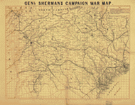 Genl.
Sherman's campaign war map. Bufford, John Henry, 1810-1870.
CREATED/PUBLISHED Boston, [1864] NOTES Scale ca. 1:670,000.
"The horizontal and upright lines [of the map grid] represent
five miles square. By referring [sic] to the number on
the left and to the letter on the base, any point may
be found to show the locality of the Union armies." Description
derived from published bibliography. Map covering most
of Georgia and South Carolina, showing defenses along
the sea coast and around the principal towns, Confederate
prisons at Andersonville and south of Millen, Ga., roads,
railroads, towns, drainage, and relief by hachures. Genl.
Sherman's campaign war map. Bufford, John Henry, 1810-1870.
CREATED/PUBLISHED Boston, [1864] NOTES Scale ca. 1:670,000.
"The horizontal and upright lines [of the map grid] represent
five miles square. By referring [sic] to the number on
the left and to the letter on the base, any point may
be found to show the locality of the Union armies." Description
derived from published bibliography. Map covering most
of Georgia and South Carolina, showing defenses along
the sea coast and around the principal towns, Confederate
prisons at Andersonville and south of Millen, Ga., roads,
railroads, towns, drainage, and relief by hachures. |
 Part
of northern Georgia : no. 2 / compiled under the direction
of Capt. Wm. E. Merrill, chief, Top'l Eng'r, D.C. Merrill,
W. E. (William Emery), 1837-1891. CREATED/PUBLISHED [Washington,
D.C.? : s.n., 1864] NOTES Covers a portion of northwestern
Georgia and adjacent Alabama to the west of Atlanta. Part
of northern Georgia : no. 2 / compiled under the direction
of Capt. Wm. E. Merrill, chief, Top'l Eng'r, D.C. Merrill,
W. E. (William Emery), 1837-1891. CREATED/PUBLISHED [Washington,
D.C.? : s.n., 1864] NOTES Covers a portion of northwestern
Georgia and adjacent Alabama to the west of Atlanta. |
 Map
showing the operations of the national forces under the
command of Maj. Gen. W. T. Sherman during the campaign
resulting in the capture of Atlanta, Georgia, Sept. 1,
1864 / drawn by E. Hergesheimer ; Chas. G. Krebs, lith.
Hergesheimer, E. (Edwin) CREATED/PUBLISHED Washington
: Coast Survey Office, [1864] NOTES Scale 1:380,160; 6
miles to 1 in. Relief shown by hachures. Shows the area
between Chattanooga, Tenn. and Lovejoy, Ga. Map
showing the operations of the national forces under the
command of Maj. Gen. W. T. Sherman during the campaign
resulting in the capture of Atlanta, Georgia, Sept. 1,
1864 / drawn by E. Hergesheimer ; Chas. G. Krebs, lith.
Hergesheimer, E. (Edwin) CREATED/PUBLISHED Washington
: Coast Survey Office, [1864] NOTES Scale 1:380,160; 6
miles to 1 in. Relief shown by hachures. Shows the area
between Chattanooga, Tenn. and Lovejoy, Ga. |
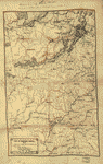
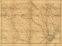
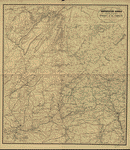 Northwestern
Georgia (with portions of the adjoining States of Tennessee
and Alabama) being part of the Department of the Cumberland.
Engineer Bureau of the War Department, January 1863. Denis
Callahan, del. Lith. of J. Bien, N.Y. Callahan, Denis.
CREATED/PUBLISHED [Washington, 1864] NOTES Scale 1:350,000
(5.524 miles to an inch). "Corrections and additions from
Capt. Wm. E. Merrills Map of Northern Georgia in 1864."
Troop positions and movements are not indicated. General
campaign map showing turnpike and stage roads, railroads,
towns, rivers and relief by hachures. Northwestern
Georgia (with portions of the adjoining States of Tennessee
and Alabama) being part of the Department of the Cumberland.
Engineer Bureau of the War Department, January 1863. Denis
Callahan, del. Lith. of J. Bien, N.Y. Callahan, Denis.
CREATED/PUBLISHED [Washington, 1864] NOTES Scale 1:350,000
(5.524 miles to an inch). "Corrections and additions from
Capt. Wm. E. Merrills Map of Northern Georgia in 1864."
Troop positions and movements are not indicated. General
campaign map showing turnpike and stage roads, railroads,
towns, rivers and relief by hachures. |
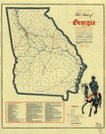
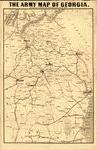 The
army map of Georgia. Louis Prang and Company. CREATED/PUBLISHED
Boston, L. Prang & Co., c1864. NOTES Scale ca. 1:800,000. The
army map of Georgia. Louis Prang and Company. CREATED/PUBLISHED
Boston, L. Prang & Co., c1864. NOTES Scale ca. 1:800,000.
|
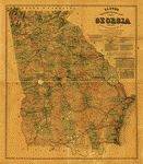 Lloyd's
topographical map of Georgia from state surveys before
the war showing railways, stations, villages, mills, &c.
Lloyd, James T. CREATED/PUBLISHED New York, J. T. Lloyd,
1864. NOTES Scale ca. 1:580,000. Hand-colored general
map with places where battles occurred underlined in red. Lloyd's
topographical map of Georgia from state surveys before
the war showing railways, stations, villages, mills, &c.
Lloyd, James T. CREATED/PUBLISHED New York, J. T. Lloyd,
1864. NOTES Scale ca. 1:580,000. Hand-colored general
map with places where battles occurred underlined in red.
|
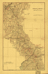
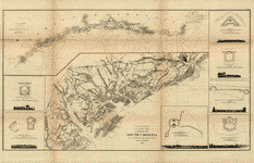
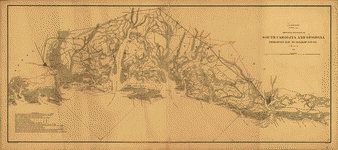
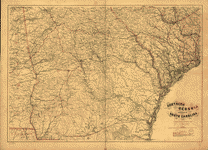 Southern
Georgia and part of South Carolina / U.S. Coast Survey,
A.D. Bache, supdt. ; drawn by A. Lindenkohl ; Chas. G.
Krebs, lith. United States Coast Survey. CREATED/PUBLISHED
[Washington, D.C.] : The Survey, 1865. NOTES Relief shown
by hachures. Includes list of authorities. Southern
Georgia and part of South Carolina / U.S. Coast Survey,
A.D. Bache, supdt. ; drawn by A. Lindenkohl ; Chas. G.
Krebs, lith. United States Coast Survey. CREATED/PUBLISHED
[Washington, D.C.] : The Survey, 1865. NOTES Relief shown
by hachures. Includes list of authorities. |
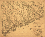
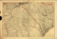 Northern
Georgia and western and central South Carolina] Drawn
by A. Lindenkohl. H. Lindenkohl & Chas. G. Krebs, lith.
Lindenkohl, A. CREATED/PUBLISHED [S.l.], U.S. Coast Survey,
A. D. Bache, Supdt., 1865 NOTES Scale 1:633,600. General
map, without title, extending from Charleston west to
the western boundary of Georgia. State names, boundaries,
and railroads are overprinted in red. Northern
Georgia and western and central South Carolina] Drawn
by A. Lindenkohl. H. Lindenkohl & Chas. G. Krebs, lith.
Lindenkohl, A. CREATED/PUBLISHED [S.l.], U.S. Coast Survey,
A. D. Bache, Supdt., 1865 NOTES Scale 1:633,600. General
map, without title, extending from Charleston west to
the western boundary of Georgia. State names, boundaries,
and railroads are overprinted in red. |
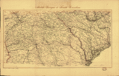 Middle
Georgia & South Carolina / U.S. Coast Survey, A. D. Bache,
supt. ; drawn by A. Lindenkohl ; Chas. G. Krebs, lith.
United States Coast Survey. CREATED/PUBLISHED [Washington]
: The Survey, [1865?] NOTES Scale ca. 1:633,600; 1 in.
= 10 miles. Relief shown by hachures. Middle
Georgia & South Carolina / U.S. Coast Survey, A. D. Bache,
supt. ; drawn by A. Lindenkohl ; Chas. G. Krebs, lith.
United States Coast Survey. CREATED/PUBLISHED [Washington]
: The Survey, [1865?] NOTES Scale ca. 1:633,600; 1 in.
= 10 miles. Relief shown by hachures. |
 Birds-eye
map of the Western and Atlantic R.R., the great Kennesaw
route; Army operations, Atlanta campaign, 1864. Fleming,
Brewster & Alley. CREATED/PUBLISHED N[ew] Y[ork], [1887]
NOTES Scale not given. Birds-eye
map of the Western and Atlantic R.R., the great Kennesaw
route; Army operations, Atlanta campaign, 1864. Fleming,
Brewster & Alley. CREATED/PUBLISHED N[ew] Y[ork], [1887]
NOTES Scale not given. |
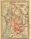
 The
State of Georgia, showing the major campaign areas and
engagement sites of the War between the States, 1861-1865.
Smith, J. Harmon. CREATED/PUBLISHED [Atlanta], Georgia
Dept. of Commerce, 1961. NOTES Scale ca. 1:960,000. "All
place names, county lines and railroads are shown as they
existed during the Civil War." Indicates "route of Davis'
attempted escape," "route of march of General Sherman's
main forces," and "Confederate defense works." Engagements
and other important sites are keyed by number to map. The
State of Georgia, showing the major campaign areas and
engagement sites of the War between the States, 1861-1865.
Smith, J. Harmon. CREATED/PUBLISHED [Atlanta], Georgia
Dept. of Commerce, 1961. NOTES Scale ca. 1:960,000. "All
place names, county lines and railroads are shown as they
existed during the Civil War." Indicates "route of Davis'
attempted escape," "route of march of General Sherman's
main forces," and "Confederate defense works." Engagements
and other important sites are keyed by number to map.
|
 The
State of Georgia, Civil War Centennial, 1864 : showing
the major campaign areas and engagement sites of the Union
and Confederate armies / prepared by State Highway Department
of Georgia, Division of Highway Planning. Georgia. State
Highway Dept. CREATED/PUBLISHED [Atlanta] : The Dept.,
[1964?] NOTES Scale ca. 1:900,000. Includes index to points
of interest and ill. The
State of Georgia, Civil War Centennial, 1864 : showing
the major campaign areas and engagement sites of the Union
and Confederate armies / prepared by State Highway Department
of Georgia, Division of Highway Planning. Georgia. State
Highway Dept. CREATED/PUBLISHED [Atlanta] : The Dept.,
[1964?] NOTES Scale ca. 1:900,000. Includes index to points
of interest and ill. |
 Map
illustrating the first epoch of the Atlanta Campaign :
embracing the region from the Tennessee River to the Oostanaula
River, showing the positions held and lines of works erected
by the enemy, also the lines of works erected by the United
States forces, the lines of march traversed by them and
their relative location in line of battle when attacking
the enemy, commanding United States forces, Major-General
W. T. Sherman, commanding rebel forces, Lieut. General
J. E. Johnston / compiled by Edward Ruger. Ruger, Edward.
CREATED/PUBLISHED [Knoxville, Tenn. : Tennessee Valley
Authority, 1974?] NOTES Scale ca. 1:80,000. Map
illustrating the first epoch of the Atlanta Campaign :
embracing the region from the Tennessee River to the Oostanaula
River, showing the positions held and lines of works erected
by the enemy, also the lines of works erected by the United
States forces, the lines of march traversed by them and
their relative location in line of battle when attacking
the enemy, commanding United States forces, Major-General
W. T. Sherman, commanding rebel forces, Lieut. General
J. E. Johnston / compiled by Edward Ruger. Ruger, Edward.
CREATED/PUBLISHED [Knoxville, Tenn. : Tennessee Valley
Authority, 1974?] NOTES Scale ca. 1:80,000. |
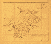
 Map
of the environs of Savannah, Georgia. 186-] Drawn by A.
Lindenkoh. Chas. G. Krebs, lith. Lindenkohl, A. CREATED/PUBLISHED
[S.l., 186-] NOTES Scale not given. Printed map without
title. Indicates fortifications, roads, railroads, drainage,
vegetation, towns, and some houses and names of residents
in outlying areas. Map
of the environs of Savannah, Georgia. 186-] Drawn by A.
Lindenkoh. Chas. G. Krebs, lith. Lindenkohl, A. CREATED/PUBLISHED
[S.l., 186-] NOTES Scale not given. Printed map without
title. Indicates fortifications, roads, railroads, drainage,
vegetation, towns, and some houses and names of residents
in outlying areas. |
 Map
of the seat of war, in South Carolina, and Georgia. Evans
& Cogswell. CREATED/PUBLISHED Charleston, S.C., Evans
& Cogswell, [1861] NOTES Scale ca. 1:450,000. Inset: Portion
of Georgia [around Savannah]. Uncolored. Scale not given.
11 x 17 cm. Confederate imprint. Shows coastal area from
Georgetown, South Carolina, to Savannah, Georgia, and
territory inland as far north as Kingstree, South Carolina,
to Orangeburgh, South Carolina. Gives the location of
forts and shows coastal shoals, drainage, roads, railroads,
ferries, bridges, dwellings with names of inhabitants,
churches, and post offices. Map
of the seat of war, in South Carolina, and Georgia. Evans
& Cogswell. CREATED/PUBLISHED Charleston, S.C., Evans
& Cogswell, [1861] NOTES Scale ca. 1:450,000. Inset: Portion
of Georgia [around Savannah]. Uncolored. Scale not given.
11 x 17 cm. Confederate imprint. Shows coastal area from
Georgetown, South Carolina, to Savannah, Georgia, and
territory inland as far north as Kingstree, South Carolina,
to Orangeburgh, South Carolina. Gives the location of
forts and shows coastal shoals, drainage, roads, railroads,
ferries, bridges, dwellings with names of inhabitants,
churches, and post offices. |
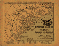 Beaufort
Harbor and coast line between Charleston, S.C. and Savanna
[sic] Ga., with 5 mile distance lines in circles round
Beaufort, and R.R. connections, roads, &c, &c. L. Prang
& Co. CREATED/PUBLISHED Boston, [1861?] NOTES Scale not
given. Indicates ships in Beaufort Harbor and a few of
the line coastal forts. "The naval force in the great
expedition" appears above the map, followed by the names
of commanding officers. Below the neat line at the bottom
of the map appear the names of the ships, the captains,
and the number of guns aboard each ship. Beaufort
Harbor and coast line between Charleston, S.C. and Savanna
[sic] Ga., with 5 mile distance lines in circles round
Beaufort, and R.R. connections, roads, &c, &c. L. Prang
& Co. CREATED/PUBLISHED Boston, [1861?] NOTES Scale not
given. Indicates ships in Beaufort Harbor and a few of
the line coastal forts. "The naval force in the great
expedition" appears above the map, followed by the names
of commanding officers. Below the neat line at the bottom
of the map appear the names of the ships, the captains,
and the number of guns aboard each ship. |
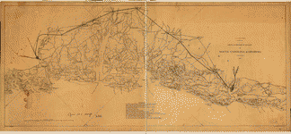 Sketch
of portions of seacoast of South Carolina & Georgia Drawn
by A. Lindenkohl. Autogr. copy by H. Lindenkohl. Lindenkohl,
A. CREATED/PUBLISHED [S.l.], 1862. NOTES Scale 1:200,000.
Autographed in ink: Gen. M. C. Meigs USA. Map of the coast
from Bull's Bay, South Carolina, to Ossabaw Sound, Georgia,
showing forts, drainage, roads, railroads, and towns.
"References" at the bottom center of the map give dates
on which forts were captured by the Federal forces. Sketch
of portions of seacoast of South Carolina & Georgia Drawn
by A. Lindenkohl. Autogr. copy by H. Lindenkohl. Lindenkohl,
A. CREATED/PUBLISHED [S.l.], 1862. NOTES Scale 1:200,000.
Autographed in ink: Gen. M. C. Meigs USA. Map of the coast
from Bull's Bay, South Carolina, to Ossabaw Sound, Georgia,
showing forts, drainage, roads, railroads, and towns.
"References" at the bottom center of the map give dates
on which forts were captured by the Federal forces. |
 Coast
of South Carolina from Charleston to Hilton Head. United
States Coast Survey. CREATED/PUBLISHED [Washington, U.S.
Coast Survey], 1862. NOTES Scale 1:200,000. Insets: Plan
and view of Fort "Beauregard"-Bay Point, S.C. Scale 1:2000.
16 x 17 cm.-Fort on Fenwick's Island, S.C. Scale 1:1000.
13 x 15 cm.-Ground plan and view of fort on Bay Point-South
Edisto R., S.C. Scale 1:1000. 14 x 15 cm.-Plan and view
of fort on Otter Isld. Point-St. Helena Sound, S.C. Scale
1:1000. 12 x 15 cm.-Fort on Sam's Point, Coosaw River,
S.C. Scale 1:1000. 13 x 15 cm.-Ground plan and view of
fort on Botany-Bay Isld., North Edisto R. Scale 1:2000.
12 x 15 cm.-Fort "Walker"-Hilton Head Isld., S.C. Scale
1:2000. 13 x 15 cm.-Sketch E showing the progress of the
survey in section no. V from 1847 to 1862. [Triangulation
network from Winyah Bay, South Carolina, to Amelia Island,
Florida] Scale 1:600,000. 24 x 74 cm. Coast
of South Carolina from Charleston to Hilton Head. United
States Coast Survey. CREATED/PUBLISHED [Washington, U.S.
Coast Survey], 1862. NOTES Scale 1:200,000. Insets: Plan
and view of Fort "Beauregard"-Bay Point, S.C. Scale 1:2000.
16 x 17 cm.-Fort on Fenwick's Island, S.C. Scale 1:1000.
13 x 15 cm.-Ground plan and view of fort on Bay Point-South
Edisto R., S.C. Scale 1:1000. 14 x 15 cm.-Plan and view
of fort on Otter Isld. Point-St. Helena Sound, S.C. Scale
1:1000. 12 x 15 cm.-Fort on Sam's Point, Coosaw River,
S.C. Scale 1:1000. 13 x 15 cm.-Ground plan and view of
fort on Botany-Bay Isld., North Edisto R. Scale 1:2000.
12 x 15 cm.-Fort "Walker"-Hilton Head Isld., S.C. Scale
1:2000. 13 x 15 cm.-Sketch E showing the progress of the
survey in section no. V from 1847 to 1862. [Triangulation
network from Winyah Bay, South Carolina, to Amelia Island,
Florida] Scale 1:600,000. 24 x 74 cm. |
 Sketch
of portions of seacoast of South Carolina & Georgia Drawn
by A. Lindenkohl.]. Lindenkohl, A. CREATED/PUBLISHED [S.l.],
1863. NOTES [Scale 1:200,000].Map of the coast from Bull's
Bay, South Carolina, to Ossabaw Sound, Georgia, showing
forts, drainage, roads, railroads, and towns. Sketch
of portions of seacoast of South Carolina & Georgia Drawn
by A. Lindenkohl.]. Lindenkohl, A. CREATED/PUBLISHED [S.l.],
1863. NOTES [Scale 1:200,000].Map of the coast from Bull's
Bay, South Carolina, to Ossabaw Sound, Georgia, showing
forts, drainage, roads, railroads, and towns. |
 Sketch
of sea coast of South Carolina and Georgia from Bull's
Bay to Ossabaw Sound / drawn by A. Lindenkohl ; E. Molitor,
lith. Lindenkohl, A. CREATED/PUBLISHED [Washington] :
U.S. Coast Survey, 1863. NOTES Scale 1:200,000. Sketch
of sea coast of South Carolina and Georgia from Bull's
Bay to Ossabaw Sound / drawn by A. Lindenkohl ; E. Molitor,
lith. Lindenkohl, A. CREATED/PUBLISHED [Washington] :
U.S. Coast Survey, 1863. NOTES Scale 1:200,000. |
 Part
of South Carolina and Georgia] Engineer Bureau, Dec. 24th
1864. United States. Army. Corps of Engineers. CREATED/PUBLISHED
[S.l., 1864] NOTES Scale 1:350,000. Southern half of an
unidentified printed map. Sheet extends from Augusta south
to Jacksonville, Georgia, and Beaufort, South Carolina,
west to Eatonton, Georgia. Indicated are roads and railroads,
cities and towns, houses and names of residents, rivers,
and forts. Part
of South Carolina and Georgia] Engineer Bureau, Dec. 24th
1864. United States. Army. Corps of Engineers. CREATED/PUBLISHED
[S.l., 1864] NOTES Scale 1:350,000. Southern half of an
unidentified printed map. Sheet extends from Augusta south
to Jacksonville, Georgia, and Beaufort, South Carolina,
west to Eatonton, Georgia. Indicated are roads and railroads,
cities and towns, houses and names of residents, rivers,
and forts. |
 Sketch
showing position of Boyd's Neck, Honey Hill, and Devaux'
Neck, in Decr. 1864 Bowen & Co., lith., Philada. Foster,
John G. (John Gray), 1823-1874. CREATED/PUBLISHED [Washington,
Government Printing Office, 1866] NOTES Scale ca. 1:670,00
(not "1 inch=10 miles"). Map indicates "lines of investment
of Gen. Sherman" at Savannah, Georgia, Boyd's Neck, Honey
Hill and Devaux' Neck, South Carolina, and "position of
rebel ironclads" on the Savannah River. Sketch
showing position of Boyd's Neck, Honey Hill, and Devaux'
Neck, in Decr. 1864 Bowen & Co., lith., Philada. Foster,
John G. (John Gray), 1823-1874. CREATED/PUBLISHED [Washington,
Government Printing Office, 1866] NOTES Scale ca. 1:670,00
(not "1 inch=10 miles"). Map indicates "lines of investment
of Gen. Sherman" at Savannah, Georgia, Boyd's Neck, Honey
Hill and Devaux' Neck, South Carolina, and "position of
rebel ironclads" on the Savannah River. |
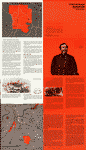
  Battle
map of Chickamauga, Georgia. Saturday 19 [and] Sunday,
20 September 1863. Map of the Chattanooga battle-fields,
November, 1863. Orchard Knob, 23d, Lookout Mountain, 24th,
Missionary Ridge, 25th. Norwood, Charles W. CREATED/PUBLISHED
Chattanooga, c1898. NOTES Scale ca. 1:32,600. -- Scale
ca. 1:63,360. The Chickamauga map is divided "into quarter-mile
sections, numbered 1 to 20 on the west and east margins,
and lettered A to O on the north and sourth." Map indicates
approximate troop positions, movements, commanding officers,
a few houses and names of residents, roads, "Chatta.,
Rome & Southern R.R.," and drainage. The Chattanooga map
is divided "into half-mile sections, numbered 1 to 19
on the west and east sides, and lettered A to L on the
north and south." The map includes positions of "troops
only in their critical situations," relief by hachures,
drainage, railroads, and the outline of the streets of
Chattanooga. Battle
map of Chickamauga, Georgia. Saturday 19 [and] Sunday,
20 September 1863. Map of the Chattanooga battle-fields,
November, 1863. Orchard Knob, 23d, Lookout Mountain, 24th,
Missionary Ridge, 25th. Norwood, Charles W. CREATED/PUBLISHED
Chattanooga, c1898. NOTES Scale ca. 1:32,600. -- Scale
ca. 1:63,360. The Chickamauga map is divided "into quarter-mile
sections, numbered 1 to 20 on the west and east margins,
and lettered A to O on the north and sourth." Map indicates
approximate troop positions, movements, commanding officers,
a few houses and names of residents, roads, "Chatta.,
Rome & Southern R.R.," and drainage. The Chattanooga map
is divided "into half-mile sections, numbered 1 to 19
on the west and east sides, and lettered A to L on the
north and south." The map includes positions of "troops
only in their critical situations," relief by hachures,
drainage, railroads, and the outline of the streets of
Chattanooga. |
This
is a must have collection for any civil war history buff!
To use
this software, you must install the free ExpressView MrSid
software which is included on the CD. This is a 30 second
process and will allow you to view and manipulate/print all
the maps in this CD collection in full detail. There is a
version for both Windows platforms and Macintosh platforms
and full installation instructions are included on the CD. |


