This
CD contains 60 rare antique maps and descriptive pages representing
fascinating details about Maryland and its vicinity during
the Civil War in MrSid format.
This
format allows you to see the entire map on your computer screen
or drill down to see the smallest details. The original maps
are often quite large, as much as 36" long or larger
and quite detailed. With the MrSID software, you can manipulate
the map to print the entire map in great detail or zoom into
a portion of the map in full detail for viewing or printing.
You could even bring the images to a local print shop to have
the maps reprinted in their full size. (MrSID software is
included on the CD.)
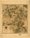
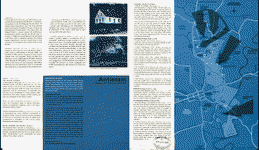
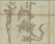
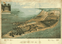
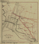
To
give you a sample of the detail you can expect in these maps,
here is an example based on a panoramic map of Washington,
DC.
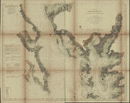
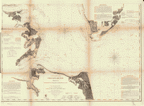
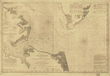
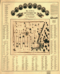
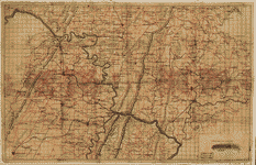
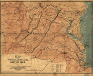
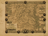
The
table below shows the description and a small image of each
map on this fascinating civil war history CD.
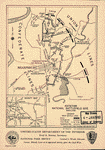
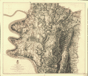
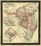
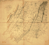
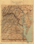
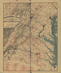
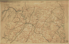 Part
of map of portions of the milit'y dept's of Washington,
Pennsylvania, Annapolis, and north eastern Virginia /
compiled in the Bureau of Topographical Eng'rs, War Department
&c. Washington, D.C. Oct. 6th, 1862 ; copied in Engr.
Bureau C.S.A. Sept. 6th, 1864 [by] Wm. L. Sheppard, Dftsmn.
; forwarded to Lieut. Genl. J.A. Early Sept. 6th 1864.
United States. Topographical Bureau. NOTES Relief shown
by hachures. Shows Washington D.C. region, including western
part of Maryland and northeastern Virginia. Does not show
Pennsylvania with the exception of Gettysburg. Part
of map of portions of the milit'y dept's of Washington,
Pennsylvania, Annapolis, and north eastern Virginia /
compiled in the Bureau of Topographical Eng'rs, War Department
&c. Washington, D.C. Oct. 6th, 1862 ; copied in Engr.
Bureau C.S.A. Sept. 6th, 1864 [by] Wm. L. Sheppard, Dftsmn.
; forwarded to Lieut. Genl. J.A. Early Sept. 6th 1864.
United States. Topographical Bureau. NOTES Relief shown
by hachures. Shows Washington D.C. region, including western
part of Maryland and northeastern Virginia. Does not show
Pennsylvania with the exception of Gettysburg. |
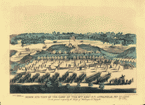 Birds'
eye view of the camp of the 67th Reg't P.V. Annapolis,
Md. : on the ground occupied by the troops of Washington
& Lafayette / pub'd & designed by Edwin Rees. Rees, Edwin.
CREATED/PUBLISHED [Philadelphia : Edwin Rees, [1863] (Philad[elphi]a
: Lith'd by L. Rosenthal) NOTES "Entered according to
act of Congress in the year 1863, by Edwin Rees, in ...
the Eastern Dis't of Penn'a." Includes list of military
officers' names. Birds'
eye view of the camp of the 67th Reg't P.V. Annapolis,
Md. : on the ground occupied by the troops of Washington
& Lafayette / pub'd & designed by Edwin Rees. Rees, Edwin.
CREATED/PUBLISHED [Philadelphia : Edwin Rees, [1863] (Philad[elphi]a
: Lith'd by L. Rosenthal) NOTES "Entered according to
act of Congress in the year 1863, by Edwin Rees, in ...
the Eastern Dis't of Penn'a." Includes list of military
officers' names. |
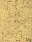
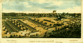 Parole
Camp Annapolis, M'd. E. Sachse & Co. CREATED/PUBLISHED
Balt[im]o[re] : Lith. by E. Sachse & Co., [1864] NOTES
Bird's-eye view. "Entered according to Act of Congress
in the year 1864 by E. Sachse & Co. in ... the District
Court of Md." Includes index to points of interest. Parole
Camp Annapolis, M'd. E. Sachse & Co. CREATED/PUBLISHED
Balt[im]o[re] : Lith. by E. Sachse & Co., [1864] NOTES
Bird's-eye view. "Entered according to Act of Congress
in the year 1864 by E. Sachse & Co. in ... the District
Court of Md." Includes index to points of interest. |
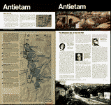
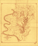
 The
field of Antietam. Wells, Jacob. CREATED/PUBLISHED [S.l.,
1886] NOTES Scale ca. 1:48,500. From Century illustrated
monthly magazine, v. 32, June 1886. p. 290. Shows batteries,
troop positions and movements, names of commanders, roads,
street pattern of Sharpsburg, drainage, vegetation, relief
by hachures, houses, names of residents, and fences. Chronology
of events appears below the map. The
field of Antietam. Wells, Jacob. CREATED/PUBLISHED [S.l.,
1886] NOTES Scale ca. 1:48,500. From Century illustrated
monthly magazine, v. 32, June 1886. p. 290. Shows batteries,
troop positions and movements, names of commanders, roads,
street pattern of Sharpsburg, drainage, vegetation, relief
by hachures, houses, names of residents, and fences. Chronology
of events appears below the map. |
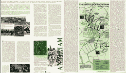 The
Battle of Antietam, September 17, 1862. United States.
National Park Service. CREATED/PUBLISHED Washington, U.S.
Govt. Print. Off., 1968. NOTES Scale not given. Shows
the placement and movement of troops during 3 phases of
the battle. The
Battle of Antietam, September 17, 1862. United States.
National Park Service. CREATED/PUBLISHED Washington, U.S.
Govt. Print. Off., 1968. NOTES Scale not given. Shows
the placement and movement of troops during 3 phases of
the battle. |
 Northwest,
or no. 1, sheet of preliminary map of Antietam (Sharpsburg)
battlefield. Enlarged from the "Michler" map of the war
records atlas with corrections and additions Antietam
Battlefield Commission [sic] Maj. Geo. B. Davis. U.S.A.,
President, H. Heth, E. A. Carman, Expert Historian, [and]
Jed. Hotchkiss, Expert Topographer. Antietam Battlefield
Board. CREATED/PUBLISHED Washington, D.C., The Norris
Peters Co., photo-litho., 1894. NOTES Scale ca. 1:10,400. Northwest,
or no. 1, sheet of preliminary map of Antietam (Sharpsburg)
battlefield. Enlarged from the "Michler" map of the war
records atlas with corrections and additions Antietam
Battlefield Commission [sic] Maj. Geo. B. Davis. U.S.A.,
President, H. Heth, E. A. Carman, Expert Historian, [and]
Jed. Hotchkiss, Expert Topographer. Antietam Battlefield
Board. CREATED/PUBLISHED Washington, D.C., The Norris
Peters Co., photo-litho., 1894. NOTES Scale ca. 1:10,400.
|
 Southwest,
or no. 2, sheet of preliminary map of Antietam (Sharpsburg)
battlefield. Enlarged from "Michler" map of the war records
atlas with corrections and additions Antietam Battlefield
Commission [sic] Maj. Geo. B. Davis, U.S.A., President,
H. Heth, E. A. Carman, Expert Historian, [and] Jed. Hotchkiss,
Expert Topographer. Antietam Battlefield Board. CREATED/PUBLISHED
Washington D.C., The Norris Peters Co., photo-litho.,
1895. NOTES Scale ca. 1:10,400. Southwest,
or no. 2, sheet of preliminary map of Antietam (Sharpsburg)
battlefield. Enlarged from "Michler" map of the war records
atlas with corrections and additions Antietam Battlefield
Commission [sic] Maj. Geo. B. Davis, U.S.A., President,
H. Heth, E. A. Carman, Expert Historian, [and] Jed. Hotchkiss,
Expert Topographer. Antietam Battlefield Board. CREATED/PUBLISHED
Washington D.C., The Norris Peters Co., photo-litho.,
1895. NOTES Scale ca. 1:10,400. |
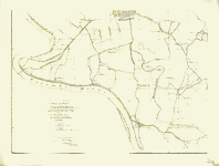
 Antietam
battlefield. Preliminary map no. 3. Hotchkiss, Jedediah,
1828-1899. CREATED/PUBLISHED Washington, D.C., Jed. Hotchkiss,
The Norris Peters Co., photo-litho. 1895 NOTES Scale ca.
1:5,040. Detailed map of the battlefield showing roads
and lanes, fences, houses, names of residents, crops,
woodland, and relief by hachures. Troop positions are
not noted. Antietam
battlefield. Preliminary map no. 3. Hotchkiss, Jedediah,
1828-1899. CREATED/PUBLISHED Washington, D.C., Jed. Hotchkiss,
The Norris Peters Co., photo-litho. 1895 NOTES Scale ca.
1:5,040. Detailed map of the battlefield showing roads
and lanes, fences, houses, names of residents, crops,
woodland, and relief by hachures. Troop positions are
not noted. |
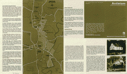
 Antietam
national battlefield site, Maryland Drawn by John J. Black,
November 1948. United States. National Park Service. CREATED/PUBLISHED
[S.l.], reprint 1959. NOTES Scale ca. 1:54,000. Map indicates
the main battle lines and the tour route. Inset: Vicinity
map. 5 x 6 cm. Illustrates a descriptive leaflet by the
U.S. National Park Service entitled "Antietam national
battlefield site, Maryland." Antietam
national battlefield site, Maryland Drawn by John J. Black,
November 1948. United States. National Park Service. CREATED/PUBLISHED
[S.l.], reprint 1959. NOTES Scale ca. 1:54,000. Map indicates
the main battle lines and the tour route. Inset: Vicinity
map. 5 x 6 cm. Illustrates a descriptive leaflet by the
U.S. National Park Service entitled "Antietam national
battlefield site, Maryland." |
 Antietam
Battlefield. United States. National Park Service. CREATED/PUBLISHED
Washington, U.S. Govt. Print. Off., 1972. NOTES Scale
ca. 1:24,000. Antietam
Battlefield. United States. National Park Service. CREATED/PUBLISHED
Washington, U.S. Govt. Print. Off., 1972. NOTES Scale
ca. 1:24,000. |
 Antietam
/ National Park Service, U.S. Department of the Interior.
United States. National Park Service. CREATED/PUBLISHED
[Washington] : The Service, [1980] NOTES Scale ca. 1:31,680. Antietam
/ National Park Service, U.S. Department of the Interior.
United States. National Park Service. CREATED/PUBLISHED
[Washington] : The Service, [1980] NOTES Scale ca. 1:31,680.
|
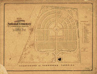 Map
of Antietam National Cemetary at Sharpsburg, Maryland
Designed by A. A. Biggs, M. D., President & Genl. Supt.,
Sharpsburg, 1866. Surveyed and drawn by Chas. P. Kahler,
C. E., Baltimore. Kahler, Charles P. CREATED/PUBLISHED
Balto., Lith. by A. Hoen & Co., 1867. NOTES Scale 1:600.
29 "references" are keyed by number to the map. Map
of Antietam National Cemetary at Sharpsburg, Maryland
Designed by A. A. Biggs, M. D., President & Genl. Supt.,
Sharpsburg, 1866. Surveyed and drawn by Chas. P. Kahler,
C. E., Baltimore. Kahler, Charles P. CREATED/PUBLISHED
Balto., Lith. by A. Hoen & Co., 1867. NOTES Scale 1:600.
29 "references" are keyed by number to the map. |
 Map
of the battlefield of Antietam, prepared by Lieut. Wm.
H. Willcox, Top. Off. & A.A.D.C. on Brig. Genl. Doubleday's
staff. [Sept. 17, 1862]. Willcox, William H. CREATED/PUBLISHED
Philada., Lith. of P. S. Duval & Son, [1862] NOTES Scale
ca. 1:13,300. Handwritten inscription in the upper right-hand
corner reads "Lieut Crawford with compts of Lt. Wm. H.
Willcox." Shows roads and streets, houses, fences, vegetation,
drainage, hachures, and troop positions. Inset: [Map of
the environs of Sharpsburg] 12 x 10 cm. Map
of the battlefield of Antietam, prepared by Lieut. Wm.
H. Willcox, Top. Off. & A.A.D.C. on Brig. Genl. Doubleday's
staff. [Sept. 17, 1862]. Willcox, William H. CREATED/PUBLISHED
Philada., Lith. of P. S. Duval & Son, [1862] NOTES Scale
ca. 1:13,300. Handwritten inscription in the upper right-hand
corner reads "Lieut Crawford with compts of Lt. Wm. H.
Willcox." Shows roads and streets, houses, fences, vegetation,
drainage, hachures, and troop positions. Inset: [Map of
the environs of Sharpsburg] 12 x 10 cm. |
 Map
of the battlefield of Antietam, [Sept. 17, 1862] [prepared
by Lieut. Wm. H. Willcox, Top. Off. & A.A.D.C. on Brig.
Genl. Doubleday's staff,] 3d edition. Willcox, William
H. CREATED/PUBLISHED [Philada., Lith. of P. S. Duval &
Son, 1862] NOTES [Scale ca. 1:13,300]. Inscribed in longhand
as follows: Obtained from Washington & presented to Gen.
R. E. Lee by J. E. B. Stuart. Map
of the battlefield of Antietam, [Sept. 17, 1862] [prepared
by Lieut. Wm. H. Willcox, Top. Off. & A.A.D.C. on Brig.
Genl. Doubleday's staff,] 3d edition. Willcox, William
H. CREATED/PUBLISHED [Philada., Lith. of P. S. Duval &
Son, 1862] NOTES [Scale ca. 1:13,300]. Inscribed in longhand
as follows: Obtained from Washington & presented to Gen.
R. E. Lee by J. E. B. Stuart. |
 Battle
of the Antietam fought September 16 & 17, 1862 Reconnoissance
of the ground occupied by the 1st Army Corps commanded
by Maj. Gen. Hooker. Made under the direction of Maj.
D. C. Houston, Chf. Engr., by Lieut. W. A. Roebling and
W. S. Long, C.E. Roebling, Washington A. CREATED/PUBLISHED
[S.l., 1862] NOTES Scale 1:10,560. Pen and ink manuscript
drawn on tracing cloth, showing "line of Hooker's advance,"
roads, houses and names of occupants, fences, vegetation,
drainage, and relief by hachures. Troop positions are
not given. Battle
of the Antietam fought September 16 & 17, 1862 Reconnoissance
of the ground occupied by the 1st Army Corps commanded
by Maj. Gen. Hooker. Made under the direction of Maj.
D. C. Houston, Chf. Engr., by Lieut. W. A. Roebling and
W. S. Long, C.E. Roebling, Washington A. CREATED/PUBLISHED
[S.l., 1862] NOTES Scale 1:10,560. Pen and ink manuscript
drawn on tracing cloth, showing "line of Hooker's advance,"
roads, houses and names of occupants, fences, vegetation,
drainage, and relief by hachures. Troop positions are
not given. |
 Antietam
Sharpsburg and vicinity. Constructed and engraved to illustrate
"The war with the South" [Compiled by Charles Sholl] Engd.
by Rae Smith. Sholl, Charles CREATED/PUBLISHED New York,
c1864. NOTES Scale ca. 1:26,700. Caption in lower margin:
A topographical map of the battle field at Antietam from
an actual survey by an engineer officer on General Doubleday's
staff. Antietam
Sharpsburg and vicinity. Constructed and engraved to illustrate
"The war with the South" [Compiled by Charles Sholl] Engd.
by Rae Smith. Sholl, Charles CREATED/PUBLISHED New York,
c1864. NOTES Scale ca. 1:26,700. Caption in lower margin:
A topographical map of the battle field at Antietam from
an actual survey by an engineer officer on General Doubleday's
staff. |
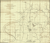
 Antietam.
Prepared by Bvt. Brig. Genl. N. Michler, Major of Engineers,
from surveys under his direction, by order of Brig. Genl.
& Bvt. Maj. Genl. A. A. Humphreys, Chief of Engineers,
and under the authority of the hon. Secretary of War.
Surveyed & drawn by Maj: J. E. Weyss, assisted by F. Theilkuhl,
J. Strasser & G. Thompson. Michler, N. (Nathaniel), 1827-1881.
CREATED/PUBLISHED [S.l.], Photo-lith. by the N.Y. Lithographing,
Engraving & Printing Co., Julius Bien, Supt., 1867. NOTES
Scale 1:21,120. "General direction of Confederate line
of battle, Sept. 16th 1862" and "(General direction of)
Confederate line of battle, Sept. 17th 1862 (evening)"
are hand-colored in red. Union troop positions are not
indicated. Detailed map of the environs of Sharpsburg
showing roads, the "Washington Co. R.R.," fences, houses,
names of residents, vegetation, drainage, villages, the
"Burnside Bridge," "Bloody Lane," "Dunker's Chapel," "National
Cemetery," and relief by hachures. Antietam.
Prepared by Bvt. Brig. Genl. N. Michler, Major of Engineers,
from surveys under his direction, by order of Brig. Genl.
& Bvt. Maj. Genl. A. A. Humphreys, Chief of Engineers,
and under the authority of the hon. Secretary of War.
Surveyed & drawn by Maj: J. E. Weyss, assisted by F. Theilkuhl,
J. Strasser & G. Thompson. Michler, N. (Nathaniel), 1827-1881.
CREATED/PUBLISHED [S.l.], Photo-lith. by the N.Y. Lithographing,
Engraving & Printing Co., Julius Bien, Supt., 1867. NOTES
Scale 1:21,120. "General direction of Confederate line
of battle, Sept. 16th 1862" and "(General direction of)
Confederate line of battle, Sept. 17th 1862 (evening)"
are hand-colored in red. Union troop positions are not
indicated. Detailed map of the environs of Sharpsburg
showing roads, the "Washington Co. R.R.," fences, houses,
names of residents, vegetation, drainage, villages, the
"Burnside Bridge," "Bloody Lane," "Dunker's Chapel," "National
Cemetery," and relief by hachures. |
 Antietam.
Enlarged and corrected from map of Gen. Michler, U.S.
Eng., by Oliver C. Gould, Portland, Maine. Gould, Oliver
C. CREATED/PUBLISHED [S.l., 189-?] NOTES Scale not given.
"No. 1 = Confeds. opposing 10 Me. & 128 P.V., 7:30 to
8:00 A.M. No. 2 & 3 = Confeds. marching behind no. 1." Antietam.
Enlarged and corrected from map of Gen. Michler, U.S.
Eng., by Oliver C. Gould, Portland, Maine. Gould, Oliver
C. CREATED/PUBLISHED [S.l., 189-?] NOTES Scale not given.
"No. 1 = Confeds. opposing 10 Me. & 128 P.V., 7:30 to
8:00 A.M. No. 2 & 3 = Confeds. marching behind no. 1."
|
 Map
of the battlefield of Antietam. No. 1. This map shows
the position of the Union and Confederate forces on the
morning of Sept. 17th, 1862, prior to the battle of Antietam
which opened at daybreak Drawn under the direction of
Antietam Board, Col. John C. Stearns, Gen. H. Heth. Theo.
Friebus, Jr. Antietam Battlefield Board. CREATED/PUBLISHED
Washington, D.C., Norris Peters Co., photo-litho., 1893.
NOTES Scale 1:14,080. Confederate forces are shown in
red and Union forces in blue. Headquarters of McClellan
and Lee are clearly indicated. Legend lists the names
of the corps, division, and brigade commanders. Brigades
are keyed by number of positions on the map. Shows roads,
railroad, houses, fences, names of residents, "Burnside
Bridge," "Bloody Lane," "Dunker's Chapel," "National Cemetery,"
towns, vegetation, drainage, fords, and relief by hachures. Map
of the battlefield of Antietam. No. 1. This map shows
the position of the Union and Confederate forces on the
morning of Sept. 17th, 1862, prior to the battle of Antietam
which opened at daybreak Drawn under the direction of
Antietam Board, Col. John C. Stearns, Gen. H. Heth. Theo.
Friebus, Jr. Antietam Battlefield Board. CREATED/PUBLISHED
Washington, D.C., Norris Peters Co., photo-litho., 1893.
NOTES Scale 1:14,080. Confederate forces are shown in
red and Union forces in blue. Headquarters of McClellan
and Lee are clearly indicated. Legend lists the names
of the corps, division, and brigade commanders. Brigades
are keyed by number of positions on the map. Shows roads,
railroad, houses, fences, names of residents, "Burnside
Bridge," "Bloody Lane," "Dunker's Chapel," "National Cemetery,"
towns, vegetation, drainage, fords, and relief by hachures.
|
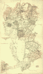
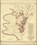 Map
of the battlefield of Antietam. This map shows the position
of each of the forty-two different commands of the regular
army engaged in the battle of Antietam, September 17,
1862. Battery "G", 2d U.S. Artillery, Lt. J. H. Butler,
commanding, was not engaged in the battle, being attached
to Gen'l. Couch's Division, near Harper's Ferry Drawn
under the direction of Antietam Board, Col. John C. Stearns,
Gen. H. Heth. Theo. Friebus Jr. Antietam Battlefield Board.
CREATED/PUBLISHED Washington D.C., Norris Peters Co.,
photo-litho., 1893. NOTES Scale 1:14,080. Legend lists
Union commands and the names of the commanders. Each unit
is keyed by number to a position on the map. Confederate
positions are not indicated. Shows roads, railroad, houses,
fences, names of residents, "Burnside Bridge," "Bloody
Lane," "Dunker's Chapel," "National Cemetery," towns,
vegetation, drainage, fords, and relief by hachures. Map
of the battlefield of Antietam. This map shows the position
of each of the forty-two different commands of the regular
army engaged in the battle of Antietam, September 17,
1862. Battery "G", 2d U.S. Artillery, Lt. J. H. Butler,
commanding, was not engaged in the battle, being attached
to Gen'l. Couch's Division, near Harper's Ferry Drawn
under the direction of Antietam Board, Col. John C. Stearns,
Gen. H. Heth. Theo. Friebus Jr. Antietam Battlefield Board.
CREATED/PUBLISHED Washington D.C., Norris Peters Co.,
photo-litho., 1893. NOTES Scale 1:14,080. Legend lists
Union commands and the names of the commanders. Each unit
is keyed by number to a position on the map. Confederate
positions are not indicated. Shows roads, railroad, houses,
fences, names of residents, "Burnside Bridge," "Bloody
Lane," "Dunker's Chapel," "National Cemetery," towns,
vegetation, drainage, fords, and relief by hachures. |
 (No.
2) Map of the battlefield of Antietam Drawn under the
direction of Antietam Board, Col. John C. Stearns [and]
Gen. H. Heth. Antietam Battlefield Board. CREATED/PUBLISHED
Washington, D.C. The Norris Peters Co., photo-litho. 1894.
NOTES Scale 1:14,908. Map of the battlefield showing roads
and lanes, houses and names of residents, fences, drainage,
woodland, and relief by hachures. Troop positions are
not indicated. (No.
2) Map of the battlefield of Antietam Drawn under the
direction of Antietam Board, Col. John C. Stearns [and]
Gen. H. Heth. Antietam Battlefield Board. CREATED/PUBLISHED
Washington, D.C. The Norris Peters Co., photo-litho. 1894.
NOTES Scale 1:14,908. Map of the battlefield showing roads
and lanes, houses and names of residents, fences, drainage,
woodland, and relief by hachures. Troop positions are
not indicated. |
 Map
of the battlefield of Antietam Published under the direction
of Daniel S. Lamont and Russell A. Alger, Secretaries
of War, by the Antietam Battlefield Board, Major Geo.
W. Davis, U.S.A. President, General E. A. Carman, late
Union army, [and] General H. Heth, late Confederate army.
Surveyed and drawn by Col. E. B. Cope, Engineer [and]
H. W. Mattern, Ass't Engineer, Gettysburg National Park.
Antietam Battlefield Board. CREATED/PUBLISHED [S.l.] Antietam
Battlefield Board 1898. NOTES Scale ca. 1:10,560. "Note:
Figures in black and crosses, thus (+) marked along roadsides
indicate numbers of tablets. For legends on tablets showing
positions of troops and their movements, see final report
of the Antietam Battlefield Board to the Secretary of
War, dated 1898." Detailed map of the battlefield showing
roads, lanes, fences, houses, names of residents, woodland,
and relief by contour lines at intervals of 10 feet. Troop
positions are not noted. Map
of the battlefield of Antietam Published under the direction
of Daniel S. Lamont and Russell A. Alger, Secretaries
of War, by the Antietam Battlefield Board, Major Geo.
W. Davis, U.S.A. President, General E. A. Carman, late
Union army, [and] General H. Heth, late Confederate army.
Surveyed and drawn by Col. E. B. Cope, Engineer [and]
H. W. Mattern, Ass't Engineer, Gettysburg National Park.
Antietam Battlefield Board. CREATED/PUBLISHED [S.l.] Antietam
Battlefield Board 1898. NOTES Scale ca. 1:10,560. "Note:
Figures in black and crosses, thus (+) marked along roadsides
indicate numbers of tablets. For legends on tablets showing
positions of troops and their movements, see final report
of the Antietam Battlefield Board to the Secretary of
War, dated 1898." Detailed map of the battlefield showing
roads, lanes, fences, houses, names of residents, woodland,
and relief by contour lines at intervals of 10 feet. Troop
positions are not noted. |
 Map
of the battlefield of Antietam. CREATED/PUBLISHED [S.l.,
19--?] NOTES Scale ca. 1:5280 (about 12 inches equals
1 mile, not "10 in. = 1 mile"). Very detailed anonymous
and undated map of the battlefield indicating roads and
lanes, drainage, houses, names of residents, grass fields,
stubble, corn fields, plowed fields, rock outcrops, rail,
post and rail, stone, and pailing fences, "fence[s], kind
unknown," hay stacks, and woodland. Relief is depicted
by contour lines at intervals of 10 feet. Troop positions
are not noted. Map
of the battlefield of Antietam. CREATED/PUBLISHED [S.l.,
19--?] NOTES Scale ca. 1:5280 (about 12 inches equals
1 mile, not "10 in. = 1 mile"). Very detailed anonymous
and undated map of the battlefield indicating roads and
lanes, drainage, houses, names of residents, grass fields,
stubble, corn fields, plowed fields, rock outcrops, rail,
post and rail, stone, and pailing fences, "fence[s], kind
unknown," hay stacks, and woodland. Relief is depicted
by contour lines at intervals of 10 feet. Troop positions
are not noted. |
 Map
of the battlefield of Antietam with the locations of monuments
erected by the Commonwealth of Pennsylvania to the 3rd,
4th, 7th, 8th regiments of infantry, Pennsylvania Reserve
Corps Prepared for Antietam Battlefield Commission of
Pennsylvania. Reduced and drawn by S. A. Hammond, Ass't.
Eng. Antietam Battlefield Memorial Commission. CREATED/PUBLISHED
[S.l., 1908?] NOTES Scale 1:18,000. Detailed map indicating
roads, drainage, fence lines, houses, names of residents,
woodland, and relief by contour lines. Inset: Mansfield
Avenue enlarged to show positions of Pennsylvania Reserve
monuments. 7 x 25 cm. Map
of the battlefield of Antietam with the locations of monuments
erected by the Commonwealth of Pennsylvania to the 3rd,
4th, 7th, 8th regiments of infantry, Pennsylvania Reserve
Corps Prepared for Antietam Battlefield Commission of
Pennsylvania. Reduced and drawn by S. A. Hammond, Ass't.
Eng. Antietam Battlefield Memorial Commission. CREATED/PUBLISHED
[S.l., 1908?] NOTES Scale 1:18,000. Detailed map indicating
roads, drainage, fence lines, houses, names of residents,
woodland, and relief by contour lines. Inset: Mansfield
Avenue enlarged to show positions of Pennsylvania Reserve
monuments. 7 x 25 cm. |
 Map
of the battlefield of Antietam with the locations of monuments
erected by the Commonwealth of Pennsylvania Prepared for
the Antietam Battlefield Memorial Commission. Reduced
and drawn by S. A. Hammond, Asst. Eng. Antietam Battlefield
Memorial Commission. CREATED/PUBLISHED N.Y., Julius Bien
& Co., lith., 1908? NOTES Scale 1:18,000. Detailed map
indicating roads, drainage, fence lines, houses, names
of residents, woodland, and relief by contour lines. Battlefield
monuments are located by red squares. Map
of the battlefield of Antietam with the locations of monuments
erected by the Commonwealth of Pennsylvania Prepared for
the Antietam Battlefield Memorial Commission. Reduced
and drawn by S. A. Hammond, Asst. Eng. Antietam Battlefield
Memorial Commission. CREATED/PUBLISHED N.Y., Julius Bien
& Co., lith., 1908? NOTES Scale 1:18,000. Detailed map
indicating roads, drainage, fence lines, houses, names
of residents, woodland, and relief by contour lines. Battlefield
monuments are located by red squares. |
 Antietam
Battlefield : new 1972 / National Park Service, U.S. Department
of the Interior. United States. National Park Service.
CREATED/PUBLISHED [Washington] : The Service, [1978] NOTES
Scale ca. 1:23,500. Antietam
Battlefield : new 1972 / National Park Service, U.S. Department
of the Interior. United States. National Park Service.
CREATED/PUBLISHED [Washington] : The Service, [1978] NOTES
Scale ca. 1:23,500. |
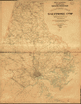 Military
map, Baltimore Co., Md. Compiled from the best authorities
and corrected by actual survey under the direction of
Col. W. F. Raynolds A.D.C., Chief Eng. 8th Army Corps.
Drawn and lithographed in the office of the Chief Eng.,
8th Army Corps, by Geo. Kaiser, Pvt. 10th N.Y. Vols. Kaiser,
George. CREATED/PUBLISHED [S.l.], 1863. NOTES Scale 1:63,360.
Detailed map indicating forts, camps, military hospitals,
roads, toll gates, railroads, towns, mills, houses and
names of residents. The names of a few towns are underscored
in red or blue. Military
map, Baltimore Co., Md. Compiled from the best authorities
and corrected by actual survey under the direction of
Col. W. F. Raynolds A.D.C., Chief Eng. 8th Army Corps.
Drawn and lithographed in the office of the Chief Eng.,
8th Army Corps, by Geo. Kaiser, Pvt. 10th N.Y. Vols. Kaiser,
George. CREATED/PUBLISHED [S.l.], 1863. NOTES Scale 1:63,360.
Detailed map indicating forts, camps, military hospitals,
roads, toll gates, railroads, towns, mills, houses and
names of residents. The names of a few towns are underscored
in red or blue. |
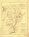
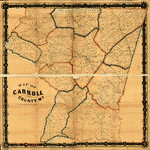 Map
of Carroll County, Md. Entered according to act of Congress
in the year 1863 by W. O. Shearer in the clerk's office
of the district court of the eastern district of Pennsylvania.
Shearer, W. O. CREATED/PUBLISHED [Philadelphia?], c1863.
NOTES Scale 1:31,600. "Made for military purposes only."
Relatively crude hand-colored lithographic map showing
roads and railroads, towns and villages, houses and names
of residents, rivers, and district boundaries. The map
includes fewer personal names than shown on "Martenet's
map of Carroll County, Maryland" (Baltimore, Simon J.
Martenet, 1862). Military information is not depicted. Map
of Carroll County, Md. Entered according to act of Congress
in the year 1863 by W. O. Shearer in the clerk's office
of the district court of the eastern district of Pennsylvania.
Shearer, W. O. CREATED/PUBLISHED [Philadelphia?], c1863.
NOTES Scale 1:31,600. "Made for military purposes only."
Relatively crude hand-colored lithographic map showing
roads and railroads, towns and villages, houses and names
of residents, rivers, and district boundaries. The map
includes fewer personal names than shown on "Martenet's
map of Carroll County, Maryland" (Baltimore, Simon J.
Martenet, 1862). Military information is not depicted.
|
|
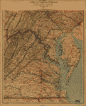
Chesapeake Bay from its head to Potamac River From
a trigonometrical survey under the direction of F. R.
Hassler and A. D. Bache, Superintendents of the survey
of the coast of the United States. United States Coast
Survey. CREATED/PUBLISHED [Washington U.S. Coast Survey]
1861-1862. NOTES Scale 1:80,000. At head of title: Coast
charts nos. 31, 32, 33. Overall title cited above appears
on coast chart no. 32 (map 18). Coast chart no. 31.
Chesapeake Bay from head of Bay to Magothy River. .
. Triangulation by J. Ferguson, T. W. Werner, J. E.
Johnstone, Capt. Topographical Engineers, U.S.A. Assistants.
Topography by T. W. Werner, J. J. S. Hassler, R. D.
Cutts, G. D. Wise, Assts., J. C. Neilson, Sub-Asst.,
J. B. Gluck & H. L. Whiting, Assts. Hydrography by the
parties under the command of Lieuts. Comdg. G. M. Bache,
S. P. Lee, W. P. McArthur, C. H. McBlair & R. Wainwright,
U.S.N. Assts. Published in 1861. ("No. 17" in upper
left corner). No. 32. From Magothy River to Choptank
River. Triangulation by J. Ferguson, F. H. Gerdes, J.
E. Johnstone, Capt. Topl. Engrs., E. Blunt, J. E. Hilgard,
Assts. and A. D. Bache, Supdt. Topography by H. L. Whiting,
F. H. Gerdes, Assts., J. C. Neilson, Sub-Asst., J. J.
S. Hassler, R. D. Cutts & G. D. Wise, Assts. Hydrography
by the parties under the command of Lieut Comdg. G.
M. Bache, S. P. Lee & W. P. McArthur, U.S.N. Assts.
Published in 1862. ("No. 18" in upper left corner).
Coast chart no. 33. Chesapeake Bay from Choptank River
to Potamac River . . . Triangulation by E. Blunt, J.
E. Hilgard, J. S. Williams and R. D. Cutts, Assistants.
Topography by J. J. S. Hassler, G. D. Wise, R. D. Cutts,
Assts. J. Seib & S. A. Wainwright, Sub-Assts. & H. L.
Whiting, Asst. Hydrography by the parties under the
command of Lieuts Comdg. W. P. McArthur, S. P. Lee and
J. J. Almy, U.S.N. Assistants. Published in 1862 ("No.
19" in upper left corner).
|
 Chesapeak
Bay. Sheet 6, from the mouth of York River to the entrance
to bay. From a trigonometrical survey under the direction
of A. D. Bache, Superintendent of the survey of the coast
of the United States. Triangulation by E. Blunt & J. Farley,
Assistants. Topography by J. J. S. Hassler, G. D. Wise,
J. Seib, Assts. & J. Mechan, Sub-Asst. Hydrography by
the party under the command of Lieut. Comdg. J. J. Almy,
U.S.N. Assistant. United States Coast Survey. CREATED/PUBLISHED
[Washington U.S U.S. Coast Survey] 1863. NOTES Scale 1:80,000. Chesapeak
Bay. Sheet 6, from the mouth of York River to the entrance
to bay. From a trigonometrical survey under the direction
of A. D. Bache, Superintendent of the survey of the coast
of the United States. Triangulation by E. Blunt & J. Farley,
Assistants. Topography by J. J. S. Hassler, G. D. Wise,
J. Seib, Assts. & J. Mechan, Sub-Asst. Hydrography by
the party under the command of Lieut. Comdg. J. J. Almy,
U.S.N. Assistant. United States Coast Survey. CREATED/PUBLISHED
[Washington U.S U.S. Coast Survey] 1863. NOTES Scale 1:80,000.
|
 Chesapeake
Bay, Sheet no. 1, York River, Hampton Roads, Chesapeake
entrance.. From a trigonometrical survey under the direction
of A. D. Bache, Superintendent of the survey of the coast
of the United States. Triangulation by E. Blunt & J. Farley,
Assistants. Topography by J. J. S. Hassler, G. D. Wise,
J. Seib, Assts. & J. Mechan, Sub-Asst. Hydrography by
the party under the command of Lieut. Comdg. J. J. Almy,
U.S.N. Assistant. Redd. drng. by W. M. C. Fairfax, A.
Strausz & L. D. Williams. Engd. by J. Knight, A. Sengteller,
H. S. Barnard & J. C. Kondrup. United States Coast Survey.
CREATED/PUBLISHED [Washington U.S. Coast Survey] 1863.
NOTES Scale 1:80,000. General chart indicating soundings,
lighthouses, buoys, and coastal vegetation. Includes sailing
directions. Chesapeake
Bay, Sheet no. 1, York River, Hampton Roads, Chesapeake
entrance.. From a trigonometrical survey under the direction
of A. D. Bache, Superintendent of the survey of the coast
of the United States. Triangulation by E. Blunt & J. Farley,
Assistants. Topography by J. J. S. Hassler, G. D. Wise,
J. Seib, Assts. & J. Mechan, Sub-Asst. Hydrography by
the party under the command of Lieut. Comdg. J. J. Almy,
U.S.N. Assistant. Redd. drng. by W. M. C. Fairfax, A.
Strausz & L. D. Williams. Engd. by J. Knight, A. Sengteller,
H. S. Barnard & J. C. Kondrup. United States Coast Survey.
CREATED/PUBLISHED [Washington U.S. Coast Survey] 1863.
NOTES Scale 1:80,000. General chart indicating soundings,
lighthouses, buoys, and coastal vegetation. Includes sailing
directions. |
 Map
and directory of Camp Patterson Park [Baltimore, Maryland]
One Hundred and Tenth Regiment of New York Volunteers.
Col. D. C. Littlejohn, commanding By. J. B. Butler, engineer
and surveyor. Printed by F. Bourquin & Co., Philadelphia.
September 27, 1862. Butler, J. B. CREATED/PUBLISHED [Philadelphia
F. Bourquin & Co.], 1862. NOTES Scale 1:360. Detailed
map indicating position of tents, principal buildings,
wagon roads, and "earthwork intrenchments of the War of
1812." Tents are keyed by number to a list of occupants
printed at the sides and bottom of the map. Includes portraits
of nine officers of the regiment. Map
and directory of Camp Patterson Park [Baltimore, Maryland]
One Hundred and Tenth Regiment of New York Volunteers.
Col. D. C. Littlejohn, commanding By. J. B. Butler, engineer
and surveyor. Printed by F. Bourquin & Co., Philadelphia.
September 27, 1862. Butler, J. B. CREATED/PUBLISHED [Philadelphia
F. Bourquin & Co.], 1862. NOTES Scale 1:360. Detailed
map indicating position of tents, principal buildings,
wagon roads, and "earthwork intrenchments of the War of
1812." Tents are keyed by number to a list of occupants
printed at the sides and bottom of the map. Includes portraits
of nine officers of the regiment. |
 Point
Lookout, Md. View of Hammond Genl. Hospital & U.S. genl.
depot for prisoners of war Lith. by E. Sachse & Co., Baltimore.
Everett, George, publisher. CREATED/PUBLISHED Point Lookout
1864. NOTES Scale not given. Sixty-three sites are listed
in the margin and keyed by number to the appropriate position
in the view. Inset: Headquarters of the general commanding
St. Mary's District. View. 17 x 13 cm. Point
Lookout, Md. View of Hammond Genl. Hospital & U.S. genl.
depot for prisoners of war Lith. by E. Sachse & Co., Baltimore.
Everett, George, publisher. CREATED/PUBLISHED Point Lookout
1864. NOTES Scale not given. Sixty-three sites are listed
in the margin and keyed by number to the appropriate position
in the view. Inset: Headquarters of the general commanding
St. Mary's District. View. 17 x 13 cm. |
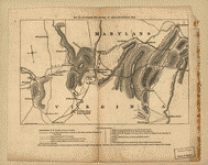
 Pocket
map showing the probable theatre of the war Compiled by
G. A. Aschbach, C.E. Allentown, Pa. Aschbach, G. A. CREATED/PUBLISHED
Philadelphia M. H. Traubel (c)1861. NOTES Scale ca. 1:1,700,000.
Map of Maryland, Delaware, and parts of Pennsylvania and
Virginia, showing "camps & forts" underlined in red, "prominent
places" underlined in blue, roads, railroads, drainage,
towns, and boundaries. Insets: [Street pattern of the
city of Baltimore] 9 x 12 cm.-[Map of the city and county
of Washington, and the county of Alexandria] 13 x 13 cm.
Contains a list of 12 buildings keyed by number to the
map. Pocket
map showing the probable theatre of the war Compiled by
G. A. Aschbach, C.E. Allentown, Pa. Aschbach, G. A. CREATED/PUBLISHED
Philadelphia M. H. Traubel (c)1861. NOTES Scale ca. 1:1,700,000.
Map of Maryland, Delaware, and parts of Pennsylvania and
Virginia, showing "camps & forts" underlined in red, "prominent
places" underlined in blue, roads, railroads, drainage,
towns, and boundaries. Insets: [Street pattern of the
city of Baltimore] 9 x 12 cm.-[Map of the city and county
of Washington, and the county of Alexandria] 13 x 13 cm.
Contains a list of 12 buildings keyed by number to the
map. |
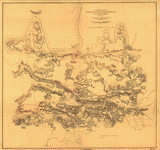
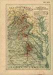
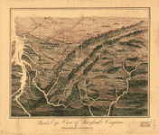 Birds
eye view of Maryland and Virginia. S. N. Gaston and Company.
CREATED/PUBLISHED [S.l.], S. N. Gaston & Co., c1861. NOTES
Not drawn to scale. Panoramic map looking south from southern
Pennsylvania showing relief, rivers, place names, and
railroads. Birds
eye view of Maryland and Virginia. S. N. Gaston and Company.
CREATED/PUBLISHED [S.l.], S. N. Gaston & Co., c1861. NOTES
Not drawn to scale. Panoramic map looking south from southern
Pennsylvania showing relief, rivers, place names, and
railroads. |
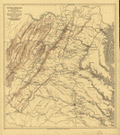
 Upper
Potomac from McCoy's Ferry to Conrad's Ferry and adjacent
portions of Maryland and Virginia compiled from county
maps and maps prepared by Col. J. N. Macomb, A.D.C. Lt.
Col. Engrs with additions and corrections by Lt. Col.
D. H. Strother, A.D.C. Engineer Department, 1863. United
States. Army. Corps of Engineers CREATED/PUBLISHED [S.l.],
1863. NOTES Scale ca. 1:130,000. Map, without border,
extends from Frederick, Maryland, west to Winchester,
Virginia, and Hagerstown, Maryland, south to Front Royal,
Virginia. Depicted are roads, railroads, canals, drainage,
houses, cities and towns, and relief by hachures. In some
areas, countryside is described by terms such as "hilly
& wooded country," "open country," etc. Upper
Potomac from McCoy's Ferry to Conrad's Ferry and adjacent
portions of Maryland and Virginia compiled from county
maps and maps prepared by Col. J. N. Macomb, A.D.C. Lt.
Col. Engrs with additions and corrections by Lt. Col.
D. H. Strother, A.D.C. Engineer Department, 1863. United
States. Army. Corps of Engineers CREATED/PUBLISHED [S.l.],
1863. NOTES Scale ca. 1:130,000. Map, without border,
extends from Frederick, Maryland, west to Winchester,
Virginia, and Hagerstown, Maryland, south to Front Royal,
Virginia. Depicted are roads, railroads, canals, drainage,
houses, cities and towns, and relief by hachures. In some
areas, countryside is described by terms such as "hilly
& wooded country," "open country," etc. |
 Upper
Potomac from McCoy's Ferry to Conrad's Ferry and adjacent
portions of Maryland and Virginia. United States. Army.
Corps of Engineers CREATED/PUBLISHED [S.l.], 1864. NOTES
Scale ca. 1:130,000. Upper
Potomac from McCoy's Ferry to Conrad's Ferry and adjacent
portions of Maryland and Virginia. United States. Army.
Corps of Engineers CREATED/PUBLISHED [S.l.], 1864. NOTES
Scale ca. 1:130,000. |
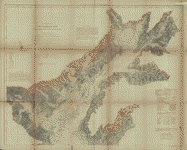
 Portion
of the Military department of Washington embraching lower
counties of Maryland. United States. Army. Corps of Engineers.
CREATED/PUBLISHED [Washington, D.C.], Engineer Bureau,
War Dep., 1865. NOTES Scale 1:200,000. General map extending
from Washington, D.C., south to Point Lookout, Maryland. Portion
of the Military department of Washington embraching lower
counties of Maryland. United States. Army. Corps of Engineers.
CREATED/PUBLISHED [Washington, D.C.], Engineer Bureau,
War Dep., 1865. NOTES Scale 1:200,000. General map extending
from Washington, D.C., south to Point Lookout, Maryland.
|
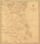
 Map
of the vicinity of Hagerstown, Funkstown, Williamsport,
and Falling Waters, Maryland Accompanying the report of
Major General G. G. Meade, on the battle of Gettysburg,
dated October 1st 1863. United States. Army. Corps of
Engineers. CREATED/PUBLISHED [S.l.], Published by authority
of the Hon. the Secretary of War. Office of the Chief
of Engineers, U.S. Army, 1879. NOTES Scale ca. 1:21,500.
"United States forces are shown in blue [and] Confederate
forces are shown in red." Indicates houses, names of residents,
stone fences, roads, vegetation, drainage, and relief
by hachures. Map
of the vicinity of Hagerstown, Funkstown, Williamsport,
and Falling Waters, Maryland Accompanying the report of
Major General G. G. Meade, on the battle of Gettysburg,
dated October 1st 1863. United States. Army. Corps of
Engineers. CREATED/PUBLISHED [S.l.], Published by authority
of the Hon. the Secretary of War. Office of the Chief
of Engineers, U.S. Army, 1879. NOTES Scale ca. 1:21,500.
"United States forces are shown in blue [and] Confederate
forces are shown in red." Indicates houses, names of residents,
stone fences, roads, vegetation, drainage, and relief
by hachures. |
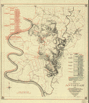
 Map
of the Maryland Campaign, Sept. 3rd to 29th 1862 George
Allen & Co., Ltd., London. Sheppard, Eric W. CREATED/PUBLISHED
London, E. W. Sheppard, [1911] NOTES Scale ca. 1:193,000.
Annotated in different colors to show the routes between
Sept. 4th and 14th of the "9th Corps, Reno,"1st Corps,
Hooker," "12th Corps, Williams," "2nd Corps, Sumner,"
"6th Corps, Franklin," "Couch's Division," and "Sykes
Division." Map
of the Maryland Campaign, Sept. 3rd to 29th 1862 George
Allen & Co., Ltd., London. Sheppard, Eric W. CREATED/PUBLISHED
London, E. W. Sheppard, [1911] NOTES Scale ca. 1:193,000.
Annotated in different colors to show the routes between
Sept. 4th and 14th of the "9th Corps, Reno,"1st Corps,
Hooker," "12th Corps, Williams," "2nd Corps, Sumner,"
"6th Corps, Franklin," "Couch's Division," and "Sykes
Division." |
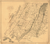
 Map
of portions of Virginia, West Virginia, and Maryland,
centering on Harpers Ferry and including Winchester, Hancock,
Emmitsburg, and Ridgeville, Maryland.] / Engineer Office,
A.N.V. ; drawn by Chas. G. Nauck, Ass't Eng. Nauck, Chas.
G. CREATED/PUBLISHED [186-] NOTES Shows roads in red,
and railroads, place names, etc. in black. Relief shown
by hachures. Map
of portions of Virginia, West Virginia, and Maryland,
centering on Harpers Ferry and including Winchester, Hancock,
Emmitsburg, and Ridgeville, Maryland.] / Engineer Office,
A.N.V. ; drawn by Chas. G. Nauck, Ass't Eng. Nauck, Chas.
G. CREATED/PUBLISHED [186-] NOTES Shows roads in red,
and railroads, place names, etc. in black. Relief shown
by hachures. |
 Map
of portions of Virginia and Maryland, extending from Baltimore
to Strasburg, and from Washington to Gettysburg, with
concentric circles at 5-mile intervals centering on Washington
and on Baltimore]. CREATED/PUBLISHED [186-] NOTES Relief
shown by hachures. Map
of portions of Virginia and Maryland, extending from Baltimore
to Strasburg, and from Washington to Gettysburg, with
concentric circles at 5-mile intervals centering on Washington
and on Baltimore]. CREATED/PUBLISHED [186-] NOTES Relief
shown by hachures. |
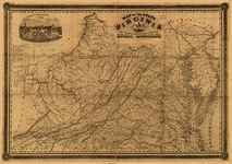
 Map
of Virginia, Maryland &c., seat of war, compiled from
the latest maps, 1861 sold by George L. Bidgood, Richmond,
Va. and Tucker & Perkins, Augusta, Ga. Hoyer & Ludwig,
lithographic establisht., Richmond, Va. Paterson, J. T.
CREATED/PUBLISHED [S.l.], J. T. Paterson, [1861] NOTES
Scale ca. 1:760,000. General map. Confederate imprint.
Pencil note in the lower margin reads "This map was advertised
in the Augusta, Ga. Daily Chronicle, Oct. 27, 1861." Includes
"Table of distances." Map
of Virginia, Maryland &c., seat of war, compiled from
the latest maps, 1861 sold by George L. Bidgood, Richmond,
Va. and Tucker & Perkins, Augusta, Ga. Hoyer & Ludwig,
lithographic establisht., Richmond, Va. Paterson, J. T.
CREATED/PUBLISHED [S.l.], J. T. Paterson, [1861] NOTES
Scale ca. 1:760,000. General map. Confederate imprint.
Pencil note in the lower margin reads "This map was advertised
in the Augusta, Ga. Daily Chronicle, Oct. 27, 1861." Includes
"Table of distances." |
 Pocket
war map of Virginia, with portraits of Scott & his generals.
Also views and plans of the principal places of note connected
with the war Lith by J. H. Bufford. Bufford, John Henry,
1810-1870. CREATED/PUBLISHED Boston, J. H. Bufford, c1861.
NOTES Scale not given. Decorative border includes portraits
of Scott, Harney, McClellan, Sprague, Fremont, Butler,
Banks, Dix, Lyon, McDowell, Mansfield, and Wool. Insets:
Cairo. 4 x 6 cm.-Charleston. 4 x 6 cm.-Washington. 5 x
6 cm.-The Vermont regiment at Newport News. [view] 3 x
4 cm.-Fortress Monroe. [view] 2 x 9 cm.-Baltimore. 4 x
6 cm.-New Orleans. 4 x 6 cm.-Richmond. 6 x 6 cm.-Savannah.
3 x 6 cm.-[Fortress] Monroe. 6 x 6 cm. Pocket
war map of Virginia, with portraits of Scott & his generals.
Also views and plans of the principal places of note connected
with the war Lith by J. H. Bufford. Bufford, John Henry,
1810-1870. CREATED/PUBLISHED Boston, J. H. Bufford, c1861.
NOTES Scale not given. Decorative border includes portraits
of Scott, Harney, McClellan, Sprague, Fremont, Butler,
Banks, Dix, Lyon, McDowell, Mansfield, and Wool. Insets:
Cairo. 4 x 6 cm.-Charleston. 4 x 6 cm.-Washington. 5 x
6 cm.-The Vermont regiment at Newport News. [view] 3 x
4 cm.-Fortress Monroe. [view] 2 x 9 cm.-Baltimore. 4 x
6 cm.-New Orleans. 4 x 6 cm.-Richmond. 6 x 6 cm.-Savannah.
3 x 6 cm.-[Fortress] Monroe. 6 x 6 cm. |
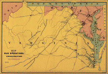 Map
showing the war operations, in Virginia & Maryland. Bufford,
John Henry, 1810-1870. CREATED/PUBLISHED Boston, J. H.
Bufford, c1861. NOTES Scale not given. Indicates railroads,
principal towns, and a few batteries. Map
showing the war operations, in Virginia & Maryland. Bufford,
John Henry, 1810-1870. CREATED/PUBLISHED Boston, J. H.
Bufford, c1861. NOTES Scale not given. Indicates railroads,
principal towns, and a few batteries. |
 Map
of the seat of war : [Virginia and Maryland] / compiled
& drawn by M.B. Grant, C.E. ; lithographed by R.H. Howell.
Grant, M. B. CREATED/PUBLISHED Savannah, Ga. : T.A. Burke,
Morning New Office, [1861?] NOTES General map. Place names
in Maryland north of Baltimore and Frederick, and south
of Washington, D.C. (with the exception of Fort Washington),
are not given. Few place names in Virginia south of Richmond
and Lynchburg (with the exception of Norfolk and the Virginia
Peninsula) are given. Map
of the seat of war : [Virginia and Maryland] / compiled
& drawn by M.B. Grant, C.E. ; lithographed by R.H. Howell.
Grant, M. B. CREATED/PUBLISHED Savannah, Ga. : T.A. Burke,
Morning New Office, [1861?] NOTES General map. Place names
in Maryland north of Baltimore and Frederick, and south
of Washington, D.C. (with the exception of Fort Washington),
are not given. Few place names in Virginia south of Richmond
and Lynchburg (with the exception of Norfolk and the Virginia
Peninsula) are given. |
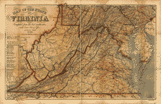
 Map
of the state of Virginia : containing the counties, principal
towns, railroads, rivers, canals & all other internal
improvements. West & Johnston. CREATED/PUBLISHED Richmond
: West & Johnston, 1862. NOTES Relief shown by hachures.
Also covers Maryland (without relief). Military features
not shown. Confederate imprint. Map
of the state of Virginia : containing the counties, principal
towns, railroads, rivers, canals & all other internal
improvements. West & Johnston. CREATED/PUBLISHED Richmond
: West & Johnston, 1862. NOTES Relief shown by hachures.
Also covers Maryland (without relief). Military features
not shown. Confederate imprint. |
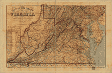
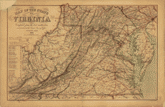
 Lloyd's
official map of the State of Virginia from actual surveys
by order of the Executive, 1828 & 1859 Corrected and revised
by J. T. Lloyd to 1862, from surveys made by Capt. W.
Angelo Powell, of the U.S. Topographical Engineers. Lloyd,
James T. CREATED/PUBLISHED New York, J. T. Lloyd, [1863]
NOTES Scale ca. 1:650,000. Lloyd's
official map of the State of Virginia from actual surveys
by order of the Executive, 1828 & 1859 Corrected and revised
by J. T. Lloyd to 1862, from surveys made by Capt. W.
Angelo Powell, of the U.S. Topographical Engineers. Lloyd,
James T. CREATED/PUBLISHED New York, J. T. Lloyd, [1863]
NOTES Scale ca. 1:650,000. |
 Map
of eastern Virginia / compiled from the best authorities
and printed at the Coast Survey Office, A. D. Bache, supdt.
; compiled by W. L. Nicholson ; lith. by Chas. G. Krebs.
Nicholson, W. L. CREATED/PUBLISHED [Washington] : The
Office, 1863. NOTES Scale ca. 1:875,000. Relief shown
by hachures. Also covers Maryland, and southeastern Pennsylvania.
Shows radial distances from Richmond and Washington, D.C. Map
of eastern Virginia / compiled from the best authorities
and printed at the Coast Survey Office, A. D. Bache, supdt.
; compiled by W. L. Nicholson ; lith. by Chas. G. Krebs.
Nicholson, W. L. CREATED/PUBLISHED [Washington] : The
Office, 1863. NOTES Scale ca. 1:875,000. Relief shown
by hachures. Also covers Maryland, and southeastern Pennsylvania.
Shows radial distances from Richmond and Washington, D.C.
|
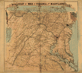
 Map
of the State of Virginia compiled from the best authorities
at the Coast Survey Office. A. D. Bache, Supdt. July 1863.
Compiled by W. L. Nicholson. Lith by Chas. G. Krebs. Nicholson,
W. L. CREATED/PUBLISHED [S.l.], 1863. NOTES Scale ca.
1:887,040. General map of Virginia, West Virginia, Maryland,
Delaware, and southern Pennsylvania showing cities and
towns, roads, rivers, and relief by hachures. The map
is overprinted in red to indicate railroads, the state
name "West Virginia," and concentric circles centered
on Richmond. Circles are at intervals of ten miles. A
table of "Distances by Rail Roads" appears below the map
title. Map
of the State of Virginia compiled from the best authorities
at the Coast Survey Office. A. D. Bache, Supdt. July 1863.
Compiled by W. L. Nicholson. Lith by Chas. G. Krebs. Nicholson,
W. L. CREATED/PUBLISHED [S.l.], 1863. NOTES Scale ca.
1:887,040. General map of Virginia, West Virginia, Maryland,
Delaware, and southern Pennsylvania showing cities and
towns, roads, rivers, and relief by hachures. The map
is overprinted in red to indicate railroads, the state
name "West Virginia," and concentric circles centered
on Richmond. Circles are at intervals of ten miles. A
table of "Distances by Rail Roads" appears below the map
title. |
 New
map of the seat of war in Virginia and Maryland Drawn
by J. G. Bruff. Lith of Lang & Cooper, New York. Bruff,
Joseph G. CREATED/PUBLISHED New York and Washington, D.C.,
J. Disturnell and W. H. and O. H. Morrison, 1863. NOTES
Scale ca. 1:360,000. Map of eastern Virginia and Maryland
showing the location and date of battles, forts, roads,
railroads, towns, drainage, and relief by hachures. New
map of the seat of war in Virginia and Maryland Drawn
by J. G. Bruff. Lith of Lang & Cooper, New York. Bruff,
Joseph G. CREATED/PUBLISHED New York and Washington, D.C.,
J. Disturnell and W. H. and O. H. Morrison, 1863. NOTES
Scale ca. 1:360,000. Map of eastern Virginia and Maryland
showing the location and date of battles, forts, roads,
railroads, towns, drainage, and relief by hachures. |
 New
map of the seat of war in Virginia and Maryland Drawn
by J. G. Bruff. Lith of Lang & Cooper, New York. Bruff,
Joseph G. CREATED/PUBLISHED New York and Washington, D.C.,
J. Disturnell and W. H. and O. H. Morrison, 1863. NOTES
[Scale ca. 1:360,000]. Another issue. This issue contains
the following additions: a) Washington is described as
being "Surrounded by forts, batteries, and redoubts."
b) Fredericksburg is labeled "H. 2 Rebel forces, Dec.
1862." c) "Explanation" contains the statement that "Washington
City is the centre of the circles of measurement, 10 miles
apart" d) Town and country names have been added. New
map of the seat of war in Virginia and Maryland Drawn
by J. G. Bruff. Lith of Lang & Cooper, New York. Bruff,
Joseph G. CREATED/PUBLISHED New York and Washington, D.C.,
J. Disturnell and W. H. and O. H. Morrison, 1863. NOTES
[Scale ca. 1:360,000]. Another issue. This issue contains
the following additions: a) Washington is described as
being "Surrounded by forts, batteries, and redoubts."
b) Fredericksburg is labeled "H. 2 Rebel forces, Dec.
1862." c) "Explanation" contains the statement that "Washington
City is the centre of the circles of measurement, 10 miles
apart" d) Town and country names have been added. |
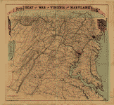
 Map
of the State of Virginia compiled from the best authorities,
and printed at the Coast Survey Office. A. D. Bache, Supdt.
May 1864. Compiled by W. L. Nicholson. Nicholson, W. L.
CREATED/PUBLISHED [S.l.], Lith. by Chas. G. Krebs., 1864.
NOTES Scale ca. 1:887,040. General map of Virginia, West
Virginia, Maryland, Delaware, and southern Pennsylvania
showing cities and towns, roads, rivers, and relief by
hachures. The map is overprinted in red to indicate railroads,
the state name "West Virginia," and concentric circles
centered on Washington, D.C. A table of "Distances by
Railroads" appears below the map title. Map
of the State of Virginia compiled from the best authorities,
and printed at the Coast Survey Office. A. D. Bache, Supdt.
May 1864. Compiled by W. L. Nicholson. Nicholson, W. L.
CREATED/PUBLISHED [S.l.], Lith. by Chas. G. Krebs., 1864.
NOTES Scale ca. 1:887,040. General map of Virginia, West
Virginia, Maryland, Delaware, and southern Pennsylvania
showing cities and towns, roads, rivers, and relief by
hachures. The map is overprinted in red to indicate railroads,
the state name "West Virginia," and concentric circles
centered on Washington, D.C. A table of "Distances by
Railroads" appears below the map title. |
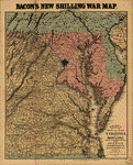 Bacon's
new map of the seat of war in Virginia and Maryland. Showing
the interesting localities around Richmond, Washington,
Baltimore &c. Bacon & Co. CREATED/PUBLISHED London, Bacon
& Co., 1864. NOTES Scale ca. 1:804,000. At top of map:
Bacon's new shilling war map. Bacon's seat of war in Virginia
designating minutely over 3,000 names of towns, streams
&c., around Richmond and Washington. The most elaborate
ever issued. London, Bacon & Co. Bacon's
new map of the seat of war in Virginia and Maryland. Showing
the interesting localities around Richmond, Washington,
Baltimore &c. Bacon & Co. CREATED/PUBLISHED London, Bacon
& Co., 1864. NOTES Scale ca. 1:804,000. At top of map:
Bacon's new shilling war map. Bacon's seat of war in Virginia
designating minutely over 3,000 names of towns, streams
&c., around Richmond and Washington. The most elaborate
ever issued. London, Bacon & Co. |
 Map
of eastern Virginia compiled from the best authorities
and printed at the Coast Survey Office, A. D. Bache, Supdt.
1864. Compiled by W. L. Nicholson. Nicholson, W. L. CREATED/PUBLISHED
[S.l.], Lith. by Chas. G. Krebs., 1864. NOTES Scale ca.
1:887,040. General map of eastern Virginia showing cities
and towns, roads, rivers, and relief by hachures. The
map is overprinted in red to indicate railroads and concentric
circles centered on Richmond and in blue to show concentratric
circles centered on Washington, D.C. Map
of eastern Virginia compiled from the best authorities
and printed at the Coast Survey Office, A. D. Bache, Supdt.
1864. Compiled by W. L. Nicholson. Nicholson, W. L. CREATED/PUBLISHED
[S.l.], Lith. by Chas. G. Krebs., 1864. NOTES Scale ca.
1:887,040. General map of eastern Virginia showing cities
and towns, roads, rivers, and relief by hachures. The
map is overprinted in red to indicate railroads and concentric
circles centered on Richmond and in blue to show concentratric
circles centered on Washington, D.C. |
 Map
of the State of Virginia compiled from the best authorities,
and printed at the Coast Survey Office. A. D. Bache, Supdt.
1865. Compiled by W. L. Nicholson. Lith. by Chas. G. Krebs.
Nicholson, W. L. CREATED/PUBLISHED [S.l.], 1865. NOTES
Scale ca. 1:887,040. General map of Virginia, West Virginia,
Maryland, Delaware, and southern Pennsylvania showing
cities and towns, roads, rivers, and relief by hachures.
The map is overprinted in red to indicate railroads, the
state name "West Virginia," and concentric circles centered
on Richmond. Printed in blue are concentric circles centered
on Washington, D.C. A table of "Distances by Railroads"
appears below the map title. Map
of the State of Virginia compiled from the best authorities,
and printed at the Coast Survey Office. A. D. Bache, Supdt.
1865. Compiled by W. L. Nicholson. Lith. by Chas. G. Krebs.
Nicholson, W. L. CREATED/PUBLISHED [S.l.], 1865. NOTES
Scale ca. 1:887,040. General map of Virginia, West Virginia,
Maryland, Delaware, and southern Pennsylvania showing
cities and towns, roads, rivers, and relief by hachures.
The map is overprinted in red to indicate railroads, the
state name "West Virginia," and concentric circles centered
on Richmond. Printed in blue are concentric circles centered
on Washington, D.C. A table of "Distances by Railroads"
appears below the map title. |
 Battle-field
map showing field of operations of the Armies of the Potomac
and James Compiled from latest government surveys and
published by J. C. & C. G. Van Hook. A. B. Graham, photo-lith.,
Washington, D. C. Van Hook, J. C. CREATED/PUBLISHED Washington,
1892 NOTES Scale ca. 1:508,500. Map of Virginia and Maryland
showing engagements, railroads, rivers and streams, place
names, and relief by hachures. "Dates and locations of
principal engagements as shown on this map" are listed
in the lower left corner. Battle-field
map showing field of operations of the Armies of the Potomac
and James Compiled from latest government surveys and
published by J. C. & C. G. Van Hook. A. B. Graham, photo-lith.,
Washington, D. C. Van Hook, J. C. CREATED/PUBLISHED Washington,
1892 NOTES Scale ca. 1:508,500. Map of Virginia and Maryland
showing engagements, railroads, rivers and streams, place
names, and relief by hachures. "Dates and locations of
principal engagements as shown on this map" are listed
in the lower left corner. |
 Map
of Virginia and neighboring states showing the location
of battles in the Civil War 1861-1865. Northrup, William
P. CREATED/PUBLISHED Buffalo, N.Y., The Matthews-Northrup
Works, c1912. NOTES Scale ca. 1:366,000. Map of eastern
Virginia and parts of North Carolina, Maryland, West Virginia,
and Pennsylvania, showing "battles in which New York regiments
were engaged," "railroads at time of war," and "turnpikes
and plank roads." Union states are colored yellow, and
Confederate states are green. Map
of Virginia and neighboring states showing the location
of battles in the Civil War 1861-1865. Northrup, William
P. CREATED/PUBLISHED Buffalo, N.Y., The Matthews-Northrup
Works, c1912. NOTES Scale ca. 1:366,000. Map of eastern
Virginia and parts of North Carolina, Maryland, West Virginia,
and Pennsylvania, showing "battles in which New York regiments
were engaged," "railroads at time of war," and "turnpikes
and plank roads." Union states are colored yellow, and
Confederate states are green. |
 ton,
Praed's new map of Virginia and Maryland to illustrate
the campaigns of 1861 to 1864. Sifton, Praed & Company,
Ltd. CREATED/PUBLISHED London, Sifton, Praed & Co., Ltd.,
"The Map House", 1912. NOTES Scale 1:633,600. General
map with place names associated with the war indicated.
Troop positions are not indicated. ton,
Praed's new map of Virginia and Maryland to illustrate
the campaigns of 1861 to 1864. Sifton, Praed & Company,
Ltd. CREATED/PUBLISHED London, Sifton, Praed & Co., Ltd.,
"The Map House", 1912. NOTES Scale 1:633,600. General
map with place names associated with the war indicated.
Troop positions are not indicated. |
 Map
to illustrate the report of Brigadier-General Hill Richardson,
sc. Richardson, James H. CREATED/PUBLISHED N.Y., [1861]
NOTES Scale not given. Map of part of West Virginia and
western Maryland from Romney west to Grafton, showing
the battle of Corricks Ford on July 14th, routes used
by Union and Confederate columns, location of bridges
burned by Confederates on July 12, 14, and 15, and the
"point where pursuit was abandoned by orders of Major-General
McClellan." Map
to illustrate the report of Brigadier-General Hill Richardson,
sc. Richardson, James H. CREATED/PUBLISHED N.Y., [1861]
NOTES Scale not given. Map of part of West Virginia and
western Maryland from Romney west to Grafton, showing
the battle of Corricks Ford on July 14th, routes used
by Union and Confederate columns, location of bridges
burned by Confederates on July 12, 14, and 15, and the
"point where pursuit was abandoned by orders of Major-General
McClellan." |
This
is a must have collection for any civil war history buff!
To use
this software, you must install the free ExpressView MrSid
software which is included on the CD. This is a 30 second
process and will allow you to view and manipulate/print all
the maps in this CD collection in full detail. There is a
version for both Windows platforms and Macintosh platforms
and full installation instructions are included on the CD. |


