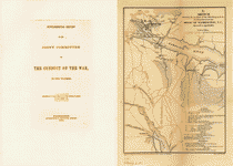
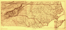
This
CD contains 47 rare historic maps and descriptive pages representing
fascinating details about North Carolina and its vicinity
during the Civil War in MrSid format.
This
format allows you to see the entire map on your computer screen
or drill down to see the smallest details. The original maps
are often quite large, as much as 36" long or larger
and quite detailed. With the MrSID software, you can manipulate
the map to print the entire map in great detail or zoom into
a portion of the map in full detail for viewing or printing.
You could even bring the images to a local print shop to have
the maps reprinted in their full size. (MrSID software is
included on the CD.)
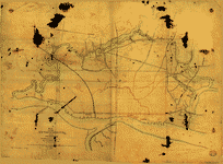
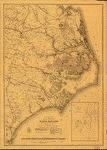
To
give you a sample of the detail you can expect in these maps,
here is an example based on a panoramic map of Washington,
DC.
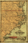
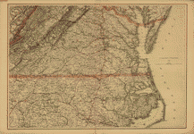
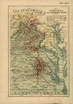
The
table below shows the description and a small image of each
map on this fascinating civil war history CD.
 The
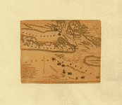
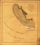
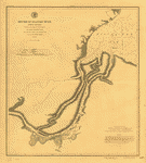
war in North Carolina. Map of the entrance to Beaufort
harbor, N.C. showing the position of Fort Macon, etc.
Colton, G. Woolworth (George Woolworth), 1827-1901. CREATED/PUBLISHED
[S.l., 1861] NOTES Scale ca. 1:48,000. Shows fortifications,
"camp Parke's div.," shoals, islands, and ship channel. The
war in North Carolina. Map of the entrance to Beaufort
harbor, N.C. showing the position of Fort Macon, etc.
Colton, G. Woolworth (George Woolworth), 1827-1901. CREATED/PUBLISHED
[S.l., 1861] NOTES Scale ca. 1:48,000. Shows fortifications,
"camp Parke's div.," shoals, islands, and ship channel.
|
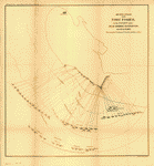
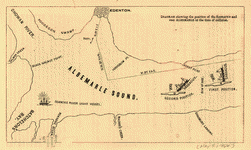 Diagram
showing the position of the Sassacus and ram Albemarle
at the time of collision. United States. Navy CREATED/PUBLISHED
Washington, Government Printing Office, 1864. NOTES Scale
not given. Map of part of Albemarle Sound showing the
first and second positions of the U.S. Steamer Sassacus
after its collision with the Confederate ironclad Albemarle. Diagram
showing the position of the Sassacus and ram Albemarle
at the time of collision. United States. Navy CREATED/PUBLISHED
Washington, Government Printing Office, 1864. NOTES Scale
not given. Map of part of Albemarle Sound showing the
first and second positions of the U.S. Steamer Sassacus
after its collision with the Confederate ironclad Albemarle.
|
|
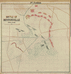
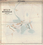
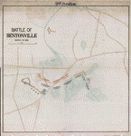
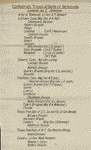
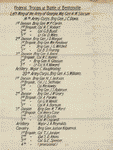
Battle of Bentonville, March 19, 1865. NOTES Relief
shown by hachures. Accompanied by 2 sheets listing the
Federal and Confederate commanding officers down to
the brigade level
|
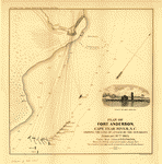 Plan
of Fort Anderson, Cape Fear River, N.C. showing the line
of attack by the gun-boats February 18th 1865 under Rear
Admiral D. D. Porter, when the rebels evacuated under
a heavy fire. Three hundred and eighty shells an hour,
thirteen hours bombardment. United States. Navy CREATED/PUBLISHED
Philada., Bowen & Co., lith, [1865] NOTES Scale ca. 1:5500. Plan
of Fort Anderson, Cape Fear River, N.C. showing the line
of attack by the gun-boats February 18th 1865 under Rear
Admiral D. D. Porter, when the rebels evacuated under
a heavy fire. Three hundred and eighty shells an hour,
thirteen hours bombardment. United States. Navy CREATED/PUBLISHED
Philada., Bowen & Co., lith, [1865] NOTES Scale ca. 1:5500.
|
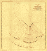
 Sketch
of vicinity of Fort Fisher / surveyed under the direction
of Brvt. Brig. Gen. C.B. Comstock, chief engineer, by
Otto Julian Schultze, Private, 15th N.Y. V. Eng. ; E.
Molitor, lith. Schultze, Otto Julian. CREATED/PUBLISHED
[Washington, D.C.] : War Dept., [1865] (Engineer Bureau,
War Dept.) NOTES Relief shown by hachures. Includes inset
of Fort Buchanan. Sketch
of vicinity of Fort Fisher / surveyed under the direction
of Brvt. Brig. Gen. C.B. Comstock, chief engineer, by
Otto Julian Schultze, Private, 15th N.Y. V. Eng. ; E.
Molitor, lith. Schultze, Otto Julian. CREATED/PUBLISHED
[Washington, D.C.] : War Dept., [1865] (Engineer Bureau,
War Dept.) NOTES Relief shown by hachures. Includes inset
of Fort Buchanan. |
 Second
attack upon Fort Fisher by the U.S. Navy under Rear Admiral
D. D. Porter, Jan 13, 14, 15, 1865. Showing the position
of vessels and line of fire. Bowen & Co., lith., Philada.
United States. Navy. CREATED/PUBLISHED [S.l., 1865] NOTES
Scale ca. 1:9800. Second
attack upon Fort Fisher by the U.S. Navy under Rear Admiral
D. D. Porter, Jan 13, 14, 15, 1865. Showing the position
of vessels and line of fire. Bowen & Co., lith., Philada.
United States. Navy. CREATED/PUBLISHED [S.l., 1865] NOTES
Scale ca. 1:9800. |
 Plan
and sections of Fort Fisher, carried by assault by the
U.S. forces, Maj. Gen. A.H. Terry commanding, Jan. 15th,
1865 / E. Molitor, lith. Comstock, C. B. (Cyrus Ballou),
1831-1910. CREATED/PUBLISHED [Washington, D.C.] : War
Dept., [1865] (Engineer Bureau, War Dept.) NOTES Relief
shown by hachures. Plan
and sections of Fort Fisher, carried by assault by the
U.S. forces, Maj. Gen. A.H. Terry commanding, Jan. 15th,
1865 / E. Molitor, lith. Comstock, C. B. (Cyrus Ballou),
1831-1910. CREATED/PUBLISHED [Washington, D.C.] : War
Dept., [1865] (Engineer Bureau, War Dept.) NOTES Relief
shown by hachures. |
 Part
of Federal point entrance to Cape Fear River. Sketch showing
line of rebel forifications captured by the combined naval
and military forces under command of Rear Admiral D. D.
Porter, U.S.N. and Major General Terry, U.S.A. January
15th, 1865. Bowen & Co., lith., Phila. United States.
Navy. CREATED/PUBLISHED [S.l., 1865] NOTES Scale ca. 1:2500. Part
of Federal point entrance to Cape Fear River. Sketch showing
line of rebel forifications captured by the combined naval
and military forces under command of Rear Admiral D. D.
Porter, U.S.N. and Major General Terry, U.S.A. January
15th, 1865. Bowen & Co., lith., Phila. United States.
Navy. CREATED/PUBLISHED [S.l., 1865] NOTES Scale ca. 1:2500.
|
 First
attack upon Fort Fisher, by the U.S. Navy under Rear Admiral
D. D. Porter, Dec. 24 and 25, 1864. Showing the position
of vessels and line of fire Bowen & Co., lith., Philada.
United States. Navy. CREATED/PUBLISHED [S.l., 1865] NOTES
Scale not given. First
attack upon Fort Fisher, by the U.S. Navy under Rear Admiral
D. D. Porter, Dec. 24 and 25, 1864. Showing the position
of vessels and line of fire Bowen & Co., lith., Philada.
United States. Navy. CREATED/PUBLISHED [S.l., 1865] NOTES
Scale not given. |
 Order
of attack on Fort Fisher by the Squadron under command
of Rear Admiral D. D. Porter, U.S.N. in the combined naval
and military operations which resulted in the capture
of the Rebel defences at New Inlet, N.C. January 14th
& 15th 1865. United States Coast Survey. CREATED/PUBLISHED
[S.l., Chas G. Krebs, lith., 1865] NOTES Scale ca. 1:10,100.
Detailed map showing the location and names of vessels,
fortifications, telegraph wires leading to torpedoes and
a few soundings. Order
of attack on Fort Fisher by the Squadron under command
of Rear Admiral D. D. Porter, U.S.N. in the combined naval
and military operations which resulted in the capture
of the Rebel defences at New Inlet, N.C. January 14th
& 15th 1865. United States Coast Survey. CREATED/PUBLISHED
[S.l., Chas G. Krebs, lith., 1865] NOTES Scale ca. 1:10,100.
Detailed map showing the location and names of vessels,
fortifications, telegraph wires leading to torpedoes and
a few soundings. |
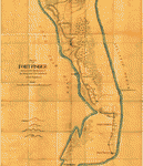
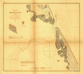
 Fort
Fisher, defensive work protecting the entrance to the
port of Wilmington, North Carolina, captured by the Federals,
Jan. 15, 1865]. CREATED/PUBLISHED [1865] NOTES Relief
shown by soundings. Indicates the location and names of
vessels, and soundings. Fort
Fisher, defensive work protecting the entrance to the
port of Wilmington, North Carolina, captured by the Federals,
Jan. 15, 1865]. CREATED/PUBLISHED [1865] NOTES Relief
shown by soundings. Indicates the location and names of
vessels, and soundings. |
 Sketch
of Fort Fisher surveyed under the direction of Bvt. Brig.
Gen. C. B. Comstock, Chief Engineer. Comstock, Cyrus B.
CREATED/PUBLISHED [S.l., 1865] NOTES Scale ca. 1:1500.
Large-scale plane of the fort showing the position, type
and size of guns, and the location of "torpedoes," roads,
buildings, rifle pits, telegraph station, vegetation,
drainage, and hachures. Four cross sections of ramparts
are given in the inset. Sketch
of Fort Fisher surveyed under the direction of Bvt. Brig.
Gen. C. B. Comstock, Chief Engineer. Comstock, Cyrus B.
CREATED/PUBLISHED [S.l., 1865] NOTES Scale ca. 1:1500.
Large-scale plane of the fort showing the position, type
and size of guns, and the location of "torpedoes," roads,
buildings, rifle pits, telegraph station, vegetation,
drainage, and hachures. Four cross sections of ramparts
are given in the inset. |
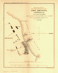 Fort
Johnston, Smithville, N.C. Evacuated Jan 16, 1865. Taken
possession of by naval and military forces Jan. 17, 1865.
Surveyed by J. S. Bradford, U.S. Coast Survey, A.D.C.
to Admiral Porter. Bowen & Co., lith., Philada. Bradford,
J. S. CREATED/PUBLISHED [S.l., 1865] NOTES Scale 1:2500. Fort
Johnston, Smithville, N.C. Evacuated Jan 16, 1865. Taken
possession of by naval and military forces Jan. 17, 1865.
Surveyed by J. S. Bradford, U.S. Coast Survey, A.D.C.
to Admiral Porter. Bowen & Co., lith., Philada. Bradford,
J. S. CREATED/PUBLISHED [S.l., 1865] NOTES Scale 1:2500.
|
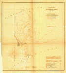 Preliminary
chart of Hatteras Inlet, North Carolina From a trigonometrical
survey under the direction of A. D. Bache, Superintendent
of the survey of the coast of the United States. Triangulation
by A. S. Wadsworth, Asst. Coast Survey. Hydrography by
the party under the command of Lieut. Comdg. T. S. Phelps,
U.S.N., Asst. Coast Survey, Bowen & Co. lith. Phila. United
States Coast Survey. CREATED/PUBLISHED [Washington, U.S.
Coast Survey], 1862. NOTES Scale 1:20,000. Preliminary
chart of Hatteras Inlet, North Carolina From a trigonometrical
survey under the direction of A. D. Bache, Superintendent
of the survey of the coast of the United States. Triangulation
by A. S. Wadsworth, Asst. Coast Survey. Hydrography by
the party under the command of Lieut. Comdg. T. S. Phelps,
U.S.N., Asst. Coast Survey, Bowen & Co. lith. Phila. United
States Coast Survey. CREATED/PUBLISHED [Washington, U.S.
Coast Survey], 1862. NOTES Scale 1:20,000. |
 regon
Inlet, N. Carolina Triangulation by W. M. Boyce, Assist.
Topography by John Mechan, Sub-Assist. Hydrography by
Henry Mitchell, Assist. Bowen & Co. lith. Philada. United
States Coast Survey. CREATED/PUBLISHED [Washington, U.S.
Coast Survey], 1862. NOTES Scale 1:20,000. regon
Inlet, N. Carolina Triangulation by W. M. Boyce, Assist.
Topography by John Mechan, Sub-Assist. Hydrography by
Henry Mitchell, Assist. Bowen & Co. lith. Philada. United
States Coast Survey. CREATED/PUBLISHED [Washington, U.S.
Coast Survey], 1862. NOTES Scale 1:20,000. |
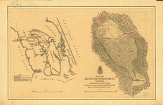 Map
of the battlefield of Roanoke Id. Feb. 8th 1862 Drawn
by Lt. Andrews, 9th N.Y. Regt. Published by authority
of the Hon. the Secretary of War, office of the Chief
of Engineers, U.S. Army. Andrews, William S. CREATED/PUBLISHED
[S.l., 1862] NOTES Scale ca. 1:1650 and 1:82,000. Detailed
map of Roanoke Island battlefield and a map of Roanoke
Island and vicinity. The former indicates Union and Confederate
troop positions, the location of a Confederate battery,
a road bisecting the battlefield, and vegetation, while
the latter shows forts and the number of guns at each,
positions of Union and Confederate vessels, drainage,
and names of principal features. Map
of the battlefield of Roanoke Id. Feb. 8th 1862 Drawn
by Lt. Andrews, 9th N.Y. Regt. Published by authority
of the Hon. the Secretary of War, office of the Chief
of Engineers, U.S. Army. Andrews, William S. CREATED/PUBLISHED
[S.l., 1862] NOTES Scale ca. 1:1650 and 1:82,000. Detailed
map of Roanoke Island battlefield and a map of Roanoke
Island and vicinity. The former indicates Union and Confederate
troop positions, the location of a Confederate battery,
a road bisecting the battlefield, and vegetation, while
the latter shows forts and the number of guns at each,
positions of Union and Confederate vessels, drainage,
and names of principal features. |
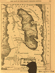 Map
of Roanoke Island. [February 8, 1862]. CREATED/PUBLISHED
[S.l., 1866] NOTES Scale ca. 1:155,000. Map indicates
the positions of the fleet in the sound and forts and
troop positions on the island. Map
of Roanoke Island. [February 8, 1862]. CREATED/PUBLISHED
[S.l., 1866] NOTES Scale ca. 1:155,000. Map indicates
the positions of the fleet in the sound and forts and
troop positions on the island. |
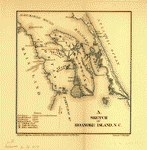 Sketch
of Roanoke Island, N.C. [February 8, 1862] Bowen & Co.,
lith., Phila. [1866]. Foster, John G. (John Gray), 1823-1874.
CREATED/PUBLISHED [Washington, Government Printing Office,
1866] NOTES Scale not given. Map indicates the location
of forts Huger, Blanchard, and Bartow, Federal and Union
gunboats, the "landing place," and the place where the
"battle was fought," and the site where the "Rebels surrendered." Sketch
of Roanoke Island, N.C. [February 8, 1862] Bowen & Co.,
lith., Phila. [1866]. Foster, John G. (John Gray), 1823-1874.
CREATED/PUBLISHED [Washington, Government Printing Office,
1866] NOTES Scale not given. Map indicates the location
of forts Huger, Blanchard, and Bartow, Federal and Union
gunboats, the "landing place," and the place where the
"battle was fought," and the site where the "Rebels surrendered."
|
 Mouths
of Roanoke River, North Carolina Triangulation and topography
by R. E. Halter, Sub-Assist. Hydrography by J. S. Bradford,
Sub-Assist. acting under orders of Actg. Rear Admiral
S. P. Lee, U.S. Navy, Comdg. North Atlantic Blockading
Squadron. United States Coast Survey. CREATED/PUBLISHED
[Washington, U.S. Coast Survey], 1864. NOTES Scale 1:30,000.
General chart indicating soundings and bottom contour
at 12 feet. Mouths
of Roanoke River, North Carolina Triangulation and topography
by R. E. Halter, Sub-Assist. Hydrography by J. S. Bradford,
Sub-Assist. acting under orders of Actg. Rear Admiral
S. P. Lee, U.S. Navy, Comdg. North Atlantic Blockading
Squadron. United States Coast Survey. CREATED/PUBLISHED
[Washington, U.S. Coast Survey], 1864. NOTES Scale 1:30,000.
General chart indicating soundings and bottom contour
at 12 feet. |
 Bird's
eye view of Confederate prison pen at Salisbury, N.C.,
taken in 1864. Kraus, C. A. CREATED/PUBLISHED Boston ;
New York : J.H. Bufford's Sons Lith., c1886. NOTES Low
angle view. Includes index to points of interest. Bird's
eye view of Confederate prison pen at Salisbury, N.C.,
taken in 1864. Kraus, C. A. CREATED/PUBLISHED Boston ;
New York : J.H. Bufford's Sons Lith., c1886. NOTES Low
angle view. Includes index to points of interest. |
 Line
of rebel works, Smith's Island, N.C. Evacuated January
16th, 1865. Taken possession of by naval and military
forces January 17th, 1865. Surveyed by J. S. Bradford,
U.S. Coast Survey, A.D.C. to Admiral D. D. Porter Bowen
& Co., lith., Philada. Bradford, J. S. CREATED/PUBLISHED
[Washington, Government Printing Office, 1865] NOTES Scale
1:5000. Line
of rebel works, Smith's Island, N.C. Evacuated January
16th, 1865. Taken possession of by naval and military
forces January 17th, 1865. Surveyed by J. S. Bradford,
U.S. Coast Survey, A.D.C. to Admiral D. D. Porter Bowen
& Co., lith., Philada. Bradford, J. S. CREATED/PUBLISHED
[Washington, Government Printing Office, 1865] NOTES Scale
1:5000. |
 Sketch
showing the position of the attacking and defending forces
at the siege of Washington, N.C., March 29 to April 16,
1863 Bowen & Co., lith., Phil. Foster, John G. (John Gray),
1823-1874. CREATED/PUBLISHED [Washington, Government Printing
Office, 1866] NOTES Scale ca. 1:207,000. "Notes" listing
Federal batteries and garrisons and Confederate batteries
are reproduced in the lower right corner. Sketch
showing the position of the attacking and defending forces
at the siege of Washington, N.C., March 29 to April 16,
1863 Bowen & Co., lith., Phil. Foster, John G. (John Gray),
1823-1874. CREATED/PUBLISHED [Washington, Government Printing
Office, 1866] NOTES Scale ca. 1:207,000. "Notes" listing
Federal batteries and garrisons and Confederate batteries
are reproduced in the lower right corner. |
 Map
showing the entrenchments around Wilmington / surveyed
& mapped under the direction of Capt. W. H. James, Prov.
Engrs., by L. C. Turner, C.E. Turner, L. C. CREATED/PUBLISHED
1863. NOTES Scale 1:7,920; 8 in. to 1 mile. opy imperfect:
Ink stained. Relief shown by hachures. Oriented with north
toward the upper left. Map
showing the entrenchments around Wilmington / surveyed
& mapped under the direction of Capt. W. H. James, Prov.
Engrs., by L. C. Turner, C.E. Turner, L. C. CREATED/PUBLISHED
1863. NOTES Scale 1:7,920; 8 in. to 1 mile. opy imperfect:
Ink stained. Relief shown by hachures. Oriented with north
toward the upper left. |
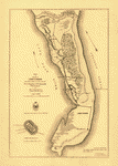
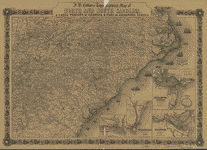
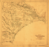
 Colton's
new topographical map of the eastern portion of the State
of North Carolina with part of Virginia & South Carolina
from the latest & best authorities. Colton, J. H. (Joseph
Hutchins), 1800-1893. CREATED/PUBLISHED New York, J. H.
Colton, 1861. NOTES [Scale ca. 1:506,880]. General map.
Coastal forts and naval blockade are depicted. Inset:
Plan of the sea coast from Virginia to Florida. 13 x 65
cm. Colton's
new topographical map of the eastern portion of the State
of North Carolina with part of Virginia & South Carolina
from the latest & best authorities. Colton, J. H. (Joseph
Hutchins), 1800-1893. CREATED/PUBLISHED New York, J. H.
Colton, 1861. NOTES [Scale ca. 1:506,880]. General map.
Coastal forts and naval blockade are depicted. Inset:
Plan of the sea coast from Virginia to Florida. 13 x 65
cm. |
 J.
H. Colton's topographical map of North and South Carolina.
A large portion of Georgia & part of adjoining states.
Entered according to Act of Congress in the year 1861
by J.H. Colton. Colton, J. H. (Joseph Hutchins), 1800-1893.
CREATED/PUBLISHED New York Printed by Lang & Laing 1861.
NOTES Scale ca. 1:1,550,000. Indicates forts, towns, roads,
railroads, county names and boundaries, geographic coordinates,
and rivers. Drawings of ships offshore denote naval blockade.
Insets: Beaufort and vicinity, N. Carolina. 8 x 9 cm.-Wilmington
and vicinity, N. Carolina. 13 x 9 cm.-Charleston Harbor
and its approaches, S. Carolina. 14 x 15 cm.-Plan of Ft.
Sumter. 4 x 4 cm.-Savannah and vicinity. 10 x 15 cm. J.
H. Colton's topographical map of North and South Carolina.
A large portion of Georgia & part of adjoining states.
Entered according to Act of Congress in the year 1861
by J.H. Colton. Colton, J. H. (Joseph Hutchins), 1800-1893.
CREATED/PUBLISHED New York Printed by Lang & Laing 1861.
NOTES Scale ca. 1:1,550,000. Indicates forts, towns, roads,
railroads, county names and boundaries, geographic coordinates,
and rivers. Drawings of ships offshore denote naval blockade.
Insets: Beaufort and vicinity, N. Carolina. 8 x 9 cm.-Wilmington
and vicinity, N. Carolina. 13 x 9 cm.-Charleston Harbor
and its approaches, S. Carolina. 14 x 15 cm.-Plan of Ft.
Sumter. 4 x 4 cm.-Savannah and vicinity. 10 x 15 cm. |
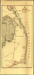
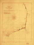 Sketch
of the coast of North Carolina from Oregon Inlet to Ocracoke
Inlet. United States Coast Survey. CREATED/PUBLISHED [Washington
U.S. Coast Survey], 1861. NOTES Scale 1:200,000. Chart
of Cape Hatteras and environs showing soundings, lighthouses,
and bottom contours at 6, 12, and 18 feet. Sketch
of the coast of North Carolina from Oregon Inlet to Ocracoke
Inlet. United States Coast Survey. CREATED/PUBLISHED [Washington
U.S. Coast Survey], 1861. NOTES Scale 1:200,000. Chart
of Cape Hatteras and environs showing soundings, lighthouses,
and bottom contours at 6, 12, and 18 feet. |
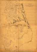 Coast
of North Carolina & Virginia compiled at the Coast Survey
Office, Febr. 1862. Drawn by A. Lindenkohl. Lith. by H.
Lindenkohl. Lindenkohl, A. CREATED/PUBLISHED [Washington,
D.C., U.S. Coast Survey, 1862] NOTES Scale 1:200,000.
Map is printed in two sheets which have been joined together
to form a continuous map. The northern sheet measures
57 x 84 cm., and the southern sheet measures 68 x 84 cm.
Map of the coast from Hampton, Virginia, to Old Cedar
Inlet, North Carolina, showing roads, railroads, rivers
and streams, and place names. Soundings are not given. Coast
of North Carolina & Virginia compiled at the Coast Survey
Office, Febr. 1862. Drawn by A. Lindenkohl. Lith. by H.
Lindenkohl. Lindenkohl, A. CREATED/PUBLISHED [Washington,
D.C., U.S. Coast Survey, 1862] NOTES Scale 1:200,000.
Map is printed in two sheets which have been joined together
to form a continuous map. The northern sheet measures
57 x 84 cm., and the southern sheet measures 68 x 84 cm.
Map of the coast from Hampton, Virginia, to Old Cedar
Inlet, North Carolina, showing roads, railroads, rivers
and streams, and place names. Soundings are not given.
|
 Coast
of North Carolina & Virginia compiled at the Coast Survey
Office, Febr. 1862. [Drawn by A. Lindenkohl. Lith. by
H. Lindenkohl.]. Lindenkohl, A. CREATED/PUBLISHED [Washington,
D.C., U.S. Coast Survey, 1862] NOTES Scale 1:200,000.
Another edition. Map is printed in two sheets which have
been joined together to form a continuous map. The northern
sheet measures 57 x 84 cm., and the southern sheet measures
68 x 84 cm. Map of the coast from Hampton, Virginia, to
Old Cedar Inlet, North Carolina, showing roads, railroads,
rivers and streams, and place names. Soundings are not
given. Northern sheet has been thoroghly revised. Many
place names, roads, and railroads have been added or repositioned.
The northwestern corner of the northern sheet has been
completed. Coast
of North Carolina & Virginia compiled at the Coast Survey
Office, Febr. 1862. [Drawn by A. Lindenkohl. Lith. by
H. Lindenkohl.]. Lindenkohl, A. CREATED/PUBLISHED [Washington,
D.C., U.S. Coast Survey, 1862] NOTES Scale 1:200,000.
Another edition. Map is printed in two sheets which have
been joined together to form a continuous map. The northern
sheet measures 57 x 84 cm., and the southern sheet measures
68 x 84 cm. Map of the coast from Hampton, Virginia, to
Old Cedar Inlet, North Carolina, showing roads, railroads,
rivers and streams, and place names. Soundings are not
given. Northern sheet has been thoroghly revised. Many
place names, roads, and railroads have been added or repositioned.
The northwestern corner of the northern sheet has been
completed. |
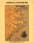 rth
Carolina coast line. Showing every inlet, sound & bay
of special interest, from Fortress Monroe to South Carolina.
L. Prang & Co. CREATED/PUBLISHED Boston, [1862] NOTES
Scale not given. At top of map: Burnside's expedition
map. Portrait of "Genl. Burnside" is in the lower right
corner. Map identifies coastal forts. rth
Carolina coast line. Showing every inlet, sound & bay
of special interest, from Fortress Monroe to South Carolina.
L. Prang & Co. CREATED/PUBLISHED Boston, [1862] NOTES
Scale not given. At top of map: Burnside's expedition
map. Portrait of "Genl. Burnside" is in the lower right
corner. Map identifies coastal forts. |
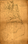
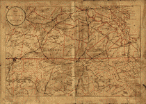
 Eastern
portion of the military department of North Carolina compiled
from the best and latest authorities in the Engineer Bureau,
War Department, May 1862. United States. Army. Corps of
Engineers. CREATED/PUBLISHED [S.l., 1862] NOTES Scale
1:350,000. Indicates coastal fortifications, roads, railroads,
drainage, canals, swamps, and towns. Insets: Entrances
to Cape Fear River, North Carolina. 29 x 20 cm.-[View
of] Rebel works for the defense of the New Inlet entrance
to Cape Fear River. 6 x 36 cm. Eastern
portion of the military department of North Carolina compiled
from the best and latest authorities in the Engineer Bureau,
War Department, May 1862. United States. Army. Corps of
Engineers. CREATED/PUBLISHED [S.l., 1862] NOTES Scale
1:350,000. Indicates coastal fortifications, roads, railroads,
drainage, canals, swamps, and towns. Insets: Entrances
to Cape Fear River, North Carolina. 29 x 20 cm.-[View
of] Rebel works for the defense of the New Inlet entrance
to Cape Fear River. 6 x 36 cm. |
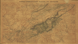
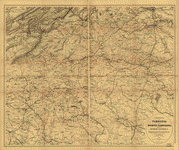
 Mountain
region of North Carolina and Tennessee / compiled by W.
L. Nicholson & A. Lindenkohl, 1863 ; drawn by A. Lindenkohl
; H. Lindenkohl & Chas. G. Krebs, lith. Nicholson, W.
L. CREATED/PUBLISHED [Washington] : U.S. Coast Survey,
[1863] NOTES Scale 1:633,600; 1 in. = 10 miles. Relief
shown by hachures. Includes list of "Authorities." Mountain
region of North Carolina and Tennessee / compiled by W.
L. Nicholson & A. Lindenkohl, 1863 ; drawn by A. Lindenkohl
; H. Lindenkohl & Chas. G. Krebs, lith. Nicholson, W.
L. CREATED/PUBLISHED [Washington] : U.S. Coast Survey,
[1863] NOTES Scale 1:633,600; 1 in. = 10 miles. Relief
shown by hachures. Includes list of "Authorities." |
 Mountain
region of North Carolina and Tennessee Compiled by W.
L. Nicholson, 1863. Drawn by A. Lindenkohl. H. Lindenkohl
& Chas. G. Krebs, lith. Nicholson, W. L. CREATED/PUBLISHED
[Washington D. C.], U.S. Coast Survey, A. D. Bache Supt.,
1863. NOTES Scale 1:633,600. Mountain
region of North Carolina and Tennessee Compiled by W.
L. Nicholson, 1863. Drawn by A. Lindenkohl. H. Lindenkohl
& Chas. G. Krebs, lith. Nicholson, W. L. CREATED/PUBLISHED
[Washington D. C.], U.S. Coast Survey, A. D. Bache Supt.,
1863. NOTES Scale 1:633,600. |
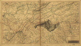
 Mountain
region of North Carolina and Tennessee. Compiled by W.
L. Nicholson & A. Lindenkohl, 1863.-With corrections to
May, 1864. Drawn by A. Lindenkohl. H. Lindenkohl & Chas.
G. Krebs, lith. Nicholson, W. L. CREATED/PUBLISHED [S.l.],
U.S. Coast Survey, A.D. Bache, Supt., [1864] NOTES Scale
1:633,600. Map of parts of the states of Kentucky, Tennessee,
Virginia, North and South Carolina, Georgia, and Alabama,
showing relief by hachures, drainage, names and boundaries
of states, roads, and railroads. Part of the route of
the "proposed military railroad from Nicholasville & Lebanon"
is indicated. Mountain
region of North Carolina and Tennessee. Compiled by W.
L. Nicholson & A. Lindenkohl, 1863.-With corrections to
May, 1864. Drawn by A. Lindenkohl. H. Lindenkohl & Chas.
G. Krebs, lith. Nicholson, W. L. CREATED/PUBLISHED [S.l.],
U.S. Coast Survey, A.D. Bache, Supt., [1864] NOTES Scale
1:633,600. Map of parts of the states of Kentucky, Tennessee,
Virginia, North and South Carolina, Georgia, and Alabama,
showing relief by hachures, drainage, names and boundaries
of states, roads, and railroads. Part of the route of
the "proposed military railroad from Nicholasville & Lebanon"
is indicated. |
 Part
of North Carolina showing approaches to Wilmington Compiled
at the U.S. Coast Survey Office, March 1864. United States
Coast Survey. CREATED/PUBLISHED [S.l., 1864] NOTES Scale
1:253,440. "Coast line from U.S. Coast Survey topographical
sheets. Interior, from State map of North Carolina." Map
of the coast of North Carolina from Cape Lookout to Cape
Fear. Part
of North Carolina showing approaches to Wilmington Compiled
at the U.S. Coast Survey Office, March 1864. United States
Coast Survey. CREATED/PUBLISHED [S.l., 1864] NOTES Scale
1:253,440. "Coast line from U.S. Coast Survey topographical
sheets. Interior, from State map of North Carolina." Map
of the coast of North Carolina from Cape Lookout to Cape
Fear. |
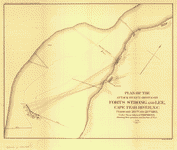 Plan
of the attack by gun-boats on Forts Strong and Lee, Cape
Fear River, N.C. February 20th and 21st 1865 under Rear
Admiral D. D. Porter. Showing their position and the line
of fire. Bowen & Co., lith., Philada. United States. Navy.
CREATED/PUBLISHED [S.l., 1865] NOTES Scale ca. 1:9,250. Plan
of the attack by gun-boats on Forts Strong and Lee, Cape
Fear River, N.C. February 20th and 21st 1865 under Rear
Admiral D. D. Porter. Showing their position and the line
of fire. Bowen & Co., lith., Philada. United States. Navy.
CREATED/PUBLISHED [S.l., 1865] NOTES Scale ca. 1:9,250.
|
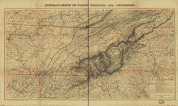
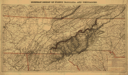 Mountain
region of North Carolina and Tennessee, compiled by W.
L. Nicholson & A. Lindenkohl, with corrections to January
1865. Drawn by A. Lindenkohl. H. Lindenkohl & Chas. G.
Krebs, lith. Nicholson, W. L. CREATED/PUBLISHED [S.l.],
U.S. Coast Survey, A. D. Bache, Supt., [1865] NOTES Scale
1:633,600. Map title printed in the top margin. Map covers
parts of the states of Kentucky, Tennessee, Virginia,
North and South Carolina, Georgia, and Alabama and shows
relief by hachures, drainage, names and boundaries of
states, roads, and railroads. This edition has been significantly
revised in the vicinity of Chattanooga, Tennessee, and
Northern Georgia. Mountain
region of North Carolina and Tennessee, compiled by W.
L. Nicholson & A. Lindenkohl, with corrections to January
1865. Drawn by A. Lindenkohl. H. Lindenkohl & Chas. G.
Krebs, lith. Nicholson, W. L. CREATED/PUBLISHED [S.l.],
U.S. Coast Survey, A. D. Bache, Supt., [1865] NOTES Scale
1:633,600. Map title printed in the top margin. Map covers
parts of the states of Kentucky, Tennessee, Virginia,
North and South Carolina, Georgia, and Alabama and shows
relief by hachures, drainage, names and boundaries of
states, roads, and railroads. This edition has been significantly
revised in the vicinity of Chattanooga, Tennessee, and
Northern Georgia. |
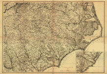 North
Carolina, with adjacent parts of Virginia and South Carolina]
Drawn by A. Lindenkohl. Lindenkohl, A. CREATED/PUBLISHED
[S.l.], U.S. Coast Survey, A. D. Bache, Supdt., 1865.
NOTES Scale 1:633,600. General map, without a title. Inset:
[Charleston, S.C., and environs] 18 x 23 cm. North
Carolina, with adjacent parts of Virginia and South Carolina]
Drawn by A. Lindenkohl. Lindenkohl, A. CREATED/PUBLISHED
[S.l.], U.S. Coast Survey, A. D. Bache, Supdt., 1865.
NOTES Scale 1:633,600. General map, without a title. Inset:
[Charleston, S.C., and environs] 18 x 23 cm. |
 North
Carolina & South Carolina Drawn by A. Lindenkohl. Chas.
G. Krebs, lith. Lindenkohl, A. CREATED/PUBLISHED [S.l.],
U.S. Coast Survey, A. D. Bache, Supdt., 1865. NOTES Scale
1:633,600. General map. "Authorities" used in making the
map are listed below the title. State names, boundaries,
and railroads are overprinted in red. North
Carolina & South Carolina Drawn by A. Lindenkohl. Chas.
G. Krebs, lith. Lindenkohl, A. CREATED/PUBLISHED [S.l.],
U.S. Coast Survey, A. D. Bache, Supdt., 1865. NOTES Scale
1:633,600. General map. "Authorities" used in making the
map are listed below the title. State names, boundaries,
and railroads are overprinted in red. |
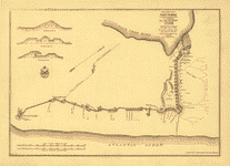
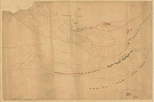
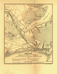 Sketch
showing the route to Newbern, pursued by the Burnside
expedition, March 13 & 14, 1862 Bowen & Co., lith., Philada.
Foster, John G. (John Gray), 1823-1874. CREATED/PUBLISHED
[Washington, Government Printing Office, 1866] NOTES Scale
1:350,000. Map shows "anchorage on night of March 12,
1862," "landing place of the troops, March 13, 1862,"
"deserted entrenchments," "battlefield March 14, 1862,"
"line of obstructions," and "line of Yankee catchers"
on the Neuse River. Sketch
showing the route to Newbern, pursued by the Burnside
expedition, March 13 & 14, 1862 Bowen & Co., lith., Philada.
Foster, John G. (John Gray), 1823-1874. CREATED/PUBLISHED
[Washington, Government Printing Office, 1866] NOTES Scale
1:350,000. Map shows "anchorage on night of March 12,
1862," "landing place of the troops, March 13, 1862,"
"deserted entrenchments," "battlefield March 14, 1862,"
"line of obstructions," and "line of Yankee catchers"
on the Neuse River. |
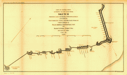
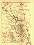 Sketch
showing route pursued in the advance to Goldsboro, N.C.,
in Dec. 1862 Bowen & Co., lith., Phila. Foster, John G.
(John Gray), 1823-1874. CREATED/PUBLISHED [S.l., 1866]
NOTES Scale not given. Crossed swords delineate where
there were "Engagement[s] fought." Sketch
showing route pursued in the advance to Goldsboro, N.C.,
in Dec. 1862 Bowen & Co., lith., Phila. Foster, John G.
(John Gray), 1823-1874. CREATED/PUBLISHED [S.l., 1866]
NOTES Scale not given. Crossed swords delineate where
there were "Engagement[s] fought." |
 Sketch
showing route of the Burnside expedition [to Roanoke Island,
N.C., February 6, 1862] Bowen & Co., lith., Phila. Foster,
John G. (John Gray), 1823-1874. CREATED/PUBLISHED [Washington,
Government Printing Office, 1866] NOTES Scale not given.
Map shows the route of the expedition and anchorages. Sketch
showing route of the Burnside expedition [to Roanoke Island,
N.C., February 6, 1862] Bowen & Co., lith., Phila. Foster,
John G. (John Gray), 1823-1874. CREATED/PUBLISHED [Washington,
Government Printing Office, 1866] NOTES Scale not given.
Map shows the route of the expedition and anchorages.
|
 North
Carolina Drawn by A. Lindenkohl] H. Lindenkohl & Chas.
G. Krebs, lith. U.S. Coast Survey, A. D. Bache, Supdt.
1865. Lindenkohl, A. CREATED/PUBLISHED [Raleigh, State
Department of Archives and History, 1966] NOTES Scale
ca. 1:950,000 (not "1 inch = 10 miles"). North
Carolina Drawn by A. Lindenkohl] H. Lindenkohl & Chas.
G. Krebs, lith. U.S. Coast Survey, A. D. Bache, Supdt.
1865. Lindenkohl, A. CREATED/PUBLISHED [Raleigh, State
Department of Archives and History, 1966] NOTES Scale
ca. 1:950,000 (not "1 inch = 10 miles"). |
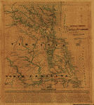 S.E.
portion of Virginia and N.E. portion of N'th Carolina
/ drawn b. Serg't Ch. Worret ; & compiled under the direction
of Col. T.J. Cram, Chief Top'l Eng'r Dep't Va. Worret,
Ch. CREATED/PUBLISHED [186-] NOTES Covers Tidewater Region
(Va.) and Albemarle Sound Region (N.C.). Shows fortifications,
settlements, roads, railroads, canals, streams, swamps,
and distances. S.E.
portion of Virginia and N.E. portion of N'th Carolina
/ drawn b. Serg't Ch. Worret ; & compiled under the direction
of Col. T.J. Cram, Chief Top'l Eng'r Dep't Va. Worret,
Ch. CREATED/PUBLISHED [186-] NOTES Covers Tidewater Region
(Va.) and Albemarle Sound Region (N.C.). Shows fortifications,
settlements, roads, railroads, canals, streams, swamps,
and distances. |
 Portions
of Virginia and North Carolina, embracing Richmond & Lynchburg,
Va. and Goldsboro & Salisbury, N.C. compiled in the Engineer
Bureau, War Department, for military purposes. United
States. Army. Corps of Engineers. CREATED/PUBLISHED N.Y.,
J. Schedler, 1864. NOTES Scale 1:350,000. General map
extending from Richmond, Virginia, south to Fayetteville,
North Carolina. Portions
of Virginia and North Carolina, embracing Richmond & Lynchburg,
Va. and Goldsboro & Salisbury, N.C. compiled in the Engineer
Bureau, War Department, for military purposes. United
States. Army. Corps of Engineers. CREATED/PUBLISHED N.Y.,
J. Schedler, 1864. NOTES Scale 1:350,000. General map
extending from Richmond, Virginia, south to Fayetteville,
North Carolina. |
 Map
of the seat of war in Virginia. CREATED/PUBLISHED 1865.
NOTES Covers southern Virginia and northern North Carolina
extending from Richmond, Va. south to Raleigh, N.C. Shows
the "Line of march" from Richmond and Petersburg to Appomattox
Court House along with the locations of the first, second,
third, and fourth fights and the surrender. Map
of the seat of war in Virginia. CREATED/PUBLISHED 1865.
NOTES Covers southern Virginia and northern North Carolina
extending from Richmond, Va. south to Raleigh, N.C. Shows
the "Line of march" from Richmond and Petersburg to Appomattox
Court House along with the locations of the first, second,
third, and fourth fights and the surrender. |
 thern
Virginia and northern North Carolina] Drawn by A. Lindenkohl.
H. Lindenkohl & Chas. G. Krebs, lith. Lindenkohl, A. CREATED/PUBLISHED
[S.l.], U.S. Coast Survey, A.D. Bache, Supdt., 1865. NOTES
Scale 1:633,600. General map, without a title. State names,
boundaries, and railroads are colored red. thern
Virginia and northern North Carolina] Drawn by A. Lindenkohl.
H. Lindenkohl & Chas. G. Krebs, lith. Lindenkohl, A. CREATED/PUBLISHED
[S.l.], U.S. Coast Survey, A.D. Bache, Supdt., 1865. NOTES
Scale 1:633,600. General map, without a title. State names,
boundaries, and railroads are colored red. |
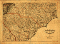
 Map
of Virginia and neighboring states showing the location
of battles in the Civil War 1861-1865. Northrup, William
P. CREATED/PUBLISHED Buffalo, N.Y., The Matthews-Northrup
Works, c1912. NOTES Scale ca. 1:366,000. Map of eastern
Virginia and parts of North Carolina, Maryland, West Virginia,
and Pennsylvania, showing "battles in which New York regiments
were engaged," "railroads at time of war," and "turnpikes
and plank roads." Union states are colored yellow, and
Confederate states are green. Map
of Virginia and neighboring states showing the location
of battles in the Civil War 1861-1865. Northrup, William
P. CREATED/PUBLISHED Buffalo, N.Y., The Matthews-Northrup
Works, c1912. NOTES Scale ca. 1:366,000. Map of eastern
Virginia and parts of North Carolina, Maryland, West Virginia,
and Pennsylvania, showing "battles in which New York regiments
were engaged," "railroads at time of war," and "turnpikes
and plank roads." Union states are colored yellow, and
Confederate states are green. |
This
is a must have collection for any civil war history buff!
To use
this software, you must install the free ExpressView MrSid
software which is included on the CD. This is a 30 second
process and will allow you to view and manipulate/print all
the maps in this CD collection in full detail. There is a
version for both Windows platforms and Macintosh platforms
and full installation instructions are included on the CD. |


