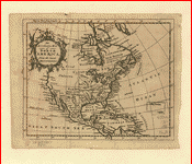
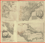
This
CD contains 76 rare antique maps of Indian Related Maps in MrSid
format. This
format allows you to see the entire map on your computer screen
or drill down to see the smallest details. The original maps
are often quite large, as much as 36" long or larger and
quite detailed. With the MrSID software, you can manipulate
the map to print the entire map in great detail or zoom into
a portion of the map in full detail for viewing or printing.
You could even bring the images to a local print shop to have
the maps reprinted in their full size. (MrSID software is included
on the CD.)
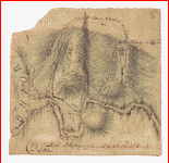
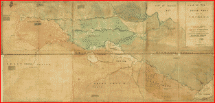
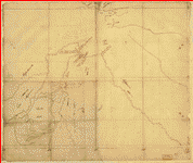
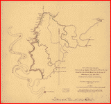
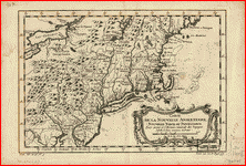
To
give you a sample of the detail you can expect in these maps,
here is an example based on a panoramic map of Washington, DC.
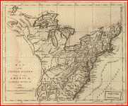
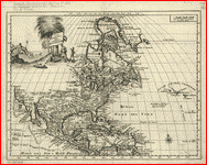
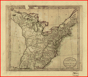
The table below shows the description and a small image of
each map on this incredible history CD.
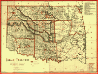
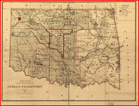
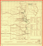
 Premier
series map of Oklahoma and Indian Territory. . Geographical
Publishing Co. CREATED/PUBLISHED [S.l.], 1905. NOTES "Indian
nations and Indian, forest, grazing, saline, and wood
reservations shown by red boundaries." Includes indexes. Premier
series map of Oklahoma and Indian Territory. . Geographical
Publishing Co. CREATED/PUBLISHED [S.l.], 1905. NOTES "Indian
nations and Indian, forest, grazing, saline, and wood
reservations shown by red boundaries." Includes indexes.
|
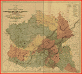
 Indian
territory: compiled under the direction of the Hon. John
H. Oberly, Commissioner of Indian Affairs, by C.A. Maxwell.
. CREATED/PUBLISHED [S.l.], 1889. SUMMARY Shows the
lands occupied by various tribes and includes details
about land transfers and cessions. Indian
territory: compiled under the direction of the Hon. John
H. Oberly, Commissioner of Indian Affairs, by C.A. Maxwell.
. CREATED/PUBLISHED [S.l.], 1889. SUMMARY Shows the
lands occupied by various tribes and includes details
about land transfers and cessions. |
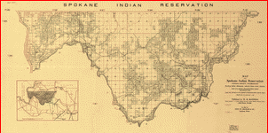 Map
of the Spokane Indian Reservation, Stevens County, Washington.
. Manning, W. M. CREATED/PUBLISHED [S.l.], 1910. Map
of the Spokane Indian Reservation, Stevens County, Washington.
. Manning, W. M. CREATED/PUBLISHED [S.l.], 1910. |
 Indian
Reservations west of the Mississippi River. . United
States. Office of Indian Affairs. CREATED/PUBLISHED [S.l.
: s.n.], 1923. Indian
Reservations west of the Mississippi River. . United
States. Office of Indian Affairs. CREATED/PUBLISHED [S.l.
: s.n.], 1923. |
 Indian
territory: compiled from the official records of the records
of the General Land Office and other sources under supervision
of Geo. U. Mayo. . CREATED/PUBLISHED [S.l.], 1887.
NOTES From the papers of President Benjamin Harrison.
DLC SUMMARY This map contains extensive cultural detail
relating to the reservations composing Indian Territory.
It has also been annotated to illustrate the boundaries
of the formation of Oklahoma Territory within the Indian
Territory. Indian
territory: compiled from the official records of the records
of the General Land Office and other sources under supervision
of Geo. U. Mayo. . CREATED/PUBLISHED [S.l.], 1887.
NOTES From the papers of President Benjamin Harrison.
DLC SUMMARY This map contains extensive cultural detail
relating to the reservations composing Indian Territory.
It has also been annotated to illustrate the boundaries
of the formation of Oklahoma Territory within the Indian
Territory. |
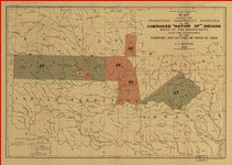
 Map
of the former territorial limits of the Cherokee "Nation
of" Indians. Royce, C. C. CREATED/PUBLISHED [S.l.],
1884. Map
of the former territorial limits of the Cherokee "Nation
of" Indians. Royce, C. C. CREATED/PUBLISHED [S.l.],
1884. |
 Map
showing the territory originally assigned Cherokee "Nation
of" Indians. . Royce, C. C. CREATED/PUBLISHED [S.l.],
1884. Map
showing the territory originally assigned Cherokee "Nation
of" Indians. . Royce, C. C. CREATED/PUBLISHED [S.l.],
1884. |
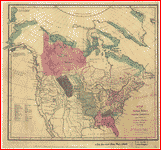 Map
of the Indian tribes of North America, about 1600 A.D.
along the Atlantic, & about 1800 A.D. westwardly.
published by the Amer. Antiq. Soc. from a drawing by Hon.
A. Gallatin. Gallatin, Albert, 1761-1849. CREATED/PUBLISHED
[Washington, D.C.] : The Society, [1836] NOTES Relief
shown pictorially. Hand colored to show the location of
Indian tribes and 11 linguistic families. Map
of the Indian tribes of North America, about 1600 A.D.
along the Atlantic, & about 1800 A.D. westwardly.
published by the Amer. Antiq. Soc. from a drawing by Hon.
A. Gallatin. Gallatin, Albert, 1761-1849. CREATED/PUBLISHED
[Washington, D.C.] : The Society, [1836] NOTES Relief
shown pictorially. Hand colored to show the location of
Indian tribes and 11 linguistic families. |
 Copy
of a sketch of the Monongahela, with the field of battle,
done by an Indian. . CREATED/PUBLISHED [1755?] NOTES
Scale not given. Manuscript, pen-and-ink and pencil. Relief
shown by hachures. In this map the name Ohio R. ou la
belle rivičre is applied also to the Allegheny. The words
"direction of" have been inserted in pencil between "By"
and "an Indian." Copy
of a sketch of the Monongahela, with the field of battle,
done by an Indian. . CREATED/PUBLISHED [1755?] NOTES
Scale not given. Manuscript, pen-and-ink and pencil. Relief
shown by hachures. In this map the name Ohio R. ou la
belle rivičre is applied also to the Allegheny. The words
"direction of" have been inserted in pencil between "By"
and "an Indian." |
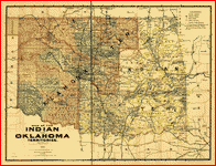
 Map
of the Indian and Oklahoma territories. . CREATED/PUBLISHED
[S.l.], 1892. Map
of the Indian and Oklahoma territories. . CREATED/PUBLISHED
[S.l.], 1892. |
 Map
showing the lands assigned to emigrant Indians west of
Arkansas and Missouri. . United States. Topographical
Bureau. CREATED/PUBLISHED [S.l.], 1836. Map
showing the lands assigned to emigrant Indians west of
Arkansas and Missouri. . United States. Topographical
Bureau. CREATED/PUBLISHED [S.l.], 1836. |
 Map
of linguistic stocks of American Indians. . CREATED/PUBLISHED
[S.l.], 1890. NOTES From: Annual report of Bureau of Ethnology,
v. 7, by J.W. Powell. Map
of linguistic stocks of American Indians. . CREATED/PUBLISHED
[S.l.], 1890. NOTES From: Annual report of Bureau of Ethnology,
v. 7, by J.W. Powell. |
 Map
of the Indian and Oklahoma territories, 1894. compiled
from the official records of the General Land Office and
other sources. Rand McNally and Company. CREATED/PUBLISHED
Chicago, 1894, c1884. NOTES Scale 1:760,320. Map
of the Indian and Oklahoma territories, 1894. compiled
from the official records of the General Land Office and
other sources. Rand McNally and Company. CREATED/PUBLISHED
Chicago, 1894, c1884. NOTES Scale 1:760,320. |
 A
map of the north west parts of America. with the utmost
respect, inscrib'd to His Excellency, Sir Guy Carleton,
Knight of the Bath: Captain General and Governor of the
province of Quebec: General and Commander in Chief of
His Majesty's forces in the said province, and frontiers
thereof. &c. &c. &c., by his most obedient humble servt.
Alexr. Henry. Henry, Alexander, 1739-1824. CREATED/PUBLISHED
[1776?] NOTES Scale ca. 1:2,000,000. Manuscript, pen-and-ink
and watercolor. Annotated with names and descriptive notes
and letterpress. Shows Indian tribes of western Ontario,
Manitoba, and Saskatchewan. A
map of the north west parts of America. with the utmost
respect, inscrib'd to His Excellency, Sir Guy Carleton,
Knight of the Bath: Captain General and Governor of the
province of Quebec: General and Commander in Chief of
His Majesty's forces in the said province, and frontiers
thereof. &c. &c. &c., by his most obedient humble servt.
Alexr. Henry. Henry, Alexander, 1739-1824. CREATED/PUBLISHED
[1776?] NOTES Scale ca. 1:2,000,000. Manuscript, pen-and-ink
and watercolor. Annotated with names and descriptive notes
and letterpress. Shows Indian tribes of western Ontario,
Manitoba, and Saskatchewan. |
 Plan
of part of western front. . CREATED/PUBLISHED [1778?]
NOTES Scale ca. 1:600,000. Shows northern Pennsylvania
and western New York, detailed mapping showing numerous
forts, Indian villages, and trails, is restricted to the
Susquehanna Valley north of Sunbury Town. Plan
of part of western front. . CREATED/PUBLISHED [1778?]
NOTES Scale ca. 1:600,000. Shows northern Pennsylvania
and western New York, detailed mapping showing numerous
forts, Indian villages, and trails, is restricted to the
Susquehanna Valley north of Sunbury Town. |
 A
plan of part of the rivers Tombecbe, Alabama, Tensa, Perdido,
& Scambia in the province of West Florida. with a
sketch of the boundary between the nation of upper Creek
Indians and that part of the province which is contigious
thereto, as settled at the congresses at Pensacola in
the years 1765 & 1771. Collected from different surveys
at the desire of the Honble John Stuart, Esquire, sole
agent and superintendant of Indian Affairs for the southern
district of North America. By David Taitt. Taitt, David.
CREATED/PUBLISHED [1771?] NOTES Scale ca. 1:126,720. Relief
shown pictorially. Cadastral map. Includes descriptive
index and notes. A
plan of part of the rivers Tombecbe, Alabama, Tensa, Perdido,
& Scambia in the province of West Florida. with a
sketch of the boundary between the nation of upper Creek
Indians and that part of the province which is contigious
thereto, as settled at the congresses at Pensacola in
the years 1765 & 1771. Collected from different surveys
at the desire of the Honble John Stuart, Esquire, sole
agent and superintendant of Indian Affairs for the southern
district of North America. By David Taitt. Taitt, David.
CREATED/PUBLISHED [1771?] NOTES Scale ca. 1:126,720. Relief
shown pictorially. Cadastral map. Includes descriptive
index and notes. |
 A
plan of the lands in New London sequestred for the sole
use and improvement of the Mohegan Indian tribe. survey'd
and measured the 7th, 8th & 9th of Septr. 1736 and protracted
by the above scale of 60 pts. to an inch by me, Humphry
Avery, survr, for the county of New London. Avery, Humphry.
CREATED/PUBLISHED 1736. NOTES Cadastral map. Covers northeastern
portion of town of Montville, Connecticut. Signed at lower
right: Humphry Avery, survr. for the county of New London.
Includes notes and text. A
plan of the lands in New London sequestred for the sole
use and improvement of the Mohegan Indian tribe. survey'd
and measured the 7th, 8th & 9th of Septr. 1736 and protracted
by the above scale of 60 pts. to an inch by me, Humphry
Avery, survr, for the county of New London. Avery, Humphry.
CREATED/PUBLISHED 1736. NOTES Cadastral map. Covers northeastern
portion of town of Montville, Connecticut. Signed at lower
right: Humphry Avery, survr. for the county of New London.
Includes notes and text. |
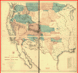
 Map
of the United States and territories showing the extent
of public surveys, Indian and military reservations, land
grant R.R.; rail roads, canals, and other details.
compiled from the official surveys of the General Land
Office and other authentic sources. United States. General
Land Office. CREATED/PUBLISHED [Washington?] 1873. NOTES
Scale ca. 1:2,500,000. Relief shown by hachures. Inset:
Territory of Alaska. SUMMARY Detailed map of the continental
United States showing drainage, state boundaries, cities
and towns, canals, land grant railroads, completed railroads,
railroads in progress of completion, and projected lines.
Major lines are named along their routes. Indian and military
reservation are shown; land offices and lighthouses are
also indicated. Map
of the United States and territories showing the extent
of public surveys, Indian and military reservations, land
grant R.R.; rail roads, canals, and other details.
compiled from the official surveys of the General Land
Office and other authentic sources. United States. General
Land Office. CREATED/PUBLISHED [Washington?] 1873. NOTES
Scale ca. 1:2,500,000. Relief shown by hachures. Inset:
Territory of Alaska. SUMMARY Detailed map of the continental
United States showing drainage, state boundaries, cities
and towns, canals, land grant railroads, completed railroads,
railroads in progress of completion, and projected lines.
Major lines are named along their routes. Indian and military
reservation are shown; land offices and lighthouses are
also indicated. |
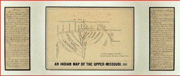 An
Indian map of the Upper-Missouri. . CREATED/PUBLISHED
1801. An
Indian map of the Upper-Missouri. . CREATED/PUBLISHED
1801. |
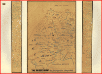 The
Mississippi. Franquelin, Jean Baptiste Louis. CREATED/PUBLISHED
[ca. 1682] NOTES Relief shown pictorially. Shows trees,
animals, and names of the Indian nations. "This is the
copy of a sketch of the Mississippi River and country,
contained in a manuscript map ... has the following title
Carte génerale de la France septentrionale, contenant
dans la d'ecouverte du pays des Ilinois ... made by the
Sieur Jolliet ... our present map ... is one of the first
French maps of the Mississippi River ever made, if not
the very first one itself." Includes a discussion of the
origin, significance, and contents of the map. The
Mississippi. Franquelin, Jean Baptiste Louis. CREATED/PUBLISHED
[ca. 1682] NOTES Relief shown pictorially. Shows trees,
animals, and names of the Indian nations. "This is the
copy of a sketch of the Mississippi River and country,
contained in a manuscript map ... has the following title
Carte génerale de la France septentrionale, contenant
dans la d'ecouverte du pays des Ilinois ... made by the
Sieur Jolliet ... our present map ... is one of the first
French maps of the Mississippi River ever made, if not
the very first one itself." Includes a discussion of the
origin, significance, and contents of the map. |
 A
general map of the middle British colonies in America.
viz. Virginia, Maryland, Delaware, Pensilvania, New-Jersey,
New York, Connecticut & Rhode-Island: Of Aquanishuonigy
the country of the confederate Indians comprehending Aquanishuonigy
proper, their places of residence, Ohio & Thuchsochruntie
their deer hunting countries, Couchsachrage & Skaniadarade
their beaver hunting countries, of the Lakes Erie, Ontario
and Champlain. Wherein is also shewn the antient & present
seats of the Indian nations. Evans, Lewis, 1700?-1756.
CREATED/PUBLISHED London, Printed for Carington Bowles,
1771. NOTES Scale ca. 1:2,250,000. A
general map of the middle British colonies in America.
viz. Virginia, Maryland, Delaware, Pensilvania, New-Jersey,
New York, Connecticut & Rhode-Island: Of Aquanishuonigy
the country of the confederate Indians comprehending Aquanishuonigy
proper, their places of residence, Ohio & Thuchsochruntie
their deer hunting countries, Couchsachrage & Skaniadarade
their beaver hunting countries, of the Lakes Erie, Ontario
and Champlain. Wherein is also shewn the antient & present
seats of the Indian nations. Evans, Lewis, 1700?-1756.
CREATED/PUBLISHED London, Printed for Carington Bowles,
1771. NOTES Scale ca. 1:2,250,000. |
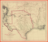
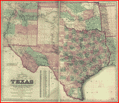 Colton's
new map of the state of Texas. the Indian Territory
and adjoining portions of New Mexico, Louisiana, and Arkansas
/ compiled from the official county maps of the General
Land Office, the personal reconnaisances and geological
explorations of Prof. A.R. Roessler, the surveys of the
Mexican Boundary Commission, U.S. Coast Surveys, U.S.
General Land Office, the various Rail Road Cos., information
furnished by Mr. Pressler, and other authentic materials
by G. Woolworth Colton. Colton, G. Woolworth (George Woolworth),
1827-1901. CREATED/PUBLISHED New York : G.W & C.B. Colton
& Co., 1872. NOTES Relief shown by hachures. "Entered
according to Act of Congress in the year 1872 by G.W.
& C.B. Colton & Co. in the Office of the Librarian of
Congress at Washington." Prime meridians: Washington and
Greenwich. Insets: New Mexico -- Public Lands -- Indian
Territory -- Missouri -- Louisiana. List showing population
of Texas by counties in 1870. Colton's
new map of the state of Texas. the Indian Territory
and adjoining portions of New Mexico, Louisiana, and Arkansas
/ compiled from the official county maps of the General
Land Office, the personal reconnaisances and geological
explorations of Prof. A.R. Roessler, the surveys of the
Mexican Boundary Commission, U.S. Coast Surveys, U.S.
General Land Office, the various Rail Road Cos., information
furnished by Mr. Pressler, and other authentic materials
by G. Woolworth Colton. Colton, G. Woolworth (George Woolworth),
1827-1901. CREATED/PUBLISHED New York : G.W & C.B. Colton
& Co., 1872. NOTES Relief shown by hachures. "Entered
according to Act of Congress in the year 1872 by G.W.
& C.B. Colton & Co. in the Office of the Librarian of
Congress at Washington." Prime meridians: Washington and
Greenwich. Insets: New Mexico -- Public Lands -- Indian
Territory -- Missouri -- Louisiana. List showing population
of Texas by counties in 1870. |
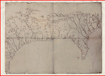 Mapa
del Golfo y costa de la Nueva Espańa : desde el Río de
Panuco hasta el cabo de Santa Elena . Santa Cruz,
Alonso de, 1505-1567. CREATED/PUBLISHED [1572?] NOTES
Relief shown pictorially. Shows the coast from the vicinity
of the Cape Fear River in North Carolina of the United
States, location of Indian settlements, and lakes and
rivers in the region to the Pánuco River in Mexico; the
interior is as far north as the latitude of the Tennessee
River. Mapa
del Golfo y costa de la Nueva Espańa : desde el Río de
Panuco hasta el cabo de Santa Elena . Santa Cruz,
Alonso de, 1505-1567. CREATED/PUBLISHED [1572?] NOTES
Relief shown pictorially. Shows the coast from the vicinity
of the Cape Fear River in North Carolina of the United
States, location of Indian settlements, and lakes and
rivers in the region to the Pánuco River in Mexico; the
interior is as far north as the latitude of the Tennessee
River. |
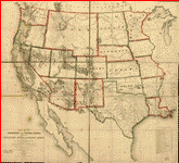
 Map
of the territory of the United States from the Mississippi
to the Pacific Ocean. ordered by Jeff'n Davis, Secretary
of War to accompany the reports of the explorations for
a railroad route. Compiled from authorized explorations
and other reliable data by G. K. Warren ... under the
direction of W. H. Emory in 1854 and of A. A. Humphreys
1854-5-6-7. Engr. by Selmar Siebert. Warren, Gouverneur
Kemble, 1830-1882. CREATED/PUBLISHED [Washington, D.C.,
War Dept., 1858?] NOTES Scale 1:3,000,000. Relief shown
by hachures and spot heights. Shows Indian tribal locations,
military posts, routes and dates of expeditions and surveys. Map
of the territory of the United States from the Mississippi
to the Pacific Ocean. ordered by Jeff'n Davis, Secretary
of War to accompany the reports of the explorations for
a railroad route. Compiled from authorized explorations
and other reliable data by G. K. Warren ... under the
direction of W. H. Emory in 1854 and of A. A. Humphreys
1854-5-6-7. Engr. by Selmar Siebert. Warren, Gouverneur
Kemble, 1830-1882. CREATED/PUBLISHED [Washington, D.C.,
War Dept., 1858?] NOTES Scale 1:3,000,000. Relief shown
by hachures and spot heights. Shows Indian tribal locations,
military posts, routes and dates of expeditions and surveys.
|
 North
America. . CREATED/PUBLISHED [n.p., 175-?] NOTES Scale
ca. 1:50,000,000. Relief shown pictorially. "Degs. west
from London." Shows colonies, a few cities and towns,
and Indian tribal territory. North
America. . CREATED/PUBLISHED [n.p., 175-?] NOTES Scale
ca. 1:50,000,000. Relief shown pictorially. "Degs. west
from London." Shows colonies, a few cities and towns,
and Indian tribal territory. |
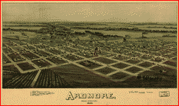 Ardmore,
Indian Territory, 1891.. Drawn by T. M. Fowler. Fowler,
T. M. (Thaddeus Mortimer), 1842-1922. CREATED/PUBLISHED
Morrisville, Pa., T. M. Fowler & James B. Moyer [1891]
NOTES Perspective map not drawn to scale. Bird's-eye-view.
Indexed for points of interest. Ardmore,
Indian Territory, 1891.. Drawn by T. M. Fowler. Fowler,
T. M. (Thaddeus Mortimer), 1842-1922. CREATED/PUBLISHED
Morrisville, Pa., T. M. Fowler & James B. Moyer [1891]
NOTES Perspective map not drawn to scale. Bird's-eye-view.
Indexed for points of interest. |
 Carte
de l'Amérique septentrionale, 1754. . Palairet, Jean,
1697-1774. CREATED/PUBLISHED [Londres, 1755] NOTES Scale
ca. 1:15,000,000. Shows boundaries, some cities and towns,
forts, and Indian tribal territory. Carte
de l'Amérique septentrionale, 1754. . Palairet, Jean,
1697-1774. CREATED/PUBLISHED [Londres, 1755] NOTES Scale
ca. 1:15,000,000. Shows boundaries, some cities and towns,
forts, and Indian tribal territory. |
 An
Accurate map of North America from the latest discoveries.
. CREATED/PUBLISHED [n.p., 175-?] NOTES Scale ca.
1:50,000,000. Relief shown pictorially. Shows "Degrees
west from London." Also shows colonies, a few cities and
towns, and Indian tribal territory. An
Accurate map of North America from the latest discoveries.
. CREATED/PUBLISHED [n.p., 175-?] NOTES Scale ca.
1:50,000,000. Relief shown pictorially. Shows "Degrees
west from London." Also shows colonies, a few cities and
towns, and Indian tribal territory. |
 Map
of Nebraska published by the Burlington Route 1886,.
compiled from the official records of the government and
rail road offices. Hirschfield, F. CREATED/PUBLISHED Omaha,
1886. NOTES Scale 1:760,320. SUMMARY Township and county
map showing drainage, cities and towns, Indian and military
reservations, land districts, and the railroad network
with names along the lines. Map
of Nebraska published by the Burlington Route 1886,.
compiled from the official records of the government and
rail road offices. Hirschfield, F. CREATED/PUBLISHED Omaha,
1886. NOTES Scale 1:760,320. SUMMARY Township and county
map showing drainage, cities and towns, Indian and military
reservations, land districts, and the railroad network
with names along the lines. |
 Ticonderoga
as it was in 1759. . CREATED/PUBLISHED [1759?] NOTES
Scale ca. 1:84,000. Includes index to military activities. Ticonderoga
as it was in 1759. . CREATED/PUBLISHED [1759?] NOTES
Scale ca. 1:84,000. Includes index to military activities.
|
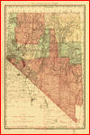 Indexed
county and township pocket map and shippers guide of Nevada.
accompanied by a new and origianl compilation and ready
reference index, showing in detail the entire railroad
network. Rand McNally and Company. CREATED/PUBLISHED Chicago,
1893. NOTES Scale ca. 1:750,000. SUMMARY Shows relief
by hachures, drainage, counties, township lines, Indian
reservations, roads, and railroads with names. Indexed
county and township pocket map and shippers guide of Nevada.
accompanied by a new and origianl compilation and ready
reference index, showing in detail the entire railroad
network. Rand McNally and Company. CREATED/PUBLISHED Chicago,
1893. NOTES Scale ca. 1:750,000. SUMMARY Shows relief
by hachures, drainage, counties, township lines, Indian
reservations, roads, and railroads with names. |
 Indexed
county and township pocket map and shippers guide of South
Dakota. . Rand McNally and Company. CREATED/PUBLISHED
Chicago, 1892. NOTES Scale ca. 1:1,150,000. SUMMARY Shows
relief by hachures, drainage, counties, township lines,
cities and towns, Indian and military reservations, area
"opened for settlement by treaty of 1889," and the railroad
network with named lines. Indexed
county and township pocket map and shippers guide of South
Dakota. . Rand McNally and Company. CREATED/PUBLISHED
Chicago, 1892. NOTES Scale ca. 1:1,150,000. SUMMARY Shows
relief by hachures, drainage, counties, township lines,
cities and towns, Indian and military reservations, area
"opened for settlement by treaty of 1889," and the railroad
network with named lines. |
 A
map of the United States of America, as settled by the
peace of 1783. . Fielding, I. CREATED/PUBLISHED London,
Decr. 1, 1783. NOTES Covers the area east of the Mississippi
River from Canada to Florida. Shows boundaries, major
towns and cities, forts Indian villages and tribal territory,
rivers, and relief. A
map of the United States of America, as settled by the
peace of 1783. . Fielding, I. CREATED/PUBLISHED London,
Decr. 1, 1783. NOTES Covers the area east of the Mississippi
River from Canada to Florida. Shows boundaries, major
towns and cities, forts Indian villages and tribal territory,
rivers, and relief. |
 Carta
geografica dell' America settentrionale. . L'Isle,
Guillaume de, 1675-1726. CREATED/PUBLISHED [Venezia, 1750]
NOTES Scale ca. 1:26,000,000. Relief shown pictorially.
Covers area including North America, Central America and
the Caribbean Islands. Shows boundaries, cities and towns,
forts, some trails, routes of exploration, and Indian
villages and tribal territory. Carta
geografica dell' America settentrionale. . L'Isle,
Guillaume de, 1675-1726. CREATED/PUBLISHED [Venezia, 1750]
NOTES Scale ca. 1:26,000,000. Relief shown pictorially.
Covers area including North America, Central America and
the Caribbean Islands. Shows boundaries, cities and towns,
forts, some trails, routes of exploration, and Indian
villages and tribal territory. |
 Bend
of the Missouri River. CREATED/PUBLISHED [1798] NOTES
Pen-and-ink. Annotated in pencil: Bend of the Missouri,
Long. 101 25"-Lat. 47 32" by Mr. Thomson, astronmer to
the N.W. Company in 1798. Gives number of warriors, houses
and tents of six Mandan and Pawnee Indian villages in
the vicinity of the junction of the Missouri and Knife
Rivers. Bend
of the Missouri River. CREATED/PUBLISHED [1798] NOTES
Pen-and-ink. Annotated in pencil: Bend of the Missouri,
Long. 101 25"-Lat. 47 32" by Mr. Thomson, astronmer to
the N.W. Company in 1798. Gives number of warriors, houses
and tents of six Mandan and Pawnee Indian villages in
the vicinity of the junction of the Missouri and Knife
Rivers. |
 A
map of the United States of America agreeable to the peace
of 1783. . Darton, William, 1755-1819. CREATED/PUBLISHED
[London, 1783] NOTES Scale ca. 1:6,300,000. Shows provincial
boundaries, Indian villages and tribal territory, rivers
and lakes, a few forts and place-names. A
map of the United States of America agreeable to the peace
of 1783. . Darton, William, 1755-1819. CREATED/PUBLISHED
[London, 1783] NOTES Scale ca. 1:6,300,000. Shows provincial
boundaries, Indian villages and tribal territory, rivers
and lakes, a few forts and place-names. |
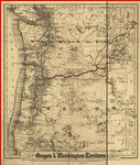 Colton's
township map of Oregon & Washington Territory. issued
by the Oregon Railway and Navigation Co. G.W. & C.B. Colton
& Co. CREATED/PUBLISHED New York, c1880. NOTES Scale ca.
1:1,000,000. SUMMARY Shows relief by hachures, drainage,
cities and towns, township and county boundaries, Indian
reservations, ocean routes, and railroads with emphasis
on the main lines. Colton's
township map of Oregon & Washington Territory. issued
by the Oregon Railway and Navigation Co. G.W. & C.B. Colton
& Co. CREATED/PUBLISHED New York, c1880. NOTES Scale ca.
1:1,000,000. SUMMARY Shows relief by hachures, drainage,
cities and towns, township and county boundaries, Indian
reservations, ocean routes, and railroads with emphasis
on the main lines. |
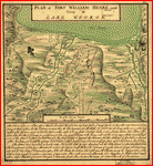 Plan
of Fort William Henry and camp at Lake George. W. Eyre,
engr. I. Heath dt. . Heath, Joseph. CREATED/PUBLISHED
[1755?] NOTES Scale ca. 1:4,800. Includes descriptive
index to military positions. Plan
of Fort William Henry and camp at Lake George. W. Eyre,
engr. I. Heath dt. . Heath, Joseph. CREATED/PUBLISHED
[1755?] NOTES Scale ca. 1:4,800. Includes descriptive
index to military positions. |
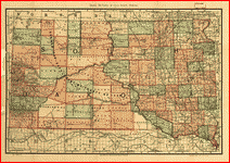
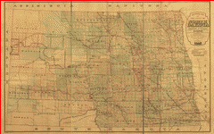 Sectional
map of the state of North Dakota. published by authority
of the commissioners of railroads under the direction
of the governor; drawn and compiled from official maps
of the General Land Office and other authentic sources.
Higbee, E. F. CREATED/PUBLISHED [n.p.], 1892. NOTES Scale
1:443,520. SUMMARY Township and county map showing relief
by hachures, drainage, cities and towns, military and
Indian reservations, and the operating and proposed railroads
with names along the lines. Sectional
map of the state of North Dakota. published by authority
of the commissioners of railroads under the direction
of the governor; drawn and compiled from official maps
of the General Land Office and other authentic sources.
Higbee, E. F. CREATED/PUBLISHED [n.p.], 1892. NOTES Scale
1:443,520. SUMMARY Township and county map showing relief
by hachures, drainage, cities and towns, military and
Indian reservations, and the operating and proposed railroads
with names along the lines. |
 Official
railroad map of Dakota issued by the railroad commissioners,
November 1st, 1886. . Rand McNally and Company. CREATED/PUBLISHED
Chicago, 1886. NOTES Scale ca. 1:1,100,000. From Second
Annual Report of the Board of Railroad Commissioners of
the Territory of Dakota (Grand Forks, Dakota 1886) (HE2709.D2)
SUMMARY Shows relief by hachures, drainage, cities and
towns, township and county boundaries, Indians, and the
railroads with lines named. Official
railroad map of Dakota issued by the railroad commissioners,
November 1st, 1886. . Rand McNally and Company. CREATED/PUBLISHED
Chicago, 1886. NOTES Scale ca. 1:1,100,000. From Second
Annual Report of the Board of Railroad Commissioners of
the Territory of Dakota (Grand Forks, Dakota 1886) (HE2709.D2)
SUMMARY Shows relief by hachures, drainage, cities and
towns, township and county boundaries, Indians, and the
railroads with lines named. |
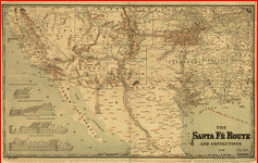 The
Santa Fé Route and connections, 1888. . Rand McNally
and Company. CREATED/PUBLISHED Chicago, 1888. SUMMARY
Map of the southwestern United States and northern Mexico
showing relief by hachures, drainage, cities and towns,
stations, Indian reservations, state boundaries, and the
railroad network emphasizing the main line. Includes railroad
names. Profiles in lower left of map. The
Santa Fé Route and connections, 1888. . Rand McNally
and Company. CREATED/PUBLISHED Chicago, 1888. SUMMARY
Map of the southwestern United States and northern Mexico
showing relief by hachures, drainage, cities and towns,
stations, Indian reservations, state boundaries, and the
railroad network emphasizing the main line. Includes railroad
names. Profiles in lower left of map. |
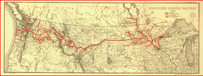 Northern
Pacific Railway 1900. . L.L. Poates Engr'g Co. CREATED/PUBLISHED
New York, 1900. SUMMARY Map of northern United States
from the Great Lakes to the Pacific Ocean showing reliief
by hachures, drainage, cities and towns, forest and timber,
Indian and military reservations. Northern
Pacific Railway 1900. . L.L. Poates Engr'g Co. CREATED/PUBLISHED
New York, 1900. SUMMARY Map of northern United States
from the Great Lakes to the Pacific Ocean showing reliief
by hachures, drainage, cities and towns, forest and timber,
Indian and military reservations. |
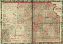
 State
of Kansas, 1884. compiled from the official records
of the General Land Office and other sources under supervision
of G.P. Strum, Principal Draughtsman, photo lith & print
by Julius Bien & Co. N.Y. 1884. United States. General
Land Office. CREATED/PUBLISHED [Washington, 1884] NOTES
Scale 1:950,400. SUMMARY Township map showing drainage,
cities and towns, Indian and military reservations, railroads,
and the limit of grants. State
of Kansas, 1884. compiled from the official records
of the General Land Office and other sources under supervision
of G.P. Strum, Principal Draughtsman, photo lith & print
by Julius Bien & Co. N.Y. 1884. United States. General
Land Office. CREATED/PUBLISHED [Washington, 1884] NOTES
Scale 1:950,400. SUMMARY Township map showing drainage,
cities and towns, Indian and military reservations, railroads,
and the limit of grants. |
 Plan
of the fort and fortress at Crown Point with their environs.
. With the disposition of the English Army under the
command of Genl. Amherst encamp'd there 1759. CREATED/PUBLISHED
[1759?] NOTES Scale 1:7,200; 200 yards to an in. Relief
shown by shading and hachures. Includes "References." Plan
of the fort and fortress at Crown Point with their environs.
. With the disposition of the English Army under the
command of Genl. Amherst encamp'd there 1759. CREATED/PUBLISHED
[1759?] NOTES Scale 1:7,200; 200 yards to an in. Relief
shown by shading and hachures. Includes "References."
|
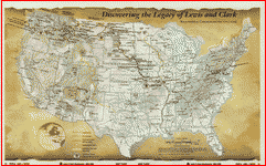 Discovering
the legacy of Lewis and Clark : bicentennial commemoration
2003-2006. CREATED/PUBLISHED Philadelphia, Penn. :
Lewis and Clark Trail Heritage Foundation, [2003] NOTES
Legend includes preparation, recruitment, exploration
and homecoming, Indian reservations, Louisiana Purchase
boundary, and Lewis and Clark National Historic Trail.
Includes historical and descriptive text about the expedition
and the historic trail. Discovering
the legacy of Lewis and Clark : bicentennial commemoration
2003-2006. CREATED/PUBLISHED Philadelphia, Penn. :
Lewis and Clark Trail Heritage Foundation, [2003] NOTES
Legend includes preparation, recruitment, exploration
and homecoming, Indian reservations, Louisiana Purchase
boundary, and Lewis and Clark National Historic Trail.
Includes historical and descriptive text about the expedition
and the historic trail. |
 Captain
Snow's scetch of the country by himself, and the best
accounts he could receive from the Indian traders. .
CREATED/PUBLISHED 1754. NOTES Scale not given. Relief
shown pictorially. Shows location of forts, western Pennsylvania,
northern Virginia, northern Maryland, Maryland-Pennsylvania
boundary line, and "Road to Philadelphia, Pennsylvania,
&ca." Includes historical notes. Captain
Snow's scetch of the country by himself, and the best
accounts he could receive from the Indian traders. .
CREATED/PUBLISHED 1754. NOTES Scale not given. Relief
shown pictorially. Shows location of forts, western Pennsylvania,
northern Virginia, northern Maryland, Maryland-Pennsylvania
boundary line, and "Road to Philadelphia, Pennsylvania,
&ca." Includes historical notes. |
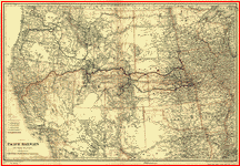 Map
showing the Pacific Railroads and their branches; prepared
for the United States Pacific Railway Commission. .
G.W. & C.B. Colton & Co. CREATED/PUBLISHED New York, [1887]
NOTES Scale ca. 1:3,800,000. SUMMARY Map of the western
United States showing relief by hachures, drainage, cities
and towns, Indian reservation, military posts, and the
railroad network with main lines color coded. Red indicates
lines "aided by U.S. Bonds." Map
showing the Pacific Railroads and their branches; prepared
for the United States Pacific Railway Commission. .
G.W. & C.B. Colton & Co. CREATED/PUBLISHED New York, [1887]
NOTES Scale ca. 1:3,800,000. SUMMARY Map of the western
United States showing relief by hachures, drainage, cities
and towns, Indian reservation, military posts, and the
railroad network with main lines color coded. Red indicates
lines "aided by U.S. Bonds." |
 An
accurate map of the United States of America, with part
of the surrounding provinces agreeable to the Treaty of
Peace of 1783, by Ino. Cary. . CREATED/PUBLISHED London,
J. Cary, 1783. NOTES Scale ca. 1:4,100,000. Relief shown
pictorially. Prime meridian: London. Shows national boundaries,
towns and cities, frontier forts, trading posts, Indian
villages and tribal territory, rivers and lakes, swamps,
portages, and relief. Includes articles I-III of the Treaty. An
accurate map of the United States of America, with part
of the surrounding provinces agreeable to the Treaty of
Peace of 1783, by Ino. Cary. . CREATED/PUBLISHED London,
J. Cary, 1783. NOTES Scale ca. 1:4,100,000. Relief shown
pictorially. Prime meridian: London. Shows national boundaries,
towns and cities, frontier forts, trading posts, Indian
villages and tribal territory, rivers and lakes, swamps,
portages, and relief. Includes articles I-III of the Treaty.
|
 Historical
map of the United States indicating battlefields, names
of commanders, number of troops engaged, number of killed
and captured during French and Indian and Revolutionary
wars, Mexican War, and the late Civil War . Rennecamp,
Charles. CREATED/PUBLISHED [St. Louis, c1890] NOTES Scale
ca. 1:4,800,000. Principal map shows location and date
of battles fought during the Civil War. The winner of
each engagement is given as well as the names of the opposing
commanders. Historical
map of the United States indicating battlefields, names
of commanders, number of troops engaged, number of killed
and captured during French and Indian and Revolutionary
wars, Mexican War, and the late Civil War . Rennecamp,
Charles. CREATED/PUBLISHED [St. Louis, c1890] NOTES Scale
ca. 1:4,800,000. Principal map shows location and date
of battles fought during the Civil War. The winner of
each engagement is given as well as the names of the opposing
commanders. |
 Karte
der verschiendenen Pacific Eisenbahnen und deren Verbindung
mit anderen Bahnen; für die "N.Y. Handels Zeitung" gezeichne.
. G.W. & C.B. Colton & Co. CREATED/PUBLISHED New York,
1870. NOTES Scale ca. 1:6,000,000. At top of map: "Beilage
zur N.Y. Handels Zeitung." SUMMARY Map of western United
States showing drainage, relief by hachures, state and
county boundaries, cities and towns, Indian and military
reservations, roads, trails, the railroad network and
the Pacific lines in heavy colors. Karte
der verschiendenen Pacific Eisenbahnen und deren Verbindung
mit anderen Bahnen; für die "N.Y. Handels Zeitung" gezeichne.
. G.W. & C.B. Colton & Co. CREATED/PUBLISHED New York,
1870. NOTES Scale ca. 1:6,000,000. At top of map: "Beilage
zur N.Y. Handels Zeitung." SUMMARY Map of western United
States showing drainage, relief by hachures, state and
county boundaries, cities and towns, Indian and military
reservations, roads, trails, the railroad network and
the Pacific lines in heavy colors. |
 Carte
generale des États Unis de l'Amerique Septentrionale,
avec les limites de chacun des dits Etats, convenus par
le traité provisional du mois de novembre 1782. Par J.
B. Eliot. . Eliot, J. B. CREATED/PUBLISHED Paris,
Chez Mondhare, 1783. NOTES Scale ca. 1:3,330,000. Relief
shown pictorially. Covers the area east of the Mississippi
River from James Bay to the Gulf of Mexico. Shows states,
towns and cities, forts, Indian villages and tribal territory,
shoals and banks along the coast and relief. Includes
an inset map of Florida, the Bahama Islands, and the Greater
Antilles. Carte
generale des États Unis de l'Amerique Septentrionale,
avec les limites de chacun des dits Etats, convenus par
le traité provisional du mois de novembre 1782. Par J.
B. Eliot. . Eliot, J. B. CREATED/PUBLISHED Paris,
Chez Mondhare, 1783. NOTES Scale ca. 1:3,330,000. Relief
shown pictorially. Covers the area east of the Mississippi
River from James Bay to the Gulf of Mexico. Shows states,
towns and cities, forts, Indian villages and tribal territory,
shoals and banks along the coast and relief. Includes
an inset map of Florida, the Bahama Islands, and the Greater
Antilles. |
 Route
of the late expedtion [sic] commanded by Act'g. Rear Admiral
D. D. Porter U.S.N. attempting to get into the Yazoo River
by the way of Steels Bayou and Deer Creek. Compiled
& drawn by A. Strausz, U.S. Coast Survey. Strausz, A.
CREATED/PUBLISHED [Washington], U.S. Coast Survey, 1863.
NOTES Scale ca. 1:215,000. "The shaded bayou shows the
route actually travelled by the gun boats. The doted line
shows the remaining proposed route." Indicates the location
of bridges, Indian mounds, and names or residents along
Deer Creek. Route
of the late expedtion [sic] commanded by Act'g. Rear Admiral
D. D. Porter U.S.N. attempting to get into the Yazoo River
by the way of Steels Bayou and Deer Creek. Compiled
& drawn by A. Strausz, U.S. Coast Survey. Strausz, A.
CREATED/PUBLISHED [Washington], U.S. Coast Survey, 1863.
NOTES Scale ca. 1:215,000. "The shaded bayou shows the
route actually travelled by the gun boats. The doted line
shows the remaining proposed route." Indicates the location
of bridges, Indian mounds, and names or residents along
Deer Creek. |
 A
map of the British and French settlements in North America.
J. Lodge. Lodge, John, d. 1796. CREATED/PUBLISHED
[n.p., 175-?] NOTES Scale ca. 1:11,000,000. Covers the
eastern half of North America from Hudson Bay to the Gulf
of Mexico. Relief shown pictorially. Shows boundaries,
cities and towns, forts, Indian villages and tribal territory,
and "Earl Granville's Property." "Longitude w. from London."
"The French Incroachments are shewn by Oblique strokes,
and their Forts with two Strokes, the English Forts by
a single Stroke." Includes a brief historical note on
the English claim to North America and the origins of
several colonies. A
map of the British and French settlements in North America.
J. Lodge. Lodge, John, d. 1796. CREATED/PUBLISHED
[n.p., 175-?] NOTES Scale ca. 1:11,000,000. Covers the
eastern half of North America from Hudson Bay to the Gulf
of Mexico. Relief shown pictorially. Shows boundaries,
cities and towns, forts, Indian villages and tribal territory,
and "Earl Granville's Property." "Longitude w. from London."
"The French Incroachments are shewn by Oblique strokes,
and their Forts with two Strokes, the English Forts by
a single Stroke." Includes a brief historical note on
the English claim to North America and the origins of
several colonies. |
 A
new and accurate map of part of North-America, comprehending
the provinces of New England, New York, Pensilvania, New
Jersey, Connecticut, Rhode Island & part of Virginia,
Canada and Hallifax. Gibson, J. (John) CREATED/PUBLISHED
[London?] 1771. NOTES Scale ca. 1:2,300,000. Covers the
area from Quebec to lower Chesapeake Bay and west along
the St. Lawrence River and the Great Lakes to Fort Detroit.
Shows provinces, towns and cities, forts, some residences,
landmarks, salt and coal deposits, swamps, grasslands,
waterfalls, Indian villages, and relief. Relief shown
pictorially. Includes historical and descriptive notes. A
new and accurate map of part of North-America, comprehending
the provinces of New England, New York, Pensilvania, New
Jersey, Connecticut, Rhode Island & part of Virginia,
Canada and Hallifax. Gibson, J. (John) CREATED/PUBLISHED
[London?] 1771. NOTES Scale ca. 1:2,300,000. Covers the
area from Quebec to lower Chesapeake Bay and west along
the St. Lawrence River and the Great Lakes to Fort Detroit.
Shows provinces, towns and cities, forts, some residences,
landmarks, salt and coal deposits, swamps, grasslands,
waterfalls, Indian villages, and relief. Relief shown
pictorially. Includes historical and descriptive notes.
|
 Map
of the country about the Mississippi. Drawn by Chegeree
(the Indian) who says he has travelled through the country.
. Chegeree. CREATED/PUBLISHED [1755?] NOTES Not drawn
to scale. Title from verso. Oriented with north toward
the upper right. Shows area from Lake Erie to the mouth
of the Ohio River. Also mounted on sheet, in same handwriting
as map, 2 sheets, one of questions, one of information
relating to the map. Map
of the country about the Mississippi. Drawn by Chegeree
(the Indian) who says he has travelled through the country.
. Chegeree. CREATED/PUBLISHED [1755?] NOTES Not drawn
to scale. Title from verso. Oriented with north toward
the upper right. Shows area from Lake Erie to the mouth
of the Ohio River. Also mounted on sheet, in same handwriting
as map, 2 sheets, one of questions, one of information
relating to the map. |
 Carte
de la Nouvelle Angleterre, Nouvelle Yorck, et Pensilvanie.
Pour servir ŕ l'Histoire générale des voyages.. Bellin,
Jacques Nicolas, 1703-1772. CREATED/PUBLISHED [Paris]
1757. NOTES Covers the area from Penobscot Bay to Chesapeake
Bay and west to Lake Erie. Shows provices, towns, forts,
rivers, Indian tribal territory, and relief. Relief shown
pictorially. Prime meridian: Paris. Carte
de la Nouvelle Angleterre, Nouvelle Yorck, et Pensilvanie.
Pour servir ŕ l'Histoire générale des voyages.. Bellin,
Jacques Nicolas, 1703-1772. CREATED/PUBLISHED [Paris]
1757. NOTES Covers the area from Penobscot Bay to Chesapeake
Bay and west to Lake Erie. Shows provices, towns, forts,
rivers, Indian tribal territory, and relief. Relief shown
pictorially. Prime meridian: Paris. |
 Partie
occidentale de la Nouvelle France ou du Canada par Mr.
Bellin, ingénieur du roy de la marine pour servir ŕ l'intelligence
des affaires de l'etat present en Amerique, communiquée
au public par les Héritiers de Homan. . Bellin, Jacques
Nicolas, 1703-1772. CREATED/PUBLISHED [Nürnberg] 1755.
NOTES Scale ca. 1:3,500,000. Relief shown pictorially.
Covers the area from Lake Superior to Kaskaskia and from
Delaware Bay to the Mississippi River. Shows a few towns,
missions, forts, Indian villages and tribal territory,
rivers and lakes, portages, and early place-names. Partie
occidentale de la Nouvelle France ou du Canada par Mr.
Bellin, ingénieur du roy de la marine pour servir ŕ l'intelligence
des affaires de l'etat present en Amerique, communiquée
au public par les Héritiers de Homan. . Bellin, Jacques
Nicolas, 1703-1772. CREATED/PUBLISHED [Nürnberg] 1755.
NOTES Scale ca. 1:3,500,000. Relief shown pictorially.
Covers the area from Lake Superior to Kaskaskia and from
Delaware Bay to the Mississippi River. Shows a few towns,
missions, forts, Indian villages and tribal territory,
rivers and lakes, portages, and early place-names. |
 Map
of the military dep't of Texas : being a section of the
map of the territory of the U.S. from the Mississippi
River to the Pacific Ocean. compiled from all the
reliable data by Lt. G.K. Warren, T.E., under the direction
of Capt. A.A. Humphreys, T.E. ; lith. of J. Bien. Warren,
Gouverneur Kemble, 1830-1882. CREATED/PUBLISHED [Washington
D.C.?] : Office Expl.ns and Surveys, War Dep't, 1859.
NOTES Relief shown by hachures. Shows Indian tribal locations,
military posts, and routes and dates of expeditions and
surveys. Map
of the military dep't of Texas : being a section of the
map of the territory of the U.S. from the Mississippi
River to the Pacific Ocean. compiled from all the
reliable data by Lt. G.K. Warren, T.E., under the direction
of Capt. A.A. Humphreys, T.E. ; lith. of J. Bien. Warren,
Gouverneur Kemble, 1830-1882. CREATED/PUBLISHED [Washington
D.C.?] : Office Expl.ns and Surveys, War Dep't, 1859.
NOTES Relief shown by hachures. Shows Indian tribal locations,
military posts, and routes and dates of expeditions and
surveys. |
 A
new sectional map of the state of Kansas showing the route
of the Union Pacific Railway--E. D. to Denver City. Col.
and complete system of projected rail roads. . Information
compiled & collected from departments of the government
at Washington, D.C. and other authentic sources by W.
J. Keeler, C. E. 1867. Du Bois, Charles. CREATED/PUBLISHED
Washington, D.C., 1867. NOTES Scale 1:253,440. SUMMARY
Detailed township and county map showing drainage. Relief
by hachures, salt marshes, and minerals in inset only.
Includes Indian reservations, roads and railroads, and
the land grants of the Union Pacific in Kansas. Lists
projected railroads. A
new sectional map of the state of Kansas showing the route
of the Union Pacific Railway--E. D. to Denver City. Col.
and complete system of projected rail roads. . Information
compiled & collected from departments of the government
at Washington, D.C. and other authentic sources by W.
J. Keeler, C. E. 1867. Du Bois, Charles. CREATED/PUBLISHED
Washington, D.C., 1867. NOTES Scale 1:253,440. SUMMARY
Detailed township and county map showing drainage. Relief
by hachures, salt marshes, and minerals in inset only.
Includes Indian reservations, roads and railroads, and
the land grants of the Union Pacific in Kansas. Lists
projected railroads. |
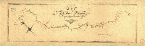 Map
of the Red River in Louisiana from the Spanish camp where
the exploring party of the U.S. was met by the Spanish
troops to where it enters the Mississippi, reduced from
the protracted courses and corrected to the latitude.
King, N. (Nicholas) 1771-1812. CREATED/PUBLISHED Philadelphia
: Engrav'd by F. Shallus, 1806. NOTES Also shows cities
and towns, Indian settlements, and features in the region
along the Red River. King's final work based on the Freeman-Curtis
expedition of 1806. Map
of the Red River in Louisiana from the Spanish camp where
the exploring party of the U.S. was met by the Spanish
troops to where it enters the Mississippi, reduced from
the protracted courses and corrected to the latitude.
King, N. (Nicholas) 1771-1812. CREATED/PUBLISHED Philadelphia
: Engrav'd by F. Shallus, 1806. NOTES Also shows cities
and towns, Indian settlements, and features in the region
along the Red River. King's final work based on the Freeman-Curtis
expedition of 1806. |
 A
new and accurate map of New Jersey, Pensilvania, New York
and New England with the adjacent countries.. Drawn
from surveys, assisted by the most approved modern maps
& charts and regulated by astronomical observations. Bowen,
Emanuel, d. 1767. CREATED/PUBLISHED [London, 1752] NOTES
Scale ca. 1:12,250,000. "No. 62" in lower left margin.
Covers the area from the Bay of Fundy southward along
the coast to Chesapeake Bay, and west to the Finger Lakes
district in New York. Shows towns and cities, forts, Indian
villiages and tribal territory, some vegetation, shoals
and banks along the coast, and relief. Relief shown pictorially. A
new and accurate map of New Jersey, Pensilvania, New York
and New England with the adjacent countries.. Drawn
from surveys, assisted by the most approved modern maps
& charts and regulated by astronomical observations. Bowen,
Emanuel, d. 1767. CREATED/PUBLISHED [London, 1752] NOTES
Scale ca. 1:12,250,000. "No. 62" in lower left margin.
Covers the area from the Bay of Fundy southward along
the coast to Chesapeake Bay, and west to the Finger Lakes
district in New York. Shows towns and cities, forts, Indian
villiages and tribal territory, some vegetation, shoals
and banks along the coast, and relief. Relief shown pictorially.
|
 Western
border states . Hall, Edward S., Cartographer. CREATED/PUBLISHED
N.Y., New York H. H. Lloyd & Co. c1861. NOTES Scale ca.
1:740,000. At top of sheet: Military portraits, map of
the seat of war, uniforms, arms, & c. Map of Missouri,
Tennessee, and parts of Nebraska, Kansas, Indian Territory,
Arkansas, Illinois, Indiana, Ohio, Kentucky, Virginia,
North Carolina, and South Carolina, showing cities and
towns, rivers, and railroads. Some important or strategic
places are underlined in red or indicated by red dots.
Above map has portraits of Generals Wool, Dix, Scott,
Fremont, Lyon, McClellan, Banks, Blenker, Butler, McDowell,
Rosecrans (here spelled "Rosencranz"), Sprague, Burnside,
and Sigel, Colonel Corcoran, and Commodore Stringham. Western
border states . Hall, Edward S., Cartographer. CREATED/PUBLISHED
N.Y., New York H. H. Lloyd & Co. c1861. NOTES Scale ca.
1:740,000. At top of sheet: Military portraits, map of
the seat of war, uniforms, arms, & c. Map of Missouri,
Tennessee, and parts of Nebraska, Kansas, Indian Territory,
Arkansas, Illinois, Indiana, Ohio, Kentucky, Virginia,
North Carolina, and South Carolina, showing cities and
towns, rivers, and railroads. Some important or strategic
places are underlined in red or indicated by red dots.
Above map has portraits of Generals Wool, Dix, Scott,
Fremont, Lyon, McClellan, Banks, Blenker, Butler, McDowell,
Rosecrans (here spelled "Rosencranz"), Sprague, Burnside,
and Sigel, Colonel Corcoran, and Commodore Stringham.
|
 View
of the Mississippi Valley from Cairo to the Gulf of Mexico
Drawn from government surveys and other authentic sources
by M.K. Couzens, Civ. Eng. . Couzens, M. K. CREATED/PUBLISHED
N.Y. New York W. Schaus c1861. NOTES Scale ca. 1:1,710,000.
At top of map: The seat of war. This is a map and not
a bird's-eye view. It covers Louisiana, Mississippi, Arkansas,
Alabama, and parts of Florida, Georgia, Kentucky, Tennessee,
Illinois, Missouri, Kansas, Indian Territory, and Texas,
and indicates forts, towns, rivers, roads, railroads,
state boundaries, and relief by shading. View
of the Mississippi Valley from Cairo to the Gulf of Mexico
Drawn from government surveys and other authentic sources
by M.K. Couzens, Civ. Eng. . Couzens, M. K. CREATED/PUBLISHED
N.Y. New York W. Schaus c1861. NOTES Scale ca. 1:1,710,000.
At top of map: The seat of war. This is a map and not
a bird's-eye view. It covers Louisiana, Mississippi, Arkansas,
Alabama, and parts of Florida, Georgia, Kentucky, Tennessee,
Illinois, Missouri, Kansas, Indian Territory, and Texas,
and indicates forts, towns, rivers, roads, railroads,
state boundaries, and relief by shading. |
 A
new map of the north parts of America claimed by France
under ye names of Louisiana, Mississipi [i.e. Mississippi],
Canada, and New France. with ye adjoining territories
of England and Spain : to Thomas Bromsall, esq., this
map of Louisiana, Mississipi [i.e. Mississippi] & c. is
most humbly dedicated, H. Moll, geographer / laid down
according to the newest and most exact observations by
H. Moll, geographer, 1720. Moll, Herman, d. 1732. CREATED/PUBLISHED
[London] : Sold by H. Moll, [1720] NOTES Relief shown
pictorially. Includes notes and ill. of "The Indian Fort
Sasquesahanok." Insets: The harbour of Annapolis Royal
-- A map of ye mouth of Mississipi [i.e. Mississippi]
and Mobile Rivers & c. A
new map of the north parts of America claimed by France
under ye names of Louisiana, Mississipi [i.e. Mississippi],
Canada, and New France. with ye adjoining territories
of England and Spain : to Thomas Bromsall, esq., this
map of Louisiana, Mississipi [i.e. Mississippi] & c. is
most humbly dedicated, H. Moll, geographer / laid down
according to the newest and most exact observations by
H. Moll, geographer, 1720. Moll, Herman, d. 1732. CREATED/PUBLISHED
[London] : Sold by H. Moll, [1720] NOTES Relief shown
pictorially. Includes notes and ill. of "The Indian Fort
Sasquesahanok." Insets: The harbour of Annapolis Royal
-- A map of ye mouth of Mississipi [i.e. Mississippi]
and Mobile Rivers & c. |
 Carte
du théatre de la guerre actuel entre les Anglais et les
Treize Colonies Unies de l'Amerique Septentrionale, dressée
par J. B. Éliot, ingénieurs des Etats Unis. . Eliot,
J. B. CREATED/PUBLISHED Paris, Chez Mondhare, 1778. NOTES
Scale ca. 1:1,400,000. Covers the area from Lake Nipissin
to lower Chesapeake Bay and west to Lake Erie. Shows states,
some counties, towns and cities, forts, Indian villages
and tribal territory, roads, and relief. Carte
du théatre de la guerre actuel entre les Anglais et les
Treize Colonies Unies de l'Amerique Septentrionale, dressée
par J. B. Éliot, ingénieurs des Etats Unis. . Eliot,
J. B. CREATED/PUBLISHED Paris, Chez Mondhare, 1778. NOTES
Scale ca. 1:1,400,000. Covers the area from Lake Nipissin
to lower Chesapeake Bay and west to Lake Erie. Shows states,
some counties, towns and cities, forts, Indian villages
and tribal territory, roads, and relief. |
 The
Santa Fé route Atchison, Topeka & Santa Fé R.R. 3 lines
between the Missouri River and the Pacific coast to the
city of Mexico via the A.T.&S. and Mexican Central R.R.
. Poole Brothers. CREATED/PUBLISHED Chicago, 1884.
NOTES Scale ca. 1:2,700,000. Title from verso. Insets:
Map of the Atchison Topeka & Santa Fé Railroad System.
Showing its connecting lines ... in the United States
and Mexico. 18 x 29 cm.--Railroad map of Mexico. 16 x
26 cm. Advertisements and ticket information on verso.
SUMMARY Map of the western United States from Kansas City
to the Pacific showing relief by shading, drainage, state
boundaries, military and Indian reservations, railroads
with main lines in heavy black; lists stage connections
on each side of map. The
Santa Fé route Atchison, Topeka & Santa Fé R.R. 3 lines
between the Missouri River and the Pacific coast to the
city of Mexico via the A.T.&S. and Mexican Central R.R.
. Poole Brothers. CREATED/PUBLISHED Chicago, 1884.
NOTES Scale ca. 1:2,700,000. Title from verso. Insets:
Map of the Atchison Topeka & Santa Fé Railroad System.
Showing its connecting lines ... in the United States
and Mexico. 18 x 29 cm.--Railroad map of Mexico. 16 x
26 cm. Advertisements and ticket information on verso.
SUMMARY Map of the western United States from Kansas City
to the Pacific showing relief by shading, drainage, state
boundaries, military and Indian reservations, railroads
with main lines in heavy black; lists stage connections
on each side of map. |
 A
new map of North America, with the British, French, Spanish,
Dutch & Danish dominions on that great continent; and
the West India Islands. done from the latest geographers,
with great improvements from the Sieurs d'Anville & Robert.
Sayer, Robert, 1725-1794. CREATED/PUBLISHED London, Printed
for Robt. Sayer [1750?] NOTES Scale ca. 1:18,500,000.
Relief shown pictorially. Shows boundaries, cities and
towns, roads, forts, Indian villages and tribal territory,
and vegetation. Also shows anchorages, currents, and routes
of navigation along the coast. Includes historical notes,
text, 10 insets of harbors, and a table showing that "North
America is divided into the continent & the islands" according
to geography and politics. A
new map of North America, with the British, French, Spanish,
Dutch & Danish dominions on that great continent; and
the West India Islands. done from the latest geographers,
with great improvements from the Sieurs d'Anville & Robert.
Sayer, Robert, 1725-1794. CREATED/PUBLISHED London, Printed
for Robt. Sayer [1750?] NOTES Scale ca. 1:18,500,000.
Relief shown pictorially. Shows boundaries, cities and
towns, roads, forts, Indian villages and tribal territory,
and vegetation. Also shows anchorages, currents, and routes
of navigation along the coast. Includes historical notes,
text, 10 insets of harbors, and a table showing that "North
America is divided into the continent & the islands" according
to geography and politics. |
 Partie
de l'Amérique septentrionale, qui comprend le cours de
l'Ohio, la Nlle. Angleterre, la Nlle York, le New Jersey,
la Pensylvanie, le Maryland, la Virginie, la Caroline.
Par le Sr. Robert de Vaugondy, géographe ordinaire du
roi. M. C. Haussard, fecit . Robert de Vaugondy, Gilles,
1688-1766. CREATED/PUBLISHED [Paris? 1755] NOTES Scale
ca. 1:3,000,000. Title on verso: "Cours de l'Ohyo." Relief
shown pictorially. Covers the area from the Great Lakes
to South Carolina and from the Atlantic coast to the Mississippi
River. Shows provinces, counties, towns and cities, riviers,
Indian villages and tribal territory, forts, numerous
place-names, and relief. Partie
de l'Amérique septentrionale, qui comprend le cours de
l'Ohio, la Nlle. Angleterre, la Nlle York, le New Jersey,
la Pensylvanie, le Maryland, la Virginie, la Caroline.
Par le Sr. Robert de Vaugondy, géographe ordinaire du
roi. M. C. Haussard, fecit . Robert de Vaugondy, Gilles,
1688-1766. CREATED/PUBLISHED [Paris? 1755] NOTES Scale
ca. 1:3,000,000. Title on verso: "Cours de l'Ohyo." Relief
shown pictorially. Covers the area from the Great Lakes
to South Carolina and from the Atlantic coast to the Mississippi
River. Shows provinces, counties, towns and cities, riviers,
Indian villages and tribal territory, forts, numerous
place-names, and relief. |
 A
new map for travelers through the United States of America
showing the railroads, canals & stage roads with the distances.
Smith, J. Calvin (John Calvin) CREATED/PUBLISHED New York,
Sherman & Smith, 1846. NOTES Scale ca. 1:4,250,000. Insets:
Railroads & canal routes from Albany to Buffalo.--Map
showing the rail roads between the cities of New York,
Boston & Albany and the Hudson R. from N. York to Albany.--Rail
road route from New York to Philadelphia.--Rail road route
from Philadelphia to Washington.--Map of Oregon, northern
California, Santa Fé &c. SUMMARY A detailed general map
of the eastern half of the United States, framed in decorative
borders, with most of the details east of the Mississippi
River. Indicates drainage, state boundaries and shows
many cities and towns with distances along roads and railroads.
Indian tribes are indicated west of the Mississippi River. A
new map for travelers through the United States of America
showing the railroads, canals & stage roads with the distances.
Smith, J. Calvin (John Calvin) CREATED/PUBLISHED New York,
Sherman & Smith, 1846. NOTES Scale ca. 1:4,250,000. Insets:
Railroads & canal routes from Albany to Buffalo.--Map
showing the rail roads between the cities of New York,
Boston & Albany and the Hudson R. from N. York to Albany.--Rail
road route from New York to Philadelphia.--Rail road route
from Philadelphia to Washington.--Map of Oregon, northern
California, Santa Fé &c. SUMMARY A detailed general map
of the eastern half of the United States, framed in decorative
borders, with most of the details east of the Mississippi
River. Indicates drainage, state boundaries and shows
many cities and towns with distances along roads and railroads.
Indian tribes are indicated west of the Mississippi River.
|
 Nieuwe
en nauwkeurige kaart van een gedeelte van Noord Amerika,
behelzende Nieuw Engeland, New York, Pensylvania, New
Jersey, Connecticut, Rhode Island, een stuk van Virginia,
Kanada en Halifax, ter opheldering der reizen van den
Heer P. Kalm. C. J. de Huyser, direx., 1772. P. Mol, geletterdt.
. Huyser, C. J. de. CREATED/PUBLISHED Utrecht, J.
v. Schoonhoven & Comp. en G. v. d. Brink Jz [1772] NOTES
Scale ca. 1:2,300,000. Relief shown pictorially. Covers
the area from Mall Bay to Chesapeake Bay and west to Lake
Erie. Shows provinces, towns and cities, some residences,
industries, forts, Indian villages, mountain passes, waterfalls,
meadows, swamps, deposits of salt, coal, and limestone. Nieuwe
en nauwkeurige kaart van een gedeelte van Noord Amerika,
behelzende Nieuw Engeland, New York, Pensylvania, New
Jersey, Connecticut, Rhode Island, een stuk van Virginia,
Kanada en Halifax, ter opheldering der reizen van den
Heer P. Kalm. C. J. de Huyser, direx., 1772. P. Mol, geletterdt.
. Huyser, C. J. de. CREATED/PUBLISHED Utrecht, J.
v. Schoonhoven & Comp. en G. v. d. Brink Jz [1772] NOTES
Scale ca. 1:2,300,000. Relief shown pictorially. Covers
the area from Mall Bay to Chesapeake Bay and west to Lake
Erie. Shows provinces, towns and cities, some residences,
industries, forts, Indian villages, mountain passes, waterfalls,
meadows, swamps, deposits of salt, coal, and limestone.
|
 Carte
de la Louisiane et des pays voisins, dédiée ŕ M. Rouillé,
sécretaire d'État, ayant le Département de la marine.
Par le Sr. Bellin, ingr. ordre. de la marine, 1750. .
Bellin, Jacques Nicolas, 1703-1772. CREATED/PUBLISHED
[Paris? 1755?] NOTES Scale ca. 1:5,800,000. "Longitude
du méridien de l'île de Fer." Covers the area from Québec
to the Gulf of Mexico and west of Santa Fé, N.M. Relief
shown pictorially. Shows cities and towns, forts, some
trails, and Indian villages and tribal territory. Carte
de la Louisiane et des pays voisins, dédiée ŕ M. Rouillé,
sécretaire d'État, ayant le Département de la marine.
Par le Sr. Bellin, ingr. ordre. de la marine, 1750. .
Bellin, Jacques Nicolas, 1703-1772. CREATED/PUBLISHED
[Paris? 1755?] NOTES Scale ca. 1:5,800,000. "Longitude
du méridien de l'île de Fer." Covers the area from Québec
to the Gulf of Mexico and west of Santa Fé, N.M. Relief
shown pictorially. Shows cities and towns, forts, some
trails, and Indian villages and tribal territory. |
 Les
costes aux environs de la rivičre de Misisipi : découvertes
par Mr. de la Salle en 1683 et reconnues par Mr. le Chevallier
d'Iberville en 1698 et 1699. Fer, Nicolas de, 1646-1720.
CREATED/PUBLISHED [Paris? : s.n.], 1701. NOTES Relief
shown pictorially. Shows locations of Indian villages
found by La Salle during his explorations of the coastal
areas of the United States. Includes text entitled "Description
de la Découverte du Missisipi, par N. de Fer" and ill.
in title area. Les
costes aux environs de la rivičre de Misisipi : découvertes
par Mr. de la Salle en 1683 et reconnues par Mr. le Chevallier
d'Iberville en 1698 et 1699. Fer, Nicolas de, 1646-1720.
CREATED/PUBLISHED [Paris? : s.n.], 1701. NOTES Relief
shown pictorially. Shows locations of Indian villages
found by La Salle during his explorations of the coastal
areas of the United States. Includes text entitled "Description
de la Découverte du Missisipi, par N. de Fer" and ill.
in title area. |
 Pensilvanić,
Novć-Cćsareć, Novi-Eboraci, Aquanishuonigć et Canadć,
brevis delineatio, juxta itinera P. Kalm a Ludovico Evans,
1750. Ćri incisa a Fr. Akrel, cura S. Kreander. .
Evans, Lewis, 1700?-1756. CREATED/PUBLISHED [n.p.] 1784.
NOTES Scale ca. 1:2,600,000. Principal meridian: Philadelphia
and Londino. Relief shown pictorially. Place names in
English. Covers the area from Quebec to Chesapeake Bay
and from Cape Cod to the west end of Lake Ontario. Includes
inset of Quebec area. SUMMARY Shows a few provincial boundaries,
towns, Indian villages and trading posts, forts, rivers,
and relief. Pensilvanić,
Novć-Cćsareć, Novi-Eboraci, Aquanishuonigć et Canadć,
brevis delineatio, juxta itinera P. Kalm a Ludovico Evans,
1750. Ćri incisa a Fr. Akrel, cura S. Kreander. .
Evans, Lewis, 1700?-1756. CREATED/PUBLISHED [n.p.] 1784.
NOTES Scale ca. 1:2,600,000. Principal meridian: Philadelphia
and Londino. Relief shown pictorially. Place names in
English. Covers the area from Quebec to Chesapeake Bay
and from Cape Cod to the west end of Lake Ontario. Includes
inset of Quebec area. SUMMARY Shows a few provincial boundaries,
towns, Indian villages and trading posts, forts, rivers,
and relief. |
 North
America. Performed under the patronage of Louis Duke of
Orleans, by the Sieur d'Anville. Greatly improved by Mr.
Bolton. . Bolton, Solomon, d. ca. 1768. CREATED/PUBLISHED
[London] 1763. NOTES Scale ca. 1:6,250,000. Relief shown
pictorially. Shows provinces, cities and towns, forts,
Indian villages and tribal territory. Also shows shoals,
banks, and other navigational hazards off the coast of
Nova Scotia and in the Caribbean area. Sheets form plates
I-IV of "Mr. Postlethwayte's dictionary of trade & commerce."
Includes inset of northeastern Canada, historical and
descriptive notes, and text "Pursuant to the last Treaty
of Peace concluded at Paris, Feb. 10, 1763." North
America. Performed under the patronage of Louis Duke of
Orleans, by the Sieur d'Anville. Greatly improved by Mr.
Bolton. . Bolton, Solomon, d. ca. 1768. CREATED/PUBLISHED
[London] 1763. NOTES Scale ca. 1:6,250,000. Relief shown
pictorially. Shows provinces, cities and towns, forts,
Indian villages and tribal territory. Also shows shoals,
banks, and other navigational hazards off the coast of
Nova Scotia and in the Caribbean area. Sheets form plates
I-IV of "Mr. Postlethwayte's dictionary of trade & commerce."
Includes inset of northeastern Canada, historical and
descriptive notes, and text "Pursuant to the last Treaty
of Peace concluded at Paris, Feb. 10, 1763." |
 A
new and accurate map of the English empire in North America;
Representing their rightful claim as confirmed by charters
and the formal surrender of their Indian friends; likewise
the encroachments of the French, with the several forts
they have unjustly erected therein. . Society of Anti-Gallicans.
CREATED/PUBLISHED London, Sold by Wm. Herbert ... , 1755.
NOTES Scale ca. 1:7,200,000. Relief shown pictorially.
"Longitude west from Ferro." "Sold by Wm. Herbert ...
& Robt. Sayer ... " Includes notes. Maps in margin: A
plan of the harbor and town of Louisbourg on the isle
of Cape Briton.--A plan of Chebucto Harbor.--The Atlantic
Ocean.--Fort Frederick built by the French at Crown or
Scalp Point in the year 1731.--A plan of Port Dauphin
on the isle of Cape Briton.--A plan of the harbour of
Annopolis Royal.--A plan of the town of Quebeck. A
new and accurate map of the English empire in North America;
Representing their rightful claim as confirmed by charters
and the formal surrender of their Indian friends; likewise
the encroachments of the French, with the several forts
they have unjustly erected therein. . Society of Anti-Gallicans.
CREATED/PUBLISHED London, Sold by Wm. Herbert ... , 1755.
NOTES Scale ca. 1:7,200,000. Relief shown pictorially.
"Longitude west from Ferro." "Sold by Wm. Herbert ...
& Robt. Sayer ... " Includes notes. Maps in margin: A
plan of the harbor and town of Louisbourg on the isle
of Cape Briton.--A plan of Chebucto Harbor.--The Atlantic
Ocean.--Fort Frederick built by the French at Crown or
Scalp Point in the year 1731.--A plan of Port Dauphin
on the isle of Cape Briton.--A plan of the harbour of
Annopolis Royal.--A plan of the town of Quebeck. |
 Map
of the territory of the United States from the Mississippi
River to the Pacific Ocean; ordered by Jeff' Davis, Secretary
of War to accompany the reports of the explorations for
a railroad route.. Compiled from authorized explorations
and other reliable data by G. K. Warren ... under the
direction of W. H. Emory in 1854 and of A. A. Humphreys
1854-5-6-7-8. Drawn by E. Freyhold. Engr. on stone by
J. Bien. Warren, Gouverneur Kemble, 1830-1882. CREATED/PUBLISHED
[Washington, D.C., War Dept., 1858] NOTES Shows Indian
tribal locations, military posts, and routes and dates
of expeditions and surveys. Scale 1:3,000,000. Map
of the territory of the United States from the Mississippi
River to the Pacific Ocean; ordered by Jeff' Davis, Secretary
of War to accompany the reports of the explorations for
a railroad route.. Compiled from authorized explorations
and other reliable data by G. K. Warren ... under the
direction of W. H. Emory in 1854 and of A. A. Humphreys
1854-5-6-7-8. Drawn by E. Freyhold. Engr. on stone by
J. Bien. Warren, Gouverneur Kemble, 1830-1882. CREATED/PUBLISHED
[Washington, D.C., War Dept., 1858] NOTES Shows Indian
tribal locations, military posts, and routes and dates
of expeditions and surveys. Scale 1:3,000,000. |
This
is a must have collection for any map history buff!
To use
this software, you must install the free ExpressView MrSid
software which is included on the CD. This is a 30 second
process and will allow you to view and manipulate/print
all the maps in this CD collection in full detail. There
is a version for both Windows platforms and Macintosh platforms
and full installation instructions are included on the CD.
|


