This
CD contains 61 rare historic maps and descriptive pages representing
fascinating details about Connecticut,
Washington DC,
Florida, Ohio and West Virginia
and its vicinity during the Civil War in MrSid format. This
format allows you to see the entire map on your computer screen
or drill down to see the smallest details. The original maps
are often quite large, as much as 36" long or larger
and quite detailed. With the MrSID software, you can manipulate
the map to print the entire map in great detail or zoom into
a portion of the map in full detail for viewing or printing.
You could even bring the images to a local print shop to have
the maps reprinted in their full size. (MrSID software is
included on the CD.)
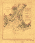
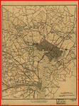
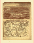
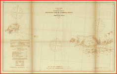
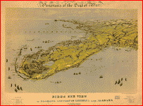
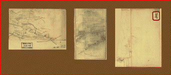
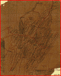
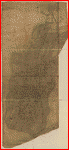
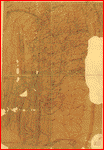
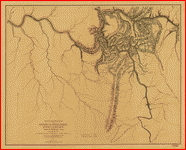
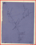
To
give you a sample of the detail you can expect in these maps,
here is an example based on a panoramic map of Washington,
DC.
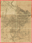
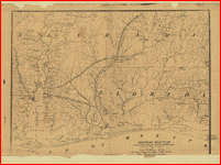
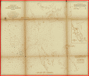
The
table below shows the description and a small image of each
map on this fascinating civil war history CD.
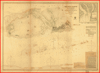
Connecticut
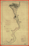
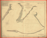
 New
Haven Harbor Founded upon a trigonometrical survey under
the direction of F. R. Hassler, Superintendent of the
survey of the coast of the United States. Triangulation
by James Ferguson and Edmund Blunt, Assistants. Topography
by C. M. Eakin, W. M. Boyce & J. Farley, Assistants. Hydrography
by the party under the command of G. S. Blake, Lieut.
U.S. Navy. Final reduction for engraving by Jno. B. Gluck,
Draughtsman. Engraved by Sherman & Smith, N.Y. Electrotype
copy no. 4 by S. Siebert, U.S.C.S. 1846. . United
States Coast Survey. CREATED/PUBLISHED [Washington, U.S.
Coast Survey, 186-] NOTES Scale 1:30,000. Harbor chart
annotated in red to show the sector of fire for guns situated
at Oyster Point and Fort Hale, Connecticut. Information
added to chart probably reflects the situation during
the Civil War. New
Haven Harbor Founded upon a trigonometrical survey under
the direction of F. R. Hassler, Superintendent of the
survey of the coast of the United States. Triangulation
by James Ferguson and Edmund Blunt, Assistants. Topography
by C. M. Eakin, W. M. Boyce & J. Farley, Assistants. Hydrography
by the party under the command of G. S. Blake, Lieut.
U.S. Navy. Final reduction for engraving by Jno. B. Gluck,
Draughtsman. Engraved by Sherman & Smith, N.Y. Electrotype
copy no. 4 by S. Siebert, U.S.C.S. 1846. . United
States Coast Survey. CREATED/PUBLISHED [Washington, U.S.
Coast Survey, 186-] NOTES Scale 1:30,000. Harbor chart
annotated in red to show the sector of fire for guns situated
at Oyster Point and Fort Hale, Connecticut. Information
added to chart probably reflects the situation during
the Civil War. |
 New
Haven Harbor Founded upon a trigonometrical survey under
the direction of F. R. Hassler, Superintendent of the
survey of the coast of the United States. Triangulation
by James Ferguson and Edmund Blunt, Assistants. Topography
by C. M. Eakin, W. M. Boyce & J. Farley, Assistants. Hydrography
by the party under the command of G. S. Blake, Lieut.
U.S. Navy. Final reduction for engraving by Jno. B. Gluck,
Draughtsman. Engraved by Sherman & Smith, N.Y. Electrotype
copy no. 4 by S. Siebert, U.S.C.S. 1846. . United
States Coast Survey. CREATED/PUBLISHED [Washington, U.S.
Coast Survey, 186-] NOTES [Scale 1:30,000]. Another copy
with annotations. Harbor chart annotated in red to show
the number and sectors of fire for guns situated at Oyster
Point and Fort Hale, Connecticut. Guns at Oyster Point
are numbered 1 to 5 and those at Fort Hale, 1 to 15. Information
added to the chart probably reflects the situation during
the Civil War. New
Haven Harbor Founded upon a trigonometrical survey under
the direction of F. R. Hassler, Superintendent of the
survey of the coast of the United States. Triangulation
by James Ferguson and Edmund Blunt, Assistants. Topography
by C. M. Eakin, W. M. Boyce & J. Farley, Assistants. Hydrography
by the party under the command of G. S. Blake, Lieut.
U.S. Navy. Final reduction for engraving by Jno. B. Gluck,
Draughtsman. Engraved by Sherman & Smith, N.Y. Electrotype
copy no. 4 by S. Siebert, U.S.C.S. 1846. . United
States Coast Survey. CREATED/PUBLISHED [Washington, U.S.
Coast Survey, 186-] NOTES [Scale 1:30,000]. Another copy
with annotations. Harbor chart annotated in red to show
the number and sectors of fire for guns situated at Oyster
Point and Fort Hale, Connecticut. Guns at Oyster Point
are numbered 1 to 5 and those at Fort Hale, 1 to 15. Information
added to the chart probably reflects the situation during
the Civil War. |
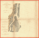
Washington
DC
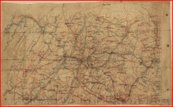
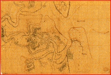
 Part
of map of portions of the milit'y dept's of Washington,
Pennsylvania, Annapolis, and north eastern Virginia /
compiled in the Bureau of Topographical Eng'rs, War Department
&c. Washington, D.C. Oct. 6th, 1862 ; copied in Engr.
Bureau C.S.A. Sept. 6th, 1864 [by] Wm. L. Sheppard, Dftsmn.
; forwarded to Lieut. Genl. J.A. Early Sept. 6th 1864.
. United States. Topographical Bureau. NOTES Relief
shown by hachures. Shows Washington D.C. region, including
western part of Maryland and northeastern Virginia. Does
not show Pennsylvania with the exception of Gettysburg. Part
of map of portions of the milit'y dept's of Washington,
Pennsylvania, Annapolis, and north eastern Virginia /
compiled in the Bureau of Topographical Eng'rs, War Department
&c. Washington, D.C. Oct. 6th, 1862 ; copied in Engr.
Bureau C.S.A. Sept. 6th, 1864 [by] Wm. L. Sheppard, Dftsmn.
; forwarded to Lieut. Genl. J.A. Early Sept. 6th 1864.
. United States. Topographical Bureau. NOTES Relief
shown by hachures. Shows Washington D.C. region, including
western part of Maryland and northeastern Virginia. Does
not show Pennsylvania with the exception of Gettysburg.
|
 A
map of Fairfax County, and parts of Loudoun and Prince
William Counties, Va., and the District of Columbia /
copied by J. Paul Hoffmann, Top'l. Office, A.N.Va. ; approved
S. Howell Brown, 1st Lt. Engs. Troops, in chg. Topl. Dept.
A.N.V., March 29th 1864. . Hoffmann, J. Paul. NOTES
Relief show by hachures. Shows western Washington D.C.
region, including fortifications and names of some residents.
Title derived from Stephenson's Civil War maps, 1989. A
map of Fairfax County, and parts of Loudoun and Prince
William Counties, Va., and the District of Columbia /
copied by J. Paul Hoffmann, Top'l. Office, A.N.Va. ; approved
S. Howell Brown, 1st Lt. Engs. Troops, in chg. Topl. Dept.
A.N.V., March 29th 1864. . Hoffmann, J. Paul. NOTES
Relief show by hachures. Shows western Washington D.C.
region, including fortifications and names of some residents.
Title derived from Stephenson's Civil War maps, 1989.
|
 Part
of map of portions of the milit'y dep'ts of Washington,
Pennsylvania, Annapolis, and north eastern Virginia /
compiled in the Bureau of Topographical Eng'rs, War Department
&c., July 1861. . United States. Topographical Bureau.
OTHER TITLES Map of portions of the milit'y dep'ts of
Washington, Pennsylvania, Annapolis and north eastern
Virginia NOTES Relief shown by shading. Shows Washington
D.C. region, including western part of Maryland and northeastern
Virginia. Does not show Pennsylvania with the exception
of Gettysburg. Probable Confederate copy of Bureau of
Topographical Engineers original. Part
of map of portions of the milit'y dep'ts of Washington,
Pennsylvania, Annapolis, and north eastern Virginia /
compiled in the Bureau of Topographical Eng'rs, War Department
&c., July 1861. . United States. Topographical Bureau.
OTHER TITLES Map of portions of the milit'y dep'ts of
Washington, Pennsylvania, Annapolis and north eastern
Virginia NOTES Relief shown by shading. Shows Washington
D.C. region, including western part of Maryland and northeastern
Virginia. Does not show Pennsylvania with the exception
of Gettysburg. Probable Confederate copy of Bureau of
Topographical Engineers original. |
 Distance
maps. Map of the Atlantic states, showing 50 mile distances
from Washington. Map of the battleground [at Manassas]
showing 5 mile distances from Washington. Map of the Fortress
Monroe, showing 1 mile distances from the fortress. .
Louis Prang and Company. CREATED/PUBLISHED Boston c1861.
NOTES Various scales. Imperfect. Left center portion is
missing. Each map indicates forts, towns, railroads, and
rivers. Insets: Position of forces at Bull Run. 8 x 8
cm.-Fortress Monroe, Old Point Comfort, Virginia. 8 x
8 cm. Population statistics given in side borders. Distance
maps. Map of the Atlantic states, showing 50 mile distances
from Washington. Map of the battleground [at Manassas]
showing 5 mile distances from Washington. Map of the Fortress
Monroe, showing 1 mile distances from the fortress. .
Louis Prang and Company. CREATED/PUBLISHED Boston c1861.
NOTES Various scales. Imperfect. Left center portion is
missing. Each map indicates forts, towns, railroads, and
rivers. Insets: Position of forces at Bull Run. 8 x 8
cm.-Fortress Monroe, Old Point Comfort, Virginia. 8 x
8 cm. Population statistics given in side borders. |
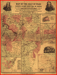
 Map
of the seat of war! . Louis Prang and Company. CREATED/PUBLISHED
Boston c1861. NOTES Various scales. Containing a map of
the vicinity of Washington, Baltimore, Harper's Ferry
and Annapolis, with five mile distance lines from Washington.
Map showing the railroad routes, coast lines and forts,
between Boston and Norfolk harbor; map of Norfolk harbor,
Fort Monroe and vicinity, with 1 mile distance lines from
Ft. Monroe; Map of the vicinity of Richmond. Small map
of the Atlantic states, showing the R.road connections;
diagram of the camp at Cairo. Plan of Haper's Ferry! Portraits
of Gen. B.F. Butler, the late Col. E. Ellsworth, &c. Map
of the seat of war! . Louis Prang and Company. CREATED/PUBLISHED
Boston c1861. NOTES Various scales. Containing a map of
the vicinity of Washington, Baltimore, Harper's Ferry
and Annapolis, with five mile distance lines from Washington.
Map showing the railroad routes, coast lines and forts,
between Boston and Norfolk harbor; map of Norfolk harbor,
Fort Monroe and vicinity, with 1 mile distance lines from
Ft. Monroe; Map of the vicinity of Richmond. Small map
of the Atlantic states, showing the R.road connections;
diagram of the camp at Cairo. Plan of Haper's Ferry! Portraits
of Gen. B.F. Butler, the late Col. E. Ellsworth, &c. |
 Map
of the seat of war! . Louis Prang and Company. CREATED/PUBLISHED
Boston c1861. NOTES Another issue. Various scales. Containing
a map of the vicinity of Washington, Baltimore, Harper's
Ferry and Annapolis, with five mile distance lines from
Washington. Map showing the railroad routes, coast lines
and forts, between Boston and Norfolk harbor; map of Norfolk
harbor, Fort Monroe and vicinity, with 1 mile distance
lines from Ft. Monroe; Map of the vicinity of Richmond.
Small map of the Atlantic states, showing the R.road connections;
diagram of the camp at Cairo. Plan of Haper's Ferry! Includes
portraits of Andrew Jackson and Gen. Winfield Scott rather
than those of Gen. B. F. Butler and Col. E. Ellsworth. Map
of the seat of war! . Louis Prang and Company. CREATED/PUBLISHED
Boston c1861. NOTES Another issue. Various scales. Containing
a map of the vicinity of Washington, Baltimore, Harper's
Ferry and Annapolis, with five mile distance lines from
Washington. Map showing the railroad routes, coast lines
and forts, between Boston and Norfolk harbor; map of Norfolk
harbor, Fort Monroe and vicinity, with 1 mile distance
lines from Ft. Monroe; Map of the vicinity of Richmond.
Small map of the Atlantic states, showing the R.road connections;
diagram of the camp at Cairo. Plan of Haper's Ferry! Includes
portraits of Andrew Jackson and Gen. Winfield Scott rather
than those of Gen. B. F. Butler and Col. E. Ellsworth.
|
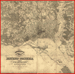 Topographical
map of the District of Columbia / surveyed in the years
1856 '57 '58 & '59 by A. Boschke ; engraved by D. McClelland,
Washington, D.C. . Boschke, A. CREATED/PUBLISHED Washington
: D. McClelland, Blanchard & Mohun, 1861. NOTES Partial
cadastral map showing some householders' names, individual
buildings, and vegetation. Relief shown by contours and
hachures. Depths shown by contours and soundings. Also
covers Virginia shoreline zone. "Entered according to
Act of Congress in the year 1861, by D. McClelland, Blanchard
& Mohun, Hugh B. Sweeny, and Thos. Blagden, in the Clerks
Office of the District Court of the District of Columbia."
Oriented with north toward the upper left. Topographical
map of the District of Columbia / surveyed in the years
1856 '57 '58 & '59 by A. Boschke ; engraved by D. McClelland,
Washington, D.C. . Boschke, A. CREATED/PUBLISHED Washington
: D. McClelland, Blanchard & Mohun, 1861. NOTES Partial
cadastral map showing some householders' names, individual
buildings, and vegetation. Relief shown by contours and
hachures. Depths shown by contours and soundings. Also
covers Virginia shoreline zone. "Entered according to
Act of Congress in the year 1861, by D. McClelland, Blanchard
& Mohun, Hugh B. Sweeny, and Thos. Blagden, in the Clerks
Office of the District Court of the District of Columbia."
Oriented with north toward the upper left. |
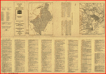 Catalogue
of points of historic interest : [Washington D.C. and
metropolitan area] / selected and marked by the Committee
on Marking Points of Historic Interest for the Thirty-Sixth
National Encampment of the Grand Army of the Republic,
Washington, 1902. . Grand Army of the Republic. Committee
on Marking Points of Historic Interest. CREATED/PUBLISHED
[Washington?] : The Committee, [1902?] NOTES Shows Civil
War hospitals and fortifications. Panel title. Includes
text, directory of committee members, and ill. Descriptive
index to points of interest and directories on verso.
Map showing location of war-time hospitals -- Map of fortifications
and defenses of Washington. Catalogue
of points of historic interest : [Washington D.C. and
metropolitan area] / selected and marked by the Committee
on Marking Points of Historic Interest for the Thirty-Sixth
National Encampment of the Grand Army of the Republic,
Washington, 1902. . Grand Army of the Republic. Committee
on Marking Points of Historic Interest. CREATED/PUBLISHED
[Washington?] : The Committee, [1902?] NOTES Shows Civil
War hospitals and fortifications. Panel title. Includes
text, directory of committee members, and ill. Descriptive
index to points of interest and directories on verso.
Map showing location of war-time hospitals -- Map of fortifications
and defenses of Washington. |
 Map
of fortifications and defenses of Washington. . Hodasevich,
R. A. CREATED/PUBLISHED [Washington, D.C.? : s.n., 1865?]
NOTES In left lower margin: Taken from a map issued by
the War Department in 1865. Map
of fortifications and defenses of Washington. . Hodasevich,
R. A. CREATED/PUBLISHED [Washington, D.C.? : s.n., 1865?]
NOTES In left lower margin: Taken from a map issued by
the War Department in 1865. |
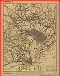
 Map
of the defences of Washington. . CREATED/PUBLISHED
[Washington, D.C.? : s.n., 1865?] NOTES Relief shown by
hachures. In lower margin below title: (From Atlas accompanying
Official Records). Map
of the defences of Washington. . CREATED/PUBLISHED
[Washington, D.C.? : s.n., 1865?] NOTES Relief shown by
hachures. In lower margin below title: (From Atlas accompanying
Official Records). |
 Potomac
River (in four sheets): Sheet no. 4, from Indian Head
to Georgetown From a trigonometrical survey under the
direction of A. D. Bache, Superintendent of the survey
of the coast of the United States. Triangulation by A.
D. Bache, Supdt., C. Ferguson, C. Hosmer and C. H. Boyd,
Sub-Assts. Topography by A. M. Harrison, C. M. Bache,
Assts., J. Mechan, C. Hosmer and C. H. Boyd, Sub-Assts.
Hydrography by the parties under the command of Lieut.
comdr. T. S. Phelps, U.S.N. and C. P. Patterson Assis.
Redd. drng. by H. Lindenkohl and L. Karcher. Engd. by
A. Maedel and A. Petersen. 1864 . United States Coast
Survey. CREATED/PUBLISHED [S.l.] 1864. NOTES Scale 1:40,000.
"No. 391" in upper left corner of map. "Electrotype copy
no. 1, by G. Mathiot, U.S.C.S." is printed in the upper
margin. Information concerning lighthouses, tides, soundings,
and the geographic coordinates of the Capitol dome is
given in the lower right corner. Potomac
River (in four sheets): Sheet no. 4, from Indian Head
to Georgetown From a trigonometrical survey under the
direction of A. D. Bache, Superintendent of the survey
of the coast of the United States. Triangulation by A.
D. Bache, Supdt., C. Ferguson, C. Hosmer and C. H. Boyd,
Sub-Assts. Topography by A. M. Harrison, C. M. Bache,
Assts., J. Mechan, C. Hosmer and C. H. Boyd, Sub-Assts.
Hydrography by the parties under the command of Lieut.
comdr. T. S. Phelps, U.S.N. and C. P. Patterson Assis.
Redd. drng. by H. Lindenkohl and L. Karcher. Engd. by
A. Maedel and A. Petersen. 1864 . United States Coast
Survey. CREATED/PUBLISHED [S.l.] 1864. NOTES Scale 1:40,000.
"No. 391" in upper left corner of map. "Electrotype copy
no. 1, by G. Mathiot, U.S.C.S." is printed in the upper
margin. Information concerning lighthouses, tides, soundings,
and the geographic coordinates of the Capitol dome is
given in the lower right corner. |
 Map
of portions of Virginia and Maryland, extending from Baltimore
to Strasburg, and from Washington to Gettysburg, with
concentric circles at 5-mile intervals centering on Washington
and on Baltimore. . CREATED/PUBLISHED [186-] NOTES
Relief shown by hachures. Date and title derived from
Stephenson's Civil War maps, 1989. Map
of portions of Virginia and Maryland, extending from Baltimore
to Strasburg, and from Washington to Gettysburg, with
concentric circles at 5-mile intervals centering on Washington
and on Baltimore. . CREATED/PUBLISHED [186-] NOTES
Relief shown by hachures. Date and title derived from
Stephenson's Civil War maps, 1989. |
 Army
map of the seat of war in Virginia, showing the battle
fields, fortification, etc. on & near the Potomac River
Drawn by J. G. Bruff. Lith. of P. S. Duval & Son, Philada.
. Bruff, Joseph Goldsborough, 1804-1889. CREATED/PUBLISHED
New York and Washn., D.C., J. Disturnell and Hudson Taylor,
c1861. NOTES Scale ca. 1:183,000. Map of the Potomac River
and vicinity from Harpers Ferry to Swan Point showing
towns, roads, railroads, names and boundaries of counties,
drainage, and relief by hachures. Principal Union and
Confederate positions are marked by small flags or underlined
in blue and red respectively. List of 33 forts defending
Washington is in the right corner. Army
map of the seat of war in Virginia, showing the battle
fields, fortification, etc. on & near the Potomac River
Drawn by J. G. Bruff. Lith. of P. S. Duval & Son, Philada.
. Bruff, Joseph Goldsborough, 1804-1889. CREATED/PUBLISHED
New York and Washn., D.C., J. Disturnell and Hudson Taylor,
c1861. NOTES Scale ca. 1:183,000. Map of the Potomac River
and vicinity from Harpers Ferry to Swan Point showing
towns, roads, railroads, names and boundaries of counties,
drainage, and relief by hachures. Principal Union and
Confederate positions are marked by small flags or underlined
in blue and red respectively. List of 33 forts defending
Washington is in the right corner. |
 Topographical
map of Virginia between Washington and Manassas Junction.
. Magnus, Charles. CREATED/PUBLISHED New York, Chs.
Magnus, [1861?] NOTES Scale ca. 1:270,000. Indicates Union
and Confederate positions at "battle of Bull Run, July
21st 1861," Union encampments, towns, roads, the street
pattern of Washington, railroads, rivers, and relief by
hachures. Inset: Leesburg to Harpers Ferry. 4 x 5 cm.
"Panoramic view of the fortifications around Washington"
(12 x 20 cm.) appears above the map. Topographical
map of Virginia between Washington and Manassas Junction.
. Magnus, Charles. CREATED/PUBLISHED New York, Chs.
Magnus, [1861?] NOTES Scale ca. 1:270,000. Indicates Union
and Confederate positions at "battle of Bull Run, July
21st 1861," Union encampments, towns, roads, the street
pattern of Washington, railroads, rivers, and relief by
hachures. Inset: Leesburg to Harpers Ferry. 4 x 5 cm.
"Panoramic view of the fortifications around Washington"
(12 x 20 cm.) appears above the map. |
 Map
of n. eastern Virginia and vicinity of Washington / compiled
in Topographical Engineers Office at Division Head Quarters
of General Irvin Mc Dowell, Arlington, January 1th [sic]
1862, from published and manuscript maps corrected by
recent surveys and reconnaissances ; engraved on stone
by J. Schedler ... N.Y. . United States. Corps of
Topographical Engineers. CREATED/PUBLISHED [Washington,
D.C.? : s.n., 1862] NOTES Shows forts and batteries in
the District of Columbia and immediate vicinity. Relief
shown by hachures. Depths shown by soundings. At head
of title: Surveys for military defences. "Additions &
corrections for Rappahannock and Rapid Ann Rivers and
their vicinity ..." added to data used in compilation. Map
of n. eastern Virginia and vicinity of Washington / compiled
in Topographical Engineers Office at Division Head Quarters
of General Irvin Mc Dowell, Arlington, January 1th [sic]
1862, from published and manuscript maps corrected by
recent surveys and reconnaissances ; engraved on stone
by J. Schedler ... N.Y. . United States. Corps of
Topographical Engineers. CREATED/PUBLISHED [Washington,
D.C.? : s.n., 1862] NOTES Shows forts and batteries in
the District of Columbia and immediate vicinity. Relief
shown by hachures. Depths shown by soundings. At head
of title: Surveys for military defences. "Additions &
corrections for Rappahannock and Rapid Ann Rivers and
their vicinity ..." added to data used in compilation.
|
 Army
map of the seat of war in Virginia, showing the battle
fields, fortifications, etc. on & near the Potomac River.
Drawn by J. G. Bruff. Lith. of P. S. Duval & Son, Philada.
. Bruff, Joseph Goldsborough, 1804-1889. CREATED/PUBLISHED
New-York and Washn., D.C., J. Disturnell and Hudson Taylor,
1862. NOTES Scale ca. 1:183,000. Map of the Potomac River
and vicinity from Harpers Ferry to Swan Point showing
towns, roads, railroads, names and boundaries of counties,
drainage, and relief by hachures. Principal Union and
Confederate positions are marked by small flags or underlined
in blue and red respectively. List of 34 forts defending
Washington is in the lower right corner. Army
map of the seat of war in Virginia, showing the battle
fields, fortifications, etc. on & near the Potomac River.
Drawn by J. G. Bruff. Lith. of P. S. Duval & Son, Philada.
. Bruff, Joseph Goldsborough, 1804-1889. CREATED/PUBLISHED
New-York and Washn., D.C., J. Disturnell and Hudson Taylor,
1862. NOTES Scale ca. 1:183,000. Map of the Potomac River
and vicinity from Harpers Ferry to Swan Point showing
towns, roads, railroads, names and boundaries of counties,
drainage, and relief by hachures. Principal Union and
Confederate positions are marked by small flags or underlined
in blue and red respectively. List of 34 forts defending
Washington is in the lower right corner. |
Florida
 Military
map no. 54, prepared as basis for additional surveys prepared
under direction of Capt. P. C. Hains, U.S.A., Act. Chief,
Engineer Dept. of the Gulf. Drawn for stone by Helmuth
Holtz. . Hains, Peter C. (Peter Conover), 1840-1921.
CREATED/PUBLISHED [S.l.], Printed by W. Pro[bert, 1864?]
NOTES Scale 1:380,160. General map of southern Alabama
and West Florida showing roads, railroads, towns, drainage,
and a few names of residents along the Tensaw River. Military
map no. 54, prepared as basis for additional surveys prepared
under direction of Capt. P. C. Hains, U.S.A., Act. Chief,
Engineer Dept. of the Gulf. Drawn for stone by Helmuth
Holtz. . Hains, Peter C. (Peter Conover), 1840-1921.
CREATED/PUBLISHED [S.l.], Printed by W. Pro[bert, 1864?]
NOTES Scale 1:380,160. General map of southern Alabama
and West Florida showing roads, railroads, towns, drainage,
and a few names of residents along the Tensaw River. |
 Preliminary
chart of main entrance to Charlotte Harbor, Florida From
a trigonometrical survey under the direction of A. D.
Bache, Superintendent of the survey of the coast of the
United States. Triangulations by Lieuts. J. C. Clark &
W. R. Terrill, U.S.A. Assts. Topography by F. W. Dorr,
C. Fergunson & C. T. Jardella, Sub-Assts. Hydrography
by the party of E. Cordell, Acting asst. . United
States Coast Survey. CREATED/PUBLISHED [Washington, U.S.
Coast Survey], 1863. NOTES Scale 1:40,000. From its Report
of the Superintendent of the Coast Survey, showing the
progress of the survey during the year 1864 (Washington,
Government Printing Office, 1866). Map 28. "No. 28" in
upper left corner. Inset: Sketch of Charlotte Harbor,
Florida. Scale 1:400,000. 18 x 12 cm. Preliminary
chart of main entrance to Charlotte Harbor, Florida From
a trigonometrical survey under the direction of A. D.
Bache, Superintendent of the survey of the coast of the
United States. Triangulations by Lieuts. J. C. Clark &
W. R. Terrill, U.S.A. Assts. Topography by F. W. Dorr,
C. Fergunson & C. T. Jardella, Sub-Assts. Hydrography
by the party of E. Cordell, Acting asst. . United
States Coast Survey. CREATED/PUBLISHED [Washington, U.S.
Coast Survey], 1863. NOTES Scale 1:40,000. From its Report
of the Superintendent of the Coast Survey, showing the
progress of the survey during the year 1864 (Washington,
Government Printing Office, 1866). Map 28. "No. 28" in
upper left corner. Inset: Sketch of Charlotte Harbor,
Florida. Scale 1:400,000. 18 x 12 cm. |
 Preliminary
chart of Escambia and Santa Maria de Galvaez [i.e., East]
Bays, Florida From a trigonometrical survey under the
direction of A. D. Bache, Superintendent of the survey
of the coast of the United States. Triangulation and topography
by F. H. Gerdes, Asst. Hydrography by the party under
the command of Lieut. Comdg. T. S. Phelps. U.S.N. Assist.
. United States Coast Survey. CREATED/PUBLISHED [Washington,
U.S. Coast Survey], 1861. NOTES Scale 1:30,000. United
States Coast Survey, no. 489. General chart showing soundings
and coast vegetation. Chart is based on "long[itude] east
from Public Square, Pensacola." Preliminary
chart of Escambia and Santa Maria de Galvaez [i.e., East]
Bays, Florida From a trigonometrical survey under the
direction of A. D. Bache, Superintendent of the survey
of the coast of the United States. Triangulation and topography
by F. H. Gerdes, Asst. Hydrography by the party under
the command of Lieut. Comdg. T. S. Phelps. U.S.N. Assist.
. United States Coast Survey. CREATED/PUBLISHED [Washington,
U.S. Coast Survey], 1861. NOTES Scale 1:30,000. United
States Coast Survey, no. 489. General chart showing soundings
and coast vegetation. Chart is based on "long[itude] east
from Public Square, Pensacola." |
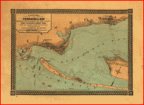
 Map
of Fernandina region, Florida. CREATED/PUBLISHED [186-?]
NOTES Scale not given. Map
of Fernandina region, Florida. CREATED/PUBLISHED [186-?]
NOTES Scale not given. |
 Sketch
showing the positions of the beacons on the Florida reefs
erected by Lieut. James Totten, U.S. Army, Assistant,
U.S.C.S. . United States Coast Survey. CREATED/PUBLISHED
[Washington, U.S. Coast Survey, 1861] NOTES Scale 1:400,000.
(Its no. 464) At head of title: U.S. Coast Survey, A.
D. Bache, Supdt. "No. 464 price 15 cents" is printed in
the upper margin. Inset: Plan of beacons devised by Lieut.
James Totten, U.S. Army, Assistant, U.S.C.S. 29 x 16 cm. Sketch
showing the positions of the beacons on the Florida reefs
erected by Lieut. James Totten, U.S. Army, Assistant,
U.S.C.S. . United States Coast Survey. CREATED/PUBLISHED
[Washington, U.S. Coast Survey, 1861] NOTES Scale 1:400,000.
(Its no. 464) At head of title: U.S. Coast Survey, A.
D. Bache, Supdt. "No. 464 price 15 cents" is printed in
the upper margin. Inset: Plan of beacons devised by Lieut.
James Totten, U.S. Army, Assistant, U.S.C.S. 29 x 16 cm.
|
 Preliminary
edition of general chart of the coast no. X, Sraits of
Florida from Key Biscayne to Marquesas Keys From a trigonometrical
survey under the direction of A. D. Bache, Superintendent
of the survey of the coast of the United States. .
United States Coast Survey. CREATED/PUBLISHED [Washington,
U.S. Coast Survey, 1862] NOTES Scale 1:400,000. From its
Report of the Superintendent of the Coast Survey, showing
the progress of the survey during the year 1863 (Washington,
Government Printing Office, 1864). Map 14. "No. 14" is
in the upper left corner. Preliminary
edition of general chart of the coast no. X, Sraits of
Florida from Key Biscayne to Marquesas Keys From a trigonometrical
survey under the direction of A. D. Bache, Superintendent
of the survey of the coast of the United States. .
United States Coast Survey. CREATED/PUBLISHED [Washington,
U.S. Coast Survey, 1862] NOTES Scale 1:400,000. From its
Report of the Superintendent of the Coast Survey, showing
the progress of the survey during the year 1863 (Washington,
Government Printing Office, 1864). Map 14. "No. 14" is
in the upper left corner. |
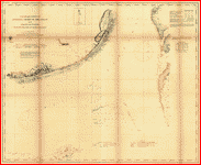
 Preliminary
chart of western end of Florida Reefs including Tortugas
Keys. . United States Coast Survey. CREATED/PUBLISHED
[Washington, U.S. Coast Survey], 1864. NOTES Scale 1:200,000.
From its Report of the Superintendent of the Coast Survey,
showing the progress of the survey during the year 1863
(Washington, Government Printing Office, 1864). Map 17.
"No. 17" is the upper left corner. At head of title: U.S.
Coast Survey, A. D. Bache, Supdt. Preliminary
chart of western end of Florida Reefs including Tortugas
Keys. . United States Coast Survey. CREATED/PUBLISHED
[Washington, U.S. Coast Survey], 1864. NOTES Scale 1:200,000.
From its Report of the Superintendent of the Coast Survey,
showing the progress of the survey during the year 1863
(Washington, Government Printing Office, 1864). Map 17.
"No. 17" is the upper left corner. At head of title: U.S.
Coast Survey, A. D. Bache, Supdt. |
 Key
West harbor and its approaches. From a trigonometrical
survey under the direction of A. D. Bache, Superintendent
of the survey of the coast of the United States. Triangulation
by J. E. Hilgard, Assistant. Topography by L. H. Adams,
Sub-Asst. Hydrography by the party under the command of
Lieut. John Rodgers, U.S. Navy Assistant. Redd. drng.
by E. K. Knorr. Engd. by E. Yeager, E. F. Woodward, and
H. M. Knight. Published 1855. . United States Coast
Survey. CREATED/PUBLISHED [Washington, U.S. Coast Survey],
1864. NOTES Scale 1:50,000. United States Coast Survey,
no. 469. General chart of Key West and environs showing
soundings, lights, channels, and island vegetation. Inset:
Sub-sketch of Key West harbor. Scale 1:30,000. 19 x 17
cm. Includes sailing directions. Key
West harbor and its approaches. From a trigonometrical
survey under the direction of A. D. Bache, Superintendent
of the survey of the coast of the United States. Triangulation
by J. E. Hilgard, Assistant. Topography by L. H. Adams,
Sub-Asst. Hydrography by the party under the command of
Lieut. John Rodgers, U.S. Navy Assistant. Redd. drng.
by E. K. Knorr. Engd. by E. Yeager, E. F. Woodward, and
H. M. Knight. Published 1855. . United States Coast
Survey. CREATED/PUBLISHED [Washington, U.S. Coast Survey],
1864. NOTES Scale 1:50,000. United States Coast Survey,
no. 469. General chart of Key West and environs showing
soundings, lights, channels, and island vegetation. Inset:
Sub-sketch of Key West harbor. Scale 1:30,000. 19 x 17
cm. Includes sailing directions. |
 A
correct map of Pensacola Bay showing topography of the
coast, Fort Pickens, U.S. Navy Yard, and all other fortifications
from the latest Government surveys. J. Weiss lith. .
Weiss, Jacob. CREATED/PUBLISHED Philadelphia, Jacob Weiss,
[186-] NOTES Scale ca. 1:62,000. A
correct map of Pensacola Bay showing topography of the
coast, Fort Pickens, U.S. Navy Yard, and all other fortifications
from the latest Government surveys. J. Weiss lith. .
Weiss, Jacob. CREATED/PUBLISHED Philadelphia, Jacob Weiss,
[186-] NOTES Scale ca. 1:62,000. |
 Sketch
of Pensacola Navy Yard and Fort Pickens from U.S. coast
surveys. By W. A. Williams, Civil Engineer. . Williams,
W. A. CREATED/PUBLISHED Boston, L. Prang & Co., [186-]
NOTES Scale ca. 1:31,000. Indicates fortifications, half-mile
distance circles centered on Fort Pickens, beacons, roads
and streets, vegetation, and a few soundings. Sketch
of Pensacola Navy Yard and Fort Pickens from U.S. coast
surveys. By W. A. Williams, Civil Engineer. . Williams,
W. A. CREATED/PUBLISHED Boston, L. Prang & Co., [186-]
NOTES Scale ca. 1:31,000. Indicates fortifications, half-mile
distance circles centered on Fort Pickens, beacons, roads
and streets, vegetation, and a few soundings. |
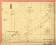
 Preliminary
chart of St. Augustine harbor, Florida Triangulation by
B. Huger, Jr., Sub-Assist. Topography by F. W. Dorr, Sub-Assist.
Hydrography by the party under the command of Lieut. Comdg.
A. Murray, U.S.N. Assist. Redd. drng. by F. Fairfax &
S. B. Linton. Engd. by E. H. Sipe & J. G. Thompson. Lith.
of Bowen & Co., Philada. . United States Coast Survey.
CREATED/PUBLISHED [Washington, U.S. Coast Survey], 1862.
NOTES Scale 1:30,000. From its Report of the Superintendent
of the Coast Survey, showing the progress of the survey
during the year 1862 (Washington, Government Printing
Office, 1864). Map 33 At head of title: U.S. Coast Survey,
A. D. Bache, Supdt. "No. 33" is in the upper left corner. Preliminary
chart of St. Augustine harbor, Florida Triangulation by
B. Huger, Jr., Sub-Assist. Topography by F. W. Dorr, Sub-Assist.
Hydrography by the party under the command of Lieut. Comdg.
A. Murray, U.S.N. Assist. Redd. drng. by F. Fairfax &
S. B. Linton. Engd. by E. H. Sipe & J. G. Thompson. Lith.
of Bowen & Co., Philada. . United States Coast Survey.
CREATED/PUBLISHED [Washington, U.S. Coast Survey], 1862.
NOTES Scale 1:30,000. From its Report of the Superintendent
of the Coast Survey, showing the progress of the survey
during the year 1862 (Washington, Government Printing
Office, 1864). Map 33 At head of title: U.S. Coast Survey,
A. D. Bache, Supdt. "No. 33" is in the upper left corner.
|
 Birds
eye view of Florida and part of Georgia and Alabama Drawn
from nature and lith. by John Bachmann. . Bachmann,
John. CREATED/PUBLISHED New York, John Bachmann, c1861.
NOTES Scale not given. At top of map: Panorama of the
seat of war. "Entered according to act of Congress in
the year 1861 by John Bachmann." Tables of distances from
Key West and Tallahassee appear in the lower margin. View
of Florida and the environs showing towns, roads, railroads,
forts, and rivers. Birds
eye view of Florida and part of Georgia and Alabama Drawn
from nature and lith. by John Bachmann. . Bachmann,
John. CREATED/PUBLISHED New York, John Bachmann, c1861.
NOTES Scale not given. At top of map: Panorama of the
seat of war. "Entered according to act of Congress in
the year 1861 by John Bachmann." Tables of distances from
Key West and Tallahassee appear in the lower margin. View
of Florida and the environs showing towns, roads, railroads,
forts, and rivers. |
 Northern
part of Florida Drawn by H. Lindenkohl. Compiled and published
at the United States Coast Survey Office, A. D. Bache,
Superintendent. 1864. . Lindenkohl, Henry. CREATED/PUBLISHED
[S.l.], United States Coast Survey Office, 1864. NOTES
Scale 1:633,600. General map of northern Florida and southern
Georgia extending from Altamaha Sound, Georgia, to 290
North lattitude. Northern
part of Florida Drawn by H. Lindenkohl. Compiled and published
at the United States Coast Survey Office, A. D. Bache,
Superintendent. 1864. . Lindenkohl, Henry. CREATED/PUBLISHED
[S.l.], United States Coast Survey Office, 1864. NOTES
Scale 1:633,600. General map of northern Florida and southern
Georgia extending from Altamaha Sound, Georgia, to 290
North lattitude. |
 St.
Mary's River and Fernandina harbor, Florida From a trigonometrical
survey under the direction of A. D. Bache, Superintendent
of the survey of the coast of the United States. Triangulation
by Capt. J. H. Simpson and Lieutenant A. W. Evans, U.S.A.
Assistants. Topography by A. M. Harrison, Assistant. Hydrography
by the party under the command of Lieut. S. D. Trenchard,
U.S.N. Assist. 1857. Resurvey of bar by C. O. Boutelle,
Asst. in 1862. Redd. drng. by P. Witzel. Engd. by A. Maedel
and R. F. Bartle. Bowen & Co. lith., Philada. . United
States Coast Survey. CREATED/PUBLISHED [Washington, U.S.
Coast Survey, 1862] NOTES Scale 1:20,000. From its Report
of the Superintendent of the Coast Survey, showing progress
of the survey during the year 1862 (Washington, Government
Printing Office, 1864). Map 31. "No. 31" in the upper
left corner. St.
Mary's River and Fernandina harbor, Florida From a trigonometrical
survey under the direction of A. D. Bache, Superintendent
of the survey of the coast of the United States. Triangulation
by Capt. J. H. Simpson and Lieutenant A. W. Evans, U.S.A.
Assistants. Topography by A. M. Harrison, Assistant. Hydrography
by the party under the command of Lieut. S. D. Trenchard,
U.S.N. Assist. 1857. Resurvey of bar by C. O. Boutelle,
Asst. in 1862. Redd. drng. by P. Witzel. Engd. by A. Maedel
and R. F. Bartle. Bowen & Co. lith., Philada. . United
States Coast Survey. CREATED/PUBLISHED [Washington, U.S.
Coast Survey, 1862] NOTES Scale 1:20,000. From its Report
of the Superintendent of the Coast Survey, showing progress
of the survey during the year 1862 (Washington, Government
Printing Office, 1864). Map 31. "No. 31" in the upper
left corner. |
 Charts
of Savannah River, Pensacola Bay, and Key West. Showing
the positions of the several fortifications. From the
United States Coast Survey From the United States Coast
Survey. . Smith, Jim (Jim C.) CREATED/PUBLISHED New
York, c1861. NOTES Scale not given. [1] Savannah River
from U.S. Coast Survey. Scale ca. 1:63,360. 18 x 26 cm.
[2] [Pensacola Bay] Scale ca. 1:80,000. 18 x 23 cm. [3]
Chart of Key West, Florida. Scale ca. 1:125,000. 22 x
20 cm. Each chart indicates fortifications, place names,
"line of 18 feet depth of water," and a few soundings. Charts
of Savannah River, Pensacola Bay, and Key West. Showing
the positions of the several fortifications. From the
United States Coast Survey From the United States Coast
Survey. . Smith, Jim (Jim C.) CREATED/PUBLISHED New
York, c1861. NOTES Scale not given. [1] Savannah River
from U.S. Coast Survey. Scale ca. 1:63,360. 18 x 26 cm.
[2] [Pensacola Bay] Scale ca. 1:80,000. 18 x 23 cm. [3]
Chart of Key West, Florida. Scale ca. 1:125,000. 22 x
20 cm. Each chart indicates fortifications, place names,
"line of 18 feet depth of water," and a few soundings.
|
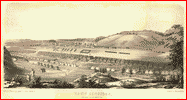
Ohio
 Bird's
eye view of Camp Chase near Columbus, Ohio. Drawn by A.
Ruger. . Ruger, A. CREATED/PUBLISHED Cin[cinnati]
Ehrgott, Forbriger & Co. [186-] NOTES Perspective map
not drawn to scale. Bird's
eye view of Camp Chase near Columbus, Ohio. Drawn by A.
Ruger. . Ruger, A. CREATED/PUBLISHED Cin[cinnati]
Ehrgott, Forbriger & Co. [186-] NOTES Perspective map
not drawn to scale. |
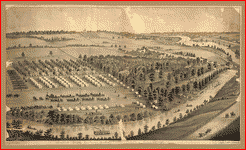
 Camp
Dennison : taken from Old Aunt Roady's Hill / drawn by
Johnson in the Zouave Lt. Guard, Company A. . Johnson.
CREATED/PUBLISHED Cincinnati : Gibson & Co. Lith., [186-]
NOTES Bird's-eye view. Camp
Dennison : taken from Old Aunt Roady's Hill / drawn by
Johnson in the Zouave Lt. Guard, Company A. . Johnson.
CREATED/PUBLISHED Cincinnati : Gibson & Co. Lith., [186-]
NOTES Bird's-eye view. |
 Map
showing the military defences of Cincinnati, Covington
and Newport Constructed under the direction of Brig. O.
M. Mitchell, by Col. Charles Whittlesey in 1861: repaired
and extended under the direction of Major Genl. H. G.
Wright commanding Department of the Ohio, by Maj. J. H.
Simpson, Chief Topogl. Engr. of the Dept. Bvt. Capt. W.
E. Merrill, & Lieut. J. A. Tardy, Corps of Engs., and
Col. Chas. Whittlesey, in 1862. Complied by order of Maj.
Genl. H. G. Wright commanding Department of the Ohio,
chiefly from surveys made under the direction of Maj.
J. H. Simpson by W. H. Searles, G. A. Aschbach, O. P.
Ransom, and J. R. Gillis, in Septr. & Octr. 1862. Published
by authority of the Hon. the Sec. of War, in the office
of the Chief of Engineers, U.S. Army. . United States.
Army. Corps of Engineers. CREATED/PUBLISHED [S.l.], office
of the Chief of Engineers, U.S. Army, 1877. NOTES Scale
ca. 1:16,000. Detailed map showing batteries and rifle
pits, common and military roads, turnpikes, city streets
and names, bridges, ferries, rural houses and names of
some residents, drainage, vegetation, towns, and relief
by hachures. Map
showing the military defences of Cincinnati, Covington
and Newport Constructed under the direction of Brig. O.
M. Mitchell, by Col. Charles Whittlesey in 1861: repaired
and extended under the direction of Major Genl. H. G.
Wright commanding Department of the Ohio, by Maj. J. H.
Simpson, Chief Topogl. Engr. of the Dept. Bvt. Capt. W.
E. Merrill, & Lieut. J. A. Tardy, Corps of Engs., and
Col. Chas. Whittlesey, in 1862. Complied by order of Maj.
Genl. H. G. Wright commanding Department of the Ohio,
chiefly from surveys made under the direction of Maj.
J. H. Simpson by W. H. Searles, G. A. Aschbach, O. P.
Ransom, and J. R. Gillis, in Septr. & Octr. 1862. Published
by authority of the Hon. the Sec. of War, in the office
of the Chief of Engineers, U.S. Army. . United States.
Army. Corps of Engineers. CREATED/PUBLISHED [S.l.], office
of the Chief of Engineers, U.S. Army, 1877. NOTES Scale
ca. 1:16,000. Detailed map showing batteries and rifle
pits, common and military roads, turnpikes, city streets
and names, bridges, ferries, rural houses and names of
some residents, drainage, vegetation, towns, and relief
by hachures. |
 Army
camp at Gaylord's Grove, Cuyahoga Falls, Ohio / drawn
by A. Ruger ... Ohio ; Beck & Pauli Lith., Milwaukee,
Wis. . Ruger, A. CREATED/PUBLISHED Madison, Wis. :
J. J. Stoner, [188-?] NOTES Perspective map not drawn
to scale. LC copy annotated in pencil: Gaylord's Grove,
Carihoga Falls, O., old army camp. LC copy imperfect:
Pieces missing along edge. "Bird's-eye-view." Probably
drawn by the author while serving in Ohio Volunteers during
the Civil War. Army
camp at Gaylord's Grove, Cuyahoga Falls, Ohio / drawn
by A. Ruger ... Ohio ; Beck & Pauli Lith., Milwaukee,
Wis. . Ruger, A. CREATED/PUBLISHED Madison, Wis. :
J. J. Stoner, [188-?] NOTES Perspective map not drawn
to scale. LC copy annotated in pencil: Gaylord's Grove,
Carihoga Falls, O., old army camp. LC copy imperfect:
Pieces missing along edge. "Bird's-eye-view." Probably
drawn by the author while serving in Ohio Volunteers during
the Civil War. |
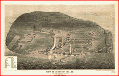 View
of Johnson's Island, near Sandusky City, O. Sketched by
Edward Gould. . Gould, Edward. CREATED/PUBLISHED Cincinnati,
O., Middleton, Strobridge & Co., lithographers c1865.
NOTES Not drawn to scale. Perspective drawing showing
fortifications, prison, buildings, and vegetation. Principal
buildings are keyed by number to a list in the lower left
corner. View
of Johnson's Island, near Sandusky City, O. Sketched by
Edward Gould. . Gould, Edward. CREATED/PUBLISHED Cincinnati,
O., Middleton, Strobridge & Co., lithographers c1865.
NOTES Not drawn to scale. Perspective drawing showing
fortifications, prison, buildings, and vegetation. Principal
buildings are keyed by number to a list in the lower left
corner. |
West Virginia
 Sketch
of roads and streams in Highland County, Va., and Pendleton
County, W. Va.. CREATED/PUBLISHED [1861] NOTES Relief
shown by hachures. Date, title and scale from Stephenson's
Civil War maps, 1989. Pencil on paper mounted on cloth.
Large ink blotches at right center. Sketch
of roads and streams in Highland County, Va., and Pendleton
County, W. Va.. CREATED/PUBLISHED [1861] NOTES Relief
shown by hachures. Date, title and scale from Stephenson's
Civil War maps, 1989. Pencil on paper mounted on cloth.
Large ink blotches at right center. |
 Sketch
of parts of Highland County, Va., and Pendleton County,
W. Va.. CREATED/PUBLISHED [1861] NOTES Relief shown
by hachures. Includes notes and the names of a few landowners. Sketch
of parts of Highland County, Va., and Pendleton County,
W. Va.. CREATED/PUBLISHED [1861] NOTES Relief shown
by hachures. Includes notes and the names of a few landowners.
|
 Map
of parts of Highland County, Va., and Pendleton County,
W. Va.. CREATED/PUBLISHED [1861] NOTES Relief shown
by hachures. Map
of parts of Highland County, Va., and Pendleton County,
W. Va.. CREATED/PUBLISHED [1861] NOTES Relief shown
by hachures. |
 Map
of the Shenandoah Valley. Hotchkiss, Jedediah, 1828-1899.
CREATED/PUBLISHED [1862] NOTES Relief shown by form lines
and hachures. Shows the Shenandoah Valley from Winchester
to Staunton, and from the Blue Ridge to the Alleghany
mountains, and includes the names of many residents. Drawn
on a 3/4 in. grid. Map
of the Shenandoah Valley. Hotchkiss, Jedediah, 1828-1899.
CREATED/PUBLISHED [1862] NOTES Relief shown by form lines
and hachures. Shows the Shenandoah Valley from Winchester
to Staunton, and from the Blue Ridge to the Alleghany
mountains, and includes the names of many residents. Drawn
on a 3/4 in. grid. |
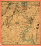
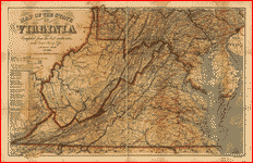 Map
of the State of Virginia compiled from the best authorities
at the Coast Survey Office. A. D. Bache, Supdt. July 1863.
Compiled by W. L. Nicholson. Lith by Chas. G. Krebs. .
Nicholson, W. L. CREATED/PUBLISHED [S.l.], 1863. NOTES
Scale ca. 1:887,040. General map of Virginia, West Virginia,
Maryland, Delaware, and southern Pennsylvania showing
cities and towns, roads, rivers, and relief by hachures.
The map is overprinted in red to indicate railroads, the
state name "West Virginia," and concentric circles centered
on Richmond. Circles are at intervals of ten miles. A
table of "Distances by Rail Roads" appears below the map
title. Map
of the State of Virginia compiled from the best authorities
at the Coast Survey Office. A. D. Bache, Supdt. July 1863.
Compiled by W. L. Nicholson. Lith by Chas. G. Krebs. .
Nicholson, W. L. CREATED/PUBLISHED [S.l.], 1863. NOTES
Scale ca. 1:887,040. General map of Virginia, West Virginia,
Maryland, Delaware, and southern Pennsylvania showing
cities and towns, roads, rivers, and relief by hachures.
The map is overprinted in red to indicate railroads, the
state name "West Virginia," and concentric circles centered
on Richmond. Circles are at intervals of ten miles. A
table of "Distances by Rail Roads" appears below the map
title. |
 Map
of the State of Virginia compiled from the best authorities,
and printed at the Coast Survey Office. A. D. Bache, Supdt.
May 1864. Compiled by W. L. Nicholson. . Nicholson,
W. L. CREATED/PUBLISHED [S.l.], Lith. by Chas. G. Krebs.,
1864. NOTES Scale ca. 1:887,040. General map of Virginia,
West Virginia, Maryland, Delaware, and southern Pennsylvania
showing cities and towns, roads, rivers, and relief by
hachures. The map is overprinted in red to indicate railroads,
the state name "West Virginia," and concentric circles
centered on Washington, D.C. A table of "Distances by
Railroads" appears below the map title. Map
of the State of Virginia compiled from the best authorities,
and printed at the Coast Survey Office. A. D. Bache, Supdt.
May 1864. Compiled by W. L. Nicholson. . Nicholson,
W. L. CREATED/PUBLISHED [S.l.], Lith. by Chas. G. Krebs.,
1864. NOTES Scale ca. 1:887,040. General map of Virginia,
West Virginia, Maryland, Delaware, and southern Pennsylvania
showing cities and towns, roads, rivers, and relief by
hachures. The map is overprinted in red to indicate railroads,
the state name "West Virginia," and concentric circles
centered on Washington, D.C. A table of "Distances by
Railroads" appears below the map title. |
 Map
of the lower Shenandoah Valley, Virginia / Eng. O[ffice,
2nd] Corps, A. N. Va., Sept 9th 1864. . Brown, Samuel
Howell. CREATED/PUBLISHED 1864. NOTES Shows the Shenandoah
Valley from the Potomac to the north to Front Royal and
Strasburg to the south, including roads, drainage, railroads,
and names of residents. Relief shown by shading. Map
of the lower Shenandoah Valley, Virginia / Eng. O[ffice,
2nd] Corps, A. N. Va., Sept 9th 1864. . Brown, Samuel
Howell. CREATED/PUBLISHED 1864. NOTES Shows the Shenandoah
Valley from the Potomac to the north to Front Royal and
Strasburg to the south, including roads, drainage, railroads,
and names of residents. Relief shown by shading. |
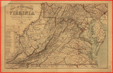 Map
of the State of Virginia compiled from the best authorities,
and printed at the Coast Survey Office. A. D. Bache, Supdt.
1865. Compiled by W. L. Nicholson. Lith. by Chas. G. Krebs.
. Nicholson, W. L. CREATED/PUBLISHED [S.l.], 1865.
NOTES Scale ca. 1:887,040. General map of Virginia, West
Virginia, Maryland, Delaware, and southern Pennsylvania
showing cities and towns, roads, rivers, and relief by
hachures. The map is overprinted in red to indicate railroads,
the state name "West Virginia," and concentric circles
centered on Richmond. Printed in blue are concentric circles
centered on Washington, D.C. A table of "Distances by
Railroads" appears below the map title. Map
of the State of Virginia compiled from the best authorities,
and printed at the Coast Survey Office. A. D. Bache, Supdt.
1865. Compiled by W. L. Nicholson. Lith. by Chas. G. Krebs.
. Nicholson, W. L. CREATED/PUBLISHED [S.l.], 1865.
NOTES Scale ca. 1:887,040. General map of Virginia, West
Virginia, Maryland, Delaware, and southern Pennsylvania
showing cities and towns, roads, rivers, and relief by
hachures. The map is overprinted in red to indicate railroads,
the state name "West Virginia," and concentric circles
centered on Richmond. Printed in blue are concentric circles
centered on Washington, D.C. A table of "Distances by
Railroads" appears below the map title. |
 Route
of the New River R.R., 188-. . Hotchkiss, Jedediah,
1828-1899. CREATED/PUBLISHED [188-] NOTES Scale ca. 1:180,700. Route
of the New River R.R., 188-. . Hotchkiss, Jedediah,
1828-1899. CREATED/PUBLISHED [188-] NOTES Scale ca. 1:180,700.
|
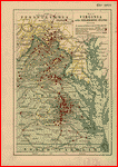 Map
of Virginia and neighboring states showing the location
of battles in the Civil War 1861-1865. . Northrup,
William P. CREATED/PUBLISHED Buffalo, N.Y., The Matthews-Northrup
Works, c1912. NOTES Scale ca. 1:366,000. Map of eastern
Virginia and parts of North Carolina, Maryland, West Virginia,
and Pennsylvania, showing "battles in which New York regiments
were engaged," "railroads at time of war," and "turnpikes
and plank roads." Union states are colored yellow, and
Confederate states are green. Map
of Virginia and neighboring states showing the location
of battles in the Civil War 1861-1865. . Northrup,
William P. CREATED/PUBLISHED Buffalo, N.Y., The Matthews-Northrup
Works, c1912. NOTES Scale ca. 1:366,000. Map of eastern
Virginia and parts of North Carolina, Maryland, West Virginia,
and Pennsylvania, showing "battles in which New York regiments
were engaged," "railroads at time of war," and "turnpikes
and plank roads." Union states are colored yellow, and
Confederate states are green. |
 Military
reconnaissance in the vicinity of Gauley Bridge, Department
of western Virginia, Brig. Genl. W. S. Rosecrans, comd'g.,
Sept. 11th to Nov. 15, 1861 By W. F. Raynolds, Capt. Top.
Engr's., W. Margedant, O. V. [and] W. Angelo Powell, C.
Engr. Published by authority of the Hon. the Secretary
of War in the office of the Chief of Engineers, U.S. Army.
. Raynolds, W. F. (William Franklin), 1820-1894. CREATED/PUBLISHED
[S.l.], office of the Chief of Engineers, U.S. Army, 1879.
NOTES Scale 1:63,360. "United States forces" are colored
blue, and "Confederate forces & works" are red. Shows
Union headquarters, towns, roads, houses, names of residents,
drainage, and relief by hachures. Military
reconnaissance in the vicinity of Gauley Bridge, Department
of western Virginia, Brig. Genl. W. S. Rosecrans, comd'g.,
Sept. 11th to Nov. 15, 1861 By W. F. Raynolds, Capt. Top.
Engr's., W. Margedant, O. V. [and] W. Angelo Powell, C.
Engr. Published by authority of the Hon. the Secretary
of War in the office of the Chief of Engineers, U.S. Army.
. Raynolds, W. F. (William Franklin), 1820-1894. CREATED/PUBLISHED
[S.l.], office of the Chief of Engineers, U.S. Army, 1879.
NOTES Scale 1:63,360. "United States forces" are colored
blue, and "Confederate forces & works" are red. Shows
Union headquarters, towns, roads, houses, names of residents,
drainage, and relief by hachures. |
 Sketch
of the area of the battles of Rich Mountain, July 11-12,
1861. List of distances from Garnett's camp in pen
on verso, annotated in pencil. Sketch
of the area of the battles of Rich Mountain, July 11-12,
1861. List of distances from Garnett's camp in pen
on verso, annotated in pencil. |
 Rough
sketch of the battle of Rich Mountain, July 11-12, 1861.
NOTES Relief shown by hachures. Rough
sketch of the battle of Rich Mountain, July 11-12, 1861.
NOTES Relief shown by hachures. |
 Map
of the Rich Mountain battlefield, W. Va. July 11-12, 1861.
NOTES Relief shown by hachures. Map
of the Rich Mountain battlefield, W. Va. July 11-12, 1861.
NOTES Relief shown by hachures. |
 Sketch
of the battle of Rich Mountain, July 11-12, 1861.
CREATED/PUBLISHED [1861] Sketch
of the battle of Rich Mountain, July 11-12, 1861.
CREATED/PUBLISHED [1861] |
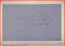
 Battle
of Rich Mt. . CREATED/PUBLISHED [1861] NOTES Relief
shown by hachures. Battle
of Rich Mt. . CREATED/PUBLISHED [1861] NOTES Relief
shown by hachures. |
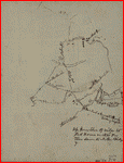
 Area
of the battle of Rich Mountain, July 11-12, 1861.
. Area
of the battle of Rich Mountain, July 11-12, 1861.
. |
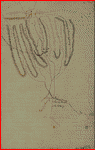
 Pencil
sketch of the road from Slaven's Cabin to the top of Cheat
Mountain in the area of the battle of Rich Mountain, July
11-12, 1861. . Pencil
sketch of the road from Slaven's Cabin to the top of Cheat
Mountain in the area of the battle of Rich Mountain, July
11-12, 1861. . |
 Rough
sketch of the Rich Mountain battle area, extending from
Beverly, W. Va. to Clarksburg. CREATED/PUBLISHED [1861]
NOTES Relief shown by hachures. Includes ancillary sketch
of Natty Creek and annotations. Rough
sketch of the Rich Mountain battle area, extending from
Beverly, W. Va. to Clarksburg. CREATED/PUBLISHED [1861]
NOTES Relief shown by hachures. Includes ancillary sketch
of Natty Creek and annotations. |
 Rough
sketch of the roads between Beverly, W. Va., Leadsville,
Bealington, and Philippi, and Bealington and Meadowville,
in the Rich Mountain area. CREATED/PUBLISHED [1861] Rough
sketch of the roads between Beverly, W. Va., Leadsville,
Bealington, and Philippi, and Bealington and Meadowville,
in the Rich Mountain area. CREATED/PUBLISHED [1861]
|
 Map
to illustrate the report of Brigadier-General Hill Richardson,
sc. . Richardson, James H. CREATED/PUBLISHED N.Y.,
[1861] NOTES Scale not given. Map of part of West Virginia
and western Maryland from Romney west to Grafton, showing
the battle of Corricks Ford on July 14th, routes used
by Union and Confederate columns, location of bridges
burned by Confederates on July 12, 14, and 15, and the
"point where pursuit was abandoned by orders of Major-General
McClellan." Map
to illustrate the report of Brigadier-General Hill Richardson,
sc. . Richardson, James H. CREATED/PUBLISHED N.Y.,
[1861] NOTES Scale not given. Map of part of West Virginia
and western Maryland from Romney west to Grafton, showing
the battle of Corricks Ford on July 14th, routes used
by Union and Confederate columns, location of bridges
burned by Confederates on July 12, 14, and 15, and the
"point where pursuit was abandoned by orders of Major-General
McClellan." |
 Map
of the battle field of Carnifex Ferry, Gauley River, West
Va., Sept. 10th 1861. United States forces commanded by
Brig. Gen. W. S. Rosecrans Published by authority of the
Hon. the Secretary of War. . United States. Army.
Corps of Engineers. CREATED/PUBLISHED [S.l.], Office of
the Chief of Engineers, U.S.A., 1876. NOTES Scale 1:5280.
"Copied from a map accompanying the report of Gen. Rosecrans."
Indicates Confederate works and batteries at Camp Gauley,
Union positions during attack and names of units, roads,
drainage, houses, fences, vegetation, and relief by hachures. Map
of the battle field of Carnifex Ferry, Gauley River, West
Va., Sept. 10th 1861. United States forces commanded by
Brig. Gen. W. S. Rosecrans Published by authority of the
Hon. the Secretary of War. . United States. Army.
Corps of Engineers. CREATED/PUBLISHED [S.l.], Office of
the Chief of Engineers, U.S.A., 1876. NOTES Scale 1:5280.
"Copied from a map accompanying the report of Gen. Rosecrans."
Indicates Confederate works and batteries at Camp Gauley,
Union positions during attack and names of units, roads,
drainage, houses, fences, vegetation, and relief by hachures.
|
 Map
showing the preliminary line of the East River Railroad,
May, 1881. . Hotchkiss, Jedediah, 1828-1899. NOTES
Scale 1:63,360. Map
showing the preliminary line of the East River Railroad,
May, 1881. . Hotchkiss, Jedediah, 1828-1899. NOTES
Scale 1:63,360. |
This is a must have collection for any civil war history
buff!
To use
this software, you must install the free ExpressView MrSid
software which is included on the CD. This is a 30 second
process and will allow you to view and manipulate/print all
the maps in this CD collection in full detail. There is a
version for both Windows platforms and Macintosh platforms
and full installation instructions are included on the CD.
|


