This
CD contains 67 rare historic maps of Florida, Cuba and the
West Indies in MrSid format.
This
format allows you to see the entire map on your computer screen
or drill down to see the smallest details. The original maps
are often quite large, as much as 36" long or larger
and quite detailed. With the MrSID software, you can manipulate
the map to print the entire map in great detail or zoom into
a portion of the map in full detail for viewing or printing.
You could even bring the images to a local print shop to have
the maps reprinted in their full size. (MrSID software is
included on the CD.)
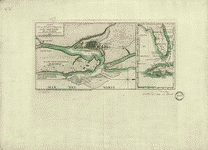
To
give you a sample of the detail you can expect in these maps,
here is an example based on a panoramic map of Washington,
DC.
The
table below shows the description and a small image of each
map on this incredible history CD.
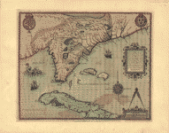
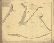
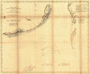
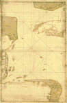 Map
showing portion of the Caribbean Sea from Florida Keys
to Nicaragua]. CREATED/PUBLISHED [17--?] NOTES Depths
shown by soundings. Map
showing portion of the Caribbean Sea from Florida Keys
to Nicaragua]. CREATED/PUBLISHED [17--?] NOTES Depths
shown by soundings. |
  Central
America. Cuba, Porto Rico, and Jamaica. J.N. Matthews
Co. CREATED PUBLISHED [S.l.], 1916. Central
America. Cuba, Porto Rico, and Jamaica. J.N. Matthews
Co. CREATED PUBLISHED [S.l.], 1916. |
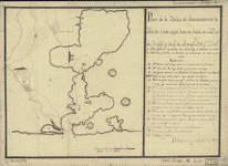 Plano
de la bahía de Guantánamo en la ysla de Cuva, cuya boca
se halla en latd. N. de 20 gros. y longd. de Tenerife
30l. gs. 27 ms. ... / Havana y abril 7 de 1751. CREATED/PUBLISHED
[1751] NOTES Scale ca. 1:120,000. Manuscript, pen-and-ink.
Relief shown pictorially and by hachures. Depths shown
by soundings. Plano
de la bahía de Guantánamo en la ysla de Cuva, cuya boca
se halla en latd. N. de 20 gros. y longd. de Tenerife
30l. gs. 27 ms. ... / Havana y abril 7 de 1751. CREATED/PUBLISHED
[1751] NOTES Scale ca. 1:120,000. Manuscript, pen-and-ink.
Relief shown pictorially and by hachures. Depths shown
by soundings. |
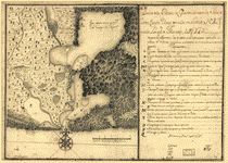 Plano
de la Baía de Guantánamo, en la ysla de Cuva, cuya boca
se alla en latitud N. 20 gs. y en la longitd. de Thenerife
301 gs. 27 ms. / Havana y abril 7 de 1751 ad. CREATED/PUBLISHED
[1751] NOTES Scale ca. 1:125,000. Manuscript, pen-and-ink
and watercolor. Relief shown pictorially. Depths shown
by soundings. Plano
de la Baía de Guantánamo, en la ysla de Cuva, cuya boca
se alla en latitud N. 20 gs. y en la longitd. de Thenerife
301 gs. 27 ms. / Havana y abril 7 de 1751 ad. CREATED/PUBLISHED
[1751] NOTES Scale ca. 1:125,000. Manuscript, pen-and-ink
and watercolor. Relief shown pictorially. Depths shown
by soundings. |
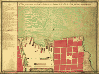
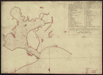 Plano
del puerto de la Havana, situado en la parte del N. de
la ysla de Cuba en la lattd. de 23010' y en longd. astronómica
de 293047', meridiano de Tenerife ... el ańo de 1783 por
Dn. Josef de Sn. Martin, the. de Navio de la Rl. Armada
... Copiado por Dn. Josef Boto Villa, Seńor 2o piloto
del No. de la Armada en este ańo de 1790. Boto Villa,
Josef. CREATED/PUBLISHED [1790] NOTES Scale ca. 1:16,000.
Manuscript, pen-and-ink and red and yellow watercolors.
Watermark: Beehive. Depths shown by soundings. Oriented
with north to the bottom. Plano
del puerto de la Havana, situado en la parte del N. de
la ysla de Cuba en la lattd. de 23010' y en longd. astronómica
de 293047', meridiano de Tenerife ... el ańo de 1783 por
Dn. Josef de Sn. Martin, the. de Navio de la Rl. Armada
... Copiado por Dn. Josef Boto Villa, Seńor 2o piloto
del No. de la Armada en este ańo de 1790. Boto Villa,
Josef. CREATED/PUBLISHED [1790] NOTES Scale ca. 1:16,000.
Manuscript, pen-and-ink and red and yellow watercolors.
Watermark: Beehive. Depths shown by soundings. Oriented
with north to the bottom. |
 Havana
op 't Eyland Cvba. Vinckeboons, Joan. CREATED/PUBLISHED
[1639?] NOTES Relief shown pictorially and by gradient
tints. Shows aerial view of the port of Havana on the
island of Cuba including buildings, ships, and fortifications.
Pen-and-ink and watercolor. Attributed to Joan Vinckeboons
by comparison with his other Dutch maps in Henry Harrisse
collection. Havana
op 't Eyland Cvba. Vinckeboons, Joan. CREATED/PUBLISHED
[1639?] NOTES Relief shown pictorially and by gradient
tints. Shows aerial view of the port of Havana on the
island of Cuba including buildings, ships, and fortifications.
Pen-and-ink and watercolor. Attributed to Joan Vinckeboons
by comparison with his other Dutch maps in Henry Harrisse
collection. |
 Plano
y explicación del Real Astillero de la Habana en la ysla
de Cuba y de sus inmediaciones. CREATED/PUBLISHED [17--?]
NOTES Oriented with north toward the lower left. Watermark:
C. & I. Honig. Plano
y explicación del Real Astillero de la Habana en la ysla
de Cuba y de sus inmediaciones. CREATED/PUBLISHED [17--?]
NOTES Oriented with north toward the lower left. Watermark:
C. & I. Honig. |
 A
Sketch of the harbour of St. Iago de Cuba. CREATED/PUBLISHED
[1765?] NOTES Scale ca. 1:15,500. Title on verso: Plan
& chart, St. Jago de Cuba, 81. Manuscript, pen-and-ink
and watercolor, on tracing paper. Relief shown pictorially.
Soundings shown in fathoms. A
Sketch of the harbour of St. Iago de Cuba. CREATED/PUBLISHED
[1765?] NOTES Scale ca. 1:15,500. Title on verso: Plan
& chart, St. Jago de Cuba, 81. Manuscript, pen-and-ink
and watercolor, on tracing paper. Relief shown pictorially.
Soundings shown in fathoms. |
 Caerte
vande Bay St. Tiago : gelegen op 't Eylant Cvba, op de
Hoochtv van 20 1/2 graedt; aen de Zuyd land van Cuba.
Vinckeboons, Joan. CREATED/PUBLISHED [1639?] NOTES Relief
shown pictorially and by gradient tints. Shows Santiago
Bay and vicinity on the island of Cuba including pictorial
presentation of the city of Santiago. Pen-and-ink and
watercolor. Attributed to Joan Vinckeboons by comparison
with his other Dutch maps in Henry Harrisse collection. Caerte
vande Bay St. Tiago : gelegen op 't Eylant Cvba, op de
Hoochtv van 20 1/2 graedt; aen de Zuyd land van Cuba.
Vinckeboons, Joan. CREATED/PUBLISHED [1639?] NOTES Relief
shown pictorially and by gradient tints. Shows Santiago
Bay and vicinity on the island of Cuba including pictorial
presentation of the city of Santiago. Pen-and-ink and
watercolor. Attributed to Joan Vinckeboons by comparison
with his other Dutch maps in Henry Harrisse collection.
|
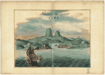
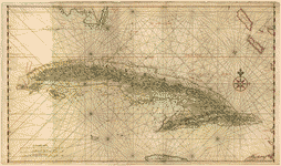 [Map
of the complete island of Cuba]. Vinckeboons, Joan. OTHER
TITLES Cuba CREATED/PUBLISHED [1639?] NOTES Relief shown
pictorially. Depths shown by soundings. Shows coastal
features, settlements on Cuba, and islands. Pen-and-ink
and watercolor. Attributed to Joan Vinckeboons by comparison
with his other Dutch maps in Henry Harrisse collection. [Map
of the complete island of Cuba]. Vinckeboons, Joan. OTHER
TITLES Cuba CREATED/PUBLISHED [1639?] NOTES Relief shown
pictorially. Depths shown by soundings. Shows coastal
features, settlements on Cuba, and islands. Pen-and-ink
and watercolor. Attributed to Joan Vinckeboons by comparison
with his other Dutch maps in Henry Harrisse collection.
|
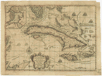
 [Map
of a part of the island of Cuba and of the Bahamas]. Vinckeboons,
Joan. CREATED/PUBLISHED [ca. 1650] NOTES Relief shown
pictorially. Pen-and-ink and watercolor. [Map
of a part of the island of Cuba and of the Bahamas]. Vinckeboons,
Joan. CREATED/PUBLISHED [ca. 1650] NOTES Relief shown
pictorially. Pen-and-ink and watercolor. |
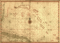
 A
new chart of the seas surrounding the island of Cuba with
the soundings, currents, ships, courses &c. and a map
of the island itself lately made by an officer in the
Navy. CREATED/PUBLISHED [London: Printed for R. Baldwin,
1762] NOTES Relief shown pictorially. Depths shown by
soundings. A
new chart of the seas surrounding the island of Cuba with
the soundings, currents, ships, courses &c. and a map
of the island itself lately made by an officer in the
Navy. CREATED/PUBLISHED [London: Printed for R. Baldwin,
1762] NOTES Relief shown pictorially. Depths shown by
soundings. |
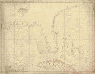
 [Costa
de Cuba desde Cabo de San Antonio a la bahía de Cardenas].
CREATED/PUBLISHED [ca. 1780] NOTES Scale ca. 1:270,000.
Manuscript, pen-and-ink and watercolor. Watermarks: D.
& C. Blauw; and, the letters DCB in a shield with a double
letter. Mounted on cloth backing. Oriented with north
to the bottom. Depths shown by soundings. [Costa
de Cuba desde Cabo de San Antonio a la bahía de Cardenas].
CREATED/PUBLISHED [ca. 1780] NOTES Scale ca. 1:270,000.
Manuscript, pen-and-ink and watercolor. Watermarks: D.
& C. Blauw; and, the letters DCB in a shield with a double
letter. Mounted on cloth backing. Oriented with north
to the bottom. Depths shown by soundings. |
 Cuba.
United States. Central Intelligence Agency. CREATED/PUBLISHED
[Washington, D.C. : Central Intelligance Agency, 1994] Cuba.
United States. Central Intelligence Agency. CREATED/PUBLISHED
[Washington, D.C. : Central Intelligance Agency, 1994]
|
 Descripcion
de la costa de Tierra Firme desde el Rio de la Empalizada
hasta Cavo de Clara. Por las latitudes y longitudes de
Dn. Bartolome de Rosa. Echo por Balentin Cierto primer
Piloto de la Real Armada, ańo de 1757. Cierto, Balentin.
CREATED/PUBLISHED [1757] NOTES Scale ca. 1:3,300,000.
Title on verso: Florida & Cuba, 140. Manuscript, pen-and-ink,
on tracing paper. Soundings shown in fathoms. Prime meridian:
Ferro. Shows Cuba, Bahama Islands, northern Yucatan Peninsula,
and the coast of the United States from "Cape Clara" to
the mouth of the Mississippi River. Descripcion
de la costa de Tierra Firme desde el Rio de la Empalizada
hasta Cavo de Clara. Por las latitudes y longitudes de
Dn. Bartolome de Rosa. Echo por Balentin Cierto primer
Piloto de la Real Armada, ańo de 1757. Cierto, Balentin.
CREATED/PUBLISHED [1757] NOTES Scale ca. 1:3,300,000.
Title on verso: Florida & Cuba, 140. Manuscript, pen-and-ink,
on tracing paper. Soundings shown in fathoms. Prime meridian:
Ferro. Shows Cuba, Bahama Islands, northern Yucatan Peninsula,
and the coast of the United States from "Cape Clara" to
the mouth of the Mississippi River. |
 Floridae
Americae provinciae recens & exactissima descriptio auctorč
Iacobo le Moyne cui cognomen de Morgues, qui Laudonierum,
altera Gallorum in eam prouinciam nauigatione comitat
est, atque adhibitis aliquot militibus ob pericula, regionis
illius interiora & maritima diligentissimč lustrauit,
& exactissimč dimensus est, obseruata etiam singulorum
fluminum inter se distantia, ut ipsemet redux Carolo .IX.
Galliarum regi, demonstrauit. Le Moyne de Morgues, Jacques,
d. 1588. CREATED/PUBLISHED [S.l. : s.n., 1591] NOTES Relief
shown pictorially. Shows Florida region, northeastern
coastline, Port Royal, Fort Caroline, Cuba, rivers, cities,
and other geographical entities. Floridae
Americae provinciae recens & exactissima descriptio auctorč
Iacobo le Moyne cui cognomen de Morgues, qui Laudonierum,
altera Gallorum in eam prouinciam nauigatione comitat
est, atque adhibitis aliquot militibus ob pericula, regionis
illius interiora & maritima diligentissimč lustrauit,
& exactissimč dimensus est, obseruata etiam singulorum
fluminum inter se distantia, ut ipsemet redux Carolo .IX.
Galliarum regi, demonstrauit. Le Moyne de Morgues, Jacques,
d. 1588. CREATED/PUBLISHED [S.l. : s.n., 1591] NOTES Relief
shown pictorially. Shows Florida region, northeastern
coastline, Port Royal, Fort Caroline, Cuba, rivers, cities,
and other geographical entities. |
 Descripcion
de la costa de Tierra Firme desde el Cavo de la Agusa
hasta la Barra de Palmas diga de la Trinidad: Con todas
las yslas, bajos, arresifes & ca. Leho por las latitudes
y longitudes de Dn. Bartolome de la Rosa. Echo por Balentin
Cierto p[r]imer Piloto de la Real Armada, ańo de 1757.
Cierto, Balentin. CREATED/PUBLISHED [1757] NOTES Scale
ca. 1:3,500,000. Title on verso: Palmas to Carthagena,
206. Manuscript, pen-and-ink, on tracing paper. Prime
meridian: Ferro. Depths shown by soundings. Insets: Plans
de la Nueva Vera Cruz; con todos sus bajos, yslas, y sondas
situado in los 19010' de latd. Norte y en 27705' de longt.
segun el meridiano de Tenerife [ca. 1:110,000]--Plano
del Alacran cituado en la sonda de Campeche por los 22030'
de latd. no. Leva[n]tado por el Capt. Dn. Felis Rodriguez.
En termino de dos meses que estubo endho bajo examinado
con todo cuydado [ca. 1:150,000] Descripcion
de la costa de Tierra Firme desde el Cavo de la Agusa
hasta la Barra de Palmas diga de la Trinidad: Con todas
las yslas, bajos, arresifes & ca. Leho por las latitudes
y longitudes de Dn. Bartolome de la Rosa. Echo por Balentin
Cierto p[r]imer Piloto de la Real Armada, ańo de 1757.
Cierto, Balentin. CREATED/PUBLISHED [1757] NOTES Scale
ca. 1:3,500,000. Title on verso: Palmas to Carthagena,
206. Manuscript, pen-and-ink, on tracing paper. Prime
meridian: Ferro. Depths shown by soundings. Insets: Plans
de la Nueva Vera Cruz; con todos sus bajos, yslas, y sondas
situado in los 19010' de latd. Norte y en 27705' de longt.
segun el meridiano de Tenerife [ca. 1:110,000]--Plano
del Alacran cituado en la sonda de Campeche por los 22030'
de latd. no. Leva[n]tado por el Capt. Dn. Felis Rodriguez.
En termino de dos meses que estubo endho bajo examinado
con todo cuydado [ca. 1:150,000] |
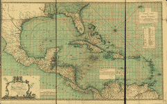
 To
His Royal Highness. George Augustus Frederick. Prince
of Wales &c. &c. &c. This chart of the West Indies, is
humbly inscribed by His Royal Highness faithful & obedient
servant Joseph Smith Speer. Thos. Bowen, sculpt. Speer,
Joseph Smith. CREATED/PUBLISHED Westminster, 1774. NOTES
Scale ca. 1:5,000,000. Hand colored. Relief shown pictorially.
Depths shown by soundings. Shows southern United States,
Mexico, Central America, West Indies, Bermudas, and northern
South America. To
His Royal Highness. George Augustus Frederick. Prince
of Wales &c. &c. &c. This chart of the West Indies, is
humbly inscribed by His Royal Highness faithful & obedient
servant Joseph Smith Speer. Thos. Bowen, sculpt. Speer,
Joseph Smith. CREATED/PUBLISHED Westminster, 1774. NOTES
Scale ca. 1:5,000,000. Hand colored. Relief shown pictorially.
Depths shown by soundings. Shows southern United States,
Mexico, Central America, West Indies, Bermudas, and northern
South America. |
 To
His Royal Highness. George Ausgustus Frederick. Prince
of Wales &c. &c. &c. This chart of the West Indies, is
humbly inscribed by His Royal Highness faithful & obedient
servant Joseph Smith Speer. Speer, Joseph Smith. CREATED/PUBLISHED
[Westminster? 1774?] NOTES Scale ca. 1:5,000,000. Hand
colored. Relief shown pictorially. Depths shown by soundings.
Shows southern United States, Mexico, Central America,
Bermudas, West Indies, and northern South America. European
possessions shown by color. To
His Royal Highness. George Ausgustus Frederick. Prince
of Wales &c. &c. &c. This chart of the West Indies, is
humbly inscribed by His Royal Highness faithful & obedient
servant Joseph Smith Speer. Speer, Joseph Smith. CREATED/PUBLISHED
[Westminster? 1774?] NOTES Scale ca. 1:5,000,000. Hand
colored. Relief shown pictorially. Depths shown by soundings.
Shows southern United States, Mexico, Central America,
Bermudas, West Indies, and northern South America. European
possessions shown by color. |
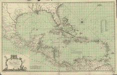
 A
general chart of the West Indies. Speer, Joseph Smith.
CREATED/PUBLISHED London, 1796. A
general chart of the West Indies. Speer, Joseph Smith.
CREATED/PUBLISHED London, 1796. |
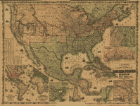 Colton's
rail-road and military map of the United States, Mexico,
the West Indies, &c. Colton, J. H. (Joseph Hutchins),
1800-1893. CREATED/PUBLISHED New York, 1862. NOTES Scale
ca. 1:6,500,000. Relief shown by hachures. Shows slave
holding states. Includes census information for 1860.
Insets: Colton's map of the Americas, Africa and a portion
of Europe showing the Atlantic and part of the Pacific
oceans.--New Orleans and delta of the Mississippi, Louisiana.--Mobile
harbor, Alabama.--Key West and Tortugas, Florida reefs.--Wilmington
and vicinity, N. Carolina.--Beaufort and vicinity, N.
Carolina.--Norfolk, fortress Monroe, James River, Richmond,
Petersburg &c &c.--Map of Charleston, Port Royal & Savannah
vicinities.--Washington, Manassas Junction, Harpers Ferry,
Baltimore, Annapolis &c &c. Colton's
rail-road and military map of the United States, Mexico,
the West Indies, &c. Colton, J. H. (Joseph Hutchins),
1800-1893. CREATED/PUBLISHED New York, 1862. NOTES Scale
ca. 1:6,500,000. Relief shown by hachures. Shows slave
holding states. Includes census information for 1860.
Insets: Colton's map of the Americas, Africa and a portion
of Europe showing the Atlantic and part of the Pacific
oceans.--New Orleans and delta of the Mississippi, Louisiana.--Mobile
harbor, Alabama.--Key West and Tortugas, Florida reefs.--Wilmington
and vicinity, N. Carolina.--Beaufort and vicinity, N.
Carolina.--Norfolk, fortress Monroe, James River, Richmond,
Petersburg &c &c.--Map of Charleston, Port Royal & Savannah
vicinities.--Washington, Manassas Junction, Harpers Ferry,
Baltimore, Annapolis &c &c. |
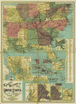 Goff's
historical map of the United States. Civil War, Spanish-Am.
War, war in the Philippines, invasion of China. Goff,
Eugenia A. Wheeler (Eugenia Almira Wheeler) CREATED/PUBLISHED
Philadelphia, McConnell School Supply Co., c1907. NOTES
Scale ca. 1:2,040,000. Wall map of the South showing location
and date of battles, some troop movements, towns, rivers,
and state boundaries. Following insets relates to the
Civil War: The Virginia and the Monitor in Hampton Roads,
1862. 15 x 14 cm.-Grant's Vicksburg campaign, January
to July 1863. 16 x 17 cm.-Lee's first northern invasion,
1862. 16 x 18 cm.-Lee's second northern invasion, 1863.
14 x 16 cm.-[Map of the coast of Texas showing the location
and date of battles] 22 x 9 cm. Includes index to place
names. Goff's
historical map of the United States. Civil War, Spanish-Am.
War, war in the Philippines, invasion of China. Goff,
Eugenia A. Wheeler (Eugenia Almira Wheeler) CREATED/PUBLISHED
Philadelphia, McConnell School Supply Co., c1907. NOTES
Scale ca. 1:2,040,000. Wall map of the South showing location
and date of battles, some troop movements, towns, rivers,
and state boundaries. Following insets relates to the
Civil War: The Virginia and the Monitor in Hampton Roads,
1862. 15 x 14 cm.-Grant's Vicksburg campaign, January
to July 1863. 16 x 17 cm.-Lee's first northern invasion,
1862. 16 x 18 cm.-Lee's second northern invasion, 1863.
14 x 16 cm.-[Map of the coast of Texas showing the location
and date of battles] 22 x 9 cm. Includes index to place
names. |
 Goff's
historical map of the Spanish-American War in the West
Indies, 1898. Goff, Eugenia A. Wheeler (Eugenia Almira
Wheeler) CREATED/PUBLISHED [S.l.], 1899. NOTES Insets:
San Juan, island of Puerto Rico.--Havana, city and harbor.--Santiago
campaign June-July 1898. Goff's
historical map of the Spanish-American War in the West
Indies, 1898. Goff, Eugenia A. Wheeler (Eugenia Almira
Wheeler) CREATED/PUBLISHED [S.l.], 1899. NOTES Insets:
San Juan, island of Puerto Rico.--Havana, city and harbor.--Santiago
campaign June-July 1898. |
  Peruuiae
avriferć regionis typus / Didaco Mendezio auctore. La
Florida / auctore Hieron. Chiaues. Guastecan reg. Ortelius,
Abraham, 1527-1598. CREATED/PUBLISHED [S.l. : s.n., 1584]
NOTES Shows portion of Central America, northwestern South
America, southern United States, and coast of Tamaulipas
in Mexico. Relief shown pictorially. Appears in the author's
Theatrum orbis terrarum. Peruuiae
avriferć regionis typus / Didaco Mendezio auctore. La
Florida / auctore Hieron. Chiaues. Guastecan reg. Ortelius,
Abraham, 1527-1598. CREATED/PUBLISHED [S.l. : s.n., 1584]
NOTES Shows portion of Central America, northwestern South
America, southern United States, and coast of Tamaulipas
in Mexico. Relief shown pictorially. Appears in the author's
Theatrum orbis terrarum. |
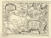 Carte
de la Florida, de la Louisiane, et pays voisins : pour
servir ŕ l'Histoire générale des voyages / par M. B.,
ing. de la marine, 1757. Bellin, Jacques Nicolas, 1703-1772.
CREATED/PUBLISHED [Paris : J. F. La Harpe, 1780] NOTES
Scale ca. 1:10,000,000. Relief shown pictorially. Carte
de la Florida, de la Louisiane, et pays voisins : pour
servir ŕ l'Histoire générale des voyages / par M. B.,
ing. de la marine, 1757. Bellin, Jacques Nicolas, 1703-1772.
CREATED/PUBLISHED [Paris : J. F. La Harpe, 1780] NOTES
Scale ca. 1:10,000,000. Relief shown pictorially. |
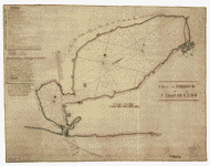
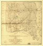 A
map of part of Alabama & Florida, showing the route of
the proposed Columbus & Pensacola Rail Road, accompanying
the report of Major J. D. Graham, U.S. Topographical Engr.
Feb. 6th, 1836; drawn chiefly from the original surveys
in the Gen. Land Office at Washington by Wm. R. Palmer,
U.S. Asst. Civil Engr. Palmer, W. R. (William R.), d.
1862. CREATED/PUBLISHED [n.p., 1836] NOTES Scale ca. 1:800,000. A
map of part of Alabama & Florida, showing the route of
the proposed Columbus & Pensacola Rail Road, accompanying
the report of Major J. D. Graham, U.S. Topographical Engr.
Feb. 6th, 1836; drawn chiefly from the original surveys
in the Gen. Land Office at Washington by Wm. R. Palmer,
U.S. Asst. Civil Engr. Palmer, W. R. (William R.), d.
1862. CREATED/PUBLISHED [n.p., 1836] NOTES Scale ca. 1:800,000.
|
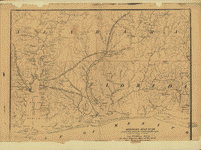 Military
map no. 54, prepared as basis for additional surveys prepared
under direction of Capt. P. C. Hains, U.S.A., Act. Chief,
Engineer Dept. of the Gulf. Drawn for stone by Helmuth
Holtz. Hains, Peter C. (Peter Conover), 1840-1921. CREATED/PUBLISHED
[S.l.], Printed by W. Pro[bert, 1864?] NOTES Scale 1:380,160.
General map of southern Alabama and West Florida showing
roads, railroads, towns, drainage, and a few names of
residents along the Tensaw River. Military
map no. 54, prepared as basis for additional surveys prepared
under direction of Capt. P. C. Hains, U.S.A., Act. Chief,
Engineer Dept. of the Gulf. Drawn for stone by Helmuth
Holtz. Hains, Peter C. (Peter Conover), 1840-1921. CREATED/PUBLISHED
[S.l.], Printed by W. Pro[bert, 1864?] NOTES Scale 1:380,160.
General map of southern Alabama and West Florida showing
roads, railroads, towns, drainage, and a few names of
residents along the Tensaw River. |
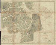
 Preliminary
chart of main entrance to Charlotte Harbor, Florida From
a trigonometrical survey under the direction of A. D.
Bache, Superintendent of the survey of the coast of the
United States. Triangulations by Lieuts. J. C. Clark &
W. R. Terrill, U.S.A. Assts. Topography by F. W. Dorr,
C. Fergunson & C. T. Jardella, Sub-Assts. Hydrography
by the party of E. Cordell, Acting asst. United States
Coast Survey. CREATED/PUBLISHED [Washington, U.S. Coast
Survey], 1863. NOTES Scale 1:40,000. Preliminary
chart of main entrance to Charlotte Harbor, Florida From
a trigonometrical survey under the direction of A. D.
Bache, Superintendent of the survey of the coast of the
United States. Triangulations by Lieuts. J. C. Clark &
W. R. Terrill, U.S.A. Assts. Topography by F. W. Dorr,
C. Fergunson & C. T. Jardella, Sub-Assts. Hydrography
by the party of E. Cordell, Acting asst. United States
Coast Survey. CREATED/PUBLISHED [Washington, U.S. Coast
Survey], 1863. NOTES Scale 1:40,000. |
 Preliminary
chart of Escambia and Santa Maria de Galvaez [i.e., East]
Bays, Florida From a trigonometrical survey under the
direction of A. D. Bache, Superintendent of the survey
of the coast of the United States. Triangulation and topography
by F. H. Gerdes, Asst. Hydrography by the party under
the command of Lieut. Comdg. T. S. Phelps. U.S.N. Assist.
United States Coast Survey. CREATED/PUBLISHED [Washington,
U.S. Coast Survey], 1861. NOTES Scale 1:30,000. United
States Coast Survey, no. 489. Preliminary
chart of Escambia and Santa Maria de Galvaez [i.e., East]
Bays, Florida From a trigonometrical survey under the
direction of A. D. Bache, Superintendent of the survey
of the coast of the United States. Triangulation and topography
by F. H. Gerdes, Asst. Hydrography by the party under
the command of Lieut. Comdg. T. S. Phelps. U.S.N. Assist.
United States Coast Survey. CREATED/PUBLISHED [Washington,
U.S. Coast Survey], 1861. NOTES Scale 1:30,000. United
States Coast Survey, no. 489. |
 [Map
of Fernandina region, Florida] CREATED/PUBLISHED [186-?] [Map
of Fernandina region, Florida] CREATED/PUBLISHED [186-?]
|
 Sketch
showing the positions of the beacons on the Florida reefs
erected by Lieut. James Totten, U.S. Army, Assistant,
U.S.C.S. United States Coast Survey. CREATED/PUBLISHED
[Washington, U.S. Coast Survey, 1861] NOTES Scale 1:400,000. Sketch
showing the positions of the beacons on the Florida reefs
erected by Lieut. James Totten, U.S. Army, Assistant,
U.S.C.S. United States Coast Survey. CREATED/PUBLISHED
[Washington, U.S. Coast Survey, 1861] NOTES Scale 1:400,000.
|
 Preliminary
edition of general chart of the coast no. X, Sraits of
Florida from Key Biscayne to Marquesas Keys From a trigonometrical
survey under the direction of A. D. Bache, Superintendent
of the survey of the coast of the United States. United
States Coast Survey. CREATED/PUBLISHED [Washington, U.S.
Coast Survey, 1862] NOTES Scale 1:400,000. From its Report
of the Superintendent of the Coast Survey, showing the
progress of the survey during the year 1863 (Washington,
Government Printing Office, 1864). Map 14. Preliminary
edition of general chart of the coast no. X, Sraits of
Florida from Key Biscayne to Marquesas Keys From a trigonometrical
survey under the direction of A. D. Bache, Superintendent
of the survey of the coast of the United States. United
States Coast Survey. CREATED/PUBLISHED [Washington, U.S.
Coast Survey, 1862] NOTES Scale 1:400,000. From its Report
of the Superintendent of the Coast Survey, showing the
progress of the survey during the year 1863 (Washington,
Government Printing Office, 1864). Map 14. |
 Preliminary
chart of western end of Florida Reefs including Tortugas
Keys. United States Coast Survey. CREATED/PUBLISHED [Washington,
U.S. Coast Survey], 1864. NOTES Scale 1:200,000. From
its Report of the Superintendent of the Coast Survey,
showing the progress of the survey during the year 1863
(Washington, Government Printing Office, 1864). Map 17. Preliminary
chart of western end of Florida Reefs including Tortugas
Keys. United States Coast Survey. CREATED/PUBLISHED [Washington,
U.S. Coast Survey], 1864. NOTES Scale 1:200,000. From
its Report of the Superintendent of the Coast Survey,
showing the progress of the survey during the year 1863
(Washington, Government Printing Office, 1864). Map 17.
|
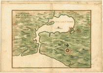
 Descripcion
de la Bahia de Santa Maria de Galve, y Puerto de Sn. Miguel
de Panzacola con toda la costa contigua y las demas bahias
que tiene en ella, hasta el Rio de Apalache / observada,
y reconozida por los ingenieros Dn. Jaime Lajonk, y Don
Juan de Siscara. Lajonk, Jaime. CREATED/PUBLISHED 1700.
NOTES Covers coast of western Florida Panhandle from Pensacola
to Apalachicola. Depths shown by soundings. Descripcion
de la Bahia de Santa Maria de Galve, y Puerto de Sn. Miguel
de Panzacola con toda la costa contigua y las demas bahias
que tiene en ella, hasta el Rio de Apalache / observada,
y reconozida por los ingenieros Dn. Jaime Lajonk, y Don
Juan de Siscara. Lajonk, Jaime. CREATED/PUBLISHED 1700.
NOTES Covers coast of western Florida Panhandle from Pensacola
to Apalachicola. Depths shown by soundings. |
 [Map
of the Gulf Coast from Florida to Mexico]. Vinckeboons,
Joan. CREATED/PUBLISHED [1639?] NOTES Depths shown by
soundings. Covers the Gulf Coast extending from St. Luis
de Tampico to Arecifo showing coastal features, rivers,
and streams. [Map
of the Gulf Coast from Florida to Mexico]. Vinckeboons,
Joan. CREATED/PUBLISHED [1639?] NOTES Depths shown by
soundings. Covers the Gulf Coast extending from St. Luis
de Tampico to Arecifo showing coastal features, rivers,
and streams. |
 Key
West harbor and its approaches. From a trigonometrical
survey under the direction of A. D. Bache, Superintendent
of the survey of the coast of the United States. Triangulation
by J. E. Hilgard, Assistant. Topography by L. H. Adams,
Sub-Asst. Hydrography by the party under the command of
Lieut. John Rodgers, U.S. Navy Assistant. Redd. drng.
by E. K. Knorr. Engd. by E. Yeager, E. F. Woodward, and
H. M. Knight. Published 1855. United States Coast Survey.
CREATED/PUBLISHED [Washington, U.S. Coast Survey], 1864.
NOTES Scale 1:50,000. United States Coast Survey, no.
469. General chart of Key West and environs showing soundings,
lights, channels, and island vegetation. Inset: Sub-sketch
of Key West harbor. Scale 1:30,000. 19 x 17 cm. Key
West harbor and its approaches. From a trigonometrical
survey under the direction of A. D. Bache, Superintendent
of the survey of the coast of the United States. Triangulation
by J. E. Hilgard, Assistant. Topography by L. H. Adams,
Sub-Asst. Hydrography by the party under the command of
Lieut. John Rodgers, U.S. Navy Assistant. Redd. drng.
by E. K. Knorr. Engd. by E. Yeager, E. F. Woodward, and
H. M. Knight. Published 1855. United States Coast Survey.
CREATED/PUBLISHED [Washington, U.S. Coast Survey], 1864.
NOTES Scale 1:50,000. United States Coast Survey, no.
469. General chart of Key West and environs showing soundings,
lights, channels, and island vegetation. Inset: Sub-sketch
of Key West harbor. Scale 1:30,000. 19 x 17 cm. |
 Plano
de la bahia de Pansacola. Copiado pr. el pilotin del No.
Dn. Josef Magule bajo la correccion del Alférez de frag[a]ta
Dn. Pedro Rivelles, mro. delineador por S. M. del Departam[en]to
de Cadiz su original levantado el ańo de 82, por Dn. Antonio
Donato Paredes. Paredes, Antonio Donato. CREATED/PUBLISHED
[1782] NOTES Scale ca. 1:60,000. Plano
de la bahia de Pansacola. Copiado pr. el pilotin del No.
Dn. Josef Magule bajo la correccion del Alférez de frag[a]ta
Dn. Pedro Rivelles, mro. delineador por S. M. del Departam[en]to
de Cadiz su original levantado el ańo de 82, por Dn. Antonio
Donato Paredes. Paredes, Antonio Donato. CREATED/PUBLISHED
[1782] NOTES Scale ca. 1:60,000. |
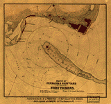
 A
correct map of Pensacola Bay showing topography of the
coast, Fort Pickens, U.S. Navy Yard, and all other fortifications
from the latest Government surveys. J. Weiss lith. Weiss,
Jacob. CREATED/PUBLISHED Philadelphia, Jacob Weiss, [186-]
NOTES Scale ca. 1:62,000. A
correct map of Pensacola Bay showing topography of the
coast, Fort Pickens, U.S. Navy Yard, and all other fortifications
from the latest Government surveys. J. Weiss lith. Weiss,
Jacob. CREATED/PUBLISHED Philadelphia, Jacob Weiss, [186-]
NOTES Scale ca. 1:62,000. |
 Sketch
of Pensacola Navy Yard and Fort Pickens from U.S. coast
surveys. By W. A. Williams, Civil Engineer. Williams,
W. A. CREATED/PUBLISHED Boston, L. Prang & Co., [186-]
NOTES Scale ca. 1:31,000. Indicates fortifications, half-mile
distance circles centered on Fort Pickens, beacons, roads
and streets, vegetation, and a few soundings. Sketch
of Pensacola Navy Yard and Fort Pickens from U.S. coast
surveys. By W. A. Williams, Civil Engineer. Williams,
W. A. CREATED/PUBLISHED Boston, L. Prang & Co., [186-]
NOTES Scale ca. 1:31,000. Indicates fortifications, half-mile
distance circles centered on Fort Pickens, beacons, roads
and streets, vegetation, and a few soundings. |
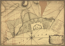 A
plan of Pensacola and its environs in its present state,
from an actual survey in 1778. Purcell, Joseph. CREATED/PUBLISHED
[1778] NOTES Scale ca. 1:4,000. A
plan of Pensacola and its environs in its present state,
from an actual survey in 1778. Purcell, Joseph. CREATED/PUBLISHED
[1778] NOTES Scale ca. 1:4,000. |
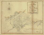 A
plan of the land between Fort Mossy and St. Augustine
in the province of East Florida. Sam Roworth, dept. survr.
genl. Roworth, Sam. CREATED/PUBLISHED [176-?] NOTES Scale
ca. 1:7,900. A
plan of the land between Fort Mossy and St. Augustine
in the province of East Florida. Sam Roworth, dept. survr.
genl. Roworth, Sam. CREATED/PUBLISHED [176-?] NOTES Scale
ca. 1:7,900. |
 [Plan
of the town and harbour of St. Augustine. Jefferys, Thomas,
d. 1771. CREATED/PUBLISHED London? 1762?] NOTES Scale
ca. 1:47,000. Title from typed label mounted with map.
Oriented with north to the right. Relief shown pictorially.
Depth shown by soundings. Ascribed to William Roberts'
An account of the first discovery and natural history
of Florida, 1763 by typed label mounted with map. Differs
from the map in Roberts' work and from the map in Thomas
Jefferys' A description of the Spanish Islands ... 1762
in that it is wanting cartouche and title information,
pagination in margin, and a statement in lower margin
"T. Jefferys, sculp." [Plan
of the town and harbour of St. Augustine. Jefferys, Thomas,
d. 1771. CREATED/PUBLISHED London? 1762?] NOTES Scale
ca. 1:47,000. Title from typed label mounted with map.
Oriented with north to the right. Relief shown pictorially.
Depth shown by soundings. Ascribed to William Roberts'
An account of the first discovery and natural history
of Florida, 1763 by typed label mounted with map. Differs
from the map in Roberts' work and from the map in Thomas
Jefferys' A description of the Spanish Islands ... 1762
in that it is wanting cartouche and title information,
pagination in margin, and a statement in lower margin
"T. Jefferys, sculp." |
 Plano
de la ciudad y puerto de San Agustin de la Florida. López
de Vargas Machuca, Tomás, 1731-1802. CREATED/PUBLISHED
Madrid, 1783. NOTES Scale ca. 1:49,000. Plano
de la ciudad y puerto de San Agustin de la Florida. López
de Vargas Machuca, Tomás, 1731-1802. CREATED/PUBLISHED
Madrid, 1783. NOTES Scale ca. 1:49,000. |
 Preliminary
chart of St. Augustine harbor, Florida Triangulation by
B. Huger, Jr., Sub-Assist. Topography by F. W. Dorr, Sub-Assist.
Hydrography by the party under the command of Lieut. Comdg.
A. Murray, U.S.N. Assist. Redd. drng. by F. Fairfax &
S. B. Linton. Engd. by E. H. Sipe & J. G. Thompson. Lith.
of Bowen & Co., Philada. United States Coast Survey. CREATED/PUBLISHED
[Washington, U.S. Coast Survey], 1862. NOTES Scale 1:30,000.
From its Report of the Superintendent of the Coast Survey,
showing the progress of the survey during the year 1862
(Washington, Government Printing Office, 1864). Map 33 Preliminary
chart of St. Augustine harbor, Florida Triangulation by
B. Huger, Jr., Sub-Assist. Topography by F. W. Dorr, Sub-Assist.
Hydrography by the party under the command of Lieut. Comdg.
A. Murray, U.S.N. Assist. Redd. drng. by F. Fairfax &
S. B. Linton. Engd. by E. H. Sipe & J. G. Thompson. Lith.
of Bowen & Co., Philada. United States Coast Survey. CREATED/PUBLISHED
[Washington, U.S. Coast Survey], 1862. NOTES Scale 1:30,000.
From its Report of the Superintendent of the Coast Survey,
showing the progress of the survey during the year 1862
(Washington, Government Printing Office, 1864). Map 33
|
 Bahia
de Tampa Spain. Dericción de Hidrografía CREATED/PUBLISHED
Madrid, Dericción de Hidrografía 1809 NOTES North oriented
toward upper right corner. Bahia
de Tampa Spain. Dericción de Hidrografía CREATED/PUBLISHED
Madrid, Dericción de Hidrografía 1809 NOTES North oriented
toward upper right corner. |
 A
map with part of the Florida coast from Cape Blaise to
Apalachie; with the boundaries betwixt East & West Floridas,
160 yards across the river call'd Apalachicola. Robt.
Slowley of Hs. Ms. sloop Druid, fecit September the 4th,
1769. Slowley, Robert. CREATED/PUBLISHED [1769] NOTES
Scale ca. 1:205,000. A
map with part of the Florida coast from Cape Blaise to
Apalachie; with the boundaries betwixt East & West Floridas,
160 yards across the river call'd Apalachicola. Robt.
Slowley of Hs. Ms. sloop Druid, fecit September the 4th,
1769. Slowley, Robert. CREATED/PUBLISHED [1769] NOTES
Scale ca. 1:205,000. |
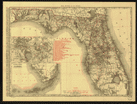
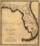 Map
of Florida. Vignoles, Charles Blacker, 1793-1875. CREATED/PUBLISHED
[S.l.], 1823. Map
of Florida. Vignoles, Charles Blacker, 1793-1875. CREATED/PUBLISHED
[S.l.], 1823. |
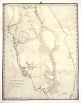 Map
of the lands belonging to R.S. Hackley, esq., in east
Florida / R.S. Hackley. Hackley, Richard S. CREATED/PUBLISHED
[1823?] NOTES Cadastral map. Covers all of Florida between
Micanopy in north and Key Biscayne Bay in south. At lower
left is probable reference to 1823 Map of Florida by Charles
Vignoles: Laid off, according to the original papers,
upon the new map of Florida, and enlarged from that map.
Signed at lower left: R.S. Hackley. Map
of the lands belonging to R.S. Hackley, esq., in east
Florida / R.S. Hackley. Hackley, Richard S. CREATED/PUBLISHED
[1823?] NOTES Cadastral map. Covers all of Florida between
Micanopy in north and Key Biscayne Bay in south. At lower
left is probable reference to 1823 Map of Florida by Charles
Vignoles: Laid off, according to the original papers,
upon the new map of Florida, and enlarged from that map.
Signed at lower left: R.S. Hackley. |
 Seat
of War. United States. Army. Corps of Engineers. CREATED/PUBLISHED
[S.l.], 1839. Seat
of War. United States. Army. Corps of Engineers. CREATED/PUBLISHED
[S.l.], 1839. |
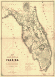
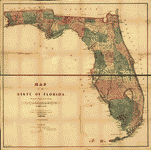
 The
State of Florida. Bruff, Joseph Goldsborough, 1804-1889.
CREATED/PUBLISHED [S.l.], 1846. The
State of Florida. Bruff, Joseph Goldsborough, 1804-1889.
CREATED/PUBLISHED [S.l.], 1846. |
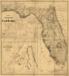
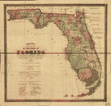
 Map
of the State of Florida showing the progress of the surveys;
from the annual report of the Surveyor General for 1856.
Drew, Columbus. CREATED/PUBLISHED Jacksonville, 1856.
NOTES Scale ca. 1:1,140,480. Map
of the State of Florida showing the progress of the surveys;
from the annual report of the Surveyor General for 1856.
Drew, Columbus. CREATED/PUBLISHED Jacksonville, 1856.
NOTES Scale ca. 1:1,140,480. |
 Map
of the State of Florida showing the progress of the surveys
accompanying annual report of the Surveyor General for
1859. United States. General Land Office. CREATED/PUBLISHED
N[ew] Y[ork], [1859] NOTES Scale 1:1,140,480. Map
of the State of Florida showing the progress of the surveys
accompanying annual report of the Surveyor General for
1859. United States. General Land Office. CREATED/PUBLISHED
N[ew] Y[ork], [1859] NOTES Scale 1:1,140,480. |
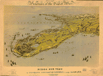 Birds
eye view of Florida and part of Georgia and Alabama Drawn
from nature and lith. by John Bachmann. Bachmann, John.
CREATED/PUBLISHED New York, John Bachmann, c1861. NOTES
Scale not given. At top of map: Panorama of the seat of
war. "Entered according to act of Congress in the year
1861 by John Bachmann." Tables of distances from Key West
and Tallahassee appear in the lower margin. View of Florida
and the environs showing towns, roads, railroads, forts,
and rivers. Birds
eye view of Florida and part of Georgia and Alabama Drawn
from nature and lith. by John Bachmann. Bachmann, John.
CREATED/PUBLISHED New York, John Bachmann, c1861. NOTES
Scale not given. At top of map: Panorama of the seat of
war. "Entered according to act of Congress in the year
1861 by John Bachmann." Tables of distances from Key West
and Tallahassee appear in the lower margin. View of Florida
and the environs showing towns, roads, railroads, forts,
and rivers. |
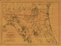 Northern
part of Florida Drawn by H. Lindenkohl. Compiled and published
at the United States Coast Survey Office, A. D. Bache,
Superintendent. 1864. Lindenkohl, Henry. CREATED/PUBLISHED
[S.l.], United States Coast Survey Office, 1864. NOTES
Scale 1:633,600. General map of northern Florida and southern
Georgia extending from Altamaha Sound, Georgia, to 290
North lattitude. Northern
part of Florida Drawn by H. Lindenkohl. Compiled and published
at the United States Coast Survey Office, A. D. Bache,
Superintendent. 1864. Lindenkohl, Henry. CREATED/PUBLISHED
[S.l.], United States Coast Survey Office, 1864. NOTES
Scale 1:633,600. General map of northern Florida and southern
Georgia extending from Altamaha Sound, Georgia, to 290
North lattitude. |
 Drew's
new map of the state of Florida, showing the townships
by the U.S. Surveys, the completed & projected railroads,
the different railroad stations and growing railroad towns.
The new towns on the rivers and interior, and the new
counties, up to the year 1874. Drew, C[olumbus]. CREATED/PUBLISHED
Jacksonville, [1874], c1873. NOTES Scale 1:1,140,480. Drew's
new map of the state of Florida, showing the townships
by the U.S. Surveys, the completed & projected railroads,
the different railroad stations and growing railroad towns.
The new towns on the rivers and interior, and the new
counties, up to the year 1874. Drew, C[olumbus]. CREATED/PUBLISHED
Jacksonville, [1874], c1873. NOTES Scale 1:1,140,480.
|
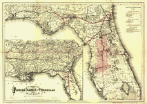 Maps
showing the Florida Transit and Peninsula Rail Road and
its connections. G.W. & C.B. Colton & Co. CREATED/PUBLISHED
New York, 1882. NOTES Scale 1:1,140,000 and 1:3,800,000. Maps
showing the Florida Transit and Peninsula Rail Road and
its connections. G.W. & C.B. Colton & Co. CREATED/PUBLISHED
New York, 1882. NOTES Scale 1:1,140,000 and 1:3,800,000.
|
 A
new sectional map of Florida issued by the land department
of the South Florida R. R. Co. and the Plant Investment
Co. Elliott, D. H. CREATED/PUBLISHED Sanford, Fla., 1888.
NOTES Scale 1:633,600. A
new sectional map of Florida issued by the land department
of the South Florida R. R. Co. and the Plant Investment
Co. Elliott, D. H. CREATED/PUBLISHED Sanford, Fla., 1888.
NOTES Scale 1:633,600. |
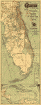
 "Standard
guide" map of the state of Florida. Matthews-Northrup
Company. CREATED/PUBLISHED [S.l.], 1891. "Standard
guide" map of the state of Florida. Matthews-Northrup
Company. CREATED/PUBLISHED [S.l.], 1891. |
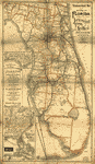
 Map
of the peninsula of Florida and adjacent islands : East
Coast Line, the St. Augustine routes and connections.
Jacksonville, St. Augustine, and Indian River Railway. Map
of the peninsula of Florida and adjacent islands : East
Coast Line, the St. Augustine routes and connections.
Jacksonville, St. Augustine, and Indian River Railway.
|
 The
east coast of Florida is paradise regained. Beckwith,
J. P. CREATED/PUBLISHED [S.l.], 1898. NOTES Florida East
Coast Railway/Steamship line running from Jacksonville
to Key West. The
east coast of Florida is paradise regained. Beckwith,
J. P. CREATED/PUBLISHED [S.l.], 1898. NOTES Florida East
Coast Railway/Steamship line running from Jacksonville
to Key West. |
 The
Rand-McNally indexed county and township pocket map and
shippers guide of Florida showing all railroads, cities,
towns, villages, post offices, lakes, rivers, etc. Rand
McNally and Company. CREATED/PUBLISHED Chicago, 1900.
NOTES Scale 1:1,203,840. The
Rand-McNally indexed county and township pocket map and
shippers guide of Florida showing all railroads, cities,
towns, villages, post offices, lakes, rivers, etc. Rand
McNally and Company. CREATED/PUBLISHED Chicago, 1900.
NOTES Scale 1:1,203,840. |
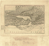
 St.
Mary's River and Fernandina harbor, Florida From a trigonometrical
survey under the direction of A. D. Bache, Superintendent
of the survey of the coast of the United States. Triangulation
by Capt. J. H. Simpson and Lieutenant A. W. Evans, U.S.A.
Assistants. Topography by A. M. Harrison, Assistant. Hydrography
by the party under the command of Lieut. S. D. Trenchard,
U.S.N. Assist. 1857. Resurvey of bar by C. O. Boutelle,
Asst. in 1862. Redd. drng. by P. Witzel. Engd. by A. Maedel
and R. F. Bartle. Bowen & Co. lith., Philada. United States
Coast Survey. CREATED/PUBLISHED [Washington, U.S. Coast
Survey, 1862] NOTES Scale 1:20,000. From its Report of
the Superintendent of the Coast Survey, showing progress
of the survey during the year 1862 (Washington, Government
Printing Office, 1864). Map 31. St.
Mary's River and Fernandina harbor, Florida From a trigonometrical
survey under the direction of A. D. Bache, Superintendent
of the survey of the coast of the United States. Triangulation
by Capt. J. H. Simpson and Lieutenant A. W. Evans, U.S.A.
Assistants. Topography by A. M. Harrison, Assistant. Hydrography
by the party under the command of Lieut. S. D. Trenchard,
U.S.N. Assist. 1857. Resurvey of bar by C. O. Boutelle,
Asst. in 1862. Redd. drng. by P. Witzel. Engd. by A. Maedel
and R. F. Bartle. Bowen & Co. lith., Philada. United States
Coast Survey. CREATED/PUBLISHED [Washington, U.S. Coast
Survey, 1862] NOTES Scale 1:20,000. From its Report of
the Superintendent of the Coast Survey, showing progress
of the survey during the year 1862 (Washington, Government
Printing Office, 1864). Map 31. |
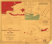 Charts
of Savannah River, Pensacola Bay, and Key West. Showing
the positions of the several fortifications. From the
United States Coast Survey From the United States Coast
Survey. Smith, Jim (Jim C.) CREATED/PUBLISHED New York,
c1861. NOTES Scale not given. [1] Savannah River from
U.S. Coast Survey. Scale ca. 1:63,360. 18 x 26 cm. [2]
[Pensacola Bay] Scale ca. 1:80,000. 18 x 23 cm. [3] Chart
of Key West, Florida. Scale ca. 1:125,000. Charts
of Savannah River, Pensacola Bay, and Key West. Showing
the positions of the several fortifications. From the
United States Coast Survey From the United States Coast
Survey. Smith, Jim (Jim C.) CREATED/PUBLISHED New York,
c1861. NOTES Scale not given. [1] Savannah River from
U.S. Coast Survey. Scale ca. 1:63,360. 18 x 26 cm. [2]
[Pensacola Bay] Scale ca. 1:80,000. 18 x 23 cm. [3] Chart
of Key West, Florida. Scale ca. 1:125,000. |
 Map
of the cost [sic] of Georgia & Florida. CREATED/PUBLISHED
[1863?] NOTES Scale 1:253,440; 1/4 in. to 1 mile. Manuscript;
pen-and-ink and watercolor. Covers the coast between Savannah
and St. Augustine. Shows swamps and marshes. From the
papers of Joseph Roswell Hawley. Map
of the cost [sic] of Georgia & Florida. CREATED/PUBLISHED
[1863?] NOTES Scale 1:253,440; 1/4 in. to 1 mile. Manuscript;
pen-and-ink and watercolor. Covers the coast between Savannah
and St. Augustine. Shows swamps and marshes. From the
papers of Joseph Roswell Hawley. |
 Carte
générale du territoire d'Orléans comprenant aussi la Floride
Occidentale et une portion du territoire du Mississipi
/ dresée d'aprčs les observations les plus récentes par
Bmi. Lafon, ingénieur géographe ŕ la N[ouve]lle. Orléans.
Lafon, Barthélémy, 1769-1820. CREATED/PUBLISHED Paris
: Ch. Picquet, 1806. NOTES Relief shown by form lines.
Depths shown by contours and soundings. Carte
générale du territoire d'Orléans comprenant aussi la Floride
Occidentale et une portion du territoire du Mississipi
/ dresée d'aprčs les observations les plus récentes par
Bmi. Lafon, ingénieur géographe ŕ la N[ouve]lle. Orléans.
Lafon, Barthélémy, 1769-1820. CREATED/PUBLISHED Paris
: Ch. Picquet, 1806. NOTES Relief shown by form lines.
Depths shown by contours and soundings. |
This
is a must have collection for any map history buff!
To use
this software, you must install the free ExpressView MrSid
software which is included on the CD. This is a 30 second
process and will allow you to view and manipulate/print
all the maps in this CD collection in full detail. There
is a version for both Windows platforms and Macintosh platforms
and full installation instructions are included on the CD.
|


