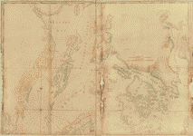
This
CD contains 71 rare antique nautical maps in MrSid format.
This
format allows you to see the entire map on your computer screen
or drill down to see the smallest details. The original maps are
often quite large, as much as 36" long or larger and quite
detailed. With the MrSID software, you can manipulate the map to
print the entire map in great detail or zoom into a portion of the
map in full detail for viewing or printing. You could even bring
the images to a local print shop to have the maps reprinted in their
full size. (MrSID software is included on the CD.)
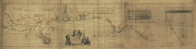
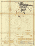
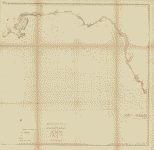
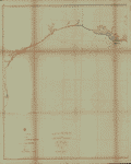
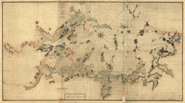
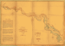
To
give you a sample of the detail you can expect in these maps, here
is an example based on a panoramic map of Washington, DC.
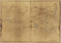
The
table below shows the description and a small image of each
map on this incredible natutical history map collection CD.
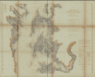
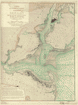
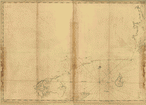
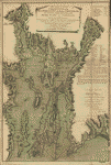
M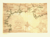 ap
of the northeast coast of North America, 1607, drawn by
Samuel de Champlain Champlain, Samuel de, 1567-1635. NOTES
Covers the coast of North America from western Nova Scotia
to Cape Cod. Pictorial map. Original title: Descripsion
des costs, pts., rades, illes de la Nouuele France faict
selon son vray méridien : avec la déclinaison de la ment
de plussieurs endrois selon que le sieur de Castes le
franc le démontre en son liure de la mécométrie de l'emnt.
/ faict et observé par le sr. de Champlain 1607. ap
of the northeast coast of North America, 1607, drawn by
Samuel de Champlain Champlain, Samuel de, 1567-1635. NOTES
Covers the coast of North America from western Nova Scotia
to Cape Cod. Pictorial map. Original title: Descripsion
des costs, pts., rades, illes de la Nouuele France faict
selon son vray méridien : avec la déclinaison de la ment
de plussieurs endrois selon que le sieur de Castes le
franc le démontre en son liure de la mécométrie de l'emnt.
/ faict et observé par le sr. de Champlain 1607. |
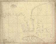
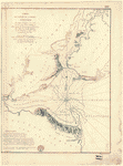
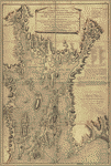
A new and correct chart of North America from Cape-Cod,
to the Havannah; drawn from the latest marine journals
& surveys, regulated and ascertained by astronomical
observations. Moore, John Hamilton, d. 1807. CREATED/PUBLISHED
London; Printed for and sold by J. H. Moore and G. Robinson,
bookseller, 1784. NOTES Scale ca. 1:1,250,000. Depths
shown by soundings.
new and correct chart of North America from Cape-Cod,
to the Havannah; drawn from the latest marine journals
& surveys, regulated and ascertained by astronomical
observations. Moore, John Hamilton, d. 1807. CREATED/PUBLISHED
London; Printed for and sold by J. H. Moore and G. Robinson,
bookseller, 1784. NOTES Scale ca. 1:1,250,000. Depths
shown by soundings. |
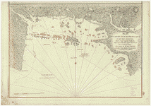
 Descripcion
de la costa de Tierra Firme desde el Rio de la Empalizada
hasta Cavo de Clara. Por las latitudes y longitudes de
Dn. Bartolome de Rosa. Echo por Balentin Cierto primer
Piloto de la Real Armada, ańo de 1757. Cierto, Balentin.
CREATED/PUBLISHED [1757] NOTES Scale ca. 1:3,300,000.
Title on verso: Florida & Cuba, 140. Manuscript, pen-and-ink,
on tracing paper. Soundings shown in fathoms. Prime meridian:
Ferro. Shows Cuba, Bahama Islands, northern Yucatan Peninsula,
and the coast of the United States from "Cape Clara" to
the mouth of the Mississippi River. Descripcion
de la costa de Tierra Firme desde el Rio de la Empalizada
hasta Cavo de Clara. Por las latitudes y longitudes de
Dn. Bartolome de Rosa. Echo por Balentin Cierto primer
Piloto de la Real Armada, ańo de 1757. Cierto, Balentin.
CREATED/PUBLISHED [1757] NOTES Scale ca. 1:3,300,000.
Title on verso: Florida & Cuba, 140. Manuscript, pen-and-ink,
on tracing paper. Soundings shown in fathoms. Prime meridian:
Ferro. Shows Cuba, Bahama Islands, northern Yucatan Peninsula,
and the coast of the United States from "Cape Clara" to
the mouth of the Mississippi River. |
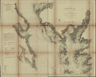
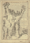
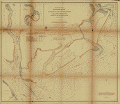
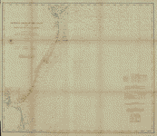 General
chart of the coast. No. IV, from Cape May to Cape Henry.
From a trigonometrical survey under the direction of F.
R. Hassler and A. D. Bache, Superintendents of the survey
of the coast of the United States. United States Coast
Survey. CREATED/PUBLISHED [Washington U.S. Coast Survey]
1862. NOTES Scale 1:400,000. General
chart of the coast. No. IV, from Cape May to Cape Henry.
From a trigonometrical survey under the direction of F.
R. Hassler and A. D. Bache, Superintendents of the survey
of the coast of the United States. United States Coast
Survey. CREATED/PUBLISHED [Washington U.S. Coast Survey]
1862. NOTES Scale 1:400,000. |
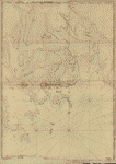
P ortolan
chart of the Mediterranean Sea ca. 1320-1350. CREATED/PUBLISHED
[13--?] NOTES Anonymous nautical chart in portolan style
probably drawn in Genoa. Covers Mediterranean Sea from
the Balearic Islands to the Levantine coast; also covers
western part of Black Sea. ortolan
chart of the Mediterranean Sea ca. 1320-1350. CREATED/PUBLISHED
[13--?] NOTES Anonymous nautical chart in portolan style
probably drawn in Genoa. Covers Mediterranean Sea from
the Balearic Islands to the Levantine coast; also covers
western part of Black Sea. |
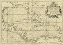 Mapa
maritimo del Golfo de Mexico e islas de la America, para
el uso de los navegantes en esta parte del mundo, construido
sobre las mexores memorias, y observaciones astronomicas
de longitudes, y latitudes. Dedicado a la Catholica Magestad
de Don Fernando VI Rey de Espańa, y de las Yndias, por
sus mas rendidos, y fieles vasallos, Thomas Lopez, y Juan
de la Cruz. López de Vargas Machuca, Tomás, 1731-1802.
CREATED/PUBLISHED [Madrid] 1755. NOTES Scale ca. 1:5,500,000.
Depths shown by soundings. Mapa
maritimo del Golfo de Mexico e islas de la America, para
el uso de los navegantes en esta parte del mundo, construido
sobre las mexores memorias, y observaciones astronomicas
de longitudes, y latitudes. Dedicado a la Catholica Magestad
de Don Fernando VI Rey de Espańa, y de las Yndias, por
sus mas rendidos, y fieles vasallos, Thomas Lopez, y Juan
de la Cruz. López de Vargas Machuca, Tomás, 1731-1802.
CREATED/PUBLISHED [Madrid] 1755. NOTES Scale ca. 1:5,500,000.
Depths shown by soundings. |
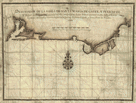
 Descripcion
de las costas, islas placeres, i bajos delas, Indias Occidentales,
corregida i calculada al meridiano dela isla de Theneriphe
enlas Canarias por Pedro Alcantara Espinosa, Campeche
i Abril 10 de 1765. Espinosa, Pedro Alcantara. CREATED/PUBLISHED
[1765] NOTES Scale ca. 1:5,000,000. Manuscript, pen-and-ink
and watercolor, on vellum. Shows the Atlantic coast of
southern U.S., Mexico, Central America, and northern South
America. Descripcion
de las costas, islas placeres, i bajos delas, Indias Occidentales,
corregida i calculada al meridiano dela isla de Theneriphe
enlas Canarias por Pedro Alcantara Espinosa, Campeche
i Abril 10 de 1765. Espinosa, Pedro Alcantara. CREATED/PUBLISHED
[1765] NOTES Scale ca. 1:5,000,000. Manuscript, pen-and-ink
and watercolor, on vellum. Shows the Atlantic coast of
southern U.S., Mexico, Central America, and northern South
America. |
M apa
y plano del Seno Mexicano. Contodas las costas, de tierra
firme e yslas de barlovento consus adyacentes, recopiladas,
sus-latitudes y longitudes en el puerto de la Havana con
junta de primeros y segdos. pilotos de la esquadra y segun
el neuvo padron; por Dn. Josef de Sn. Martin Suares, theniente
de navio de la Real Armada, Ayudante y primer piloto mayor
de Derrotas, celebrada por disposicion del, Exmo Sor.
Dn. Josef Solano y Bote, caballero ... Delineado, en Cadiz
por Dn. Josef Dias Portaly. Ańo de 1787. San Martín Suárez,
José de. CREATED/PUBLISHED [n.p., 1787] NOTES Scale ca.
1:3,250,000. Depths shown by soundings. Shows coasts of
southern United States, eastern Mexico, eastern Central
America, northern South America, and West Indies. Includes
tables of "Nombres de los cayos del canal viejo" and "Nombres
de los cayos del nte. de la Havana." apa
y plano del Seno Mexicano. Contodas las costas, de tierra
firme e yslas de barlovento consus adyacentes, recopiladas,
sus-latitudes y longitudes en el puerto de la Havana con
junta de primeros y segdos. pilotos de la esquadra y segun
el neuvo padron; por Dn. Josef de Sn. Martin Suares, theniente
de navio de la Real Armada, Ayudante y primer piloto mayor
de Derrotas, celebrada por disposicion del, Exmo Sor.
Dn. Josef Solano y Bote, caballero ... Delineado, en Cadiz
por Dn. Josef Dias Portaly. Ańo de 1787. San Martín Suárez,
José de. CREATED/PUBLISHED [n.p., 1787] NOTES Scale ca.
1:3,250,000. Depths shown by soundings. Shows coasts of
southern United States, eastern Mexico, eastern Central
America, northern South America, and West Indies. Includes
tables of "Nombres de los cayos del canal viejo" and "Nombres
de los cayos del nte. de la Havana." |
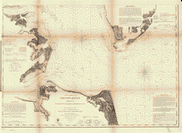
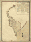
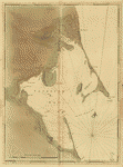
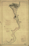
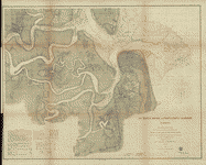
 Chesapeake
Bay from its head to Potamac River From a trigonometrical
survey under the direction of F. R. Hassler and A. D.
Bache, Superintendents of the survey of the coast of the
United States. United States Coast Survey. CREATED/PUBLISHED
[Washington U.S. Coast Survey] 1861-1862. NOTES Scale
1:80,000. From its Report of the Superintendent of the
Coast Survey, showing the progress of the survey during
the year 1864 (Washington, Government Printing Office,
1866). Chesapeake
Bay from its head to Potamac River From a trigonometrical
survey under the direction of F. R. Hassler and A. D.
Bache, Superintendents of the survey of the coast of the
United States. United States Coast Survey. CREATED/PUBLISHED
[Washington U.S. Coast Survey] 1861-1862. NOTES Scale
1:80,000. From its Report of the Superintendent of the
Coast Survey, showing the progress of the survey during
the year 1864 (Washington, Government Printing Office,
1866).
 |
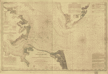
 Chesapeak
Bay. Sheet 6, from the mouth of York River to the entrance
to bay. From a trigonometrical survey under the direction
of A. D. Bache, Superintendent of the survey of the coast
of the United States. Triangulation by E. Blunt &
J. Farley, Assistants. Topography by J. J. S. Hassler,
G. D. Wise, J. Seib, Assts. & J. Mechan, Sub-Asst.
Hydrography by the party under the command of Lieut. Comdg.
J. J. Almy, U.S.N. Assistant. United States Coast Survey.
CREATED/PUBLISHED [Washington U.S U.S. Coast Survey] 1863.
NOTES Scale 1:80,000. From its Report of the Superintendent
of the Coast Survey showing the progress of the survey
during the year 1862 (Washington, Government Printing
Office, 1864). Chesapeak
Bay. Sheet 6, from the mouth of York River to the entrance
to bay. From a trigonometrical survey under the direction
of A. D. Bache, Superintendent of the survey of the coast
of the United States. Triangulation by E. Blunt &
J. Farley, Assistants. Topography by J. J. S. Hassler,
G. D. Wise, J. Seib, Assts. & J. Mechan, Sub-Asst.
Hydrography by the party under the command of Lieut. Comdg.
J. J. Almy, U.S.N. Assistant. United States Coast Survey.
CREATED/PUBLISHED [Washington U.S U.S. Coast Survey] 1863.
NOTES Scale 1:80,000. From its Report of the Superintendent
of the Coast Survey showing the progress of the survey
during the year 1862 (Washington, Government Printing
Office, 1864). |
 Chesapeake
Bay, Sheet no. 1, York River, Hampton Roads, Chesapeake
entrance.. From a trigonometrical survey under the direction
of A. D. Bache, Superintendent of the survey of the coast
of the United States. Triangulation by E. Blunt &
J. Farley, Assistants. Topography by J. J. S. Hassler,
G. D. Wise, J. Seib, Assts. & J. Mechan, Sub-Asst.
Hydrography by the party under the command of Lieut. Comdg.
J. J. Almy, U.S.N. Assistant. Redd. drng. by W. M. C.
Fairfax, A. Strausz & L. D. Williams. Engd. by J.
Knight, A. Sengteller, H. S. Barnard & J. C. United
States Coast Survey. CREATED/PUBLISHED [Washington U.S.
Coast Survey] 1863. NOTES Scale 1:80,000. Kondrup. Chesapeake
Bay, Sheet no. 1, York River, Hampton Roads, Chesapeake
entrance.. From a trigonometrical survey under the direction
of A. D. Bache, Superintendent of the survey of the coast
of the United States. Triangulation by E. Blunt &
J. Farley, Assistants. Topography by J. J. S. Hassler,
G. D. Wise, J. Seib, Assts. & J. Mechan, Sub-Asst.
Hydrography by the party under the command of Lieut. Comdg.
J. J. Almy, U.S.N. Assistant. Redd. drng. by W. M. C.
Fairfax, A. Strausz & L. D. Williams. Engd. by J.
Knight, A. Sengteller, H. S. Barnard & J. C. United
States Coast Survey. CREATED/PUBLISHED [Washington U.S.
Coast Survey] 1863. NOTES Scale 1:80,000. Kondrup. |
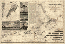 Die
Chinesische Küste : der Provinz Kuang-tung, zu beiden
Seiten des Meridians von Macao. Berghaus, Heinrich Karl
Wilhelm, 1797-1884. OTHER TITLES Provinz Kuang-tung, zu
beiden Seiten des Meridians von Macao CREATED/PUBLISHED
Gotha : Justus Perthes, 1834. NOTES Depth shown by soundings
and hachures. Die
Chinesische Küste : der Provinz Kuang-tung, zu beiden
Seiten des Meridians von Macao. Berghaus, Heinrich Karl
Wilhelm, 1797-1884. OTHER TITLES Provinz Kuang-tung, zu
beiden Seiten des Meridians von Macao CREATED/PUBLISHED
Gotha : Justus Perthes, 1834. NOTES Depth shown by soundings
and hachures. |
 A
Sketch of the harbour of St. Iago de Cuba. CREATED/PUBLISHED
[1765?] NOTES Scale ca. 1:15,500. Soundings shown in fathoms. A
Sketch of the harbour of St. Iago de Cuba. CREATED/PUBLISHED
[1765?] NOTES Scale ca. 1:15,500. Soundings shown in fathoms.
|
 Plano
de la Bahia de la Ware y entrada de Filadelfie. Campo,
Josef del. CREATED/PUBLISHED [178-?] NOTES Scale ca. 1:200,000.
Soundings shown in fathoms. Plano
de la Bahia de la Ware y entrada de Filadelfie. Campo,
Josef del. CREATED/PUBLISHED [178-?] NOTES Scale ca. 1:200,000.
Soundings shown in fathoms. |
 Descripcion
de la Bahia de Santa Maria de Galve, y Puerto de Sn. Miguel
de Panzacola con toda la costa contigua y las demas bahias
que tiene en ella, hasta el Rio de Apalache / observada,
y reconozida por los ingenieros Dn. Jaime Lajonk, y Don
Juan de Siscara. Lajonk, Jaime. CREATED/PUBLISHED 1700.
NOTES Covers coast of western Florida Panhandle from Pensacola
to Apalachicola. Depths shown by soundings. Descripcion
de la Bahia de Santa Maria de Galve, y Puerto de Sn. Miguel
de Panzacola con toda la costa contigua y las demas bahias
que tiene en ella, hasta el Rio de Apalache / observada,
y reconozida por los ingenieros Dn. Jaime Lajonk, y Don
Juan de Siscara. Lajonk, Jaime. CREATED/PUBLISHED 1700.
NOTES Covers coast of western Florida Panhandle from Pensacola
to Apalachicola. Depths shown by soundings. |
 A
description of the sea coasts ... in the East Indies /
by William Hacke. Hacke, William. OTHER TITLES Hack's
descript of ye East Indies Title also known as: Buccaneer
atlas CREATED/PUBLISHED [1690?] NOTES Covers the coasts
of eastern Africa, India, and the East Indies. Relief
shown pictorially. Each drawing bears a brief description
with soundings, distances and facts regarding anchorages
and navigation of rivers which might be of value in pirating
activities. This atlas is known as the "Buccaneer atlas"
because it results from the experience of Hacke in association
with Captain Bartholomew Sharpe, the notorious Buccaneer
on various expeditions to the South Sea. A
description of the sea coasts ... in the East Indies /
by William Hacke. Hacke, William. OTHER TITLES Hack's
descript of ye East Indies Title also known as: Buccaneer
atlas CREATED/PUBLISHED [1690?] NOTES Covers the coasts
of eastern Africa, India, and the East Indies. Relief
shown pictorially. Each drawing bears a brief description
with soundings, distances and facts regarding anchorages
and navigation of rivers which might be of value in pirating
activities. This atlas is known as the "Buccaneer atlas"
because it results from the experience of Hacke in association
with Captain Bartholomew Sharpe, the notorious Buccaneer
on various expeditions to the South Sea. |
 L'hydrographie
françoise : recueil des cartes générales et particuličres
qui ont éte faites pour le service des vaisseaux du roy,
par ordre des Ministres de la marine, depuis 1737, jusqu'en.
Bellin, Jacques Nicolas, 1703-1772. CREATED/PUBLISHED
Paris, [1737-72] 1765. L'hydrographie
françoise : recueil des cartes générales et particuličres
qui ont éte faites pour le service des vaisseaux du roy,
par ordre des Ministres de la marine, depuis 1737, jusqu'en.
Bellin, Jacques Nicolas, 1703-1772. CREATED/PUBLISHED
Paris, [1737-72] 1765. |
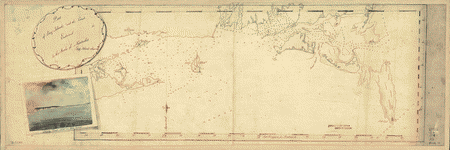
A map with part of the Florida coast from Cape Blaise to
Apalachie; with the boundaries betwixt East & West
Floridas, 160 yards across the river call'd Apalachicola.
Robt. Slowley of Hs. Ms. sloop Druid, fecit September
the 4th, 1769. Slowley, Robert. CREATED/PUBLISHED [1769]
NOTES Scale ca. 1:205,000. Depths shown by soundings.
map with part of the Florida coast from Cape Blaise to
Apalachie; with the boundaries betwixt East & West
Floridas, 160 yards across the river call'd Apalachicola.
Robt. Slowley of Hs. Ms. sloop Druid, fecit September
the 4th, 1769. Slowley, Robert. CREATED/PUBLISHED [1769]
NOTES Scale ca. 1:205,000. Depths shown by soundings.
|
 Maps
of East and West Florida. B. Romans, inv. delin. &
in Ćre incidit. Romans, Bernard, ca. 1720-ca. 1784. CREATED/PUBLISHED
[New York, 1781] NOTES Scale ca. 1:500,000. Cover title.
Alternate title from Peter Force's catalog of printed
maps: Florida and its vicinity. Relief shown by hachures.
Depths shown by soundings. Maps
of East and West Florida. B. Romans, inv. delin. &
in Ćre incidit. Romans, Bernard, ca. 1720-ca. 1784. CREATED/PUBLISHED
[New York, 1781] NOTES Scale ca. 1:500,000. Cover title.
Alternate title from Peter Force's catalog of printed
maps: Florida and its vicinity. Relief shown by hachures.
Depths shown by soundings.
 |
 Coast
of Maine from Frenchman Bay to Mosquito Harbor.Des Barres,
Joseph F. W. (Joseph Frederick Wallet), 1722-1824. CREATED/PUBLISHED
London] 1776. NOTES Scale ca. 1:130,000. Hand colored.
Relief shown by hachures. Coast
of Maine from Frenchman Bay to Mosquito Harbor.Des Barres,
Joseph F. W. (Joseph Frederick Wallet), 1722-1824. CREATED/PUBLISHED
London] 1776. NOTES Scale ca. 1:130,000. Hand colored.
Relief shown by hachures. |
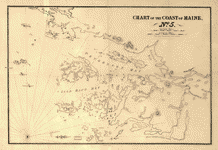
C oast
of Maine from Salter Island to Portland Head.Des Barres,
Joseph F. W. (Joseph Frederick Wallet), 1722-1824. CREATED/PUBLISHED
London] I. F. W. Des Barres, 1776. NOTES Scale ca. 1:48,000.
Relief shown by hachures and shading. Soundings shown
in feet. oast
of Maine from Salter Island to Portland Head.Des Barres,
Joseph F. W. (Joseph Frederick Wallet), 1722-1824. CREATED/PUBLISHED
London] I. F. W. Des Barres, 1776. NOTES Scale ca. 1:48,000.
Relief shown by hachures and shading. Soundings shown
in feet. |
 Coast
of New England from Cape Elizabeth, Me. to Newburyport,
Mass. Des Barres, Joseph F. W. (Joseph Frederick Wallet),
1722-1824. CREATED/PUBLISHED London] 1776. NOTES Scale
ca. 1:130,000. Relief shown by hachures. Coast
of New England from Cape Elizabeth, Me. to Newburyport,
Mass. Des Barres, Joseph F. W. (Joseph Frederick Wallet),
1722-1824. CREATED/PUBLISHED London] 1776. NOTES Scale
ca. 1:130,000. Relief shown by hachures. |
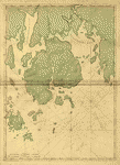
 Coast
of Maine showing Blue Hill Bay, Penobscot Bay, Belfast
Bay, Islesboro Island, Deer Island, and other islands.
[Des Barres, Joseph F. W. (Joseph Frederick Wallet)] 1722-1824.
CREATED/PUBLISHED London, 1776?] NOTES Scale ca. 1:48,500.
Relief shown by hachures. Depths shown by soundings. Coast
of Maine showing Blue Hill Bay, Penobscot Bay, Belfast
Bay, Islesboro Island, Deer Island, and other islands.
[Des Barres, Joseph F. W. (Joseph Frederick Wallet)] 1722-1824.
CREATED/PUBLISHED London, 1776?] NOTES Scale ca. 1:48,500.
Relief shown by hachures. Depths shown by soundings. |
 Coast
of Maine showing entrances of Blue Hill Bay, Isle of Haut
Bay, and Penobscot Bay, with Owls Head, Vinalhaven Island,
Isle au Haut, and other islands. [Des Barres, Joseph F.
W. (Joseph Frederick Wallet)] 1722-1824. CREATED/PUBLISHED
London, 1776?] NOTES Scale ca. 1:48,500. Relief shown
by hachures. Depths shown by soundings. Coast
of Maine showing entrances of Blue Hill Bay, Isle of Haut
Bay, and Penobscot Bay, with Owls Head, Vinalhaven Island,
Isle au Haut, and other islands. [Des Barres, Joseph F.
W. (Joseph Frederick Wallet)] 1722-1824. CREATED/PUBLISHED
London, 1776?] NOTES Scale ca. 1:48,500. Relief shown
by hachures. Depths shown by soundings. |
 Coast
of New England from Chatham Harbor to Narragansett Bay.
Des Barres, Joseph F. W. (Joseph Frederick Wallet), 1722-1824.
CREATED/PUBLISHED London] 1779. NOTES Scale ca. 1:130,000.
Depths shown by soundings. Coast
of New England from Chatham Harbor to Narragansett Bay.
Des Barres, Joseph F. W. (Joseph Frederick Wallet), 1722-1824.
CREATED/PUBLISHED London] 1779. NOTES Scale ca. 1:130,000.
Depths shown by soundings. |
 Cedar
Keys, Florida From a trigonometrical survey under the
direction of A. D. Bache, Superintendent of the survey
of the coast of the United States. Triangulation by F.
H. Gerdes, Asst. and B. Huger Jr., Sub-Assist. Topography
by F. H. Gerdes, Asst. Hydrography by the parties under
the command of Lieuts. Comdg. O. H. Berryman & J.
J. Guthrie, U.S.N. Assts. Redd. drng by A. Schoepf and
A. Strauss [sic]. engd. by W. Langran and F. Bartle. Lith.
of C. Knickerbocker, Albany, N.Y. Cedar
Keys, Florida From a trigonometrical survey under the
direction of A. D. Bache, Superintendent of the survey
of the coast of the United States. Triangulation by F.
H. Gerdes, Asst. and B. Huger Jr., Sub-Assist. Topography
by F. H. Gerdes, Asst. Hydrography by the parties under
the command of Lieuts. Comdg. O. H. Berryman & J.
J. Guthrie, U.S.N. Assts. Redd. drng by A. Schoepf and
A. Strauss [sic]. engd. by W. Langran and F. Bartle. Lith.
of C. Knickerbocker, Albany, N.Y. |
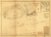
 Preliminary
chart of Escambia and Santa Maria de Galvaez [i.e., East]
Bays, Florida From a trigonometrical survey under the
direction of A. D. Bache, Superintendent of the survey
of the coast of the United States. Triangulation and topography
by F. H. Gerdes, Asst. Hydrography by the party under
the command of Lieut. Comdg. T. S. Phelps. U.S.N. Assist.
United States Coast Survey. CREATED/PUBLISHED [Washington,
U.S. Coast Survey], 1861. NOTES Scale 1:30,000. United
States Coast Survey, no. 489. General chart showing soundings
and coast vegetation. Chart is based on "long[itude] east
from Public Square, Pensacola." Preliminary
chart of Escambia and Santa Maria de Galvaez [i.e., East]
Bays, Florida From a trigonometrical survey under the
direction of A. D. Bache, Superintendent of the survey
of the coast of the United States. Triangulation and topography
by F. H. Gerdes, Asst. Hydrography by the party under
the command of Lieut. Comdg. T. S. Phelps. U.S.N. Assist.
United States Coast Survey. CREATED/PUBLISHED [Washington,
U.S. Coast Survey], 1861. NOTES Scale 1:30,000. United
States Coast Survey, no. 489. General chart showing soundings
and coast vegetation. Chart is based on "long[itude] east
from Public Square, Pensacola." |
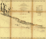
 Preliminary
edition of general chart of the coast no. X, Sraits of
Florida from Key Biscayne to Marquesas Keys From a trigonometrical
survey under the direction of A. D. Bache, Superintendent
of the survey of the coast of the United States. United
States Coast Survey. CREATED/PUBLISHED [Washington, U.S.
Coast Survey, 1862] NOTES Scale 1:400,000. Preliminary
edition of general chart of the coast no. X, Sraits of
Florida from Key Biscayne to Marquesas Keys From a trigonometrical
survey under the direction of A. D. Bache, Superintendent
of the survey of the coast of the United States. United
States Coast Survey. CREATED/PUBLISHED [Washington, U.S.
Coast Survey, 1862] NOTES Scale 1:400,000. |
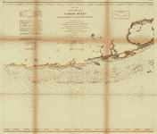
Preliminary coast chart ... Florida Reefs [on four sheets]
From a trigonometrical survey under the direction of A.
D. Bache, Superintendent of the survey of the coast of
the United States. United States Coast Survey. CREATED/PUBLISHED
[Washington, U.S. Coast Survey, 1864] NOTES Scale 1:80,000.
 |
 Key
West harbor and its approaches. From a trigonometrical
survey under the direction of A. D. Bache, Superintendent
of the survey of the coast of the United States. Triangulation
by J. E. Hilgard, Assistant. Topography by L. H. Adams,
Sub-Asst. Hydrography by the party under the command of
Lieut. John Rodgers, U.S. Navy Assistant. Redd. drng.
by E. K. Knorr. Engd. by E. Yeager, E. F. Woodward, and
H. M. Knight. Published 1855. United States Coast Survey.
CREATED/PUBLISHED [Washington, U.S. Coast Survey], 1864.
NOTES Scale 1:50,000. Key
West harbor and its approaches. From a trigonometrical
survey under the direction of A. D. Bache, Superintendent
of the survey of the coast of the United States. Triangulation
by J. E. Hilgard, Assistant. Topography by L. H. Adams,
Sub-Asst. Hydrography by the party under the command of
Lieut. John Rodgers, U.S. Navy Assistant. Redd. drng.
by E. K. Knorr. Engd. by E. Yeager, E. F. Woodward, and
H. M. Knight. Published 1855. United States Coast Survey.
CREATED/PUBLISHED [Washington, U.S. Coast Survey], 1864.
NOTES Scale 1:50,000. |
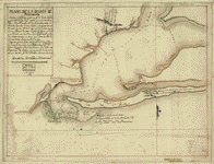 Plano
de la bahia de Pansacola. Copiado pr. el pilotin del No.
Dn. Josef Magule bajo la correccion del Alférez de frag[a]ta
Dn. Pedro Rivelles, mro. delineador por S. M. del Departam[en]to
de Cadiz su original levantado el ańo de 82, por Dn. Antonio
Donato Paredes. Paredes, Antonio Donato. CREATED/PUBLISHED
[1782] NOTES Scale ca. 1:60,000. Watermark: Zoonen. Relief
shown pictorially. Depths shown by soundings. Plano
de la bahia de Pansacola. Copiado pr. el pilotin del No.
Dn. Josef Magule bajo la correccion del Alférez de frag[a]ta
Dn. Pedro Rivelles, mro. delineador por S. M. del Departam[en]to
de Cadiz su original levantado el ańo de 82, por Dn. Antonio
Donato Paredes. Paredes, Antonio Donato. CREATED/PUBLISHED
[1782] NOTES Scale ca. 1:60,000. Watermark: Zoonen. Relief
shown pictorially. Depths shown by soundings. |
  Gulf
coast of the United States, Key West to Rio Grande.United
States Coast Survey. CREATED/PUBLISHED [Washington, U.S.
Coast Survey], 1863. NOTES Scale 1:1,200,000. Eastern
part [Key West to the Mississipi River.]--Western Part
[Mississippi River to Rio Grande] Gulf
coast of the United States, Key West to Rio Grande.United
States Coast Survey. CREATED/PUBLISHED [Washington, U.S.
Coast Survey], 1863. NOTES Scale 1:1,200,000. Eastern
part [Key West to the Mississipi River.]--Western Part
[Mississippi River to Rio Grande] |
 Draught
of the Bay of Honduras and the Musqueto Shoar. By George
Robertson, Master of His Majesty's ship The Prince Edward.
Robertson, George, master of H. M. S. Dolphin. CREATED/PUBLISHED
[1764] NOTES Scale ca. 1:430,000. Oriented with north
to the left. Relief shown pictorially. Depths shown by
soundings. Draught
of the Bay of Honduras and the Musqueto Shoar. By George
Robertson, Master of His Majesty's ship The Prince Edward.
Robertson, George, master of H. M. S. Dolphin. CREATED/PUBLISHED
[1764] NOTES Scale ca. 1:430,000. Oriented with north
to the left. Relief shown pictorially. Depths shown by
soundings. |
 A
draught of the Bay of Honduras and part of the Musquetto
Shore. Corected, the variation to be allowed at Ballieze
River, 7d. 0 e[as]terly at Bonacre 6..30 e[as]terly by
George Robertson. Robertson, George, master of H. M. S.
Dolphin. CREATED/PUBLISHED [1764?] NOTES Scale ca. 1:435,000. A
draught of the Bay of Honduras and part of the Musquetto
Shore. Corected, the variation to be allowed at Ballieze
River, 7d. 0 e[as]terly at Bonacre 6..30 e[as]terly by
George Robertson. Robertson, George, master of H. M. S.
Dolphin. CREATED/PUBLISHED [1764?] NOTES Scale ca. 1:435,000.
|
 Carte
de l'entrée de la rivičre d'Hudson, dépuis Sandy-Hook
jusques ŕ New-York avec les bancs, sondes, marques de
navigation &c. Rédigée d'aprčs un plan anglois au
Dépôt général de la marine par ordre de M. de Sartine,
conseiller d'Etat, Ministre et Secretaire d'Etat, au Département
de la marine. France. Dépôt des cartes et plans de la
marine. CREATED/PUBLISHED [Paris?] Dépôt de la marine,
1778. NOTES Scale ca. 1:70,000. Hand colored. Depths shown
by soundings. Relief shown by land form drawings. Carte
de l'entrée de la rivičre d'Hudson, dépuis Sandy-Hook
jusques ŕ New-York avec les bancs, sondes, marques de
navigation &c. Rédigée d'aprčs un plan anglois au
Dépôt général de la marine par ordre de M. de Sartine,
conseiller d'Etat, Ministre et Secretaire d'Etat, au Département
de la marine. France. Dépôt des cartes et plans de la
marine. CREATED/PUBLISHED [Paris?] Dépôt de la marine,
1778. NOTES Scale ca. 1:70,000. Hand colored. Depths shown
by soundings. Relief shown by land form drawings. |
 Carte
de l'entrée de la rivičre d'Hudson, dépuis Sandy-Hook
jusques ŕ New-York avec les bancs, sondes, marques de
navigation &c. Rédigée d'aprčs un plan anglois au
Dépôt général de la marine, par ordre de M. de Sartine,
conseiller d'Etat, ministre et secrétaire d'Etat, au Département
de la marine. France. Dépôt des cartes et plans de la
marine. CREATED/PUBLISHED [Paris?] Dépôt de la marine,
1778. NOTES Scale ca. 1:70,000. Depths shown by soundings.
Relief shown by land form drawings. Carte
de l'entrée de la rivičre d'Hudson, dépuis Sandy-Hook
jusques ŕ New-York avec les bancs, sondes, marques de
navigation &c. Rédigée d'aprčs un plan anglois au
Dépôt général de la marine, par ordre de M. de Sartine,
conseiller d'Etat, ministre et secrétaire d'Etat, au Département
de la marine. France. Dépôt des cartes et plans de la
marine. CREATED/PUBLISHED [Paris?] Dépôt de la marine,
1778. NOTES Scale ca. 1:70,000. Depths shown by soundings.
Relief shown by land form drawings. |
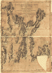
 Mount
Desert Island and neighboring coast of Maine. [Des Barres,
Joseph F. W. (Joseph Frederick Wallet)] 1722-1824. CREATED/PUBLISHED
London, 1776?] NOTES Scale ca. 1:49,000. Relief shown
by hachures. Depths shown by soundings. Mount
Desert Island and neighboring coast of Maine. [Des Barres,
Joseph F. W. (Joseph Frederick Wallet)] 1722-1824. CREATED/PUBLISHED
London, 1776?] NOTES Scale ca. 1:49,000. Relief shown
by hachures. Depths shown by soundings. |
 Plan
de la baie et du havre de Casco et des îles adjacentes,
par Cyprian Southack. Rédigé, d'aprčs un plan anglois,
au Dépôt général des cartes, plans et journaux de la marine.
Par ordre de M. de Sartine, conseiller d'Etat, ministre
et secretaire d'Etat au Département de la marine. Southack,
Cyprian, 1662-1745. CREATED/PUBLISHED [Paris] 1779. NOTES
Scale ca. 1:85,000. Depths shown by soundings. Plan
de la baie et du havre de Casco et des îles adjacentes,
par Cyprian Southack. Rédigé, d'aprčs un plan anglois,
au Dépôt général des cartes, plans et journaux de la marine.
Par ordre de M. de Sartine, conseiller d'Etat, ministre
et secretaire d'Etat au Département de la marine. Southack,
Cyprian, 1662-1745. CREATED/PUBLISHED [Paris] 1779. NOTES
Scale ca. 1:85,000. Depths shown by soundings. |
 Mount
Desert Island and neighboring coast of Maine. [Des Barres,
Joseph F. W. (Joseph Frederick Wallet)] 1722-1824. CREATED/PUBLISHED
London, 1776?] NOTES Scale ca. 1:49,000. Relief shown
by hachures. Depths shown by soundings. Mount
Desert Island and neighboring coast of Maine. [Des Barres,
Joseph F. W. (Joseph Frederick Wallet)] 1722-1824. CREATED/PUBLISHED
London, 1776?] NOTES Scale ca. 1:49,000. Relief shown
by hachures. Depths shown by soundings. |
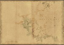
Chart of the coast of Maine / Moody del. on stone. Porter,
Seward, 1784-1838. CREATED/PUBLISHED [Bath, Me.?] : Seward
Porter, [1837], (Boston : T. Moore's Lithography) NOTES
Relief shown by hachures on some sheets. Depths shown
by soundings. 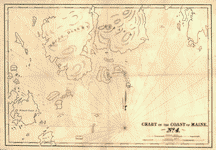
|
 A
chart of Boston Bay and vicinity. Des Barres, Joseph F.
W. (Joseph Frederick Wallet), 1722-1824. CREATED/PUBLISHED
London, 1776?] NOTES Scale ca. 1:50,000. Relief shown
by hachures. Depths shown by soundings. A
chart of Boston Bay and vicinity. Des Barres, Joseph F.
W. (Joseph Frederick Wallet), 1722-1824. CREATED/PUBLISHED
London, 1776?] NOTES Scale ca. 1:50,000. Relief shown
by hachures. Depths shown by soundings. |
 Boston
Harbour, with the surroundings, &c. Hills, John, surveyor
CREATED/PUBLISHED 177-?] NOTES Scale ca. 1:24,000. Title
from William Faden's Catalogue of a curious and valuable
collection of original maps and plans. 1862. Relief shown
by shading and hachures. Depths shown by soundings. Boston
Harbour, with the surroundings, &c. Hills, John, surveyor
CREATED/PUBLISHED 177-?] NOTES Scale ca. 1:24,000. Title
from William Faden's Catalogue of a curious and valuable
collection of original maps and plans. 1862. Relief shown
by shading and hachures. Depths shown by soundings. |
 Chart
of Buzzards Bay and Vineyard Sound. Des Barres, Joseph
F. W. (Joseph Frederick Wallet), 1722-1824. CREATED/PUBLISHED
London] 1776. NOTES Scale ca. 1:51,000. Depths shown by
soundings. Chart
of Buzzards Bay and Vineyard Sound. Des Barres, Joseph
F. W. (Joseph Frederick Wallet), 1722-1824. CREATED/PUBLISHED
London] 1776. NOTES Scale ca. 1:51,000. Depths shown by
soundings. |
 Buzzards
Bay and shoals of Nantucket. Knight, John. CREATED/PUBLISHED
[1778] NOTES Scale ca. 1:100,000. Title on verso: Nantucket
Shoals and Buzzards's Bay by Lieutt. Knight, 1778. Soundings
shown in fathoms. Buzzards
Bay and shoals of Nantucket. Knight, John. CREATED/PUBLISHED
[1778] NOTES Scale ca. 1:100,000. Title on verso: Nantucket
Shoals and Buzzards's Bay by Lieutt. Knight, 1778. Soundings
shown in fathoms. |
C hart
of Nantucket Island and the eastern half of Martha's Vineyard.
Des Barres, Joseph F. W. (Joseph Frederick Wallet), 1722-1824.
CREATED/PUBLISHED London] 1776. NOTES Scale ca. 1:51,000.
Hand colored. Relief shown by hachures. Depths shown by
soundings. hart
of Nantucket Island and the eastern half of Martha's Vineyard.
Des Barres, Joseph F. W. (Joseph Frederick Wallet), 1722-1824.
CREATED/PUBLISHED London] 1776. NOTES Scale ca. 1:51,000.
Hand colored. Relief shown by hachures. Depths shown by
soundings. |
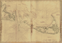 Chart
of Nantucket Island and the eastern half of Martha's Vineyard.
Des Barres, Joseph F. W. (Joseph Frederick Wallet), 1722-1824.
CREATED/PUBLISHED London] 1776. NOTES Scale ca. 1:51,000.
Relief shown by hachures. Depths shown by soundings. Chart
of Nantucket Island and the eastern half of Martha's Vineyard.
Des Barres, Joseph F. W. (Joseph Frederick Wallet), 1722-1824.
CREATED/PUBLISHED London] 1776. NOTES Scale ca. 1:51,000.
Relief shown by hachures. Depths shown by soundings. |
 Chart
of Plymouth Bay. Des Barres, Joseph F. W. (Joseph Frederick
Wallet), 1722-1824. CREATED/PUBLISHED London, 177-] NOTES
Scale ca. 1:24,000. Relief shown by hachures. Depths shown
by soundings. Chart
of Plymouth Bay. Des Barres, Joseph F. W. (Joseph Frederick
Wallet), 1722-1824. CREATED/PUBLISHED London, 177-] NOTES
Scale ca. 1:24,000. Relief shown by hachures. Depths shown
by soundings. |
 The
coast of New England. Des Barres, Joseph F. W. (Joseph
Frederick Wallet), 1722-1824. CREATED/PUBLISHED [London]
J. F. W. Des Barres, 1776. NOTES Scale ca. 1:520,000.
Relief shown by hachures and shading. Soundings shown
in feet. The
coast of New England. Des Barres, Joseph F. W. (Joseph
Frederick Wallet), 1722-1824. CREATED/PUBLISHED [London]
J. F. W. Des Barres, 1776. NOTES Scale ca. 1:520,000.
Relief shown by hachures and shading. Soundings shown
in feet. |
 Part
of Long Island; and the coast eastward to the shoals of
Nantucket. [Knight, John] CREATED / PUBLISHED [1778?]
NOTES Scale ca. 1:600,000. Prime meridian: Greenwich.
Has watermarks. Soundings shown in fathoms. Part
of Long Island; and the coast eastward to the shoals of
Nantucket. [Knight, John] CREATED / PUBLISHED [1778?]
NOTES Scale ca. 1:600,000. Prime meridian: Greenwich.
Has watermarks. Soundings shown in fathoms. |
 Coast
of Rhode Island and Long Island from Narragansett Bay
to Peconic Bay. Des Barres, Joseph F. W. (Joseph Frederick
Wallet), 1722-1824. CREATED/PUBLISHED London] J. F. W.
Des Barres, 1779. NOTES Scale ca. 1:115,000. Relief shown
by hachures. Soundings shown in feet. Coast
of Rhode Island and Long Island from Narragansett Bay
to Peconic Bay. Des Barres, Joseph F. W. (Joseph Frederick
Wallet), 1722-1824. CREATED/PUBLISHED London] J. F. W.
Des Barres, 1779. NOTES Scale ca. 1:115,000. Relief shown
by hachures. Soundings shown in feet. |
C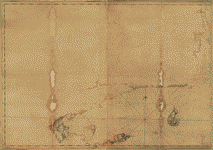 oast
of Rhode Island and Long Island from Narragansett Bay
to Peconic Bay. Des Barres, Joseph F. W. (Joseph Frederick
Wallet), 1722-1824. CREATED/PUBLISHED London] J. F. W.
Des Barres, 1779. NOTES Scale ca. 1:115,000. Relief shown
by hachures and shading. Soundings shown in feet. oast
of Rhode Island and Long Island from Narragansett Bay
to Peconic Bay. Des Barres, Joseph F. W. (Joseph Frederick
Wallet), 1722-1824. CREATED/PUBLISHED London] J. F. W.
Des Barres, 1779. NOTES Scale ca. 1:115,000. Relief shown
by hachures and shading. Soundings shown in feet. |
 Potomac
River (in four sheets): Sheet no. 4, from Indian Head
to Georgetown From a trigonometrical survey under the
direction of A. D. Bache, Superintendent of the survey
of the coast of the United States. Triangulation by A.
D. Bache, Supdt., C. Ferguson, C. Hosmer and C. H. Boyd,
Sub-Assts. Topography by A. M. Harrison, C. M. Bache,
Assts., J. Mechan, C. Hosmer and C. H. Boyd, Sub-Assts.
Hydrography by the parties under the command of Lieut.
comdr. T. S. Phelps, U.S.N. and C. P. Patterson Assis.
Redd. drng. by H. Lindenkohl and L. Karcher. Engd. by
A. Maedel and A. Petersen. 1864 United States Coast Survey.
CREATED/PUBLISHED [S.l.] 1864. NOTES Scale 1:40,000. Potomac
River (in four sheets): Sheet no. 4, from Indian Head
to Georgetown From a trigonometrical survey under the
direction of A. D. Bache, Superintendent of the survey
of the coast of the United States. Triangulation by A.
D. Bache, Supdt., C. Ferguson, C. Hosmer and C. H. Boyd,
Sub-Assts. Topography by A. M. Harrison, C. M. Bache,
Assts., J. Mechan, C. Hosmer and C. H. Boyd, Sub-Assts.
Hydrography by the parties under the command of Lieut.
comdr. T. S. Phelps, U.S.N. and C. P. Patterson Assis.
Redd. drng. by H. Lindenkohl and L. Karcher. Engd. by
A. Maedel and A. Petersen. 1864 United States Coast Survey.
CREATED/PUBLISHED [S.l.] 1864. NOTES Scale 1:40,000. |
 A
chart of the harbour of Rhode Island and Narraganset Bay.
Surveyed in pursuance of directions from the Lords of
Trade to His Majesty's Surveyor General for the northern
district of North America. Published at the request of
The Right Honourable Lord Viscount Howe. Des Barres, Joseph
F. W. (Joseph Frederick Wallet), 1722-1824. CREATED/PUBLISHED
[London] 1776. NOTES Scale ca. 1:51,000. Relief shown
by hachures. Depths shown by soundings. A
chart of the harbour of Rhode Island and Narraganset Bay.
Surveyed in pursuance of directions from the Lords of
Trade to His Majesty's Surveyor General for the northern
district of North America. Published at the request of
The Right Honourable Lord Viscount Howe. Des Barres, Joseph
F. W. (Joseph Frederick Wallet), 1722-1824. CREATED/PUBLISHED
[London] 1776. NOTES Scale ca. 1:51,000. Relief shown
by hachures. Depths shown by soundings. |
 A
topographical chart of the bay of Narraganset in the province
of New England, with all the isles contained therein,
among which Rhode Island and Connonicut have been particularly
surveyed, shewing the true position & bearings of
the banks, shoals, rocks &c. as likewise the soundings;
To which have been added the several works & batteries
raised by the Americans. Taken by order of the principal
farmers on Rhode Island. Blaskowitz, Charles. CREATED/PUBLISHED
[London] Engraved & printed for Wm. Faden, 1777. NOTES
Scale ca. 1:50,000. Hand colored. Relief shown by hachures.
Depths shown by soundings. A
topographical chart of the bay of Narraganset in the province
of New England, with all the isles contained therein,
among which Rhode Island and Connonicut have been particularly
surveyed, shewing the true position & bearings of
the banks, shoals, rocks &c. as likewise the soundings;
To which have been added the several works & batteries
raised by the Americans. Taken by order of the principal
farmers on Rhode Island. Blaskowitz, Charles. CREATED/PUBLISHED
[London] Engraved & printed for Wm. Faden, 1777. NOTES
Scale ca. 1:50,000. Hand colored. Relief shown by hachures.
Depths shown by soundings. |
 A
topographical chart of the bay of Narraganset in the province
of New England, with all the isles contained therein,
among which Rhode Island and Connonicut have been particularly
surveyed, shewing the true position & bearings of
the banks, shoals, rocks &c. as likewise the soundings:
To which have been added the several works & batteries
raised by the Americans. Taken by order of the principal
farmers on Rhode Island. Blaskowitz, Charles. CREATED/PUBLISHED
[London] Engraved & printed for Wm. Faden, 1777. NOTES
Scale ca. 1:50,000. Relief shown by hachures. Depths shown
by soundings and form lines. A
topographical chart of the bay of Narraganset in the province
of New England, with all the isles contained therein,
among which Rhode Island and Connonicut have been particularly
surveyed, shewing the true position & bearings of
the banks, shoals, rocks &c. as likewise the soundings:
To which have been added the several works & batteries
raised by the Americans. Taken by order of the principal
farmers on Rhode Island. Blaskowitz, Charles. CREATED/PUBLISHED
[London] Engraved & printed for Wm. Faden, 1777. NOTES
Scale ca. 1:50,000. Relief shown by hachures. Depths shown
by soundings and form lines. |
A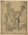 map of the bay of Narraganset with the islands therein
and part of the country adjacent. Blaskowitz, Charles.
CREATED/PUBLISHED [1777?] NOTES Scale ca. 1:63,360. Manuscript,
pen-and-ink and watercolor. Relief shown by shading. Depths
shown by soundings.
map of the bay of Narraganset with the islands therein
and part of the country adjacent. Blaskowitz, Charles.
CREATED/PUBLISHED [1777?] NOTES Scale ca. 1:63,360. Manuscript,
pen-and-ink and watercolor. Relief shown by shading. Depths
shown by soundings. |
 Plan
de la baie de Narraganset dans la Nouvelle Angleterre
avec toutes les îles qu'elle renferme parmi lesquelles
se trouvent Rhode-Island et l'île de Connonicut. Levé
par Charles Blaskowits et publié ŕ Londres en 1777. Dressé
au Dépôt général des cartes, plans et journaux de la marine,
pour le service des vaisseaux du roi. Par ordre de M.
de Sartine, conseiller d'État, ministre et secrétaire
d'État ayant le Département de la marine. Petit, sculp.
Blaskowitz, Charles. CREATED/PUBLISHED [Paris] Dépôt général
de la marine, 1780. NOTES Scale ca. 1:70,000. Relief shown
pictorially and by hachures. Soundings shown in fathoms. Plan
de la baie de Narraganset dans la Nouvelle Angleterre
avec toutes les îles qu'elle renferme parmi lesquelles
se trouvent Rhode-Island et l'île de Connonicut. Levé
par Charles Blaskowits et publié ŕ Londres en 1777. Dressé
au Dépôt général des cartes, plans et journaux de la marine,
pour le service des vaisseaux du roi. Par ordre de M.
de Sartine, conseiller d'État, ministre et secrétaire
d'État ayant le Département de la marine. Petit, sculp.
Blaskowitz, Charles. CREATED/PUBLISHED [Paris] Dépôt général
de la marine, 1780. NOTES Scale ca. 1:70,000. Relief shown
pictorially and by hachures. Soundings shown in fathoms.
|
 St.
Mary's River and Fernandina harbor, Florida From a trigonometrical
survey under the direction of A. D. Bache, Superintendent
of the survey of the coast of the United States. Triangulation
by Capt. J. H. Simpson and Lieutenant A. W. Evans, U.S.A.
Assistants. Topography by A. M. Harrison, Assistant. Hydrography
by the party under the command of Lieut. S. D. Trenchard,
U.S.N. Assist. 1857. Resurvey of bar by C. O. Boutelle,
Asst. in 1862. Redd. drng. by P. Witzel. Engd. by A. Maedel
and R. F. Bartle. Bowen & Co. lith., Philada. United
States Coast Survey. CREATED/PUBLISHED [Washington, U.S.
Coast Survey, 1862] NOTES Scale 1:20,000. St.
Mary's River and Fernandina harbor, Florida From a trigonometrical
survey under the direction of A. D. Bache, Superintendent
of the survey of the coast of the United States. Triangulation
by Capt. J. H. Simpson and Lieutenant A. W. Evans, U.S.A.
Assistants. Topography by A. M. Harrison, Assistant. Hydrography
by the party under the command of Lieut. S. D. Trenchard,
U.S.N. Assist. 1857. Resurvey of bar by C. O. Boutelle,
Asst. in 1862. Redd. drng. by P. Witzel. Engd. by A. Maedel
and R. F. Bartle. Bowen & Co. lith., Philada. United
States Coast Survey. CREATED/PUBLISHED [Washington, U.S.
Coast Survey, 1862] NOTES Scale 1:20,000. |
 Preliminary
chart of Beaufort River, Station Creek, Story and Harbor
Rivers forming inside passage between Port Royal and St.
Helena Sounds, South Carolina From a trigonometrical survey
under the direction of A. D. Bache, Superintendent of
the survey of the coast of the United States. Triangulation
by C. O. Boutelle, Assist. Topography by John Seib, Asst.
& C. Rockwell, Sub-Asst. Hydrography by the parties
under the command of Lieuts. Comdg. J. N. Maffitt, J.
P. Bankhead, U.S.N., C. O. Boutelle & W. S. Edwards,
Assts. Coast Survey. United States Coast Survey. CREATED/PUBLISHED
[Washington, U.S. Coast Survey], 1864. NOTES 1:40,000. Preliminary
chart of Beaufort River, Station Creek, Story and Harbor
Rivers forming inside passage between Port Royal and St.
Helena Sounds, South Carolina From a trigonometrical survey
under the direction of A. D. Bache, Superintendent of
the survey of the coast of the United States. Triangulation
by C. O. Boutelle, Assist. Topography by John Seib, Asst.
& C. Rockwell, Sub-Asst. Hydrography by the parties
under the command of Lieuts. Comdg. J. N. Maffitt, J.
P. Bankhead, U.S.N., C. O. Boutelle & W. S. Edwards,
Assts. Coast Survey. United States Coast Survey. CREATED/PUBLISHED
[Washington, U.S. Coast Survey], 1864. NOTES 1:40,000.
|
P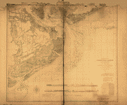 reliminary
chart of Charleston Harbor and its approaches. United
States Coast Survey. CREATED/PUBLISHED [S.l.], Published
in 1858. Additions in 1862. NOTES Inscribed in ink: Transferred
from Office of Chf. Engr., Defenses of Washington, to
Engr. Dept., Jany. 1866. DLC Shows fortifications, towns,
soundings, roads and streets, vegetation, and drainage. reliminary
chart of Charleston Harbor and its approaches. United
States Coast Survey. CREATED/PUBLISHED [S.l.], Published
in 1858. Additions in 1862. NOTES Inscribed in ink: Transferred
from Office of Chf. Engr., Defenses of Washington, to
Engr. Dept., Jany. 1866. DLC Shows fortifications, towns,
soundings, roads and streets, vegetation, and drainage.
|
 Resurvey
of Charleston Bar by W. S. Edwards, Asst. and F. P. Webber,
Sub-Asst., under the direction of C. O. Boutelle, Assistant,
1864. Redd. Drng. by J. J. Ricketts & A. Boschke.
Engd. by F. Dankworth, J. Knight, E. Yeager & G. McCoy.
United States Coast Survey. CREATED/PUBLISHED [S.l., 1864]
NOTES Scale 1:30,000. Resurvey
of Charleston Bar by W. S. Edwards, Asst. and F. P. Webber,
Sub-Asst., under the direction of C. O. Boutelle, Assistant,
1864. Redd. Drng. by J. J. Ricketts & A. Boschke.
Engd. by F. Dankworth, J. Knight, E. Yeager & G. McCoy.
United States Coast Survey. CREATED/PUBLISHED [S.l., 1864]
NOTES Scale 1:30,000. |
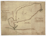
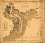
 Hydrographic
reconnaissance of James River, Virginia, from entrance
to City Point / by Com'r W.T. Muse & Lieuts. R. Wainwright
& J.N. Maffitt, U.S.N. Assts. Coast Survey from 1854
to '59. United States Coast Survey. CREATED/PUBLISHED
[Washington, D.C.] : U.S. Coast Survey, [1862] NOTES General
nautical chart. Depths shown by soundings and contours. Hydrographic
reconnaissance of James River, Virginia, from entrance
to City Point / by Com'r W.T. Muse & Lieuts. R. Wainwright
& J.N. Maffitt, U.S.N. Assts. Coast Survey from 1854
to '59. United States Coast Survey. CREATED/PUBLISHED
[Washington, D.C.] : U.S. Coast Survey, [1862] NOTES General
nautical chart. Depths shown by soundings and contours.
|
 York
River and Mobajack [sic] Bay, Va. / tracing for Maj. Genl.
Franklin from Maj. Humphrey's [sic] Comg. Topl. Engrs.,
Army of Potomac. Humphreys, A. A. (Andrew Atkinson), 1810-1883.
OTHER TITLES York River and Mobjack Bay, Va. CREATED/PUBLISHED
[1862?] NOTES Depths shown by soundings. Shows roads,
settlements, farmsteads with residents' names, battery
on North River tributary, and low-water line. York
River and Mobajack [sic] Bay, Va. / tracing for Maj. Genl.
Franklin from Maj. Humphrey's [sic] Comg. Topl. Engrs.,
Army of Potomac. Humphreys, A. A. (Andrew Atkinson), 1810-1883.
OTHER TITLES York River and Mobjack Bay, Va. CREATED/PUBLISHED
[1862?] NOTES Depths shown by soundings. Shows roads,
settlements, farmsteads with residents' names, battery
on North River tributary, and low-water line. |
This
is a must have collection for any map history buff!
To
use this software, you must install the free ExpressView MrSid
software which is included on the CD. This is a 30 second process
and will allow you to view and manipulate/print all the maps
in this CD collection in full detail. There is a version for
both Windows platforms and Macintosh platforms and full installation
instructions are included on the CD.
|


