This
CD contains 34 rare antique maps and descriptive pages representing
fascinating details about Canada and the United States during
the Revolutionary War in MrSid format. This
format allows you to see the entire map on your computer screen
or drill down to see the smallest details. The original maps
are often quite large, as much as 36" long or larger
and quite detailed. With the MrSID software, you can manipulate
the map to print the entire map in great detail or zoom into
a portion of the map in full detail for viewing or printing.
You could even bring the images to a local print shop to have
the maps reprinted in their full size. (MrSID software is
included on the CD.)
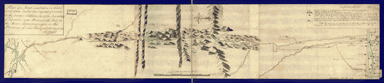
To
give you a sample of the detail you can expect in these maps,
here is an example based on a panoramic map of Washington,
DC.
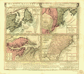
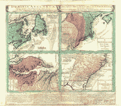
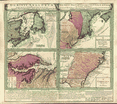
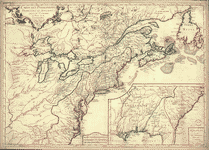
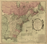
The
table below shows the description and a small image of each
map on this incredible history CD.
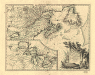
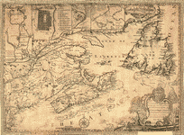
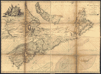 Map
of Nova Scotia, or Acadia; with the islands of Cape Breton
and St. John's, from actual surveys, by Captn. Montresor,
engir., 1768. Montrésor, John, 1736-1799. CREATED/PUBLISHED
London; Printed & sold by A. Dury [1768] NOTES Scale ca.
1:390,000; 60 miles to a degree. Relief shown pictorially.
Depths shown by soundings. Imperfect: Deterioration along
creases. Map
of Nova Scotia, or Acadia; with the islands of Cape Breton
and St. John's, from actual surveys, by Captn. Montresor,
engir., 1768. Montrésor, John, 1736-1799. CREATED/PUBLISHED
London; Printed & sold by A. Dury [1768] NOTES Scale ca.
1:390,000; 60 miles to a degree. Relief shown pictorially.
Depths shown by soundings. Imperfect: Deterioration along
creases. |
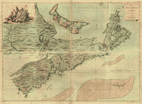 Map
of Nova Scotia, or Acadia; with the islands of Cape Breton
and St. John's, from actual surveys, by Captn. Montresor,
engir. Montrésor, John, 1736-1799. CREATED/PUBLISHED London;
Printed & sold by A. Dury, 1768. NOTES Scale ca. 1:390,000.
Hand colored. Relief shown pictorially and by hachures.
Depths shown by soundings. Shows administrative boundaries
on St. John's Island. Map
of Nova Scotia, or Acadia; with the islands of Cape Breton
and St. John's, from actual surveys, by Captn. Montresor,
engir. Montrésor, John, 1736-1799. CREATED/PUBLISHED London;
Printed & sold by A. Dury, 1768. NOTES Scale ca. 1:390,000.
Hand colored. Relief shown pictorially and by hachures.
Depths shown by soundings. Shows administrative boundaries
on St. John's Island. |
 A
map of the north west parts of America, with the utmost
respect, inscrib'd to His Excellency, Sir Guy Carleton,
Knight of the Bath: Captain General and Governor of the
province of Quebec: General and Commander in Chief of
His Majesty's forces in the said province, and frontiers
thereof. &c. &c. &c., by his most obedient humble servt.
Alexr. Henry. Henry, Alexander, 1739-1824. CREATED/PUBLISHED
[1776?] NOTES Scale ca. 1:2,000,000. Manuscript, pen-and-ink
and watercolor. Annotated with names and descriptive notes
and letterpress. Watermark: J. Whatman. Shows Indian tribes
of western Ontario, Manitoba, and Saskatchewan. A
map of the north west parts of America, with the utmost
respect, inscrib'd to His Excellency, Sir Guy Carleton,
Knight of the Bath: Captain General and Governor of the
province of Quebec: General and Commander in Chief of
His Majesty's forces in the said province, and frontiers
thereof. &c. &c. &c., by his most obedient humble servt.
Alexr. Henry. Henry, Alexander, 1739-1824. CREATED/PUBLISHED
[1776?] NOTES Scale ca. 1:2,000,000. Manuscript, pen-and-ink
and watercolor. Annotated with names and descriptive notes
and letterpress. Watermark: J. Whatman. Shows Indian tribes
of western Ontario, Manitoba, and Saskatchewan. |
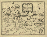
 Partie
occidentale de la Nouvelle France ou Canada. Par Mr. Bellin,
ingenieur de la marine. Bellin, Jacques Nicolas, 1703-1772.
CREATED/PUBLISHED [Paris?] 1755. NOTES Scale ca. 1:3,000,000.
Hand colored. "Longitude occidentale du meridien de Paris."
Relief shown pictorially. Shows Great Lakes region. Partie
occidentale de la Nouvelle France ou Canada. Par Mr. Bellin,
ingenieur de la marine. Bellin, Jacques Nicolas, 1703-1772.
CREATED/PUBLISHED [Paris?] 1755. NOTES Scale ca. 1:3,000,000.
Hand colored. "Longitude occidentale du meridien de Paris."
Relief shown pictorially. Shows Great Lakes region. |
 Partie
orientale du Canada, traduitte de l'anglois de la carte
de Jefferys publiée a Londres en May 1755. Le Rouge, Georges-Louis.
CREATED/PUBLISHED Paris [1755?] NOTES Scale ca. 1:2,000,000.
Hand colored. Relief shown pictorially. Prime meridian:
Isle de Fer. Partie
orientale du Canada, traduitte de l'anglois de la carte
de Jefferys publiée a Londres en May 1755. Le Rouge, Georges-Louis.
CREATED/PUBLISHED Paris [1755?] NOTES Scale ca. 1:2,000,000.
Hand colored. Relief shown pictorially. Prime meridian:
Isle de Fer. |
 Partie
de l'Amérique septent? qui comprend la Nouvelle France
ou le Canada, par le Sr. Robert de Vaugondy, géog? ordinaire
du roy. Avec privilege 1755. C. Haussard, sculp. Robert
de Vaugondy, Gilles, 1688-1766. CREATED/PUBLISHED [Paris,
1758] NOTES Scale ca. 1:4,000,000. Hand colored. Relief
shown pictorially. From the author's Atlas universel.
1757 [i.e. 1758] Includes "Supplement pour les Lacs du
Canada," ca. 1:5,500,000. Partie
de l'Amérique septent? qui comprend la Nouvelle France
ou le Canada, par le Sr. Robert de Vaugondy, géog? ordinaire
du roy. Avec privilege 1755. C. Haussard, sculp. Robert
de Vaugondy, Gilles, 1688-1766. CREATED/PUBLISHED [Paris,
1758] NOTES Scale ca. 1:4,000,000. Hand colored. Relief
shown pictorially. From the author's Atlas universel.
1757 [i.e. 1758] Includes "Supplement pour les Lacs du
Canada," ca. 1:5,500,000. |
 Partie
orientale du Canada. Traduitte de l'anglois de la carte
de Jefferys publiée ŕ Londres en May 1755. Le Rouge, Georges-Louis.
CREATED/PUBLISHED Paris, Le Rouge [1762] NOTES Scale ca.
1:2,000,000. Relief shown pictorially. Text in French
and German. From the author's Atlas général contenant
le detail des quatre parties du monde principalement.
[1762] Includes a table of comparative latitudes and longitudes. Partie
orientale du Canada. Traduitte de l'anglois de la carte
de Jefferys publiée ŕ Londres en May 1755. Le Rouge, Georges-Louis.
CREATED/PUBLISHED Paris, Le Rouge [1762] NOTES Scale ca.
1:2,000,000. Relief shown pictorially. Text in French
and German. From the author's Atlas général contenant
le detail des quatre parties du monde principalement.
[1762] Includes a table of comparative latitudes and longitudes.
|
 La
Nouvelle France oů Canada. Bellin, Jacques Nicolas, 1703-1772.
CREATED/PUBLISHED [Paris, 1764] NOTES Scale ca. 1:9,000,000.
Relief shown pictorially. Depths shown by soundings. La
Nouvelle France oů Canada. Bellin, Jacques Nicolas, 1703-1772.
CREATED/PUBLISHED [Paris, 1764] NOTES Scale ca. 1:9,000,000.
Relief shown pictorially. Depths shown by soundings. |
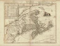
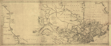
 A
map of Canada and the north part of Louisiana with the
adjacent countrys. By Thos. Jefferys, geographer to His
Majesty, 1762. Jefferys, Thomas, d. 1771. CREATED/PUBLISHED
London [1768] NOTES Scale ca. 1:8,000,000. Relief shown
pictorially. From the author's General topography of North
America and the West Indies... 1768. A
map of Canada and the north part of Louisiana with the
adjacent countrys. By Thos. Jefferys, geographer to His
Majesty, 1762. Jefferys, Thomas, d. 1771. CREATED/PUBLISHED
London [1768] NOTES Scale ca. 1:8,000,000. Relief shown
pictorially. From the author's General topography of North
America and the West Indies... 1768. |
 A
map of Canada and the north part of Louisiana with the
adjacent countrys. By Thos. Jefferys, geographer to His
Majesty, 1762. Jefferys, Thomas, d. 1771. CREATED/PUBLISHED
London [1768] NOTES Scale ca. 1:8,000,000. Relief shown
pictorially. Shows the Pacific Coast from 400 N. lat.
to 600 N. lat. A
map of Canada and the north part of Louisiana with the
adjacent countrys. By Thos. Jefferys, geographer to His
Majesty, 1762. Jefferys, Thomas, d. 1771. CREATED/PUBLISHED
London [1768] NOTES Scale ca. 1:8,000,000. Relief shown
pictorially. Shows the Pacific Coast from 400 N. lat.
to 600 N. lat. |
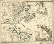
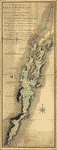
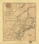
 This
map of the province of Nova-Scotia and parts adjacent.
Turner, James, d. 1759. CREATED/PUBLISHED Philadelphia;
Printed and sold by R. Aitken [1776] NOTES Scale ca. 1:3,750,000.
Relief shown pictorially. Shows the Maritime Provinces,
Newfoundland, and the St. Laurence River Valley between
1755 and 1757. Inscribed to "His Majesty's Province of
Nova Scotia ... " Includes "View of Boston," inset of
Halifax Harbor, and insets, with indexes, of Halifax,
Quebec, and "City & port of Louisbourg." This
map of the province of Nova-Scotia and parts adjacent.
Turner, James, d. 1759. CREATED/PUBLISHED Philadelphia;
Printed and sold by R. Aitken [1776] NOTES Scale ca. 1:3,750,000.
Relief shown pictorially. Shows the Maritime Provinces,
Newfoundland, and the St. Laurence River Valley between
1755 and 1757. Inscribed to "His Majesty's Province of
Nova Scotia ... " Includes "View of Boston," inset of
Halifax Harbor, and insets, with indexes, of Halifax,
Quebec, and "City & port of Louisbourg." |
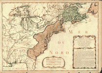
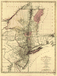
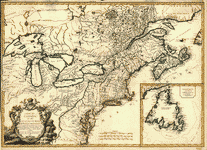 Carte
du Canada et des Etats-Unis de l'Amérique Septentrionale
/ par le Sr. Robert de Vaugondy, Géog. Ord. du Roi ...
et Censeur Royal. Robert de Vaugondy, Gilles, 1688-1766.
CREATED/PUBLISHED Paris : Chez Fortin, Ing'r mécanicien
du Roi pour les globes et sphčres, 1778. NOTES Covers
Canada east of Lake Superior and south of James Bay; covers
U.S. north of Albemarle Bay (N.C.). Relief shown pictorially.
Third state. Meridians numbered eastward from unspecified
prime (Montréal at 3050E). Believed to be the earlist
map to use the name United States of America (in any language).
Watermarked (unclear wording with pointed cross at center
of embellished circle with pendant cross). Includes Newfoundland
inset and pictorial title cartouche. Carte
du Canada et des Etats-Unis de l'Amérique Septentrionale
/ par le Sr. Robert de Vaugondy, Géog. Ord. du Roi ...
et Censeur Royal. Robert de Vaugondy, Gilles, 1688-1766.
CREATED/PUBLISHED Paris : Chez Fortin, Ing'r mécanicien
du Roi pour les globes et sphčres, 1778. NOTES Covers
Canada east of Lake Superior and south of James Bay; covers
U.S. north of Albemarle Bay (N.C.). Relief shown pictorially.
Third state. Meridians numbered eastward from unspecified
prime (Montréal at 3050E). Believed to be the earlist
map to use the name United States of America (in any language).
Watermarked (unclear wording with pointed cross at center
of embellished circle with pendant cross). Includes Newfoundland
inset and pictorial title cartouche. |
 Partie
de l'Amérique septent? qui comprend la Nouvelle France
ou le Canada, par le Sr. Robert de Vaugondy, géog? ordinaire
du roy. Avec privilege 1755. C. Haussard, sculp. Robert
de Vaugondy, Gilles, 1688-1766. CREATED/PUBLISHED [Paris,
1786] NOTES Scale ca. 1:4,000,000. Hand colored. Relief
shown pictorially. Shows the boundary of the Colony of
Quebec as established by the Royal Proclamation of 1763. Partie
de l'Amérique septent? qui comprend la Nouvelle France
ou le Canada, par le Sr. Robert de Vaugondy, géog? ordinaire
du roy. Avec privilege 1755. C. Haussard, sculp. Robert
de Vaugondy, Gilles, 1688-1766. CREATED/PUBLISHED [Paris,
1786] NOTES Scale ca. 1:4,000,000. Hand colored. Relief
shown pictorially. Shows the boundary of the Colony of
Quebec as established by the Royal Proclamation of 1763.
|
 Partie
occidentale de la Nouvelle France ou du Canada par Mr.
Bellin, ingénieur du roy de la marine pour servir ŕ l'intelligence
des affaires de l'etat present en Amerique, communiquée
au public par les Héritiers de Homan. Bellin, Jacques
Nicolas, 1703-1772. CREATED/PUBLISHED [Nürnberg] 1755.
NOTES Scale ca. 1:3,500,000. Relief shown pictorially.
Covers the area from Lake Superior to Kaskaskia and from
Delaware Bay to the Mississippi River. Shows a few towns,
missions, forts, Indian villages and tribal territory,
rivers and lakes, portages, and early place-names. Partie
occidentale de la Nouvelle France ou du Canada par Mr.
Bellin, ingénieur du roy de la marine pour servir ŕ l'intelligence
des affaires de l'etat present en Amerique, communiquée
au public par les Héritiers de Homan. Bellin, Jacques
Nicolas, 1703-1772. CREATED/PUBLISHED [Nürnberg] 1755.
NOTES Scale ca. 1:3,500,000. Relief shown pictorially.
Covers the area from Lake Superior to Kaskaskia and from
Delaware Bay to the Mississippi River. Shows a few towns,
missions, forts, Indian villages and tribal territory,
rivers and lakes, portages, and early place-names. |
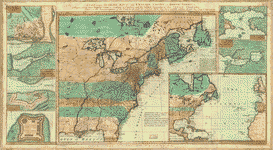 A
new and accurate map of the English empire in North America;
Representing their rightful claim as confirmed by charters
and the formal surrender of their Indian friends; likewise
the encroachments of the French, with the several forts
they have unjustly erected therein. Society of Anti-Gallicans.
CREATED/PUBLISHED London, Sold by Wm. Herbert ... , 1755.
NOTES Scale ca. 1:7,200,000. Hand colored. Relief shown
pictorially. "Longitude west from Ferro." "Sold by Wm.
Herbert ... & Robt. Sayer ... " Includes notes. Maps in
margin: A plan of the harbor and town of Louisbourg on
the isle of Cape Briton.--A plan of Chebucto Harbor.--The
Atlantic Ocean.--Fort Frederick built by the French at
Crown or Scalp Point in the year 1731.--A plan of Port
Dauphin on the isle of Cape Briton.--A plan of the harbour
of Annopolis Royal.--A plan of the town of Quebeck. A
new and accurate map of the English empire in North America;
Representing their rightful claim as confirmed by charters
and the formal surrender of their Indian friends; likewise
the encroachments of the French, with the several forts
they have unjustly erected therein. Society of Anti-Gallicans.
CREATED/PUBLISHED London, Sold by Wm. Herbert ... , 1755.
NOTES Scale ca. 1:7,200,000. Hand colored. Relief shown
pictorially. "Longitude west from Ferro." "Sold by Wm.
Herbert ... & Robt. Sayer ... " Includes notes. Maps in
margin: A plan of the harbor and town of Louisbourg on
the isle of Cape Briton.--A plan of Chebucto Harbor.--The
Atlantic Ocean.--Fort Frederick built by the French at
Crown or Scalp Point in the year 1731.--A plan of Port
Dauphin on the isle of Cape Briton.--A plan of the harbour
of Annopolis Royal.--A plan of the town of Quebeck. |
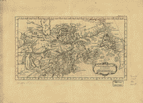
 Canada
et Louisiane, par le Sr. le Rouge ingénieur géographe
du Roy. Le Rouge, Georges-Louis. CREATED/PUBLISHED Paris,
1755. NOTES Scale ca. 1:4,450,000. Hand colored. Relief
shown pictorially. Includes illus. of Niagara Falls and
additional place-names. Canada
et Louisiane, par le Sr. le Rouge ingénieur géographe
du Roy. Le Rouge, Georges-Louis. CREATED/PUBLISHED Paris,
1755. NOTES Scale ca. 1:4,450,000. Hand colored. Relief
shown pictorially. Includes illus. of Niagara Falls and
additional place-names. |
 Canada
et Louisiane par le Sr. Le Rouge, ingenieur géographe
du roy. Le Rouge, Georges-Louis. CREATED/PUBLISHED Paris,
1755. NOTES Scale ca. 1:4,450,000. Hand colored. Relief
shown pictorially. Includes illus. of Niagara Falls and
text at bottom of map. Canada
et Louisiane par le Sr. Le Rouge, ingenieur géographe
du roy. Le Rouge, Georges-Louis. CREATED/PUBLISHED Paris,
1755. NOTES Scale ca. 1:4,450,000. Hand colored. Relief
shown pictorially. Includes illus. of Niagara Falls and
text at bottom of map. |
 Carte
du Canada et de la Louisiane qui forment la Nouvelle France
et des colonies angloises ou sont representez les pays
contestez. Nolin, Jean Baptiste, 1686-1762. CREATED/PUBLISHED
Paris, Chez Daumont, 1756. NOTES Scale ca. 1:5,000,000.
Hand colored. Relief shown pictorially and by hachures. Carte
du Canada et de la Louisiane qui forment la Nouvelle France
et des colonies angloises ou sont representez les pays
contestez. Nolin, Jean Baptiste, 1686-1762. CREATED/PUBLISHED
Paris, Chez Daumont, 1756. NOTES Scale ca. 1:5,000,000.
Hand colored. Relief shown pictorially and by hachures.
|
 Dominia
Anglorum in America Septentrionali. Specialibus mappis
Londini primum a Mollio edita, nunc recusa ab Homannianis
Hered. Homann Erben (Firm) CREATED/PUBLISHED [Norimbergć,
1759] NOTES Scales vary. Hand colored. Relief shown pictorially.
Sheet title in Latin and German. Individual map titles
and text in German. Maps in English and German. From the
authors' Atlas geographicvs maior. 1753-59 [i.e. 1784;
v. 1, 1759] part 2, no. 85. Includes text and glossary.
A. Newfovndland, od. Terra Nova S. Lavrentii Bay, die
Fisch-Bank, Acadia, nebst einem Theil New Schotland.--B.
New Engelland, New York, New Yersey und Pensilvania.--C.
Virginia und Maryland.--D. Carolina, nebst einem Theil
von Florida. Dominia
Anglorum in America Septentrionali. Specialibus mappis
Londini primum a Mollio edita, nunc recusa ab Homannianis
Hered. Homann Erben (Firm) CREATED/PUBLISHED [Norimbergć,
1759] NOTES Scales vary. Hand colored. Relief shown pictorially.
Sheet title in Latin and German. Individual map titles
and text in German. Maps in English and German. From the
authors' Atlas geographicvs maior. 1753-59 [i.e. 1784;
v. 1, 1759] part 2, no. 85. Includes text and glossary.
A. Newfovndland, od. Terra Nova S. Lavrentii Bay, die
Fisch-Bank, Acadia, nebst einem Theil New Schotland.--B.
New Engelland, New York, New Yersey und Pensilvania.--C.
Virginia und Maryland.--D. Carolina, nebst einem Theil
von Florida. |
 Dominia
Anglorum in America Septentrionali. Specialibus mappis
Londini primum a Mollio edita, nunc recusa ab Homannianis
Hered. Homann Erben (Firm) CREATED/PUBLISHED [Norimbergć,
1759] NOTES Scales vary. Hand colored. Relief shown pictorially.
Sheet title in Latin and German. Individual map titles
and text in German. Maps in English and German. From the
authors' Atlas geographicvs maior, 1753-59 [i.e. 1781,
v. 1, 1759] v. 1, no. 141. Differs from other copies in
Long Island boundary coloration. Includes text and glossary.
A. Newfovndland, od. Terra Nova S. Lavrentii Bay, die
Fisch-Bank, Acadia, nebst einem Theil New Schotland.--B.
New Engelland, New York, New Yersey und Pensilvania.--C.
Virginia und Maryland.--D. Carolina, nebst einem Theil
von Florida. Dominia
Anglorum in America Septentrionali. Specialibus mappis
Londini primum a Mollio edita, nunc recusa ab Homannianis
Hered. Homann Erben (Firm) CREATED/PUBLISHED [Norimbergć,
1759] NOTES Scales vary. Hand colored. Relief shown pictorially.
Sheet title in Latin and German. Individual map titles
and text in German. Maps in English and German. From the
authors' Atlas geographicvs maior, 1753-59 [i.e. 1781,
v. 1, 1759] v. 1, no. 141. Differs from other copies in
Long Island boundary coloration. Includes text and glossary.
A. Newfovndland, od. Terra Nova S. Lavrentii Bay, die
Fisch-Bank, Acadia, nebst einem Theil New Schotland.--B.
New Engelland, New York, New Yersey und Pensilvania.--C.
Virginia und Maryland.--D. Carolina, nebst einem Theil
von Florida. |
 Dominia
Anglorum in America Septentrionali. Specialibus mappis
Londini primum a Mollio edita, nunc recusa ab Hommanianis
Hered. Homann Erben (Firm) CREATED/PUBLISHED [Norimbergć,
between 1759 and 1784] NOTES Scales vary. Hand colored.
Relief shown pictorially. Sheet title in Latin and German.
Individual map titles and text in German. Maps in English
and German. Differs from other copies in Québec and New
England states boundaries. Includes text and glossary.
A. Newfovndland, od. Terra Nova S. Lavrentii Bay, die
Fisch-Bank, Acadia, nebst einem Theil New Schotland.--B.
New Engelland, New York, New Yersey und Pensilvania.--C.
Virginia und Maryland.--D. Carolina, nebst einem Theil
von Florida. Dominia
Anglorum in America Septentrionali. Specialibus mappis
Londini primum a Mollio edita, nunc recusa ab Hommanianis
Hered. Homann Erben (Firm) CREATED/PUBLISHED [Norimbergć,
between 1759 and 1784] NOTES Scales vary. Hand colored.
Relief shown pictorially. Sheet title in Latin and German.
Individual map titles and text in German. Maps in English
and German. Differs from other copies in Québec and New
England states boundaries. Includes text and glossary.
A. Newfovndland, od. Terra Nova S. Lavrentii Bay, die
Fisch-Bank, Acadia, nebst einem Theil New Schotland.--B.
New Engelland, New York, New Yersey und Pensilvania.--C.
Virginia und Maryland.--D. Carolina, nebst einem Theil
von Florida. |
 Carte
des possessions françoises et angloises dans le Canada,
et partie de la Louisiane, 1756. L. Thevenard fil. sculp.
Longchamps, géographe. CREATED/PUBLISHED Paris [1769]
NOTES Scale ca. 1:3,900,000. Hand colored. Relief shown
pictorially. From Louis Charles Desnos' Atlas général.
1767-[69] Includes map extension entitled "Supplement
pour les possessions françoises et angloises au sud de
la Louisiane. Gravé par Chambon." Carte
des possessions françoises et angloises dans le Canada,
et partie de la Louisiane, 1756. L. Thevenard fil. sculp.
Longchamps, géographe. CREATED/PUBLISHED Paris [1769]
NOTES Scale ca. 1:3,900,000. Hand colored. Relief shown
pictorially. From Louis Charles Desnos' Atlas général.
1767-[69] Includes map extension entitled "Supplement
pour les possessions françoises et angloises au sud de
la Louisiane. Gravé par Chambon." |
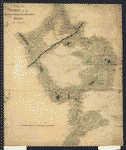
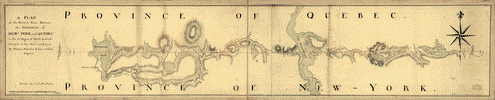
 A
survey of Lake Champlain including Crown Point and St.
Iohn's on which is fixed the line of forty five degrees
north lattit. terminating the boundarys betwe[e]n the
provinces of Quebec and New York agre[e]able to his Majesty's
proclamation done by order and instruction of the Honourable
James Murray, esqr., Governor of the Province of Quebec
and the Honourable His Majestys Council by Iohn Collins,
depy. surv. genl., May 21th 1765. Charles Blaskowitz,
draughtsman. Collins, John, d. 1795. CREATED/PUBLISHED
[1765] NOTES Scale ca. 1:127,000. Manuscript, pen-and-ink
and watercolor. Relief shown pictorially and by shading. A
survey of Lake Champlain including Crown Point and St.
Iohn's on which is fixed the line of forty five degrees
north lattit. terminating the boundarys betwe[e]n the
provinces of Quebec and New York agre[e]able to his Majesty's
proclamation done by order and instruction of the Honourable
James Murray, esqr., Governor of the Province of Quebec
and the Honourable His Majestys Council by Iohn Collins,
depy. surv. genl., May 21th 1765. Charles Blaskowitz,
draughtsman. Collins, John, d. 1795. CREATED/PUBLISHED
[1765] NOTES Scale ca. 1:127,000. Manuscript, pen-and-ink
and watercolor. Relief shown pictorially and by shading.
|
|
Plan of a rout undertaken in winter, Jany. 26th, from
Quebec, the capital of Canada, to the frontier settlements
of the Township of Topsham near Brunswick Fort on the
River Ammerascaegun in the Province of New Hampshire,
Feby. 20th 1760 / John Montresor, sub. engr. & lieut.
Montrésor, John, 1736-1799. CREATED/PUBLISHED [1760?]
NOTES Scale 1:506,880; miles 8 to an in. Manuscript;
pen-and-ink and watercolor. Oriented with north to the
right.
|
 A
map of the sources of the Chaudičre, Penobscot, and Kennebec
rivers, by Montresore. Montrésor, John, 1736-1799. CREATED/PUBLISHED
[1761?] NOTES Scale ca. 1:390,000. Manuscript, pen-and-ink
and watercolor. Mounted on cloth backing with reinforced
edges. Relief shown pictorially. Shows campsite locations
for the author's expedition from Quebec into Maine. A
map of the sources of the Chaudičre, Penobscot, and Kennebec
rivers, by Montresore. Montrésor, John, 1736-1799. CREATED/PUBLISHED
[1761?] NOTES Scale ca. 1:390,000. Manuscript, pen-and-ink
and watercolor. Mounted on cloth backing with reinforced
edges. Relief shown pictorially. Shows campsite locations
for the author's expedition from Quebec into Maine. |
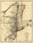
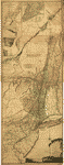
 A
map of the provinces of New-York and New Jersey, with
a part of Pennsylvania and the Province of Quebec. From
the topographical observations of C. J. Sauthier. Engraved
and published by Matthew Albert Lotter. Sauthier, Claude
Joseph. CREATED/PUBLISHED Augsburg, 1777. NOTES Scale
ca. 1:1,040,000. Hand colored. LC copy mounted on cloth
and paper backing. Prime meridian: New York. Relief shown
pictorially. Shows administrative divisions in New York
and New Jersey. A
map of the provinces of New-York and New Jersey, with
a part of Pennsylvania and the Province of Quebec. From
the topographical observations of C. J. Sauthier. Engraved
and published by Matthew Albert Lotter. Sauthier, Claude
Joseph. CREATED/PUBLISHED Augsburg, 1777. NOTES Scale
ca. 1:1,040,000. Hand colored. LC copy mounted on cloth
and paper backing. Prime meridian: New York. Relief shown
pictorially. Shows administrative divisions in New York
and New Jersey. |
 A
map of the provinces of New-York and New-Yersey, with
a part of Pennsylvania and the Province of Quebec. From
the topographical observations of C. J. Sauthier. Engraved
and published by Matthew Albert Lotter. Sauthier, Claude
Joseph. CREATED/PUBLISHED Augsburg, 1777. NOTES Scale
ca. 1:1,040,000. Hand colored. LC copy mounted on cloth
and paper backing. Prime meridian: New York. Relief shown
pictorially. LC copy annotated in upper left margin: 8.11.4s.IV.
Shows administrative divisions in New York and New Jersey. A
map of the provinces of New-York and New-Yersey, with
a part of Pennsylvania and the Province of Quebec. From
the topographical observations of C. J. Sauthier. Engraved
and published by Matthew Albert Lotter. Sauthier, Claude
Joseph. CREATED/PUBLISHED Augsburg, 1777. NOTES Scale
ca. 1:1,040,000. Hand colored. LC copy mounted on cloth
and paper backing. Prime meridian: New York. Relief shown
pictorially. LC copy annotated in upper left margin: 8.11.4s.IV.
Shows administrative divisions in New York and New Jersey.
|
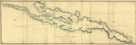 Plan,
Lake Champlain from Fort St. John's to Ticonderoga, with
the soundings, rocks, shoals, and sands, surveyed in the
years 1778, 1779. CREATED/PUBLISHED [1779] NOTES Scale
1:63,360; 1 mile to 1 in. Manuscript, pen-and-ink and
watercolor. Oriented with north to the left. Shows ships
present at the Battle of Valcour Island, Oct. 11, 1776
and a running fight at Buttonmold Bay, Oct., 13, 1776. Plan,
Lake Champlain from Fort St. John's to Ticonderoga, with
the soundings, rocks, shoals, and sands, surveyed in the
years 1778, 1779. CREATED/PUBLISHED [1779] NOTES Scale
1:63,360; 1 mile to 1 in. Manuscript, pen-and-ink and
watercolor. Oriented with north to the left. Shows ships
present at the Battle of Valcour Island, Oct. 11, 1776
and a running fight at Buttonmold Bay, Oct., 13, 1776.
|
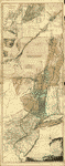
 The
provinces of New York and New Jersey; with part of Pensilvania,
and the province of Quebec. Drawn by Capt. Holland. Engraved
by Thomas Jefferys, geographer to His Majesty.--and improved
from the modern surveys of those colonies down to the
year 1776. Holland, Samuel, 1728-1801. CREATED/PUBLISHED
London, Robt. Sayer & John Bennett, 1775 [i.e. 1776] NOTES
Scale ca. 1:650,000. Hand colored. LC copy deteriorated
in margins. Relief shown pictorially. Shows administrative
divisions. Insets: A chart of the mouth of Hudson's River,
from Sandy Hook to New York.--A plan of the city of New
York.--Plan of Amboy, with its environs, from an actual
survey. The
provinces of New York and New Jersey; with part of Pensilvania,
and the province of Quebec. Drawn by Capt. Holland. Engraved
by Thomas Jefferys, geographer to His Majesty.--and improved
from the modern surveys of those colonies down to the
year 1776. Holland, Samuel, 1728-1801. CREATED/PUBLISHED
London, Robt. Sayer & John Bennett, 1775 [i.e. 1776] NOTES
Scale ca. 1:650,000. Hand colored. LC copy deteriorated
in margins. Relief shown pictorially. Shows administrative
divisions. Insets: A chart of the mouth of Hudson's River,
from Sandy Hook to New York.--A plan of the city of New
York.--Plan of Amboy, with its environs, from an actual
survey. |
 The
provinces of New York and New Jersey; with part of Pensilvania,
and the Province of Quebec. Drawn by Major Holland, Surveyor
General, of the Northern District in America. Corrected
and improved, from the original materials, by Governr.
Pownall, Member of Parliament, 1776. Pownall, Thomas,
1722-1805. CREATED/PUBLISHED London, Robt. Sayer & John
Bennett, 1776. NOTES Scale ca. 1:650,000. Hand colored.
Relief shown pictorially. Shows administrative divisions.
From Thomas Jeffery's American atlas. 1778. Insets: A
chart of the mouth of Hudson's River, from Sandy Hook
to New York.--A plan of the city of New York.--Plan of
Amboy, with its environs, from an actual survey. The
provinces of New York and New Jersey; with part of Pensilvania,
and the Province of Quebec. Drawn by Major Holland, Surveyor
General, of the Northern District in America. Corrected
and improved, from the original materials, by Governr.
Pownall, Member of Parliament, 1776. Pownall, Thomas,
1722-1805. CREATED/PUBLISHED London, Robt. Sayer & John
Bennett, 1776. NOTES Scale ca. 1:650,000. Hand colored.
Relief shown pictorially. Shows administrative divisions.
From Thomas Jeffery's American atlas. 1778. Insets: A
chart of the mouth of Hudson's River, from Sandy Hook
to New York.--A plan of the city of New York.--Plan of
Amboy, with its environs, from an actual survey. |
 The
provinces of New York and New Jersey; with part of Pensilvania,
and the province of Quebec. Drawn by Major Holland, Surveyor
General, of the Northern District in America. Corrected
and improved, from the original materials, by Governr.
Pownall, Member of Parliament, 1776. Pownall, Thomas,
1722-1805. CREATED/PUBLISHED London, Robt. Sayer & John
Bennett, 1776. NOTES Scale ca. 1:650,000. Hand colored.
Relief shown pictorially. Shows administrative divisions.
Insets: A chart of the mouth of Hudson's River, from Sandy
Hook to New York.--A plan of the city of New York.--Plan
of Amboy, with its environs, from an actual survey. The
provinces of New York and New Jersey; with part of Pensilvania,
and the province of Quebec. Drawn by Major Holland, Surveyor
General, of the Northern District in America. Corrected
and improved, from the original materials, by Governr.
Pownall, Member of Parliament, 1776. Pownall, Thomas,
1722-1805. CREATED/PUBLISHED London, Robt. Sayer & John
Bennett, 1776. NOTES Scale ca. 1:650,000. Hand colored.
Relief shown pictorially. Shows administrative divisions.
Insets: A chart of the mouth of Hudson's River, from Sandy
Hook to New York.--A plan of the city of New York.--Plan
of Amboy, with its environs, from an actual survey. |
 Pensilvanić,
Novć-Cćsareć, Novi-Eboraci, Aquanishuonigć et Canadć,
brevis delineatio, juxta itinera P. Kalm a Ludovico Evans,
1750. Ćri incisa a Fr. Akrel, cura S. Kreander. Evans,
Lewis, 1700?-1756. CREATED/PUBLISHED [n.p.] 1784. NOTES
Scale ca. 1:2,600,000. Principal meridian: Philadelphia
and Londino. Hand colored. Relief shown pictorially. Place
names in English. Covers the area from Quebec to Chesapeake
Bay and from Cape Cod to the west end of Lake Ontario.
Includes inset of Quebec area. Pensilvanić,
Novć-Cćsareć, Novi-Eboraci, Aquanishuonigć et Canadć,
brevis delineatio, juxta itinera P. Kalm a Ludovico Evans,
1750. Ćri incisa a Fr. Akrel, cura S. Kreander. Evans,
Lewis, 1700?-1756. CREATED/PUBLISHED [n.p.] 1784. NOTES
Scale ca. 1:2,600,000. Principal meridian: Philadelphia
and Londino. Hand colored. Relief shown pictorially. Place
names in English. Covers the area from Quebec to Chesapeake
Bay and from Cape Cod to the west end of Lake Ontario.
Includes inset of Quebec area. |
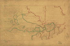
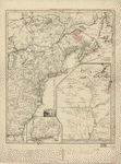
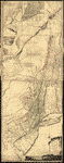
 A
plan of the division line between the provinces of New-York
and Quebec. In the 45th degree of north latitude. Survey'd
in the year 1771 & 1772. By Thomas Valentine & John Collins,
esquirs. Drawn by C. J. Sauthier. Valentine, Thomas. CREATED/PUBLISHED
[1772] NOTES Scale ca. 1:125,000. Manuscript, black and
red ink and watercolor. Relief shown by hachures. Map
shows primarily Vermont with Québec (Province) and New
York (State) A
plan of the division line between the provinces of New-York
and Quebec. In the 45th degree of north latitude. Survey'd
in the year 1771 & 1772. By Thomas Valentine & John Collins,
esquirs. Drawn by C. J. Sauthier. Valentine, Thomas. CREATED/PUBLISHED
[1772] NOTES Scale ca. 1:125,000. Manuscript, black and
red ink and watercolor. Relief shown by hachures. Map
shows primarily Vermont with Québec (Province) and New
York (State) |
 Bowles's
new pocket map of the United States of America; the British
possessions of Canada, Nova Scotia, and Newfoundland,
with the French and Spanish territories of Louisiana and
Florida, as settled by the preliminary articles of peace
signed at Versailles the 20th. Jany. 1783. Bowles, Carington,
1724-1793. CREATED/PUBLISHED London, 1784. NOTES Scale
ca. 1:6,500,000. Hand colored. Relief shown pictorially.
Prime meridian: Ferro and London. Bowles's
new pocket map of the United States of America; the British
possessions of Canada, Nova Scotia, and Newfoundland,
with the French and Spanish territories of Louisiana and
Florida, as settled by the preliminary articles of peace
signed at Versailles the 20th. Jany. 1783. Bowles, Carington,
1724-1793. CREATED/PUBLISHED London, 1784. NOTES Scale
ca. 1:6,500,000. Hand colored. Relief shown pictorially.
Prime meridian: Ferro and London. |
This
is a must have collection for any map history buff!
To use this software, you must install the free ExpressView
MrSid software which is included on the CD. This is a 30 second
process and will allow you to view and manipulate/print all
the maps in this CD collection in full detail. There is a version
for both Windows platforms and Macintosh platforms and full
installation instructions are included on the CD.
|


