This
CD contains 55 rare antique maps and descriptive pages representing
fascinating details about Boston and its vicinity during the
Revolutionary War in MrSid format. This
format allows you to see the entire map on your computer screen
or drill down to see the smallest details. The original maps
are often quite large, as much as 36" long or larger
and quite detailed. With the MrSID software, you can manipulate
the map to print the entire map in great detail or zoom into
a portion of the map in full detail for viewing or printing.
You could even bring the images to a local print shop to have
the maps reprinted in their full size. (MrSID software is
included on the CD.)
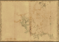
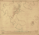
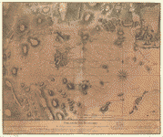
To
give you a sample of the detail you can expect in these maps,
here is an example based on a panoramic map of Washington,
DC.
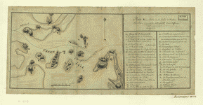
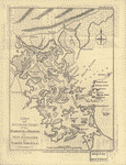
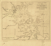
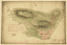
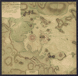
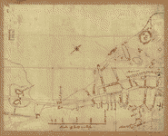
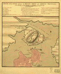
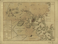
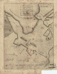
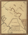
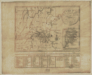
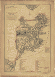
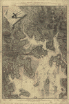
The
table below shows the description and a small image of each
map on this incredible history CD.
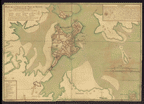
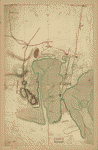
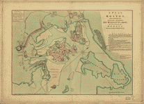
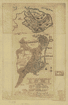
 Plan
of the action which happen'd 17th. June 1775, at Charles
Town, N. America. Page, Thomas Hyde, Sir, 1746-1821. CREATED/PUBLISHED
[1775] NOTES Scale ca. 1:8,000. Manuscript, pen-and-ink
and watercolor. Has watermark. Relief shown by hachures.
Inscribed on verso: Plan of the action, Charles Town,
17th June 1775. Eng. Page. Plan
of the action which happen'd 17th. June 1775, at Charles
Town, N. America. Page, Thomas Hyde, Sir, 1746-1821. CREATED/PUBLISHED
[1775] NOTES Scale ca. 1:8,000. Manuscript, pen-and-ink
and watercolor. Has watermark. Relief shown by hachures.
Inscribed on verso: Plan of the action, Charles Town,
17th June 1775. Eng. Page. |
 [Rough
draft of Charlestown, in water colour. CREATED/PUBLISHED
1775] NOTES Scale ca. 1:4,500. Title from William Faden's
Catalogue of a curious and valuable collection of original
maps and plans, 1862. Manuscript, pen-and-ink and watercolor.
Has watermarks. Oriented with north toward the upper right.
Relief shown by hachures. Shows position of British and
"Rebel" troops during the Battle of Bunker Hill. North
is oriented to the bottom. Called a rough draft of the
same cartographer's "Plan of Charles Town... after the
action of the 17th. June 1775." . It is however, a detailed
delineation of the Battle of Bunker Hill. Names and writing
are similar to Lieut. Page's Plan of action which happen'd
17th. June 1775. [Rough
draft of Charlestown, in water colour. CREATED/PUBLISHED
1775] NOTES Scale ca. 1:4,500. Title from William Faden's
Catalogue of a curious and valuable collection of original
maps and plans, 1862. Manuscript, pen-and-ink and watercolor.
Has watermarks. Oriented with north toward the upper right.
Relief shown by hachures. Shows position of British and
"Rebel" troops during the Battle of Bunker Hill. North
is oriented to the bottom. Called a rough draft of the
same cartographer's "Plan of Charles Town... after the
action of the 17th. June 1775." . It is however, a detailed
delineation of the Battle of Bunker Hill. Names and writing
are similar to Lieut. Page's Plan of action which happen'd
17th. June 1775. |
 A
plan of the action at Bunkers-Hill, on the 17th. of June,
1775, between His Majesty's troops under the command of
Major General Howe, and the rebel forces, by Lieut. Page,
of the Engineers, who acted as aide de camp to General
Howe in that action. Page, Thomas Hyde, Sir, 1746-1821.
CREATED/PUBLISHED [1775] NOTES Scale ca. 1:4,800. Manuscript,
pen-and-ink and watercolor. An engraved map, with change
of title, appears in Stedman's History of the origin,
process, and termination of the American War. London,
1794. A copy of this issue is included in William Faden's
Atlas of the battles of the American Revolution. [New
York, 1845] Has watermark. Relief shown by hachures. "N.B.
The ground plan is from an actual survey of Captn. Montresor." A
plan of the action at Bunkers-Hill, on the 17th. of June,
1775, between His Majesty's troops under the command of
Major General Howe, and the rebel forces, by Lieut. Page,
of the Engineers, who acted as aide de camp to General
Howe in that action. Page, Thomas Hyde, Sir, 1746-1821.
CREATED/PUBLISHED [1775] NOTES Scale ca. 1:4,800. Manuscript,
pen-and-ink and watercolor. An engraved map, with change
of title, appears in Stedman's History of the origin,
process, and termination of the American War. London,
1794. A copy of this issue is included in William Faden's
Atlas of the battles of the American Revolution. [New
York, 1845] Has watermark. Relief shown by hachures. "N.B.
The ground plan is from an actual survey of Captn. Montresor."
|
 A
sketch of the action between the British forces and the
American provincials, on the heights of the peninsula
of Charlestown, the 17th of June 1775. Engravd by Jefferys
& Faden. Jefferys, Thomas, d. 1771. CREATED/PUBLISHED
London, 1775. NOTES Scale ca. 1:13,800. Hand colored.
Relief shown by hachures. Indexed for points of military
interest. A
sketch of the action between the British forces and the
American provincials, on the heights of the peninsula
of Charlestown, the 17th of June 1775. Engravd by Jefferys
& Faden. Jefferys, Thomas, d. 1771. CREATED/PUBLISHED
London, 1775. NOTES Scale ca. 1:13,800. Hand colored.
Relief shown by hachures. Indexed for points of military
interest. |
 A
Plan of the battle, on Bunkers Hill fought on the 17th
of June 1775, by an officer on the spot. CREATED/PUBLISHED
London, Printed for R. Sayer & J. Bennett, 1775. NOTES
Scale ca. 1:12,000. Relief shown by hachures. In lower
margin: The following description of the action near Boston,
on the 17th of June, is taken from a letter written by
General Burgoyne to his nephew Lord Stanley. A
Plan of the battle, on Bunkers Hill fought on the 17th
of June 1775, by an officer on the spot. CREATED/PUBLISHED
London, Printed for R. Sayer & J. Bennett, 1775. NOTES
Scale ca. 1:12,000. Relief shown by hachures. In lower
margin: The following description of the action near Boston,
on the 17th of June, is taken from a letter written by
General Burgoyne to his nephew Lord Stanley. |
 Bunker
Hill--rough sketch. CREATED/PUBLISHED 1775?] NOTES Scale
not given. Title from Peter Force's catalog of manuscript
maps. Manuscript, pen-and-ink. Relief shown by hachures.
Shows landing places, positions of British units, and
"Rebels line of march." Bunker
Hill--rough sketch. CREATED/PUBLISHED 1775?] NOTES Scale
not given. Title from Peter Force's catalog of manuscript
maps. Manuscript, pen-and-ink. Relief shown by hachures.
Shows landing places, positions of British units, and
"Rebels line of march." |
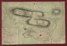
 Battle
of Bunker Hill. CREATED/PUBLISHED 1775?] NOTES Scale ca.
1:3,900. Title from manuscript catalog of Peter Force
map collection. Manuscript, pen-and-ink and pencil. Relief
shown by hachures. Includes "References" to points of
military interest in different hand and ink. Battle
of Bunker Hill. CREATED/PUBLISHED 1775?] NOTES Scale ca.
1:3,900. Title from manuscript catalog of Peter Force
map collection. Manuscript, pen-and-ink and pencil. Relief
shown by hachures. Includes "References" to points of
military interest in different hand and ink. |
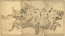
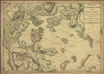
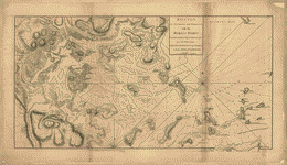
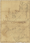
 A
chart of Boston Bay and vicinity. Des Barres, Joseph F.
W. (Joseph Frederick Wallet), 1722-1824. CREATED/PUBLISHED
London, 1776?] NOTES Scale ca. 1:50,000. Relief shown
by hachures. Depths shown by soundings. A
chart of Boston Bay and vicinity. Des Barres, Joseph F.
W. (Joseph Frederick Wallet), 1722-1824. CREATED/PUBLISHED
London, 1776?] NOTES Scale ca. 1:50,000. Relief shown
by hachures. Depths shown by soundings. |
 Plan
d'une partie de la rade de Boston pour faire connaitre
le dispositif de ses deffenses. CREATED/PUBLISHED [1778]
NOTES Scale ca. 1:42,000. Manuscript, pen-and-ink and
watercolor. Has watermark. Relief shown by hachures. "Legende"
includes positions of vessels of French fleet, by name
and commander. Accompanied by: Partie extraite d'un Memoire
général sur Boston. Plan
d'une partie de la rade de Boston pour faire connaitre
le dispositif de ses deffenses. CREATED/PUBLISHED [1778]
NOTES Scale ca. 1:42,000. Manuscript, pen-and-ink and
watercolor. Has watermark. Relief shown by hachures. "Legende"
includes positions of vessels of French fleet, by name
and commander. Accompanied by: Partie extraite d'un Memoire
général sur Boston. |
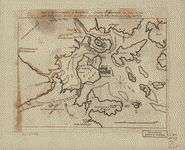
 A
new and accurate chart of the harbour of Boston in New
England in North America / J. Lodge, sc. Lodge, John,
d. 1796. CREATED/PUBLISHED London : J. Bew, 1782. NOTES
Also shows islands, rocks, channels, shoals, and towns
and roads along coast. Relief shown by hachures. Depths
shown by soundings. In upper right margin: Political Mag.,
Nov. 1782. A
new and accurate chart of the harbour of Boston in New
England in North America / J. Lodge, sc. Lodge, John,
d. 1796. CREATED/PUBLISHED London : J. Bew, 1782. NOTES
Also shows islands, rocks, channels, shoals, and towns
and roads along coast. Relief shown by hachures. Depths
shown by soundings. In upper right margin: Political Mag.,
Nov. 1782. |
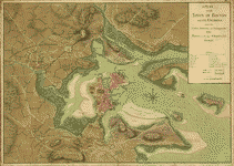
 A
plan of the town and chart of the harbour of Boston :
exhibiting a view of the islands, castle forts, and entrances
into the said harbour. CREATED/PUBLISHED [London : s.n.,
1775] NOTES Depths shown by soundings. From Gentleman's
magazine, vol. 45, Jan. 1775. In center of lower margin:
Feby. 1st 1775. A
plan of the town and chart of the harbour of Boston :
exhibiting a view of the islands, castle forts, and entrances
into the said harbour. CREATED/PUBLISHED [London : s.n.,
1775] NOTES Depths shown by soundings. From Gentleman's
magazine, vol. 45, Jan. 1775. In center of lower margin:
Feby. 1st 1775. |
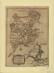
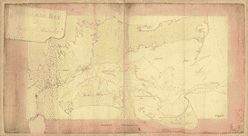
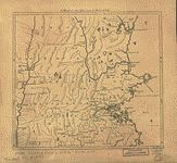 A
Map of 100 miles round Boston. CREATED/PUBLISHED [London,
1775] NOTES Scale ca. 1:800,000. Relief shown pictorially.
Shows area from Cape Ann to the Connecticut River and
from northern Connecticut River and from northern Connecticut
and Rhode Island to Kittery and York in Maine. A
Map of 100 miles round Boston. CREATED/PUBLISHED [London,
1775] NOTES Scale ca. 1:800,000. Relief shown pictorially.
Shows area from Cape Ann to the Connecticut River and
from northern Connecticut River and from northern Connecticut
and Rhode Island to Kittery and York in Maine. |
 Map
of the environs of Boston. Drawn at Boston in June, 1775.
Almon, John, 1737-1805. CREATED/PUBLISHED London, J. Almon,
1775. NOTES Scale ca. 1:46,000. Relief shown pictorially
and by hachures. From The Remembrancer, 3d ed. 1775. Shows
camp and lines of Generals Putnam, Ward, and Thomas and
batteries and fortifications in the Boston area. Map
of the environs of Boston. Drawn at Boston in June, 1775.
Almon, John, 1737-1805. CREATED/PUBLISHED London, J. Almon,
1775. NOTES Scale ca. 1:46,000. Relief shown pictorially
and by hachures. From The Remembrancer, 3d ed. 1775. Shows
camp and lines of Generals Putnam, Ward, and Thomas and
batteries and fortifications in the Boston area. |
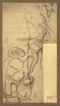
 Roxbury
to Concord. Roads & distances, &c. CREATED/PUBLISHED [1775?]
NOTES Not drawn to scale. Title from manuscript catalog
of the Peter Force map collection. Manuscript, pen-and-ink
and watercolor. Has watermarks. Oriented with north to
the left. Relief shown by hachures. Roxbury
to Concord. Roads & distances, &c. CREATED/PUBLISHED [1775?]
NOTES Not drawn to scale. Title from manuscript catalog
of the Peter Force map collection. Manuscript, pen-and-ink
and watercolor. Has watermarks. Oriented with north to
the left. Relief shown by hachures. |
 Map
of the environs of Roxbury showing roads to Jamaica, Cambridge,
Dorchester, Milton, etc. CREATED/PUBLISHED [1775?] NOTES
Scale not given. Title from P. L. Phillips' List of maps
of America. Manuscript, pen-and-ink and watercolor. Relief
shown by hachures. Typewritten label on verso: Map of
the environs of Boston showing roads from Roxbury to Dorchester,
Milton, Jamaica, Cambridge, and Walter T., Brooklyn and
N. York. 1775. Map
of the environs of Roxbury showing roads to Jamaica, Cambridge,
Dorchester, Milton, etc. CREATED/PUBLISHED [1775?] NOTES
Scale not given. Title from P. L. Phillips' List of maps
of America. Manuscript, pen-and-ink and watercolor. Relief
shown by hachures. Typewritten label on verso: Map of
the environs of Boston showing roads from Roxbury to Dorchester,
Milton, Jamaica, Cambridge, and Walter T., Brooklyn and
N. York. 1775. |
 Grundriss
von der Stadt Boston und ihren Gegenden. CREATED/PUBLISHED
[Leipzig, Arkstee & Merkus, 1758] NOTES Scale ca. 1:45,000.
Relief shown by hachures. Grundriss
von der Stadt Boston und ihren Gegenden. CREATED/PUBLISHED
[Leipzig, Arkstee & Merkus, 1758] NOTES Scale ca. 1:45,000.
Relief shown by hachures. |
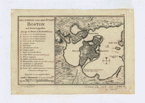
 Plan
de la ville et du port de Boston; capitale de la Nouvelle
Angleterre. Bellin, Jacques Nicolas, 1703-1772. CREATED/PUBLISHED
Paris, Chés Lattré [1764?] NOTES Scale ca. 1:11,300. Hand
colored. Relief shown pictorially. Attributed to Bellin
in Boston Engineering Department's List of maps of Boston
published between 1600 and 1903. Includes text, ward index,
and index to points of interest. Plan
de la ville et du port de Boston; capitale de la Nouvelle
Angleterre. Bellin, Jacques Nicolas, 1703-1772. CREATED/PUBLISHED
Paris, Chés Lattré [1764?] NOTES Scale ca. 1:11,300. Hand
colored. Relief shown pictorially. Attributed to Bellin
in Boston Engineering Department's List of maps of Boston
published between 1600 and 1903. Includes text, ward index,
and index to points of interest. |
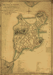
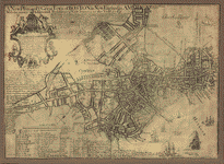 A
new plan of ye great town of Boston in New England in
America with the many additionall buildings & new streets,
to the year, 1769. Price, William, fl. 1725-1769. CREATED/PUBLISHED
Boston [1769] NOTES Scale ca. 1:5,700. Oriented with north
toward the upper right. LC copy annotated in ink. On bottom
of the sheet, covered with a heavy outer neat line: Engraved
and printed by Fra. Dewing, Boston NE. 1722. Sold by Capt.
John Bonner ... Includes text, ward index, and index to
points of interest. A
new plan of ye great town of Boston in New England in
America with the many additionall buildings & new streets,
to the year, 1769. Price, William, fl. 1725-1769. CREATED/PUBLISHED
Boston [1769] NOTES Scale ca. 1:5,700. Oriented with north
toward the upper right. LC copy annotated in ink. On bottom
of the sheet, covered with a heavy outer neat line: Engraved
and printed by Fra. Dewing, Boston NE. 1722. Sold by Capt.
John Bonner ... Includes text, ward index, and index to
points of interest. |
 Boston
Harbour, with the surroundings, &c. Hills, John, surveyor
CREATED/PUBLISHED 177-?] NOTES Scale ca. 1:24,000. Title
from William Faden's Catalogue of a curious and valuable
collection of original maps and plans. 1862. Manuscript,
pen-and-ink and watercolor. Relief shown by shading and
hachures. Depths shown by soundings. Oriented with north
toward the upper left. Boston
Harbour, with the surroundings, &c. Hills, John, surveyor
CREATED/PUBLISHED 177-?] NOTES Scale ca. 1:24,000. Title
from William Faden's Catalogue of a curious and valuable
collection of original maps and plans. 1862. Manuscript,
pen-and-ink and watercolor. Relief shown by shading and
hachures. Depths shown by soundings. Oriented with north
toward the upper left. |
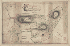
 Major
Genl. Howe's encampment on Bunkers Hill at Charles T.,
June 1775. CREATED/PUBLISHED [1775] NOTES Scale not given.
Manuscript, pen-and-ink and watercolor. Relief shown by
hachures. Shows position of troops and fortifications. Major
Genl. Howe's encampment on Bunkers Hill at Charles T.,
June 1775. CREATED/PUBLISHED [1775] NOTES Scale not given.
Manuscript, pen-and-ink and watercolor. Relief shown by
hachures. Shows position of troops and fortifications.
|
 Plan
of the "Neck" and fortifications] Delivd. to H.E. Gl.
Gage, June 30th. 1775.--J.M. Montrésor, John, 1736-1799.
CREATED/PUBLISHED [1775] NOTES Scale ca. 1:5,650. Title
from P. L. Phillips' A list of maps of America, p. 148.
Alternate title from Peter Force's catalog of manuscript
maps: Works for defense of Boston. Manuscript, pen-and-ink
and watercolor. Oriented with north toward the upper right.
Relief shown by hachures. Plan
of the "Neck" and fortifications] Delivd. to H.E. Gl.
Gage, June 30th. 1775.--J.M. Montrésor, John, 1736-1799.
CREATED/PUBLISHED [1775] NOTES Scale ca. 1:5,650. Title
from P. L. Phillips' A list of maps of America, p. 148.
Alternate title from Peter Force's catalog of manuscript
maps: Works for defense of Boston. Manuscript, pen-and-ink
and watercolor. Oriented with north toward the upper right.
Relief shown by hachures. |
 Plan
of the heights of Charles Town, &c. R: W: Lieut.: R. W.
F. Boston, Dec. 13, 1775. Williams, Richard, 18th cent.
CREATED/PUBLISHED [1775] NOTES Scale ca. 1:6,000. Manuscript,
pen-and-ink and watercolor. Has watermark. Oriented with
north toward the upper left. Relief shown by hachures.
Inset: work made in place of the rebels' redoubt. Plan
of the heights of Charles Town, &c. R: W: Lieut.: R. W.
F. Boston, Dec. 13, 1775. Williams, Richard, 18th cent.
CREATED/PUBLISHED [1775] NOTES Scale ca. 1:6,000. Manuscript,
pen-and-ink and watercolor. Has watermark. Oriented with
north toward the upper left. Relief shown by hachures.
Inset: work made in place of the rebels' redoubt. |
 A
new and correct plan of the town of Boston, and provincial
camp. Aitken, sculp. Aitken, Robert, 1735-1802. CREATED/PUBLISHED
[Philadelphia, 1775] NOTES Scale ca. 1:7,200. "Engrav'd
for the Pennsylva. magazine" v. 1, 1775, p. 29. Relief
shown pictorially. Includes inset of provincial camp,
ca. 1:125,000. A
new and correct plan of the town of Boston, and provincial
camp. Aitken, sculp. Aitken, Robert, 1735-1802. CREATED/PUBLISHED
[Philadelphia, 1775] NOTES Scale ca. 1:7,200. "Engrav'd
for the Pennsylva. magazine" v. 1, 1775, p. 29. Relief
shown pictorially. Includes inset of provincial camp,
ca. 1:125,000. |
 Plan
of the peninsula of Charles Town shewing the three posts
that His Majesty's troops have kept and fortified with
buildings therein for guard rooms, Boston, 3th. [sic]
Decr. 1775. To His Excellency Major General Howe, Commander
in Chief of His Majesty's forces, &c. John Montresor,
commandg. engrs. Montrésor, John, 1736-1799. CREATED/PUBLISHED
[1775] NOTES Scale ca. 1:4,860. Manuscript, pen-and-ink
and watercolor. Relief shown by hachures and shading.
Dedication is in different ink from drafting of map. Includes
index to major fortifications. Plan
of the peninsula of Charles Town shewing the three posts
that His Majesty's troops have kept and fortified with
buildings therein for guard rooms, Boston, 3th. [sic]
Decr. 1775. To His Excellency Major General Howe, Commander
in Chief of His Majesty's forces, &c. John Montresor,
commandg. engrs. Montrésor, John, 1736-1799. CREATED/PUBLISHED
[1775] NOTES Scale ca. 1:4,860. Manuscript, pen-and-ink
and watercolor. Relief shown by hachures and shading.
Dedication is in different ink from drafting of map. Includes
index to major fortifications. |
 Plan
of Charles Town, with the intrenchments, and encampment
of His Majesty's troops, after the action of the 17th.
June 1775. CREATED/PUBLISHED [1775] NOTES Scale ca. 1:4,800.
Manuscript, pen-and-ink and watercolor. Has watermark.
Relief shown by hachures. The writing is similar to that
of Lieut. Page on his "Plan of the action which happen'd
17th. June 1775." and also very like the "Rough draft
of Charlestown" Plan
of Charles Town, with the intrenchments, and encampment
of His Majesty's troops, after the action of the 17th.
June 1775. CREATED/PUBLISHED [1775] NOTES Scale ca. 1:4,800.
Manuscript, pen-and-ink and watercolor. Has watermark.
Relief shown by hachures. The writing is similar to that
of Lieut. Page on his "Plan of the action which happen'd
17th. June 1775." and also very like the "Rough draft
of Charlestown" |
 A
draught of the towns of Boston and Charles Town and the
circumjacent country shewing the works thrown up by His
Majesty's troops, and also those by the rebels, during
the campaign: 1775. Montrésor, John, 1736-1799. CREATED/PUBLISHED
[1775] NOTES Scale ca. 1:26,500. Manuscript, pen-and-ink
and watercolor. Watermark: J. Whatman. Relief shown by
shading. Depths shown by soundings. "N.B. The rebels entrenchments
are express'd as they appear from Beacon Hill which are
color'd yellow." A
draught of the towns of Boston and Charles Town and the
circumjacent country shewing the works thrown up by His
Majesty's troops, and also those by the rebels, during
the campaign: 1775. Montrésor, John, 1736-1799. CREATED/PUBLISHED
[1775] NOTES Scale ca. 1:26,500. Manuscript, pen-and-ink
and watercolor. Watermark: J. Whatman. Relief shown by
shading. Depths shown by soundings. "N.B. The rebels entrenchments
are express'd as they appear from Beacon Hill which are
color'd yellow." |
 Boston,
S. West part. No. 25. CREATED/PUBLISHED 1775. NOTES Scale
ca. 1:5,600. Title in pencil; matches title in Peter Force's
catalog of manuscript maps. Manuscript, pen-and-ink. Oriented
with north toward the upper right. Relief shown by hachures.
Shows fortifications and troop stations, including the
4th, 5th, 10th, 47th, and Marines. Boston,
S. West part. No. 25. CREATED/PUBLISHED 1775. NOTES Scale
ca. 1:5,600. Title in pencil; matches title in Peter Force's
catalog of manuscript maps. Manuscript, pen-and-ink. Oriented
with north toward the upper right. Relief shown by hachures.
Shows fortifications and troop stations, including the
4th, 5th, 10th, 47th, and Marines. |
 Sketch
of the action between the British forces and American
provincials, on the heights of the peninsula of Charlestown,
the 17th June 1775. [By] Iohn Humfrey. Humfrey, John,
18th cent. CREATED/PUBLISHED 1775. NOTES Scale ca. 1:13,800.
Manuscript, pen-and-ink and watercolor. Has watermark.
Relief shown pictorially and by shading. Shows troop movements.
Includes "Explanation," an index to troops and points
of military interest. Sketch
of the action between the British forces and American
provincials, on the heights of the peninsula of Charlestown,
the 17th June 1775. [By] Iohn Humfrey. Humfrey, John,
18th cent. CREATED/PUBLISHED 1775. NOTES Scale ca. 1:13,800.
Manuscript, pen-and-ink and watercolor. Has watermark.
Relief shown pictorially and by shading. Shows troop movements.
Includes "Explanation," an index to troops and points
of military interest. |
 A
plan of the town and harbour of Boston and the country
adjacent with the road from Boston to Concord, shewing
the place of the late engagement between the King's troops
& the provincials, together with the several encampments
of both armies in & about Boston. Taken from an actual
survey. Humbly inscribed to Richd. Whitworth by J. De
Costa; C. Hall, sc. De Costa, J. CREATED/PUBLISHED London,
1775. NOTES Scale ca. 1:120,000. Hand colored. Relief
shown by hachures. Includes index to points of military
interest. A
plan of the town and harbour of Boston and the country
adjacent with the road from Boston to Concord, shewing
the place of the late engagement between the King's troops
& the provincials, together with the several encampments
of both armies in & about Boston. Taken from an actual
survey. Humbly inscribed to Richd. Whitworth by J. De
Costa; C. Hall, sc. De Costa, J. CREATED/PUBLISHED London,
1775. NOTES Scale ca. 1:120,000. Hand colored. Relief
shown by hachures. Includes index to points of military
interest. |
 Exact
plan of General Gage's lines on Boston Neck in America.
Aitken, sculp. Aitken, Robert, 1735-1802. CREATED/PUBLISHED
[Philadelphia, 1775?] NOTES Scale ca. 1:3,500. Relief
shown by hachures. Depths shown by form lines. Exact
plan of General Gage's lines on Boston Neck in America.
Aitken, sculp. Aitken, Robert, 1735-1802. CREATED/PUBLISHED
[Philadelphia, 1775?] NOTES Scale ca. 1:3,500. Relief
shown by hachures. Depths shown by form lines. |
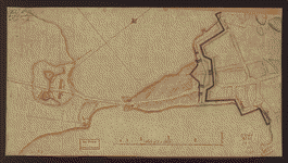
 A
Plan oe [i.e. of] the British lines on Boston Neck in
August 1775. CREATED/PUBLISHED [1775?] NOTES Scale ca.
1:3,300. Manuscript, pen-and-ink and watercolor. Has watermark.
Oriented with north to the bottom. A
Plan oe [i.e. of] the British lines on Boston Neck in
August 1775. CREATED/PUBLISHED [1775?] NOTES Scale ca.
1:3,300. Manuscript, pen-and-ink and watercolor. Has watermark.
Oriented with north to the bottom. |
 A
Map of forty miles north, thirty miles west, and twentyfive
miles south of Boston, including an accurate draft of
the harbour and town. CREATED/PUBLISHED [n.p., 1775?]
NOTES Scale ca. 1:320,000. Relief shown pictorially. Includes
"References to the harbour and environs of Boston," reflecting
points of general interest and military events which occured
in 1775, "References to the town of Boston," and inset
of "Boston Town." A
Map of forty miles north, thirty miles west, and twentyfive
miles south of Boston, including an accurate draft of
the harbour and town. CREATED/PUBLISHED [n.p., 1775?]
NOTES Scale ca. 1:320,000. Relief shown pictorially. Includes
"References to the harbour and environs of Boston," reflecting
points of general interest and military events which occured
in 1775, "References to the town of Boston," and inset
of "Boston Town." |
 Plan
of the Neck and environs. CREATED/PUBLISHED 1775?] NOTES
Scale ca. 1:12,000. Title in brackets on verso. Manuscript,
pen-and-ink and watercolor. Oriented with north to the
bottom. Relief shown by hachures. Shows fortifications
at the Boston Neck and ranges to different points from
a battery on Foster's Hill on Dorchester Neck and from
fortifications outside the Neck which do not agree. Plan
of the Neck and environs. CREATED/PUBLISHED 1775?] NOTES
Scale ca. 1:12,000. Title in brackets on verso. Manuscript,
pen-and-ink and watercolor. Oriented with north to the
bottom. Relief shown by hachures. Shows fortifications
at the Boston Neck and ranges to different points from
a battery on Foster's Hill on Dorchester Neck and from
fortifications outside the Neck which do not agree. |
 Plan
of Boston & vicinity. CREATED/PUBLISHED [1775?] NOTES
Scale ca. 1:24,000. Title from verso, legible only with
back lighting. Alternate title from Philip Lee Phillips'
A list of maps of America: Boston and environs, showing
entrenchments. Manuscript, pen-and-ink and watercolor.
Oriented with north to the left. Relief shown by shading
and hachures. Plan
of Boston & vicinity. CREATED/PUBLISHED [1775?] NOTES
Scale ca. 1:24,000. Title from verso, legible only with
back lighting. Alternate title from Philip Lee Phillips'
A list of maps of America: Boston and environs, showing
entrenchments. Manuscript, pen-and-ink and watercolor.
Oriented with north to the left. Relief shown by shading
and hachures. |
 Boston,
its environs and harbour, with the rebels works raised
against that town in 1775, from the observations of Lieut.
Page of His Majesty's Corps of Engineers, and from those
of other gentlemen. Page, Thomas Hyde, Sir, 1746-1821.
CREATED/PUBLISHED [1775?] NOTES Scale ca. 1:24,000. Manuscript,
pen-and-ink and watercolor. Relief shown by hachures.
Depths shown by soundings. Boston,
its environs and harbour, with the rebels works raised
against that town in 1775, from the observations of Lieut.
Page of His Majesty's Corps of Engineers, and from those
of other gentlemen. Page, Thomas Hyde, Sir, 1746-1821.
CREATED/PUBLISHED [1775?] NOTES Scale ca. 1:24,000. Manuscript,
pen-and-ink and watercolor. Relief shown by hachures.
Depths shown by soundings. |
 A
plan of the town of Boston and its environs, with the
lines, batteries, and incampments of the British and American
armies. [Page, Thomas Hyde, Sir] 1746-1821. CREATED/PUBLISHED
[1776] NOTES Scale ca. 1:24,000. Manuscript, pen-and-ink
and watercolor. Relief shown by hachures. Depths shown
by soundings. Includes "References." A
plan of the town of Boston and its environs, with the
lines, batteries, and incampments of the British and American
armies. [Page, Thomas Hyde, Sir] 1746-1821. CREATED/PUBLISHED
[1776] NOTES Scale ca. 1:24,000. Manuscript, pen-and-ink
and watercolor. Relief shown by hachures. Depths shown
by soundings. Includes "References." |
 Carte
du port et havre de Boston avec les côtes adjacentes,
dans laquel on a tracée les camps et les retranchemens
occupé, tant par les Anglois que par les Américains. Dediée
et presentée au Roi par ... le Chr. de Beaurain, geógraphe
de sa majeste ... en 1776. Gravé P. Croisey ci-devant
graveur de la marine. Beaurain, chevalier de, fils. CREATED/PUBLISHED
Paris [1776] NOTES Scale ca. 1:22,000. Hand colored. Relief
shown by hachures. Depths shown by soundings. "Cette carte
ŕ été copié sur un plan original apporté ŕ la cour d'Angleterre
... " Shows location of British and American forces. Indexed
for points of interest. Soundings shown in fathoms. Carte
du port et havre de Boston avec les côtes adjacentes,
dans laquel on a tracée les camps et les retranchemens
occupé, tant par les Anglois que par les Américains. Dediée
et presentée au Roi par ... le Chr. de Beaurain, geógraphe
de sa majeste ... en 1776. Gravé P. Croisey ci-devant
graveur de la marine. Beaurain, chevalier de, fils. CREATED/PUBLISHED
Paris [1776] NOTES Scale ca. 1:22,000. Hand colored. Relief
shown by hachures. Depths shown by soundings. "Cette carte
ŕ été copié sur un plan original apporté ŕ la cour d'Angleterre
... " Shows location of British and American forces. Indexed
for points of interest. Soundings shown in fathoms. |
 A
plan of Boston, and its environs, shewing the true situation
of His Majesty's army, and also those of the rebels. Drawn
by an engineer at Boston, Octr. 1775. The principal part
of this plan was survey'd by Richard Williams, Lieutenant
at Boston ... Engrav'd by Jno. Lodge. Williams, Richard,
18th cent. CREATED/PUBLISHED London, Andrew Dury, 1776.
NOTES Scale ca. 1:15,000. Relief shown by hachures. Includes
"References" to points of military and general interest.
Oriented with north toward the upper right. A
plan of Boston, and its environs, shewing the true situation
of His Majesty's army, and also those of the rebels. Drawn
by an engineer at Boston, Octr. 1775. The principal part
of this plan was survey'd by Richard Williams, Lieutenant
at Boston ... Engrav'd by Jno. Lodge. Williams, Richard,
18th cent. CREATED/PUBLISHED London, Andrew Dury, 1776.
NOTES Scale ca. 1:15,000. Relief shown by hachures. Includes
"References" to points of military and general interest.
Oriented with north toward the upper right. |
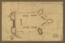
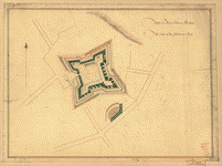
 Fort
on Charlestown Point. CREATED/PUBLISHED [1776?] NOTES
Scale 1:3,168; 264 ft. to 1 in. Manuscript, pen-and-ink
and watercolor. Has watermark. Relief shown by hachures. Fort
on Charlestown Point. CREATED/PUBLISHED [1776?] NOTES
Scale 1:3,168; 264 ft. to 1 in. Manuscript, pen-and-ink
and watercolor. Has watermark. Relief shown by hachures.
|
 Fort
on Dorcester Point. CREATED/PUBLISHED [1776?] NOTES Scale
1:480; 40 ft. to 1 in. Manuscript, pen-and-ink and watercolor.
Has watermark. Relief shown by hachures. Fort
on Dorcester Point. CREATED/PUBLISHED [1776?] NOTES Scale
1:480; 40 ft. to 1 in. Manuscript, pen-and-ink and watercolor.
Has watermark. Relief shown by hachures. |
 Fort
on Fort Hill in Boston. CREATED/PUBLISHED [1776?] NOTES
Scale 1:1,584; 132 ft. to 1 in. Manuscript, pen-and-ink
and watercolor. Has watermark. Relief shown by hachures. Fort
on Fort Hill in Boston. CREATED/PUBLISHED [1776?] NOTES
Scale 1:1,584; 132 ft. to 1 in. Manuscript, pen-and-ink
and watercolor. Has watermark. Relief shown by hachures.
|
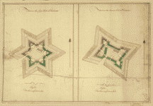 Fort
on the first hill in Dorcester. Fort on the second hill
in Dorcester. CREATED/PUBLISHED [1776?] NOTES Scale 1:480;
40 ft. to 1 in. Manuscript, pen-and-ink and watercolor.
Relief shown by hachures. Fort
on the first hill in Dorcester. Fort on the second hill
in Dorcester. CREATED/PUBLISHED [1776?] NOTES Scale 1:480;
40 ft. to 1 in. Manuscript, pen-and-ink and watercolor.
Relief shown by hachures. |
 Rough
draught of Boston and harbour. CREATED/PUBLISHED 1776?]
NOTES Scale ca. 1:18,500. Title from William Faden's Catalogue
of a curious and valuable collection of original maps
and plans. 1862. Manuscript, pen-and-ink and watercolor.
Has watermark. Shows location of troops and fortifications. Rough
draught of Boston and harbour. CREATED/PUBLISHED 1776?]
NOTES Scale ca. 1:18,500. Title from William Faden's Catalogue
of a curious and valuable collection of original maps
and plans. 1862. Manuscript, pen-and-ink and watercolor.
Has watermark. Shows location of troops and fortifications.
|
 Carte
von dem Hafen und der Stadt Boston mit den umliegenden
Gegenden und der Lägern sowohl der Americaner als auch
des Engländer, von dem Cheval. de Beaurin nach dem Pariser
Orignal von 1776. G. F. I. Frentzel, sculps. Beaurain,
chevalier de, fils. CREATED/PUBLISHED Leipzig, In der
Johann Carl Müllerischen Buch und Kunsthandlung zu haben
[1776?] NOTES Scale ca. 1:25,000. Hand colored to show
location of British and American forces. Relief shown
by hachures. Depths shown by soundings. Carte
von dem Hafen und der Stadt Boston mit den umliegenden
Gegenden und der Lägern sowohl der Americaner als auch
des Engländer, von dem Cheval. de Beaurin nach dem Pariser
Orignal von 1776. G. F. I. Frentzel, sculps. Beaurain,
chevalier de, fils. CREATED/PUBLISHED Leipzig, In der
Johann Carl Müllerischen Buch und Kunsthandlung zu haben
[1776?] NOTES Scale ca. 1:25,000. Hand colored to show
location of British and American forces. Relief shown
by hachures. Depths shown by soundings. |
 A
plan of the town of Boston, with the intrenchments &c.
of His Majestys forces in 1775: From the observations
of Lieut. Page of His Majesty's Corps of Engineers; and
from the plans of other gentlemen. Page, Thomas Hyde,
Sir, 1746-1821. CREATED/PUBLISHED [London]; Engraved &
printed for Wm. Faden, 1777. NOTES Scale ca. 1:9,700.
Includes "References to the lines &c." and "References
to the town." A
plan of the town of Boston, with the intrenchments &c.
of His Majestys forces in 1775: From the observations
of Lieut. Page of His Majesty's Corps of Engineers; and
from the plans of other gentlemen. Page, Thomas Hyde,
Sir, 1746-1821. CREATED/PUBLISHED [London]; Engraved &
printed for Wm. Faden, 1777. NOTES Scale ca. 1:9,700.
Includes "References to the lines &c." and "References
to the town." |
 A
plan of Boston in New England with its environs, including
Milton, Dorchester, Roxbury, Brooklin, Cambridge, Medford,
Charlestown, parts of Malden and Chelsea with the military
works constructed in those places in the years 1775 and
1776. Engrav'd in aqua tinta by Francis Jukes. Pelham,
Henry, 1749-1806. CREATED/PUBLISHED London, 1777. NOTES
Scale ca. 1:14,000. Relief shown by shading. Depths shown
by soundings. Includes facsimile of pass issued by James
Urquhart, town major, to allow free passage of Henry Pelham
"to take a plan of the towns of Boston & Charlestown and
the rebel works round these places;" dedication "To the
Right Honourable Lord George Germain ... " with autographed
signature of Henry Pelham; and, index to points of interest
in margin. Oriented with north toward the upper right. A
plan of Boston in New England with its environs, including
Milton, Dorchester, Roxbury, Brooklin, Cambridge, Medford,
Charlestown, parts of Malden and Chelsea with the military
works constructed in those places in the years 1775 and
1776. Engrav'd in aqua tinta by Francis Jukes. Pelham,
Henry, 1749-1806. CREATED/PUBLISHED London, 1777. NOTES
Scale ca. 1:14,000. Relief shown by shading. Depths shown
by soundings. Includes facsimile of pass issued by James
Urquhart, town major, to allow free passage of Henry Pelham
"to take a plan of the towns of Boston & Charlestown and
the rebel works round these places;" dedication "To the
Right Honourable Lord George Germain ... " with autographed
signature of Henry Pelham; and, index to points of interest
in margin. Oriented with north toward the upper right.
|
 A
plan of the town of Boston with the intrenchments &ca.
of His Majesty's forces in 1775, from the observations
of Lieut. Page of His Majesty's Corps of Engineers, and
from those of other gentlemen. Page, Thomas Hyde, Sir,
1746-1821. CREATED/PUBLISHED [1777?] NOTES Scale ca. 1:9,600.
Manuscript, pen-and-ink and watercolor. Relief shown by
hachures. A
plan of the town of Boston with the intrenchments &ca.
of His Majesty's forces in 1775, from the observations
of Lieut. Page of His Majesty's Corps of Engineers, and
from those of other gentlemen. Page, Thomas Hyde, Sir,
1746-1821. CREATED/PUBLISHED [1777?] NOTES Scale ca. 1:9,600.
Manuscript, pen-and-ink and watercolor. Relief shown by
hachures. |
 Plan
of the town with the attack on Bunkers-Hill in the peninsula
of Charlestown, the 17th. of June 1775. Robson, T. CREATED/PUBLISHED
Newcastle upon Tyne [Eng.] Printed for T. Robson [1778]
NOTES Scale ca. 1:19,000. Relief shown by hachures. Battle
of Bunker Hill shown pictorially. Plan
of the town with the attack on Bunkers-Hill in the peninsula
of Charlestown, the 17th. of June 1775. Robson, T. CREATED/PUBLISHED
Newcastle upon Tyne [Eng.] Printed for T. Robson [1778]
NOTES Scale ca. 1:19,000. Relief shown by hachures. Battle
of Bunker Hill shown pictorially. |
 Boston,
its environs and harbour, with the rebels works raised
against that town in 1775, from the observations of Lieut.
Page of His Majesty's Corps of Engineers, and from the
plans of Capt. Montresor. Page, Thomas Hyde, Sir, 1746-1821.
CREATED/PUBLISHED [London] Wm. Faden, 1778. NOTES Scale
ca. 1:24,000. Relief shown by hachures. Depths shown by
soundings. Boston,
its environs and harbour, with the rebels works raised
against that town in 1775, from the observations of Lieut.
Page of His Majesty's Corps of Engineers, and from the
plans of Capt. Montresor. Page, Thomas Hyde, Sir, 1746-1821.
CREATED/PUBLISHED [London] Wm. Faden, 1778. NOTES Scale
ca. 1:24,000. Relief shown by hachures. Depths shown by
soundings. |
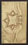 A
Temporary project for a star redout [sic] to contain 150
men. CREATED/PUBLISHED [1778?] NOTES Scale not given.
Manuscript, pen-and-ink and watercolor. "No. 53." On verso,
partly illegible and in a different hand: Boston ... part
of the ... project for the war ... Drawing of a fortification
on the road to Roxbury near Boston Neck, with list of
proposed guns. A
Temporary project for a star redout [sic] to contain 150
men. CREATED/PUBLISHED [1778?] NOTES Scale not given.
Manuscript, pen-and-ink and watercolor. "No. 53." On verso,
partly illegible and in a different hand: Boston ... part
of the ... project for the war ... Drawing of a fortification
on the road to Roxbury near Boston Neck, with list of
proposed guns. |
 Chart
of Buzzards Bay and Vineyard Sound. Des Barres, Joseph
F. W. (Joseph Frederick Wallet), 1722-1824. CREATED/PUBLISHED
London] 1776. NOTES Scale ca. 1:51,000. Depths shown by
soundings. Chart
of Buzzards Bay and Vineyard Sound. Des Barres, Joseph
F. W. (Joseph Frederick Wallet), 1722-1824. CREATED/PUBLISHED
London] 1776. NOTES Scale ca. 1:51,000. Depths shown by
soundings. |
 Buzzards
Bay and shoals of Nantucket. Knight, John. CREATED/PUBLISHED
[1778] NOTES Scale ca. 1:100,000. Title on verso: Nantucket
Shoals and Buzzards's Bay by Lieutt. Knight, 1778. Soundings
shown in fathoms. Manuscript, pen-and-ink, pencil, and
watercolor. Watermark: Large fleur-de-lis in a shield
surmounted by a crown over an undecipherable figure, all
of which are over the letters GR and J. Whatman. Buzzards
Bay and shoals of Nantucket. Knight, John. CREATED/PUBLISHED
[1778] NOTES Scale ca. 1:100,000. Title on verso: Nantucket
Shoals and Buzzards's Bay by Lieutt. Knight, 1778. Soundings
shown in fathoms. Manuscript, pen-and-ink, pencil, and
watercolor. Watermark: Large fleur-de-lis in a shield
surmounted by a crown over an undecipherable figure, all
of which are over the letters GR and J. Whatman. |
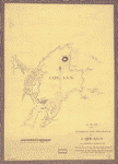 A
plan of the harbour and peninsula of Cape Ann in North
America, drawn from a survey: the soundings & naval observations
by Lieut: Henry Mowat, commander of His. Majys: armed
ship Canceaux P: D'Auvergne, fecit, 1776. N.B. this is
surveyed by Samuel Holland, Esqr. Holland, Samuel, 1728-1801.
CREATED/PUBLISHED [1776] NOTES Scale ca. 1:53,000. Manuscript,
pen-and-ink. Relief shown by hachures. Depths shown by
soundings. A
plan of the harbour and peninsula of Cape Ann in North
America, drawn from a survey: the soundings & naval observations
by Lieut: Henry Mowat, commander of His. Majys: armed
ship Canceaux P: D'Auvergne, fecit, 1776. N.B. this is
surveyed by Samuel Holland, Esqr. Holland, Samuel, 1728-1801.
CREATED/PUBLISHED [1776] NOTES Scale ca. 1:53,000. Manuscript,
pen-and-ink. Relief shown by hachures. Depths shown by
soundings. |
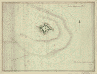
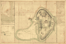 A
general & particular plan of the island of Castle William
near Boston, shewing the works in their original & present
state, together with sections thro' the same. Carried
on and survey'd under the direction of and by John Montrésor,
Esqr., engineer extraordinary & Capt. Lieut. by order
of the Honble: Thomas Gage, Esqr., Lieutenant General
and Commander in Chief of His Majesty's forces in North
America. Montrésor, John, 1736-1799. CREATED/PUBLISHED
[1771?] NOTES Scale 1:600; 50 ft. to an in. Manuscript,
pen-and-ink and watercolor. Has watermarks. Relief shown
by shading. Oriented with north toward the upper right. A
general & particular plan of the island of Castle William
near Boston, shewing the works in their original & present
state, together with sections thro' the same. Carried
on and survey'd under the direction of and by John Montrésor,
Esqr., engineer extraordinary & Capt. Lieut. by order
of the Honble: Thomas Gage, Esqr., Lieutenant General
and Commander in Chief of His Majesty's forces in North
America. Montrésor, John, 1736-1799. CREATED/PUBLISHED
[1771?] NOTES Scale 1:600; 50 ft. to an in. Manuscript,
pen-and-ink and watercolor. Has watermarks. Relief shown
by shading. Oriented with north toward the upper right.
|
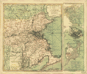 The
Seat of war in New England, by an American volunteer,
with the marches of the several corps sent by the Colonies
towards Boston, with the attack on Bunkers-Hill. CREATED/PUBLISHED
London, Printed for R. Sayer & J. Bennett, 1775. NOTES
Scale ca. 1:450,000. Hand colored. Prime meridian: Boston.
Relief shown by hachures. Includes "Plan of Boston Harbour,
from an actual survey" and "Plan of the town of Boston
with the attack on Bunkers-Hill in the peninsula of Charlestown,
the 17th of June, 1775." The
Seat of war in New England, by an American volunteer,
with the marches of the several corps sent by the Colonies
towards Boston, with the attack on Bunkers-Hill. CREATED/PUBLISHED
London, Printed for R. Sayer & J. Bennett, 1775. NOTES
Scale ca. 1:450,000. Hand colored. Prime meridian: Boston.
Relief shown by hachures. Includes "Plan of Boston Harbour,
from an actual survey" and "Plan of the town of Boston
with the attack on Bunkers-Hill in the peninsula of Charlestown,
the 17th of June, 1775." |
This is a must have collection for any map history buff!
To use this software, you must install the free ExpressView
MrSid software which is included on the CD. This is a 30 second
process and will allow you to view and manipulate/print all
the maps in this CD collection in full detail. There is a version
for both Windows platforms and Macintosh platforms and full
installation instructions are included on the CD.
|


