This
CD contains 54 rare antique maps and descriptive pages representing
fascinating details about New Jersey and its vicinity during
the Revolutionary War in MrSid format. This
format allows you to see the entire map on your computer screen
or drill down to see the smallest details. The original maps
are often quite large, as much as 36" long or larger
and quite detailed. With the MrSID software, you can manipulate
the map to print the entire map in great detail or zoom into
a portion of the map in full detail for viewing or printing.
You could even bring the images to a local print shop to have
the maps reprinted in their full size. (MrSID software is
included on the CD.)
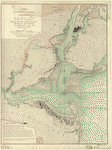
To
give you a sample of the detail you can expect in these maps,
here is an example based on a panoramic map of Washington,
DC.
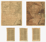
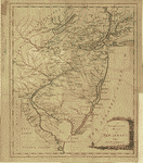
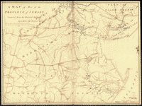
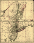
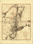
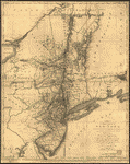
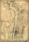
The
table below shows the description and a small image of each
map on this incredible history CD.
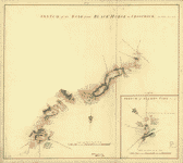
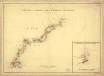
 Map
of the coast of New Jersey from Barnegat Inlet to Cape
May. CREATED/PUBLISHED 177-?] NOTES Scale ca. 1:32,000.
Manuscript, pen-and-ink. Oriented with north to the right.
Relief shown by shading. Soundings shown in fathoms. Shows
the coast and the Mullica River inland to the site of
the "Batsto forge." Indexed for points of interest. Map
of the coast of New Jersey from Barnegat Inlet to Cape
May. CREATED/PUBLISHED 177-?] NOTES Scale ca. 1:32,000.
Manuscript, pen-and-ink. Oriented with north to the right.
Relief shown by shading. Soundings shown in fathoms. Shows
the coast and the Mullica River inland to the site of
the "Batsto forge." Indexed for points of interest. |
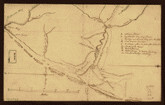
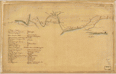
 Sketch
of the road from Black Horse to Crosswick, by I. Hills,
June 1778. Sketch of Allens Town, June 1778. Hills, John,
surveyor. CREATED/PUBLISHED [1778] NOTES Scale ca. 1:26,000
and ca. 1:16,000; 800 paces to an in. (not 400 paces to
an in.) and 400 paces to an in. Manuscript, pen-and-ink
and watercolor. Has watermarks. Sketch
of the road from Black Horse to Crosswick, by I. Hills,
June 1778. Sketch of Allens Town, June 1778. Hills, John,
surveyor. CREATED/PUBLISHED [1778] NOTES Scale ca. 1:26,000
and ca. 1:16,000; 800 paces to an in. (not 400 paces to
an in.) and 400 paces to an in. Manuscript, pen-and-ink
and watercolor. Has watermarks. |
 Sketch
of the road from Black Horse to Crosswick. Sketch of Allen's
Town. [By] I. H. Hills, John, surveyor. CREATED/PUBLISHED
1778. NOTES Scale ca. 1:26,000; 800 paces to the in. Manuscript,
pen-and-ink and watercolor. Has watermarks. Relief shown
by shading. Sketch
of the road from Black Horse to Crosswick. Sketch of Allen's
Town. [By] I. H. Hills, John, surveyor. CREATED/PUBLISHED
1778. NOTES Scale ca. 1:26,000; 800 paces to the in. Manuscript,
pen-and-ink and watercolor. Has watermarks. Relief shown
by shading. |
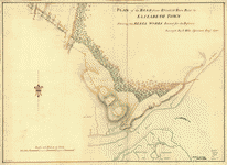 Plan
of the road from Elizabeth Town Point to Elizabeth Town
shewing the rebel works raised for its defence. Survey'd
by I. Hills, assistant engr., 1780. Hills, John, surveyor.
CREATED/PUBLISHED [1780] NOTES Scale ca. 1:4,800; 400
ft. to an in. Manuscript, pen-and-ink and watercolor.
Has watermarks. Relief shown by shading. Plan
of the road from Elizabeth Town Point to Elizabeth Town
shewing the rebel works raised for its defence. Survey'd
by I. Hills, assistant engr., 1780. Hills, John, surveyor.
CREATED/PUBLISHED [1780] NOTES Scale ca. 1:4,800; 400
ft. to an in. Manuscript, pen-and-ink and watercolor.
Has watermarks. Relief shown by shading. |
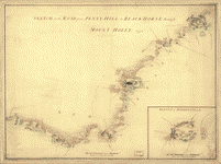 Sketch
of Haddonfield. Sketch of the road from Penny Hill to
Black Horse through Mount Holly, 1778. [By] I. H. Hills,
John, surveyor. CREATED/PUBLISHED [1778] NOTES Scale ca.
1:36,000 (not 800 paces to an inch.). Manuscript, pen-and-ink
and watercolor. Has watermarks. Relief shown by shading. Sketch
of Haddonfield. Sketch of the road from Penny Hill to
Black Horse through Mount Holly, 1778. [By] I. H. Hills,
John, surveyor. CREATED/PUBLISHED [1778] NOTES Scale ca.
1:36,000 (not 800 paces to an inch.). Manuscript, pen-and-ink
and watercolor. Has watermarks. Relief shown by shading.
|
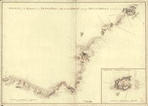 Sketch
of Haddonfield, March 1778. Sketch of the roads from Pennyhill
to Black Horse through Mount Holly. By I. Hills, June
1778. Hills, John, surveyor. CREATED/PUBLISHED [1778]
NOTES Scale ca. 1:16,000 and ca. 1:32,000; 400 paces to
an in. and 800 paces to an in. (not 400 paces to an in.).
Manuscript, pen-and-ink and watercolor. Has watermarks.
No. 5 oriented with north toward the lower left. Relief
shown by shading. Sketch
of Haddonfield, March 1778. Sketch of the roads from Pennyhill
to Black Horse through Mount Holly. By I. Hills, June
1778. Hills, John, surveyor. CREATED/PUBLISHED [1778]
NOTES Scale ca. 1:16,000 and ca. 1:32,000; 400 paces to
an in. and 800 paces to an in. (not 400 paces to an in.).
Manuscript, pen-and-ink and watercolor. Has watermarks.
No. 5 oriented with north toward the lower left. Relief
shown by shading. |
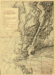
 Map
showing the west shore of the North or Hudson River, from
surveys by Lieut. B. Ratzer-of His Majesty's 60th or Royal
American Regiment, made in the years 1766 and 1767. Ratzer,
Bernard. CREATED/PUBLISHED [1767?] NOTES Scale not given.
Title from penciled annotation in upper left corner. Manuscript,
pen-and-ink tracing. Relief shown by hachures. Depths
shown by form lines. Shows the coastal area of Jersey
City from "Hobocken" to "Salt Meadows." Map
showing the west shore of the North or Hudson River, from
surveys by Lieut. B. Ratzer-of His Majesty's 60th or Royal
American Regiment, made in the years 1766 and 1767. Ratzer,
Bernard. CREATED/PUBLISHED [1767?] NOTES Scale not given.
Title from penciled annotation in upper left corner. Manuscript,
pen-and-ink tracing. Relief shown by hachures. Depths
shown by form lines. Shows the coastal area of Jersey
City from "Hobocken" to "Salt Meadows." |
 Amboy
to Elizabethtown. CREATED/PUBLISHED 1778?] NOTES Scale
ca. 1:9,000. Title from manuscript catalog of Peter Force
map collection. Manuscript, pen-and-ink. Oriented with
north toward the lower right. Shows eastern part of Middlesex
and Union counties opposite Staten Island. Amboy
to Elizabethtown. CREATED/PUBLISHED 1778?] NOTES Scale
ca. 1:9,000. Title from manuscript catalog of Peter Force
map collection. Manuscript, pen-and-ink. Oriented with
north toward the lower right. Shows eastern part of Middlesex
and Union counties opposite Staten Island. |
 A
map, Middlesex County. Reduced from the original survey
by I. Hills, asst. engineer, 1781. Hills, John, surveyor.
CREATED/PUBLISHED [1781] NOTES Scale ca. 1:64,000. Title
from table of contents: A survey of Middlesex County by
B. Morgan, A. Dunham [and] J. Rue. Manuscript, pen-and-ink
and watercolor. Has watermarks. Oriented with north to
the right. A
map, Middlesex County. Reduced from the original survey
by I. Hills, asst. engineer, 1781. Hills, John, surveyor.
CREATED/PUBLISHED [1781] NOTES Scale ca. 1:64,000. Title
from table of contents: A survey of Middlesex County by
B. Morgan, A. Dunham [and] J. Rue. Manuscript, pen-and-ink
and watercolor. Has watermarks. Oriented with north to
the right. |
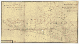 A
map of Monmouth County. Reduced from the original survey
by I. Hills, asst. engineer, 1781. Hills, John, surveyor.
CREATED/PUBLISHED [1781] NOTES Scale ca. 1:63,000. Title
from table of contents: A survey of Monmouth County by
B. Morgan, I. Williams [and] A. Dennis. Manuscript, pen-and-ink
and watercolor. Has watermarks. Oriented with north to
the right. A
map of Monmouth County. Reduced from the original survey
by I. Hills, asst. engineer, 1781. Hills, John, surveyor.
CREATED/PUBLISHED [1781] NOTES Scale ca. 1:63,000. Title
from table of contents: A survey of Monmouth County by
B. Morgan, I. Williams [and] A. Dennis. Manuscript, pen-and-ink
and watercolor. Has watermarks. Oriented with north to
the right. |
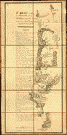 Carte
de l'affaire de Montmouth : ou le G'al Washington commandon
l'armée américaine et le G'l Clinton l'armée angloise
le 28 juin 1778 / par M'r Capitaine, A.d.C. du Général
LaFayette. Capitaine du Chesnoy, Michel, 1746-1804. OTHER
TITLES Title on ms. label affixed to cloth backing: Carte
de l'affaire de Montmouth le 28 juin 1778 entre Clinton
et Washington CREATED/PUBLISHED [1778] NOTES Shows troop
positions at the Battle of Monmouth (near Englishtown,
Monmouth Co., N.J.). Relief shown by hachures. Place-names
in English. Pen-and-ink and watercolors. Sectioned to
12 panels and mounted on cloth backing to fold to ca.
20 x 14 cm. Includes descriptive index of military positions. Carte
de l'affaire de Montmouth : ou le G'al Washington commandon
l'armée américaine et le G'l Clinton l'armée angloise
le 28 juin 1778 / par M'r Capitaine, A.d.C. du Général
LaFayette. Capitaine du Chesnoy, Michel, 1746-1804. OTHER
TITLES Title on ms. label affixed to cloth backing: Carte
de l'affaire de Montmouth le 28 juin 1778 entre Clinton
et Washington CREATED/PUBLISHED [1778] NOTES Shows troop
positions at the Battle of Monmouth (near Englishtown,
Monmouth Co., N.J.). Relief shown by hachures. Place-names
in English. Pen-and-ink and watercolors. Sectioned to
12 panels and mounted on cloth backing to fold to ca.
20 x 14 cm. Includes descriptive index of military positions.
|
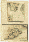 Plan
of Perth Amboy from an actual survey. Sketch of Bonham
Town. [Grant, James, deputy surveyor] CREATED/PUBLISHED
[1777?] NOTES Scale ca. 1:12,000 and scale not given.
Manuscript, pen-and-ink and watercolor. Has watermark.
Relief shown by shading. Sketch of Bonhamton shows "Redoubts
for its defence in the winter, 1776-1777." Plan
of Perth Amboy from an actual survey. Sketch of Bonham
Town. [Grant, James, deputy surveyor] CREATED/PUBLISHED
[1777?] NOTES Scale ca. 1:12,000 and scale not given.
Manuscript, pen-and-ink and watercolor. Has watermark.
Relief shown by shading. Sketch of Bonhamton shows "Redoubts
for its defence in the winter, 1776-1777." |
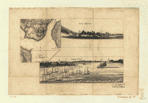 Plan
d'Amboy. Vues de la rade de Charles-Town et de Fort Sulivan,
mai 1780. CREATED/PUBLISHED n.p., 1780] NOTES Scale ca.
1:25,600. Title from Philip Lee Phillips' List of maps
of America. Has watermark. Relief shown by hachures. The
view of Charleston Harbor concerns the assault on Fort
Sulivan during the siege of Charleston, 1780. Plan d'Amboy.--Fort-Sulivan.--Charles-Town. Plan
d'Amboy. Vues de la rade de Charles-Town et de Fort Sulivan,
mai 1780. CREATED/PUBLISHED n.p., 1780] NOTES Scale ca.
1:25,600. Title from Philip Lee Phillips' List of maps
of America. Has watermark. Relief shown by hachures. The
view of Charleston Harbor concerns the assault on Fort
Sulivan during the siege of Charleston, 1780. Plan d'Amboy.--Fort-Sulivan.--Charles-Town.
|
 Plan
of Princeton, Dec. 31, 1776. [Cadwalader, John] 1742-1786.
CREATED/PUBLISHED [1776] NOTES Scale not given. Title
on verso. Manuscript, pen-and-ink. Reconnaissance map
showing "Gen Lesley, or headquarters" position with entrenchments
near Princeton on December 31, 1776. Apparently the map
referred to by General Cadwalader in his letter to General
Washington, dated Crosswicks, Dec. 31, 1776. Includes
descriptive notes. Plan
of Princeton, Dec. 31, 1776. [Cadwalader, John] 1742-1786.
CREATED/PUBLISHED [1776] NOTES Scale not given. Title
on verso. Manuscript, pen-and-ink. Reconnaissance map
showing "Gen Lesley, or headquarters" position with entrenchments
near Princeton on December 31, 1776. Apparently the map
referred to by General Cadwalader in his letter to General
Washington, dated Crosswicks, Dec. 31, 1776. Includes
descriptive notes. |
 A
map, Somerset County. Reduced from the original survey
by I. Hills, asst. engineer, 1781. Hills, John, surveyor.
CREATED/PUBLISHED [1781] NOTES Scale ca. 1:64,000. Title
from table of contents: A survey of Sommerset County by
B. Morgan. Manuscript, pen-and-ink and watercolor. Has
watermarks. Oriented with north to the right. A
map, Somerset County. Reduced from the original survey
by I. Hills, asst. engineer, 1781. Hills, John, surveyor.
CREATED/PUBLISHED [1781] NOTES Scale ca. 1:64,000. Title
from table of contents: A survey of Sommerset County by
B. Morgan. Manuscript, pen-and-ink and watercolor. Has
watermarks. Oriented with north to the right. |
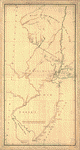
 Three
maps [i.e. map on 3 sheets] of northern New Jersey, with
reference to the boundary between New York and New Jersey.
OTHER TITLES Three maps of northern New Jersey, with reference
to the boundary between New York and New Jersey CREATED/PUBLISHED
[1769?] NOTES Scale ca. 1:180,000. Title from William
Faden's Catalogue of a curious and valuable collection
of original maps and plans. Boston, 1862. Manuscript,
pen-and-ink and watercolor. Relief shown by hachures and
shading. Imperfect: Edges torn. Shows roads, county and
township boundaries, land grants, the division line between
East and West Jersey, 5 different proposed division lines
between New Jersey and New York by separate claims and
surveys, and part of long island. Three
maps [i.e. map on 3 sheets] of northern New Jersey, with
reference to the boundary between New York and New Jersey.
OTHER TITLES Three maps of northern New Jersey, with reference
to the boundary between New York and New Jersey CREATED/PUBLISHED
[1769?] NOTES Scale ca. 1:180,000. Title from William
Faden's Catalogue of a curious and valuable collection
of original maps and plans. Boston, 1862. Manuscript,
pen-and-ink and watercolor. Relief shown by hachures and
shading. Imperfect: Edges torn. Shows roads, county and
township boundaries, land grants, the division line between
East and West Jersey, 5 different proposed division lines
between New Jersey and New York by separate claims and
surveys, and part of long island. |
 Lines
run in the Jersies for determining boundaries between
that Province & New York. CREATED/PUBLISHED [1769?] NOTES
Scale ca. 1:740,000. Title from verso. Manuscript, pen-and-ink. Lines
run in the Jersies for determining boundaries between
that Province & New York. CREATED/PUBLISHED [1769?] NOTES
Scale ca. 1:740,000. Title from verso. Manuscript, pen-and-ink.
|
 New
York & New Jersey commissioners line from 410 on Hudson's
River taken in 1769. CREATED/PUBLISHED [1769?] NOTES Scale
ca. 1:600,000. Title from verso. At head of title, in
a different hand: New York & New Jersey. Manuscript, pen-and-ink
and watercolor. Shows "Province of New Jersey," "Part
of the province of New York," part of the "Province of
Pensylvania," and the "Partition line ordered by the commissioners
in 1769." New
York & New Jersey commissioners line from 410 on Hudson's
River taken in 1769. CREATED/PUBLISHED [1769?] NOTES Scale
ca. 1:600,000. Title from verso. At head of title, in
a different hand: New York & New Jersey. Manuscript, pen-and-ink
and watercolor. Shows "Province of New Jersey," "Part
of the province of New York," part of the "Province of
Pensylvania," and the "Partition line ordered by the commissioners
in 1769." |
 Map
of British outposts between Burlington and New Bridge,
New Jersey, December 1776. CREATED/PUBLISHED 1776] NOTES
Not drawn to scale. Alternate title in Philip Lee Phillips'
A list of maps of America: Maps of the road taken by the
British troops from New Bridge to Burlington, N.J. Manuscript,
pen-and-ink and watercolor. Has watermarks. Shows roads
and distances between posts. Includes table of military
units and their stations. Map
of British outposts between Burlington and New Bridge,
New Jersey, December 1776. CREATED/PUBLISHED 1776] NOTES
Not drawn to scale. Alternate title in Philip Lee Phillips'
A list of maps of America: Maps of the road taken by the
British troops from New Bridge to Burlington, N.J. Manuscript,
pen-and-ink and watercolor. Has watermarks. Shows roads
and distances between posts. Includes table of military
units and their stations. |
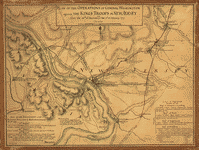 Plan
of the operations of General Washington against the King's
troops in New Jersey, from the 26th of December 1776 to
the 3d of January 1777. CREATED/PUBLISHED [1777] NOTES
Scale ca. 1:113,000. Manuscript, pen-and-ink and watercolor.
Relief shown by hachures. Shows area from Newtown, Pennsylvania
to Kingston, New Jersey, with routes of British and American
forces. Includes tables "Loss in the engagement on the
road from Princetown to Maidenhead, January the 3d 1777"
and "Loss at Trenton, December 26th 1776." Plan
of the operations of General Washington against the King's
troops in New Jersey, from the 26th of December 1776 to
the 3d of January 1777. CREATED/PUBLISHED [1777] NOTES
Scale ca. 1:113,000. Manuscript, pen-and-ink and watercolor.
Relief shown by hachures. Shows area from Newtown, Pennsylvania
to Kingston, New Jersey, with routes of British and American
forces. Includes tables "Loss in the engagement on the
road from Princetown to Maidenhead, January the 3d 1777"
and "Loss at Trenton, December 26th 1776." |
 A
New and accurate map of the present seat of war in North
America, comprehending New Jersey, Philadelphia, Pensylvania,
New-York, &c. CREATED/PUBLISHED [London, 1777] NOTES Scale
ca. 1:550,000. Relief shown pictorially. From the Universal
magazine, v. 61, June 1777. Accompanied by: A succinct
account of the city of Philadelphia, illustrated with
a new and accurate map of the present seat of war in North
America, comprehending Philadelphia, Pennsylvania, New-York,
New-Jersey A
New and accurate map of the present seat of war in North
America, comprehending New Jersey, Philadelphia, Pensylvania,
New-York, &c. CREATED/PUBLISHED [London, 1777] NOTES Scale
ca. 1:550,000. Relief shown pictorially. From the Universal
magazine, v. 61, June 1777. Accompanied by: A succinct
account of the city of Philadelphia, illustrated with
a new and accurate map of the present seat of war in North
America, comprehending Philadelphia, Pennsylvania, New-York,
New-Jersey |
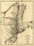
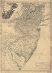  The
Province of New Jersey, divided into East and West, commonly
called the Jerseys. Engraved & published by Wm. Faden.
Faden, William, 1750?-1836. CREATED/PUBLISHED [London]
1777. NOTES Scale ca. 1:420,000. Hand colored. LC copy
2 imperfect: Deteriorated in margins. Prime meridian:
Philadelphia. Relief shown by hachures. Shows county boundaries
and "Division line run in 1743 between East New Jersey
and West New Jersey." "This map has been drawn from the
survey made in 1769 ... by Bernard Ratzer ... and from
another large survey of the northern parts ... by Gerard
Banker." The
Province of New Jersey, divided into East and West, commonly
called the Jerseys. Engraved & published by Wm. Faden.
Faden, William, 1750?-1836. CREATED/PUBLISHED [London]
1777. NOTES Scale ca. 1:420,000. Hand colored. LC copy
2 imperfect: Deteriorated in margins. Prime meridian:
Philadelphia. Relief shown by hachures. Shows county boundaries
and "Division line run in 1743 between East New Jersey
and West New Jersey." "This map has been drawn from the
survey made in 1769 ... by Bernard Ratzer ... and from
another large survey of the northern parts ... by Gerard
Banker." |
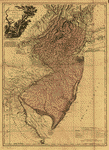
 The
Province of New Jersey, divided into East and West, commonly
called the Jerseys. Engraved & published by Wm. Faden.
Faden, William, 1750?-1836. CREATED/PUBLISHED [London]
1778. NOTES Scale ca. 1:420,000. Hand colored. LC copy
imperfect: Margins are deteriorated. Prime meridian: Philadelphia.
Relief shown by hachures. Shows county boundaries and
"Division line run in 1743 between East New Jersey and
West New Jersey." "This map has been drawn from the survey
made in 1769 ... by Bernard Ratzer ... and from another
large survey of the northern parts ... by Gerard Banker." The
Province of New Jersey, divided into East and West, commonly
called the Jerseys. Engraved & published by Wm. Faden.
Faden, William, 1750?-1836. CREATED/PUBLISHED [London]
1778. NOTES Scale ca. 1:420,000. Hand colored. LC copy
imperfect: Margins are deteriorated. Prime meridian: Philadelphia.
Relief shown by hachures. Shows county boundaries and
"Division line run in 1743 between East New Jersey and
West New Jersey." "This map has been drawn from the survey
made in 1769 ... by Bernard Ratzer ... and from another
large survey of the northern parts ... by Gerard Banker."
|
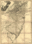 The
Province of New Jersey, divided into East and West, commonly
called the Jerseys. Engraved & published by Wm. Faden.
Faden, William, 1750?-1836. CREATED/PUBLISHED [London]
1778. NOTES Scale ca. 1:420,000. Sectioned and mounted
on cloth backing. Prime meridian: Philadelphia. Relief
shown by hachures. Shows county boundaries and "Division
line run in 1743 between East New Jersey and West New
Jersey." "This map has been drawn from the survey made
in 1769 ... by Bernard Ratzer ... and from another large
survey of the northern parts ... by Gerard Banker." The
Province of New Jersey, divided into East and West, commonly
called the Jerseys. Engraved & published by Wm. Faden.
Faden, William, 1750?-1836. CREATED/PUBLISHED [London]
1778. NOTES Scale ca. 1:420,000. Sectioned and mounted
on cloth backing. Prime meridian: Philadelphia. Relief
shown by hachures. Shows county boundaries and "Division
line run in 1743 between East New Jersey and West New
Jersey." "This map has been drawn from the survey made
in 1769 ... by Bernard Ratzer ... and from another large
survey of the northern parts ... by Gerard Banker." |
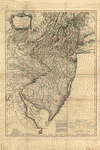 The
Province of New Jersey, divided into East and West, commonly
called the Jerseys. Engraved & published by Wm. Faden,
Charing Cross, December 1st, 1777. Croisey, sculpt. Faden,
William, 1750?-1836. CREATED/PUBLISHED Paris, Chez les
Srs. Perrier et Verrier [1778?] NOTES Scale ca. 1:430,000.
Hand colored. LC copy imperfect: Deteriorated along folds.
Prime meridian: Philadelphia. Relief shown by hachures.
Cartographic source note in English and French. Shows
county boundaries and "Division line run in 1743 between
East New Jersey and West New Jersey." "This map has been
drawn from the survey made in 1769 ... by Bernard Ratzer
... and from another large survey of the northern parts
... by Gerard Banker." The
Province of New Jersey, divided into East and West, commonly
called the Jerseys. Engraved & published by Wm. Faden,
Charing Cross, December 1st, 1777. Croisey, sculpt. Faden,
William, 1750?-1836. CREATED/PUBLISHED Paris, Chez les
Srs. Perrier et Verrier [1778?] NOTES Scale ca. 1:430,000.
Hand colored. LC copy imperfect: Deteriorated along folds.
Prime meridian: Philadelphia. Relief shown by hachures.
Cartographic source note in English and French. Shows
county boundaries and "Division line run in 1743 between
East New Jersey and West New Jersey." "This map has been
drawn from the survey made in 1769 ... by Bernard Ratzer
... and from another large survey of the northern parts
... by Gerard Banker." |
 The
State of New Jersey. CREATED/PUBLISHED [n.p., 178-?] NOTES
Scale ca. 1:650,000. Shows boundaries between East and
West Jersey, 1676-1775, and between New Jersey and New
York. The
State of New Jersey. CREATED/PUBLISHED [n.p., 178-?] NOTES
Scale ca. 1:650,000. Shows boundaries between East and
West Jersey, 1676-1775, and between New Jersey and New
York. |
 A new and accurate map of New Jersey, from the best authorities.
CREATED/PUBLISHED [London, 1780] NOTES From The universal
magazine of knowledge and pleasure (June, 1780), vol.
66. Text in pocket. Includes part of New York, Pennsylvania
and Delaware. Shows counties, towns and cities, road,
mills, rivers and streams, ferries, bays, and inlets,
beaches, Sandy Hook lighthouse, lines of division between
New Jersey and West Jersey for 1687 to 1743, and relief.
A new and accurate map of New Jersey, from the best authorities.
CREATED/PUBLISHED [London, 1780] NOTES From The universal
magazine of knowledge and pleasure (June, 1780), vol.
66. Text in pocket. Includes part of New York, Pennsylvania
and Delaware. Shows counties, towns and cities, road,
mills, rivers and streams, ferries, bays, and inlets,
beaches, Sandy Hook lighthouse, lines of division between
New Jersey and West Jersey for 1687 to 1743, and relief.
|
 A
map of part of the province of Jersey. Compiled from the
original surveys by I. Hills, asst. engineer, 1781. Hills,
John, surveyor. CREATED/PUBLISHED [1781] NOTES Scale ca.
1:85,000. Title from table of contents: A survey of part
of the province of New Jersey contain[in]g part of Middlesex
County, and part of Monmouth, Somerset, and Essex counties
with part of Statten [sic] Island in the province of New
York. By Morgan, Williams, Dennis, Rue, Dunham, Taylor,
Skinner, &c. Manuscript, pen-and-ink and watercolor. A
map of part of the province of Jersey. Compiled from the
original surveys by I. Hills, asst. engineer, 1781. Hills,
John, surveyor. CREATED/PUBLISHED [1781] NOTES Scale ca.
1:85,000. Title from table of contents: A survey of part
of the province of New Jersey contain[in]g part of Middlesex
County, and part of Monmouth, Somerset, and Essex counties
with part of Statten [sic] Island in the province of New
York. By Morgan, Williams, Dennis, Rue, Dunham, Taylor,
Skinner, &c. Manuscript, pen-and-ink and watercolor. |
 A
sketch of the northern parts of New Jersey. Copied from
the original by Lieut. I. Hills, 23d Regt., 1781. Hills,
John, surveyor. CREATED/PUBLISHED [1781] NOTES Scale 1:126,720;
2 miles to an in. Manuscript, pen-and-ink and watercolor.
Has watermarks. Relief shown by hachures. A
sketch of the northern parts of New Jersey. Copied from
the original by Lieut. I. Hills, 23d Regt., 1781. Hills,
John, surveyor. CREATED/PUBLISHED [1781] NOTES Scale 1:126,720;
2 miles to an in. Manuscript, pen-and-ink and watercolor.
Has watermarks. Relief shown by hachures. |
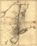
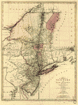
 The
provinces of New York, and New Jersey; with part of Pensilvania,
and the governments of Trois Rivičres, and Montreal: Drawn
by Capt. Holland. Engraved by Thomas Jefferys, geographer
to His Majesty. Holland, Samuel, 1728-1801. CREATED/PUBLISHED
[London] Printed for Robt. Sayer ... and T. Jefferys [1768?]
NOTES Scale ca. 1:650,000. Title in upper margin: A chorographical
map of the country between Albany, Oswego, Fort Frontenac,
and les Trois Rivičres ... Drawn from authentic surveys
by Thomas Jefferys, geographer to His Majesty. Hand colored.
Prime meridian: London. Relief shown pictorially. The
provinces of New York, and New Jersey; with part of Pensilvania,
and the governments of Trois Rivičres, and Montreal: Drawn
by Capt. Holland. Engraved by Thomas Jefferys, geographer
to His Majesty. Holland, Samuel, 1728-1801. CREATED/PUBLISHED
[London] Printed for Robt. Sayer ... and T. Jefferys [1768?]
NOTES Scale ca. 1:650,000. Title in upper margin: A chorographical
map of the country between Albany, Oswego, Fort Frontenac,
and les Trois Rivičres ... Drawn from authentic surveys
by Thomas Jefferys, geographer to His Majesty. Hand colored.
Prime meridian: London. Relief shown pictorially. |
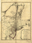
 The
provinces of New York, and New Jersey; with part of Pensilvania,
and the province of Quebec. Drawn by Capt. Holland. Engraved
by Thomas Jefferys, geographer to His Majesty. And improved
from the modern surveys of those colonies down to the
year 1775. Holland, Samuel, 1728-1801. CREATED/PUBLISHED
London, Printed for Robt. Sayer & John Bennett, 1775.
NOTES Scale ca. 1:650,000. Hand colored. Relief shown
pictorially. Shows "Longitude west from London." Shows
township and county boundaries. Includes historical notes
and insets of "A chart of the mouth of Hudson's River,
from Sandy Hook to New York," "A plan of the city of New
York," and "Plan of Amboy with its environs." The
provinces of New York, and New Jersey; with part of Pensilvania,
and the province of Quebec. Drawn by Capt. Holland. Engraved
by Thomas Jefferys, geographer to His Majesty. And improved
from the modern surveys of those colonies down to the
year 1775. Holland, Samuel, 1728-1801. CREATED/PUBLISHED
London, Printed for Robt. Sayer & John Bennett, 1775.
NOTES Scale ca. 1:650,000. Hand colored. Relief shown
pictorially. Shows "Longitude west from London." Shows
township and county boundaries. Includes historical notes
and insets of "A chart of the mouth of Hudson's River,
from Sandy Hook to New York," "A plan of the city of New
York," and "Plan of Amboy with its environs." |
  A
map of the Province of New-York, reduc'd from the large
drawing of that Province, compiled from actual surveys
by order of His Excellency William Tryon, Esqr., Captain
General & Governor of the same, by Claude Joseph Sauthier;
to which is added New-Jersey, from the topographical observations
of C. J. Sauthier & B. Ratzer. Engraved by William Faden
... 1776. Sauthier, Claude Joseph. CREATED/PUBLISHED London,
Wm. Faden, 1776. NOTES Scale ca. 1:1,050,000. Hand colored.
Relief shown by hachures. Shows administrative boundaries
in New York and New Jersey. Also shows portions of Pennsylvania
and New England. A
map of the Province of New-York, reduc'd from the large
drawing of that Province, compiled from actual surveys
by order of His Excellency William Tryon, Esqr., Captain
General & Governor of the same, by Claude Joseph Sauthier;
to which is added New-Jersey, from the topographical observations
of C. J. Sauthier & B. Ratzer. Engraved by William Faden
... 1776. Sauthier, Claude Joseph. CREATED/PUBLISHED London,
Wm. Faden, 1776. NOTES Scale ca. 1:1,050,000. Hand colored.
Relief shown by hachures. Shows administrative boundaries
in New York and New Jersey. Also shows portions of Pennsylvania
and New England. |
 A
map of the Province of New-York, reduc'd from the large
drawing of that Province, compiled from actual surveys
by order of His Excellency William Tryon, Esqr. Captain
General & Governor of the same, by Claude Joseph Sauthier;
to which is added New-Jersey, from the topographical observations
of C. J. Sauthier and B. Ratzer. Engraved by William Faden
... 1776. Sauthier, Claude Joseph. CREATED/PUBLISHED London,
W. Faden, 1776. NOTES Scale ca. 1:1,000,000. Hand colored.
Relief shown by hachures. Prime meridian: New York. Shows
administrative boundaries in New York and New Jersey.
Also shows portions of Pennsylvania and New England. A
map of the Province of New-York, reduc'd from the large
drawing of that Province, compiled from actual surveys
by order of His Excellency William Tryon, Esqr. Captain
General & Governor of the same, by Claude Joseph Sauthier;
to which is added New-Jersey, from the topographical observations
of C. J. Sauthier and B. Ratzer. Engraved by William Faden
... 1776. Sauthier, Claude Joseph. CREATED/PUBLISHED London,
W. Faden, 1776. NOTES Scale ca. 1:1,000,000. Hand colored.
Relief shown by hachures. Prime meridian: New York. Shows
administrative boundaries in New York and New Jersey.
Also shows portions of Pennsylvania and New England. |
 A
sketch of the operations of His Majesty's fleet and army
under the command of Vice Admiral the Rt. Hble. Lord Viscount
Howe and Genl. Sr. Wm. Howe, K.B., in 1776. Des Barres,
Joseph F. W. (Joseph Frederick Wallet), 1722-1824. CREATED/PUBLISHED
[London] J. F. W. D[es Barres, 1777] NOTES Scale ca. 1:130,000.
Hand colored. Relief shown by hachures and shading. Depths
shown by soundings. Centered on the Hudson River and New
York Bay from Sandy Hook to Haverstraw. Includes index
entitled "References." A
sketch of the operations of His Majesty's fleet and army
under the command of Vice Admiral the Rt. Hble. Lord Viscount
Howe and Genl. Sr. Wm. Howe, K.B., in 1776. Des Barres,
Joseph F. W. (Joseph Frederick Wallet), 1722-1824. CREATED/PUBLISHED
[London] J. F. W. D[es Barres, 1777] NOTES Scale ca. 1:130,000.
Hand colored. Relief shown by hachures and shading. Depths
shown by soundings. Centered on the Hudson River and New
York Bay from Sandy Hook to Haverstraw. Includes index
entitled "References." |
 The
provinces of New York, and New Jersey; with part of Pensilvania
and the province of Quebec. Drawn by Major Holland, Surveyor
General of the Northern District in America. Corrected
and improved, from the original materials, by Governr.
Pownall. Hen. Contger, Sculp. Mog. Pownall, Thomas, 1722-1805.
CREATED/PUBLISHED Frankfort upon the Mayn, Harry Lodowick
Broenner, 1777. NOTES Scale ca. 1:650,000. Hand colored.
Relief shown pictorially. Prime meridian: London. Insets:
A chart of the mouth of Hudsons River, from Sandy Hook
to New York.--Plan of Amboy with its environs from an
actual survey.--A plan of the city of New York. The
provinces of New York, and New Jersey; with part of Pensilvania
and the province of Quebec. Drawn by Major Holland, Surveyor
General of the Northern District in America. Corrected
and improved, from the original materials, by Governr.
Pownall. Hen. Contger, Sculp. Mog. Pownall, Thomas, 1722-1805.
CREATED/PUBLISHED Frankfort upon the Mayn, Harry Lodowick
Broenner, 1777. NOTES Scale ca. 1:650,000. Hand colored.
Relief shown pictorially. Prime meridian: London. Insets:
A chart of the mouth of Hudsons River, from Sandy Hook
to New York.--Plan of Amboy with its environs from an
actual survey.--A plan of the city of New York. |
 A
plan of the operations of the King's army under the command
of General Sr. William Howe, K.B. in New York and east
New Jersey against the American forces commanded by General
Washington from the 12th. of October, to the 28th. of
November 1776, wherein is particularly distinguished the
engagement on the White Plains, the 28th. of October.
By Claude Joseph Sauthier; engraved by Wm. Faden, 1777.
Sauthier, Claude Joseph. CREATED/PUBLISHED [London] W.
Faden, 1777. NOTES Scale ca. 1:84,000. Hand colored. Relief
shown by hachures. A
plan of the operations of the King's army under the command
of General Sr. William Howe, K.B. in New York and east
New Jersey against the American forces commanded by General
Washington from the 12th. of October, to the 28th. of
November 1776, wherein is particularly distinguished the
engagement on the White Plains, the 28th. of October.
By Claude Joseph Sauthier; engraved by Wm. Faden, 1777.
Sauthier, Claude Joseph. CREATED/PUBLISHED [London] W.
Faden, 1777. NOTES Scale ca. 1:84,000. Hand colored. Relief
shown by hachures. |
 A
map of the provinces of New-York and New-Yersey, with
a part of Pennsylvania and the Province of Quebec. From
the topographical observations of C. J. Sauthier. Engraved
and published by Matthew Albert Lotter. Sauthier, Claude
Joseph. CREATED/PUBLISHED Augsburg, 1777. NOTES Scale
ca. 1:1,040,000. Hand colored. LC copy mounted on cloth
and paper backing. Prime meridian: New York. Relief shown
pictorially. A
map of the provinces of New-York and New-Yersey, with
a part of Pennsylvania and the Province of Quebec. From
the topographical observations of C. J. Sauthier. Engraved
and published by Matthew Albert Lotter. Sauthier, Claude
Joseph. CREATED/PUBLISHED Augsburg, 1777. NOTES Scale
ca. 1:1,040,000. Hand colored. LC copy mounted on cloth
and paper backing. Prime meridian: New York. Relief shown
pictorially. |
 A
map of the provinces of New-York and New Jersey, with
a part of Pennsylvania and the Province of Quebec. From
the topographical observations of C. J. Sauthier. Engraved
and published by Matthew Albert Lotter. Sauthier, Claude
Joseph. CREATED/PUBLISHED Augsburg, 1777. NOTES Scale
ca. 1:1,040,000. Hand colored. LC copy mounted on cloth
and paper backing. Prime meridian: New York. Relief shown
pictorially. Shows administrative divisions in New York
and New Jersey. A
map of the provinces of New-York and New Jersey, with
a part of Pennsylvania and the Province of Quebec. From
the topographical observations of C. J. Sauthier. Engraved
and published by Matthew Albert Lotter. Sauthier, Claude
Joseph. CREATED/PUBLISHED Augsburg, 1777. NOTES Scale
ca. 1:1,040,000. Hand colored. LC copy mounted on cloth
and paper backing. Prime meridian: New York. Relief shown
pictorially. Shows administrative divisions in New York
and New Jersey. |
 Mappa
geographica Provincić Nova Eboraci ab Anglis New-York
dictć ex ampliori delineatione ad exactas dimensiones
concinnata in arctius spatium redacta cura Claudii Josephi
Sauthier cui accedit Nova Jersey ex topographicis observationibus.
Sumtibus Homanianor. Heredum. Homann Erben (Firm) CREATED/PUBLISHED
Norimbergć, 1778. NOTES Scale ca. 1:1,050,000. Title in
upper margin: Carte geographique des provinces Neu-York
et Neu-Jersey en Amérique publié par les Heritiers de
Homann 1778. Hand colored. Prime meridian: New York. Relief
shown by hachures. Shows administrative boundaries in
New York and New Jersey. Also shows portions of Pennsylvania
and New England. Mappa
geographica Provincić Nova Eboraci ab Anglis New-York
dictć ex ampliori delineatione ad exactas dimensiones
concinnata in arctius spatium redacta cura Claudii Josephi
Sauthier cui accedit Nova Jersey ex topographicis observationibus.
Sumtibus Homanianor. Heredum. Homann Erben (Firm) CREATED/PUBLISHED
Norimbergć, 1778. NOTES Scale ca. 1:1,050,000. Title in
upper margin: Carte geographique des provinces Neu-York
et Neu-Jersey en Amérique publié par les Heritiers de
Homann 1778. Hand colored. Prime meridian: New York. Relief
shown by hachures. Shows administrative boundaries in
New York and New Jersey. Also shows portions of Pennsylvania
and New England. |
 Operations
in America. No. 2. CREATED/PUBLISHED [1780?] NOTES Scale
ca. 1:13,000. Manuscript, pen-and-ink and watercolor.
Title from verso in pencil. Relief shown by hachures and
shading. Has watermark. Shows area west of the Hudson
River and Staten Island. Shows place and settlers' names,
fortifications, and principal fort at West Point called
"Fort Arnold." Operations
in America. No. 2. CREATED/PUBLISHED [1780?] NOTES Scale
ca. 1:13,000. Manuscript, pen-and-ink and watercolor.
Title from verso in pencil. Relief shown by hachures and
shading. Has watermark. Shows area west of the Hudson
River and Staten Island. Shows place and settlers' names,
fortifications, and principal fort at West Point called
"Fort Arnold." |
 A
map containing part of the Provinces of New York and New
Jersey, drawn from surveys compiled by Thomas Millidge,
major 1st Battalion, New Jersey Volunteers, 1780. This
map is drawn for Oliver Delancey, Esquire, adjutant general
of N: America & major of the 17th Light Dragoons, by Andrew
Skinner, 1781. Skinner, Andrew, geographer. CREATED/PUBLISHED
[1781] NOTES Scale ca. 1:126,000. Manuscript, pen-and-ink
and watercolor. Relief shown by shading. Shows area between
the Hudson and Delaware Rivers, from Kingston, N.Y. to
Trenton, including names of some property owners. A
map containing part of the Provinces of New York and New
Jersey, drawn from surveys compiled by Thomas Millidge,
major 1st Battalion, New Jersey Volunteers, 1780. This
map is drawn for Oliver Delancey, Esquire, adjutant general
of N: America & major of the 17th Light Dragoons, by Andrew
Skinner, 1781. Skinner, Andrew, geographer. CREATED/PUBLISHED
[1781] NOTES Scale ca. 1:126,000. Manuscript, pen-and-ink
and watercolor. Relief shown by shading. Shows area between
the Hudson and Delaware Rivers, from Kingston, N.Y. to
Trenton, including names of some property owners. |
 Plan
of part of the River Delaware from Chester to Philadelphia,
in which is mark'd the position of His Majs. ships on
the 15th. of November 1777. The obstructions to the navigation
of the river, laid down by the rebels, are also mark'd.
Hunter, John, 1738-1821. CREATED/PUBLISHED [1778] NOTES
Scale ca. 1:30,000. Manuscript, pen-and-ink and watercolor.
Oriented with north toward the upper left. Depths shown
by soundings. Plan
of part of the River Delaware from Chester to Philadelphia,
in which is mark'd the position of His Majs. ships on
the 15th. of November 1777. The obstructions to the navigation
of the river, laid down by the rebels, are also mark'd.
Hunter, John, 1738-1821. CREATED/PUBLISHED [1778] NOTES
Scale ca. 1:30,000. Manuscript, pen-and-ink and watercolor.
Oriented with north toward the upper left. Depths shown
by soundings. |
 A
topographical map of Hudsons River, with the channels
depth of water, rocks, shoals &c. and the country adjacent,
from Sandy-Hook, New York and bay to Fort Edward, also
the communication with Canada by Lake George and Lake
Champlain, as high as Fort Chambly on Sorel River. 1776.
Sauthier, Claude Joseph. CREATED/PUBLISHED London, Wm.
Faden [1777] NOTES Scale 1:253,440; 4 miles to 1 in. Hand
colored. Relief shown by hachures. Depths shown by soundings. A
topographical map of Hudsons River, with the channels
depth of water, rocks, shoals &c. and the country adjacent,
from Sandy-Hook, New York and bay to Fort Edward, also
the communication with Canada by Lake George and Lake
Champlain, as high as Fort Chambly on Sorel River. 1776.
Sauthier, Claude Joseph. CREATED/PUBLISHED London, Wm.
Faden [1777] NOTES Scale 1:253,440; 4 miles to 1 in. Hand
colored. Relief shown by hachures. Depths shown by soundings.
|
 Carte
de l'entrée de la rivičre d'Hudson, dépuis Sandy-Hook
jusques ŕ New-York avec les bancs, sondes, marques de
navigation &c. Rédigée d'aprčs un plan anglois au Dépôt
général de la marine par ordre de M. de Sartine, conseiller
d'Etat, Ministre et Secretaire d'Etat, au Département
de la marine. France. Dépôt des cartes et plans de la
marine. CREATED/PUBLISHED [Paris?] Dépôt de la marine,
1778. NOTES Scale ca. 1:70,000. Hand colored. Depths shown
by soundings. Relief shown by land form drawings. Includes
"Avertissement." Carte
de l'entrée de la rivičre d'Hudson, dépuis Sandy-Hook
jusques ŕ New-York avec les bancs, sondes, marques de
navigation &c. Rédigée d'aprčs un plan anglois au Dépôt
général de la marine par ordre de M. de Sartine, conseiller
d'Etat, Ministre et Secretaire d'Etat, au Département
de la marine. France. Dépôt des cartes et plans de la
marine. CREATED/PUBLISHED [Paris?] Dépôt de la marine,
1778. NOTES Scale ca. 1:70,000. Hand colored. Depths shown
by soundings. Relief shown by land form drawings. Includes
"Avertissement." |
 Carte
de l'entrée de la rivičre d'Hudson, dépuis Sandy-Hook
jusques ŕ New-York avec les bancs, sondes, marques de
navigation &c. Rédigée d'aprčs un plan anglois au Dépôt
général de la marine, par ordre de M. de Sartine, conseiller
d'Etat, ministre et secrétaire d'Etat, au Département
de la marine. France. Dépôt des cartes et plans de la
marine. CREATED/PUBLISHED [Paris?] Dépôt de la marine,
1778. NOTES Scale ca. 1:70,000. Depths shown by soundings.
Relief shown by land form drawings. "339." Includes "Avertissement." Carte
de l'entrée de la rivičre d'Hudson, dépuis Sandy-Hook
jusques ŕ New-York avec les bancs, sondes, marques de
navigation &c. Rédigée d'aprčs un plan anglois au Dépôt
général de la marine, par ordre de M. de Sartine, conseiller
d'Etat, ministre et secrétaire d'Etat, au Département
de la marine. France. Dépôt des cartes et plans de la
marine. CREATED/PUBLISHED [Paris?] Dépôt de la marine,
1778. NOTES Scale ca. 1:70,000. Depths shown by soundings.
Relief shown by land form drawings. "339." Includes "Avertissement."
|
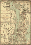
 New
York Island and East Jersey. Unfinished. CREATED/PUBLISHED
177-?] NOTES Scale ca. 1:17,000. Title from manuscript
catalog of the Peter Force map collection. Variant title
in Philip Lee Phillips' A list of maps of America: Topography
of upper part of Manhattan Island from about 85th St.
to about the Van Cortlandt Manor house, above King's bridge.
1777-1780. Manuscript, pen-and-ink and watercolor. Relief
shown by shading. Shows detailed topography of Manhattan
Island north of Hell Gate, east of the Harlem River to
the Bronx River, and in New Jersey west to the Hackensack
River. Without names or military information. New
York Island and East Jersey. Unfinished. CREATED/PUBLISHED
177-?] NOTES Scale ca. 1:17,000. Title from manuscript
catalog of the Peter Force map collection. Variant title
in Philip Lee Phillips' A list of maps of America: Topography
of upper part of Manhattan Island from about 85th St.
to about the Van Cortlandt Manor house, above King's bridge.
1777-1780. Manuscript, pen-and-ink and watercolor. Relief
shown by shading. Shows detailed topography of Manhattan
Island north of Hell Gate, east of the Harlem River to
the Bronx River, and in New Jersey west to the Hackensack
River. Without names or military information. |
 Position
du camp de l'armée combinée a Philipsburg du 6 juillet
au 19 aoust. CREATED/PUBLISHED [1781] NOTES Scale ca.
1:80,000; 2,000 toises = 40 mm. Manuscript, pen-and-ink
and watercolor. Has watermarks. Relief shown by hachures.
Shows area from Staten Island to Tarrytown, N.Y. Includes
"Legende." Position
du camp de l'armée combinée a Philipsburg du 6 juillet
au 19 aoust. CREATED/PUBLISHED [1781] NOTES Scale ca.
1:80,000; 2,000 toises = 40 mm. Manuscript, pen-and-ink
and watercolor. Has watermarks. Relief shown by hachures.
Shows area from Staten Island to Tarrytown, N.Y. Includes
"Legende." |
 A
map of the Province of New-York reduc'd from the large
drawing of that Province, compiled from actual surveys
by order of His Excellency William Tryon, Esqr., Captain
General & Governor of the same, by Claude Joseph Sauthier;
to which is added New Jersey. from the topographical observations
of C. J. Sauthier & B. Ratzer. Engraved by William Faden
... 1776. Sauthier, Claude Joseph. CREATED/PUBLISHED London,
Wm. Faden, 1776. NOTES Scale ca. 1:1,050,000. Hand colored.
LC copy mounted on cloth backing. Relief shown by hachures.
Differs from other copies: Western boundary of Tryon County
and eastern boundaries of Cumberland and Glocester counties
not colored. Shows administrative boundaries in New York
and New Jersey. Also shows portions of Pennsylvania and
New England. A
map of the Province of New-York reduc'd from the large
drawing of that Province, compiled from actual surveys
by order of His Excellency William Tryon, Esqr., Captain
General & Governor of the same, by Claude Joseph Sauthier;
to which is added New Jersey. from the topographical observations
of C. J. Sauthier & B. Ratzer. Engraved by William Faden
... 1776. Sauthier, Claude Joseph. CREATED/PUBLISHED London,
Wm. Faden, 1776. NOTES Scale ca. 1:1,050,000. Hand colored.
LC copy mounted on cloth backing. Relief shown by hachures.
Differs from other copies: Western boundary of Tryon County
and eastern boundaries of Cumberland and Glocester counties
not colored. Shows administrative boundaries in New York
and New Jersey. Also shows portions of Pennsylvania and
New England. |
 A
plan of the operations of the King's army under the command
of General Sir William Howe, K.B. in New York and east
New Jersey, against the American forces commanded by General
Washington from the 12th of October to the 28th of November
1776, wherein is particularly distinguished the engagement
on the White Plains the 28th of October. By [C. J. Sauthier.
Sauthier, Claude Joseph. CREATED/PUBLISHED 1776?] NOTES
Scale ca. 1:85,000. Manuscript, pen-and-ink and watercolor.
Has watermark. Relief shown by hachures. Includes descriptive
notes. A
plan of the operations of the King's army under the command
of General Sir William Howe, K.B. in New York and east
New Jersey, against the American forces commanded by General
Washington from the 12th of October to the 28th of November
1776, wherein is particularly distinguished the engagement
on the White Plains the 28th of October. By [C. J. Sauthier.
Sauthier, Claude Joseph. CREATED/PUBLISHED 1776?] NOTES
Scale ca. 1:85,000. Manuscript, pen-and-ink and watercolor.
Has watermark. Relief shown by hachures. Includes descriptive
notes. |
 The
provinces of New York and New Jersey; with part of Pensilvania,
and the province of Quebec. Drawn by Capt. Holland. Engraved
by Thomas Jefferys, geographer to His Majesty.--and improved
from the modern surveys of those colonies down to the
year 1776. Holland, Samuel, 1728-1801. CREATED/PUBLISHED
London, Robt. Sayer & John Bennett, 1775 [i.e. 1776] NOTES
Scale ca. 1:650,000. Hand colored. LC copy deteriorated
in margins. Relief shown pictorially. Shows administrative
divisions. Insets: A chart of the mouth of Hudson's River,
from Sandy Hook to New York.--A plan of the city of New
York.--Plan of Amboy, with its environs, from an actual
survey. The
provinces of New York and New Jersey; with part of Pensilvania,
and the province of Quebec. Drawn by Capt. Holland. Engraved
by Thomas Jefferys, geographer to His Majesty.--and improved
from the modern surveys of those colonies down to the
year 1776. Holland, Samuel, 1728-1801. CREATED/PUBLISHED
London, Robt. Sayer & John Bennett, 1775 [i.e. 1776] NOTES
Scale ca. 1:650,000. Hand colored. LC copy deteriorated
in margins. Relief shown pictorially. Shows administrative
divisions. Insets: A chart of the mouth of Hudson's River,
from Sandy Hook to New York.--A plan of the city of New
York.--Plan of Amboy, with its environs, from an actual
survey. |
 The
provinces of New York and New Jersey; with part of Pensilvania,
and the Province of Quebec. Drawn by Major Holland, Surveyor
General, of the Northern District in America. Corrected
and improved, from the original materials, by Governr.
Pownall, Member of Parliament, 1776. Pownall, Thomas,
1722-1805. CREATED/PUBLISHED London, Robt. Sayer & John
Bennett, 1776. NOTES Scale ca. 1:650,000. Hand colored.
Relief shown pictorially. Shows administrative divisions.
From Thomas Jeffery's American atlas. 1778. Insets: A
chart of the mouth of Hudson's River, from Sandy Hook
to New York.--A plan of the city of New York.--Plan of
Amboy, with its environs, from an actual survey. The
provinces of New York and New Jersey; with part of Pensilvania,
and the Province of Quebec. Drawn by Major Holland, Surveyor
General, of the Northern District in America. Corrected
and improved, from the original materials, by Governr.
Pownall, Member of Parliament, 1776. Pownall, Thomas,
1722-1805. CREATED/PUBLISHED London, Robt. Sayer & John
Bennett, 1776. NOTES Scale ca. 1:650,000. Hand colored.
Relief shown pictorially. Shows administrative divisions.
From Thomas Jeffery's American atlas. 1778. Insets: A
chart of the mouth of Hudson's River, from Sandy Hook
to New York.--A plan of the city of New York.--Plan of
Amboy, with its environs, from an actual survey. |
 The
provinces of New York and New Jersey; with part of Pensilvania,
and the province of Quebec. Drawn by Major Holland, Surveyor
General, of the Northern District in America. Corrected
and improved, from the original materials, by Governr.
Pownall, Member of Parliament, 1776. Pownall, Thomas,
1722-1805. CREATED/PUBLISHED London, Robt. Sayer & John
Bennett, 1776. NOTES Scale ca. 1:650,000. Hand colored.
Relief shown pictorially. Shows administrative divisions.
Insets: A chart of the mouth of Hudson's River, from Sandy
Hook to New York.--A plan of the city of New York.--Plan
of Amboy, with its environs, from an actual survey. The
provinces of New York and New Jersey; with part of Pensilvania,
and the province of Quebec. Drawn by Major Holland, Surveyor
General, of the Northern District in America. Corrected
and improved, from the original materials, by Governr.
Pownall, Member of Parliament, 1776. Pownall, Thomas,
1722-1805. CREATED/PUBLISHED London, Robt. Sayer & John
Bennett, 1776. NOTES Scale ca. 1:650,000. Hand colored.
Relief shown pictorially. Shows administrative divisions.
Insets: A chart of the mouth of Hudson's River, from Sandy
Hook to New York.--A plan of the city of New York.--Plan
of Amboy, with its environs, from an actual survey. |
This
is a must have collection for any map history buff!
To use
this software, you must install the free ExpressView MrSid
software which is included on the CD. This is a 30 second
process and will allow you to view and manipulate/print
all the maps in this CD collection in full detail. There
is a version for both Windows platforms and Macintosh platforms
and full installation instructions are included on the CD.
|


