|
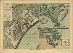
The Revolutionary War Map Collection 6 CD Set - 366 Maps in Total
Price: $44.97
Purchase the entire set of 6 CDs of Revolutionary War maps for just $44.97 and save 25% off the individual purchase price (a savings of $15.)
Price: $44.97
 Add to Cart
More Info
Email a Friend Add to Cart
More Info
Email a Friend
|
|
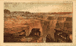
The Tertiary history of the Grand Cańon District on CD
Price: $9.97
The Grand Canyon of the Colorado River in northwestern Arizona is one of the earth's greatest natural wonders. It became a national park in 1919. Theodore Roosevelt created the Grand Canyon Game Preserve by proclamation in 1906 and Grand Canyon National Monument in 1908. Senate bills to establish a national park were introduced and defeated in 1910 and 1911; the Grand Canyon National Park Act was finally signed by President Woodrow Wilson in 1919. The National Park Service, which had been established in 1916, assumed administration of the park.
Price: $9.97
Add to Cart
More Info
Email a Friend
|
|
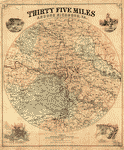
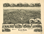
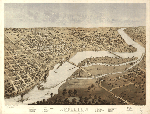
The United States Panoramic Map Collection 31 CD Set - 1309 Maps
Price: $149.97
Purchase the entire set of 31 CDs of United States Panoramic Maps for just $149.97 and save over 50% off the individual purchase price (a savings of more than $150.)
Price: $149.97
Add to Cart
More Info
Email a Friend
|

|
Theatrum Orbis Terrarum - The Ortelius Atlas
Price: $9.97
Ortelius's Theatrum Orbis Terrarum (Theatre of the World) is considered the first true atlas in the modern sense: a collection of uniform map sheets and sustaining text bound to form a book for which copper printing plates were specifically engraved. The Ortelius atlas is sometimes referred to as the summary of sixteenth-century cartography.
Price: $9.97
Add to Cart
More Info
Email a Friend
|
|
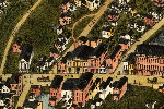
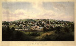
Vermont 25 City Panoramic Maps on CD
Price: $9.97
Vermont Panoramic Maps. The panoramic map was a popular cartographic form used to depict U.S. and Canadian cities and towns during the late nineteenth and early twentieth centuries (1847 to 1929.) Known also as bird's-eye views, perspective maps, and aero views, panoramic maps are nonphotographic representations of cities portrayed as if viewed from above at an oblique angle. Although not generally drawn to scale, they show street patterns, individual buildings, and major landscape features in perspective.
Price: $9.97
Add to Cart
More Info
Email a Friend
|
|
Virginia 21 City Panoramic Maps on CD
Price: $9.97
Virginia Panoramic Maps. The panoramic map was a popular cartographic form used to depict U.S. and Canadian cities and towns during the late nineteenth and early twentieth centuries (1847 to 1929.) Known also as bird's-eye views, perspective maps, and aero views, panoramic maps are nonphotographic representations of cities portrayed as if viewed from above at an oblique angle. Although not generally drawn to scale, they show street patterns, individual buildings, and major landscape features in perspective.
Price: $9.97
Add to Cart
More Info
Email a Friend
|

|
Virginia Civil War Maps Volume 1 CD
Price: $9.97
This CD contains 90 rare historic maps and descriptive pages representing fascinating details about Virginia and its vicinity during the Civil War.
Price: $9.97
Add to Cart
More Info
Email a Friend
|

|
Virginia Civil War Maps Volume 2 CD
Price: $9.97
his CD contains 97 rare historic maps and descriptive pages representing fascinating details about Virginia and its vicinity during the Civil War.
Price: $9.97
Add to Cart
More Info
Email a Friend
|
|
Virginia Civil War Maps Volume 3 CD
Price: $9.97
This CD contains 83 rare historic maps and descriptive pages representing fascinating details about Virginia and its vicinity during the Civil War.
Price: $9.97
Add to Cart
More Info
Email a Friend
|
|
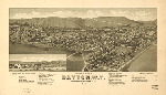
Washington 20 City Panoramic Maps on CD
Price: $9.97
Washington Panoramic Maps. The panoramic map was a popular cartographic form used to depict U.S. and Canadian cities and towns during the late nineteenth and early twentieth centuries (1847 to 1929.) Known also as bird's-eye views, perspective maps, and aero views, panoramic maps are nonphotographic representations of cities portrayed as if viewed from above at an oblique angle. Although not generally drawn to scale, they show street patterns, individual buildings, and major landscape features in perspective.
Price: $9.97
Add to Cart
More Info
Email a Friend
|
|
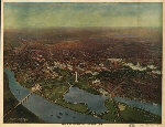
Washington DC (District of Columbia) 18 City Panoramic Maps on CD
Price: $9.97
Washington DC (District of Columbia) Panoramic Maps. The panoramic map was a popular cartographic form used to depict U.S. and Canadian cities and towns during the late nineteenth and early twentieth centuries (1847 to 1929.) Known also as bird's-eye views, perspective maps, and aero views, panoramic maps are nonphotographic representations of cities portrayed as if viewed from above at an oblique angle. Although not generally drawn to scale, they show street patterns, individual buildings, and major landscape features in perspective.
Price: $9.97
Add to Cart
More Info
Email a Friend
|
|
West Virginia 29 City Panoramic Maps on CD
Price: $9.97
West Virginia Panoramic Maps. The panoramic map was a popular cartographic form used to depict U.S. and Canadian cities and towns during the late nineteenth and early twentieth centuries (1847 to 1929.) Known also as bird's-eye views, perspective maps, and aero views, panoramic maps are nonphotographic representations of cities portrayed as if viewed from above at an oblique angle. Although not generally drawn to scale, they show street patterns, individual buildings, and major landscape features in perspective.
Price: $9.97
Add to Cart
More Info
Email a Friend
|
|
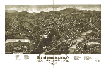
Wisconsin 62 City Panoramic Maps on CD
Price: $9.97
Wisconsin Panoramic Maps. The panoramic map was a popular cartographic form used to depict U.S. and Canadian cities and towns during the late nineteenth and early twentieth centuries (1847 to 1929.) Known also as bird's-eye views, perspective maps, and aero views, panoramic maps are nonphotographic representations of cities portrayed as if viewed from above at an oblique angle. Although not generally drawn to scale, they show street patterns, individual buildings, and major landscape features in perspective.
Price: $9.97
Add to Cart
More Info
Email a Friend
|


