| |

|
|
|
This category doesn't have anything in it, but check back soon!
|
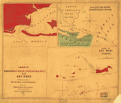
Antique Maps
Explore our world through ancient maps. We offer a large number of map collections on CD sure to tickle every map fanciest. Maps from the 14th century to the 19th century are included in the collections.
|
|
Displaying 21 - 40 of 73 Products:
|
|
|
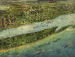
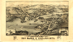
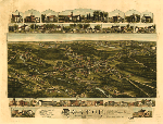
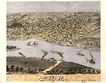
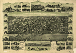
Florida, Georgia and Alabama 38 City Panoramic Maps on CD
Price: $9.97
Panoramic Maps of Florida, Georgia and Alabama. The panoramic map was a popular cartographic form used to depict U.S. and Canadian cities and towns during the late nineteenth and early twentieth centuries (1847 to 1929.) Known also as bird's-eye views, perspective maps, and aero views, panoramic maps are nonphotographic representations of cities portrayed as if viewed from above at an oblique angle. Although not generally drawn to scale, they show street patterns, individual buildings, and major landscape features in perspective.
Price: $9.97
 Add to Cart
More Info
Email a Friend Add to Cart
More Info
Email a Friend
|
|
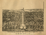
Georgia Civil War Maps CD
Price: $9.97
This CD contains 69 rare historic maps and descriptive pages representing fascinating details about Georgia and its vicinity during the Civil War.
Price: $9.97
Add to Cart
More Info
Email a Friend
|
|
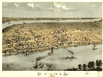
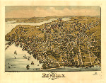
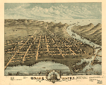
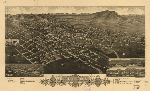
Illinois 64 City Panoramic Maps on CD
Price: $9.97
Panoramic maps of Illinois. The panoramic map was a popular cartographic form used to depict U.S. and Canadian cities and towns during the late nineteenth and early twentieth centuries (1847 to 1929.) Known also as bird's-eye views, perspective maps, and aero views, panoramic maps are nonphotographic representations of cities portrayed as if viewed from above at an oblique angle. Although not generally drawn to scale, they show street patterns, individual buildings, and major landscape features in perspective.
Price: $9.97
Add to Cart
More Info
Email a Friend
|
|
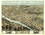
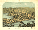
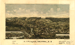
Indiana 17 City Panoramic Maps on CD
Price: $9.97
Indiana Panoramic Maps. The panoramic map was a popular cartographic form used to depict U.S. and Canadian cities and towns during the late nineteenth and early twentieth centuries (1847 to 1929.) Known also as bird's-eye views, perspective maps, and aero views, panoramic maps are nonphotographic representations of cities portrayed as if viewed from above at an oblique angle. Although not generally drawn to scale, they show street patterns, individual buildings, and major landscape features in perspective.
Price: $9.97
Add to Cart
More Info
Email a Friend
|

|
Iowa 21 City Panoramic Maps on CD
Price: $9.97
Iowa Panoramic Maps. The panoramic map was a popular cartographic form used to depict U.S. and Canadian cities and towns during the late nineteenth and early twentieth centuries (1847 to 1929.) Known also as bird's-eye views, perspective maps, and aero views, panoramic maps are nonphotographic representations of cities portrayed as if viewed from above at an oblique angle. Although not generally drawn to scale, they show street patterns, individual buildings, and major landscape features in perspective.
Price: $9.97
Add to Cart
More Info
Email a Friend
|
|
Maine 28 City Panoramic Maps on CD
Price: $9.97
Maine Panoramic Maps. The panoramic map was a popular cartographic form used to depict U.S. and Canadian cities and towns during the late nineteenth and early twentieth centuries (1847 to 1929.) Known also as bird's-eye views, perspective maps, and aero views, panoramic maps are nonphotographic representations of cities portrayed as if viewed from above at an oblique angle. Although not generally drawn to scale, they show street patterns, individual buildings, and major landscape features in perspective.
Price: $9.97
Add to Cart
More Info
Email a Friend
|
|
Maryland 12 City Panoramic Maps on CD
Price: $9.97
Maryland Panoramic Maps. The panoramic map was a popular cartographic form used to depict U.S. and Canadian cities and towns during the late nineteenth and early twentieth centuries (1847 to 1929.) Known also as bird's-eye views, perspective maps, and aero views, panoramic maps are nonphotographic representations of cities portrayed as if viewed from above at an oblique angle. Although not generally drawn to scale, they show street patterns, individual buildings, and major landscape features in perspective.
Price: $9.97
Add to Cart
More Info
Email a Friend
|
|
Maryland Civil War Maps CD
Price: $9.97
This CD contains 60 rare antique maps and descriptive pages representing fascinating details about Maryland and its vicinity during the Civil War.
Price: $9.97
Add to Cart
More Info
Email a Friend
|
|
Massachusetts V1 52 City Panoramic Maps on CD
Price: $9.97
Massachusetts Panoramic Maps Volume 1. The panoramic map was a popular cartographic form used to depict U.S. and Canadian cities and towns during the late nineteenth and early twentieth centuries (1847 to 1929.) Known also as bird's-eye views, perspective maps, and aero views, panoramic maps are nonphotographic representations of cities portrayed as if viewed from above at an oblique angle. Although not generally drawn to scale, they show street patterns, individual buildings, and major landscape features in perspective.
Price: $9.97
Add to Cart
More Info
Email a Friend
|
|
Massachusetts V2 60 City Panoramic Maps on CD
Price: $9.97
Massachusetts Panoramic Maps Volume 2. The panoramic map was a popular cartographic form used to depict U.S. and Canadian cities and towns during the late nineteenth and early twentieth centuries (1847 to 1929.) Known also as bird's-eye views, perspective maps, and aero views, panoramic maps are nonphotographic representations of cities portrayed as if viewed from above at an oblique angle. Although not generally drawn to scale, they show street patterns, individual buildings, and major landscape features in perspective.
Price: $9.97
Add to Cart
More Info
Email a Friend
|
|
Michigan 45 City Panoramic Maps on CD
Price: $9.97
Michigan Panoramic Maps. The panoramic map was a popular cartographic form used to depict U.S. and Canadian cities and towns during the late nineteenth and early twentieth centuries (1847 to 1929.) Known also as bird's-eye views, perspective maps, and aero views, panoramic maps are nonphotographic representations of cities portrayed as if viewed from above at an oblique angle. Although not generally drawn to scale, they show street patterns, individual buildings, and major landscape features in perspective.
Price: $9.97
Add to Cart
More Info
Email a Friend
|
|
Minnesota 40 City Panoramic Maps on CD
Price: $9.97
Minnesota Panoramic Maps. The panoramic map was a popular cartographic form used to depict U.S. and Canadian cities and towns during the late nineteenth and early twentieth centuries (1847 to 1929.) Known also as bird's-eye views, perspective maps, and aero views, panoramic maps are nonphotographic representations of cities portrayed as if viewed from above at an oblique angle. Although not generally drawn to scale, they show street patterns, individual buildings, and major landscape features in perspective.
Price: $9.97
Add to Cart
More Info
Email a Friend
|
|
Mississippi Civil War Maps CD
Price: $9.97
This CD contains 39 rare historic maps and descriptive pages representing fascinating details about Mississippi and its vicinity during the Civil War.
Price: $9.97
Add to Cart
More Info
Email a Friend
|
|
Missouri 41 City Panoramic Maps on CD
Price: $9.97
Missouri Panoramic Maps. The panoramic map was a popular cartographic form used to depict U.S. and Canadian cities and towns during the late nineteenth and early twentieth centuries (1847 to 1929.) Known also as bird's-eye views, perspective maps, and aero views, panoramic maps are nonphotographic representations of cities portrayed as if viewed from above at an oblique angle. Although not generally drawn to scale, they show street patterns, individual buildings, and major landscape features in perspective.
Price: $9.97
Add to Cart
More Info
Email a Friend
|
|
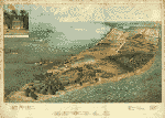
Montana, N. Dakota, S. Dakota, Nebraska 28 City Panoramic Maps on CD
Price: $9.97
Montana, North Dakota, South Dakota, Nebraska & Nevada Panoramic Maps. The panoramic map was a popular cartographic form used to depict U.S. and Canadian cities and towns during the late nineteenth and early twentieth centuries (1847 to 1929.) Known also as bird's-eye views, perspective maps, and aero views, panoramic maps are nonphotographic representations of cities portrayed as if viewed from above at an oblique angle. Although not generally drawn to scale, they show street patterns, individual buildings, and major landscape features in perspective.
Price: $9.97
Add to Cart
More Info
Email a Friend
|
|
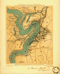
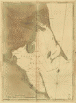
Nautical Atlases of North America From The 1500's to the 1800's on CD
Price: $9.97
This CD Contains 71 Rare Historical Nautical Atlases of North America And its Environs From The 1500's to the 1800's on CD.
Price: $9.97
Add to Cart
More Info
Email a Friend
|

|
New England Revolutionary War Era Maps on CD
Price: $9.97
This CD contains 70 rare antique maps and descriptive pages representing fascinating details about New England - Including Maps of
Connecticut, Rhode Island, Massachusetts,
New Hampshire, Maine and Vermont - and its vicinity during the Revolutionary War.
Price: $9.97
Add to Cart
More Info
Email a Friend
|
|
New Hampshire 42 City Panoramic Maps on CD
Price: $9.97
New Hampshire Panoramic Maps. The panoramic map was a popular cartographic form used to depict U.S. and Canadian cities and towns during the late nineteenth and early twentieth centuries (1847 to 1929.) Known also as bird's-eye views, perspective maps, and aero views, panoramic maps are nonphotographic representations of cities portrayed as if viewed from above at an oblique angle. Although not generally drawn to scale, they show street patterns, individual buildings, and major landscape features in perspective.
Price: $9.97
Add to Cart
More Info
Email a Friend
|
|
New Jersey 43 City Panoramic Maps on CD
Price: $9.97
New Jersey Panoramic Maps. The panoramic map was a popular cartographic form used to depict U.S. and Canadian cities and towns during the late nineteenth and early twentieth centuries (1847 to 1929.) Known also as bird's-eye views, perspective maps, and aero views, panoramic maps are nonphotographic representations of cities portrayed as if viewed from above at an oblique angle. Although not generally drawn to scale, they show street patterns, individual buildings, and major landscape features in perspective.
Price: $9.97
Add to Cart
More Info
Email a Friend
|

|
New Jersey Revolutionary War Era Maps on CD
Price: $9.97
This CD contains 54 rare antique maps and descriptive pages representing fascinating details about New Jersey and its vicinity during the Revolutionary War.
Price: $9.97
Add to Cart
More Info
Email a Friend
|
|
Displaying 21 - 40 of 73 Products:
|
|
|
|


